Louisiana
| State of Louisiana | |||||||||||
| |||||||||||
| Official language(s) | None (English and French de facto) | ||||||||||
| Capital | Baton Rouge | ||||||||||
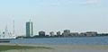
| Largest city | New Orleans | ||||||||||
| Largest metro area | Greater New Orleans | ||||||||||
| Area | Ranked 31st | ||||||||||
| - Total | 51,843 sq mi (135,382 km²) | ||||||||||
| - Width | 130 miles (210 km) | ||||||||||
| - Length | 379 miles (610 km) | ||||||||||
| - % water | 15 | ||||||||||
| - Latitude | 28° 56′ N to 33° 01′ N | ||||||||||
| - Longitude | 88° 49′ W to 94° 03′ W | ||||||||||
| Population | Ranked 25th in the U.S. | ||||||||||
| - Total | 4,657,757 | ||||||||||
| - Density | 106.9/sq mi (41.3/km2) Ranked 23rd in the U.S. | ||||||||||
| - Median income | $50,935[1] (47th) | ||||||||||
| Elevation | |||||||||||
| - Highest point | Driskill Mountain[2][3] 535 ft (163 m) | ||||||||||
| - Mean | 100 ft (30 m) | ||||||||||
| - Lowest point | New Orleans[2][3] -8 ft (-2.5 m) | ||||||||||
| Admission to Union | April 30, 1812 (18th) | ||||||||||
| Governor | [[ John Bel Edwards]] (D) | ||||||||||
| Lieutenant Governor | Billy Nungesser (R) | ||||||||||
| U.S. Senators | Bill Cassidy (R) John Kennedy (R) | ||||||||||
| Time zone | Central: UTC-6/-5 | ||||||||||
| Abbreviations | LA US-LA | ||||||||||
| Web site | louisiana.gov | ||||||||||


Louisiana is a state located in the southern region of the United States of America. Its capital is Baton Rouge and its largest city is New Orleans. Both cities are located in the Mississippi Delta, which makes up about one-quarter of the state's total land area. The current state of Louisiana is the small southern-most portion of the former Louisiana Territory, which was formed following the Louisiana Purchase - 530 million acres of territory purchased by the U.S. from France in 1803.
The area's fertile soil and warm climate gave rise to the early culture at Poverty Point, one of the largest and most important Native American sites in North America and the oldest of its size in the Western Hemisphere. Those conditions centuries later made the land attractive to cotton and sugar planters. The importation of thousands of slaves from Africa allowed the planters to operate their plantations. The port of New Orleans was the Southern United States' largest center of the slave trade, with as many as 25 slave auction houses operating. Following the Civil War and the Emancipation Proclamation, discrimination against former slaves became entrenched during the Reconstruction period. This practice continued until the civil rights movement of the 1950s and 1960s. Federal legislation helped bring an end to such practices.
As a result of settlement patterns, some Louisiana urban environments have a multicultural, multilingual heritage. This is strongly influenced by an admixture of eighteenth-century French, Spanish, and African cultures. Before achieving statehood in 1812, the territory of Louisiana had been alternately a Spanish or French colony. In addition, many of the eighteenth century slaves had come from the same region of West Africa, thus concentrating their culture. The Mardi Gras festival, culminating the day before Ash Wednesday at the start of Lenten season, draws visitors from around the nation.
Much of the state, and significantly New Orleans, was devastated August 2005 by Hurricane Katrina, one of the most deadly hurricanes in the history of the United States.
Geography
Louisiana is bordered to the west by the state of Texas; to the north by Arkansas; to the east by Mississippi; and to the south by the Gulf of Mexico.
A large part of Louisiana is the creation and product of the Mississippi River. It was originally covered by an arm of the sea, and has been built up by the silt carried down the valley by the great river.
Due both to extensive flood control measures along the Mississippi River and natural subsidence, Louisiana was suffering, in the early twenty-first century, from the loss of coastal land area. State and federal government efforts to halt or reverse this phenomenon were underway.
The creation of new delta land in the south-central portion of the state by the Atchafalaya River indicates that the Mississippi River is seeking a new path to the Gulf. Much engineering effort is devoted to keeping the river near its traditional route, as the state's economy and shipping depend on it.
Topography


The surface of the state may properly be divided into two parts, the uplands and the alluvial. The alluvial regions, including the low swamps and coast lands lie principally along the Mississippi River, which traverses the state from north to south for a distance of about 600 miles (1,000 km) and empties into the Gulf of Mexico; the Red River; the Ouachita River and its branches; and other minor streams (some of which are called bayous). The Mississippi River flows along a ridge formed by its own deposits (known as a levee), from which the lands decline toward the low swamps beyond at an average fall of six feet per mile (3 m/km).
The higher lands and contiguous hill lands of the north and northwestern parts of the state consist of prairie and woodlands.
The elevations above sea level range from 10 feet (3 m) at the coast and swamp lands to 50 and 60 feet (15–18 m) at the prairie and alluvial lands. Driskill Mountain, the highest point in the state, is only 535 feet (163 m) above sea level; only two other states, Florida and Delaware, are geographically lower than Louisiana.
The state's rivers and smaller streams constitute a natural system of navigable waterways, aggregating over 4,000 miles (6,400 km) in length. These waterways are unequaled in any other state. The state also has 1,060 square miles (2,745 km²) of land-locked bays; 1,700 square miles (4,400 km²) of inland lakes; and a river surface of over 500 square miles (1,300 km²).
Climate
Louisiana has a humid subtropical climate, perhaps the most "classic" example of a humid subtropical climate of all the Southeastern states, with long, hot, humid summers and short, mild winters. The subtropical characteristics of the state are due in large part to the influence of the Gulf of Mexico, which even at its farthest point is no more than 200 miles (320 km) away. Precipitation is frequent throughout the year, although the summer is slightly wetter than the rest of the year. Southern Louisiana receives far more copious rainfall, especially during the winter months.
Louisiana is often affected by tropical cyclones and is very vulnerable to strikes by major hurricanes, particularly the lowlands around and in the New Orleans area. The unique geography of the region with its many bayous, marshes, and inlets can make major hurricanes especially destructive. The area is also prone to frequent thunderstorms, especially in the summer. The entire state averages over 60 days of thunderstorms a year, more than any other state except Florida. Louisiana averages 27 tornadoes annually. The entire state is vulnerable to a tornado strike, with the extreme southern portion of the state slightly less so than the rest of the state.
Flora and fauna
Alligators are common in Louisiana's extensive swamps, bogs, lakes, rivers, and bayous. Other water-loving mammals such as mink, raccoons, otters, muskrats, and beavers are also found. Coastal areas are home to many varieties of birds, including brown pelicans, herons, and egrets. The northern forests are home to deer, squirrels, rabbits, bears, muskrats, mink, opossums, bobcats, and skunks.
Louisiana's forests offer a mix of oak, pine, beech, black walnut, and cypress.
Geographic and statistical areas
Louisiana is divided into 64 parishes in the same way that most of the other U.S. states are divided into counties. Louisiana is the only state that uses the term "parish" instead of "county." The largest parish by population is Jefferson Parish, and the largest by land area is Cameron Parish.
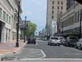
Alexandria
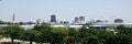
Baton Rouge
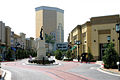
Bossier City
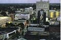
Lafayette
Lake Charles

New Orleans

Shreveport


History

Early settlement
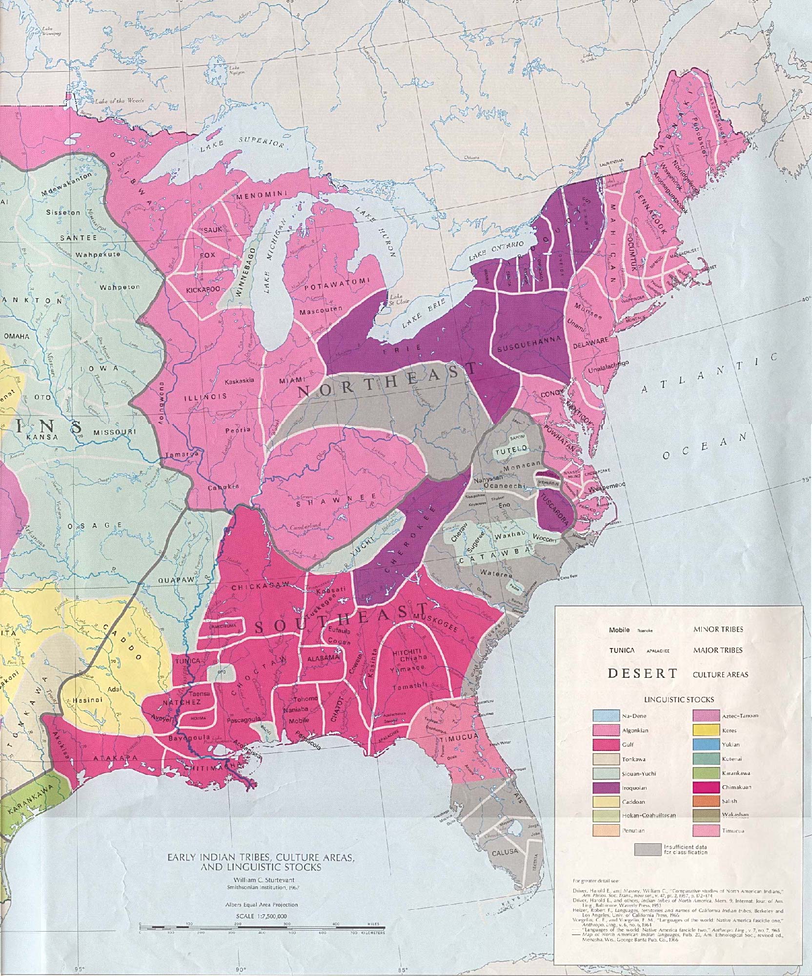
Louisiana has been inhabited by Native Americans for at least three thousand years, when the mound at Poverty Point in northern Louisiana is estimated to have been built. Many place names in the state are transliterations of those used in Native American dialects. Tribes that inhabited what is now Louisiana included the Atakapa, the Opelousa, the Acolapissa, the Tangipahoa, and the Chitimacha in the southeast; the Washa, the Chawasha, the Yagenechito, the Bayougoula, and the Houma (part of the Choctaw nation), the Quinipissa, the Okelousa, the Avoyel, the Taensa (part of the Natchez nation), the Tunica, and the Koroa. Central and northwest Louisiana was home to a substantial portion of the Caddo nation and the Natchitoches confederacy, consisting of the Natchitoches, the Yatasi, the Nakasa, the Doustioni, the Quachita, and the Adai.[4]
Exploration and colonization by Europeans
The first European explorers to visit Louisiana came in 1528, when a Spanish expedition located the mouth of the Mississippi River. In 1541, Hernando de Soto's expedition crossed the region. Spanish interest in Louisiana soon thereafter became dormant.
In the late seventeenth century, French expeditions established a foothold on the Mississippi River and Gulf Coast. In 1682, the French explorer Robert Cavelier de La Salle named the region Louisiana to honor France's King Louis XIV. The French colony of Louisiana originally claimed all the land on both sides of the Mississippi River and north to French territory in Canada. The following present-day states were once part of Louisiana: Louisiana, Mississippi, Arkansas, Oklahoma, Missouri, Kansas, Nebraska, Iowa, Illinois, Indiana, Michigan, Wisconsin, Minnesota, North Dakota, and South Dakota.
The settlement of Natchitoches (along the Red River in present-day northwest Louisiana) was established in 1714, making it the oldest permanent European settlement in the Louisiana Purchase territory. The settlement had the dual goals of establishing trade with the Spanish in Texas and deterring Spanish advances into Louisiana. Also, the northern terminus of the Old San Antonio Road (sometimes called El Camino Real, or Kings Highway) was at Natchitoches. The settlement soon became a flourishing river port and crossroads, giving rise to vast cotton kingdoms along the river. Louisiana's French settlements contributed to further exploration and outposts, concentrated along the banks of the Mississippi and its major tributaries.
Recognizing the importance of the Mississippi River to trade and military interests, France made New Orleans the seat of civilian and military authority in 1722. From then until the United States acquired the territory in 1803, France and Spain traded control of the region's colonial empire.
France ceded most of its territory to the east of the Mississippi to Great Britain in the aftermath of the Seven Years' War or French and Indian War, as it was known in North America. It retained the area around New Orleans and the parishes around Lake Pontchartrain. The rest of Louisiana became a colony of Spain after the Seven Years' War by the Treaty of Paris of 1763.
During the period of Spanish rule, several thousand French-speaking refugees from the region of Acadia (now Nova Scotia, Canada) made their way to Louisiana following their expulsion by Britain after the Seven Years' War. They settled chiefly in southwestern Louisiana. The Spanish, eager to gain more Catholic settlers, welcomed the refugees, whose descendants are known as Cajuns.
In 1800, France's Napoleon Bonaparte acquired Louisiana from Spain in the Treaty of San Ildefonso, an arrangement kept secret for two years.
Purchase by the United States

Napoleon's ambitions in Louisiana involved the creation of a new empire centered on the Caribbean sugar trade. In October 1801 he sent a large military force to retake the island of Santo Domingo, lost in a slave revolt in the 1790s. Defeated by Haitian revolutionaries, Napoleon decided to sell Louisiana.
In the meantime, Thomas Jefferson, third president of the United States, was disturbed by Napoleon Bonaparte's plans to re-establish French colonies in America. By possessing New Orleans, Napoleon controlled the Mississippi River and could close the river at any time, disrupting commerce. Jefferson appointed James Monroe as special envoy to Napoleon's France to assist in obtaining New Orleans for the United States. Napoleon, needing funds to support his designs on controlling Europe, agreed to the terms. The purchase was an important moment in the presidency of Thomas Jefferson. At the time, it faced domestic opposition as being possibly unconstitutional.
Jefferson had authorized the expenditure of $10 million for a port city and instead received treaties committing the government to spend $15 million on a land package. The Louisiana Territory, 530 million acres was purchased for less than 3 cents per acre, in a transaction known historically as the Louisiana Purchase, doubled the size of the United States overnight and set a precedent for the purchase of territory. It opened the way for the expansion of the United States across the continent to the Pacific Ocean.
Nineteenth century
New Orleans was the site of important battles in both the War of 1812 (1812-1815). Under the command of Andrew Jackson the American forces defeated a superior British force before news of the end of the war had reached the combatants. Jackson's victory was aided by pirate captain Jean La Fitte. Leading up to the American Civil War, Louisiana had seceded from the Union in 1861 and joined the Confederate States of America. In 1862, a Union fleet under David Farragut captured New Orleans and held it throughout the war, keeping the Mississippi River open to commerce. However, much of the rest of the state remained in Confederate hands until 1865 when the war ended.
Although the slaves on the plantations were freed by the Emancipation Proclamation in 1863, political power remained elusive for much of the next century. The system of using slavery for harvesting sugar and cotton was replaced by the nearly equally repressive sharecropping system. Railroads opened up the northern and western parts of the state for development, allowing lumber companies access to Louisiana's forests. In modern times, Louisiana's forests have proved to be as profitable as its sugar and cotton.
Modern era

Oil and natural gas were discovered in the early years of the twentieth century. Oil refineries provided jobs, and the economy shifted from agricultural to industrial.
Social changes took place as well, with African-Americans gaining more rights. Nevertheless, more people lived in poverty in Louisiana than in any other state.
On August 29, 2005, Hurricane Katrina destroyed large parts of Louisiana, resulting in 1,836 confirmed deaths, 705 people missing, and hundreds of thousands of homes and businesses destroyed. Katrina was the costliest hurricane, as well as one of the five deadliest, in the history of the United States.[5] The most severe loss of life and property damage occurred in New Orleans, which flooded as the levee system catastrophically failed, in many cases hours after the storm had moved inland. Eventually 80 percent of the city became flooded and also large tracts of neighboring parishes, and the floodwaters lingered for weeks.[6]
Three years later, thousands of displaced residents in Mississippi and Louisiana were still living in trailers, while thousands others had been forced to relocate to other areas of the nation. On May 2, 2008, Louisiana Governor Bobby Jindal used a speech to The National Press Club to request that President George W. Bush free up money to complete work on Louisiana's levees.[7]
Economy

The state's principal agricultural products include seafood (it is the biggest producer of crawfish in the world, supplying approximately 90 percent), cotton, soybeans, cattle, sugarcane, poultry and eggs, dairy products, and rice. Industry generates chemical products, petroleum and coal products, food processing and transportation equipment, and paper products. Tourism is an important element in the economy.
The Port of South Louisiana, located on the Mississippi between New Orleans and Baton Rouge, is the largest-volume shipping port in the Western Hemisphere and fourth largest in the world.
Energy
Louisiana is rich in crude oil and natural gas. Oil and gas deposits are found in abundance both onshore and offshore in state-owned waters. In addition, vast crude oil and natural gas reserves are found offshore in the federally administered Outer Continental Shelf (OCS) in the Gulf of Mexico.
The oil and gas industry, as well as its subsidiary industries such as transport and refining, have dominated Louisiana's economy since the 1940s. Beginning in 1950, Louisiana was sued several times by the U.S. Interior Department, in efforts by the federal government to strip Louisiana of its submerged-land property rights. These control vast stores of reservoirs of oil and natural gas.
Law and government


In 1849, the state moved the capital from New Orleans to Baton Rouge. Donaldsonville, Opelousas, and Shreveport have briefly served as the seat of Louisiana state government. The Louisiana State Capitol and the Louisiana Governor's Mansion are both located in Baton Rouge, which is located in the southeast portion of the state along the Mississippi River. It owes its location and its historical importance to its site upon Istrouma Bluff, the first bluff upriver from the Mississippi delta, which protects the city’s residents from flooding and other natural disasters. The city was founded in 1699, incorporated in 1817, and designated Louisiana's capital in 1849.
Louisiana has seven congressional districts and is represented in the U.S. House of Representatives by four Republicans and three Democrats. Louisiana has nine votes in the Electoral College.
Civil law
The Louisiana political and legal structure has maintained several elements from the time of French governance. One is the use of the term "parish" (from the French: paroisse) in place of "county" for administrative subdivision. Another is the legal system of civil law based on French, German, and Spanish legal codes and ultimately Roman law—as opposed to English common law. Common law is "judge-made" law based on precedent, and is the basis of statutes in all other U.S. states.
Marriage
In 1997, Louisiana became the first state to offer the option of a traditional marriage or a covenant marriage.[8] In a covenant marriage, the couple waives their right to a "no-fault" divorce after six months of separation, which is available in a traditional marriage, thus divorce is not easily obtained. To divorce under a covenant marriage, a couple must demonstrate cause.
Elections
From 1898 to 1965, after Louisiana had effectively disfranchised African-Americans and poor whites, it essentially was a one-party state dominated by elite white Democrats. The franchise for whites was expanded somewhat during the decades, but blacks remained essentially disfranchised until the Civil Rights Movement, culminating in passage of the Voting Rights Act of 1965. Since the 1960s, when civil rights legislation was passed under President Lyndon Johnson to protect voting and civil rights, most African Americans in the state have affiliated with the Democratic Party. In the same years, many white conservatives have moved to support Republican Party candidates in national and gubernatorial elections. David Vitter was the first Republican in Louisiana to be popularly elected as a U.S. senator, in 1999.
Since 2008, elections have been run under a closed primary system — limited to registered party members. Louisiana has seven seats in to the U.S. House of Representatives, which are held by four Republicans and three Democrats.
Demographics

Louisiana is the second-most populous of the South Central United States after Texas. The majority of the state's growing population lives in southern Louisiana, spread throughout Greater New Orleans, the Florida Parishes, and Acadiana.
Around 5 percent of the population aged 5 and over speak French or Cajun-French at home, while another 5 percent speak Spanish.
Religion
The population of Louisiana is made up of numerous Protestant denominations, comprising about half of those claiming a religion. They are concentrated in the northern and central parts of the state and in the northern tier of the Florida Parishes. Because of the French and Spanish heritage, whose descendants are Cajun and Louisiana and French Creole, and later Irish, Italian, and German immigrants, there is also a large Roman Catholic population, particularly in the southern part of the state.
Among states in the Deep South (discounting Florida's Panhandle and much of Texas) the historic role of Catholicism in Louisiana is unparalleled and unique. Among the states of the Union, Louisiana's unique use of the term parish (French la parouche) for county is rooted in the pre-statehood role of Catholic church parishes in the administration of government.
Ethnicities and cultures

- Cajun and Creole population
Cajuns and Creoles of French ancestry are dominant in much of the southern part of the state. The Creole people of Louisiana are split into two racial divisions, White French Creoles and Black Creoles, originating from Haiti. White French Creoles generally have French, Spanish, Italian, Irish, or German ancestors who fled Haiti during the slave revolts. Black Creoles, or Creoles of Color, are generally a mix of African, French, Spanish, and Native American heritage.
- African-American population
Louisiana's population has the second largest proportion of African-Americans in the United States, behind neighboring Mississippi. Official census statistics do not distinguish between those of English-speaking heritage and those of French-speaking heritage.
- Southern White population
Whites of Southern U.S. background predominate in northern Louisiana. These people are largely of English, Welsh, and Scots Irish backgrounds.
- Other Europeans
Before the Louisiana Purchase, some German families had settled in a rural area along the lower Mississippi valley. They assimilated into Cajun and Creole communities. In 1840 New Orleans was the third largest and most wealthy city in the nation and the largest city in the South. Its bustling port and trade economy attracted numerous Irish, Italian, German, and Portuguese immigrants, of which the first two groups were totally Catholic, and some Portuguese and Germans were, adding to the Catholic culture in southern Louisiana. New Orleans is also home to sizable Dutch, Greek, and Polish communities, and Jews of various nationalities.
- Hispanic Americans
In 2006, an estimated 10 percent of the state's population were of Hispanic origin. The state has attracted an influx of immigrants from various countries of Latin America, such as Mexico, Cuba, the Dominican Republic, Honduras, El Salvador and Nicaragua. Older Cuban-American and Dominican communities in the New Orleans area sometimes date back to the 1920s and even as early as the 1880s. But the majority of New Orleans' Hispanic population came in the 1990s and during the post-Katrina peak (2005), when 100,000 Mexicans and other Latin Americans moved there to work in home construction, remodeling, and wreckage removal.
- Asian Americans
A significant number of people of Asian descent live in Louisiana, including the descendants of Chinese workers who arrived in the late nineteenth and early twentieth centuries, often from the Caribbean. Another wave of Chinese immigration, this time from Southeast Asia, occurred in the late twentieth century.
In the 1970s and 1980s, numerous Vietnamese and other Southeast Asian refugees came to the Gulf Coast to work in the fishing and shrimping industries. About 95 percent of Louisiana's Asian population resides in New Orleans, also home to well-established East Indian and Korean communities.
Perhaps the largest out of the state's Asian American groups are Filipinos, with the earliest arrivals working on Spanish ships from the Philippines.
Notes
- ↑ Median Household Income in Louisiana Federal Reserve Bank of St. Louis. Retrieved June 17, 2022
- ↑ 2.0 2.1 Elevations and Distances in the United States United States Geological Survey. Retrieved June 17, 2022.
- ↑ 3.0 3.1 Elevation adjusted to North American Vertical Datum of 1988.
- ↑ William C. Sturtevant, Map of Early Indian tribes, culture areas, and linguistic stocks University of Texas Library. Retrieved June 17, 2022.
- ↑ Richard D. Knabb, Jamie R. Rhome, and Daniel P. Brown, Tropical Cyclone Report: Hurricane Katrina National Hurricane Center, 2005. Retrieved June 16, 2022.
- ↑ Dan D. Swenson and Bob Marshall, Flash Flood: Hurricane Katrina's Inundation of New Orleans, August 29, 2005 The Times-Picayune. Retrieved June 16, 2022.
- ↑ Mark Schleifstein, Jindal asks Bush for levee cash The Times-Picayune, July 19, 2008. Retrieved June 17, 2022.
- ↑ Joel A. Nichols, Louisiana's Covenant Marriage Law: A First Step Towards a More Robust Pluralism in Marriage and Divorce Law? Emory Law Journal 47 (1998). Retrieved June 13, 2022.
ReferencesISBN links support NWE through referral fees
- Batiza, Rodolfo. The Louisiana civil code of 1808: its actual sources and present relevance. New Orleans: Tulane University, 1971. Retrieved June 17, 2022.
- Fortier, Alcée. A History of Louisiana. Wentworth Press 2019 (original 1904). ISBN 978-0526822157
- Gayarré, Charles. History of Louisiana. Pelican Publishing, 1999 (original 1867). ISBN 978-0882890418
- Hintz, Martin. Louisiana. New York: Children's Press, 1998. ISBN 0516206346
- Lassieur, Allison. Louisiana. New York: Children's Press, 2008. ISBN 9780531185605
- Martin, François-Xavier. The History of Louisiana, from the earliest period. Forgotten Books, 2018 (original 1882). ISBN 978-0260114068
- Yiannopoulos, A. N. Civil law system, Louisiana and comparative law: a coursebook: texts, cases and materials. Baton Rouge: Claitor's Pub. Division, 1999. ISBN 9781579803803
External links
All links retrieved March 16, 2025.
- Official State of Louisiana website
- Louisiana State Databases - Annotated list of searchable databases produced by Louisiana state agencies and compiled by the Government Documents Roundtable of the American Library Association.
- NOLA.com
- Louisiana Endowment for the Humanities
| Political divisions of the United States | |||||||
|---|---|---|---|---|---|---|---|
| |||||||
Credits
New World Encyclopedia writers and editors rewrote and completed the Wikipedia article in accordance with New World Encyclopedia standards. This article abides by terms of the Creative Commons CC-by-sa 3.0 License (CC-by-sa), which may be used and disseminated with proper attribution. Credit is due under the terms of this license that can reference both the New World Encyclopedia contributors and the selfless volunteer contributors of the Wikimedia Foundation. To cite this article click here for a list of acceptable citing formats.The history of earlier contributions by wikipedians is accessible to researchers here:
The history of this article since it was imported to New World Encyclopedia:
Note: Some restrictions may apply to use of individual images which are separately licensed.