New York
| State of New York | |||||||||||
| |||||||||||
| Capital | Albany | ||||||||||
| Largest city | New York City | ||||||||||
| Largest metro area | New York City Metropolitan Area | ||||||||||
| Area | Ranked 27th | ||||||||||
| - Total | 54,556[2] sq mi (141,300 km²) | ||||||||||
| - Width | 285 miles (455 km) | ||||||||||
| - Length | 330 miles (530 km) | ||||||||||
| - % water | 13.5 | ||||||||||
| - Latitude | 40° 30′ N to 45° 1′ N | ||||||||||
| - Longitude | 71° 51′ W to 79° 46′ W | ||||||||||
| Population | Ranked 4th in the U.S. | ||||||||||
| - Total | 20,215,751[3] | ||||||||||
| - Density | 416.42/sq mi (159/km2) Ranked 7th in the U.S. | ||||||||||
| Elevation | |||||||||||
| - Highest point | Mount Marcy[4][5] 5,343 ft (1628.57 m) | ||||||||||
| - Mean | 1,000 ft (300 m) | ||||||||||
| - Lowest point | Atlantic Ocean[4][5] 0 ft (0 m) | ||||||||||
| Admission to Union | July 26, 1788 (11th) | ||||||||||
| Governor | Kathy Hochul (D) | ||||||||||
| Lieutenant Governor | Brian Benjamin (D) | ||||||||||
| U.S. Senators | Charles Schumer (D) Kirsten Gillibrand (D) | ||||||||||
| Time zone | Eastern: UTC-5/-4 | ||||||||||
| Abbreviations | NY US-NY | ||||||||||
| Web site | www.ny.gov | ||||||||||


New York is a state in the Mid-Atlantic and Northeastern regions of the United States of America. It is bordered by Vermont, Massachusetts, Connecticut, New Jersey, and Pennsylvania, and shares an international border with the Canadian provinces of Quebec and Ontario. Its five largest cities are New York City (also the largest city in the United States), Buffalo, Rochester, Yonkers, and Syracuse.
New York City is known for its history as a gateway for immigration to the United States and its status as a transportation and manufacturing center.
New York was inhabited by Algonquian, Iroquois, and Lenape Native peoples at the time Dutch and French nationals moved into the region in the very early seventeenth century. First claimed by Henry Hudson in 1609, the region came to have Dutch forts in Fort Orange, present day Albany, NY, in 1614 and was colonized by the Dutch in 1624, at both Albany and Manhattan; it later fell to British annexation in 1664. About one third of all of the battles of the Revolutionary War took place in New York. The state ratified the United States Constitution in 1788, the 11th state to do so; its own constitution was enacted in 1777.
| New York state insignia | |
|---|---|
| Motto | Excelsior (Ever Upward) |
| Slogan | I Love New York |
| Bird | Eastern bluebird |
| Animal | Beaver |
| Fish | Brook trout; salt water - Striped bass |
| Insect | Ladybug |
| Flower | Rose |
| Tree | Sugar maple |
| Song | "I Love New York" |
| Quarter |  2001 |
| Reptile | Snapping turtle |
| Beverage | Milk |
| Colors | Blue & Gold |
| Fossil | Sea scorpion |
| Gemstone | Garnet |
Geography
New York covers 47,214 sq miles (122,284 km²). In size, New York ranks 27th compared with the other 50 states. The Great Appalachian Valley dominates eastern New York, while Lake Champlain is the chief northern feature of the valley, which also includes the Hudson River flowing southward to the Atlantic Ocean. The rugged Adirondack Mountains, with vast tracts of wilderness, lie west of the valley. Most of the southern part of the state is on the Allegheny plateau, which rises from the southeast to the Catskill Mountains, marking the southern edge of the Finger Lakes drainage area. The western section of the state is drained by the Allegheny River and rivers of the Susquehanna and Delaware systems. The Delaware River Basin Compact, signed in 1961 by New York, New Jersey, Pennsylvania, Delaware, and the federal government, regulates the utilization of water of the Delaware system.
New York's borders touch (clockwise from the west) two Great Lakes (Erie and Ontario, which are connected by the Niagara River); the provinces of Ontario and Quebec in Canada; Lake Champlain; three New England states (Vermont, Massachusetts, and Connecticut); the Atlantic Ocean, and two Mid-Atlantic states (New Jersey and Pennsylvania).
While the state is best known for New York City's urban atmosphere, especially Manhattan's skyscrapers, most of the state is dominated by farms, forests, rivers, mountains, and lakes. New York's Adirondack Park is larger than any U.S. National Park outside of Alaska. Niagara Falls, on the Niagara River as it flows from Lake Erie to Lake Ontario, is a popular attraction. The Hudson River begins with Lake Tear of the Clouds and flows south through the eastern part of the state without draining Lakes George or Champlain. Lake George empties at its north end into Lake Champlain, whose northern end extends into Canada, where it drains into the Richelieu and then the St Lawrence Rivers. Four of New York City's five boroughs are on the three islands at the mouth of the Hudson River: Manhattan Island, Staten Island, and Brooklyn and Queens on Long Island.
"Upstate" is a common term for New York State counties north of suburban Westchester, Rockland and Dutchess counties. Upstate New York typically includes the Catskill and Adirondack Mountains, the Shawangunk Ridge, the Finger Lakes and the Great Lakes in the west; and Lake Champlain, Lake George, and Oneida Lake in the northeast; and rivers such as the Delaware, Genesee, Mohawk, and Susquehanna. The highest elevation in New York is Mount Marcy in the Adirondacks.
Climate
- General Climatic Features
The climate of New York State is broadly representative of the humid continental type, which prevails in the northeastern United States, but its diversity is not usually encountered within an area of comparable size. Masses of cold, dry air frequently arrive from the northern interior of the continent. Prevailing winds from the south and southwest transport warm, humid air, which has been conditioned by the Gulf of Mexico and adjacent subtropical waters. These two air masses provide the dominant continental characteristics of the climate. A third great air mass flows inland from the North Atlantic Ocean and produces cool, cloudy, and damp weather conditions. This maritime influence is important to New York's climatic regime, especially in the southeastern portion of the state, but it is secondary to that of the more prevalent air mass flow from the continent.
Nearly all storm and frontal systems moving eastward across the continent pass through or in close proximity to New York State. Storm systems often move northward along the Atlantic coast and have an important influence on the weather and climate of Long Island and the lower Hudson Valley. Frequently, areas deep in the interior of the state feel the effects of such coastal storms.
- Temperature
Many atmospheric and physiographic controls on the climate result in a considerable variation of temperature conditions over New York State. The average annual mean temperature ranges from about 40° in the Adirondacks to near 55° in the New York City area. In January, the average mean temperature is approximately 16° in the Adirondacks and St. Lawrence Valley, but increases to about 26° along Lake Erie and in the lower Hudson Valley and to 31° on Long Island. The highest temperature of record in New York State is 108° at Troy on July 22, 1926. Temperatures of 107° have been observed at Lewiston, Elmira, Poughkeepsie, and New York City. The record coldest temperature is -52° at Stillwater Reservoir (northern Herkimer County) on February 9, 1934 and also at Old Forge (also northern Herkimer County) on February 18, 1979. Some 30 communities have recorded temperatures of -40° or colder, most of them occurring in the northern one-half of the state and the remainder in the Western Plateau Division and in localities just south of the Mohawk Valley.
The winters are long and cold in the Plateau Divisions of the state. In the majority of winter seasons, a temperature of -25°C or lower can be expected in the northern highlands (Northern Plateau) and -15°C or colder in the southwestern and east-central highlands (Southern Plateau). The Adirondack region records from 35 to 45 days with below zero temperatures in normal to severe winters.
The summer climate is cool in the Adirondacks, Catskills, and higher elevations of the Southern Plateau. The New York City area and lower portions of the Hudson Valley have rather warm summers by comparison, with some periods of high, uncomfortable humidity. The remainder of New York State enjoys pleasantly warm summers, marred by only occasional, brief intervals of sultry conditions. Summer daytime temperatures usually range from the upper 70s to mid 80s (25 to 30 ˚C) over much of the State, producing an atmospheric environment favorable to many athletic, recreational, and other outdoor activities.
The average length of the freeze-free season in New York State varies from 100 to 120 days in the Adirondacks, Catskills, and higher elevations of the Western Plateau Division to 180 to 200 days on Long Island. The important fruit and truck crop areas in the Great Lakes Plain enjoy a frost-free growing season of from 150 to 180 days in duration. A freeze-free season of similar length also prevails in the Hudson Valley from Albany southward to Westchester and Orange Counties, another zone of valuable crop production. The Southern Plateau, St. Lawrence Valley, and Lake Champlain regions have an average duration of 120 to 150 days between the last spring and first fall freezes.
State parks

New York has many state parks and two major forest preserves. Adirondack Park, roughly the size of the state of Vermont and the largest state park in the continental United States at 2.8 million acres, was established in 1892 and given state constitutional protection in 1894. The thinking that lead to the creation of the Park first appeared in George Perkins Marsh's Man and Nature. published in 1864.[6] Marsh argued that deforestation could lead to desertification]; referring to the clearing of once-lush lands surrounding the Mediterranean, he asserted "the operation of causes set in action by man has brought the face of the earth to a desolation almost as complete as that of the moon."
The Catskill Park was protected in legislation passed in 1885, which declared that its land was to be conserved as wild forest lands and never put up for sale or lease. Consisting of 700,000 acres (2,800 km²) of land (half of which is public Forest Preserve), the park is a habitat for bobcats, minks and fishers. There are some 400 black bears living in the region. The state operates numerous campgrounds and there are over 300 miles (480 km) of marked and maintained multi-use trails in the Park.
The Montauk State Park boasts the Famous Montauk Lighthouse commissioned by President George Washington in 1792, and is a major tourist attraction and is located in the township of East Hampton, Suffolk County. Also close by in Montauk, Hither Hills park offers camping and is a popular destination with surfcasting sportfisherman.
History
.png)
The area was long inhabited by the Lenape. Lenape in canoes met Giovanni da Verrazzano, the first European explorer to enter New York Harbor, in 1524. Giovanni da Verrazzano named this place Nouvelle Angoulême (New Angouleme) in honor of the French king François I, Count of Angoulême. A French explorer and map-maker, Samuel de Champlain, described his explorations through New York in 1609. That same year Henry Hudson, an Englishman working for the Dutch, claimed the area in the name of the Netherlands. It was to be called New Amsterdam.
The Dutch, who began to establish trading posts on the Hudson River in 1614, claimed jurisdiction over the territory between the Connecticut and the Delaware Rivers, which they called New Netherlands. The government was vested in "The United New Netherland Company," chartered in 1614, and then in "The Dutch West India Company," chartered in 1621.
In 1649, a convention of the settlers petitioned the "Lords States-General of the United Netherlands" to grant them "suitable burgher government, such as their High Mightinesses shall consider adapted to this province, and resembling somewhat the government of our Fatherland," with certain permanent privileges and exemptions, that they might pursue "the trade of our country, as well along the coast from Terra Nova to Cape Florida as to the West Indies and Europe, whenever our Lord God shall be pleased to permit."

The directors of the West India Company resented this attempt to shake their rule and wrote their director and council at New Amsterdam: "We have already connived as much as possible at the many impertinences of some restless spirits, in the hope that they might be shamed by our discreetness and benevolence, but, perceiving that all kindnesses do not avail, we must, therefore, have recourse to God to Nature and the Law. We accordingly hereby charge and command your Honors whenever you shall certainly discover any Clandestine Meetings, Conventicles or machinations against our States government or that of our country that you proceed against such malignants in proportion to their crimes."
These grants embraced all the lands between the west bank of the Connecticut River and the east bank of the Delaware River.
In 1663 the Duke of York purchased the grant of Long Island and other islands on the New England coast made in 1635 to the Earl of Stirling, and, in 1664, the Duke equipped an armed expedition, which took possession of New Amsterdam, which was thenceforth called New York, after the Duke.[7] This conquest was confirmed by the treaty of Credo, in July 1667. In July 1673, a Dutch fleet recaptured New York and held it until it was restored to the English by the treaty of Westminster in February, 1674. The second grant was obtained by the Duke of York in July, 1674 to perfect his title. The original grants are in the New York state Library.
New York was established by its colonial charter. This constitution was framed by a convention which assembled at White Plains, New York on July 10, 1776, and after repeated adjournments and changes of location, terminated its labors at Kingston, New York on Sunday evening, April 20, 1777, when the constitution was adopted with but one dissenting vote. It was not submitted to the people for ratification, and was drafted by Colonel John Jay. On July 9, George Clinton was declared elected and he was inaugurated as Governor at Kingston on July 30, 1777. Albany became the capital of the State in January 1797.

The western part of New York had been settled by the six nations of the Iroquois Confederacy for at least 500 years before Europeans came. The Iroquois had maintained the area between Seneca and Cayuga Lakes as a grassland prairie, which abounded in wild game including grazing American Bison herds. In colonial times, the Iroquois were prosperously growing corn, vegetables and orchards, and keeping cows and hogs; fish were also abundant.
Sullivan's men returned from the campaign to Pennsylvania and New England to tell of the enormous wealth of this new territory. Many of them were given land grants in gratitude for their service in the Revolution. From 1786 through 1797 several groups of wealthy land speculators entered into agreements with one another, with neighboring states, and with the Indians to obtain title to vast tracts of land in western New York. Some purchases of Iroquois lands are the subject of numerous modern-day land claims by the individual nations of the Six Nations.
The colonial charter of New York granted unlimited westward expansion, despite Native American presence in the Area. Massachusetts' charter had the same provision, causing territorial disputes between the colonies and with the Iroquois. During the revolution, four of the Iroquois nations fought on the side of the British, with one exception, the Oneidas. In 1779, Major General John Sullivan was sent to defeat the Iroquois. The Sullivan Expedition moved northward through the Finger Lakes and Genesee Country, burning all the Iroquois communities and destroying their crops and orchards. Homeless now, in their own land, the Indians marched to Niagara, where, around the fort the English built huts for them to pass the winter in. Owing to the severe cold, hunting became impossible that season; so that they were forced to live on salted food, which produced scurvy, and hundreds of them died. After the war, many moved to Canada.

For the Oneida nation's assistance in defeating the British, primarily assisting General Washington's army at Valley Forge, then President Washington while on tour of the Mohawk Valley signed the Treaty of Canandaigua. This Treaty promised the Oneidas among other things a large swath of land from Pennsylvania to Canada, forever. The Treaty was violated in the mid-1800s by New York State. This became the basis for the present land claim dispute.
New York was one of the original thirteen colonies that became the United States. It was the 11th state to ratify the United States Constitution, on July 26, 1788.
Transportation in western New York was difficult before canals were built in the early part of the nineteenth century. The Hudson and Mohawk Rivers could be navigated only as far as Central New York. While the St. Lawrence River could be navigated to Lake Ontario, the way westward to the other Great Lakes was blocked by Niagara Falls, and so the only route to western New York was over land. Governor DeWitt Clinton strongly advocated building a canal to connect the Hudson River with Lake Erie, and thus all the Great Lakes. Work commenced in 1817, and the Erie Canal was finished in 1825 and was replaced by the Barge Canal in 1918; and the system of waterways was further expanded by the construction of the St. Lawrence Seaway. The canal opened up vast areas of New York to commerce and settlement, and enabled port cities such as Buffalo to grow and prosper. The Welland Canal was completed in 1972.

Politics and government

New York State has had five constitutions, adopted in 1777, 1821, 1846, 1894, and 1938. Under its present constitution (adopted in 1938), New York is governed by three branches of government: the executive branch, consisting of the Governor of New York and the other independently elected constitutional officers; the legislative branch, consisting of the bicameral New York State Legislature; and the judicial branch, consisting of the state's highest court, the New York Court of Appeals, and lower courts. The state has two U.S. senators, 29 members in the United States House of Representatives, and 31 electoral votes in national presidential elections (a drop from its 41 votes during the 1970s).
New York's capital is Albany. The state's subordinate political units are its 62 counties. Other officially incorporated governmental units are towns, cities, and villages. New York has more than 4,200 local governments that take one of these forms. About 52 percent of all revenue raised by local governments in the state is raised solely by the government of New York City, which is the largest municipal government in the United States.
Many of New York's public services are carried out by public benefit corporations, frequently called authorities or development corporations. Well-known public benefit corporations in New York include the Metropolitan Transportation Authority, which oversees New York City's public transportation system, and the Port Authority of New York and New Jersey, a bi-state transportation infrastructure agency.
New York's legal system is explicitly based on English common Law. Capital punishment was declared unconstitutional in 2004.
Politics
New York State consistently supports candidates belonging to the Democratic Party in national elections. Democratic presidential candidate John Kerry won New York State by 19 percentage points in 2004, while Democrat Al Gore won the state by an even larger margin of 25 percentage points in 2000. New York City is a major Democratic stronghold with liberal politics. Many of the state's other urban areas, including Albany, Ithaca, Buffalo, Rochester, and Syracuse are also Democratic. Suburban areas and rural upstate New York, however, are generally more conservative than the cities and tends to favor Republicans. Heavily populated suburban areas such as Westchester County and Long Island have swung between the major parties over the past 25 years and often have tightly contested local elections.
New York City is the most important source of political fund-raising in the United States for both major parties. Four of the top five zip codes in the nation for political contributions are in Manhattan.
Economy


New York City is the leading center of banking, finance and communication in the United States and is the location of the New York Stock Exchange, the largest stock exchange in the world by dollar volume. Many of the world's largest corporations are based in the city.
New York's agricultural outputs are dairy products, cattle and other livestock, vegetables, nursery stock, and apples. New York's industrial outputs are printing and publishing, scientific instruments, electric equipment, machinery, chemical products, and tourism.
New York exports a wide variety of goods such as foodstuffs, commodities, minerals, manufactured goods, cut diamonds, and automobile parts. New York's largest imports are oil, gold, aluminum, natural gas, electricity, rough diamonds, and lumber.
Canada is a very important economic partner for the state. Tourism from the north is also a large part of the economy.
The state also has a large manufacturing sector that includes printing and the production of garments, furs, railroad equipment and bus line vehicles. Many of these industries are concentrated in upstate regions. Albany and the Hudson Valley are major centers of nanotechnology and microchip manufacturing, while the Rochester area is important in photographic equipment and imaging, including such companies as Bausch and Lomb, Eastman Kodak, and Ilex.
New York is a major agricultural producer, ranking among the top five states for agricultural products including dairy, apples, tart cherries, cabbage, potatoes, onions, maple syrup, feed grains, and many others. The state is the second largest producer of cabbage in the United States. The state has about a quarter of its land in farms, totaling around 7,596,000 acres. The south shore of Lake Ontario provides the right mix of soils and microclimate for many apple, cherry, plum, pear and peach orchards. Apples are also grown in the Hudson Valley and near Lake Champlain. The south shore of Lake Erie, the Hudson Valley, the eastern end of Long Island and the southern Finger Lakes hillsides are the four major producing areas with vineyards. New York is the nation's third-largest grape-producing state, behind California and Washington, and second largest wine producer by volume. A moderately sized saltwater commercial fishery is located along the Atlantic side of Long Island. The principal catches by value are clams, lobsters, squid, and flounder.
Transportation
New York boasts the most extensive and one of the oldest transportation infrastructures in the country. Engineering difficulties because of the terrain of the state and the unique issues of the city brought on by urban crowding have had to be overcome since the state was young. Population expansion of the state generally followed the path of the early waterways, first the Hudson River and then the Erie Canal. Today, railroad lines and the New York State Thruway follow the same general route. Today, the New York State transportation network includes:
- A state and local highway system, encompassing over 110,000 miles (177,000 km) of highway and 17,000 bridges.
- A 5,000 mile (8,000 km) rail network, carrying over 42 million short tons (38 million metric tons) of equipment, raw materials, manufactured goods and produce each year.
- Over 130 public transit operators, serving over 5.2 million passengers each day.
- Twelve major public and private ports, handling more than 110 million short tons (100 million metric tons) of freight annually.
- 456 public and private aviation facilities, through which more than 31 million people travel each year. It owns two airports, Stewart International Airport near Newburgh, and Republic Airport on Long Island. Stewart is currently leased to the Port Authority of New York and New Jersey.
New York City is home to the most complex and extensive transportation network in the United States, with more than 13,000 iconic yellow cabs,[8] 120,000 daily bicyclists,[9] a massive subway system, bus and railroad systems, immense airports, landmark bridges and tunnels, ferry service and even an aerial commuter tramway. MTA subways, buses and railroads move about 2.4 billion New Yorkers a year - about one in every three users of mass transit in the United States and two-thirds of the nation's rail riders live in New York and its suburbs.
Three suburban commuter railroad systems enter and leave New York City, including the Long Island Rail Road, MTA Metro-North, the PATH system and five of NJTransit's rail services.
Besides New York City, many of the other cities have urban and regional public transportation. Syracuse is the smallest city in the U.S. to have a commuter rail line, known as OnTrack. Buffalo also has a Subway line, sometimes called a Lightrail System run by the Niagrara Frontier Transportation Authority, and Rochester had a subway system from 1927-1957, although it is mostly filled in or left abandoned. Only a small part exists under the old Erie Canal Aqueduct near City Hall was still used for paper deliveries up until as recently as 1996.
Portions of the transportation system are intermodal, allowing travelers to easily switch from one mode of transportation to another. One of the most notable examples is AirTrain JFK which allows rail passengers to travel directly to terminals at Kennedy Airport.
Education
Primary, middle-level, and secondary education
The University of the State of New York (USNY) (distinct from the State University of New York, known as SUNY), its policy-setting Board of Regents, and its administrative arm, the New York State Education Department, oversee all public primary, middle-level, and secondary education in the state. The New York City Department of Education, which manages the public school system in New York City, is largest school district in the United States with more students than the combined population of eight U.S. states. Over 1 million students are taught in more than 1,200 separate schools.
Public secondary education in the state consists of high schools that teach elective courses in trades, languages, and liberal arts with tracks for gifted, college-bound and industrial arts students. New York is one of seven states that mandates the teaching of Holocaust and genocide studies at some point in elementary or secondary school curricula.
Colleges and universities

Overall, New York is the nation’s largest college town with more than one million students.[10]
New York's statewide public university system is the State University of New York (SUNY) which hosts top flight schools such as Binghamton University, Stony Brook University, SUNY Fredonia, and SUNY Geneseo. SUNY is the largest public university system in the United States.
The City University of New York (CUNY) is the public university system of New York City and is independent of the SUNY system. It is the largest urban university in the United States, with 11 senior colleges, 6 community colleges, a doctorate-granting graduate school, a journalism school, a law school and the Sophie Davis School of Biomedical Education.
New York is also home to such notable private universities as Columbia University, Vassar College, Colgate University, New York University, Rensselaer Polytechnic Institute, Rochester Institute of Technology, the University of Rochester, and Syracuse University. New York has hundreds of other private colleges and universities, including many religious and special-purpose institutions. The state's land-grant university is Cornell University, a private university.
Two of the nation's five Federal Service Academies are located in New York: The United States Military Academy at West Point and the United States Merchant Marine Academy at Kings Point.
Demographics
Population

New York is a slow growing state with a large rate of emigration to other states. New York state is a leading destination for international immigration, however. The center of population of New York is located in Orange County, in the town of Deerpark.
New York City has a population of close to 9 million people, over 40 percent of the state's population.
Racial and ancestral makeup
The major ancestry groups in New York state are Italian, Irish, and German.
New York is home to the largest Dominican population in the United States, but there has been a significant spread to other states in the last decade. The New York City neighborhood of Harlem has historically been a major cultural capital for African-Americans. Queens, also in New York City, is home to the state's largest Asian-American population.
Religion
The majority of New York's religious population are Christian, followed by the irreligious, Judaism, Islam, Buddhism, Hinduism, and other faiths.
Cities and towns

The largest city in the state and the most populous city in the United States is New York City, which is comprised of five boroughs (the Bronx, Manhattan, Queens, Brooklyn, and Staten Island), however the Big Apple spans five counties as well (New York, Kings, Queens, Bronx, Richmond). These counties, however, are unlike the other 57 in that they no longer have separate "county services" nor do they have county seats. New York City is home to more than 40 percent of the state's population. Buffalo is the second largest city in the state. Albany is the state capital, and the Town of Hempstead is the civil township with the largest population.
The southern tip of New York State—New York City, its suburbs including Long Island, the southern portion of the Hudson Valley, and most of northern New Jersey—can be considered to form the central core of a "megalopolis," a super-city stretching from the northern suburbs of Boston to the southern suburbs of Washington D.C. in Virginia and therefore occasionally called "BosWash." First described by Jean Gottmann in 1961 as a new phenomenon in the history of world urbanization, the megalopolis is characterized by a coalescence of previous already-large cities of the Eastern Seaboard: a heavy specialization on tertiary activity related to government, trade, law, education, finance, publishing and control of economic activity; plus a growth pattern not so much of more population and more area as more intensive use of already existing urbanized area and ever more sophisticated links from one specialty to another.[11] Several other groups of megalopolis-type super-cities exist in the world, but that centered around New York City was the first described and still is the best example.
Sports
New York hosted the 1980 Winter Olympics at Lake Placid, the Games known for the USA-USSR hockey game dubbed the "Miracle on Ice" in which a group of American college students and amateurs defeated the heavily-favored Soviet national ice hockey team 4-3 and went on to win the gold medal. Lake Placid also hosted the 1932 Winter Olympics. Along with St. Moritz, Switzerland and Innsbruck, Austria, it is one of the three places to have twice hosted the Winter Olympic Games.
New York City has teams in the four major North American professional sports leagues, each of which also has its headquarters in the city.
Baseball is the city's most closely followed sport. There have been fourteen World Series championship series between New York City teams, in matchups called Subway Series. New York is one of only three cities (Chicago and Los Angeles being the others) to have two baseball teams. The city's two current Major League Baseball teams are the New York Yankees and the New York Mets. The city also was once home to the New York Giants (now the San Francisco Giants) and the Brooklyn Dodgers (now the Los Angeles Dodgers). Both teams moved to California in 1958. There are also two minor league baseball teams in the city, the Staten Island Yankees and Brooklyn Cyclones.
The city is represented in the National Football League by the New York Jets and New York Giants (officially the New York Football Giants), although both teams play their home games in Giants Stadium in nearby New Jersey.
The New York Rangers represent the city in the National Hockey League, calling Madison Square Garden home. In soccer, New York is represented by the Major League Soccer side, Red Bull New York. The "Red Bulls" also play their home games at the Giants Stadium in New Jersey.
The New York City Marathon is the largest marathon in the world. The city's National Basketball Association team is the New York Knicks and the city's Women's National Basketball Association team is the New York Liberty. The first national college-level basketball championship, the National Invitation Tournament, was held in New York in 1938 and remains in the city. Rucker Park in Harlem is a celebrated court where many professional athletes play in the summer league.
As a global city, New York supports many events outside these sports. Queens is host of the U.S. Tennis Open, one of the four Grand Slam tournaments. The New York City Marathon is the world's largest, and the 2004-2006 runnings hold the top three places in the marathons with the largest number of finishers, including 37,866 finishers in 2006. The Millrose Games is an annual track and field meet whose featured event is the Wanamaker Mile. Boxing is also a very prominent part of the city's sporting scene, with events like the Amateur Boxing Golden Gloves being held at Madison Square Garden each year.
Notes
- ↑ State Symbols USA, New York State Motto Retrieved February 3, 2022.
- ↑ Land and Water Area of States (2000) Infoplease. Retrieved February 3, 2022. Note: This area is based on U.S. Census Bureau figures. Other sources such as The World Almanac and the Rand McNally World Atlas use an area of 49,576 square miles (128,400 km²), which would rank the state 30th.
- ↑ 2020 Census Apportionment Results United States Census Bureau. Retrieved February 3, 2022.
- ↑ 4.0 4.1 Elevations and Distances in the United States United States Geological Survey. Retrieved February 3, 2022.
- ↑ 5.0 5.1 Elevation adjusted to North American Vertical Datum of 1988.
- ↑ A Political History of the Adirondack Park and Forest Preserve. Adirondack-Park.net. Retrieved February 3, 2022.
- ↑ Joanne R. Reitano, New York State: Peoples, Places, and Priorities: A Concise History with Sources (Routledge, 2015, ISBN 978-0415819985).
- ↑ Yellow Taxicabs. New York City Taxi & Limousine Commission. Retrieved February 3, 2022
- ↑ Bruce Schaller, Biking It. Gotham Gazette, July 18, 2006. Retrieved February 3, 2022.
- ↑ Richard Florida, The Reality of America's College Towns Bloomberg CityLab, September 8, 2016. Retrieved February 3, 2022.
- ↑ Jean Gottman and Robert Harper (eds.), Since Megalopolis: The Urban Writings of Jean Gottman (Johns Hopkins University Press, 1990, ISBN 978-0801838125).
ReferencesISBN links support NWE through referral fees
- Gottman, Jean, and Robert Harper (eds.). Since Megalopolis: The Urban Writings of Jean Gottman. Johns Hopkins University Press, 1990. ISBN 978-0801838125
- Klein, Milton M. The Empire State: A History of New York. Cornell University Press, 2005. ISBN 978-0801489914
- Reitano, Joanne R. New York State: Peoples, Places, and Priorities: A Concise History with Sources. Routledge, 2015. ISBN 978-0415819985
- Schwietert Collazo, Julie. New York State. Moon Travel, 2020. ISBN 978-1640498297
Gallery
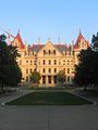
State Capital in Albany
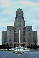
City Hall in Buffalo
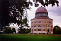
Union College in Schenectady
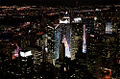
Times Square in Manhattan (NYC)
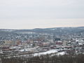
City of Binghamton
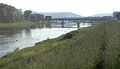
Chemung River in Elmira
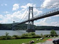
Mid-Hudson Bridge in Poughkeepsie
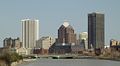
Skyline of Rochester
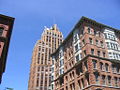
State Tower Building in Syracuse


External links
All links retrieved June 30, 2025.
- New York State Office of Parks Recreation and Historic Preservation
- State of New York Website
- I Love New York - official New York State tourism website
- History of Slavery in New York state
- The Geography of New York
| Political divisions of the United States | |||||||
|---|---|---|---|---|---|---|---|
| |||||||
Credits
New World Encyclopedia writers and editors rewrote and completed the Wikipedia article in accordance with New World Encyclopedia standards. This article abides by terms of the Creative Commons CC-by-sa 3.0 License (CC-by-sa), which may be used and disseminated with proper attribution. Credit is due under the terms of this license that can reference both the New World Encyclopedia contributors and the selfless volunteer contributors of the Wikimedia Foundation. To cite this article click here for a list of acceptable citing formats.The history of earlier contributions by wikipedians is accessible to researchers here:
The history of this article since it was imported to New World Encyclopedia:
Note: Some restrictions may apply to use of individual images which are separately licensed.