Utah
| State of Utah | |||||||||||
| |||||||||||
| Official language(s) | English | ||||||||||
| Capital | Salt Lake City | ||||||||||
| Largest city | capital | ||||||||||
| Largest metro area | Salt Lake City | ||||||||||
| Area | Ranked 13th | ||||||||||
| - Total | 84,899 sq mi (219,887 km²) | ||||||||||
| - Width | 270 miles (435 km) | ||||||||||
| - Length | 350 miles (565 km) | ||||||||||
| - % water | 3.25 | ||||||||||
| - Latitude | 37° N to 42° N | ||||||||||
| - Longitude | 109° 3′ W to 114° 3′ W | ||||||||||
| Population | Ranked 30th in the U.S. | ||||||||||
| - Total | 3,271,616 [1] | ||||||||||
| - Density | 36.53/sq mi (14.12/km2) Ranked 41st in the U.S. | ||||||||||
| - Median income | $60,365[2] (11th) | ||||||||||
| Elevation | |||||||||||
| - Highest point | Kings Peak[3][4] 13,518 ft (4,120.3 m) | ||||||||||
| - Mean | 6,100 ft (1,860 m) | ||||||||||
| - Lowest point | Beaver Dam Wash at Arizona border[3][4] 2,180 ft (664.4 m) | ||||||||||
| Admission to Union | January 4, 1896 (45th) | ||||||||||
| Governor | Mike DeWine (R) | ||||||||||
| Lieutenant Governor | Jon Husted (R) | ||||||||||
| U.S. Senators | Sherrod Brown (D) Rob Portman (R) | ||||||||||
| Time zone | Mountain: UTC-7/-6 | ||||||||||
| Abbreviations | UT US-UT | ||||||||||
| Web site | www.utah.gov | ||||||||||


Utah, a state located in the western United States, was the 45th state admitted to the union (January 4, 1896). The majority of Utah's population, known as "Utahns," live in an urban concentration known as the Wasatch Front, which stretches from Ogden on the north to Provo on the south with Salt Lake City as the center.
Utah's pivotal central western location makes the state a natural transportation center. Other key industries include information technology and research, government services, mining, and tourism. Utah is home to five national parks as well as incredible geological diversity in the form of snowcapped mountains to well-watered river valleys to rugged, stony deserts.
The state is also known for being one of the most religiously homogeneous states in the Union, with approximately 65 percent of its inhabitants claiming membership in The Church of Jesus Christ of Latter-day Saints, which greatly influences Utah culture and daily life.
Etymology
Utah's name originates from the Native American tribe known as the Ute, who ranged across much of the northern Colorado Plateau from at least 2,000 years B.C.E. Southern Paiute and Gosiute (inter-related and belonging to the Shoshone group) resided alongside the Ute at the time of European exploration of the area. "Ute" can be translated as "high land" or "land of the sun."[5] It is alternatively translated as "People of the mountains."[6]
People who live in Utah are known as "Utahns."
Geography


Utah, in the western United States, is bounded on the north by Idaho, Wyoming to the northeast, Colorado to its east, while its southern border is Arizona, and Nevada lies to the west. Its southeast corner touches the northwest corner of New Mexico, though they do not share a common boundary.
Unique within the 48 contiguous states, the four states of Utah, Colorado, New Mexico, and Arizona meet at a single point, known as the Four Corners Monument. The state comprises a total land mass of 84,899 square miles (219,887 km²).
Topography
Utah has three distinct geological regions: the Colorado Plateau, which covers slightly more than half the state, the Rocky Mountains, and the Great Basin.
The Colorado Plateau, ranging through parts of Colorado, New Mexico and Arizona, covers the southeastern half of Utah. Relatively high in elevation, this region is primarily comprised of Kayenta and Navajo sandstone. The Colorado River and its tributaries wind through this rock, creating some of the most spectacular wild terrain in the world. Wind and rain have sculpted the soft rock outcroppings over millions of years, producing breathtaking sites of canyons, gullies, arches, pinnacles, buttes, bluffs, and mesas throughout south-central and southeast Utah. Protected parks such as Arches, Bryce Canyon, Canyonlands, Capitol Reef, and Zion national parks, Cedar Breaks, Grand Staircase-Escalante, Hovenweep, and Natural Bridges national monuments, Glen Canyon National Recreation Area (site of the popular tourist destination, Lake Powell), Dead Horse Point and Goblin Valley state parks, and Monument Valley, a popular photographic and filming site are found here.
The Great Basin lies in the western third of the state. Within this basin is the Great Salt Lake, southwest of which is the Great Salt Lake Desert, covering 4,000 square miles and stretching to the Nevada border. This region is desert-like and contains both occasional mountain peaks and the well-known Bonneville Salt Flats.
Running down the center of the state is the Wasatch Range, a segment of the south-central Rocky Mountains, with heights of approximately 12,000 feet (3,650 m) above sea level. Portions of these mountains receive more than 500 inches (12.7 m) of snow each year and are home to world-renowned ski resorts, made popular by the light, fluffy snow. In the northeastern section of the state, running east to west, are the Uinta Mountains, which attain heights of 13,000 feet (3,950 m) and where the highest state summit, Kings Peak, 13,528 feet (4,123 m), is found. The Uinta Mountains are the only major mountain range in the United States running in an east–west direction.
Like much of the U.S. West and Southwest, the federal government owns a vast amount, over 70 percent, of Utah's land. Controlled by such departments as Bureau of Land Management, National Park, or designated Wilderness Areas, this is meant to protect and preserve the land. Often, contention occurs between commercial and personal interests such as ranching, mining, energy development, and recreation. The parks bring a substantial amount of income to the state through tourism.
Climate
Utah has four distinct seasons. July's average temperature is about 70° F (21° C). The average winter temperature is slightly below freezing except in "Dixie," the southwestern part of the state which has a warm, almost dry, subtropical climate, leading to its nickname. Daily temperatures vary widely: Salt Lake City has July highs of 90° F (32° C) or above, the nights are 55° to 65° F (13° to 18° C). In the populated areas, cold snaps are usually short and not severe. However, some mountain valleys, generally experience temperatures below 0 °F (-18 °C) 50 days per year. Sometimes the mountains to Utah's north and east function as barriers to Arctic air. Summer produces the other extreme, with high temperatures averaging between 85 °F (29 °C) and 100 °F (38 °C).
Most of Utah is arid due to its proximity to the West's mountain systems, which divert much of the precipitation. Average annual precipitation is 11 inches (280 millimeters). Its eastern and southern areas commonly receive 12 inches (300 mm) or less of precipitation per year, and the annual rainfall in western Utah is generally less than ten inches (25 cm). The Wasatch Front receives approximately 15 inches, while the Great Salt Lake Desert is quite dry, with less than eight inches annually. Rain favors the mountain areas, with more than 40 inches per year overall, although annual precipitation in some alpine places can be up to 60 inches. Utah's northern section is affected by air masses from the North Pacific, much of its precipitation falling in the cool season. Utah's southwestern valleys generally receive no snow, while ten feet or more is common at its mountain resorts. Snowfall is common from November through mid-April in the lower elevations and from October through May in the mountains. The mountains often retain snow into July.
Flora and fauna
The beauty of Utah's diverse natural landscape is considered one of the state's greatest assets. It is home to 17 National Parks and 43 State Parks.
There are 4,000 known plant species in the state representing six climatic zones, ranging from lowland desert to mountain peaks. There are over 15,000,000 acres of timberland, though only one-fourth of that is commercially viable. Commonly found are: Aspen, blue spruce, cactus, cedar, creosote bush, firs, Juniper, Joshua tree, mesquite, native grasses for grazing, piñon pine, pines, saltbush, sagebrush, shad scale and yucca.
Once home to bison, timber wolves and bears, these large animals have virtually disappeared from Utah's terrain. The most common large animal remaining is the mule deer. Bobcat, lynx and coyote make their home here. Birds include golden eagles, hawks, magpies and owls. Game birds include grouse, pheasant and quail. Blue herons, sea gulls and white pelicans are some of the birds found in the refuges of the Great Salt Lake. Also native to the state are several species of game fish, reptiles and amphibians.
History
Native American history
Archaeological sites throughout Utah have identified the area as having human population for 10,000-12,000 years. These ancient people, who were hunters and gatherers, adapted to life in the state's varied landscapes: deserts, high mountains, badlands, and marshes.
The Anasazi, or Pueblo culture, came north into Utah around 400 C.E., remaining until around 1250. These people were farmers who irrigated fields to grow crops and built pueblos, or villages which housed several hundred people. Their apartment constructions, some as high as five stories, were made on cliff caves or flat hills called mesas or tables.

The Fremonts and Anasazi peoples were famous for their rock art, depicted in chipped or painted symbols and figures on canyon walls. For unknown reasons, their homes and villages were abandoned in the late 1200s, perhaps due to inclement weather, such as drought, or invasions of other more aggressive peoples.
European-American explorers and settlers came to the area in the eighteenth and nineteenth centuries, finding Shoshone Indians; Paiute (Pahutes), Gosiute (or Goshutes) and Ute who had come to the area about the time the Anasazi left. Some of these peoples practiced irrigation, raising maize and pumpkins. Others lived a nomadic lifestyle, centered around the hunting of buffalo. The Utes, most prevalent of these three tribes, were the inspiration for the name of the modern-day state of Utah.
The Ute were the first modern Indians in Utah to utilize horses, which had been brought to the American west by the Spanish, where some got loose and lived in wild herds. The Ute became skillful riders and traveled throughout the entire state, hunting buffalo and other animals. Their numbers and power grew, and they adopted slave trading from the Spaniards, raiding the other two weaker, smaller tribes. Some Ute customs still prevalent today include the spring Bear Dance and the summer Sun dance.
The Navajo comprise a large Nation in New Mexico, Arizona, and since 1500, the area in Utah near Four Corners. Like the Utes, they domesticated the horse and sheep and lived as herders.
Conflict and confinement

The Ute experience with European-American settlers is similar to that of many other Native American groups: competition, confrontation and eventual coerced relocation to reservations. Of particular interest are the Walker War (1853–1854) and Black Hawk War (1865–1872) in Utah. Over the years, several other skirmishes and incidents occurred between Utes and white gold-seekers and settlers in Utah and Colorado. These Ute "uprisings" were the result of friction between recently arrived Anglos and local Ute groups. At the same time, the Ute were allies of the United States in its wars with the Navajo and Apache to the south.
A series of treaties established a small reservation in 1864 in northeast Utah, and a reservation in 1868, which included the western third of modern Colorado, including on land actually claimed by other tribes. This was whittled away until only the modern reservations are left: a large cession of land in 1873 transferred the gold-rich San Juan area, and was followed in 1879 by the loss of most of the remaining land.
Eventually, the various bands of Utes were consolidated onto three reservations. Several of these bands still maintain separate identities as part of the Ute tribal organizations. Although initially large and located in areas that white settlers deemed undesirable, the sizes of these reservations were repeatedly reduced by various government actions, encroachment by white settlers and mining interests. In the twentieth century, several U.S. federal court decisions restored portions of the original reservation land to the Ute Tribes' jurisdiction and awarded monetary compensations.
Mountain men
In the 1800s hundreds of mountain men, or fur traders traveling throughout the west established their own trails in search of beaver for pelts to be made into popular hats in U.S. and European cities. Kit Carson, a well known guide and Jim Beckwourth, a mountain man leader, and other traders enjoyed the independence of their occupation and delighted in the boisterous, if excessive, parties such as an Ogden gathering that Mr. Beckwourth described in 1826: "Mirth, songs, dancing, shouting, trading, running, jumping, singing, racing, target shooting, yarns, frolic, with all sorts of extravagances that white men or Indians could invent, were freely indulged in."
Great hardship was endured as well. Jedediah Strong Smith was the first white man to cross Utah throughout the state, north to south and east to west. His animals were ill and exhausted after traveling, and he was forced to consume his sick horse to survive.
This business flourished for about 20 years, until the supply of fur animals, like the beaver, diminished and the fashions changed. With no remaining economic incentive and no established families in the area, the mountain men left Utah in the late 1840s seeking wealth elsewhere.
Early pioneers
Several groups of settlers, westward–bound to California or Oregon Territory, passed through Utah. The Bartleson-Bidwell group of 1841 were the first American emigrants to cross Utah. They and the Donner-Reed Party who traveled five years later, used the Miera map which presented a non-existent river. Both groups reached California but suffered great deprivations of weather and food along the way and were compelled to abandon many supplies, wagons, and animals. The Donner-Reed party was reduced from 87 to 44 of their original group of emigrants after wintering in adverse conditions, with no hope of rescue.
John C. Frémont a famous western government explorer, aided by guide Kit Carson, visited the Great Salt Lake Region in 1843-1844. In 1845 he printed a correct map that identified the drainage of the Great Salt Lake as a Great Basin. Two years after the map was printed, the first group of Caucasian members and three African-American slaves used the revised map when it traveled to Utah, following the path of the Donner-Reed party trail. These Mormon pioneers would claim this western desert and mountainous area as their homeland.
Mormon settlement
The Mormon faith began in Palymra, New York when the founder Joseph Smith, Jr., at the age of 14, reported an apparition from God and Jesus. Three years later he reported that the angel Moroni appeared and revealed church teachings to him over a four-year period, after which he received the golden plates and a revelation from John the Baptist. Smith and a scribe, Mr. Cowdery, baptized each other as Church priests, in the Melchizedec order, and became the Church's first elders. The Mormon Church was officially founded in 1830 and suffered years of persecution, culminating in Smith's assassination in 1844.
The death of the church's founder posed serious problems, especially since Smith had left no clear choice as a successor. The Twelve Apostles of the church, through prayer, determined the group's new leader to be Brigham Young. Young led the first group of Mormon pioneers on a 1,300 mile trek to the Salt Lake Valley on July 24, 1847. During the next 22 years, more than 70,000 Latter Day Saints pioneers crossed the plains and settled in Utah.
The church grew rapidly, and many adherents from the eastern United States and other nations settled in Utah. Church leaders assigned groups to settle throughout the West. With such religious expansion efforts and land irrigation, settlements grew quickly along Utah's Wasatch Front, centered in Salt Lake City. Then it expanded to the Bountiful and Weber Valley, and continued to Provo and Utah Valley. Prominent early LDS towns in Utah were St. George, Logan, and Manti (where the first temples in Utah were built), Fillmore (the territorial capital between 1850 and 1856), Nephi, Levan, Spanish Fork, Springville, Provo Bench (renamed Orem), and many others. Young named this new Mormon pioneer territory Deseret which means "honeybee." This symbol appears on the Utah state flag, and it is the source of the state motto, "Industry." [7]
Mountain Meadows massacre
One of the most tragic and disturbing events in Mormon history took place on September 11, 1857, when approximately 120 men, women and children, traveling through Utah to California were massacred by a force consisting of Mormon militia members and Southern Paiute Indians. This came to be known as the Mountain Meadows massacre.
The Baker-Fancher train consisted of California-bound emigrants who started their journey in Arkansas and Missouri. Earlier in the year, Mormon apostle Parley P. Pratt had been murdered near the town of Van Buren, Arkansas. Rumor had it that some of the members of the train were among those who had participated in Pratt's murder, or that they bragged about his killing.
The group arrived in Salt Lake City in late July. It was common for emigrant parties to camp near Mountain Meadows for several days or even weeks while their animals gained condition for the grueling desert crossings still to come. They were camping there in early September when they were surrounded by a group of hostile Paiutes. A small group of Mormons had sent word of the situation to Brigham Young, seeking his counsel. Unfortunately, his advice was late in coming, arriving two days after the massacre. His letter had directed: "In regard to the emigration trains passing through our settlements, we must not interfere with them until they are first notified to keep away. You must not meddle with them. The Indians we expect will do as they please but you should try and preserve good feelings with them." The small group of Mormons who were involved went to trial and were excommunicated.
There are conflicting accounts of this event and the truth may not come to full disclosure in this lifetime. However, in the 1980s, descendants of the victims and the perpetrators met together to start bridging the divide and make peace with the past. Through a series of meetings the seeds of reconciliation were planted.
Polygamy


The Mormon practice of polygamy was countered by the federal government's Edmunds Act of 1882. Both the government and the general public condemned this practice and considered LDS members to be un-American and rebellious because of it. Multiple attempts to have Utah (the original State of Deseret of which Young was governor) recognized as a state failed due to strong resistance to the practice of polygamy.
In 1890, the Church beliefs and practices were changed following a new revelation which outlawed the practice of polygamy. Wilford Woodruff, then president of the Church, issued a manifesto called the "Great Accommodation" which generally suspended the solemnization of plural marriages for an indefinite period.
Utah was granted statehood 1896, six years after the manifesto was issued. The original proposal was for the creation of a Mormon state encompassing all remaining lands to the West with the exception of New Mexico and California. Eventually the current day boundaries came into play as other states joined the Union.
Twentieth century
In the early 1900s Utah attained renown for its natural beauty as Bryce Canyon National Park and Zion National Park became national landmarks. The southern portion of the state became a popular filming spot for arid, rugged western scenes; most Americans came to recognize such natural landmarks as Delicate Arch and "the Mittens" of Monument Valley. During the 1950s, through 1970s, the Interstate highway system was constructed.
Beginning in 1939, the Alta Ski Area was established, and Utah became famous throughout the world for its high quality snow and skiing, which many consider the best in the world, especially in the Wasatch Range. Salt Lake City was selected to host the 2002 Winter Olympics in 1995, and many of the Olympic venues along the Wasatch Front are still used for sporting events. To better serve the tourists within and from outside Utah, the TRAX light-rail system was developed in Salt Lake Valley and the city–wide freeway system was updated.
Law and government


Salt Lake City is the capital and largest city of the "Beehive State" as well as the county seat for Salt Lake County. It sits at the base of the Wasatch Mountains, on the Jordan River at the southeastern end of Great Salt Lake and is sandwiched between Grand Canyon and Zion National Parks to the south and Yellowstone and the Grand Tetons to the north.
Founded by Brigham Young in 1847, it is home of the world headquarters of the Church of Jesus Christ of Latter-day Saints (Mormons), the famous Mormon Tabernacle and the University of Utah. Located near famous ski resorts, the city is a regional center for business, religious and social life. [8]
State and local politics
As with most U.S. states, Utah's government is divided into three branches: executive, legislative, and judicial.
The top executives of Utah are the governor and the lieutenant governor, who are elected on the same ticket to a maximum of two four-year terms.
The Utah State Legislature consists of a Senate and a House of Representatives. State senators serve four-year terms and representatives, two year terms. The state legislature meets each year in January for an annual 45-day session.
The state Supreme Court is the court of last resort in Utah. Five justices, whom the governor initially appoints, serve on this court. They must be elected to subsequent terms. Other lower court justices and judges follow this same procedure. The state Court of Appeals handles cases from the trial courts. Trial level courts are the district courts and justice courts.
The Republican Party prevails in the state's leadership. Governors usually assume a centrist position on social issues and favor free economic trade. While state senators and representatives generally pass socially conservative policies the governor has the right-of-veto, which is often utilized.
In general, Utah is one of the most conservative states in the Union. The 2006 general session of the legislature passed S.J.R. 9, an amendment recognizing the "rights of public school students to voluntarily engage in prayer and other expressions considered religious in nature in public schools." [9]
Federal politics
Utah is one of the most Republican states in the nation, with Republican presidential nominees consistently achieving one of their highest margins of victory here. The state has not voted for a Democrat for President since 1964 when Lyndon B. Johnson won the state's electoral vote.
Economy

Major industries of Utah include: mining, cattle ranching, salt production, and government services.
Research, information technology development, and service based industries are important economic activities along the Salt Lake City-Ogden-Provo corridor.
Utahns have a particular mindset regarding giving, which has placed them first among all U.S. states in the proportion of income given to charity by the wealthy.
Natural resources and mining
The late nineteenth century marked the beginning of the state's mining boom which attracted large numbers of immigrants with job opportunities. Since the days of the Utah Territory mining has played a major role in Utah's economy.
During the early part of the Cold War era, uranium was mined in the eastern part of the state. Today mining activity still plays a major role in the state's economy. Minerals mined include copper, gold, silver, molybdenum, zinc, lead, and beryllium. Fossil fuels include coal, petroleum, and natural gas.
In eastern Utah petroleum production is a major industry. Near Salt Lake City, petroleum refining is done by a number of oil companies. In central Utah, coal production accounts for much of the mining activity.
Tourism

Tourism is a major industry in Southern Utah. The state's five national parks (Arches, Bryce Canyon, Canyonlands, Capitol Reef, and Zion) along with the ski resorts in the northern Wasatch Range, the Bonneville Salt Flats, the Great Salt Lake, Temple Square, Sundance Film Festival, and the Utah Shakespearean Festival are popular attractions.
The mountains are popular for camping, rock-climbing, skiing, snowboarding, mountain–biking and hiking.
Transportation
Utah has five Interstate Highway systems.
- Interstate 15 is the main interstate highway in the state, entering from Arizona and spanning the state north-south, entering Idaho near the town of Portage. It serves the primary population centers of the state.
- Interstate 80 spans the northern portion of the state west-east. It enters from Nevada at Wendover, traverses Salt Lake City, then crosses the Wasatch Range, entering Wyoming.
- Interstate 84 splits from I-80 at the town of Echo, heading west through the Wasatch Range and joining I-15 southwest of Ogden. The two interstates stay merged until Tremonton, where I-84 heads northwest, entering Idaho near Snowville.
- Interstate 70 splits from I-15 at Cove Fort, heading east through the mountains and into Colorado west of Grand Junction, traversing desolate desert terrain and serving the various national parks and national monuments of southern Utah. The stretch of I-70 between the towns of Salina and Green River is the longest stretch of interstate in the country without any services.
- Interstate 215 is the "belt route" forming a loop around Salt Lake City.
There is also a state highway system.
Salt Lake City International Airport is the only international airport in the state and serves as a hub of Delta Airlines. In 2005 it was ranked first in on-time departures and second in on-time arrivals in the country, and consistently ranks in the top 10 for customer service.
There are a number of small regional airports throughout the state.
Education
With 90.7 percent of Utahns aged 25 and over having completed high school and 26.9 percent with a bachelor's degree or higher, Utah ranks among the leading states in educational development and attainment of its population. The year 2002 saw 30,337 high school students graduate.
The state has a reputation for high-quality educational programs in its public, private and parochial schools. Nearly half million students attend elementary and secondary schools on an annual basis.
Higher education
Utah has ten public degree-granting universities and colleges, and three private higher learning institutions which offer training in a multitude of subject areas. The state's System of Higher Education is governed by the Utah State Board of Regents and assisted by a local Board of Trustees.
The state's three research–based institutions are
- the University of Utah, whose most common degrees awarded include Economics, Political Science, Mass Communications, Psychology, and Sociology.
- Utah State University, which was originally established as an agricultural college but has since expanded its studies to include the History of the American West and plans to extend its Arts Program.
- Brigham Young University, established by the Mormon Church, offers courses in business, culinary arts, digital arts and graphic design, education, fashion design and interior design, health and medicine, law and justice, and technology.
Other schools of higher learning include the College of Eastern Utah, Dixie State College of Utah, ITT Technical Institute, LDS Business College, Southern Utah University, Utah Valley State College, and Western Governors University (an online university).
Demographics
| State symbols |
|
The state's population is concentrated in two areas, the Wasatch Front in the north-central part of the state, with a population of approximately two million. There are five major metropolitan areas running north-south along this range:
- Logan
- Ogden-Clearfield
- Salt Lake City
- Provo-Orem
- St. George
The other population center is in southwestern Utah, locally known as "Dixie."
Ethnicity
Most Utahns are of Northern European descent. Among the European immigrants who settled in Utah from 1850 to 1950, the highest percentage were British, followed by second ranking Scandinavians. Caucasians form the major group in every county except San Juan, which has a large Navajo population.
The Hispanic population is growing rapidly, especially in Salt Lake City, Ogden, and Orem/Provo area. These include recent immigrants from Mexico, Central America and South America. Utah's African-American population is relatively small; most are middle-class professionals who relocated from California.
Culture
There have been three major influences in Utah's history which affect its overall cultural climate today - "Old West" Cowboys, Native American tribes, and Mormon settlers.
Utah's sparsely–populated wide–open spaces were inviting to legitimate cowboys, cattle rustlers and outlaws in the 1800s. Except for several concentrated population centers, Utah remains wide open today, allowing for an abundance of ranches with modern cowboys.
There are five major American Indian tribes within the state: 1) Ute; 2) Dine' (Navajo); 3) Paiute; 4) Goshute; and 5) Shoshoni. The Navajo are a major tourist draw due to their excellent craftsmanship. They are well–known for their jewelry made of turquoise, silver, and local gemstones. The five tribes continue to be an important part of Utah's modern culture. [11]
Approximately 65 percent of the state's population belong to the Mormon faith. This has had a profound influence on the state especially in terms of accepted social practices, politics and lawmaking. Mormons not only hold, but practice, conservatism in such things as alcohol consumption and gambling. Their beliefs in family values and community are strong.
Photo gallery
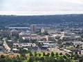
Provo
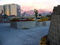
Sandy
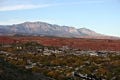
St. George
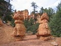
Red Canyon
The Four Corners - Utah, Colorado, Arizona & New Mexico


Notes
- ↑ 2020 Census Apportionment Results The United States Census Bureau, April 26, 2021. Retrieved April 25, 2022.
- ↑ United States Median Household Income United States Census Bureau. Retrieved April 25, 2022.
- ↑ 3.0 3.1 Elevations and Distances in the United States United States Geological Survey. Retrieved April 25, 2022.
- ↑ 4.0 4.1 Elevation adjusted to North American Vertical Datum of 1988.
- ↑ Southern Ute Museum of Northern Arizona. Retrieved April 25, 2022.
- ↑ Nancy McClure, The Arts and Culture of the Ute Indians – Points West Online Buffalo Bill Center of the West. Retrieved April 25, 2022.
- ↑ Corporation of the President of The Church of Jesus Christ of Latter-day Saints: "Church History in the Fullness of Times." 1989.
- ↑ Salt Lake City www.utah.com. Retrieved April 25, 2022.
- ↑ S.J.R.9 2006 General Session State of Utah. Retrieved April 25, 2022.
- ↑ Utah State Symbols USA. Retrieved April 25, 2022.
- ↑ The Old West Utah Travel Industry. Retrieved April 25, 2022.
ReferencesISBN links support NWE through referral fees
- Brown, Jonatha A. Utah. Portraits of the states. Milwaukee, WI: Gareth Stevens, 2007. ISBN 0836847091
- Fradin, Dennis B. Utah. From Sea to Shining Sea. Chicago: Childrens Press, 1993. ISBN 9780516038445
- McCarthy, Betty. America the beautiful. Utah. Chicago: Childrens Press, 1990. ISBN 9780516004907
- Ross, Dana Fuller. Utah! Toronto: Bantam, 1984. ISBN 055323921X
- Sprinkel, Douglas A., Thomas C. Chidsey, and Paul B. Anderson. Geology of Utah's parks and monuments. Utah Geological Association publication, 28. Salt Lake City, UT: Utah Geological Association, 2003. ISBN 9781882054107
External links
All links retrieved May 3, 2023.
- Official Website of the State of Utah
- This is Utah
- Visit Utah
- The University of Utah
- Utah State University
- Utah National Park Service
| Political divisions of the United States | |||||||
|---|---|---|---|---|---|---|---|
| |||||||
Credits
New World Encyclopedia writers and editors rewrote and completed the Wikipedia article in accordance with New World Encyclopedia standards. This article abides by terms of the Creative Commons CC-by-sa 3.0 License (CC-by-sa), which may be used and disseminated with proper attribution. Credit is due under the terms of this license that can reference both the New World Encyclopedia contributors and the selfless volunteer contributors of the Wikimedia Foundation. To cite this article click here for a list of acceptable citing formats.The history of earlier contributions by wikipedians is accessible to researchers here:
The history of this article since it was imported to New World Encyclopedia:
Note: Some restrictions may apply to use of individual images which are separately licensed.