Vermont
| State of Vermont | |||||||||||
| |||||||||||
| Official language(s) | English | ||||||||||
| Capital | Montpelier | ||||||||||
| Largest city | Burlington | ||||||||||
| Area | Ranked 45th | ||||||||||
| - Total | 9,620 sq mi (24,923 km²) | ||||||||||
| - Width | 80 miles (130 km) | ||||||||||
| - Length | 160 miles (260 km) | ||||||||||
| - % water | 4.1 | ||||||||||
| - Latitude | 42° 44′ N to 45° 1′ N | ||||||||||
| - Longitude | 71° 28′ W to 73° 26′ W | ||||||||||
| Population | Ranked 49th in the U.S. | ||||||||||
| - Total | 626,431 (2020)[1] | ||||||||||
| - Density | 67.7/sq mi (26.1/km2) Ranked 30th in the U.S. | ||||||||||
| - Median income | $72,431[2] (26th) | ||||||||||
| Elevation | |||||||||||
| - Highest point | Mount Mansfield[3][4] 4,395 ft (1339.69 m) | ||||||||||
| - Mean | 1,000 ft (300 m) | ||||||||||
| - Lowest point | Lake Champlain[3][4] 95 to 100 ft (29 to 30 m) | ||||||||||
| Admission to Union | March 4, 1791 (14th) | ||||||||||
| Governor | Phil Scott (R) | ||||||||||
| Lieutenant Governor | John S. Rodgers (R) | ||||||||||
| U.S. Senators | Bernie Sanders (I) Peter Welch (D) | ||||||||||
| Time zone | Eastern: UTC–5/−4 | ||||||||||
| Abbreviations | US-VT | ||||||||||
| Web site | www.vermont.gov | ||||||||||


Vermont is a state in the New England region of the northeastern United States of America. The state ranks 45th by total area, and 43rd by land area at 9,250 square miles. It is the only New England state with no Atlantic Ocean coastline. It is bordered by Massachusetts to the south, New Hampshire to the east, New York to the west, and the Canadian province of Quebec to the north. Notable physical features include the Green Mountains in the west and Lake Champlain in the northwest.
The original Native American tribes in the area were the Algonquian Abenaki, and the Iroquois Federation. Claimed by France, the territory became a British possession after France's defeat in the French and Indian War. For many years, control of the area was disputed by the surrounding colonies, notably New Hampshire and New York. Settlers who held land titles granted by these colonies were opposed by the Green Mountain Boys militia, which eventually prevailed in creating an independent state. Vermont became the 14th state to join the United States, following a 14-year period during and after the Revolutionary War as the independent Republic of Vermont.

The leading producer of maple syrup in the United States, Vermont is also well-known for the beauty and tranquility of its mountains and unspoiled valleys, as attested to by the fact that tourism is its largest industry.
Geography
Located in the New England region of the eastern United States, Vermont is bordered to the north by the Canadian province of Quebec, to the east by New Hampshire, to the south by Massachusetts, and to the west by New York.
Comprising 9,614 square miles (24,902 km²), Vermont is one of the smallest states; only five are smaller. Of this, 9,250 square miles (23,955 km²) is land and 365 square miles (948 km²) is water, making it the 43rd largest in land area and the 47th in water area. In area, it is larger than El Salvador and smaller than Haiti.
The west bank of the Connecticut River marks the eastern border of the state with New Hampshire (the river itself is part of New Hampshire). Lake Champlain, the major lake in Vermont, is the sixth-largest body of fresh water in the United States and separates Vermont from New York in the northwest portion of the state. From north to south, Vermont is 159 miles (256 km). Its greatest width, from east to west, is 89 miles (143 km) at the Canadian border; the narrowest width is 37 miles (60 km) at the Massachusetts line. The state's geographic center is in the town of Washington, three miles (5 km) east of Roxbury.

There are six distinct physiographic regions within the state. Categorized by geological and physical attributes, they are the Northeastern Highlands, the Green Mountains, the Taconic Mountains, the Champlain Lowlands, the Valley of Vermont and the Vermont Piedmont.
The origin of the name Green Mountains (French: Verts monts) is uncertain. Some authorities say that they are so named because they have much more forestation than the higher White Mountains of New Hampshire and Adirondacks of New York. Other authorities say that they are so named because of the predominance of mica-quartz-chlorite schist, a green-hued metamorphosed shale. The range forms a north-south spine running most of the length of the state, slightly west of its center. In the southwest portion of the state are the Taconic Mountains; the Granitic Mountains are in the northeast.[5] In the northwest near Lake Champlain is the fertile Champlain Valley. In the south of the valley is Lake Bomoseen.
Several of Vermont's mountains have timberlines: Mount Mansfield, the highest mountain in the state, as well as Killington are examples. About 77 percent of the state is covered by forest; the rest is covered in meadow, uplands, lakes, ponds and swampy wetlands.
Areas in Vermont administered by the National Park Service include the Appalachian National Scenic Trail and the Marsh-Billings-Rockefeller National Historical Park in Woodstock.
Flora and fauna

Vermont's hillsides are covered with pine, spruce, fir, hemlock, maple and birch trees. Ferns and wildflowers are plentiful, as are the brooks and streams that run through the wooded areas of the state. The sugar maple is the state tree, and its abundance has made Vermont the number one state in the nation in maple syrup production.
The state's deer population is large, and deer hunting is an autumn ritual. Bears and moose are common, as are smaller animals. Fish are plentiful, making fishing a popular sport, including winter ice fishing.
Climate
Vermont has a continental moist climate, with warm, humid summers and cold winters, which become colder at higher elevations. It has a Koppen climate classification of Dfb, similar to Minsk, Stockholm, and Fargo. The state is known for its mud season in spring followed by a generally mild early summer, hot Augusts and a colorful autumn, and particularly for its cold winters. The northern part of the state, including the rural northeastern section (dubbed the "Northeast Kingdom") is known for exceptionally cold winters, often averaging 10 °F (6 °C) colder than the southern areas of the state. Annual snowfall averages between 60 to 100 inches (150–250 cm) depending on elevation, giving Vermont some of New England's best cross-country and downhill ski areas.
In the autumn, Vermont's hills experience an explosion of red, orange and gold foliage displayed on the sugar maple as cold weather approaches. This famous display of color that occurs so abundantly in Vermont is not due so much to the presence of a particular variant of the sugar maple; rather it is caused by a number of soil and climate conditions unique to the area.
The highest-recorded temperature was 105 °F (41 °C), at Vernon on July 4, 1911; the lowest-recorded temperature was -50 °F (-46 °C), at Bloomfield on December 30, 1933.
History
Prehistory and Precolumbian

Vermont was covered with shallow seas periodically from the Cambrian to Devonian periods. Most of the sedimentary rocks laid down in these seas were deformed by mountain-building. Fossils, however, are common in the Lake Champlain region. Lower areas of western Vermont were flooded again, as part of the Saint Lawrence Valley "Champlain Sea" at the end of the last ice age, when the land had not yet rebounded from the weight of the glaciers. Shells of salt-water mollusks, along with the bones of beluga whales, have been found in the Lake Champlain region.
Little is known of the pre-Columbian history of Vermont. The western part of the state was originally home to a small population of Algonquian-speaking tribes, including the Mohican and Abenaki peoples. Between 8500 to 7000 B.C.E., at the time of the Champlain Sea, Native peoples inhabited and hunted in Vermont. From the eighth century to 1000 B.C.E. was the Archaic Period. During that era, Natives migrated year-round. From 1000 B.C.E. to 1600 C.E. was the Woodland Period, when villages and trade networks were established, and ceramic and bow and arrow technology was developed. Sometime between 1500 and 1600, the Iroquois drove many of the smaller native tribes out of Vermont, later using the area as a hunting ground and warring with the remaining Abenaki. The population in 1500 is estimated to have been around 10,000 people.
Colonial
The first European to see Vermont is thought to have been Jacques Cartier, in 1535. On July 30, 1609, French explorer Samuel de Champlain claimed the area of what is now Lake Champlain, naming the region les Vert Monts (the Green Mountains). France claimed Vermont as part of New France, and in 1666, erected Fort Sainte Anne on Isle La Motte in Lake Champlain. This was the first European settlement in Vermont and the site of the first Roman Catholic Mass.
Non-French settlers began to explore Vermont. In 1690, a group of Dutch-British settlers from Albany, New York under Captain Jacobus de Warm established the De Warm Stockade at Chimney Point (eight miles or 13 km west of present-day Addison).
In 1731, more French settlers arrived and eventually constructed Fort St. Frédéric, begun in 1734. The fort gave the French control of the border region in the Lake Champlain Valley, encouraging settlement. The British succeeded in capturing the fort in 1759 after repeated attempts, forcing the French out of the valley. The following year, the settlement was burned by Mohawks.
The first permanent British settlement was established in 1724, with the construction of Fort Dummer in Vermont's far southeast. The second British settlement was the 1761 founding of Bennington in the southwest.

During the Seven Years War, locally known as the French and Indian War, some Vermont settlers, including Ethan Allen, joined the colonial militia assisting the British in attacks on the French. Fort Carillon on the New York-Vermont border, a French fort constructed in 1755, was the site of two British offensives under Lord Amherst's command: the unsuccessful British attack in 1758 and the retaking of the following year with no major resistance (most of the garrison had been removed to defend Quebec, Montreal, and the western forts). The British renamed the fort Fort Ticonderoga (which became the site of two later battles during the American Revolutionary War). Following France's loss in the French and Indian War, the 1763 Treaty of Paris gave control of the land to the British.
The end of the war brought new settlers to Vermont. A fort at Crown Point, New York had been built, and the Crown Point Military Road stretched from the east to the west of the Vermont wilderness from Springfield to Chimney Point, making travel from the neighboring British colonies easier. Three colonies laid claim to the area. The Province of Massachusetts Bay claimed the land on the basis of the 1629 charter of the Massachusetts Bay Colony. The Province of New York claimed Vermont based on the early Dutch Charter to the West India Company for lands west of the Connecticut River, and the identical land granted to the Duke of York (later King James II) in 1664. The Province of New Hampshire also claimed Vermont based upon a decree of George II in 1740. In 1741, George II ruled that Massachusetts's claims in Vermont and New Hampshire were invalid and fixed Massachusetts's northern boundary at its present location. This still left New Hampshire and New York with conflicting claims to the land.
The situation resulted in the New Hampshire Grants, a series of 135 land grants made between 1749 and 1764 by New Hampshire's colonial governor, Benning Wentworth. The grants sparked a dispute with the New York governor, who began granting charters of his own for New Yorker settlement in Vermont. In 1770, Ethan Allen—along with his brothers Ira and Levi, as well as Seth Warner—recruited an informal militia, the Green Mountain Boys, to protect the interests of the original New Hampshire settlers against the new migrants from New York. When a New York judge arrived in Westminster with New York settlers in March 1775, violence broke out as angry citizens took over the courthouse and called a sheriff's posse. This resulted in the deaths of Daniel Houghton and William French in the "Westminster Massacre."
Independence to Statehood

On January 18, 1777, representatives of the New Hampshire Grants convened in Westminster and declared the independence of the Vermont Republic.[6] For the first six months of the republic's existence, the republic was called New Connecticut.
On June 2, a second convention of 72 delegates met at Westminster, known as the "Westminster Convention." At this meeting, the delegates adopted the name "Vermont" on the suggestion of Dr. Thomas Young of Philadelphia, a supporter of the delegates who wrote a letter advising them on how to achieve admission into the newly independent United States as the 14th state. The delegates set the time for a meeting one month later. On July 4, the Constitution of the Vermont Republic was drafted during a violent thunderstorm at the Windsor Tavern owned by Elijah West and was adopted by the delegates on July 8, following four days of debate. This was among the first written constitutions in North America and was indisputably the first to abolish the institution of slavery, provide for universal manhood suffrage and require support of public schools. The Windsor tavern has been preserved as the Old Constitution House, administered as a state historic site.
The Battle of Bennington, fought on August 16, 1777, conferred legitimacy on the republic. Vermont's sovereignty was challenged by New York, New Hampshire, Great Britain, and the new United States. The republic's ability to defeat a powerful military invader gave it a legitimacy among its scattered frontier society that would sustain it through fourteen years of fragile independence before it finally achieved statehood as the 14th state in the union in 1791.


The Battles of Bennington[7] and Saratoga are recognized as the turning point in the Revolutionary War because they were the first major defeat of a British army and convinced the French that the Americans were worthy of military aid. General John Stark became widely known as the "Hero of Bennington," and the anniversary of the battle is still celebrated in Vermont as a legal holiday known as "Bennington Battle Day."[8]
Vermont continued to govern itself as a sovereign entity based in the eastern town of Windsor for fourteen years. The Vermont Republic issued its own currency, coins and operated a statewide postal service. Thomas Chittenden led the nascent republic as its governor from 1778 to 1789 and from 1790 to 1791, when Vermont joined the federal Union as the fourteenth state–the first state to enter the union after the original thirteen colonies, and a counterweight to slave holding Kentucky, which was admitted to the Union shortly afterward.
Vermont had a unicameral legislature until 1836.
An 1854 Vermont Senate report on slavery echoed the Vermont Constitution's first article, on the rights of all men, questioning how a government could favor the rights of one people over another. The report fueled growth of the abolition movement in the state, and in response, a resolution from the Georgia General Assembly authorizing the "towing of Vermont out to sea." The mid to late 1850s saw a transition from Vermonters mostly favoring slavery's containment, to a far more serious opposition to the institution, producing the Radical Republican and abolitionist Thaddeus Stevens. As the Whig party shriveled, and the Republican Party emerged, Vermont strongly trended in support of its candidates, first on the state level and later for the presidency. In 1860 it voted for President Lincoln, giving him the largest margin of victory of any state.
The Civil War
During the American Civil War, Vermont sent more than 34,000 men into United States service, contributing 18 regiments of infantry and cavalry, three batteries of light artillery, three companies of sharpshooters, two companies of frontier cavalry, and thousands in the regular army and navy, and in other states’ units. Almost 5,200 Vermonters, 15 percent, were killed or mortally wounded in action or died of disease. Vermonters, if not Vermont units, participated in every major battle of the war.
Among the most famous of the Vermont units were the 1st Vermont Brigade, the 2nd Vermont Brigade, and the 1st Vermont Cavalry.
A large proportion of Vermont’s state and national-level politicians for several decades after the Civil War were veterans.
The northernmost land action of the war, the St. Albans Raid, took place in Vermont.
Postbellum era and beyond
The two decades following the end of the American Civil War (1864-1885) brought both economic expansion and contraction, and fairly dramatic social change. Vermont's railroads expanded and were linked to national systems, agricultural output and export soared and incomes increased. But Vermont also felt the effects of recessions and financial panics, particularly the 1873 Panic which resulted in a substantial exodus of young Vermonters. The transition in thinking about the rights of citizens, first brought to a head by the 1854 Vermont Senate report on slavery, and later Lincoln's Gettysburg Address in changing how citizens perceived civil rights, fueled agitation for women's suffrage. The first election in which women were allowed to vote was on December 18, 1880, when women were granted limited suffrage and were first allowed to vote in town elections, and then in state legislative races.
On April 25, 2000, as a result of the Vermont Supreme Court's decision in Baker v. Vermont, the Vermont General Assembly passed and Governor Howard Dean signed into law H.0847, which provided the state sanctioned benefits of marriage to gay and lesbian couples in the form of civil unions. Controversy over the civil unions bill was a central issue in the subsequent 2000 elections.
Law and government

Montpelier serves as Vermont's capital city. With a population of 8,035 in the 2000 census, it is the least-populated state capital in the U.S. Lying along the upper Winooski River just northwest of the city of Barre, it commands the main pass through the Green Mountains near the center of the state. Colonel Jacob Davis, among the first European settlers to establish a village there, is believed to have named the settlement for the French city Montpellier. (The name is a contraction of mont – hill, and peller – bare or shorn.) The township was chartered August 14, 1781 and was named the state capital in 1805.
State and local politics
Vermonters elect a state governor and lieutenant governor on separate tickets, meaning that the offices can be filled by members of different parties. In addition to the Governor and Lieutenant Governor, four other officials are elected on a statewide ballot: Secretary of State, State Treasurer, Auditor of Accounts, and Attorney General.
The state government is made up of the executive branch, the legislative branch, and the judicial branch. All members of the executive and legislative branch serve two-year terms including the governor and senators. There are no term limits for any office. Vermont's state legislature is the Vermont General Assembly, a bicameral body composed of the Vermont House of Representatives (the lower house) and the Vermont Senate (the upper house). There are 30 state Senators, and 150 members in the House of Representatives.
Like most of New England, Vermont has a nearly non-existent county government. The next effective governmental level below state government are municipalities, most of which are towns.
Vermonters are known for their political independence. The state's unique history and history of independent political thought has led to movements for the establishment of the Second Vermont Republic and other plans advocating secession.[9]
The Vermont government maintains a proactive stance regarding the environment, social services, and prevention of urbanization. Legislators have recently tended to vote liberal on social issues, and moderate to conservative on fiscal issues.
Another case involves the recent controversy over the adoption of civil unions, an institution which grants same-sex couples nearly all the rights and privileges of marriage. In Baker v. Vermont (1999), the Vermont Supreme Court ruled that, under the Constitution of Vermont, the state must either allow same-sex marriage or provide a separate but equal status for them. The state legislature chose the second option by creating the institution of civil union; the bill was passed by the legislature and signed into law by Governor Howard Dean.
Civil rights and liberties
The Vermont Constitution outlines and guarantees broad rights for its citizens. When written, it was considered one of the most far-reaching in the new world and in Europe, predating the Bill of Rights by a dozen years. The Constitution's first chapter, "Declaration of the Rights of the Inhabitants of The State of Vermont" prohibited slavery and indentured servitude, and allowed for universal suffrage for men, regardless of property ownership. The Declaration of Rights set in place broad protections of religious freedom and conscience while prohibiting establishment or promotion of any faith by the government or compulsion to worship. The "Declaration of the Rights of the Inhabitants of The State of Vermont" is believed to have been a model for the Déclaration universelle sur des droits de l'homme (Universal Declaration of the Rights of Man) approved by the National Assembly of France, August 26, 1789.
Federal politics
In the early 1960s many progressive Vermont Republicans and newcomers to the state helped bolster the state's small Democratic Party. Until 1992, Vermont had supported a Democrat for president only once since the party's founding—in Lyndon Johnson's 1964 landslide victory against Barry Goldwater. In 1992, it supported Democrat Bill Clinton for president and has voted for Democrats in every presidential election since. Vermont gave John Kerry his fourth-largest margin of victory in 2004. He won the state's popular vote by 20 percentage points over incumbent George W. Bush, taking almost 59 percent of the vote. Essex County in the state's northeastern section was the only county to vote for Bush.
Economy
The service sector is the mainstay of Vermont's economy. Though there are pockets of high unemployment, the state average is low in comparison to other states.
Vermont collects personal income tax in a progressive structure of five different income brackets, ranging from 3.6 percent to 9.5 percent. The state's general sales tax rate is 6 percent, which is imposed on sales of tangible personal property, amusement charges, fabrication charges, some public utility charges and some service contracts. Some localities impose an additional 1 percent Local Option Tax. Property taxes are imposed for the support of education and municipal services.
Tourism

Tourism is the state's largest industry after the service sector. Summer camps contribute to the tourist economy. Trout fishing, lake fishing, and ice fishing draw outdoor enthusiasts to the state, as does the hiking on the Long Trail. In the summer, resort towns such as Stowe, Manchester, and Woodstock host visitors.
In winter, nordic and backcountry skiers visit to travel the length of the state on the Catamount Trail. The ski resorts Stowe, Killington Ski Resort, Mad River Glen, Sugarbush, Stratton, Jay Peak, Okemo, Mount Snow and Bromley host skiers from around the globe, although their largest markets are the Boston, Montreal and New York metropolitan areas.
Resorts, hotels, restaurants, and shops, designed to attract tourists, employ people year-round, while several horse shows are annual events. Vermont's state parks, historic sites, museums, golf courses, and new boutique hotels with spas were designed to attract tourists.
Quarrying
The extractive industries play a significant part in the state's economy. It is the largest producer of slate in the country, with these quarries operate along the Vermont–New York border. Dimension stone - natural stone that is fabricated to specific sizes or shapes - is the greatest producer of quarrying revenues.
The towns of Rutland and Barre are the traditional centers of marble and granite quarrying and carving in the U.S. Quarries in Barre are among the largest granite pits in the world. Up the western side of the state runs the "Marble Valley" joining up with the "Slate Valley" that runs from just inside New York across from Chimney Point until it meets the "Granite Valley" that runs south past Rutland, home of the Rock of Ages quarry, the largest granite quarry in America. Marble from Proctor is used for constructing commercial and public buildings—such as the U.S. Supreme Court Building in Washington, D.C., and the United Nations headquarters in New York City.
For many years Vermont was also the headquarters of the smallest union in the U.S., the Stonecutters Association, of about 500 members.
Agriculture and industry
First settled by farmers, loggers and hunters, Vermont lost much of its population as farmers moved west into the Great Plains in search of abundant, easily tilled land. Logging similarly fell off as over-cutting and the exploitation of other forests made Vermont's forest less attractive. Although these population shifts devastated Vermont's economy, the early loss of population had the beneficial effect of allowing Vermont's land and forest to recover. The accompanying lack of industry has allowed Vermont to avoid many of the ill-effects of 20th century industrial busts, effects that still plague neighboring states. Today, most of Vermont's forests consist of second-growth.
Agriculture and related industries contribute $2.6 billion, about 12 percent, directly and indirectly to the state's economy. In 2000, only three percent of the state's working population was still engaged in agriculture. Though it has been surpassed by tourism and manufacturing, it remains an important economic sector.
While less than 50 percent of the Vermont's farms are dairy farms, more than 75 percent of the state's farm income comes from dairy products.
An important and growing part of Vermont's economy is the manufacture and sale of artisan foods, fancy foods, and novelty items trading in part upon the Vermont "brand" which the state manages and defends. Examples of these specialty exports include Cabot Cheese, the Vermont Teddy Bear Company, Fine Paints of Europe, Vermont Butter and Cheese Company, several micro breweries, ginseng growers, Burton Snowboards, Lake Champlain Chocolates, King Arthur Flour, and Ben and Jerry's Ice Cream.
Transportation

Vermont's main mode of travel is by automobile. Individual communities and counties have public transit, but their breadth of coverage is frequently limited. Greyhound Lines services a number of small towns. The major road arteries are north-south routes in the Connecticut River valley and the lowland valley south of Lake Champlain. Interstate highways connect the state with Massachusetts, New Hampshire, and Quebec. However, the majority of roads are determined by the contours of the land; often hilly, narrow and winding.
There is limited Amtrak passenger rail service which includes only two lines; the Ethan Allen Express serves the cities of Fair Haven Rutland, while the Vermonter serves Bellows Falls, Brattleboro, Essex Junction, Montpelier, Randolph, Saint Albans, Waterbury, White River Junction, and Windsor.
There is ferry service to New York State from Burlington, Charlotte, Grand Isle, and Shoreham. All but the Shoreham ferry are operated by the Lake Champlain Transportation Company.
Vermont is served by two commercial airports:
- Burlington International Airport is the largest in the state, with regular flights to Atlanta, Boston, Chicago, Cincinnati, Cleveland, Detroit, New York City, Philadelphia, Plattsburgh, New York, and Washington, DC.
- Rutland State Airport has regular flights to Albany and Boston.
Education
Vermont's 1777 constitution was the first in English-speaking North America to mandate public funding for universal education, a requirement first met by elementary-level village schools with sessions held in the cooler months to accommodate farm work. By the end of the eighteenth century, grammar schools, instructing students in English, algebra, geometry, Greek, and Latin, had been established at Bennington, Burlington, Castleton, Middlebury, Montpelier, and Windsor. These grammar schools were of a higher caliber than the smaller villages' schools, and the level of education at some was deemed equivalent to college level.
By the mid-nineteenth century, an expansion in settlement and population, along with increased prosperity, brought grammar schools to all corners of Vermont. With a new system of public funding for primary and secondary education, many of these schools became municipal public schools. Several remained private, becoming private high-school-level academies, and several become colleges; the Orange County Grammar School became Vermont Technical College, the Rutland County Grammar School became Castleton State College, the Lamoille County Grammar School became Johnson State College, and the Addison County Grammar School became Middlebury College.
In the 1860s a shortage of qualified teachers brought the establishment of state "normal schools," a term based on the French term école normale – a school to train teachers.
The one-room school house, born of small multi-age rural populations, continued well into the twentieth century. By 1920, all public schools, including the one-room school houses, were regulated by the state government. In the early 1930s, state legislation established a review and certification program similar to accreditation.
Higher education
The University of Vermont (UVM) was established in 1791 by Ira Allen. By the mid-twentieth century, all but one of the state normal schools, and many of the seminaries, had become four-year colleges of liberal arts and sciences. At the University of Vermont, George Perkins Marsh and later the influence of Vermont-born philosopher and educator John Dewey brought about the concepts of electives and learning-by-doing. Today Vermont has five colleges within the Vermont State Colleges system, UVM, fourteen other private, degree-granting colleges, including Middlebury College, a private, co-educational liberal arts college founded in 1800, the Vermont Law School at Royalton, and Norwich University, the oldest private military college in the United States and birthplace of ROTC, founded in 1819.
Demographics
Vermont is the least populous New England state. The largest city in Vermont, Burlington, which has a population of less than 50,000.
Residents of British ancestry (especially English) live throughout most of Vermont. The northern part of the state maintains a significant percentage of people of French-Canadian ancestry. In recent decades, the Burlington area has welcomed the resettlement of several refugee communities. These include individuals and families from Southeast Asia, Bosnia, Sudan, and Tibet. These communities have grown to include non-refugees and in some cases are several generations in the making.
The changing demographics between those with multi-generational ties to the state and those who are newcomers, bringing different values with them, has resulted in a degree of tension between the two perspectives. This tension is expressed in the terms, "Woodchuck," being applied to those established in the state, and "Flatlander," applied to the newcomers.[10]
Religion
More than two-thirds of Vermont residents identify themselves as Christians. The largest single religious body in the state is the Roman Catholic Church. The largest Protestant denomination in the state is the United Church of Christ, followed by the United Methodist Church.
Joseph Smith, Jr. and Brigham Young—the first two leaders of the Church of Jesus Christ of Latter-day Saints—were both born in Vermont. Adherents to the Mormon faith, however, constitute less than a single percentage point of Vermont's population. A memorial to Joseph Smith, at his birthplace in Sharon, is maintained by the LDS.
The state has the highest concentration of western-convert Buddhists in the country, and is home to several Buddhist retreat centers.[11]
Miscellaneous topics
| Vermont State symbols |
|
Vermont festivals include the Vermont Maple Festival,[12] Festival on the Green, [13] the Apple Festival (held each Columbus Day Weekend), the Marlboro Music Festival, and the Vermont Mozart Festival. The Vermont Symphony Orchestra is supported by the state and performs throughout the region.
The Brattleboro-based Vermont Theatre Company presents an annual summer Shakespeare festival. Brattleboro also hosts the summertime Strolling of the Heifers parade which celebrates Vermont's unique dairy culture. Montpelier is home to the annual Green Mountain Film Festival. In the Northeast Kingdom, The Bread and Puppet Theatre holds weekly shows in Glover in a natural outdoor amphitheater.
Vermont is the birthplace of former presidents Calvin Coolidge and Chester A. Arthur.
Photo gallery
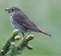
Hermit Thrush
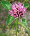
Red Clover

Western honey bee


Notes
- ↑ 2020 Census Apportionment Results United States Census Bureau, April 26, 2021. Retrieved March 5, 2023.
- ↑ Median Annual Household Income The Henry J. Kaiser Family Foundation, 2021. Retrieved March 5, 2023.
- ↑ 3.0 3.1 Elevations and Distances in the United States United States Geological Survey. Retrieved March 5, 2023.
- ↑ 4.0 4.1 Elevation adjusted to North American Vertical Datum of 1988.
- ↑ Edward Day Collins, A History of Vermont, With the State Constitution, Geological and Geographical Notes, Chronology, Statistical Tables, Maps, and Illustrations (Andesite Press, 2015 (original 1903), ISBN 978-1297737565.
- ↑ Michael Smith, Vermont Declaration of Independence Second Vermont Republic, April 22, 2019. Retrieved March 5, 2023.
- ↑ The Battle of Bennington August 16, 1777 Virtual Vermont. Retrieved March 5, 2023.
- ↑ The Bennington Flag: A Pre-Constitutional Symbol of Freedom Ammo.com. Retrieved March 5, 2023.
- ↑ These relatively small political movements are similar in nature to those found in California, Hawaii, Louisiana, and Texas; although the historical contexts are variant.
- ↑ Nina Keck, Where Do The Terms 'Woodchuck' And 'Flatlander' Come From? Vermont Public, December 17, 2020. Retrieved March 5, 2023.
- ↑ Sarah Schweitzer, Green mountains, good karma Boston Globe, February 23, 2005. Retrieved March 5, 2023.
- ↑ Vermont Maple Festival Retrieved March 5, 2023.
- ↑ Festival on the Green Retrieved March 5, 2023.
ReferencesISBN links support NWE through referral fees
- Albers, Jan. Hands on the land a history of the Vermont landscape. Cambridge, MA: Published for the Orton Family Foundation, Rutland, VT by MIT Press, 2000. ISBN 0262011751
- Allen, Ira. The natural and political history of the State of Vermont. Rutland, VT: Tuttle, 1969. ISBN 0804804192
- Bryan, Frank M., and John McClaughry. The Vermont papers recreating democracy on a human scale. Chelsea, VT: Chelsea Green Pub. Co., 1989. ISBN 0930031199
- Coffin, Howard. Full duty Vermonters in the Civil War. Woodstock, VT: Countryman Press, 1995. ISBN 0881503495
- Collins, Edward Day. A History of Vermont, With the State Constitution, Geological and Geographical Notes, chronology, Statistical Tables, Maps, and Illustrations. Andesite Press, 2015 (original 19030). ISBN 978-1297737565
- Doyle, William. The Vermont political tradition and those who helped make it. Montpelier, VT: W. Doyle, 1999. ISBN 0961548614
- Duffy, John J., and Vincent Feeney. Vermont an illustrated history. Sun Valley, CA: American Historical Press, 2000. ISBN 1892724081
- Duffy, John J., Samuel B. Hand, and Ralph H. Orth. The Vermont encyclopedia. Hanover, NH: University Press of New England, 2003. ISBN 1584650869
- Klyza, Christopher McGrory, and Stephen C. Trombulak. The story of Vermont a natural and cultural history. Middlebury bicentennial series in environmental studies. Hanover, NH: University Press of New England, 1999. ISBN 978-0874517439
- Meeks, Harold A. Vermont's land and resources. Shelburne, VT: New England Press, 1986. ISBN 0933050402
- Sherman, Joe. Fast lane on a dirt road. White River Junction, VT: Chelsea Green Pub. Co., 2000. ISBN 1890132748
- Sherman, Michael, Gene Sessions, and P. Jeffrey Potash. Freedom and unity a history of Vermont. Barre, VT: Vermont Historical Society, 2004. ISBN 9780934720489
- Sletcher, Michael. "New England." The Greenwood encyclopedia of American regional cultures. Westport, CT: Greenwood Press, 2004. ISBN 031332753X
- Tree, Christina, and Sally West Johnson. Vermont an explorer's guide. Woodstock, VT: Countryman Press, 2002. ISBN 0881505196
- Van de Water, Frederic Franklyn. The reluctant republic: Vermont, 1724-1791. Taftsville, VT: Countryman Press, 1974. ISBN 0914378023
| Political divisions of the United States | |||||||
|---|---|---|---|---|---|---|---|
| |||||||
Credits
New World Encyclopedia writers and editors rewrote and completed the Wikipedia article in accordance with New World Encyclopedia standards. This article abides by terms of the Creative Commons CC-by-sa 3.0 License (CC-by-sa), which may be used and disseminated with proper attribution. Credit is due under the terms of this license that can reference both the New World Encyclopedia contributors and the selfless volunteer contributors of the Wikimedia Foundation. To cite this article click here for a list of acceptable citing formats.The history of earlier contributions by wikipedians is accessible to researchers here:
The history of this article since it was imported to New World Encyclopedia:
Note: Some restrictions may apply to use of individual images which are separately licensed.