|
|
| (113 intermediate revisions by 9 users not shown) |
| Line 1: |
Line 1: |
| − | {{claimed}}{{Contracted}} | + | {{Approved}}{{Submitted}}{{Images OK}}{{Paid}}{{Copyedited}} |
| − | {{US state | | + | {{Infobox U.S. state |
| − | Name = Utah |
| + | | Name = Utah |
| − | Fullname = State of Utah |
| + | | Fullname = State of Utah |
| − | Flag = Flag of Utah.svg |
| + | | Flag = Flag of Utah.svg |
| − | Flaglink = [[Flag of Utah]] |
| + | | Flaglink = [[Flag of Utah|Flag]] |
| − | Seal = Utahstateseal.jpg |
| + | | Seal = Seal of Utah.png |
| − | Map = Map_of_USA_UT.svg |
| + | | Map = Map_of_USA_UT.svg |
| − | Nickname = Beehive State|
| + | | Nickname = Beehive State |
| − | Motto = "Industry" |
| + | | Motto = Industry |
| − | Capital = [[Salt Lake City, Utah|Salt Lake City]] |
| + | | Former = Utah Territory |
| − | LargestCity = [[Salt Lake City, Utah|Salt Lake City]] |
| + | | Capital = [[Salt Lake City]] |
| − | Governor = [[Jon M. Huntsman, Jr.]] (R)|
| + | | LargestCity = capital |
| − | Senators = [[Orrin Hatch]] (R)<br />[[Robert Foster Bennett|Bob Bennett]] (R) |
| + | | LargestCounty = [[Salt Lake County, Utah|Salt Lake County]] |
| − | PostalAbbreviation = UT |
| + | | LargestMetro = [[Salt Lake City metropolitan area|Salt Lake City]] |
| − | OfficialLang = [[English language|English]]|
| + | | Governor = [[Mike DeWine]] (R) |
| − | AreaRank = 13<sup>th</sup> |
| + | | Lieutenant Governor = [[Jon Husted]] (R) |
| − | TotalAreaUS = 84,889 |
| + | | Legislature = [[Utah State Legislature|State Legislature]] |
| − | TotalArea = 219,887 |
| + | | Upperhouse = [[Utah State Senate|State Senate]] |
| − | LandAreaUS = 82,122 |
| + | | Lowerhouse = [[Utah House of Representatives|House of Representatives]] |
| − | LandArea = 212,751 |
| + | | Senators = [[Sherrod Brown]] (D)<br />[[Rob Portman]] (R) |
| − | WaterAreaUA = 2,754 |
| + | | PostalAbbreviation = UT |
| − | WaterArea = 7,136 |
| + | | OfficialLang = English |
| − | PCWater = 3.25 |
| + | | AreaRank = 13th |
| − | PopRank = 34<sup>th</sup> |
| + | | TotalAreaUS = 84,899 |
| − | 2000Pop = 2,233,169 |
| + | | TotalArea = 219,887 |
| − | DensityRank = 41<sup>st</sup> |
| + | | LandAreaUS = 82,144 |
| − | 2000DensityUS = 27.2 <!-- quickfacts.census.gov —> |
| + | | LandArea = 212,751 |
| − | 2000Density = 10.50 |
| + | | WaterAreaUA = 2,755 |
| − | MedianHouseholdIncome = $50,614 |
| + | | WaterArea = 7,136 |
| − | IncomeRank = 11<sup>th</sup> |
| + | | PCWater = 3.25 |
| − | AdmittanceOrder = 45<sup>th</sup> |
| + | | PopRank = 30th |
| − | AdmittanceDate = January 4, 1896 |
| + | |PopRank = 30th |
| − | TimeZone = [[Mountain Standard Time Zone|Mountain]]: [[UTC]]-7/[[Daylight saving time|-6]] |
| + | | 2000DensityUS = |
| − | Longitude = 109°W to 114°W |
| + | | 2000Density = 14.12 |
| − | Latitude = 37°N to 42°N |
| + | | 2010DensityUS = 36.53 |
| − | WidthUS = 270 |
| + | |DensityRank=41st |
| − | Width = 435 |
| + | | 2010Pop =3,271,616 <ref name="Bureau 2021">[https://www.census.gov/data/tables/2020/dec/2020-apportionment-data.html 2020 Census Apportionment Results] ''The United States Census Bureau'', April 26, 2021. Retrieved April 25, 2022. </ref> |
| − | LengthUS = 350 |
| + | | MedianHouseholdIncome = $60,365<ref>[https://www.census.gov/search-results.html?searchType=web&cssp=SERP&q=median%20household%20income United States Median Household Income] ''United States Census Bureau''. Retrieved April 25, 2022.</ref> |
| − | Length = 565 |
| + | | IncomeRank = 11th |
| − | HighestPoint = [[Kings Peak]]<ref name=usgs>{{cite web| year =29 April 2005 | url =http://erg.usgs.gov/isb/pubs/booklets/elvadist/elvadist.html#Highest| title =Elevations and Distances in the United States| publisher =U.S Geological Survey| accessdate = November 8 | accessyear = 2006}}</ref>
| + | | AdmittanceOrder = 45th |
| − | |
| + | | AdmittanceDate = January 4, 1896 |
| − | HighestElevUS = 13,528 |
| + | | TimeZone = [[Mountain Standard Time Zone|Mountain]]: [[UTC]]-7/[[Daylight saving time|-6]] |
| − | HighestElev = 4,126 |
| + | | Longitude = 109° 3′ W to 114° 3′ W |
| − | MeanElevUS = 6,100 |
| + | | Latitude = [[37th parallel north|37° N]] to [[42nd parallel north|42° N]] |
| − | MeanElev = 1,860 |
| + | | WidthUS = 270 |
| − | LowestPoint = [[Beaver Dam Wash]]<ref>Arave, Lynn. 2006. [http://deseretnews.com/dn/view/0,1249,645197370,00.html Utah's basement — Beaver Dam Wash is state's lowest elevation.] Deseret Morning News. Retrieved July 29, 2007.</ref>|
| + | | Width = 435 |
| − | LowestElevUS = 2,178 |
| + | | LengthUS = 350 |
| − | LowestElev = 664 |
| + | | Length = 565 |
| − | ISOCode = US-UT |
| + | | HighestPoint = [[Kings Peak]]<ref name=USGS>[https://pubs.usgs.gov/gip/Elevations-Distances/elvadist.html Elevations and Distances in the United States] ''United States Geological Survey''. Retrieved April 25, 2022.</ref><ref name=NAVD88>Elevation adjusted to [[North American Vertical Datum of 1988]].</ref> |
| − | Website = www.utah.gov
| + | | HighestElevUS = 13,518 |
| | + | | HighestElev = 4,120.3 |
| | + | | MeanElevUS = 6,100 |
| | + | | MeanElev = 1,860 |
| | + | | LowestPoint = [[Beaver Dam Wash]] at <br>[[Arizona]] border<ref name=USGS/><ref name=NAVD88/> |
| | + | | LowestElevUS = 2,180 |
| | + | | LowestElev = 664.4 |
| | + | | ISOCode = US-UT |
| | + | | Website = www.utah.gov |
| | }} | | }} |
| | | | |
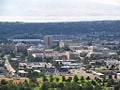
| − | '''Utah''' ([[International Phonetic Alphabet|IPA]]: {{IPA|[ˈjutɔː, ˈjutɑː]}}) an [[intermountain state]] located in the [[western United States|western]] [[United States]], became the [[List of U.S. states by date of statehood|45th state]] to join the Union on [[January 4,]] 1896. Approximately 88% of Utah's 2,500,000 population is concentrated in its capital and largest metropolis, [[Salt Lake City, Utah|Salt Lake City]], which lies in the center of the [[Wasatch Front]]. Most remaining Utahns reside in the state's other major cities, also located in the Wasatch Front which include the suburb of Sandy, the twin cities of Provo and Orem to the south, and Ogden and Logan, which lie north of the capital. <ref> Fradin, Dennis. 1993. From Sea to Shining Sea—Utah. Retrieved July 29, 2007. </ref> In contrast to the heavily populated cities, Utah contains vast, almost uninhabited stretches of land. As a result, Utah ranks as the sixth most urbanized state in the Union.<ref> [http://encarta.msn.com/encyclopedia_761577046_6/Utah.html MSN Encarta]</ref> | + | '''Utah''', a state located in the western [[United States]], was the 45th state admitted to the union (January 4, 1896). The majority of Utah's population, known as "Utahns," live in an urban concentration known as the [[Wasatch Front]], which stretches from Ogden on the north to Provo on the south with [[Salt Lake City]] as the center. |
| | | | |
| − | | + | Utah's pivotal central western location makes the state a natural transportation center. Other key industries include information technology and research, government services, mining, and tourism. Utah is home to five national parks as well as incredible geological diversity in the form of snowcapped [[mountain]]s to well-watered river [[valley]]s to rugged, stony [[desert]]s. |
| − | The state is famous for its geological diversity, which ranges from snowcapped mountains to great flowing river valleys and includes rugged, stony deserts carved into spectacular scenes. Simultaneously, Utah is known as one of the most religiously homogeneous states in the Union; approximately 62%<ref name="SLT-Morm">[http://www.sltrib.com/ci_2886596 Mormon portion of Utah population steadily shrinking]. Matt Canham, ''[[Salt Lake Tribune]]''.</ref> of its residents proclaim membership in [[The Church of Jesus Christ of Latter-day Saints]], also known as the [[LDS]] or [[Mormon]] Church. Due to its large numbers, this denomination naturally exerts strong influence upon Utah's culture and daily life. Examples are evident in the number of LDS churches, particularly the Great Temple in Salt Lake City, home of the world renowned Mormon Tabernacle Choir, the Deseret publishing company, which the LDS Church founded, and the famous Brigham Young University, also established by a Mormon pioneer.
| + | {{toc}} |
| − | | + | The state is also known for being one of the most religiously homogeneous states in the Union, with approximately 65 percent of its inhabitants claiming membership in [[Church of Jesus Christ of Latter-day Saints|The Church of Jesus Christ of Latter-day Saints]], which greatly influences Utah culture and daily life. |
| − | | |
| − | With its pivotal central western location, Utah is a natural center of transportation. Other industries that play a key role in the state include information technology and research, government services, mining, and tourism. Utah attracts numerous visitors to its famous splendid churches and museums, its spectacular parks, and natural recreation areas, notably Bryce Canyon. As the State Motto, ''Industry'', indicates, Utah has a long tradition of resourcefulness and hard work. [[St. George, Utah]] was the fastest growing metropolitan area in the United States from [http://www.census.gov/prod/2006pubs/smadb/smadb-06appe.pdf 2000-2005] In 2006, Utah was ranked as the sixth fastest growing state in the Nation.[http://www.census.gov/Press-Release/www/releases/archives/population/007910.html]
| |
| | | | |
| | ==Etymology== | | ==Etymology== |
| | + | Utah's name originates from the [[Native American]] tribe known as the ''[[Ute]]'', who ranged across much of the northern Colorado Plateau from at least 2,000 years B.C.E. Southern Paiute and Gosiute (inter-related and belonging to the [[Shoshone]] group) resided alongside the Ute at the time of European exploration of the area. "Ute" can be translated as "high land" or "land of the sun."<ref>[https://musnaz.org/on-view/native-peoples-of-the-colorado-plateau/ute/#:~:text=%E2%80%9CUte%E2%80%9D%20means%20%E2%80%9Chigh%20land,but%20traveled%20as%20nomadic%20groups. Southern Ute] ''Museum of Northern Arizona''. Retrieved April 25, 2022.</ref> It is alternatively translated as "People of the mountains."<ref>Nancy McClure, [https://centerofthewest.org/2016/03/20/points-west-arts-culture-ute-indians/ The Arts and Culture of the Ute Indians – Points West Online] ''Buffalo Bill Center of the West''. Retrieved April 25, 2022.</ref> |
| | | | |
| − | Utah's name originates from the Ute Indian language, which is translated "people of the mountains."<ref>[http://www.utah.gov/about/quickfacts.html Quick Facts about Utah's history and land]. State of Utah. Retrieved July 30, 2007.</ref> The Utes comprised the most populous of Utah's indigenous peoples who lived in the vicinity prior to and during white settlement.<ref> McCarthy, Betty. 1990. America the Beautiful—Utah. </ref> | + | People who live in Utah are known as "Utahns." |
| | | | |
| | ==Geography== | | ==Geography== |
| − | {{seealso|List of Utah counties}}
| + | [[Image:delicatearch.jpg|thumb|right|400px|Delicate Arch, [[Arches National Park]], Utah]] |
| − | {{US state symbols |
| + | [[Image:Utahgeography.jpg|thumb|right|350px|Utah from space. The state is known for its diversity in geology, climate, and ecosystems.]] |
| − | Name = Utah |
| + | [[Image:Mojave2.jpg|thumb|400px|Joshua Trees, yucca plants, and Jumping Cholla cactus occupy the far southwest corner of the state in the Mojave Desert.]] |
| − | Flag = Utah state flag.png |
| + | [[Image:SecondDam LoganCanyonUT.jpg|300px|right|thumb|Logan Canyon in northern Utah.]] |
| − | Seal = Utahstateseal.jpg |
| + | [[Image:Saltph26.jpg|thumb|400px|right|Bonneville Salt Flats]] |
| − | Emblem = [[Beehive]] |
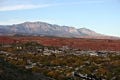
| + | Utah, in the western United States, is bounded on the north by [[Idaho]], [[Wyoming]] to the northeast, [[Colorado]] to its east, while its southern border is [[Arizona]], and [[Nevada]] lies to the west. Its southeast corner touches the northwest corner of [[New Mexico]], though they do not share a common boundary. |
| − | Nickname = Beehive State |
| + | |
| − | Motto = Industry |
| + | Unique within the 48 contiguous states, the four states of Utah, Colorado, New Mexico, and Arizona meet at a single point, known as the [[Four Corners Monument]]. The state comprises a total land mass of 84,899 [[square miles]] (219,887 km²). |
| − | Tartan = Utah State Tartan |
| |
| − | Capital = [[Salt Lake City, Utah|Salt Lake City]] |
| |
| − | Animal = [[Red Deer|Rocky Mountain Elk]] |
| |
| − | Bird = [[California Gull|California Seagull]] |
| |
| − | Butterfly = N/A |
| |
| − | Fish = [[Bonneville Cutthroat Trout]] |
| |
| − | Flower = [[Calochortus nuttallii|Sego Lily]] |
| |
| − | Game = Chess|
| |
| − | Grass = [[Indian ricegrass]]|
| |
| − | Insect = [[Western honey bee|European Honey Bee]] |
| |
| − | Reptile = N/A |
| |
| − | Tree = [[Blue Spruce]] |
| |
| − | Wildflower = N/A |
| |
| − | Beverage = N/A |
| |
| − | Colors = N/A |
| |
| − | Cookware = Dutch oven |
| |
| − | Fossil = [[Allosaurus]] |
| |
| − | Gemstone = [[Topaz]] |
| |
| − | Mineral = Copper |
| |
| − | StateRock = Coal |
| |
| − | Soil = Mivida |
| |
| − | Star = [[Dubhe]] |
| |
| − | Ships = [[USS Utah (BB-31)]] |
| |
| − | Snack Food = [[green]] [[Jell-O]] |
| |
| − | Fruit = [[Cherry]] |
| |
| − | Vegetable = [[Spanish Sweet Onion]] |
| |
| − | HistoricVegetable = [[Sugar Beet]] |
| |
| − | CookingPot = [[Dutch Oven]] |
| |
| − | Song = ''[[Utah, This is the Place]]'' |
| |
| − | Slogan = [[Life Elevated]] |
| |
| − | Hymn = [[Utah We Love Thee]] |
| |
| − | Dance = [[Square Dance]] |
| |
| − | Waltz = N/A |
| |
| − | FolkDance = [[Square Dance]]
| |
| − | }}
| |
| − | [[Image:Map of Utah NA.png|thumb|right|200px|Map of Utah]]
| |
| − | [[Image:delicatearch.jpg|thumb|right|200px|Delicate Arch, [[Arches National Park]], Utah]] | |
| − | [[Image:Utahgeography.jpg|thumb|right|200px|Utah from space. The state is known for its diversity in geology, climate, and ecosystems.]] | |
| − | [[Image:Mojave2.jpg|thumb|200px|Joshua Trees, yucca plants, and Jumping Cholla cactus occupy the far southwest corner of the state in the Mojave Desert.]] | |
| − | [[Image:SecondDam LoganCanyonUT.jpg|200px|right|thumb|Logan Canyon in northern Utah.]] | |
| − | [[Image:PSP 021.jpg|thumb|200px|right|Mount Timpanogos in the Wasatch Range of the [[Rocky Mountains]].]] | |
| | | | |
| | ===Topography=== | | ===Topography=== |
| | + | Utah has three distinct geological regions: the [[Colorado Plateau]], which covers slightly more than half the state, the [[Rocky Mountains]], and the [[Great Basin]]. |
| | | | |
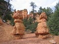
| − | Utah is generally rocky with three distinct geological regions: the [[Rocky Mountains]], the [[Great Basin]], and the [[Colorado Plateau]]. Residents and visitors alike enjoy Utah's natural diversity, which ranges from arid deserts and [[sand dune]]s to thriving [[pine tree|pine]] [[forest]]s in its mountains and valleys. | + | The Colorado Plateau, ranging through parts of Colorado, New Mexico and Arizona, covers the southeastern half of Utah. Relatively high in elevation, this region is primarily comprised of [[Kayenta]] and [[Navajo sandstone]]. The [[Colorado River]] and its tributaries wind through this rock, creating some of the most spectacular wild terrain in the world. Wind and rain have sculpted the soft rock outcroppings over millions of years, producing breathtaking sites of canyons, gullies, arches, pinnacles, buttes, bluffs, and mesas throughout south-central and southeast Utah. Protected parks such as [[Arches National Park|Arches]], [[Bryce Canyon National Park|Bryce Canyon]], [[Canyonlands National Park|Canyonlands]], [[Capitol Reef National Park|Capitol Reef]], and [[Zion National Park|Zion]] national parks, [[Cedar Breaks National Monument|Cedar Breaks]], [[Grand Staircase-Escalante National Monument|Grand Staircase-Escalante]], [[Hovenweep National Monument|Hovenweep]], and [[Natural Bridges National Monument|Natural Bridges]] national monuments, [[Glen Canyon National Recreation Area]] (site of the popular tourist destination, [[Lake Powell]]), [[Dead Horse Point State Park|Dead Horse Point]] and [[Goblin Valley State Park|Goblin Valley]] state parks, and [[Monument Valley]], a popular photographic and filming site are found here. |
| − | | |
| − | Utah shares its borders with several states including [[Idaho]] to its northwest, [[Nevada]] to its west, [[Wyoming]] to its northeast, [[Colorado]] to its east, [[New Mexico]] to its southeast, and [[Arizona]] to its south. Utah is also one of the [[Four Corners (United States)|Four Corners]] states. In a situation unique within the 48 contiguous states and at a single point, these four state borders meet: Utah, Colorado, New Mexico; and Arizona at the [[Four Corners Monument]]). The Beehive State comprises a total land mass of 84,899 [[square miles]] (219,887 km²).
| |
| − | | |
| − | One of Utah's defining characteristics is the variety of its [[terrain]]. Running down the center of the state is the [[Wasatch Range]], which rises to heights of approximately 12,000 [[foot (unit of length)|feet]] (3,650 m) above sea level. Portions of these mountains receive more than 500 [[inch]]es (12.7 m) of [[snow]] each year and are home to world-renowned [[ski resort]]s, made popular by the light, fluffy snow. In the northeastern section of the state, running east to west, are the [[Uinta Mountains]], which rise to heights of 13,000 feet (3,950 m) or more and contain the highest summit in the state, [[Kings Peak]], with an elevation of 13,528 feet (4,123 m),<ref name=usgs/>.
| |
| | | | |
| − | Approximately 75% of Utah's residents live at the western base of the Wasatch Range, also known as the [[Wasatch Front]], which is a series of valleys and basins. These residents dwell in the major cities of [[Ogden, Utah|Ogden]], [[Salt Lake City, Utah|Salt Lake City]], [[Layton, Utah|Layton]], [[West Valley City, Utah|West Valley City]], [[Sandy, Utah|Sandy]], [[West Jordan, Utah|West Jordan]], [[Orem, Utah|Orem]], and [[Provo, Utah|Provo]]. This region extends from [[Brigham City, Utah|Brigham City]] at the north end to [[Nephi, Utah|Nephi]] at the south end. Utah is growing rapidly as a whole, and in this region, urban sprawl is increasing along the valley outskirts.
| + | The Great Basin lies in the western third of the state. Within this basin is the [[Great Salt Lake]], southwest of which is the Great Salt Lake Desert, covering 4,000 square miles and stretching to the [[Nevada]] border. This region is desert-like and contains both occasional mountain peaks and the well-known Bonneville Salt Flats. |
| | | | |
| − | Western Utah is primarily an arid desert with a gorgeous landscape that is difficult to farm and develop. Its geological features include a [[Basin and Range Province|basin and range]]. Small mountain ranges and rugged terrain prevail throughout the landscape. The [[Bonneville Salt Flats]] provide an exception to the topography. They are comparatively flat as a result of once forming the lake bed of [[Lake Bonneville]]. [[Great Salt Lake]], [[Utah Lake]], [[Sevier Lake]], [[Rush Lake (Utah)|Rush Lake]] and [[Little Salt Lake]] are all remnants of this ancient freshwater lake,<ref>Morgan, Dale L. (1947). The Great Salt Lake. Salt Lake City: University of Utah Press. ISBN 0-87480-478-7 p.22</ref> which once covered most of the eastern [[Great Basin]]. West of the [[Great Salt Lake]], stretching to the [[Nevada]] border, lies the [[Great Salt Lake Desert]], forming the most arid part of Utah. This juncture posed a difficult crossing point for American pioneers as they ventured west. For example, Mary Ann Hafen related a tale of her travels in 1860 when her family reached the Salt Lake Valley. " There were six to our cart. Father and Mother pulled it; Rosie (who was two years old) rode, John (age 9) and I (age 6) walked. Sometimes, when it was downhill, they let me ride, too....Mother's feet [became] so swollen that she could not wear shoes, but had to wrap her feet with cloth."<ref> McCarthy, Betty. 1990. Children's Press. Chicago, IL. America the Beautiful—Utah. page 41.</ref>
| + | Running down the center of the state is the [[Wasatch Range]], a segment of the south-central Rocky Mountains, with heights of approximately 12,000 feet (3,650 m) above sea level. Portions of these mountains receive more than 500 inches (12.7 m) of [[snow]] each year and are home to world-renowned [[ski resort]]s, made popular by the light, fluffy snow. In the northeastern section of the state, running east to west, are the [[Uinta Mountains]], which attain heights of 13,000 feet (3,950 m) and where the highest state summit, [[Kings Peak]], 13,528 feet (4,123 m), is found. The Uinta Mountains are the only major mountain range in the United States running in an east–west direction. |
| | | | |
| − | Much of the scenic southern landscape is comprised of [[Kayenta]] and [[Navajo sandstone]]. The [[Colorado River (U.S.)|Colorado River]] and its tributaries wind their way through this sandstone, creating some of the most spectacular wild terrain in the world. Wind and rain have sculpted the soft rock outcroppings over millions of years, producing breathtaking sites of canyons, gullies, arches, pinnacles, buttes, bluffs, and mesas throughout south-central and southeast Utah. This terrain is accentuated and maintained in protected parks such as [[Arches National Park|Arches]], [[Bryce Canyon National Park|Bryce Canyon]], [[Canyonlands National Park|Canyonlands]], [[Capitol Reef National Park|Capitol Reef]], and [[Zion National Park|Zion]] national parks, [[Cedar Breaks National Monument|Cedar Breaks]], [[Grand Staircase-Escalante National Monument|Grand Staircase-Escalante]], [[Hovenweep National Monument|Hovenweep]], and [[Natural Bridges National Monument|Natural Bridges]] national monuments, [[Glen Canyon National Recreation Area]] (site of the popular tourist destination, [[Lake Powell]]), [[Dead Horse Point State Park|Dead Horse Point]] and [[Goblin Valley State Park|Goblin Valley]] state parks, and [[Monument Valley]], a popular photographic and filming site.
| + | Like much of the U.S. West and Southwest, the federal government owns a vast amount, over 70 percent, of Utah's land. Controlled by such departments as Bureau of Land Management, National Park, or designated Wilderness Areas, this is meant to protect and preserve the land. Often, contention occurs between commercial and personal interests such as ranching, mining, energy development, and recreation. The parks bring a substantial amount of income to the state through tourism. |
| − | | |
| − | Southwestern Utah contains the state's lowest and hottest spot. This area is also called [[Dixie (Utah)|Dixie]] because here early settlers harvested limited amounts of cotton, a popular southern U.S. cash crop. [[Beaverdam Wash]], the site of the state's lowest point, lies in far southwestern Utah. Its elevation is 2,000 feet (610 m).<ref name=usgs/> The northernmost portion of the [[Mojave Desert]] is also found in this region. Many retirees and tourists are flocking to Dixie, where the population is growing rapidly and travelers and residents alike enjoy Utah's highest ski resort, [[Brian Head Ski Resort|Brian Head]] located to Dixie's immediate north.
| |
| − | | |
| − | In contrast, Eastern Utah has a high elevation, most of which is covered by plateaus and basins. Its primary economies include [[mining]], [[Petroleum|oil]], [[natural gas]]-drilling, [[ranching]], and [[recreation]]. Much of eastern Utah contains part of the [[Uintah and Ouray Indian Reservation]]. The Navajo Nation also extends into southeastern Utah. The most popular destination within eastern Utah is [[Dinosaur National Monument]].
| |
| − | | |
| − | Like most of the [[The West (U.S.)|west]] and [[Southwest United States|southwest]] states, the [[Government of the United States|federal government]] owns a vast amount of Utah's land. Over seventy percent of the land is under the jurisdiction of the [[Bureau of Land Management|BLM]] [[public land|land]], [[Utah State Trustland]], or [[U.S. National Forest]], park, [[U.S. National Monument]], [[National Recreation Area]] or [[U.S. Wilderness Area]]. The highest amount of Utah land uner federal jurisdiction is in some of the southern Utah counties, which stands at 90% in 2007. Contention occurs when restrictions are placed upon such activities as ranching, mining, energy development, and motorized recreation. However regular tourism and non motorized recreation are driving forces that bring many people to these area, and this population does not mind the federal control. <ref> Look Smart—Find Articles on Utah and federally owned land.[http://findarticles.com/p/articles/mi_qn4188/is_20070429/ai_n19051272] Retrieved August 3, 2007. </ref>
| |
| | | | |
| | ===Climate=== | | ===Climate=== |
| − | Most of Utah is arid and high in elevation. Many of its eastern and southern areas receive 12 inches (300 mm) or less of precipitation per year, and the annual rainfall in western Utah is generally less than ten inches (25 cm). Likewise, the Wasatch Front receives approximately 15 inches (38 cm). The Great Salt Lake Desert is especially dry, receiving less than five inches (13 cm) annually. The rain favors the mountain areas, where more than 40 inches (1 m) falls per year, although some areas obtain up to 60 inches (1.5 m).
| + | Utah has four distinct seasons. July's average temperature is about 70° F (21° C). The average winter [[temperature]] is slightly below freezing except in "Dixie," the southwestern part of the state which has a warm, almost dry, subtropical climate, leading to its nickname. Daily temperatures vary widely: Salt Lake City has July highs of 90° F (32° C) or above, the nights are 55° to 65° F (13° to 18° C). In the populated areas, cold snaps are usually short and not severe. However, some mountain valleys, generally experience temperatures below 0 °F (-18 °C) 50 days per year. Sometimes the mountains to Utah's north and east function as barriers to [[Arctic]] air. Summer produces the other extreme, with high temperatures averaging between 85 °F (29 °C) and 100 °F (38 °C). |
| | | | |
| − | Snowfall is common in [[winter]] everywhere except along the southern border and in the Great Salt Lake Desert. [[St. George, Utah|St. George]] averages about three inches (7.5 cm) of snow per year, while Salt Lake City receives almost 60 inches (1.5 m) annually (amplified by the [[lake effect snow|lake effect]] from the Great Salt Lake). Many mountain areas receive 350 inches (9 m) of snow in a year, while portions of the [[Wasatch Range]] receive up to 500 inches (12.7 m). Snowfall is common from November through mid-April in the lower elevations and from October through May in the mountains. The mountains often remain snow-covered into July. Fog and haze often caused by [[temperature inversion]]s are common in the valleys and basins during winter, especially the [[Uinta Basin]], just south of the [[Uinta Mountains]].
| + | Most of Utah is arid due to its proximity to the West's mountain systems, which divert much of the precipitation. Average annual precipitation is 11 inches (280 millimeters). Its eastern and southern areas commonly receive 12 inches (300 mm) or less of precipitation per year, and the annual rainfall in western Utah is generally less than ten inches (25 cm). The Wasatch Front receives approximately 15 inches, while the Great Salt Lake Desert is quite dry, with less than eight inches annually. [[Rain]] favors the mountain areas, with more than 40 inches per year overall, although annual precipitation in some alpine places can be up to 60 inches. Utah's northern section is affected by air masses from the North Pacific, much of its precipitation falling in the cool season. Utah's southwestern valleys generally receive no [[snow]], while ten feet or more is common at its mountain resorts. Snowfall is common from November through mid-April in the lower elevations and from October through May in the mountains. The mountains often retain snow into July. |
| | | | |
| − | During [[summer]] and [[autumn|fall]], most of the precipitation occurs from the storms that originate from the south. These tempests consist of short, sporadic, and intense [[thunderstorm]]s that can cause [[wildfire]]s and [[flash flood]]s. Most precipitation during the rest of the year arrives on jetstreams from the [[Pacific Ocean]]. [[Spring (season)|Spring]] is the wettest season across the northern part of the state, while the south experiences its wettest times in late summer and early fall. Winter is the wettest season in most of the mountain areas.
| + | ===Flora and fauna=== |
| | + | The beauty of Utah's diverse natural landscape is considered one of the state's greatest assets. It is home to 17 National Parks and 43 State Parks. |
| | | | |
| − | Utah winters are frigid, with temperatures throughout most of the state falling below freezing. High temperatures average between 25 °[[Fahrenheit|F]] (-4 °[[Celsius|C]]) and 50 °F (10 °C) across the state. Days below 0 °F (-18 °C) generally occur in many areas at least once a year. In most of the populated areas, the cold snaps are usually short and not severe. However, some mountain valleys, including Randolph, generally experience temperatures below 0 °F (-18 °C) 50 days per year. Mountains to Utah's north and east sometimes function as barriers to [[Arctic]] air. In the summer, one can experience the other extreme, with high temperatures averaging between 85 °F (29 °C) and 100 °F (38 °C). Days over 100 °F (38 °C) can be expected in most areas below 5,000 feet (1,500 m) at least once per year and are the norm in the southern valleys. According to the Golden Gate Weather Service, the record high temperature in Utah was 117 °F (47 °C), recorded at St. George on July 5, 1985, <ref> [http://historyforkids.utah.gov/history_and_facts/overview.html] Retrieved August 1, 2007. </ref> and the record low was -69 °F (-56 °C), recorded at [[Peter's Sink]] in the [[Bear River Mountains]] of northern Utah on February 1, 1985.<ref>[http://www.ksl.com/index.php?nid=341&sid=148094 Utah Cold Weather Facts - Snow and Winter Storms]. ''KSL.com.''</ref>
| + | There are 4,000 known plant species in the state representing six climatic zones, ranging from lowland desert to mountain peaks. There are over 15,000,000 acres of timberland, though only one-fourth of that is commercially viable. Commonly found are: [[Aspen]], [[blue spruce]], [[cactus]], [[cedar]], [[creosote bush]], [[fir]]s, [[Juniper]], [[Joshua tree]], [[mesquite]], [[native grass]]es for grazing, piñon pine, [[pine]]s, [[saltbush]], [[sagebrush]], [[shad scale]] and [[yucca]]. |
| | | | |
| − | Like most of the western United States, Utah has very few thunderstorms. Generally, people experience them fewer than 40 days per year; however, when they happen, these tempests are usually short but intense. Generally only two tornadoes occur in the state each year.<ref name= "Annual average number of tornadoes"> [http://www.ncdc.noaa.gov/img/climate/research/tornado/small/avgt5304.gif] NOAA National Climatic Data Center. Retrieved on October 24, 2006. </ref>
| + | Once home to [[bison]], [[Wolf|timber wolves]] and [[bear]]s, these large animals have virtually disappeared from Utah's terrain. The most common large animal remaining is the [[Deer|mule deer]]. [[Bobcat]], [[lynx]] and [[coyote]] make their home here. Birds include golden [[eagle]]s, [[hawk]]s, magpies and [[owl]]s. [[Game bird]]s include [[grouse]], [[pheasant]] and [[quail]]. [[Blue heron]]s, [[sea gull]]s and white [[pelican]]s are some of the birds found in the refuges of the Great Salt Lake. Also native to the state are several species of game fish, [[reptile]]s and [[amphibia]]ns. |
| | | | |
| | ==History== | | ==History== |
| − | {{main|History of Utah}}
| + | ===Native American history=== |
| − | | + | [[Archaeology|Archaeological]] sites throughout Utah have identified the area as having human population for 10,000-12,000 years. These ancient people, who were [[Hunter-gatherer|hunters and gatherers]], adapted to life in the state's varied landscapes: deserts, high mountains, badlands, and marshes. |
| − | | |
| − | | |
| − | ===Native American History=== | |
| − | The original inhabitants of Utah were Desert Culture dwellers who lived in the Great Basin near present day Wendover about 12,000 years ago. They were nomadic, moving with the seasons. For food, they gathered berries, grains, nuts, and medicinal plants. Each family hunted insects, rabbits, and rodents, however, families worked together to track large animals such as antelope and sheep.
| |
| − | | |
| − | The Fremont Culture peoples lived in Utah about 400 C.E. They had learned farming and building techniques from ancient Mexican civilizations. The Fremonts lives throughout Utah north of the Colorado River. Today we can find many of their sites on top of older Desert Culture sites. These indigenous peoples built pit houses which they dug into the ground and lined with stone or plaster and covered with tree limbs and brush. A particularly large grouping of 20 such houses has been found in Caldwell Village in the Uinta Basin.
| |
| − | | |
| − | A third ancient culture developed south of the Colorado River, which lived at the same time as the Fremont Civilization. They were known as the [[Anasazi]], a [[Navajo]] word which means ''Ancient Ones''. The Anasazi were farmers who irrigated fields to grow crops and built [[pueblos]], or villages which housed several hundred people. Their apartment constructions, which were as high as five stories, were made on cliff caves or flat hills called [[mesas]] or tables. The most renowned of these structures is located in Hovenweep, southeastern Utah.
| |
| − | | |
| − | The Fremonts and Anasazi peoples were famous for their rock art, depicted in chipped or painted symbols and figures on canyon walls. For unknown reasons, their homes and villages were abandoned in the late 1200s, perhaps due either to inclement weather, such as drought or invasions of other more aggressive peoples.
| |
| − | | |
| − | More recent indigenous groups include the [[Paiutes]] (Pahutes), [[Gosiutes]] (or Goshutes) [[Utes]] and [[Shoshones]] who arrived in Utah around the time the Fremonts and Anasazis had left. These groups came from southern California and northern Mexico. The [[Paiutes]] lived in southern Utah, parts of Arizona, Nevada, and California. They were hunters and traveled as small families. The western deserts were the homes of the [[Gosiutes]], whom the early explorers and settlers called [[''Digger Indians'']] since they dug their foods of seeds, roots, and insects. They were the poorest of the three modern Indian groups.
| |
| − | | |
| − | The [[Utes]] were the most prevalent of the three. They were the first modern Indians in Utah to utilize the horse and they became skillful riders and traveled throughout the entire state, hunting buffalo and other animals. Their numbers and power grew, and they also adapted slave trading from the Spaniards, raiding the other two weaker and smaller tribes. Some Ute customs are still practiced: the spring Bear Dance and the summer Sun dance.
| |
| − | | |
| − | The [[Navajo]] comprise a large Nation, which generally lives in New Mexico and Arizona. However, they began to occupy an area near Four Corners around 1500. Like the Utes, they domesticated the horse and sheep and they lived as herders and excellent craftsman as weavers, metalworkers, and jewelers, sets which are made of turquoise, silver, and other local stones and metals. <ref> McCarthy, Betty. ''America the Beautiful—Utah''. 1990. </ref>
| |
| − | | |
| − | Among the different types of indigenous groups in the area, the Utes were the ones with whom white settlers clashed most. The other groups were less populous and the Utes had enslaved or killed some of them. At first, the Utes traded with settlers. Relations worsened, however, as white numbers increased dramatically, diminishing the food supply for native peoples.
| |
| − | | |
| − | Beginning in 1865, [[Utah's Black Hawk War]] developed into the deadliest conflict in the territory's history. Chief [[Antonga Black Hawk]] died in 1870 three years after he had surrendered having seen the futility of continuing further bloodshed of his people and others. Black Hawk and the Ute Nation had raided white settlements earlier, seeking cattle to replace the land and food that was lost due to the settlers influx. His father, Sanpitch, had been been brutally murdered by Dolf Bennett in 1866. Noonch, Black Hawk's Ute name, visited every city from Cedar City to the south to Payson in the north, and he restored friendly relations with the peoples therein. He was buried in the foothills east and south of Spring Lake Villa, Utah County. <ref. "Black Hawk Passes Over, A letter from William Provert."</ref> Mr. Provert shared the information with Mr. Peter Gottfriedson who included it in his website: <ref>http://www.blackhawkwarutah.com/black_hawk_war_utah.htm#BLACK_HAWK_PASSES_OVER__]</ref>
| |
| − | | |
| − | Later the Chief's remains were removed from burial and put on display in an LDS church museum at Temple Square, heinous treatment for any deceased person, especially a leader who strove to promote peace. After 86 years, a young boy scout, seeking to gain the Eagle Scout rank through research, rescued the former chief's bones from storage. The tribe again provided the Chief a proper burial, so important to Native tradition. Despite the chief's valient efforts to attain peace, battles continued between the settlers and the indigenous peoples until additional federal troops were ordered to suppress the [[Ghost Dance]] of 1872. This war is unique among the [[Indian Wars]] because it was a three-way conflict, with mounted Timpanogos [[Ute Tribe|Ute]]s led by Antonguer Black Hawk exploited by both federal and LDS authorities.<ref>http://www.blackhawkwarutah.com/black_hawk_war_utah.htm#BLACK_HAWK_PASSES_OVER__]</ref>
| |
| − | | |
| − | Unfortunately many settlers' excessive desire for land during this period was instrumental in driving the Utes from their original lands in Central Utah and Colorado in 1879 to the Utah desert. Native Americans living on reservations in Utah, as in other states, were still affected by white laws. For example, in an effort to assimilate Native children into white society, indigenous youngsters, including those living on reservations, were forced to attend boarding schools for six consecutive years. During that period those students were not permitted to visit their parents. Regrettably, many of these children died from imported diseases to which they no immunity and were buried on property outlying the school. <ref> "Black Hawk Passes Over, A letter from William Provert." </ref>
| |
| − | | |
| − | Although Utah's Native Americans still experience many problems, issues are being addressed today to bring solutions in the Beehive State. Government leaders, business people, and the Natives themselves are working together to implement new opportunites for the tribes. For example, investor John Jurrius, who helps fund oil exploration, and Governor Jon Huntsman has made unprecedented efforts to convene with each tribe to better understand and help resolve the people's needs. Deseretnews.com reports that Utah's Native American tribes are finding new, creative ways to fund their tribes' families besides gambling, which is illegal in the state. As a result, more tribal members can rise from poverty, find ways to combat other problems such as unemployment, improve test scores which have ranked at the 36 percentile, below Hispanics, and reduce suicide rates.
| |
| − | | |
| − | Meanwhile, indigeneous peoples are promoting their culture at powwows; the Shoshones, for example, have set goals to preserve their language, songs, dances and crafts as well. Tribal business endeavors include Shoshone document translation services for the F.B.I., a Paiute computer services company with a minimum pay rate of $10.00 per hour, and Ute and Navajo oil sales. Governor Huntsman met with the Paiutes in May 2006 to teach Paiute children, improve the tribe's business culture, and implement a suicide prevention program. Native suicide rates are five times the national average. As the Governor so accurately expressed, ''It's about the emerging generation and doing what's necessary for them.'' <ref> Deseretnews.com Utah News, ''A New Day in Utah's Indian Country'', September 24, 2006. [http://www.deseretnews.com/dn/view/0,1249,650192875,00.html] Retrived August 4, 2007. </ref>
| |
| − | | |
| − | ===European Influence===
| |
| − | In July, 1776 the [[Spaniards]] were the first [[Europeans]] to visit Utah. [[Francisco Atanasio Domínguez]] and[[Silvestre Vélez de Escalante]] were [[Franciscan friars]], or Catholic priests of the Franciscan order, who were searching for an overland route to the missions in Monterey, California. The friars believed that the Ute settlement had potential, and they promised to return. However, their promise did not materialize as later the priests encountered difficulties in traveling, short supplies, and inclement weather. A map that they had designed indicated a river where none existed, so travelers along the route who referenced it either suffered death or extreme deprivation from thirst as a result. <ref> McCarthy, Betty. ''America the Beautiful—Utah''. 1990. </ref>
| |
| − | | |
| − | ===Mountain Men===
| |
| − | In the 1800s hundreds of [[mountain men]], or [[fur traders]] traveling throughout the west established their own mountain trails in search of beaver for pelts to be made into popular hats in St. Louis and other U.S. and European cities. [[Kit Carson]], who became a well known guide and [[Jim Beckwourth]], a leader among the mountain men, were two of these more famous traders who delighted in the trade and boisterous life style, such as Mr. Beckwourth depicted at the 1826 gathering in Ogden: ''Mirth, songs, dancing, shouting, trading, running, jumping, singing, racing, target shooting, yarns, frolic, with all sorts of extravagances that white men or Indians could invent, were freely indulged in.''
| |
| − | | |
| − | Jedeiah Strong Smith was the first white man to cross Utah throughout the state, north to south and east to west. His animals were ill and exhausted as a result of his travels, and he had to consume his sick horse to survive.
| |
| − | | |
| − | The mountain men and the Indians business exchanged flourished for about 20 years until the supply of animals diminished and the fashions changed. With no economic base left in the fur trade industry and no families in the locale, the mountain men left the area in the late 1840s. <ref> McCarthy, Betty. ''America the Beautiful—Utah''. 1990. </ref>
| |
| − | | |
| − | ===Early American Pioneers===
| |
| − | Several groups of settlers were westward bound to California or Oregon Territory, and they passed through Utah along the way. The Bartleson-Bidwell group of 1841 was the first emigrant train to cross Utah. They were following that Miera map which presented the non-existent river. They did reach California after four months, only after having to abandon much of their supplies, wagons, and animals. A similar situation occurred in 1846 with the Donner-Reed party who experienced thirst in Utah, frigid cold in the Sierra Nevadas and finally reached California with only half (44) of their original group of 87 emigrants.
| |
| | | | |
| − | John C. Frémont a famous western government explorer, aided by guide Kit Carson, visited the Great Salt Lake Region in 1843-44. In 1845 he printed a correct map and identified the drainage of the Great Salt Lake as a ''Great Basin''. Two years after that map was printed, the first Caucasian group to travel, settle, and remain in Utah would arrive following the path of the Donner-Reed party trail, but this time with knowledge of the terrain that Frémont had provided. These Mormon settlers would claim this western desert and mountainous area as their homeland. <ref> McCarthy, Betty. ''America the Beautiful—Utah''. 1990. </ref>
| + | The [[Anasazi]], or [[Pueblo]] culture, came north into Utah around 400 C.E., remaining until around 1250. These people were farmers who irrigated fields to grow crops and built [[pueblos]], or villages which housed several hundred people. Their apartment constructions, some as high as five stories, were made on cliff caves or flat hills called [[mesas]] or tables. |
| | + | [[Image:Chief Ouray - Brady-Handy.jpg|thumb|right|350px|The great [[Ute]] leader, Chief Ouray and Chipeta. Ouray was considered a great leader, and called ''The White Man's Friend,'' as he sought reconciliation between peoples.]] |
| | | | |
| − | ===Mormon Settlement===
| + | The Fremonts and Anasazi peoples were famous for their [[rock art]], depicted in chipped or painted symbols and figures on canyon walls. For unknown reasons, their homes and villages were abandoned in the late 1200s, perhaps due to inclement weather, such as drought, or invasions of other more aggressive peoples. |
| − | The [[Mormon]] faith started in Illinois, but the group eventually fled to Utah seeking freedom of worship. More than 11,000<ref>Leonard J. Arrington and Davis Bitton: "The Mormon Experience," page 22. Vintage/Random House, 1979.</ref> Latter-Day Saints remained in [[Nauvoo, IL]] after the [[assassination of Joseph Smith, Jr.]] in Carthage, Illinois. Smith founded the new religion in 1930 based on an apparition from God and Jesus at the age of 14. Three years later the angel Moroni appeared and revealed church teachings to Smith over a four year period. After this time, he received the golden plates. Following revelation from John the Baptist, one of Smith's scribes, Mr. Cowdery, and Joseph Smith baptized each other as Church priests, and these two became the Church's first elders. | |
| | | | |
| − | Joseph Smith and five other men founded the Church of Christ in 1830. The group moved to Kirtland, Ohio, near Cleveland. In 1834 the members changed the church's name to the ''Church of the Latter Day Saints.'' This early period was very difficult. Members experienced financial struggles, verbal opposition, and hostility from neighbors of other denominations. Their troubles climaxed in a massacre of 17 Saints in 1838 at Haun's Mill, Far West, Missouri in Caldwell County. This locale had been reserved for Church members after they had been expelled from nearby Jackson County . <ref> Early History of the LDS from www.religioustolerance.org/lds_hist.htm, May 25, 2007</ref>
| + | European-American explorers and settlers came to the area in the eighteenth and nineteenth centuries, finding Shoshone Indians; [[Paiute]] (Pahutes), [[Gosiute]] (or Goshutes) and [[Ute]] who had come to the area about the time the [[Anasazi]] left. Some of these peoples practiced [[irrigation]], raising [[corn|maize]] and [[pumpkin]]s. Others lived a [[nomad]]ic lifestyle, centered around the hunting of [[Bison|buffalo]]. The Utes, most prevalent of these three tribes, were the inspiration for the name of the modern-day state of Utah. |
| | | | |
| − | [[Brigham Young]], the President of the Council of the Twelve Apostles of [[The Church of Jesus Christ of Latter-Day Saints]], emerged as their new leader. Under Young's leadership, the first group of [[Mormon pioneers]] traveled to the [[Salt Lake Valley]] on July 24, 1847. More than 70,000 Latter Day Saints pioneers crossed the plains and settled in Utah during the following 22 years.<ref>William W. Slaughter and Michael Landon: "Trail of Hope - The Story of the Mormon Trail." Shadow Mountain, 1997.</ref> | + | The Ute were the first modern Indians in Utah to utilize [[horse]]s, which had been brought to the American west by the Spanish, where some got loose and lived in wild herds. The Ute became skillful riders and traveled throughout the entire state, hunting buffalo and other animals. Their numbers and power grew, and they adopted [[slave trading]] from the Spaniards, raiding the other two weaker, smaller tribes. Some Ute customs still prevalent today include the spring Bear Dance and the summer Sun dance. |
| | | | |
| − | For the first few years, [[Brigham Young]] and the thousands of early Salt Lake City settlers struggled to survive. The Mormons sought refuge in a desolate, barren desert where they believed no one else would want to live. Finally, after migrating from state to state and facing nonrelenting persecution, they finally hoped to practice their religion in peace.
| + | The [[Navajo]] comprise a large Nation in New Mexico, Arizona, and since 1500, the area in Utah near Four Corners. Like the Utes, they domesticated the horse and sheep and lived as herders. |
| | | | |
| − | Unknown to most people, Utah was the source of many pioneer settlements which later located elsewhere in the West. From the beginning, Salt Lake City was considered the hub of a "far-flung commonwealth"<ref>Arrington and Bitton, p. 118</ref> of Mormon settlements. The hardworking congregation multiplied many new members, and it brought a constant supply of converts hailing from the eastern United States and around the world. To encourage Mormon development in the area, Church leaders frequently assigned groups of church members to settle throughout the West. Applying the science of irrigation with their religious expansion efforts, settlements grew along Utah's Wasatch front (Salt Lake City, then expanded to the Bountiful and Weber Valley, and continued to Provo and Utah Valley. Thus large pioneer populations were established in an area that [[Jim Bridger]] had advised Young would be inhospitable for the cultivation of crops because of frost.<ref>William Clayton, edited by George D. Smith: "An Intimate Chronicle: The Journals of William Clayton," p. 300. Signature Books, 1991.</ref>
| + | ==== Conflict and confinement ==== |
| | + | [[Image:Ute delegation.jpg|thumb|350px|Delegation of Ute Indians in Washington, D.C. in 1880.]] |
| | + | The Ute experience with European-American settlers is similar to that of many other [[Native American]] groups: competition, confrontation and eventual coerced relocation to reservations. Of particular interest are the [[Walker War]] (1853–1854) and [[Black Hawk War (Utah)|Black Hawk War]] (1865–1872) in Utah. Over the years, several other skirmishes and incidents occurred between Utes and white gold-seekers and settlers in Utah and Colorado. These Ute "uprisings" were the result of friction between recently arrived Anglos and local Ute groups. At the same time, the Ute were allies of the [[United States]] in its wars with the [[Navajo]] and [[Apache]] to the south. |
| | | | |
| − | Through the end of the 1800s, Brigham Young directed Mormon pioneers to leave Salt Lake City and establish hundreds of other western settlements in Utah, Idaho, Nevada, Arizona, Wyoming, California, Canada, and Mexico. Some noteworthy Mormon municipality settlements outside Utah include Las Vegas, Nevada, Franklin, Idaho (the first white settlement in Idaho), San Bernadino, California, Star Valley, Wyoming, and Carson Valley, Nevada. Prominent Utah LDS settlements included St. George, Logan, and Manti (where settlers raised the three first temples in Utah, many years before the larger and more famous Salt Lake City Temple was completed in 1892). Other Utah cities settled initially by Mormons include Parowan, Cedar City, Bluff, Moab, Vernal, Fillmore (the territorial capital between 1850 and 1856), Nephi, Levan, Spanish Fork, Springville, Provo Bench (renamed Orem), Pleasant Grove, American Fork, Lehi, Sandy, Murray, Jordan, Centerville, Farmington, Huntsville, Kaysville, Grantsville, Tooele, Roy, Brigham City, and many other smaller towns. A Mormon expansionist, Young named this new [[Mormon pioneer]] territory [[Deseret]]. The Church of Jesus Christ of Latter Day Saints had taught its followers that Deseret means "honeybee"; therefore, the beehive appears on the Utah state flag, and it is the source of the state motto, "Industry."<ref>Corporation of the President of The Church of Jesus Christ of Latter-day Saints: "Church History in the Fullness of Times." 1989.</ref>
| + | A series of treaties established a small reservation in 1864 in northeast Utah, and a reservation in 1868, which included the western third of modern Colorado, including on land actually claimed by other tribes. This was whittled away until only the modern reservations are left: a large cession of land in 1873 transferred the [[gold]]-rich San Juan area, and was followed in 1879 by the loss of most of the remaining land. |
| | | | |
| − | In 1847 when the first LDS pioneers arrived, Utah was under [[Mexico|Mexican]] jurisdiction. The Mormons were happy with this arrangement because they were outside U.S. governance. Furthermore, plenty of land was available since there was little or no Mexican settlement in the area. <ref> Utah History To Go: ''The War with Mexico Had a Major Impact on Utah History''.[http://historytogo.utah.gov/utah_chapters/trappers,_traders,_and_explorers/mexicanwarimpactonutahsfuture.html] Retrieved August 4, 2007. </ref> With the signing of the [[Treaty of Guadalupe Hidalgo]], on February 2, 1848 after the United States won the [[Mexican-American War]], the land became a [[United States]] territory. The [[United States Senate]] ratified this treaty on March 10. In 1850, the [[Utah Territory]] was created with the [[Compromise of 1850]], and [[Fillmore, Utah|Fillmore]] was designated the territorial capital until 1856 when Salt Lake City assumed that role which it has held to this day.
| + | Eventually, the various bands of Utes were consolidated onto three reservations. Several of these bands still maintain separate identities as part of the Ute tribal organizations. Although initially large and located in areas that white settlers deemed undesirable, the sizes of these reservations were repeatedly reduced by various government actions, encroachment by white settlers and [[mining]] interests. In the twentieth century, several U.S. federal court decisions restored portions of the original reservation land to the Ute Tribes' jurisdiction and awarded monetary compensations. |
| | | | |
| − | Disputes between the [[Mormon]] inhabitants and the [[Government of the United States|US Government]] intensified due to The Church of Jesus Christ of Latter-day Saints members' practice of [[plural marriage]] or [[polygamy]]. The Mormons advocated establishing the [[State of Deseret]] into the Union. Its original size extended west to east from San Diego to the summit of the Rocky Mountains and north to south from the Wind River Mountains in Wyoming to Arizona's Gila River in the south. It incorporated parts of modern states reaching from Oregon and Idaho to Colorado and New Mexico. It included parts of these states: Oregon, Idaho, Colorado, and New Mexico,<ref> ''Utah History to Go'' www.sltrib.com [http://historytogo.utah.gov/salt_lake_tribune/history_matters/090900.html]. Retrieved August 5, 2007. </ref> but was later reduced to its present size.
| + | ===Mountain men=== |
| | + | In the 1800s hundreds of mountain men, or [[Fur trade|fur trader]]s traveling throughout the west established their own trails in search of [[beaver]] for pelts to be made into popular hats in [[U.S.]] and [[Europe]]an cities. [[Kit Carson]], a well known guide and [[Jim Beckwourth]], a mountain man leader, and other traders enjoyed the independence of their occupation and delighted in the boisterous, if excessive, parties such as an Ogden gathering that Mr. Beckwourth described in 1826: ''"Mirth, songs, dancing, shouting, trading, running, jumping, singing, racing, target shooting, yarns, frolic, with all sorts of extravagances that white men or Indians could invent, were freely indulged in."'' |
| | | | |
| − | Utah territory was located far from the Nation's capitol, but news of the LDS Church's polygamous practices spread rapidly. As a result, the general American public considered LDS members to be un-American and rebellious, and it resumed its contention again toward the Latter Day Saints. In 1857, news of a false rebellion spread; the federal government dispatched troops for the "Utah expedition" to crush the alleged revolt and replace the territorial governor, [[Brigham Young]], with [[Alfred Cumming (governor)|Alfred Cumming]]. Thus began the [[Utah War]].
| + | Great hardship was endured as well. [[Jedediah Smith|Jedediah Strong Smith]] was the first white man to cross Utah throughout the state, north to south and east to west. His animals were ill and exhausted after traveling, and he was forced to consume his sick horse to survive. |
| | | | |
| − | As federal troops approached Salt Lake in northern Utah, frightened Mormon settlers and [[Paiutes]] aligned in southern Utah to attack and kill 120 immigrants from [[Arkansas]] during what was later named the [[Mountain Meadows Massacre]]. The strife between LDS leaders and the federal government created from this slaughter endured for decades. Only one person, [[John D. Lee]], was convicted of the murders, and he was executed at the massacre site.
| + | This business flourished for about 20 years, until the supply of fur animals, like the beaver, diminished and the fashions changed. With no remaining economic incentive and no established families in the area, the mountain men left Utah in the late 1840s seeking wealth elsewhere. |
| | | | |
| − | Before [[Albert Sidney Johnston]] led troops into the territory, Brigham Young directed all residents of Salt Lake City to evacuate south to [[Utah Valley]]. Young then dispatched a force, the [[Nauvoo Legion]], which attempted to delay the government's advance by burning federal wagons and supplies. Despite these challenges, the troops arrived, and Young officially relinquished control to Cumming. However, Young's influence was exerted behind the scenes, and many people commented that he retained actual territorial control. Several governors appointed by President Buchanan to direct the region each resigned, with each executive leader stating that Utah's territorial government refused to cooperate with them. One federal decision that Young approved was Col. Johnston's move to establish Fort Floyd 40 miles southwest of Salt Lake City.
| + | === Early pioneers=== |
| | + | Several groups of settlers, westward–bound to [[California]] or [[Oregon Territory]], passed through Utah. The Bartleson-Bidwell group of 1841 were the first American emigrants to cross Utah. They and the [[Donner-Reed Party]] who traveled five years later, used the Miera map which presented a non-existent river. Both groups reached California but suffered great deprivations of weather and food along the way and were compelled to abandon many supplies, wagons, and animals. The Donner-Reed party was reduced from 87 to 44 of their original group of emigrants after wintering in adverse conditions, with no hope of rescue. |
| | | | |
| − | [[Image:Saltph26.jpg|thumb|300px|right|Bonneville Salt Flats]] | + | John C. Frémont a famous western government explorer, aided by guide Kit Carson, visited the Great Salt Lake Region in 1843-1844. In 1845 he printed a correct map that identified the drainage of the Great Salt Lake as a ''Great Basin.'' Two years after the map was printed, the first group of Caucasian members and three [[African-American]] slaves used the revised map when it traveled to Utah, following the path of the Donner-Reed party trail. These [[Church of Jesus Christ of the Latter Day Saints|Mormon]] pioneers would claim this western desert and mountainous area as their homeland. |
| | | | |
| − | Though the federal government strove to acquire greater influence in Utah Territory, the [[American Civil War]] forced the troops to divert their attention to the battlefields of that bloody event. As a result, the Utah territory, in effect, remained in LDS hands until [[Patrick Edward Connor|Patrick E. Connor]] arrived with a regiment of California volunteers in 1862. Connor established [[Fort Douglas (Utah)|Fort Douglas]] just three miles (5 km) east of Salt Lake City. To increase non-Mormon settlement in the area, he encouraged his people to search for mineral deposits. Minerals were discovered in [[Tooele County, Utah|Tooele County]], and, as usual, when news of such announcements spread, miners dashed to the territory in search of quick profits.
| + | ===Mormon settlement=== |
| | + | The [[Mormon]] faith began in Palymra, [[New York]] when the founder [[Joseph Smith, Jr.]], at the age of 14, reported an apparition from [[God]] and [[Jesus]]. Three years later he reported that the angel Moroni appeared and revealed church teachings to him over a four-year period, after which he received the golden plates and a revelation from [[John the Baptist]]. Smith and a scribe, Mr. Cowdery, baptized each other as Church priests, in the Melchizedec order, and became the Church's first elders. The Mormon Church was officially founded in 1830 and suffered years of persecution, culminating in Smith's assassination in 1844. |
| | | | |
| − | During the 1870s and 1880s, laws were passed to punish polygamists, generally to encarceration, which was often far from home. <ref> [http://scholar.google.com/scholar?q=punishments+for+polygamy+in+Utah+in+1870s+and+1880s&hl=en&um=1&oi=scholart. Consigned to a Distant Prison: Idaho Mormons in the South Dakota Penitentiary, Bashor, Melvin L. and Woods, Fred E.] Retrieved August 1, 2007 </ref> In the [[1890 Manifesto]], the LDS Church banned polygamy and the writers of the State Constitution expressly prohibited its practice, a condition required for Utah to attain statehood. Then Utah reapplied and officially became a state on January 4, 1896. Forbidding the practice of polygamy likewise became a requirement for other western states awaiting statehood after Utah had joined. Utah was the last state admitted to the Union in the [[Nineteenth Century]].
| + | The death of the church's founder posed serious problems, especially since Smith had left no clear choice as a successor. The Twelve Apostles of the church, through prayer, determined the group's new leader to be [[Brigham Young]]. Young led the first group of Mormon pioneers on a 1,300 mile trek to the Salt Lake Valley on July 24, 1847. During the next 22 years, more than 70,000 Latter Day Saints pioneers crossed the plains and settled in Utah. |
| − | [[Image:October 12 2005 Alpine Loop Utah United States.JPG|200px|thumb|Alpine Loop near Sundance in the fall.]]
| |
| | | | |
| − | [[Image:May 28 2006 Snowbird UT USA.jpg|thumb|300px|right|[[Snowbird ski resort]]]] | + | The church grew rapidly, and many adherents from the eastern United States and other nations settled in Utah. Church leaders assigned groups to settle throughout the West. With such religious expansion efforts and land irrigation, settlements grew quickly along Utah's Wasatch Front, centered in [[Salt Lake City]]. Then it expanded to the Bountiful and Weber Valley, and continued to Provo and Utah Valley. Prominent early LDS towns in Utah were St. George, Logan, and Manti (where the first temples in Utah were built), Fillmore (the territorial capital between 1850 and 1856), Nephi, Levan, Spanish Fork, Springville, Provo Bench (renamed Orem), and many others. Young named this new Mormon pioneer territory [[Deseret]] which means "honeybee." This symbol appears on the Utah state flag, and it is the source of the state motto, "Industry." <ref> Corporation of the President of The Church of Jesus Christ of Latter-day Saints: "Church History in the Fullness of Times." 1989. </ref> |
| | | | |
| − | ===Important Events in the 1800s=== | + | ==== Mountain Meadows massacre ==== |
| − | Salt Lake City was the site of the last link of the [[First Transcontinental Telegraph]], completed in October of 1861. President [[Abraham Lincoln]] and Brigham Young were among the first officials to send a message via the new invention.
| + | One of the most tragic and disturbing events in Mormon history took place on September 11, 1857, when approximately 120 men, women and children, traveling through Utah to [[California]] were massacred by a force consisting of Mormon militia members and Southern Paiute Indians. This came to be known as the Mountain Meadows massacre. |
| | | | |
| − | [[Image:Saltph26.jpg|thumb|300px|right|Bonneville Salt Flats]] | + | The Baker-Fancher train consisted of California-bound emigrants who started their journey in [[Arkansas]] and [[Missouri]]. Earlier in the year, Mormon apostle Parley P. Pratt had been murdered near the town of Van Buren, Arkansas. Rumor had it that some of the members of the train were among those who had participated in Pratt's murder, or that they bragged about his killing. |
| | | | |
| | + | The group arrived in Salt Lake City in late July. It was common for emigrant parties to camp near Mountain Meadows for several days or even weeks while their animals gained condition for the grueling desert crossings still to come. They were camping there in early September when they were surrounded by a group of hostile Paiutes. A small group of Mormons had sent word of the situation to Brigham Young, seeking his counsel. Unfortunately, his advice was late in coming, arriving two days after the massacre. His letter had directed: "In regard to the emigration trains passing through our settlements, we must not interfere with them until they are first notified to keep away. You must not meddle with them. The Indians we expect will do as they please but you should try and preserve good feelings with them." The small group of Mormons who were involved went to trial and were excommunicated. |
| | | | |
| − | On May 10, 1869, the [[First Transcontinental Railroad]] was completed at [[Promontory Summit]], north of the [[Great Salt Lake]]. The railroad brought increasing numbers of people to the territory where several influential business people made fortunes. Ogden became the main city for transferring rolling stock, passengers, and freight once the railroad was completed. Additional industries developed at this time including woolen mills, canneries, livestock yards, flour mills, breweries, iron works, banks, hotels, telephone, telegraph, and power companies. In 1879 Ogden inventor John M. Browning patented the single shot rifle and 100 other gun styles. <ref> [http://www.historyforkids.utah.gov/homework_help/counties/weber.html. Settlers and Development. Utah Gov] Retrieved August 1, 2007. </ref> The town of Corrine, founded in 1869 and named after one of General J. A. Williamson's daughters, became famous for freighting and banking. This town's goal was to become the commercial center of the Intermountain West. Between 1869 to 1878 Corinne contained 257 businesses relating to freight transport and banking. <ref> [http://library.usa.edu/Specol/manuscript/collms241.html.] Retrieved August 1, 2007.</ref>
| + | There are conflicting accounts of this event and the truth may not come to full disclosure in this lifetime. However, in the 1980s, descendants of the victims and the perpetrators met together to start bridging the divide and make peace with the past. Through a series of meetings the seeds of reconciliation were planted. |
| | | | |
| − | Utah granted full [[suffrage|voting rights]] to women in 1870, 26 years before becoming a state. Among all U.S. states, only [[Wyoming]] granted [[Women's suffrage|suffrage to women]] earlier. [http://www.constitutioncenter.org/.../cw08_12159.html] However, in 1887 the [[Edmunds-Tucker Act]] was passed by Congress in an effort to curtail excessive Mormon influence in the territorial government. One of the provisions of the Act was to repeal suffrage; full suffrage was not returned until Utah was admitted to the Union in 1896.
| + | ==== Polygamy ==== |
| | + | [[Image:October 12 2005 Alpine Loop Utah United States.JPG|300px|thumb|Alpine Loop near Sundance in the fall.]] |
| | + | [[Image:May 28 2006 Snowbird UT USA.jpg|thumb|400px|right|[[Snowbird ski resort]]]] |
| | | | |
| − | The [[constitution]] of Utah was enacted in 1895. Notably, the constitution outlawed [[polygamy]] and reestablished the territorial practice of women's [[suffrage]]. Utah's Constitution has been [[Constitutional amendment|amended]] many times since its inception.<ref>[http://elections.utah.gov/ConstitutionalAmendments.htm Constitutional Amendments, Initiatives & Referendums]. ''State of Utah Elections Office.''</ref> | + | The Mormon practice of [[polygamy]] was countered by the federal government's Edmunds Act of 1882. Both the government and the general public condemned this practice and considered LDS members to be un-American and rebellious because of it. Multiple attempts to have Utah (the original ''[[State of Deseret]]'' of which Young was governor) recognized as a state failed due to strong resistance to the practice of polygamy. |
| | | | |
| − | ===1900s to present===
| + | In 1890, the Church beliefs and practices were changed following a new revelation which outlawed the practice of polygamy. Wilford Woodruff, then president of the Church, issued a manifesto called the "Great Accommodation" which generally suspended the solemnization of plural marriages for an indefinite period. |
| − | In the early 1900s, with the establishment of national landmarks, including [[Bryce Canyon National Park]] and [[Zion National Park]], Utah was attaining renown for its natural beauty. Southern Utah became a popular filming spot for arid, rugged western scenes, and such natural landmarks as [[Delicate Arch]] and most Americans recognize "the Mittens" of [[Monument Valley]]. During the 1950s, '60s, and '70s, the [[Interstate highway]] system was constructed, facilitating accessibility to the spectacular southern scenic areas. | |
| | | | |
| − | Beginning in 1939, the [[Alta Ski Area]] was established, and Utah became famous throughout the world for its skiing. The [[Wasatch Range]] provides the resort with top quality dry, powdery snow that many people consider makes some of the best skiing in the world. Salt Lake City won the bid for the [[2002 Winter Olympics]] in 1995, and obtaining this honor greatly boosted the state's economy. The popularity of these ski resorts has increased, and many of the Olympic venues along the [[Wasatch Front]] are still used for sporting events. To serve the tourists both within and from outside Utah, the [[UTA TRAX|TRAX]] light-rail system was developed in [[Salt Lake Valley]] and the freeway system circling the city was updated.
| + | Utah was granted statehood 1896, six years after the manifesto was issued. The original proposal was for the creation of a Mormon state encompassing all remaining lands to the West with the exception of New Mexico and California. Eventually the current day boundaries came into play as other states joined the Union. |
| | | | |
| − | During the late 20th century, the state grew quickly. In the 1970s, growth was phenomenal in the suburbs. [[Sandy, Utah|Sandy]] was one of the fastest growing cities in the country at that time. Today, many areas of Utah continue to experience amazing growth. Northern [[Davis County, Utah|Davis]], southern and western [[Salt Lake County, Utah|Salt Lake]], [[Summit, Utah|Summit]], eastern [[Tooele County, Utah|Tooele]], [[Utah County, Utah|Utah]], [[Wasatch County, Utah|Wasatch]], and [[Washington County, Utah|Washington]] counties are among the rapidly growing areas. The twenty-first century growth phenomenum which includes the complex situations of a modern society, appears to repeat the political struggle in earlier eras of how to deal with [[transportation]] and [[urbanization]] issues for Utah's diverse residents as, once again, development consumes agricultural land and wilderness areas.
| + | === Twentieth century === |
| | + | In the early 1900s Utah attained renown for its natural beauty as [[Bryce Canyon National Park]] and [[Zion National Park]] became national landmarks. The southern portion of the state became a popular filming spot for arid, rugged western scenes; most Americans came to recognize such natural landmarks as [[Delicate Arch]] and "the Mittens" of [[Monument Valley]]. During the 1950s, through 1970s, the [[Interstate highway]] system was constructed. |
| | | | |
| − | Utah is also one of only two states in the Union to outlaw all forms of [[gambling]]; the other is [[Hawaii]]. When Utah was a territory, its residents outlawed gambling in January 1850, <ref> Utah History Encyclopedia ''Deseret''. [http://www.google.com/search?hl=en&q=+Utah+territorial+law+on+gambling+&btnG=Search] Retrieved August 4, 2007. </ref> and the institution has never been permitted since the land attained statehood. Utah is an [[alcoholic beverage control state]]. Since 1935, <ref> Utah History Encyclopedia. ''Prohibition''. [http://www.media.utah.edu/UHE/p/PROHIBITION.html] Retrieved August 4, 2007. </ref> the [[Utah Department of Alcoholic Beverage Control]] has regulated the sale of alcohol. People of ages 21 and older may purchase wine and spiritous liquors state liquor stores upon presenting proof of official photo identification. Local laws may prohibit the sale of beer and other alcoholic beverages on Sundays. In general, people and organizations are not permitted to bring alcohol into the state; they need to purchase it in Utah. The largest size of heavy (full strength) beer dispensed in Utah is 1 liter. No kegs of beer are available except to accredited foreign diplomatic missions under certain restrictions. <ref> ''Utah Department of Alcohol Beverage Control, Liquor Laws''.[http://www.alcbev.state.ut.us/Olympic_Info/oly_faqs.html#1] Retrieved August 4, 2007.</ref>
| + | Beginning in 1939, the [[Alta Ski Area]] was established, and Utah became famous throughout the world for its high quality snow and skiing, which many consider the best in the world, especially in the [[Wasatch Range]]. [[Salt Lake City]] was selected to host the 2002 Winter Olympics in 1995, and many of the Olympic venues along the [[Wasatch Front]] are still used for sporting events. To better serve the tourists within and from outside Utah, the TRAX light-rail system was developed in [[Salt Lake Valley]] and the city–wide freeway system was updated. |
| | | | |
| | ==Law and government== | | ==Law and government== |
| − | {{see|List of Utah Governors|List of Utah State Legislatures|Utah State Senate|Utah State House of Representatives}}
| + | [[Image:Slc mormon tempel.jpg|thumb|right|350px|The Salt Lake Temple of the Church of Jesus Christ of Latter-day Saints is the largest attraction in the city's Temple Square.]] |
| | + | [[Image:Slccapitol.jpg|thumb|right|400px|The Utah State Capitol, Salt Lake City.]] |
| | + | [[Image:Mathesoncourthouse.jpg|thumb|right|400px|The Scott Matheson Courthouse is the seat of the Utah Supreme Court]] |
| | + | [[Salt Lake City]] is the capital and largest city of the "Beehive State" as well as the county seat for Salt Lake County. It sits at the base of the [[Wasatch Mountains]], on the Jordan River at the southeastern end of [[Great Salt Lake]] and is sandwiched between [[Grand Canyon National Park|Grand Canyon]] and [[Zion National Park]]s to the south and [[Yellowstone]] and the [[Grand Tetons]] to the north. |
| | | | |
| − | ===State Capital===
| + | Founded by [[Brigham Young]] in 1847, it is home of the world headquarters of the Church of Jesus Christ of Latter-day Saints (Mormons), the famous [[Mormon Tabernacle]] and the University of Utah. Located near famous ski resorts, the city is a regional center for business, religious and social life. <ref> [http://www.utah.com/saltlake Salt Lake City] ''www.utah.com.'' Retrieved April 25, 2022. </ref> |
| − | Salt Lake City is the capital of the Beehive State and its largest city. It is also the county seat for Salt Lake County, and it is located between the Grand Canyon and Zion national parks. It home to the University of Utah and the Mormon Tabernacle and is located near famous ski resorts, and a regional business headquarters. <ref> www.utah.com ''Salt Lake City'' [http://www.utah.com/saltlake]. Retrieved August 5, 2007. </ref>
| |
| | | | |
| − | ===State Politics=== | + | ===State and local politics=== |
| | As with most U.S. states, Utah's government is divided into three branches: executive, legislative, and judicial. | | As with most U.S. states, Utah's government is divided into three branches: executive, legislative, and judicial. |
| | | | |
| − | The current governor of Utah is [[Jon M. Huntsman, Jr.]],<ref>[http://www.utah.gov/governor/] State of Utah: Office of the governor</ref> a member of the [[United States Republican Party|Republican Party]]. He is a proponent of a [[flat tax]],<ref>[http://deseretnews.com/dn/view/0,1249,635164929,00.html] 5% flat tax urged for Utah ''Deseret Morning News''</ref> an opponent to same-sex marriage, and a supporter of creating a [[Same-sex marriage in the United States|reciprocal beneficiary status]] for same-sex couples,<ref>[http://www.hrc.org/Template.cfm?Section=Home&CONTENTID=22369&TEMPLATE=/ContentManagement/ContentDisplay.cfm] Marriage Measure Dividing Utah Race ''Deseret Morning News''</ref> and an opponent to [[intelligent design]] being taught in the classroom.<ref>[http://deseretnews.com/dn/view/0,1249,600158730,00.html Huntsman opposes 'design' as science] ''Deseret Morning News''</ref> He receives high approval ratings among Utahns regardless of political affiliation.<ref>[http://www.surveyusa.com/client/PollReport.aspx?g=2ca1093c-ef11-4698-8351-073aa4d64d9f Hunstman approval 3/17/2006]</ref> Governors are elected for a four year term. | + | The top executives of Utah are the governor and the lieutenant governor, who are elected on the same ticket to a maximum of two four-year terms. |
| − | | |
| − | Utah also has Lieutenant Governor Herbert, who ranks just below the Governor and likewise serves a four year term. <ref> www.utah.gov [http://www.utah.gov/ltgovernor/] Retrieved August 5, 2007. </ref> The [[Utah State Legislature]] consists of a [[Utah State Senate|Senate]] and a [[Utah State House of Representatives|House of Representatives]]. State senators serve four year terms and representatives, two year terms. The Utah Legislature meets each year in January for an annual forty-five day session. The [[Utah Supreme Court]] is the court of last resort in Utah. Five justices, whom the governor initally appoints, serve on this court. However, voters must elect them for subsequent terms; this same procedure of initial appointment with follow-up election applies to the lower court justices and judges in Utah as well. The Utah Court of Appeals [http://www.utcourts.gov/courts/appell/] handles cases from the trial courts. Trial level courts are the district courts and justice courts.
| |
| | | | |
| − | The state's leadership is run by the Republican Party. State governors are usually [[centrist]] on social issues and favor free trade on economic policies, while the state senate and house are much more polarized with Republican members passing very socially conservative policies on party-line and partisan votes. Many of these bills have been subsequently vetoed by the governors. For example, the current Governor of Utah, The Honorable Jon Huntsman, opposed and successfully blocked SB 155. This proposal which state level conservatives introduced, would have allowed an expansion beyond Section 32 of nuclear waste. The governor stated that SB 155 does not change the fact that EnergySolutions cannot accept Class B and C wastes and different types of higher radionuclide wastes.... He added that ''the State will not become the dumping ground for other states' nuclear waste. I remain committed to fighting increased volumes of waste.'' <ref> [http://www.allamericanpatriots.com/node/20306]. Retrieved August 3, 2007. </ref> | + | The Utah State Legislature consists of a Senate and a House of Representatives. State senators serve four-year terms and representatives, two year terms. The state legislature meets each year in January for an annual 45-day session. |
| | | | |
| − | While Utah's residents are generally more tolerant of gay rights and polls indicate that a majority of support some expression of legal recognition for same-sex couples, the state legislature is much more likely to strongly oppose this concept. For example, while legislators generally vote to reprehend the perpetrators of hate crimes against homosexuals as portrayed in SB14 in the year 2000, they generally strongly support restrictive actions against gays, such as the refusal to support homosexual rights to same sex marriages or civil unions (HJR-25, passed on March 3, 2004 or allowing homosexuals to adopt (SB23, passed on February 21, 2000). <ref> [http://www.actwin.com/eatonohio/gay/utahs.html] Utah State Senate, State Legislator Voting Records. Retrieved August 3, 2007.</ref> Towards sex offenders About 80% of Utah's Legislature are members of The Church of Jesus Christ of Latter-day Saints,<ref>{{cite news |title=Letter by LDS leaders cheers Utah Democrats |url=http://deseretnews.com/dn/view/0,1249,635191859,00.html |last=Bernick, Jr.|first=Bob |date=2006-03-15 |publisher=[[Deseret Morning News]]}}</ref> while they account for 62% of the population.<ref name=SLT-Morm />
| + | The state Supreme Court is the court of last resort in Utah. Five justices, whom the governor initially appoints, serve on this court. They must be elected to subsequent terms. Other lower court justices and judges follow this same procedure. The state Court of Appeals handles cases from the trial courts. Trial level courts are the district courts and justice courts. |
| | | | |
| − | For example, in 2006, Congress passed legislation designed to prohibit joint-custody for a non-biological parent of a child. The governor, who supports reciprocal benefits for same-sex couples, vetoed that custody measure. <ref> Canham, Matt The Salt Lake Tribune August 3, 2007 [http://www.sltrib.com/ci_2888021] Retrieved August 3, 2007.</ref>
| + | The Republican Party prevails in the state's leadership. Governors usually assume a centrist position on social issues and favor free economic trade. While state senators and representatives generally pass socially conservative policies the governor has the right-of-veto, which is often utilized. |
| | | | |
| − | {| align="right" border="2" cellpadding="4" cellspacing="0" style="margin: 1em 1em 1em 0; border: 1px #aaa solid; border-collapse: collapse; font-size: 95%;"
| + | In general, Utah is one of the most conservative states in the Union. The 2006 general session of the legislature passed ''S.J.R. 9,'' an amendment recognizing the "rights of public school students to voluntarily engage in prayer and other expressions considered religious in nature in public schools." <ref> [https://le.utah.gov/~2006/bills/sbillenr/SJR009.pdf S.J.R.9] ''2006 General Session State of Utah''. Retrieved April 25, 2022. </ref> |
| − | |+ '''Senator Bennett results'''
| |
| − | |- bgcolor=lightgrey
| |
| − | ! Year
| |
| − | ! [[Republican Party (United States)|Republican]]
| |
| − | ! [[Democratic Party (United States)|Democratic]]
| |
| − | |-
| |
| − | |align="center" bgcolor="#fff3f3"|2004
| |
| − | |align="center" bgcolor="#fff3f3"|'''69%''' ''626,640
| |
| − | |align="center" bgcolor="#f0f0ff"|28% ''258,955
| |
| − | |-
| |
| − | |align="center" bgcolor="#fff3f3"|1998
| |
| − | |align="center" bgcolor="#fff3f3"|'''64%'''
| |
| − | |align="center" bgcolor="#f0f0ff"|33%
| |
| − | |}
| |
| − | Another example of greater conservative practices in the state include the use of prayer in public meetings. For example, prayers are common in Utah politics, and lawmakers of both parties, whether [[liberal]] or [[conservatism|conservative]], openly speak of their relationship with God or their [[religion|religious beliefs]] in ordinary conversation.{{or}}
| |
| | | | |
| − | Utah has its liberal areas which include [[Carbon County, Utah|Carbon County]], [[Grand County, Utah|Grand County]], [[Salt Lake County]], and [[Summit County, Utah|Summit County]]. Signs exists that liberal thinking is attaining influence. Currently, both Salt Lake City and Salt Lake County have Democratic Party mayors, and about one million of the state's two and a half million residents reside in these places. Salt Lake City's Mayor [[Rocky Anderson]] supports such liberal causes as same-sex marriage and the Kyoto Treaty, while the county mayor [[Peter Corroon]] is a relative of Senator [[Howard Dean]], and the two share similar views. <ref> Salt Lake City Gov., ''On Eve of Olympics, Salt Lake City Joins World in Support of Kyoto Protocol''[http://www.slcgov.com/mayor/pressreleases/kyoto%20protocol.htm] Retrieved August 3, 2007. </ref> <ref> Edwards, Alan. ''Deseret Morning News'' October 27, 2004. [http://deseretnews.com/dn/view/0,1249,595101066,00.html] Retrieved August 3, 2007. </ref> In fact, Salt Lake City has not voted for a Republican mayor since the 1970s. Generally, Salt Lake County's Democrats favor the economic policies of [[free trade]]. According to the Deseret News edition of June 14, 2006, Utah County Democrat platform, like most other residents, "define marriage as a union between one man and one woman." They also acknowledge that some people have different viewpoints, and they strive "to understand the difference in a spirit of civility, hope, and mutual respect." Regarding abortion, the LDS Democrats state that they view every abortion as a "tragedy." They oppose abortion for convenience and feel that it should be limited to "instances of pregnancy resulting from rape or incest, cases of fetal deformities, or when there is a serious threat to the life or health of the mother."<ref> [http://findarticles.com/p/articles/mi_qn4188/is_20060614/ai_n16479883] Democrats readdress gay marriage and abortion. Retrieved August 2, 2007. </ref> | + | ===Federal politics=== |
| | + | Utah is one of the most Republican states in the nation, with Republican presidential nominees consistently achieving one of their highest margins of victory here. The state has not voted for a Democrat for President since 1964 when [[Lyndon B. Johnson]] won the state's electoral vote. |
| | | | |
| − | {| align="right" border="2" cellpadding="4" cellspacing="0" style="margin: 1em 1em 1em 0; border: 1px #aaa solid; border-collapse: collapse; font-size: 95%;"
| + | ==Economy== |
| − | |+ '''Senator Hatch results''' | + | [[Image:Bryce Canyon Amphitheater Hoodoos Panorama.jpg|thumb|right|450px|[[Bryce Canyon National Park]] is a major tourist attraction.]] |
| − | |- bgcolor=lightgrey | + | Major industries of Utah include: [[mining]], [[cattle]] ranching, [[salt]] production, and government services. |
| − | ! Year
| |
| − | ! [[Republican Party (United States)|Republican]]
| |
| − | ! [[Democratic Party (United States)|Democratic]]
| |
| − | |-
| |
| − | |align="center" bgcolor="#fff3f3"|2006
| |
| − | |align="center" bgcolor="#fff3f3"|NA
| |
| − | |align="center" bgcolor="#f0f0ff"|NA
| |
| − | |-
| |
| − | |align="center" bgcolor="#fff3f3"|2000
| |
| − | |align="center" bgcolor="#fff3f3"|'''66%''' ''501,925
| |
| − | |align="center" bgcolor="#f0f0ff"|32% ''241,129
| |
| − | |}
| |
| − | Carbon County's Democrats are generally comprised of members of the large [[Greeks|Greek]], [[Italians|Italian]],and [[Balkans|Southeastern European]] communities, whose ancestors migrated in the early 1900s to work in the extensive mining industry. Their viewpoints are heavily influenced by [[New Deal]] [[labor union|labor politics]].<ref>[http://www.media.utah.edu/UHE/u/UNITEDMINEWORKERS.html Utah History Encyclopedia - United Mine Workers of America]</ref>
| |
| | | | |
| − | Grand County's politics strongly support [[environmentalism]] and are generally socially liberal. The county has a large [[hippie]] community situated in the popular tourist destination, [[Moab, Utah|Moab]],<ref> Canham, Matt The Salt Lake Tribune August 3, 2007 [http://www.sltrib.com/ci_2888021] Retrieved August 3, 2007.</ref> in red rock country between [[Arches National Park]] and [[Canyonlands National Park]].
| + | Research, information technology development, and service based industries are important economic activities along the Salt Lake City-Ogden-Provo corridor. |
| | | | |
| − | The Democrats of Summit County are the by-product of the migration of wealthy families from [[California]] in the 1990s to the ski resort town of [[Park City, Utah|Park City]]; their views generally support the economic policies that labor unions favor and the same social policies the liberals prefer. ]],<ref> Canham, Matt The Salt Lake Tribune August 3, 2007 [http://www.sltrib.com/ci_2888021] Retrieved August 3, 2007.</ref>
| + | Utahns have a particular mindset regarding giving, which has placed them first among all U.S. states in the proportion of income given to charity by the wealthy. |
| | | | |
| − | {| align="right" border="2" cellpadding="4" cellspacing="0" style="margin: 1em 1em 1em 0; border: 1px #aaa solid; border-collapse: collapse; font-size: 95%;"
| + | === Natural resources and mining === |
| − | |+ '''Salt Lake County Mayor'''
| + | The late nineteenth century marked the beginning of the state's mining boom which attracted large numbers of immigrants with job opportunities. Since the days of the Utah Territory [[mining]] has played a major role in Utah's economy. |
| − | |- bgcolor=lightgrey
| |
| − | ! Year
| |
| − | ! [[Republican Party (United States)|Republican]]
| |
| − | ! [[Democratic Party (United States)|Democratic]]
| |
| − | |-
| |
| − | |align="center" bgcolor="#f0f0ff"|2004
| |
| − | |align="center" bgcolor="#fff3f3"|44% ''144,928
| |
| − | |align="center" bgcolor="#f0f0ff"|'''48%''' ''157,287
| |
| − | |-
| |
| − | |align="center" bgcolor="#fff3f3"|2000
| |
| − | |align="center" bgcolor="#fff3f3"|'''52%''' ''158,787
| |
| − | |align="center" bgcolor="#f0f0ff"|47% ''144,011
| |
| − | |}
| |
| − | The state's most Republican areas tend to be [[Utah County]], where [[Brigham Young University]] is located, [[Provo, Utah|Provo]], and almost all the rural counties. [http://www.le.state.ut.us/asp/roster/roster.asp] [http://www.le.state.ut.us/documents/redistricting/redist.htm] These areas generally maintain socially conservative views similar to those of the national [[Religious Right]]. | |
| | | | |
| − | ===Federal Politics===
| + | During the early part of the [[Cold War]] era, [[uranium]] was mined in the eastern part of the state. Today mining activity still plays a major role in the state's economy. [[Mineral]]s mined include [[copper]], [[gold]], [[silver]], [[molybdenum]], [[zinc]], [[lead]], and [[beryllium]]. [[Fossil]] fuels include [[coal]], [[petroleum]], and [[natural gas]]. |
| − | {| align="right" border="2" cellpadding="4" cellspacing="0" style="margin: 1em 1em 1em 0; border: 1px #aaa solid; border-collapse: collapse; font-size: 95%;"
| |
| − | |+ '''Presidential elections results'''
| |
| − | |- bgcolor=lightgrey
| |
| − | ! Year
| |
| − | ! [[Republican Party (United States)|Republican]]
| |
| − | ! [[Democratic Party (United States)|Democratic]]
| |
| − | |-
| |
| − | |align="center" bgcolor="#fff3f3"|[[U.S. presidential election, 2004|2004]]
| |
| − | |align="center" bgcolor="#fff3f3"|'''71%''' ''663,742
| |
| − | |align="center" bgcolor="#f0f0ff"|26% ''241,199
| |
| − | |-
| |
| − | |align="center" bgcolor="#fff3f3"|[[U.S. presidential election, 2000|2000]]
| |
| − | |align="center" bgcolor="#fff3f3"|'''67%''' ''512,168
| |
| − | |align="center" bgcolor="#f0f0ff"|26% ''201,734
| |
| − | |-
| |
| − | |align="center" bgcolor="#fff3f3"|[[U.S. presidential election, 1996|1996]]
| |
| − | |align="center" bgcolor="#fff3f3"|'''54%''' ''361,911
| |
| − | |align="center" bgcolor="#f0f0ff"|33% ''221,633
| |
| − | |-
| |
| − | |align="center" bgcolor="#fff3f3"|[[U.S. presidential election, 1992|1992]]
| |
| − | |align="center" bgcolor="#fff3f3"|'''43%''' ''322,632
| |
| − | |align="center" bgcolor="#f0f0ff"|25% ''183,429
| |
| − | |-
| |
| − | |align="center" bgcolor="#fff3f3"|[[U.S. presidential election, 1988|1988]]
| |
| − | |align="center" bgcolor="#fff3f3"|'''66%''' ''428,442
| |
| − | |align="center" bgcolor="#f0f0ff"|32% ''207,343
| |
| − | |}
| |
| − | Historically, Utah has experienced controversial issues in its relationship with the federal government and the rest of the country. During territorial days the Federal government opposed the LDS Church on the issue of polygamy, and the Mormons renounced plural marriages in 1890. In 1896, Utah gained admission to the Union. With mining and other commercial development, other settlers arrived in the area after the Mormon pioneers. Relations have often been strained between the Latter Day Saints and non-LDS populations. [http://www.media.utah.edu/UHE/c/CHURCHJESUSLATTER.html] These tensions played a large part in Utah's historical ([[Liberal Party (Utah)|Liberal Party]] vs. [[People's Party (Utah)|People's Party]]).
| |
| | | | |
| − | [[Image:Slccapitol.jpg|thumb|right|300px|The Utah State Capitol, Salt Lake City.]] | + | In eastern Utah [[petroleum]] production is a major industry. Near [[Salt Lake City]], petroleum refining is done by a number of oil companies. In central Utah, [[coal]] production accounts for much of the mining activity. |
| − | [[Image:Mathesoncourthouse.jpg|thumb|right|300px|The Scott Matheson Courthouse is the seat of the Utah Supreme Court]]
| |
| | | | |
| − | Both of Utah's [[United States Senate|U.S. Senators]], [[Orrin Hatch]] and [[Robert Foster Bennett]], are Republican. Two more Republicans, [[Rob Bishop]] and [[Chris Cannon]], as well as one member of the [[United States Democratic Party|Democratic Party]], [[Jim Matheson]], represent Utah in the [[United States House of Representatives]].
| + | ===Tourism=== |
| | + | [[Image:Grandjunctionalpineloop 087.jpg|thumb|400px|Bridal Veil Falls in Provo Canyon between Orem and Heber City.]] |
| | | | |
| − | [[The Church of Jesus Christ of Latter-day Saints]] is the religion of the majority of Utahns, and the majority of politicians in Utah from both political parties are LDS. While the Church maintains an official policy of neutrality regarding political affiliations and candidates,<ref>{{cite web| url = http://www.lds.org/newsroom/issues/answer/0,19491,6056-1-462-44-462,00.html|title=Political Neutrality|accessdate=2006 October 19|publisher=The Church of Jesus Christ of Latter-day Saints}}</ref> Utahns generally elect Republicans. Self-identified Latter-day Saints are more likely to vote for Republicans than non-Mormons, and Utah is one of the most Republican states in the nation.<ref>{{cite news |title=Mormon, GOP Link Doomed Democrats; Religion statistics paint a bleak picture for party; LDS-GOP Link Dooms Democrats |last=Harrie |first=Dan |date=2002-12-06 |publisher=[[Salt Lake Tribune]]}}; see also{{cite news |title= Utah No. 1 in approval of Bush |url=http://deseretnews.com/dn/view/0,1249,640198210,00.html |last=Bernick, Jr.|first=Bob |date=2006-07-28 |publisher=[[Deseret Morning News]]}}</ref> The overwhelming preference of LDS members for the [[Utah Republican Party|Republican Party of Utah]] is controversial. | + | Tourism is a major industry in Southern Utah. The state's five national parks ([[Arches National Park|Arches]], [[Bryce Canyon National Park|Bryce Canyon]], [[Canyonlands]], [[Capitol Reef]], and [[Zion National Park|Zion]]) along with the ski resorts in the northern [[Wasatch Range]], the [[Bonneville Salt Flats]], the [[Great Salt Lake]], Temple Square, Sundance Film Festival, and the Utah Shakespearean Festival are popular attractions. |
| | | | |
| − | In the 1970s, then-[[Quorum of the Twelve Apostles|Apostle]] [[Ezra Taft Benson]] was quoted by the [[Associated Press]] that it would be difficult for a faithful Latter-day Saint to be a liberal Democrat.<ref name="Marlin Jensen">{{cite news |title= GOP Dominance Troubles Church; It hurts Utah, says general authority, disavowing any perceived Republican-LDS Link; LDS Official Calls for More Political Diversity |last=Harrie |first=Dan |date=1998-05-03 |publisher=[[Salt Lake Tribune]]}}</ref> Although the LDS Church has officially repudiated such statements on many occasions, Democratic candidates—including LDS Democrats—believe that Republicans capitalize on the perception that the Republican Party is doctrinally superior.<ref>{{cite news |title= Utah's theocratic past colors church-state perceptions |url=http://www.findarticles.com/p/articles/mi_qn4188/is_20030517/ai_n11388083 |last=Henetz |first=Patty |date=2003-05-17 |publisher=[[Deseret Morning News]]}}</ref> Political scientist and pollster Dan Jones explains this disparity by noting that the national Democratic Party is generally associated with liberal viewpoints that support gay rights and abortion. This position makes Latter-day Saints uncomfortable.<ref>{{cite news |title=Pollster: Demos share blame for GOP lock on Utah |last=Winters |first=Rosemary |date=2006-08-14 |publisher=[[Salt Lake Tribune]]}}</ref> The Republican Party in heavily Mormon [[Utah County, Utah|Utah County]] presents itself as the morally superior choice for Latter-day Saints. Even though Democratic candidate are predominantly LDS, socially conservative, and pro-life, no Democrat has won in Utah county since 1994.<ref>{{cite news |title= A lonely place for Demos |url=http://www.deseretnews.com/dn/view/0,1249,650204528,00.html |last=Walsh |first=Tad |date=2006-11-05 |publisher=[[Deseret Morning News]]}}</ref> David Magleby, dean of Social and Behavioral Sciences at [[Brigham Young University]], a lifelong Democrat and political analyst, asserts that the Republican Party holds more conservative positions than the LDS Church. Magleby argues that the local conservative Democrats platforms better match LDS doctrine.<ref>{{cite news |title=Far Right Wing of Utah GOP at Odds With LDS Positions |last=Rolly |first=Paul |date=2002-04-28 |publisher=[[Salt Lake Tribune]]}}</ref> To elaborate, the Republican Party of Utah opposes all abortions under any conditions while the LDS Church and Utah Democrats allow exceptions for rape, incest, and endangerment to the mother's life should the fetus be born. Similarly, the state GOP has disagreed with the LDS Church position opposing concealed firearms in places of worship.
| + | The mountains are popular for [[camping]], [[rock-climbing]], [[skiing]], [[snowboarding]], mountain–biking and [[hiking]]. |
| | | | |
| − | The LDS Church itself has been concerned by the perception of political bias in the wake of Massachusetts Republican [[Mitt Romney]]'s prospective presidential campaign.<ref>{{cite news |title=LDS officials distance church from Romney |url=http://deseretnews.com/dn/view/0,1249,650201262,00.html |last=Speckman |first=Stephen |date=2006-10-24 |publisher=[[Deseret Morning News]]}}</ref> In 1998 the Church expressed concern that Utahns perceived the Republican Party as an LDS institution and, the LDS authorized lifelong Democrat and [[Quorums of the Seventy|Seventy]], Marlin Jensen, to promote LDS bipartisanship.<ref name="Marlin Jensen">
| + | ===Transportation=== |
| | + | Utah has five Interstate Highway systems. |
| | + | * Interstate 15 is the main interstate highway in the state, entering from [[Arizona]] and spanning the state north-south, entering [[Idaho]] near the town of Portage. It serves the primary population centers of the state. |
| | + | * Interstate 80 spans the northern portion of the state west-east. It enters from [[Nevada]] at Wendover, traverses [[Salt Lake City, Utah|Salt Lake City]], then crosses the [[Wasatch Range]], entering [[Wyoming]]. |
| | + | * Interstate 84 splits from I-80 at the town of Echo, heading west through the [[Wasatch Range]] and joining I-15 southwest of Ogden. The two interstates stay merged until Tremonton, where I-84 heads northwest, entering Idaho near Snowville. |
| | + | * Interstate 70 splits from I-15 at Cove Fort, heading east through the mountains and into [[Colorado]] west of [[Grand Junction, Colorado|Grand Junction]], traversing desolate desert terrain and serving the various national parks and national monuments of southern Utah. The stretch of I-70 between the towns of Salina and Green River is the longest stretch of interstate in the country without any services. |
| | + | * Interstate 215 is the "belt route" forming a loop around Salt Lake City. |
| | | | |
| − | Utah is more conservative than the United States overall, particularly on social issues. Compared to other Republican-dominated states in the Mountain West such as [[Wyoming]], Utah politics have a more moralistic and less libertarian character according to David Magleby.<ref>{{cite news |title= Utah conservatives put U.S. peers to shame |url=http://deseretnews.com/dn/view/0,1249,270020446,00.html |last=Bernick, Jr.|first=Bob |date=2001-05-21 |publisher=[[Deseret Morning News]]}}</ref>
| + | There is also a state highway system. |
| | | | |
| − | {| align="right" border="2" cellpadding="4" cellspacing="0" style="margin: 1em 1em 1em 0; border: 1px #aaa solid; border-collapse: collapse; font-size: 95%;"
| + | [[Salt Lake City International Airport]] is the only international [[airport]] in the state and serves as a hub of [[Delta Airlines]]. In 2005 it was ranked first in on-time departures and second in on-time arrivals in the country, and consistently ranks in the top 10 for customer service. |
| − | |+ '''Governor elections results'''
| |
| − | |- bgcolor=lightgrey
| |
| − | ! Year
| |
| − | ! [[Republican Party (United States)|Republican]]
| |
| − | ! [[Democratic Party (United States)|Democratic]]
| |
| − | |-
| |
| − | |align="center" bgcolor="#fff3f3"|2004
| |
| − | |align="center" bgcolor="#fff3f3"|'''57%''' ''473,814
| |
| − | |align="center" bgcolor="#f0f0ff"|42% ''350,841
| |
| − | |-
| |
| − | |align="center" bgcolor="#fff3f3"|2000
| |
| − | |align="center" bgcolor="#fff3f3"|'''56%''' ''422,357
| |
| − | |align="center" bgcolor="#f0f0ff"|43% ''320,141
| |
| − | |-
| |
| − | |align="center" bgcolor="#fff3f3"|1996
| |
| − | |align="center" bgcolor="#fff3f3"|'''75%''' ''500,293
| |
| − | |align="center" bgcolor="#f0f0ff"|24% ''155,294
| |
| − | |}
| |
| | | | |
| − | While Utah's residents are generally more tolerant of gay rights and polls indicate that a majority of support some expression of legal recognition for same-sex couples, the state legislature is much more likely to strongly oppose this concept. For example, while legislators generally vote to reprehend the perpetrators of hate crimes against homosexuals as portrayed in SB14 in the year 2000, they generally strongly support restrictive actions against gays, such as the refusal to support homosexual rights to same sex marriages or civil unions (HJR-25, passed on March 3, 2004 or allowing homosexuals to adopt (SB23, passed on February 21, 2000). <ref> [http://www.actwin.com/eatonohio/gay/utahs.html] Utah State Senate, State Legislator Voting Records. Retrieved August 3, 2007.</ref> Towards sex offenders About 80% of Utah's Legislature are members of The Church of Jesus Christ of Latter-day Saints,<ref>{{cite news |title=Letter by LDS leaders cheers Utah Democrats |url=http://deseretnews.com/dn/view/0,1249,635191859,00.html |last=Bernick, Jr.|first=Bob |date=2006-03-15 |publisher=[[Deseret Morning News]]}}</ref> while they account for 62% of the population.<ref name=SLT-Morm />
| + | There are a number of small regional airports throughout the state. |
| | | | |
| − | For example, in 2006, Congress passed legislation designed to prohibit joint-custody for a non-biological parent of a child. The governor, who supports reciprocal benefits for same-sex couples, vetoed that custody measure. <ref> Canham, Matt The Salt Lake Tribune August 3, 2007 [http://www.sltrib.com/ci_2888021] Retrieved August 3, 2007.</ref>
| + | ==Education== |
| − |
| + | With 90.7 percent of Utahns aged 25 and over having completed high school and 26.9 percent with a bachelor's degree or higher, Utah ranks among the leading states in [[education]]al development and attainment of its population. The year 2002 saw 30,337 high school students graduate. |
| − | {| align="right" border="2" cellpadding="4" cellspacing="0" style="margin: 1em 1em 1em 0; border: 1px #aaa solid; border-collapse: collapse; font-size: 95%;"
| |
| − | |+ '''Senator Bennett results'''
| |
| − | |- bgcolor=lightgrey
| |
| − | ! Year
| |
| − | ! [[Republican Party (United States)|Republican]]
| |
| − | ! [[Democratic Party (United States)|Democratic]]
| |
| − | |-
| |
| − | |align="center" bgcolor="#fff3f3"|2004
| |
| − | |align="center" bgcolor="#fff3f3"|'''69%''' ''626,640
| |
| − | |align="center" bgcolor="#f0f0ff"|28% ''258,955
| |
| − | |-
| |
| − | |align="center" bgcolor="#fff3f3"|1998
| |
| − | |align="center" bgcolor="#fff3f3"|'''64%'''
| |
| − | |align="center" bgcolor="#f0f0ff"|33%
| |
| − | |}
| |
| − | Another example of greater conservative practices in the state include the use of prayer in public meetings. For example, prayers are common in Utah politics, and lawmakers of both parties, whether [[liberal]] or [[conservatism|conservative]], openly speak of their relationship with God or their [[religion|religious beliefs]] in ordinary conversation.{{or}}
| |
| − | | |
| − | Utah has its liberal areas which include [[Carbon County, Utah|Carbon County]], [[Grand County, Utah|Grand County]], [[Salt Lake County]], and [[Summit County, Utah|Summit County]]. Signs exists that liberal thinking is attaining influence. Currently, both Salt Lake City and Salt Lake County have Democratic Party mayors, and about one million of the state's two and a half million residents reside in these places. Salt Lake City's Mayor [[Rocky Anderson]] supports such liberal causes as same-sex marriage and the Kyoto Treaty, while the county mayor [[Peter Corroon]] is a relative of Senator [[Howard Dean]], and the two share similar views. <ref> Salt Lake City Gov., ''On Eve of Olympics, Salt Lake City Joins World in Support of Kyoto Protocol''[http://www.slcgov.com/mayor/pressreleases/kyoto%20protocol.htm] Retrieved August 3, 2007. </ref> <ref> Edwards, Alan. ''Deseret Morning News'' October 27, 2004. [http://deseretnews.com/dn/view/0,1249,595101066,00.html] Retrieved August 3, 2007. </ref> In fact, Salt Lake City has not voted for a Republican mayor since the 1970s. Generally, Salt Lake County's Democrats favor the economic policies of [[free trade]]. According to the Deseret News edition of June 14, 2006, Utah County Democrat platform, like most other residents, "define marriage as a union between one man and one woman." They also acknowledge that some people have different viewpoints, and they strive "to understand the difference in a spirit of civility, hope, and mutual respect." Regarding abortion, the LDS Democrats state that they view every abortion as a "tragedy." They oppose abortion for convenience and feel that it should be limited to "instances of pregnancy resulting from rape or incest, cases of fetal deformities, or when there is a serious threat to the life or health of the mother."<ref> [http://findarticles.com/p/articles/mi_qn4188/is_20060614/ai_n16479883] Democrats readdress gay marriage and abortion. Retrieved August 2, 2007. </ref>
| |
| | | | |
| − | {| align="right" border="2" cellpadding="4" cellspacing="0" style="margin: 1em 1em 1em 0; border: 1px #aaa solid; border-collapse: collapse; font-size: 95%;"
| + | The state has a reputation for high-quality educational programs in its public, private and parochial schools. Nearly half million students attend elementary and secondary schools on an annual basis. |
| − | |+ '''Senator Hatch results'''
| |
| − | |- bgcolor=lightgrey
| |
| − | ! Year
| |
| − | ! [[Republican Party (United States)|Republican]]
| |
| − | ! [[Democratic Party (United States)|Democratic]]
| |
| − | |-
| |
| − | |align="center" bgcolor="#fff3f3"|2006
| |
| − | |align="center" bgcolor="#fff3f3"|NA
| |
| − | |align="center" bgcolor="#f0f0ff"|NA
| |
| − | |-
| |
| − | |align="center" bgcolor="#fff3f3"|2000
| |
| − | |align="center" bgcolor="#fff3f3"|'''66%''' ''501,925
| |
| − | |align="center" bgcolor="#f0f0ff"|32% ''241,129
| |
| − | |}
| |
| − | Carbon County's Democrats are generally comprised of members of the large [[Greeks|Greek]], [[Italians|Italian]],and [[Balkans|Southeastern European]] communities, whose ancestors migrated in the early 1900s to work in the extensive mining industry. Their viewpoints are heavily influenced by [[New Deal]] [[labor union|labor politics]].<ref>[http://www.media.utah.edu/UHE/u/UNITEDMINEWORKERS.html Utah History Encyclopedia - United Mine Workers of America]</ref>
| |
| | | | |
| − | Grand County's politics strongly support [[environmentalism]] and are generally socially liberal. The county has a large [[hippie]] community situated in the popular tourist destination, [[Moab, Utah|Moab]],<ref> Canham, Matt The Salt Lake Tribune August 3, 2007 [http://www.sltrib.com/ci_2888021] Retrieved August 3, 2007.</ref> in red rock country between [[Arches National Park]] and [[Canyonlands National Park]].
| + | ===Higher education=== |
| | + | Utah has ten public degree-granting universities and colleges, and three private higher learning institutions which offer training in a multitude of subject areas. The state's System of Higher Education is governed by the Utah State Board of Regents and assisted by a local Board of Trustees. |
| | | | |
| − | The Democrats of Summit County are the by-product of the migration of wealthy families from [[California]] in the 1990s to the ski resort town of [[Park City, Utah|Park City]]; their views generally support the economic policies that labor unions favor and the same social policies the liberals prefer. ]],<ref> Canham, Matt The Salt Lake Tribune August 3, 2007 [http://www.sltrib.com/ci_2888021] Retrieved August 3, 2007.</ref> | + | The state's three research–based institutions are |
| | + | *the [http://www.utah.edu/home/index.uofu University of Utah], whose most common degrees awarded include [[Economics]], [[Political Science]], [[Mass Communications]], [[Psychology]], and [[Sociology]]. |
| | + | *[http://www.usu.edu/ Utah State University], which was originally established as an agricultural college but has since expanded its studies to include the [[History of the American West]] and plans to extend its Arts Program. |
| | + | *[http://www.byu.edu/webapp/home/index.jsp Brigham Young University], established by the Mormon Church, offers courses in business, culinary arts, digital arts and graphic design, education, fashion design and interior design, health and medicine, law and justice, and technology. |
| | | | |
| − | {| align="right" border="2" cellpadding="4" cellspacing="0" style="margin: 1em 1em 1em 0; border: 1px #aaa solid; border-collapse: collapse; font-size: 95%;"
| + | Other schools of higher learning include the ''College of Eastern Utah,'' ''Dixie State College of Utah,'' ''ITT Technical Institute,'' ''LDS Business College,'' ''Southern Utah University,'' ''Utah Valley State College,'' and ''Western Governors University'' (an online university). |
| − | |+ '''Salt Lake County Mayor'''
| |
| − | |- bgcolor=lightgrey
| |
| − | ! Year
| |
| − | ! [[Republican Party (United States)|Republican]]
| |
| − | ! [[Democratic Party (United States)|Democratic]]
| |
| − | |-
| |
| − | |align="center" bgcolor="#f0f0ff"|2004
| |
| − | |align="center" bgcolor="#fff3f3"|44% ''144,928
| |
| − | |align="center" bgcolor="#f0f0ff"|'''48%''' ''157,287
| |
| − | |-
| |
| − | |align="center" bgcolor="#fff3f3"|2000
| |
| − | |align="center" bgcolor="#fff3f3"|'''52%''' ''158,787
| |
| − | |align="center" bgcolor="#f0f0ff"|47% ''144,011
| |
| − | |}
| |
| − | The state's most Republican areas tend to be [[Utah County]], where [[Brigham Young University]] is located, [[Provo, Utah|Provo]], and almost all the rural counties. [http://www.le.state.ut.us/asp/roster/roster.asp] [http://www.le.state.ut.us/documents/redistricting/redist.htm] These areas generally maintain socially conservative views similar to those of the national [[Religious Right]].
| |
| − | | |
| − | The state has not voted for a Democrat for President since 1964. Historically, Republican presidential nominees achieve one of their highest margins of victory here. Utah was the Republicans' best state in the 1976,<ref>[http://uselectionatlas.org/RESULTS/data.php?year=1976&datatype=national&def=1&f=1&off=0&elect=0] 1976 Presidential Election Data - National by State</ref> 1980,<ref>[http://uselectionatlas.org/RESULTS/data.php?year=1980&datatype=national&def=1&f=1&off=0&elect=0] 1980 Presidential Election Data - National by State</ref> 1984,<ref>[http://uselectionatlas.org/RESULTS/data.php?year=1984&datatype=national&def=1&f=1&off=0&elect=0] 1984 Presidential Election Data - National by State</ref> 1988,<ref>[http://uselectionatlas.org/RESULTS/data.php?year=1988&datatype=national&def=1&f=1&off=0&elect=0] 1988 Presidential Election Data - National by State</ref> 1996,<ref>[http://uselectionatlas.org/RESULTS/data.php?year=1996&datatype=national&def=1&f=1&off=0&elect=0] 1996 Presidential Election Data - National by State</ref> 2000<ref>[http://uselectionatlas.org/RESULTS/data.php?year=2000&datatype=national&def=1&f=1&off=0&elect=0] 2000 Presidential Election Data - National by State</ref> and 2004<ref>[http://uselectionatlas.org/RESULTS/data.php?year=2004&datatype=national&def=1&f=1&off=0&elect=0] 2004 Presidential Election Data - National by State</ref> elections. In 1992, Utah was the only state in the Nation where Democratic candidate Bill Clinton finished behind both Republican candidate George H. W. Bush and Independent candidate [[Ross Perot]].<ref>[http://uselectionatlas.org/RESULTS/data.php?year=1992&datatype=national&def=1&f=1&off=0&elect=0] 1992 Presidential Election Data - National by State</ref> In 2004, Republican George W. Bush won every county in Utah, and as usual, the state gave him his largest margin of victory in the country. He won the state's 5 electoral votes by a margin of 46 percentage points with 71.5% of the vote cast. In the 1996 Presidential elections the Republican candidate received a smaller 54% of the vote while the Democrat earned 34%.<ref>[http://www.presidentelect.org/e1996.html President Elect - 1996]</ref>
| |
| − | | |
| − | ==Economy==
| |
| − | [[Image:Bryce Canyon Amphitheater Hoodoos Panorama.jpg|thumb|right|250px|[[Bryce Canyon National Park]] is a major tourist attraction]]
| |
| − | According to the U.S. Bureau of Economic Analysis, the gross state product of Utah in 2004 was $82.6 billion. The per capita personal income was $26,606 in 2004. Major industries of Utah include mining, cattle ranching, salt production, and government services.
| |
| − | | |
| − | According to the 2007 State New Economy Index, Utah is ranked as the top state in the Nation for [[Economic]] [[Dynamism]], determined by <blockquote>
| |
| − | "The degree to which state economies are knowledge-based, globalized, entrepreneurial, information technology-driven and innovation-based."
| |
| − | </blockquote>
| |
| − | | |
| − | In eastern Utah petroleum production is a major industry. [http://ogm.utah.gov/oilgas/MAP_SEARCH/Utah_map.htm] Near Salt Lake City, petroleum refining is done by a number of oil companies. In central Utah, coal production accounts for much of the mining activity.
| |
| − | | |
| − | Tourism is a major industry in Southern Utah, with Utah's five national parks ([[Arches National Park|Arches]], [[Bryce Canyon]], [[Canyonlands]], [[Capitol Reef]], and [[Zion]]) and many other attractions. In [[Moab, Utah|Moab]] mountain biking is a popular sport. Research, information technology development, and service based industries are important economic activities along the Salt Lake City-Ogden-Provo corridor. Utah is also noted for its ski resorts, near [[Salt Lake City, Utah|Salt Lake City]], [[Park City, Utah|Park City]], [[Ogden, Utah|Ogden]], [[Provo, Utah|Provo]], and [[Cedar City, Utah|Cedar City]] (Brian Head).
| |
| − | | |
| − | Utah collects personal [[income tax]] within 6 income brackets. The state [[sales tax]] has a base rate of 5.75%, with cities and counties levying additional local sales taxes that vary among the municipalities. [[Property tax]]es are assessed and collected locally. Utah does not charge [[Intangible asset|intangible property tax]]es and it does not apply an [[inheritance tax]].
| |
| − | | |
| − | ===Transportation===
| |
| − | {{see|List of Utah State Routes|Utah Transit Authority}}
| |
| − | [[Interstate 15]] is Utah's main interstate highway. It continues east into the state from [[Arizona]], heads north to [[Idaho]] and serves the cities of [[St. George, Utah|St. George]], [[Orem, Utah|Orem]], [[Provo, Utah|Provo]], [[Salt Lake City, Utah|Salt Lake City]], and [[Ogden, Utah|Ogden]]. Breaking from [[Interstate 80]] at [[Echo, Utah|Echo]], [[Interstate 84 (west)|Interstate 84]] heads northwest through the mountains and turns onto the [[Wasatch Front]], merging with I-15 at [[Roy, Utah|Roy]], staying merged until [[Tremonton, Utah|Tremonton]]. I-84 then continues northwest into Idaho near [[Snowville, Utah|Snowville]]. I-80 enters from [[Nevada]] at [[Wendover, Utah|Wendover]] and heads east through Salt Lake City, briefly merging with I-15 before it ascends into the mountains and weaves through canyons and across plateaus into [[Wyoming]], just before it reaches [[Evanston, Wyoming|Evanston]]. [[Interstate 70]] commences at [[Cove Fort, Utah|Cove Fort]]. It heads east through mostly uninhabited areas, providing access to many of southern Utah's recreation areas before it enters [[Colorado]]. The stretch of I-70 between [[Salina, Utah|Salina]] and [[Green River, Utah|Green River]] is the longest stretch of interstate in the Nation without any services.
| |
| − | | |
| − | The [[UTA TRAX|TRAX]] light rail system in the [[Salt Lake Valley]] consists of two lines. One provides access from [[downtown Salt Lake City]] and [[Sandy, Utah|Sandy]], and the other line extends to the [[University of Utah]] east of downtown. The [[Utah Transit Authority]], or UTA, operates a bus system which extends across the Wasatch Front and into [[Tooele, Utah|Tooele]], and which provides winter service to the ski resorts above Salt Lake City. Several bus companies carry passengers to the ski resorts in winter, and local bus services also serve [[Logan, Utah|Logan]], [[St. George, Utah|St. George]] and [[Cedar City, Utah|Cedar City]]. The [[Legacy Highway]] is a controversial freeway that is planned to eventually run down the entire length of the Wasatch Front. Construction on the first portion, known as the [[Legacy Parkway]], in southern [[Davis County, Utah|Davis County]], started in spring 2006. A commuter rail line, [[FrontRunner]], is being built between [[Salt Lake City, Utah|Salt Lake City]] and [[Pleasant View, Utah|Pleasant View]], north of [[Ogden, Utah|Ogden]], and will be completed by 2008. Eventually, FrontRunner is expected to span the Wasatch Front from [[Brigham City, Utah|Brigham City]] in the north to [[Payson, Utah|Payson]] in the south.
| |
| − | | |
| − | ==Education==
| |
| − | Utah has recently enacted a universal school voucher program.
| |
| − | | |
| − | ===Colleges and universities===
| |
| − | <table><tr><td valign=top>
| |
| − | *[[Brigham Young University]] in [[Provo, Utah|Provo]]
| |
| − | *[[College of Eastern Utah]] in [[Price, Utah|Price]]
| |
| − | *[[Dixie State College of Utah]] (formerly Dixie College) in [[St. George, Utah|St. George]]
| |
| − | *[[ITT Technical Institute]] in [[Murray, Utah|Murray]]
| |
| − | *[[LDS Business College]] in [[Salt Lake City, Utah|Salt Lake City]]
| |
| − | *[[Neumont University]] in [[South Jordan, Utah|South Jordan]]
| |
| − | *[[Provo College]] in [[Provo, Utah|Provo]]
| |
| − | *[[Salt Lake Community College]] in [[Taylorsville, Utah|Taylorsville]]
| |
| − | *[[Snow College]] in [[Ephraim, Utah|Ephraim]] and [[Richfield, Utah|Richfield]]
| |
| − | *[[Southern Utah University]] (formerly Southern Utah State College) in [[Cedar City, Utah|Cedar City]]
| |
| − | </td><td valign=top>
| |
| − | *[[Stevens-Henager College]] at various locations statewide
| |
| − | *[[University of Phoenix]] at various locations statewide
| |
| − | *[[University of Utah]] in [[Salt Lake City, Utah|Salt Lake City]]
| |
| − | *[[Utah College of Massage Therapy]] in [[Salt Lake City, Utah|Salt Lake City]]
| |
| − | *[[Utah State University]] in [[Logan, Utah|Logan]] (satellite campuses at various state locations)
| |
| − | *[[Utah Valley State College]] (Utah Valley University effective July 2008) in [[Orem, Utah|Orem]]
| |
| − | *[[Weber State University]] in [[Ogden, Utah|Ogden]]
| |
| − | *[[Western Governors University]] an online university, begun by former Utah Governor, Michael O. Leavitt
| |
| − | *[[Westminster College, Salt Lake City|Westminster College]] in [[Salt Lake City, Utah|Salt Lake City]]
| |
| − | </td></tr></table>
| |
| | | | |
| | ==Demographics== | | ==Demographics== |
| − | [[Image:Utah population map.png|thumb|left|200px|Utah Population Density Map]]
| + | {{MetaSidebar|250px|#ffffaa|right|[[Utah state symbols|State symbols]]| |
| − | The [[center of population]] of Utah is located in [[Utah County, Utah|Utah County]] in the city of [[Lehi, Utah|Lehi]] [http://www.census.gov/geo/www/cenpop/statecenters.txt].
| + | *'''[[State Emblem|Emblem]]''' Beehive |
| − | As of 2005, Utah's estimated population stands at 2,469,585, which marks an increase of 48,877, or 2.0%, from that of the previous year, and an increase of 236,387, or 10.6%, since the year 2000. This total reflects a natural increase since the last census of 186,411 people—254,433 births minus 68,022 deaths. The number indicates an increase due to a net migration of 16,173 people into the state. Immigration from outside the United States produced a net increase of 49,995 people; migration to other states brought a net loss of 33,822 people.
| + | *'''[[State motto|Motto]]:''' "Industry" |
| − | | + | *'''[[State song|Song]]:''' "Utah, This Is The Place" |
| − | Much of the population lives in cities and towns along the [[Wasatch Front]], a metropolitan region that runs north-south with the [[Wasatch Mountains]] rising on the eastern side. The rest of the state is mostly rural or wilderness. Most residents are members of the Mormon faith, and Utah has a higher percentage of people sharing a single religious denomination than any other state.
| + | *'''[[State Hymn|Hymn]]:''' "Utah We Love Thee" |
| − | [[Image:Utah Counties.png|thumb|right|120px|Utah county boundaries]]
| + | *'''[[State Folk Dance]]:''' Square Dance |
| − | | + | *'''[[State Animal|Animal]]:''' Rocky Mountain Elk |
| − | Utah contains 5 [[metropolitan areas]] ([[Logan, Utah|Logan]], [[Ogden, Utah|Ogden]]-[[Clearfield, Utah|Clearfield]], [[Salt Lake City, Utah|Salt Lake City]], [[Provo, Utah|Provo]]-[[Orem, Utah|Orem]], and [[St. George, Utah|St. George]]), and 5 [[United States micropolitan area|micropolitan area]]s ([[Brigham City, Utah|Brigham City]], [[Heber, Utah|Heber]], [[Vernal, Utah|Vernal]], [[Price, Utah|Price]], and [[Cedar City, Utah|Cedar City]]).
| + | *'''[[State Bird|Bird]]:''' California Seagull |
| − | | + | *'''[[State fish|Fish]]:''' Bonneville Cutthroat Trout |
| − | The St. George metropolitan area is currently the second fastest growing in the country, following the [[Las Vegas metropolitan area]], while the Heber metropolitan area is also the second-fastest growing in the country (behind [[Palm Coast, Florida]]).<ref>[http://deseretnews.com/dn/view/0,1249,610152931,00.html St. George growth 2nd fastest in U.S.]. Deborah Bulkeley, ''Deseret Morning News''</ref> Growth is not limited to urban locales: the rural agricultural areas of [[Juab County, Utah|Juab]] and [[Millard County, Utah|Millard]] counties have likewise experienced rapid population growth. The top counties from which residents moved to Juab county from 2005 to 2006 included Utah, 3.9%; Salt Lake, 0.65%; Sanpete, 0.38%; and Washington, 0.38%. <ref> [http://www.city-data.com/county/Juab_County-UT.html] Juab County, UT detailed profile, houses, real estate. Retrieved August 1, 2007.</ref> In neighboring Millard County, the county population in 2005 registered as 12,284, 25% of which were urban, and 75%, rural. The percentage of taxpayers which relocated to Millard from other counties during 2005 and 2006 included Utah, 1.23%; Salt Lake, .066%; and Washington, 0.66%.<ref> [http://www.city-data.com/county/Millard_County-UT.html] Millard County, UT detailed profile, houses, real estate. Retrieved August 1, 2007. </ref>
| + | *'''[[State flower|Flower]]:''' Sego Lily |
| − | | + | *'''[[State Fossil|Fossil]]:''' Allosaurus |
| − | ===Race and ancestry===
| + | *'''[[State Fruit|Fruit]]:''' Cherry |
| − | {{US Demographics}}
| + | *'''[[State Grass|Grass]]:''' Indian Rice Grass |
| − | The largest ancestry groups in the state are:
| + | *'''[[State gem|Gem]]:''' Topaz |
| − | | + | *'''[[State insect|Insect]]:''' Honey Bee |
| − | * 29.0% [[English American|English]] | + | *'''[[State mineral|Mineral]]:''' Copper |
| − | * 11.5% [[German-American|German]]
| + | *'''[[State Rock|Rock]]:''' Coal |
| − | * 6.8% [[United States|American]] (Most are of British heritage)
| + | *'''[[State Star|Star]]:''' Dubhe |
| − | * 6.5% [[Danish American|Danish]]
| + | *'''[[State tree|Tree]]:''' Blue Spruce |
| − | * 5.9% [[Irish American|Irish]]
| + | *'''[[State Vegetable|Vegetable]]:''' Spanish Sweet Onion |
| − | * 4.4% [[Scottish American|Scottish]]
| + | *'''[[State Historic Vegetable|Historic Vegetable]]:''' Sugar Beet <ref> [https://statesymbolsusa.org/states/united-states/utah Utah] ''State Symbols USA''. Retrieved April 25, 2022.</ref> |
| − | | + | }} |
| − | Most Utahns are of [[Northern Europe]]an descent.<ref>[http://www.utah.gov/about/demographics.html Demographics & Statistics]. ''Utah.gov.''</ref> From the beginning the majority of people who migrated to Utah were Americans. Among the European immigrants who settled in Utah from 1850 to 1950, the highest percentage within the state were [[British]] followed by second ranking [[Scandinavians]] who comprised 34% of foreign born Utahns in 1900 and 16% of the total population. <ref> [http://historytogo.utah.gov/people/ethnic_cultures/the_peoples_of_utah/scandinaviansaga.html] Utah History to go—Scandinavian Saga. Retrieved August 2, 2007. </ref> [[Anglo-Utahns]] form the major group in every county except [[San Juan County, Utah|San Juan County]], which has a large [[Navajo people|Navajo]] [[Native Americans in the United States|Indian]] population. [[Chinese American|Chinese]] have the most [[Asian American|Asians]]. Other Asian ethnicities include [[Japanese-Americans]], [[Koreans]], [[Republic of India|Indians]] and [[Pakistanis]]. [[Tonga]]ns form the most populous [[Pacific Islander]] group; the majority of them are Mormons who converted in the South Pacific under LDS missionary work programs which started in 1844.<ref> [http://www.media.utah.edu/UHE/s/SOUTHSEAILANDERS.html] Retrieved August 2, 2007. </ref> [[Hispanics]] are rapidly growing in the state, especially in [[Salt Lake City]], Ogden, and [[Orem, Utah|Orem]]/[[Provo, Utah|Provo]] area. Their numbers include recent immigrants from [[Latin America]], predominantly [[Mexico]], but also [[Central America]] and [[South America]]. The mountain states, which includes Utah, indicates an increase of 274% or 403,293 Mexican workers between 1990 to 2000 and 550,290 in the year of 2000.<ref> [http://www.ailf.org/ipc/ipf0902.asp] Numeric and Percentage Growth of Mexican Immigrant Workers, by U.S. Regional Division, Source 1990 Census and Census 2000 Supplementary. Retrieved August 2, 2007. </ref>
| |
| − | | |
| − | Utah's [[African-American]] population is relatively small; yet it includes many newcomers to the state, generally middle-class professionals from [[California]]. Two small African-American communities live in southern Salt Lake City and in Ogden near [[Hill Air Force Base]]. Utah Black Organizations in Salt Lake City include a Black Educator Alliance, and a Minority Worker Training Program. At the University of Utah, there is a Women's Resource Center, Ethnic Studies Department, and a Center for Ethnic Student Affairs.<ref> [http://www.google.com/search?hl=en&q=African-American+communities+in+southern+Salt+Lake+City+and+Ogden+near+Hill+Air+Force+Base&btnG=Google+Search] Utah Black Organizations Academic Organizations. Retrieved August 1, 2007. </ref>
| |
| − | | |
| − | Prior to the 1960s, Utahns of African-American descent frequently experienced racial discrimination in the forms of refusal of service at restaurants and other public facilities and reduced job opportunities. Entertainers such as Harry Belafonte, Paul Robeson, Ella Fitzgerald, diplomat Ralph Bunche, American Ambassador to the United Nations, and Congressman Adam Clayton Powell and his wife, actress Hazel Scott were denied access to restaurants and hotels solely because of their race when they visited the state. Even Bishop Osmonde Walker of the A.M.E. (African Methodist Episcopalian) Church was likewise prohibited from registering at the Newhouse Hotel in 1954. Additionally, African-Americans were denied access to recreational facilities and relegated to the balconies in the theaters.
| |
| − | | |
| − | One breakthrough that penetrated the color barrier occurred when Ruby Rice became the first African-American teacher at the Intermountain Indian School in 1950. Similarly in 1954, the first African-American was hired to teach in a public school in the Ogden district. Fortunately, today all minorities including African-Americans, Hispanics and Pacific Islanders, finally enjoy access to the same opportunities as all citizens of the state.<ref> [http://digital.lib.usu.edu/cdm4/item_viewer.php?CISOROOT=/minority&CISOPTR=215&CISOBOX=1&REC=3RCISOROOT=/minority&CISOPTR=215&CISOBOX=1&REC=3] Facing the Color Line: Race: Ethnicity in Cache Valley. Retrieved August 1, 2007. </ref>
| |
| − | | |
| − | ===Religion===
| |
| − | [[Image:100 0297.jpg|thumb|250px|The Great Salt Lake]]
| |
| − | [[Image:May 27 2006 Red Canyon UT USA.jpg|thumb|250px|Red Canyon]]
| |
| − | A majority of the state's residents are members of [[The Church of Jesus Christ of Latter-day Saints]], sometimes called the [[Mormon]] or LDS Church. As of 2004, the percentage of Utahns included in those counted as members of The LDS Church comprised 62.4% of the state's population,<ref name="SLT-Morm"/>. This figure represents less than 50% of the population living in urban areas and over 90% of the rural dwellers. By the time of the 1980 Census, the Mormon population statewide still hovered near 70 percent according to a 2007 Washington Post report, in Utah County, the rate was 90% percent. Only in four rural counties (Daggett, San Juan, Carbon, and Grand) are Mormons a minority. In two of those, less than 50% percent of the people are members of any church. By the 1990s, the figures changed due to the rapid growth in Wasatch Front suburbs, including Washington County. <ref> [http://weberstudies.weber.edu/archive/archive%20B%20Vol.%2011-16.1/Vol.%2013.1/13.1Sessions.htm] </ref> However, rural Utah continues to be either largely LDS or without religious affiliation. The only other state in the Nation in which a majority of the population belongs to a single religious body is [[Rhode Island]]. The number of [[Catholic]]s in Utah is increasing due to recent immigrant growth from [[Mexico,]] and other Latin American sources, added to the earlier Catholic migrations from [[Italy]], [[Austria]], [[Germany]] and [[Ireland]]. A consistent number of Protestant mainline denominations, such as [[Baptist]]s, [[Lutheran]]s and [[Methodist]]s, grouped together comprise approximately 15.7% of Utah's population. <ref> [http://www.adherents.com/adhloc/Wh_345.html] Adherents.com, Religion by Location. Retrieved August 2, 2007.</ref> The ''[[Salt Lake Tribune]]'' has projected that as early as 2030, Latter-day Saints may lose their majority status throughout the state, not only in [[Salt Lake County, Utah|Salt Lake City]].<ref name="SLT-Morm"/>
| |
| − | | |
| − | The religion known as [[Mormonism]] has historically exerted a strong regional influence which contributed to the state's restrictive attitude towards [[alcoholic beverage|alcohol]] consumption and the practice of [[gambling]]. Also, LDS conservative beliefs have contributed to the state's high [[birth rate]] (which is 25% higher than the national average and is the highest of any American state.).<ref name=birth rate">[http://www.sltrib.com/ci_4183423 Utah holds onto No.1 birth rate]</ref> Before the [[1890 Manifesto]], the Church's teachings of [[plural marriage]] had led to confrontation with the U.S. federal government in the [[Utah War]].<ref name="GBH Polygamy">[http://library.lds.org/nxt/gateway.dll/Magazines/Ensign/1998.htm/ensign%20november%201998.htm/what%20are%20people%20asking%20about%20us.htm?f=templates$fn=document-frame.htm$3.0$q=$x= Hinckley, Gordon B. “What Are People Asking about Us?” Ensign, Nov. 1998, 70, Q4]</ref>
| |
| − | | |
| − | The Mormons in Utah tend to hold [[Conservatism in the United States|conservative]] views regarding most political issues. The majority of Utahns are registered [[Republican Party (United States)|Republican]]s. However, Utah Mormons have demonstrated their [[moderate]] viewpoints in certain social/moral issues. One example includes author Amital Etzioni who writes about the Third Way and the importance of a communitarian society, which should achieve a balance between state, market, and community and other practical issues. <ref> Etzioni, Amitai. 2001. A289 - The Third Way to a Good Society.[http://www.adherents.com/adhloc/Wh_345.html] </ref> Early Mormon settlers in the 19th century had more members registered as [[Democratic Party (United States)|Democrats]], a common trait among farmers of that era who lived in the Midwestern United States as most Utah Mormons did briefly. Historically, the LDS founders practiced a version of [[socialism]] according to their tradition of social welfare and family values, community, and assistance. Indeed, the LDS church taught its members to "look out for each other" and possessed a generous or [[liberal]] attitude in the realm of [[theology]]. For example, a Washington Post article cites how young LDS missionaries are reaching out to the African-American community, which in the past, was often sidelined. <ref> ''The Saints Go Marching In,'' 2007. [http://www.washingtonpost.com/wp-dyn/content/article/2007/05/09/AR2007050901770_2.html] </ref> Like the early United States Founding Fathers, they supported the higher group needs first, building their public facilities or churches, schools, irrigation projects and other community buildings before their private ones, such as their own homes. <ref> McCarthy, Betty. 1990. Chicago, IL. America The Beautiful—Utah. page 39</ref>
| |
| − | | |
| − | (The statistics below indicate self identified religious affilations of ''adults'' who live in Utah. Please note that these numbers do not include children, thus creating the disparity with the percentage identified above.)<ref name="CUNY"/>
| |
| − | | |
| − | * [[Latter-day Saints]] - 62% | |
| − | * [[Roman Catholicism in the United States|Roman Catholics]] - 6%
| |
| − | * [[Episcopal Church in the United States of America|Episcopalians]] - 3%
| |
| − | * [[Baptists]] - 2%
| |
| − | * Other Christians - 3%
| |
| − | * [[Evangelicalism|Evangelicals]] - 1%
| |
| − | * [[Presbyterians]] - 1%
| |
| − | * [[Lutherans]] - 1%
| |
| − | * [[Methodists]] - 1%
| |
| − | * Non-religious - 17%
| |
| − | * Refused to identify - 4%
| |
| − | * Other - 3%
| |
| − | * [[Muslim]] - 1%
| |
| − | | |
| − | | |
| − | These totals are rounded. Additional religious groups include [[Pentecostal]], [[Judaism]], [[Church of Christ]], [[Non-denominational]], [[United Church of Christ]], [[Jehovah's Witness]], [[Assemblies of God]], [[Buddhist]], [[Church of God]], and the [[Seventh-day Adventist Church]], which each represent less than .5% of the population. <ref> [http://www.adherents.com/Na/Na_508.html] Adherents.com. Retrieved August 1, 2007. </ref>
| |
| − | | |
| − | ===Age and Sex===
| |
| − | | |
| − | Utah ranks number one in total birth rate within the United States; therefore, it has the youngest population of any state.
| |
| − | | |
| − | The age distribution in Utah is:
| |
| − | * 9.4% under age 5
| |
| − | * 32.2% under age 18
| |
| − | * 59.3% ages 18 through 64
| |
| − | * 8.5% 65 or older
| |
| − | | |
| − | The gender composition of Utah is:
| |
| − | * 49.9% female
| |
| − | * 50.1% male
| |
| − | | |
| − | ==Miscellaneous Topics==
| |
| − | | |
| − | == Tourism ==
| |
| − | Utah has a large tourism business, and the state hosted the [[2002 Winter Olympics]]. The ski resorts in the northern [[Wasatch Range]], the [[Bonneville Salt Flats]], the [[Great Salt Lake]], the five national parks in the south, such as [[Arches National Park|Arches]], [[Zion National Park|Zion]] and [[Bryce Canyon National Park|Bryce Canyon]], and cultural attractions such as [[Temple Square]], [[Sundance Film Festival]], and the [[Utah Shakespearean Festival]] include the most visited. To obtain more information on Utah parks, outdoor recreation, lodging, and additional attractions, please visit the official tourism site for the state of Utah: [[www.utah.com]][[Image:Grandjunctionalpineloop 087.jpg|thumb|300px| Bridal Veil Falls in Provo Canyon between Orem and Heber City.]]
| |
| − | | |
| − | == Mining ==
| |
| − | The late 19th century marked the beginning of the state's mining boom which attracted large numbers of immigrants of diverse faiths with job opportunities. An example includes the [[Bingham Canyon Mine]], one of the world's largest open pit mines). Since the period of the [[Utah Territory]], mining has played a major role in Utah's economy. Historical mining towns include Mercur in Tooele County, Silver Reef in Washington County, Eureka in Juab County, and Park City in Summit County, which, like other such towns in the American West, were characteristic of a boom and bust cycle.
| |
| − | | |
| − | During the [[Cold War]] era, uranium was mined in eastern Utah. Today mining activity still plays a major role in the state's economy. Minerals mined in Utah include copper, gold, silver, molybdenum, zinc, lead, and beryllium. Fossil fuels include coal, petroleum, and natural gas. [http://history.utah.gov/mining_heritage_alliance/highlights.html]
| |
| − | [[Image:KMinepic.jpg|thumb|300px| Bingham Canyon Mine southwest of Salt Lake City.]] | |
| − | | |
| − | | |
| − | | |
| − | | |
| − | | |
| − | | |
| − | | |
| − | | |
| − | | |
| − | ===Politics===
| |
| − | {| align="right" border="2" cellpadding="4" cellspacing="0" style="margin: 1em 1em 1em 0; border: 1px #aaa solid; border-collapse: collapse; font-size: 95%;"
| |
| − | |+ '''Presidential elections results'''
| |
| − | |- bgcolor=lightgrey
| |
| − | ! Year
| |
| − | ! [[Republican Party (United States)|Republican]]
| |
| − | ! [[Democratic Party (United States)|Democratic]]
| |
| − | |-
| |
| − | |align="center" bgcolor="#fff3f3"|[[U.S. presidential election, 2004|2004]]
| |
| − | |align="center" bgcolor="#fff3f3"|'''71%''' ''663,742
| |
| − | |align="center" bgcolor="#f0f0ff"|26% ''241,199
| |
| − | |-
| |
| − | |align="center" bgcolor="#fff3f3"|[[U.S. presidential election, 2000|2000]]
| |
| − | |align="center" bgcolor="#fff3f3"|'''67%''' ''512,168
| |
| − | |align="center" bgcolor="#f0f0ff"|26% ''201,734
| |
| − | |-
| |
| − | |align="center" bgcolor="#fff3f3"|[[U.S. presidential election, 1996|1996]]
| |
| − | |align="center" bgcolor="#fff3f3"|'''54%''' ''361,911
| |
| − | |align="center" bgcolor="#f0f0ff"|33% ''221,633
| |
| − | |-
| |
| − | |align="center" bgcolor="#fff3f3"|[[U.S. presidential election, 1992|1992]]
| |
| − | |align="center" bgcolor="#fff3f3"|'''43%''' ''322,632
| |
| − | |align="center" bgcolor="#f0f0ff"|25% ''183,429
| |
| − | |-
| |
| − | |align="center" bgcolor="#fff3f3"|[[U.S. presidential election, 1988|1988]]
| |
| − | |align="center" bgcolor="#fff3f3"|'''66%''' ''428,442
| |
| − | |align="center" bgcolor="#f0f0ff"|32% ''207,343
| |
| − | |}
| |
| − | Historically, politics in Utah have been controversial, for example, the Federal government versus the LDS Church on the issue of polygamy. The LDS Church renounced polygamy in 1890; in 1896, Utah gained admission to the Union. Many new people settled the area soon after the Mormon pioneers. Relations have often been strained between the LDS population and the non-LDS population. [http://www.media.utah.edu/UHE/c/CHURCHJESUSLATTER.html] These tensions played a large part in Utah's historical ([[Liberal Party (Utah)|Liberal Party]] vs. [[People's Party (Utah)|People's Party]]).
| |
| − | | |
| − | [[Image:Slccapitol.jpg|thumb|right|300px|The Utah State Capitol, Salt Lake City.]] | |
| − | [[Image:Mathesoncourthouse.jpg|thumb|right|300px|The Scott Matheson Courthouse is the seat of the Utah Supreme Court]]
| |
| − | The current governor of Utah is [[Jon M. Huntsman, Jr.]],<ref>[http://www.utah.gov/governor/] State of Utah: Office of the governor</ref> a member of the [[United States Republican Party|Republican Party]]. He is a proponent of a [[flat tax]],<ref>[http://deseretnews.com/dn/view/0,1249,635164929,00.html] 5% flat tax urged for Utah ''Deseret Morning News''</ref> an opponent to same-sex marriage, and a supporter of creating a [[Same-sex marriage in the United States|reciprocal beneficiary status]] for same-sex couples,<ref>[http://www.hrc.org/Template.cfm?Section=Home&CONTENTID=22369&TEMPLATE=/ContentManagement/ContentDisplay.cfm] Marriage Measure Dividing Utah Race ''Deseret Morning News''</ref> and an opponent to [[intelligent design]] being taught in the classroom.<ref>[http://deseretnews.com/dn/view/0,1249,600158730,00.html Huntsman opposes 'design' as science] ''Deseret Morning News''</ref> He receives high approval ratings among Utahns regardless of political affiliation.<ref>[http://www.surveyusa.com/client/PollReport.aspx?g=2ca1093c-ef11-4698-8351-073aa4d64d9f Hunstman approval 3/17/2006]</ref>
| |
| − | | |
| − | Both of Utah's [[United States Senate|U.S. Senators]], [[Orrin Hatch]] and [[Robert Foster Bennett]], are Republican. Two more Republicans, [[Rob Bishop]] and [[Chris Cannon]], as well as one member of the [[United States Democratic Party|Democratic Party]], [[Jim Matheson]], represent Utah in the [[United States House of Representatives]].
| |
| − | | |
| − | [[The Church of Jesus Christ of Latter-day Saints]] is the religion of the majority of Utahns, and the majority of politicians in Utah from both political parties are LDS. While the Church maintains an official policy of neutrality regarding political affiliations and candidates,<ref>{{cite web| url = http://www.lds.org/newsroom/issues/answer/0,19491,6056-1-462-44-462,00.html|title=Political Neutrality|accessdate=2006 October 19|publisher=The Church of Jesus Christ of Latter-day Saints}}</ref> Utahns generally elect Republicans. Self-identified Latter-day Saints are more likely to vote for Republicans than non-Mormons, and Utah is one of the most Republican states in the nation.<ref>{{cite news |title=Mormon, GOP Link Doomed Democrats; Religion statistics paint a bleak picture for party; LDS-GOP Link Dooms Democrats |last=Harrie |first=Dan |date=2002-12-06 |publisher=[[Salt Lake Tribune]]}}; see also{{cite news |title= Utah No. 1 in approval of Bush |url=http://deseretnews.com/dn/view/0,1249,640198210,00.html |last=Bernick, Jr.|first=Bob |date=2006-07-28 |publisher=[[Deseret Morning News]]}}</ref> The connection between the LDS Church and the [[Utah Republican Party|Republican Party of Utah]] is controversial.
| |
| − | | |
| − | In the 1970s, then-[[Quorum of the Twelve Apostles|Apostle]] [[Ezra Taft Benson]] was quoted by the [[Associated Press]] that it would be difficult for a faithful Latter-day Saint to be a liberal Democrat.<ref name="Marlin Jensen">{{cite news |title= GOP Dominance Troubles Church; It hurts Utah, says general authority, disavowing any perceived Republican-LDS Link; LDS Official Calls for More Political Diversity |last=Harrie |first=Dan |date=1998-05-03 |publisher=[[Salt Lake Tribune]]}}</ref> Although the LDS Church has officially repudiated such statements on many occasions, Democratic candidates—including LDS Democrats—believe that Republicans capitalize on the perception that the Republican Party is doctrinally superior.<ref>{{cite news |title= Utah's theocratic past colors church-state perceptions |url=http://www.findarticles.com/p/articles/mi_qn4188/is_20030517/ai_n11388083 |last=Henetz |first=Patty |date=2003-05-17 |publisher=[[Deseret Morning News]]}}</ref> Political scientist and pollster Dan Jones explains this disparity by noting that the national Democratic Party is generally associated with liberal viewpoints that support gay rights and abortion. This position makes Latter-day Saints uncomfortable.<ref>{{cite news |title=Pollster: Demos share blame for GOP lock on Utah |last=Winters |first=Rosemary |date=2006-08-14 |publisher=[[Salt Lake Tribune]]}}</ref> The Republican Party in heavily Mormon [[Utah County, Utah|Utah County]] presents itself as the morally superior choice for Latter-day Saints. Even though Democratic candidate are predominantly LDS, socially conservative, and pro-life, no Democrat has won in Utah county since 1994.<ref>{{cite news |title= A lonely place for Demos |url=http://www.deseretnews.com/dn/view/0,1249,650204528,00.html |last=Walsh |first=Tad |date=2006-11-05 |publisher=[[Deseret Morning News]]}}</ref> David Magleby, dean of Social and Behavioral Sciences at [[Brigham Young University]], a lifelong Democrat and political analyst, asserts that the Republican Party holds more conservative positions than the LDS Church. Magleby argues that the local conservative Democrats platforms better match LDS doctrine.<ref>{{cite news |title=Far Right Wing of Utah GOP at Odds With LDS Positions |last=Rolly |first=Paul |date=2002-04-28 |publisher=[[Salt Lake Tribune]]}}</ref> To elaborate, the Republican Party of Utah opposes all abortions under any conditions while the LDS Church and Utah Democrats allow exceptions for rape, incest, and endangerment to the mother's life should the fetus be born. Similarly, the state GOP has disagreed with the LDS Church position opposing concealed firearms in places of worship.
| |
| − | | |
| − | The LDS Church itself has been concerned by the perception of political bias in the wake of Massachusetts Republican [[Mitt Romney]]'s prospective presidential campaign.<ref>{{cite news |title=LDS officials distance church from Romney |url=http://deseretnews.com/dn/view/0,1249,650201262,00.html |last=Speckman |first=Stephen |date=2006-10-24 |publisher=[[Deseret Morning News]]}}</ref> In 1998 the Church expressed concern that Utahns perceived the Republican Party as an LDS institution and, the LDS authorized lifelong Democrat and [[Quorums of the Seventy|Seventy]], Marlin Jensen, to promote LDS bipartisanship.<ref name="Marlin Jensen">
| |
| − | | |
| − | Utah is much more conservative than the United States as a whole, particularly on social issues. Compared to other Republican-dominated states in the Mountain West such as [[Wyoming]], Utah politics have a more moralistic and less libertarian character according to David Magleby.<ref>{{cite news |title= Utah conservatives put U.S. peers to shame |url=http://deseretnews.com/dn/view/0,1249,270020446,00.html |last=Bernick, Jr.|first=Bob |date=2001-05-21 |publisher=[[Deseret Morning News]]}}</ref>
| |
| − | | |
| − | {| align="right" border="2" cellpadding="4" cellspacing="0" style="margin: 1em 1em 1em 0; border: 1px #aaa solid; border-collapse: collapse; font-size: 95%;"
| |
| − | |+ '''Governor elections results'''
| |
| − | |- bgcolor=lightgrey
| |
| − | ! Year
| |
| − | ! [[Republican Party (United States)|Republican]]
| |
| − | ! [[Democratic Party (United States)|Democratic]]
| |
| − | |-
| |
| − | |align="center" bgcolor="#fff3f3"|2004
| |
| − | |align="center" bgcolor="#fff3f3"|'''57%''' ''473,814
| |
| − | |align="center" bgcolor="#f0f0ff"|42% ''350,841
| |
| − | |-
| |
| − | |align="center" bgcolor="#fff3f3"|2000
| |
| − | |align="center" bgcolor="#fff3f3"|'''56%''' ''422,357
| |
| − | |align="center" bgcolor="#f0f0ff"|43% ''320,141
| |
| − | |-
| |
| − | |align="center" bgcolor="#fff3f3"|1996
| |
| − | |align="center" bgcolor="#fff3f3"|'''75%''' ''500,293
| |
| − | |align="center" bgcolor="#f0f0ff"|24% ''155,294
| |
| − | |}
| |
| − | The state's leadership is run by the Republican Party. State governors are usually [[centrist]] on social issues and favor free trade on economic policies, while the state senate and house are much more polarized with Republican members passing very socially conservative policies on party-line and partisan votes. Many of these bills have been subsequently vetoed by the governors. For example, the current Governor of Utah, The Honorable Jon Huntsman, opposed and successfully blocked SB 155. This proposal which state level conservatives introduced, would have allowed an expansion beyond Section 32 of nuclear waste. The governor stated that SB 155 does not change the fact that EnergySolutions cannot accept Class B and C wastes and different types of higher radionuclide wastes.... He added that ''the State will not become the dumping ground for other states' nuclear waste. I remain committed to fighting increased volumes of waste.'' <ref> [http://www.allamericanpatriots.com/node/20306]. Retrieved August 3, 2007. </ref>
| |
| − | | |
| − | While Utah's residents are generally more tolerant of gay rights and polls indicate that a majority of support some expression of legal recognition for same-sex couples, the state legislature is much more likely to strongly oppose this concept. For example, while legislators generally vote to reprehend the perpetrators of hate crimes against homosexuals as portrayed in SB14 in the year 2000, they generally strongly support restrictive actions against gays, such as the refusal to support homosexual rights to same sex marriages or civil unions (HJR-25, passed on March 3, 2004 or allowing homosexuals to adopt (SB23, passed on February 21, 2000). <ref> [http://www.actwin.com/eatonohio/gay/utahs.html] Utah State Senate, State Legislator Voting Records. Retrieved August 3, 2007.</ref> Towards sex offenders About 80% of Utah's Legislature are members of The Church of Jesus Christ of Latter-day Saints,<ref>{{cite news |title=Letter by LDS leaders cheers Utah Democrats |url=http://deseretnews.com/dn/view/0,1249,635191859,00.html |last=Bernick, Jr.|first=Bob |date=2006-03-15 |publisher=[[Deseret Morning News]]}}</ref> while they account for 62% of the population.<ref name=SLT-Morm />
| |
| − | | |
| − | For example, in 2006, Congress passed legislation designed to prohibit joint-custody for a non-biological parent of a child. The governor, who supports reciprocal benefits for same-sex couples, vetoed that custody measure. <ref> Canham, Matt The Salt Lake Tribune August 3, 2007 [http://www.sltrib.com/ci_2888021] Retrieved August 3, 2007.</ref>
| |
| − |
| |
| − | {| align="right" border="2" cellpadding="4" cellspacing="0" style="margin: 1em 1em 1em 0; border: 1px #aaa solid; border-collapse: collapse; font-size: 95%;"
| |
| − | |+ '''Senator Bennett results'''
| |
| − | |- bgcolor=lightgrey
| |
| − | ! Year
| |
| − | ! [[Republican Party (United States)|Republican]]
| |
| − | ! [[Democratic Party (United States)|Democratic]]
| |
| − | |-
| |
| − | |align="center" bgcolor="#fff3f3"|2004
| |
| − | |align="center" bgcolor="#fff3f3"|'''69%''' ''626,640
| |
| − | |align="center" bgcolor="#f0f0ff"|28% ''258,955
| |
| − | |-
| |
| − | |align="center" bgcolor="#fff3f3"|1998
| |
| − | |align="center" bgcolor="#fff3f3"|'''64%'''
| |
| − | |align="center" bgcolor="#f0f0ff"|33%
| |
| − | |}
| |
| − | Another example of greater conservative practices in the state include the use of prayer in public meetings. For example, prayers are common in Utah politics, and lawmakers of both parties, whether [[liberal]] or [[conservatism|conservative]], openly speak of their relationship with God or their [[religion|religious beliefs]] in ordinary conversation.{{or}}
| |
| − | | |
| − | Utah does have its liberal areas which include [[Carbon County, Utah|Carbon County]], [[Grand County, Utah|Grand County]], [[Salt Lake County]], and [[Summit County, Utah|Summit County]]. Signs exists that liberal thinking is attaining influence. Currently, both Salt Lake City and Salt Lake County have Democratic Party mayors, and about one million of the state's two and a half million residents reside in these places. Salt Lake City's Mayor [[Rocky Anderson]] supports such liberal causes as same-sex marriage and the Kyoto Treaty, while the county mayor [[Peter Corroon]] is a relative of Senator [[Howard Dean]], and the two share similar views. <ref> Salt Lake City Gov., ''On Eve of Olympics, Salt Lake City Joins World in Support of Kyoto Protocol''[http://www.slcgov.com/mayor/pressreleases/kyoto%20protocol.htm] Retrieved August 3, 2007. </ref> <ref> Edwards, Alan. ''Deseret Morning News'' October 27, 2004. [http://deseretnews.com/dn/view/0,1249,595101066,00.html] Retrieved August 3, 2007. </ref> In fact, Salt Lake City has not voted for a Republican mayor since the 1970s. Generally, Salt Lake County's Democrats favor the economic policies of [[free trade]]. According to the Deseret News edition of June 14, 2006, Utah County Democrat platform, like most other residents, "define marriage as a union between one man and one woman." They also acknowledge that some people have different viewpoints, and they strive "to understand the difference in a spirit of civility, hope, and mutual respect." Regarding abortion, the LDS Democrats state that they view every abortion as a "tragedy." They oppose abortion for convenience and feel that it should be limited to "instances of pregnancy resulting from rape or incest, cases of fetal deformities, or when there is a serious threat to the life or health of the mother."<ref> [http://findarticles.com/p/articles/mi_qn4188/is_20060614/ai_n16479883] Democrats readdress gay marriage and abortion. Retrieved August 2, 2007. </ref>
| |
| | | | |
| − | {| align="right" border="2" cellpadding="4" cellspacing="0" style="margin: 1em 1em 1em 0; border: 1px #aaa solid; border-collapse: collapse; font-size: 95%;"
| + | The state's population is concentrated in two areas, the [[Wasatch Front]] in the north-central part of the state, with a population of approximately two million. There are five major metropolitan areas running north-south along this range: |
| − | |+ '''Senator Hatch results'''
| + | * Logan |
| − | |- bgcolor=lightgrey
| + | * Ogden-Clearfield |
| − | ! Year
| + | * Salt Lake City |
| − | ! [[Republican Party (United States)|Republican]]
| + | * Provo-Orem |
| − | ! [[Democratic Party (United States)|Democratic]]
| + | * St. George |
| − | |-
| |
| − | |align="center" bgcolor="#fff3f3"|2006
| |
| − | |align="center" bgcolor="#fff3f3"|NA
| |
| − | |align="center" bgcolor="#f0f0ff"|NA
| |
| − | |-
| |
| − | |align="center" bgcolor="#fff3f3"|2000
| |
| − | |align="center" bgcolor="#fff3f3"|'''66%''' ''501,925
| |
| − | |align="center" bgcolor="#f0f0ff"|32% ''241,129
| |
| − | |}
| |
| − | Carbon County's Democrats are generally comprised of members of the large [[Greeks|Greek]], [[Italians|Italian]],and [[Balkans|Southeastern European]] communities, whose ancestors migrated in the early 1900s to work in the extensive mining industry. Their viewpoints are heavily influenced by [[New Deal]] [[labor union|labor politics]].<ref>[http://www.media.utah.edu/UHE/u/UNITEDMINEWORKERS.html Utah History Encyclopedia - United Mine Workers of America]</ref>
| |
| | | | |
| − | Grand County's politics strongly support [[environmentalism]] and are generally socially liberal. The county has a large [[hippie]] community situated in the popular tourist destination, [[Moab, Utah|Moab]],<ref> Canham, Matt The Salt Lake Tribune August 3, 2007 [http://www.sltrib.com/ci_2888021] Retrieved August 3, 2007.</ref> in red rock country between [[Arches National Park]] and [[Canyonlands National Park]].
| + | The other population center is in southwestern Utah, locally known as "[[Utah's Dixie|Dixie]]." |
| | | | |
| − | The Democrats of Summit County are the by-product of the migration of wealthy families from [[California]] in the 1990s to the ski resort town of [[Park City, Utah|Park City]]; their views generally support the economic policies that labor unions favor and the same social policies the liberals prefer. ]],<ref> Canham, Matt The Salt Lake Tribune August 3, 2007 [http://www.sltrib.com/ci_2888021] Retrieved August 3, 2007.</ref>
| + | ===Ethnicity === |
| | + | Most Utahns are of [[Northern Europe]]an descent. Among the European immigrants who settled in Utah from 1850 to 1950, the highest percentage were [[British]], followed by second ranking [[Scandinavia]]ns. Caucasians form the major group in every county except San Juan, which has a large [[Navajo]] population. |
| | | | |
| − | {| align="right" border="2" cellpadding="4" cellspacing="0" style="margin: 1em 1em 1em 0; border: 1px #aaa solid; border-collapse: collapse; font-size: 95%;"
| + | The [[Hispanic]] population is growing rapidly, especially in [[Salt Lake City]], Ogden, and Orem/Provo area. These include recent immigrants from [[Mexico]], [[Central America]] and [[South America]]. Utah's [[African-American]] population is relatively small; most are middle-class professionals who relocated from [[California]]. |
| − | |+ '''Salt Lake County Mayor'''
| |
| − | |- bgcolor=lightgrey
| |
| − | ! Year
| |
| − | ! [[Republican Party (United States)|Republican]]
| |
| − | ! [[Democratic Party (United States)|Democratic]]
| |
| − | |-
| |
| − | |align="center" bgcolor="#f0f0ff"|2004
| |
| − | |align="center" bgcolor="#fff3f3"|44% ''144,928
| |
| − | |align="center" bgcolor="#f0f0ff"|'''48%''' ''157,287
| |
| − | |-
| |
| − | |align="center" bgcolor="#fff3f3"|2000
| |
| − | |align="center" bgcolor="#fff3f3"|'''52%''' ''158,787
| |
| − | |align="center" bgcolor="#f0f0ff"|47% ''144,011
| |
| − | |}
| |
| − | The state's most Republican areas tend to be [[Utah County]], where [[Brigham Young University]] is located, [[Provo, Utah|Provo]], and almost all the rural counties. [http://www.le.state.ut.us/asp/roster/roster.asp] [http://www.le.state.ut.us/documents/redistricting/redist.htm] These areas generally maintain socially conservative views similar to those of the national [[Religious Right]].
| |
| | | | |
| − | The state has not voted for a Democrat for president since 1964. Historically, Republican presidential nominees achieve one of their highest margins of victory here. Utah was the Republicans' best state in the 1976,<ref>[http://uselectionatlas.org/RESULTS/data.php?year=1976&datatype=national&def=1&f=1&off=0&elect=0] 1976 Presidential Election Data - National by State</ref> 1980,<ref>[http://uselectionatlas.org/RESULTS/data.php?year=1980&datatype=national&def=1&f=1&off=0&elect=0] 1980 Presidential Election Data - National by State</ref> 1984,<ref>[http://uselectionatlas.org/RESULTS/data.php?year=1984&datatype=national&def=1&f=1&off=0&elect=0] 1984 Presidential Election Data - National by State</ref> 1988,<ref>[http://uselectionatlas.org/RESULTS/data.php?year=1988&datatype=national&def=1&f=1&off=0&elect=0] 1988 Presidential Election Data - National by State</ref> 1996,<ref>[http://uselectionatlas.org/RESULTS/data.php?year=1996&datatype=national&def=1&f=1&off=0&elect=0] 1996 Presidential Election Data - National by State</ref> 2000<ref>[http://uselectionatlas.org/RESULTS/data.php?year=2000&datatype=national&def=1&f=1&off=0&elect=0] 2000 Presidential Election Data - National by State</ref> and 2004<ref>[http://uselectionatlas.org/RESULTS/data.php?year=2004&datatype=national&def=1&f=1&off=0&elect=0] 2004 Presidential Election Data - National by State</ref> elections. In 1992, Utah was the only state in the Nation where Democratic candidate Bill Clinton finished behind both Republican candidate George H. W. Bush and Independent candidate [[Ross Perot]].<ref>[http://uselectionatlas.org/RESULTS/data.php?year=1992&datatype=national&def=1&f=1&off=0&elect=0] 1992 Presidential Election Data - National by State</ref> In 2004, Republican George W. Bush won every county in Utah, and as usual, the state gave him his largest margin of victory in the country. He won the state's 5 electoral votes by a margin of 46 percentage points with 71.5% of the vote cast. In the 1996 Presidential elections the Republican candidate received a smaller 54% of the vote while the Democrat earned 34%.<ref>[http://www.presidentelect.org/e1996.html President Elect - 1996]</ref>
| + | ==Culture== |
| | + | There have been three major influences in Utah's history which affect its overall cultural climate today - "Old West" [[Cowboy]]s, [[Native American]] tribes, and [[Mormon]] settlers. |
| | | | |
| − | ===Important cities and towns===
| + | Utah's sparsely–populated wide–open spaces were inviting to legitimate cowboys, cattle rustlers and outlaws in the 1800s. Except for several concentrated population centers, Utah remains wide open today, allowing for an abundance of ranches with modern cowboys. |
| − | {{main|List of cities in Utah|List of cities in Utah (by population)}}
| |
| − | {{See also|Utah locations by per capita income}}[[Image:092102 03.jpg|right|px225|thumb|Salt Lake City]]
| |
| − | [[Image:Provo iv.jpg|right|px200|thumb|Provo]]
| |
| − | [[Image:Jordan Commons, Sandy, Utah, United States, August, 2004.JPG|right|px200|thumb|Sandy]]
| |
| − | [[Image:09-17-04i.jpg|right|px200|thumb|Park City]]
| |
| − | [[Image:Dtn st george.jpg|right|px200|thumb|St. George]]
| |
| | | | |
| − | Utah's population is concentrated in two areas, the [[Wasatch Front]] in the north-central part of the state, with a population of approximately 2 million; and in southwestern Utah, locally known as "[[Utah's Dixie|Dixie]]," which has nearly 150,000 residents.
| + | There are five major American Indian tribes within the state: 1) [[Ute]]; 2) Dine' ([[Navajo]]); 3) [[Paiute]]; 4) [[Goshute]]; and 5) [[Shoshoni]]. The Navajo are a major tourist draw due to their excellent craftsmanship. They are well–known for their jewelry made of [[turquoise]], [[silver]], and local gemstones. The five tribes continue to be an important part of Utah's modern culture. <ref>[https://www.utah.com/things-to-do/attractions/old-west/ The Old West] ''Utah Travel Industry''. Retrieved April 25, 2022.</ref> |
| | | | |
| − | According the 2000 Census, Utah was the fourth fastest growing state (at 29.6%) in the United States between 1990 and 2000. [[St. George, Utah|St. George]], in the southwest, is the second-fastest growing metropolitan area in the United States, trailing [[Greeley, Colorado]].
| + | Approximately 65 percent of the state's population belong to the Mormon faith. This has had a profound influence on the state especially in terms of accepted social practices, politics and lawmaking. Mormons not only hold, but practice, conservatism in such things as [[alcohol]] consumption and [[gambling]]. Their beliefs in [[family values]] and community are strong. |
| | | | |
| − | The state's two fastest growing counties are: Summit (at 91.6%; ranking it 8th in the country) and [[Washington County, Utah|Washington]] (at 86.1%; ranking it 12th). The cities (defined as having at least 9,000 residents in 2000) that saw the greatest increases between 1990 and 2000 included: [[Draper, Utah|Draper]] (248%), [[South Jordan, Utah|South Jordan]] (141%), [[Lehi, Utah|Lehi]] (125%), [[Riverton, Utah|Riverton]] (122%), and [[Syracuse, Utah|Syracuse]] (102%). Between 1990 and 2000 the five fastest-growing cities of any size were [[Cedar Hills, Utah|Cedar Hills]] (302%), [[Draper, Utah|Draper]] (248%), [[Woodland Hills, Utah|Woodland Hills]] (213%), [[Ivins, Utah|Ivins]] (173%), and [[South Jordan, Utah|South Jordan]] (141%). According to [[U.S. Census Bureau]] estimates, the five fastest-growing cities of any size between 2000 and 2005 were [[Herriman, Utah|Herriman]] (637%), [[Saratoga Springs, Utah|Saratoga Springs]] (548%), [[Eagle Mountain, Utah|Eagle Mountain]] (380%), [[Cedar Hills, Utah|Cedar Hills]] (152%), and [[Syracuse, Utah|Syracuse]] (91%).
| + | == Photo gallery== |
| | + | <center><gallery> |
| | + | Image:Provo iv.jpg|Provo |
| | + | Image:Jordan Commons, Sandy, Utah, United States, August, 2004.JPG|Sandy |
| | + | Image:Dtn st george.jpg|St. George |
| | + | Image:May 27 2006 Red Canyon UT USA.jpg|Red Canyon |
| | + | Image:The Four Corners.jpg|The Four Corners - Utah, Colorado, Arizona & New Mexico |
| | + | </gallery></center> |
| | | | |
| − | {| class="wikitable" style="text-align:left; margin-left:60px"
| |
| − | |-
| |
| − | ! Utah<br/>Rank !! align=center |City !! Population<br/>(2005)<br/> within<br/>city limits !! Land<br/>Area<br/>(sq. miles) !! Population<br/>Density<br/> per sq mi !! County
| |
| − | |-
| |
| − | | 1 ||align=left | [[Salt Lake City, UT|Salt Lake City]] || '''178,097''' || 109.1 || 1,632.4 || [[Salt Lake County|Salt Lake]]
| |
| − | |-
| |
| − | | 2 ||align=left | [[Provo, UT|Provo]] || '''113,459''' || 39.6 || 2,865.1 || [[Utah County|Utah]]
| |
| − | |-
| |
| − | | 3 ||align=left | [[West Valley City, UT|West Valley City]] || '''113,300''' || 35.4 || 3,200.5 || [[Salt Lake County|Salt Lake]]
| |
| − | |-
| |
| − | | 4 ||align=left | [[West Jordan, Utah|West Jordan]] || '''91,444''' || 30.9 || 2,959.3 || [[Salt Lake County|Salt Lake]]
| |
| − | |-
| |
| − | | 5 ||align=left | [[Orem, UT|Orem]] || '''89,713''' || 18.4 || 4,875.7 || [[Utah County|Utah]]
| |
| − | |-
| |
| − | | 6 ||align=left | [[Sandy, UT|Sandy]] || '''89,664''' || 22.3 || 4,020.8 || [[Salt Lake County|Salt Lake]]
| |
| − | |-
| |
| − | | 7 ||align=left | [[Ogden, UT|Ogden]] || '''78,309''' || 26.6 || 2,943.9 || [[Weber County|Weber]]
| |
| − | |-
| |
| − | | 8 ||align=left | [[St. George, Utah|St. George]] || '''64,201''' || 64.4 || 996.9 || [[Washington County, Utah|Washington]]
| |
| − | |-
| |
| − | | 9 ||align=left | [[Layton, UT|Layton]] || '''61,782''' || 20.7 || 2,984.6 || [[Davis County, Utah|Davis]]
| |
| − | |-
| |
| − | |10 ||align=left | [[Taylorsville, UT|Taylorsville]] || '''58,009''' || 10.7 || 5,421.4 || [[Salt Lake County|Salt Lake]]
| |
| − | |}
| |
| − |
| |
| − | {| class="wikitable" style="text-align:left; margin-left:60px"
| |
| − | |-
| |
| − | ! align=center |Combined Statistical Area !! Population<br/>(2004)
| |
| − | |-
| |
| − | | align=left | [[Salt Lake City]]-[[Ogden, Utah|Ogden]]-[[Clearfield]]<br/>comprised of:<br/>''Salt Lake City'' and ''Ogden-Clearfield'' Metropolitan Areas and<br/>''Brigham City'' and ''Heber'' Micropolitan Areas (as listed below)|| '''1,559,230'''
| |
| − | |-
| |
| − | |}
| |
| − |
| |
| − | {| class="wikitable" style="text-align:left; margin-left:60px"
| |
| − | |-
| |
| − | ! Utah<br/>Rank !! align=center |Metropolitan Area !! Population<br/>(2004) !! U.S.<br/>Rank !! Counties
| |
| − | |-
| |
| − | | 1 ||align=left | [[Salt Lake City, Utah|Salt Lake City]]* || '''1,018,826''' || 50 || [[Salt Lake County, Utah|Salt Lake]], [[Tooele County, Utah|Tooele]], [[Summit County, Utah|Summit]]
| |
| − | |-
| |
| − | | 2 ||align=left | [[Ogden, Utah|Ogden]]-[[Clearfield, Utah|Clearfield]]* || '''477,455''' || 101 || [[Weber County, Utah|Weber]], [[Davis County, Utah|Davis]], [[Morgan County, Utah|Morgan]]
| |
| − | |-
| |
| − | | 3 ||align=left | [[Provo, Utah|Provo]]-[[Orem, Utah|Orem]] || '''412,361''' || 112 || [[Utah County, Utah|Utah]]
| |
| − | |-
| |
| − | | 4 ||align=left | [[St. George, Utah|St. George]] || '''109,924''' || 318 || [[Washington County, Utah|Washington]]
| |
| − | |-
| |
| − | | 5 ||align=left | [[Logan, Utah|Logan]] || '''109,666''' || 320 || [[Cache County, Utah|Cache]], [[Franklin County, Idaho|Franklin (Idaho)]]
| |
| − | |}
| |
| − |
| |
| − | * Until 2003, the Salt Lake City and Ogden-Clearfield metropolitan areas were considered as a single metropolitan area.<ref>[http://www.sen.ca.gov/sor/reports/COMM_STUDIES/SPRAWLREPORTFINAL.HTM An Economist's Perspective on Urban Sprawl, Part 1]</ref>
| |
| − |
| |
| − | {| class="wikitable" style="text-align:left; margin-left:60px"
| |
| − | |-
| |
| − | ! Utah<br/>Rank !! align=center |Micropolitan Area !! Population<br/>(2004) !! U.S.<br/>Rank
| |
| − | |-
| |
| − | | 1 ||align=left | [[Brigham City, Utah|Brigham City]] || '''44,810''' || 280
| |
| − | |-
| |
| − | | 2 ||align=left | [[Cedar City, Utah|Cedar City]] || '''36,285''' || 386
| |
| − | |-
| |
| − | | 3 ||align=left | [[Vernal, Utah|Vernal]] || '''26,671''' || 495
| |
| − | |-
| |
| − | | 4 ||align=left | [[Price, Utah|Price]] || '''19,689''' || 550
| |
| − | |-
| |
| − | | 5 ||align=left | [[Heber, Utah|Heber]] || '''18,139''' || 560
| |
| − | |}
| |
| − |
| |
| − | <!-- The 25 richest places are important! Please include them. —> <!-- Sorry, I couldn't find them. —>
| |
| − |
| |
| − | ==Sports==
| |
| − | The [[Utah Jazz]] of the [[National Basketball Association]] play in the [[EnergySolutions Arena]]<ref>Speckman, Stephen and Smeath, Doug [http://deseretnews.com/dn/view/0,1249,650209221,00.html ''What's in a name? Bit of a hassle'']. [[Deseret Morning News]], 2006-11-22. Last accessed 2006-11-22.</ref> in [[Salt Lake City, Utah|Salt Lake City]]. Utah is the least populous U.S. state to have a [[major professional sports league]] franchise, although the [[Washington D.C.|District of Columbia]] has fewer people. Other teams include:
| |
| − | [[Image:Utah Jazz logo.png|200px|thumb|The [[Utah Jazz]] NBA team based in Salt Lake City.]]
| |
| − | * [[Real Salt Lake]] of [[Major League Soccer]] in [[Rice-Eccles Stadium]] in Salt Lake City (a [[soccer-specific stadium]] has been approved for [[Sandy, Utah|Sandy]], and ground was broken for the new stadium on August 12, 2006)<ref>[http://kutv.com/topstories/local_story_224033748.html Real Salt Lake Breaks Ground For Sandy Stadium]. ''kutv.com.''</ref>
| |
| − | * [[Salt Lake Bees]] of the [[Pacific Coast League]] in [[Franklin Covey Field]] in Salt Lake City
| |
| − | * [[Ogden Raptors]] of the [[Pioneer League]] in [[Lindquist Field]] in Ogden
| |
| − | * [[Orem Owlz]] of the [[Pioneer League]] in [[Parkway Crossings]] in [[Orem, Utah|Orem]]
| |
| − | * [[Utah Grizzlies]] of the [[ECHL]] in the [[E Center]] in [[West Valley City, Utah|West Valley City]]
| |
| − | * [[Utah Blaze]] of the [[Arena Football League]] at the [[EnergySolutions Arena]] in Salt Lake City
| |
| − |
| |
| − | ''See also [[List of professional sports teams in Utah]]''
| |
| − |
| |
| − | ==Miscellaneous==
| |
| − | <!--<br clear="all">
| |
| − |
| |
| − | {{wide image|WasatchMountainsSaltLakeCountyWestSide.jpg|1200px|<center>''A view of the [[Wasatch Mountains]] with the peak of [[Mount Timpanogos]] covered in clouds on the far right upper corner.''</center>}}
| |
| − | —>
| |
| | <br clear="all"> | | <br clear="all"> |
| | | | |
| | {{wide image|PilotPanoUT.jpg|1200px|<center>''Panoramic view of the salt flats of the Great Salt Lake Desert.''</center>}} | | {{wide image|PilotPanoUT.jpg|1200px|<center>''Panoramic view of the salt flats of the Great Salt Lake Desert.''</center>}} |
| | | | |
| − | *Popular recreational destinations within the mountains besides the ski resorts include [[Flaming Gorge National Recreation Area]], [[Timpanogos Cave National Monument]], [[Bear Lake (Idaho-Utah)|Bear Lake]], and [[Jordanelle Reservoir|Jordanelle]], [[Strawberry Reservoir|Strawberry]], [[Pineview Reservoir]], [[East Canyon Reservoir|East Canyon]], and [[Rockport Reservoir|Rockport]] reservoirs. The mountains are popular [[camping]], [[rock-climbing]], [[skiing]], [[snowboarding]], and [[hiking]] destinations.
| + | == Notes == |
| − | *The [[USS Utah|USS ''Utah'']] was named in honor of this state.
| + | <references/> |
| − | *The [[Space Shuttle Solid Rocket Booster]] is built and serviced by the [[Thiokol]] division of [[ATK]], which has its facilities in Promontory Point. Boosters are tested periodically at a proving grounds in the Wasatch Range.
| |
| − | *According to a study based on prescription claims from one mail-order pharmaceutical provider<ref>[http://www.express-scripts.com/ourcompany/news/outcomesresearch/prescriptiondrugatlas/ Prescription Drug Atlas], www.express-scripts.com/ourcompany/news/outcomesresearch/prescriptiondrugatlas/</ref>, Utah (as of 2000) ranked first in antidepressant and narcotic painkiller use, and was in the top three for prescriptions for thyroid medications, anticonvulsants and anti-rheumatics.<ref>[http://deseretnews.com/dn/view/0,1249,640196840,00.html "Why high antidepressant use in Utah?"], July 22, 2006, ''[[Deseret News]]''</ref> Utah once ranked first in personal bankruptcies per capita in the United States; however, as of 2005, this is no longer true.<ref>[http://deseretnews.com/dn/view/0,1249,635206768,00.html "Utah bankruptcy filings down 77% from April 2005"], May 12, 2006, ''[[Deseret News]]''</ref> The state ranks 47th in teen pregnancy and even some of these teens are married, a common practice in the state). Utah ranks last in percentage of births out of wedlock, last in the number of abortions per capita, and last in percentage of teen pregnancies that are terminated in abortion. It is important to note that statistics relating to pregnancies and abortions may be artificially low arising from teenagers who leave the state to obtain abortions elsewhere due to parental notification requirements.<ref>[http://www.agi-usa.org/pubs/journals/2911597.html "Teenage Abortion and Pregnancy Statistics by State, 1992"]</ref><ref>[http://www.agi-usa.org/pubs/ib22.html "Contraception Counts: State-by-State Information"]</ref> Utah has the lowest child poverty rate in the country, despite its young demographics.<ref name="ldsdemss">[http://www.adherents.com/largecom/lds_dem.html "Sampling of Latter-day Saint/Utah Demographics and Social Statistics from National Sources"]</ref>
| |
| − | *According to [[Internal Revenue Service]] tax returns, Utahns rank first among all U.S. states in the proportion of income given to charity by the wealthy.<ref name="ldsdemss" />
| |
| − | *[[Jell-O]] is the official snack food of Utah; this choice has given Utah the term of the [[Jello Belt]].<ref>[http://news.bbc.co.uk/1/hi/world/americas/1156021.stm "Utah loves Jell-O - official"], February 6, 2001, ''BBC News''</ref>
| |
| − | | |
| − | *Mexican President [[Vicente Fox]] visited Salt Lake City, Utah, on May 23, 2006, as the first stop on his trip to the United States, which also included stops in California and Washington states. It is unusual for a foreign head of state to visit Utah (except for the 2002 Salt Lake City Olympics). However, the growing presence of Mexicans and Mexican Americans in the state and a desire to promote Mexican economic improvement and trade with the United States inspired his visit. Referring to the presence of his countrymen in Utah, President Fox reports, ''The future of North America must guarantee great competitiveness, greater regional security, greater availability of energy, greater trade exchanges and, naturally, a greater well-being for all of its inhabitants.'' Regarding economy and Mexican-US trade, the President remarked, ''“We need to continue to strengthen the economic, educational and cultural ties between ourselves. We fully support the businessmen in Utah and Mexico that are present with us today.'' <ref> www.kutv.com, Mexican President Vicente Fox Visits Utah. May 23, 2006. [http://kutv.com/topstories/local_story_143135235.html] Retrieved August 3, 2007. </ref> Furthermore, the LDS Church has grown in Mexico, with 1,043,718 members as of December 31, 2005,<ref>[http://www.lds.org/newsroom/page/0,15606,4036-1---12-168,00.html Membership Distribution]. ''LDS.org Newsroom.''</ref>, although only about 200,000 profess to be LDS <ref>[http://www.inegi.gob.mx/prod_serv/contenidos/espanol/bvinegi/productos/censos/poblacion/2000/definitivos/Nal/tabulados/00re01.pdf]
| |
| − | . ''Mexican Census.''</ref>
| |
| − | | |
| − | * The popular subculture, [[Straight Edge]], is an anti-drug/anti-alcohol [[punk music]] band which started in Washington, D.C. during the 1980s. Originally named ''Minor Threat'' the leader, Ian MacKaye, renamed the group Straight Edge after one of the songs in their first album. Thus the band expressed its desire to practice an correct, safe lifestyle that is straight like a ruler's edge. The songs, written in simple, direct punk style, portray the group's alternative message of the dangers and emptiness of today's youth who, succumbing to peer pressure, consume illegal drugs, tobacco, and excessive alcohol and practice violence and lascivious behavior. This group has grown among youth in many nations. Large numbers of Utahns, primarily in Salt Lake City and Provo, have joined since the 1990s. <ref> www.bbc.co.uk Edited Guide Entry. Straight Edge Philosophy. August 4, 2007. [http://www.bbc.co.uk/dna/h2g2/A545212] Retrieved August 4, 2007. </ref> The group's basic ideals were formed to inspire correct behavior. An ABC report states, however, that some of the members have applied their beliefs and practices in a self centered and self-righteous vigilante style, and this story warns Utahns to be careful of those members who practice excesses. <ref> ''Straight Edge'', March 26, 1999. [http://members.tripod.com/~XthinkX/files/2020sxe.html] Retrieved August 3, 2007. </ref>
| |
| − | | |
| − | ===Famous Utahns===
| |
| − | *[[Roseanne Barr]] - Comedian, actress, writer, talk-show hostess.
| |
| − | *[[Shawn Bradley]] - Former [[National Basketball Association|NBA]] player.
| |
| − | *[[John Browning|John Moses Browning]] - Designer of popular [[firearm]]s including the [[M2 Browning machine gun|M2 .50 caliber machine gun]] and the [[M1911 Colt pistol|Colt Model 1911 .45 semi-automatic handgun]].
| |
| − | *[[Butch Cassidy]] - Outlaw.
| |
| − | *[[Gary Coleman]] - Actor who relocated to Utah after the movie [[Church Ball]] was filmed.[http://deseretnews.com/dn/view/0,1249,600151418,00.html]
| |
| − | *[[Andre Dyson]] - [[NFL]] player
| |
| − | *[[Kevin Dyson]] - NFL player
| |
| − | *[[Marriner Eccles]] - Banker, economist, and [[Chairman of the Federal Reserve]] during [[Franklin Delano Roosevelt|Roosevelt]] and [[Harry S. Truman|Truman]] administrations.
| |
| − | *[[Philo Farnsworth]] - Inventor of the electronic [[television]].
| |
| − | *[[John D. Fitzgerald]] - Author of [[The Great Brain]] series of children's books.
| |
| − | *[[Brandon Flowers]] - Lead singer of [[The Killers (band)|The Killers]] (He was born in Las Vegas and raised in [[Nephi, Utah]].)
| |
| − | *[[Jake Garn]] - Former U.S. Senator and one-time [[astronaut]].
| |
| − | *[[John Gilbert (actor)|John Gilbert]] - Silent-film actor.
| |
| − | *[[John D. Lee]]- Early [[Mormon]] Church leader. The only man convicted in the [[Mountain Meadows Massacre]].
| |
| − | *[[Orrin Hatch]] - U.S. Senator
| |
| − | *[[Jon Huntsman, Sr.]] - Business person, philanthropist.
| |
| − | *[[Jewel Kilcher|Jewel]] - Musician, author.
| |
| − | *[[Chad Lewis]] - NFL player
| |
| − | *[[Maddox (writer)|Maddox]] - Internet satirist and author of [[The Best Page In The Universe]] and [[The Alphabet of Manliness]].
| |
| − | *[[John Willard Marriott]] - Founder of a worldwide hotel business [[Marriott International, Inc.]].
| |
| − | *[[Bert McCracken]] - Lead singer of [[The Used]], he wss raised in Utah and moved out of state at age 18.
| |
| − | *[[Larry H. Miller]] - Business person, philanthropist.
| |
| − | *[[Merlin Olsen]] - Former [[NFL|National Football League]] player and actor.
| |
| − | *[[Donny Osmond]] - Singer, actor, former talk-show host.
| |
| − | *[[Marie Osmond]] - Singer, actress, business person.
| |
| − | *[[The Osmonds]] - Show business family and former pop-music group.
| |
| − | *[[Neil Papiano]] - Internationally prominent Los Angeles lawyer
| |
| − | *[[Kim Peek]] - The world renowned [[savant]] The title character of "[[Rain Man]]" was modeled after him.
| |
| − | *[[Robert Redford]] - Actor, director, movie producer, environmentalist, philanthropist
| |
| − | *[[Cael Sanderson]] - Four-time NCAA champion wrestler, 2004 Olympic Gold Medal winner, and current wrestling coach of his alma-mater, Iowa State. He grew up in Heber City.
| |
| − | *[[Brent Scowcroft]] - [[United States National Security Advisor|National Security Advisor]] to Presidents [[Gerald Ford]] and [[George H. W. Bush]].
| |
| − | *[[SheDaisy]] - Country music group. All 3 members were born in Utah.
| |
| − | *[[Branden Steineckert]] - Drummer of [[Rancid (band)|Rancid]] and ex-drummer of [[The Used]]. He was born in [[Idaho]], but raised in Utah from an early age and currently lives in the state.
| |
| − | *[[Mack Swain]] - [[Vaudeville]] performer and silent-film actor.
| |
| − | *The band [[The Used]] was formed in Utah; all current members were born there.
| |
| − | *[[Mike Weir]] - Professional golfer.
| |
| − | *[[Scott Wolf]] - Actor.
| |
| − | *[[James Woods]] - Born in [[Vernal, Utah]]. A well renowned actor, appearing in several major motion pictures, including [[Casino]] and in many high profile videogames, including [[Grand Theft Auto San Andreas]].
| |
| − | *[[Loretta Young]] - Actress
| |
| − | *[[Mahonri Young]] - Sculptor and artist.
| |
| − | *[[Steve Young (athlete)|Steve Young]] - Hall of Fame quarterback for [[San Francisco 49ers]], won NFL's [[Most Valuable Player]] award 1992 and 1994, direct descendant of [[Brigham Young]].
| |
| − | *[[David Zabriskie]] cyclist, stage winner in all three grand tours, yellow jersey holder, national TT champion
| |
| − | <br/>
| |
| − | *Of notable interest: the band, [[Utah Saints]]. is not from Utah, but from [[Leeds]], [[England]].
| |
| − | | |
| − | ===Branding===
| |
| − | The state of Utah relies heavily on the income of tourists and travelers who take advantage of the state's ski resorts and natural beauty. As such, Utah has sought a slogan with which to "brand" itself as an attraction worldwide. From this phenomena several state slogans have arisen, the most famous of which is "The Greatest Snow on Earth," which first appeared in 1962. Utah adopted the phrase officially in 1975, and it now adorns nearly half of the state's license plates. In 2001, Utah Governor [[Mike Leavitt]] approved a new state slogan, "Utah! Where Ideas Connect," which lasted until March 10, 2006, when the Utah Travel Council and the office of [[Jon Huntsman, Jr.|Governor Jon Huntsman]] announced that [http://utah.travel/"Life Elevated"] would be the new state slogan.
| |
| − | | |
| − | ===In entertainment=== | |
| − | Locales in Utah provide the settings of or the filming locations for many books, films,<ref>http://us.imdb.com/LocationTree?Utah,+USA</ref> and television series.<ref>http://us.imdb.com/LocationTree?Utah,+USA</ref> The following list provides some examples.
| |
| − | | |
| − | ====Books====
| |
| − | *[[Harry Turtledove]]'s ''[[Timeline-191]]'', which is set in a North American scene in which the South won the [[American Civil War|Civil War]], mentions Utah several times. According to the story, the state's Mormon population rebels against the Federal Government of the United States in an attempt to create the Nation of Deseret throughout the series. This scenario results in battles in and around [[Salt Lake City]], [[Provo, Utah|Provo]], and other locations.
| |
| − | *In ''[[Around the World in Eighty Days]]'', the characters travel through Utah by train.
| |
| − | *The children's series [[The Great Brain]] is set in a fictional town modeled after [[Price, Utah]].
| |
| − | *[[Edward Abbey]]'s ''[[The Monkey Wrench Gang]]'' takes place in Southern Utah and Northern Arizona. The characters' ultimate goal is to destroy the [[Glen Canyon Dam]].
| |
| − | | |
| − | ====Film====
| |
| − | *''[[SLC Punk!]]'' takes place in [[Salt Lake City]].
| |
| − | *''[[Broken Arrow]]'' was filmed in [[Moab, Utah|Moab]].
| |
| − | *Some scenes in ''[[Indiana Jones and the Last Crusade]]'' were filmed in [[Moab, Utah|Moab]].
| |
| − | *Scenes from ''[[Dumb and Dumber]]'' were filmed in Utah.
| |
| − | *''[[High School Musical]]'' was shot at the [[Salt Lake City School District #East High School|East High School]].
| |
| − | *''[[Footloose]]'' was shot in [[Payson, Utah|Payson]] and [[Lehi, Utah|Lehi]].
| |
| − | *''[[Three O'Clock High]]'' was shot at [[Ogden High School]].
| |
| − | * [[Con Air]]
| |
| − | * [[Drive Me Crazy]]was shot at [[Ogden High School]].
| |
| − | * [[Carnival of Souls]]
| |
| − | * [[The Cheyenne Social Club]]
| |
| − | * [[Harry in Your Pocket]]
| |
| − | * Head, ([[The Monkees]])
| |
| − | * [[The World's Fastest Indian]]
| |
| − | * [[Jeremiah Johnson]]
| |
| − | * [[Butch Cassidy and the Sundance Kid]]
| |
| − | * [[The Eiger Sanction]]
| |
| − | * [[The Electric Horseman]]
| |
| − | * [[The Car]]
| |
| − | * [[The House of Seven Corpses]]
| |
| − | * [[Airport 1975]]
| |
| − | * [[2001: A Space Odyssey]]
| |
| − | * [[Easy Rider]]
| |
| − | * [[Electra Glide in Blue]]
| |
| − | * [[How the West Was Won]]
| |
| − | * [[Stagecoach (film)]]
| |
| − | * [[The Trial of Billy Jack]]
| |
| − | * [[Windtalkers]]
| |
| − | * [[National Lampoon's Vacation]]
| |
| − | * [[Rio Grande,]] ([[John Wayne]], [[John Ford]])
| |
| − | * [[Mission: Impossible]]
| |
| − | * [[Octopussy]]
| |
| − | * [[Thelma & Louise]] filmed in Moab, near [[Arches National Park]] and [[Dead Horse Point]] Park
| |
| − | * [[The Sandlot]] was filmed in [[Ogden]].
| |
| − | * [[Galaxy Quest]]
| |
| − | *Some parts of [[Pirates of the Caribbean: Dead Man's Chest]] and [[Pirates of the Caribbean: At World's End]] were shot at the Salt Flats.
| |
| − | * The scenes involving the ''Charlotte'' in [[National Treasure (film)|National Treasure]] were shot in Utah.
| |
| − | * Utah was driven through and mentioned in "Anywhere but Here"
| |
| − | * [[Mobsters and Mormons]]
| |
| − | | |
| − | ====Television====
| |
| − | *In the ''[[Doctor Who]]'' episode "[[Dalek (Doctor Who episode)|Dalek]]," Utah was the base of operations for the fictional character [[List of Doctor Who villains#Henry van Statten|Henry van Statten]].
| |
| − | *In ''[[Prison Break]]'', [[D.B. Cooper]] buried his money under a silo in the Utah desert, near [[Tooele, Utah|Tooele]]. In much of the first half of the second season, the characters attempt to reach Utah and recover the money.
| |
| − | *In the series ''[[The Visitor (TV series)|The Visitor]]'', the main character's spaceship was shot down and crash-landed in the mountains east of [[Salt Lake City]].
| |
| − | *''[[Everwood]]'' was filmed in [[Ogden, Utah|Ogden]] and [[South Salt Lake]].
| |
| − | *Regular production for ''[[Touched by an Angel]]'' was based in [[Salt Lake City]].
| |
| − | *''[[Big Love]]'', an [[HBO]] television drama about a [[polygamous]] family, is set in Utah.
| |
| | | | |
| − | ==See also== | + | == References == |
| − | {{portalpar|Utah|Flag of Utah.svg}}
| + | * Brown, Jonatha A. ''Utah.'' Portraits of the states. Milwaukee, WI: Gareth Stevens, 2007. ISBN 0836847091 |
| − | {{portal|Latter-day Saints|Christus statue temple square salt lake city.jpg| 40}}
| + | * Fradin, Dennis B. ''Utah.'' From Sea to Shining Sea. Chicago: Childrens Press, 1993. ISBN 9780516038445 |
| − | *[[Moab Jeep Safari]] | + | * McCarthy, Betty. ''America the beautiful. Utah.'' Chicago: Childrens Press, 1990. ISBN 9780516004907 |
| − | *[[Mormon Corridor]] | + | * Ross, Dana Fuller. ''Utah!'' Toronto: Bantam, 1984. ISBN 055323921X |
| − | *[[Mormon Miracle Pageant]]
| + | * Sprinkel, Douglas A., Thomas C. Chidsey, and Paul B. Anderson. ''Geology of Utah's parks and monuments.'' Utah Geological Association publication, 28. Salt Lake City, UT: Utah Geological Association, 2003. ISBN 9781882054107 |
| − | *[[Mormon Tabernacle Choir]]
| |
| − | *[[Mountain peaks of the Rocky Mountains]]
| |
| − | *[[Music of Utah]]
| |
| − | *[[Scouting in Utah]] | |
| − | *[[Sundance Film Festival]] | |
| − | *[[Utah Highway Patrol]]
| |
| − | *[[Utah Jazz]]
| |
| − | *[[Utah Shakespearean Festival]] in [[Cedar City, Utah|Cedar City]]
| |
| − | *[[Utah Symphony Orchestra]], which performs in [[Abravanel Hall]] in Salt Lake City
| |
| − | | |
| − | ==References ==
| |
| − | <!--See http://en.wikipedia.org/wiki/Wikipedia:Footnotes for an explanation of how to generate footnotes using the <ref(erences/)> tags—>
| |
| − | <div class="references-small" style="-moz-column-count:2; column-count:2;" >
| |
| − | <references/>
| |
| − | </div>
| |
| | | | |
| | ==External links== | | ==External links== |
| − | {{sisterlinks|Utah}}
| + | All links retrieved May 3, 2023. |
| | | | |
| − | *[http://historytogo.utah.gov/index.html Utah History to go] | + | * [https://www.utah.gov/index.html Official Website of the State of Utah] |
| − | *[http://historyforkids.utah.gov/ Utah History for kids] | + | * [https://www.utah.com/ This is Utah] |
| − | *[http://www.utah.gov/ State of Utah official Web site] | + | * [https://www.visitutah.com/ Visit Utah] |
| − | *[http://BeehiveReport.com/ Beehive Report] - Utah news sources. | + | * [https://www.utah.edu/ The University of Utah] |
| − | *[http://utah.travel/ Utah Office of Tourism]
| + | * [https://www.usu.edu/ Utah State University] |
| − | *[http://www.wildernessutah.com Wilderness Utah]- Hiking and Backpacking in Utah
| + | * [https://www.nps.gov/state/ut/index.htm Utah] ''National Park Service'' |
| − | *[http://www.utahstatechamber.org/ Utah State Chamber of Commerce] | |
| − | *[http://www.usgs.gov/state/state.asp?State=UT USGS real-time, geographic, and other scientific resources of Utah] | |
| − | *[http://quickfacts.census.gov/qfd/states/49000.html Utah QuickFacts from the U.S. Census Bureau]
| |
| − | *[http://www.singletracktreks.com Mountain Bike Trails in Utah]
| |
| − | *[http://www.archives.state.ut.us/exhibits/Statehood/1896text.htm Full text of the Utah state constitution]
| |
| − | *[http://www.ers.usda.gov/StateFacts/UT.htm Utah State Facts]
| |
| − | *[http://www.snowguide.org/ski_areas/united_states/utah.htm Utah Ski and Snowboard Areas on SnowGuide.org]
| |
| − | *[http://www.envisionogden.org/ Envision Ogden — Northern Utah Outdoor Recreation guide]
| |
| − | *[http://www.utahsearch.com UtahSearch - Links to Utah official sites]
| |
| | | | |
| − | {{Utah}}
| |
| | {{United States}} | | {{United States}} |
| | | | |
| − | {{coor title d|39.5|N|111.5|W|region:US-UT_type:state}} | + | {{credit|Utah|143906492|Ute_tribe|141762519}} |
| | | | |
| − | [[Category:Nations and places]] | + | [[Category:Geography]] |
| | [[Category:United States]] | | [[Category:United States]] |
| − |
| |
| − |
| |
| − | {{credit|143906492}}
| |
| State of Utah
|
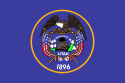
|
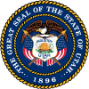
|
| Flag
|
Seal
|
| Nickname(s): Beehive State
|
| Motto(s): Industry
|
|
|
|
| Official language(s)
|
English
|
| Capital |
Salt Lake City
|
| Largest city |
capital
|
| Largest metro area |
Salt Lake City
|
| Area |
Ranked 13th
|
| - Total |
84,899 sq mi
(219,887 km²)
|
| - Width |
270 miles (435 km)
|
| - Length |
350 miles (565 km)
|
| - % water |
3.25
|
| - Latitude |
37° N to 42° N
|
| - Longitude |
109° 3′ W to 114° 3′ W
|
| Population |
Ranked 30th in the U.S.
|
| - Total |
3,271,616 [1]
|
| - Density |
36.53/sq mi (14.12/km2)
Ranked 41st in the U.S.
|
| - Median income |
$60,365[2] (11th)
|
| Elevation |
|
| - Highest point
|
Kings Peak[3][4]
13,518 ft (4,120.3 m)
|
| - Mean |
6,100 ft (1,860 m)
|
| - Lowest point |
Beaver Dam Wash at
Arizona border[3][4]
2,180 ft (664.4 m)
|
| Admission to Union
|
January 4, 1896 (45th)
|
| Governor |
Mike DeWine (R)
|
| Lieutenant Governor |
Jon Husted (R)
|
| U.S. Senators |
Sherrod Brown (D)
Rob Portman (R)
|
| Time zone
|
Mountain: UTC-7/-6
|
| Abbreviations
|
UT US-UT
|
| Web site
|
www.utah.gov
|
Utah, a state located in the western United States, was the 45th state admitted to the union (January 4, 1896). The majority of Utah's population, known as "Utahns," live in an urban concentration known as the Wasatch Front, which stretches from Ogden on the north to Provo on the south with Salt Lake City as the center.
Utah's pivotal central western location makes the state a natural transportation center. Other key industries include information technology and research, government services, mining, and tourism. Utah is home to five national parks as well as incredible geological diversity in the form of snowcapped mountains to well-watered river valleys to rugged, stony deserts.
The state is also known for being one of the most religiously homogeneous states in the Union, with approximately 65 percent of its inhabitants claiming membership in The Church of Jesus Christ of Latter-day Saints, which greatly influences Utah culture and daily life.
Etymology
Utah's name originates from the Native American tribe known as the Ute, who ranged across much of the northern Colorado Plateau from at least 2,000 years B.C.E. Southern Paiute and Gosiute (inter-related and belonging to the Shoshone group) resided alongside the Ute at the time of European exploration of the area. "Ute" can be translated as "high land" or "land of the sun."[5] It is alternatively translated as "People of the mountains."[6]
People who live in Utah are known as "Utahns."
Geography

Utah from space. The state is known for its diversity in geology, climate, and ecosystems.

Joshua Trees, yucca plants, and Jumping Cholla cactus occupy the far southwest corner of the state in the Mojave Desert.

Logan Canyon in northern Utah.
Utah, in the western United States, is bounded on the north by Idaho, Wyoming to the northeast, Colorado to its east, while its southern border is Arizona, and Nevada lies to the west. Its southeast corner touches the northwest corner of New Mexico, though they do not share a common boundary.
Unique within the 48 contiguous states, the four states of Utah, Colorado, New Mexico, and Arizona meet at a single point, known as the Four Corners Monument. The state comprises a total land mass of 84,899 square miles (219,887 km²).
Topography
Utah has three distinct geological regions: the Colorado Plateau, which covers slightly more than half the state, the Rocky Mountains, and the Great Basin.
The Colorado Plateau, ranging through parts of Colorado, New Mexico and Arizona, covers the southeastern half of Utah. Relatively high in elevation, this region is primarily comprised of Kayenta and Navajo sandstone. The Colorado River and its tributaries wind through this rock, creating some of the most spectacular wild terrain in the world. Wind and rain have sculpted the soft rock outcroppings over millions of years, producing breathtaking sites of canyons, gullies, arches, pinnacles, buttes, bluffs, and mesas throughout south-central and southeast Utah. Protected parks such as Arches, Bryce Canyon, Canyonlands, Capitol Reef, and Zion national parks, Cedar Breaks, Grand Staircase-Escalante, Hovenweep, and Natural Bridges national monuments, Glen Canyon National Recreation Area (site of the popular tourist destination, Lake Powell), Dead Horse Point and Goblin Valley state parks, and Monument Valley, a popular photographic and filming site are found here.
The Great Basin lies in the western third of the state. Within this basin is the Great Salt Lake, southwest of which is the Great Salt Lake Desert, covering 4,000 square miles and stretching to the Nevada border. This region is desert-like and contains both occasional mountain peaks and the well-known Bonneville Salt Flats.
Running down the center of the state is the Wasatch Range, a segment of the south-central Rocky Mountains, with heights of approximately 12,000 feet (3,650 m) above sea level. Portions of these mountains receive more than 500 inches (12.7 m) of snow each year and are home to world-renowned ski resorts, made popular by the light, fluffy snow. In the northeastern section of the state, running east to west, are the Uinta Mountains, which attain heights of 13,000 feet (3,950 m) and where the highest state summit, Kings Peak, 13,528 feet (4,123 m), is found. The Uinta Mountains are the only major mountain range in the United States running in an east–west direction.
Like much of the U.S. West and Southwest, the federal government owns a vast amount, over 70 percent, of Utah's land. Controlled by such departments as Bureau of Land Management, National Park, or designated Wilderness Areas, this is meant to protect and preserve the land. Often, contention occurs between commercial and personal interests such as ranching, mining, energy development, and recreation. The parks bring a substantial amount of income to the state through tourism.
Climate
Utah has four distinct seasons. July's average temperature is about 70° F (21° C). The average winter temperature is slightly below freezing except in "Dixie," the southwestern part of the state which has a warm, almost dry, subtropical climate, leading to its nickname. Daily temperatures vary widely: Salt Lake City has July highs of 90° F (32° C) or above, the nights are 55° to 65° F (13° to 18° C). In the populated areas, cold snaps are usually short and not severe. However, some mountain valleys, generally experience temperatures below 0 °F (-18 °C) 50 days per year. Sometimes the mountains to Utah's north and east function as barriers to Arctic air. Summer produces the other extreme, with high temperatures averaging between 85 °F (29 °C) and 100 °F (38 °C).
Most of Utah is arid due to its proximity to the West's mountain systems, which divert much of the precipitation. Average annual precipitation is 11 inches (280 millimeters). Its eastern and southern areas commonly receive 12 inches (300 mm) or less of precipitation per year, and the annual rainfall in western Utah is generally less than ten inches (25 cm). The Wasatch Front receives approximately 15 inches, while the Great Salt Lake Desert is quite dry, with less than eight inches annually. Rain favors the mountain areas, with more than 40 inches per year overall, although annual precipitation in some alpine places can be up to 60 inches. Utah's northern section is affected by air masses from the North Pacific, much of its precipitation falling in the cool season. Utah's southwestern valleys generally receive no snow, while ten feet or more is common at its mountain resorts. Snowfall is common from November through mid-April in the lower elevations and from October through May in the mountains. The mountains often retain snow into July.
Flora and fauna
The beauty of Utah's diverse natural landscape is considered one of the state's greatest assets. It is home to 17 National Parks and 43 State Parks.
There are 4,000 known plant species in the state representing six climatic zones, ranging from lowland desert to mountain peaks. There are over 15,000,000 acres of timberland, though only one-fourth of that is commercially viable. Commonly found are: Aspen, blue spruce, cactus, cedar, creosote bush, firs, Juniper, Joshua tree, mesquite, native grasses for grazing, piñon pine, pines, saltbush, sagebrush, shad scale and yucca.
Once home to bison, timber wolves and bears, these large animals have virtually disappeared from Utah's terrain. The most common large animal remaining is the mule deer. Bobcat, lynx and coyote make their home here. Birds include golden eagles, hawks, magpies and owls. Game birds include grouse, pheasant and quail. Blue herons, sea gulls and white pelicans are some of the birds found in the refuges of the Great Salt Lake. Also native to the state are several species of game fish, reptiles and amphibians.
History
Native American history
Archaeological sites throughout Utah have identified the area as having human population for 10,000-12,000 years. These ancient people, who were hunters and gatherers, adapted to life in the state's varied landscapes: deserts, high mountains, badlands, and marshes.
The Anasazi, or Pueblo culture, came north into Utah around 400 C.E., remaining until around 1250. These people were farmers who irrigated fields to grow crops and built pueblos, or villages which housed several hundred people. Their apartment constructions, some as high as five stories, were made on cliff caves or flat hills called mesas or tables.

The great
Ute leader, Chief Ouray and Chipeta. Ouray was considered a great leader, and called
The White Man's Friend, as he sought reconciliation between peoples.
The Fremonts and Anasazi peoples were famous for their rock art, depicted in chipped or painted symbols and figures on canyon walls. For unknown reasons, their homes and villages were abandoned in the late 1200s, perhaps due to inclement weather, such as drought, or invasions of other more aggressive peoples.
European-American explorers and settlers came to the area in the eighteenth and nineteenth centuries, finding Shoshone Indians; Paiute (Pahutes), Gosiute (or Goshutes) and Ute who had come to the area about the time the Anasazi left. Some of these peoples practiced irrigation, raising maize and pumpkins. Others lived a nomadic lifestyle, centered around the hunting of buffalo. The Utes, most prevalent of these three tribes, were the inspiration for the name of the modern-day state of Utah.
The Ute were the first modern Indians in Utah to utilize horses, which had been brought to the American west by the Spanish, where some got loose and lived in wild herds. The Ute became skillful riders and traveled throughout the entire state, hunting buffalo and other animals. Their numbers and power grew, and they adopted slave trading from the Spaniards, raiding the other two weaker, smaller tribes. Some Ute customs still prevalent today include the spring Bear Dance and the summer Sun dance.
The Navajo comprise a large Nation in New Mexico, Arizona, and since 1500, the area in Utah near Four Corners. Like the Utes, they domesticated the horse and sheep and lived as herders.
Conflict and confinement

Delegation of Ute Indians in Washington, D.C. in 1880.
The Ute experience with European-American settlers is similar to that of many other Native American groups: competition, confrontation and eventual coerced relocation to reservations. Of particular interest are the Walker War (1853–1854) and Black Hawk War (1865–1872) in Utah. Over the years, several other skirmishes and incidents occurred between Utes and white gold-seekers and settlers in Utah and Colorado. These Ute "uprisings" were the result of friction between recently arrived Anglos and local Ute groups. At the same time, the Ute were allies of the United States in its wars with the Navajo and Apache to the south.
A series of treaties established a small reservation in 1864 in northeast Utah, and a reservation in 1868, which included the western third of modern Colorado, including on land actually claimed by other tribes. This was whittled away until only the modern reservations are left: a large cession of land in 1873 transferred the gold-rich San Juan area, and was followed in 1879 by the loss of most of the remaining land.
Eventually, the various bands of Utes were consolidated onto three reservations. Several of these bands still maintain separate identities as part of the Ute tribal organizations. Although initially large and located in areas that white settlers deemed undesirable, the sizes of these reservations were repeatedly reduced by various government actions, encroachment by white settlers and mining interests. In the twentieth century, several U.S. federal court decisions restored portions of the original reservation land to the Ute Tribes' jurisdiction and awarded monetary compensations.
Mountain men
In the 1800s hundreds of mountain men, or fur traders traveling throughout the west established their own trails in search of beaver for pelts to be made into popular hats in U.S. and European cities. Kit Carson, a well known guide and Jim Beckwourth, a mountain man leader, and other traders enjoyed the independence of their occupation and delighted in the boisterous, if excessive, parties such as an Ogden gathering that Mr. Beckwourth described in 1826: "Mirth, songs, dancing, shouting, trading, running, jumping, singing, racing, target shooting, yarns, frolic, with all sorts of extravagances that white men or Indians could invent, were freely indulged in."
Great hardship was endured as well. Jedediah Strong Smith was the first white man to cross Utah throughout the state, north to south and east to west. His animals were ill and exhausted after traveling, and he was forced to consume his sick horse to survive.
This business flourished for about 20 years, until the supply of fur animals, like the beaver, diminished and the fashions changed. With no remaining economic incentive and no established families in the area, the mountain men left Utah in the late 1840s seeking wealth elsewhere.
Early pioneers
Several groups of settlers, westward–bound to California or Oregon Territory, passed through Utah. The Bartleson-Bidwell group of 1841 were the first American emigrants to cross Utah. They and the Donner-Reed Party who traveled five years later, used the Miera map which presented a non-existent river. Both groups reached California but suffered great deprivations of weather and food along the way and were compelled to abandon many supplies, wagons, and animals. The Donner-Reed party was reduced from 87 to 44 of their original group of emigrants after wintering in adverse conditions, with no hope of rescue.
John C. Frémont a famous western government explorer, aided by guide Kit Carson, visited the Great Salt Lake Region in 1843-1844. In 1845 he printed a correct map that identified the drainage of the Great Salt Lake as a Great Basin. Two years after the map was printed, the first group of Caucasian members and three African-American slaves used the revised map when it traveled to Utah, following the path of the Donner-Reed party trail. These Mormon pioneers would claim this western desert and mountainous area as their homeland.
Mormon settlement
The Mormon faith began in Palymra, New York when the founder Joseph Smith, Jr., at the age of 14, reported an apparition from God and Jesus. Three years later he reported that the angel Moroni appeared and revealed church teachings to him over a four-year period, after which he received the golden plates and a revelation from John the Baptist. Smith and a scribe, Mr. Cowdery, baptized each other as Church priests, in the Melchizedec order, and became the Church's first elders. The Mormon Church was officially founded in 1830 and suffered years of persecution, culminating in Smith's assassination in 1844.
The death of the church's founder posed serious problems, especially since Smith had left no clear choice as a successor. The Twelve Apostles of the church, through prayer, determined the group's new leader to be Brigham Young. Young led the first group of Mormon pioneers on a 1,300 mile trek to the Salt Lake Valley on July 24, 1847. During the next 22 years, more than 70,000 Latter Day Saints pioneers crossed the plains and settled in Utah.
The church grew rapidly, and many adherents from the eastern United States and other nations settled in Utah. Church leaders assigned groups to settle throughout the West. With such religious expansion efforts and land irrigation, settlements grew quickly along Utah's Wasatch Front, centered in Salt Lake City. Then it expanded to the Bountiful and Weber Valley, and continued to Provo and Utah Valley. Prominent early LDS towns in Utah were St. George, Logan, and Manti (where the first temples in Utah were built), Fillmore (the territorial capital between 1850 and 1856), Nephi, Levan, Spanish Fork, Springville, Provo Bench (renamed Orem), and many others. Young named this new Mormon pioneer territory Deseret which means "honeybee." This symbol appears on the Utah state flag, and it is the source of the state motto, "Industry." [7]
Mountain Meadows massacre
One of the most tragic and disturbing events in Mormon history took place on September 11, 1857, when approximately 120 men, women and children, traveling through Utah to California were massacred by a force consisting of Mormon militia members and Southern Paiute Indians. This came to be known as the Mountain Meadows massacre.
The Baker-Fancher train consisted of California-bound emigrants who started their journey in Arkansas and Missouri. Earlier in the year, Mormon apostle Parley P. Pratt had been murdered near the town of Van Buren, Arkansas. Rumor had it that some of the members of the train were among those who had participated in Pratt's murder, or that they bragged about his killing.
The group arrived in Salt Lake City in late July. It was common for emigrant parties to camp near Mountain Meadows for several days or even weeks while their animals gained condition for the grueling desert crossings still to come. They were camping there in early September when they were surrounded by a group of hostile Paiutes. A small group of Mormons had sent word of the situation to Brigham Young, seeking his counsel. Unfortunately, his advice was late in coming, arriving two days after the massacre. His letter had directed: "In regard to the emigration trains passing through our settlements, we must not interfere with them until they are first notified to keep away. You must not meddle with them. The Indians we expect will do as they please but you should try and preserve good feelings with them." The small group of Mormons who were involved went to trial and were excommunicated.
There are conflicting accounts of this event and the truth may not come to full disclosure in this lifetime. However, in the 1980s, descendants of the victims and the perpetrators met together to start bridging the divide and make peace with the past. Through a series of meetings the seeds of reconciliation were planted.
Polygamy

Alpine Loop near Sundance in the fall.
The Mormon practice of polygamy was countered by the federal government's Edmunds Act of 1882. Both the government and the general public condemned this practice and considered LDS members to be un-American and rebellious because of it. Multiple attempts to have Utah (the original State of Deseret of which Young was governor) recognized as a state failed due to strong resistance to the practice of polygamy.
In 1890, the Church beliefs and practices were changed following a new revelation which outlawed the practice of polygamy. Wilford Woodruff, then president of the Church, issued a manifesto called the "Great Accommodation" which generally suspended the solemnization of plural marriages for an indefinite period.
Utah was granted statehood 1896, six years after the manifesto was issued. The original proposal was for the creation of a Mormon state encompassing all remaining lands to the West with the exception of New Mexico and California. Eventually the current day boundaries came into play as other states joined the Union.
Twentieth century
In the early 1900s Utah attained renown for its natural beauty as Bryce Canyon National Park and Zion National Park became national landmarks. The southern portion of the state became a popular filming spot for arid, rugged western scenes; most Americans came to recognize such natural landmarks as Delicate Arch and "the Mittens" of Monument Valley. During the 1950s, through 1970s, the Interstate highway system was constructed.
Beginning in 1939, the Alta Ski Area was established, and Utah became famous throughout the world for its high quality snow and skiing, which many consider the best in the world, especially in the Wasatch Range. Salt Lake City was selected to host the 2002 Winter Olympics in 1995, and many of the Olympic venues along the Wasatch Front are still used for sporting events. To better serve the tourists within and from outside Utah, the TRAX light-rail system was developed in Salt Lake Valley and the city–wide freeway system was updated.
Law and government

The Salt Lake Temple of the Church of Jesus Christ of Latter-day Saints is the largest attraction in the city's Temple Square.

The Utah State Capitol, Salt Lake City.

The Scott Matheson Courthouse is the seat of the Utah Supreme Court
Salt Lake City is the capital and largest city of the "Beehive State" as well as the county seat for Salt Lake County. It sits at the base of the Wasatch Mountains, on the Jordan River at the southeastern end of Great Salt Lake and is sandwiched between Grand Canyon and Zion National Parks to the south and Yellowstone and the Grand Tetons to the north.
Founded by Brigham Young in 1847, it is home of the world headquarters of the Church of Jesus Christ of Latter-day Saints (Mormons), the famous Mormon Tabernacle and the University of Utah. Located near famous ski resorts, the city is a regional center for business, religious and social life. [8]
State and local politics
As with most U.S. states, Utah's government is divided into three branches: executive, legislative, and judicial.
The top executives of Utah are the governor and the lieutenant governor, who are elected on the same ticket to a maximum of two four-year terms.
The Utah State Legislature consists of a Senate and a House of Representatives. State senators serve four-year terms and representatives, two year terms. The state legislature meets each year in January for an annual 45-day session.
The state Supreme Court is the court of last resort in Utah. Five justices, whom the governor initially appoints, serve on this court. They must be elected to subsequent terms. Other lower court justices and judges follow this same procedure. The state Court of Appeals handles cases from the trial courts. Trial level courts are the district courts and justice courts.
The Republican Party prevails in the state's leadership. Governors usually assume a centrist position on social issues and favor free economic trade. While state senators and representatives generally pass socially conservative policies the governor has the right-of-veto, which is often utilized.
In general, Utah is one of the most conservative states in the Union. The 2006 general session of the legislature passed S.J.R. 9, an amendment recognizing the "rights of public school students to voluntarily engage in prayer and other expressions considered religious in nature in public schools." [9]
Federal politics
Utah is one of the most Republican states in the nation, with Republican presidential nominees consistently achieving one of their highest margins of victory here. The state has not voted for a Democrat for President since 1964 when Lyndon B. Johnson won the state's electoral vote.
Economy
Major industries of Utah include: mining, cattle ranching, salt production, and government services.
Research, information technology development, and service based industries are important economic activities along the Salt Lake City-Ogden-Provo corridor.
Utahns have a particular mindset regarding giving, which has placed them first among all U.S. states in the proportion of income given to charity by the wealthy.
Natural resources and mining
The late nineteenth century marked the beginning of the state's mining boom which attracted large numbers of immigrants with job opportunities. Since the days of the Utah Territory mining has played a major role in Utah's economy.
During the early part of the Cold War era, uranium was mined in the eastern part of the state. Today mining activity still plays a major role in the state's economy. Minerals mined include copper, gold, silver, molybdenum, zinc, lead, and beryllium. Fossil fuels include coal, petroleum, and natural gas.
In eastern Utah petroleum production is a major industry. Near Salt Lake City, petroleum refining is done by a number of oil companies. In central Utah, coal production accounts for much of the mining activity.
Tourism

Bridal Veil Falls in Provo Canyon between Orem and Heber City.
Tourism is a major industry in Southern Utah. The state's five national parks (Arches, Bryce Canyon, Canyonlands, Capitol Reef, and Zion) along with the ski resorts in the northern Wasatch Range, the Bonneville Salt Flats, the Great Salt Lake, Temple Square, Sundance Film Festival, and the Utah Shakespearean Festival are popular attractions.
The mountains are popular for camping, rock-climbing, skiing, snowboarding, mountain–biking and hiking.
Transportation
Utah has five Interstate Highway systems.
- Interstate 15 is the main interstate highway in the state, entering from Arizona and spanning the state north-south, entering Idaho near the town of Portage. It serves the primary population centers of the state.
- Interstate 80 spans the northern portion of the state west-east. It enters from Nevada at Wendover, traverses Salt Lake City, then crosses the Wasatch Range, entering Wyoming.
- Interstate 84 splits from I-80 at the town of Echo, heading west through the Wasatch Range and joining I-15 southwest of Ogden. The two interstates stay merged until Tremonton, where I-84 heads northwest, entering Idaho near Snowville.
- Interstate 70 splits from I-15 at Cove Fort, heading east through the mountains and into Colorado west of Grand Junction, traversing desolate desert terrain and serving the various national parks and national monuments of southern Utah. The stretch of I-70 between the towns of Salina and Green River is the longest stretch of interstate in the country without any services.
- Interstate 215 is the "belt route" forming a loop around Salt Lake City.
There is also a state highway system.
Salt Lake City International Airport is the only international airport in the state and serves as a hub of Delta Airlines. In 2005 it was ranked first in on-time departures and second in on-time arrivals in the country, and consistently ranks in the top 10 for customer service.
There are a number of small regional airports throughout the state.
Education
With 90.7 percent of Utahns aged 25 and over having completed high school and 26.9 percent with a bachelor's degree or higher, Utah ranks among the leading states in educational development and attainment of its population. The year 2002 saw 30,337 high school students graduate.
The state has a reputation for high-quality educational programs in its public, private and parochial schools. Nearly half million students attend elementary and secondary schools on an annual basis.
Higher education
Utah has ten public degree-granting universities and colleges, and three private higher learning institutions which offer training in a multitude of subject areas. The state's System of Higher Education is governed by the Utah State Board of Regents and assisted by a local Board of Trustees.
The state's three research–based institutions are
- the University of Utah, whose most common degrees awarded include Economics, Political Science, Mass Communications, Psychology, and Sociology.
- Utah State University, which was originally established as an agricultural college but has since expanded its studies to include the History of the American West and plans to extend its Arts Program.
- Brigham Young University, established by the Mormon Church, offers courses in business, culinary arts, digital arts and graphic design, education, fashion design and interior design, health and medicine, law and justice, and technology.
Other schools of higher learning include the College of Eastern Utah, Dixie State College of Utah, ITT Technical Institute, LDS Business College, Southern Utah University, Utah Valley State College, and Western Governors University (an online university).
Demographics
| State symbols
|
- Emblem Beehive
- Motto: "Industry"
- Song: "Utah, This Is The Place"
- Hymn: "Utah We Love Thee"
- State Folk Dance: Square Dance
- Animal: Rocky Mountain Elk
- Bird: California Seagull
- Fish: Bonneville Cutthroat Trout
- Flower: Sego Lily
- Fossil: Allosaurus
- Fruit: Cherry
- Grass: Indian Rice Grass
- Gem: Topaz
- Insect: Honey Bee
- Mineral: Copper
- Rock: Coal
- Star: Dubhe
- Tree: Blue Spruce
- Vegetable: Spanish Sweet Onion
- Historic Vegetable: Sugar Beet [10]
|
The state's population is concentrated in two areas, the Wasatch Front in the north-central part of the state, with a population of approximately two million. There are five major metropolitan areas running north-south along this range:
- Logan
- Ogden-Clearfield
- Salt Lake City
- Provo-Orem
- St. George
The other population center is in southwestern Utah, locally known as "Dixie."
Ethnicity
Most Utahns are of Northern European descent. Among the European immigrants who settled in Utah from 1850 to 1950, the highest percentage were British, followed by second ranking Scandinavians. Caucasians form the major group in every county except San Juan, which has a large Navajo population.
The Hispanic population is growing rapidly, especially in Salt Lake City, Ogden, and Orem/Provo area. These include recent immigrants from Mexico, Central America and South America. Utah's African-American population is relatively small; most are middle-class professionals who relocated from California.
Culture
There have been three major influences in Utah's history which affect its overall cultural climate today - "Old West" Cowboys, Native American tribes, and Mormon settlers.
Utah's sparsely–populated wide–open spaces were inviting to legitimate cowboys, cattle rustlers and outlaws in the 1800s. Except for several concentrated population centers, Utah remains wide open today, allowing for an abundance of ranches with modern cowboys.
There are five major American Indian tribes within the state: 1) Ute; 2) Dine' (Navajo); 3) Paiute; 4) Goshute; and 5) Shoshoni. The Navajo are a major tourist draw due to their excellent craftsmanship. They are well–known for their jewelry made of turquoise, silver, and local gemstones. The five tribes continue to be an important part of Utah's modern culture. [11]
Approximately 65 percent of the state's population belong to the Mormon faith. This has had a profound influence on the state especially in terms of accepted social practices, politics and lawmaking. Mormons not only hold, but practice, conservatism in such things as alcohol consumption and gambling. Their beliefs in family values and community are strong.
Photo gallery
The Four Corners - Utah, Colorado, Arizona & New Mexico
Panoramic view of the salt flats of the Great Salt Lake Desert.
Notes
- ↑ 2020 Census Apportionment Results The United States Census Bureau, April 26, 2021. Retrieved April 25, 2022.
- ↑ United States Median Household Income United States Census Bureau. Retrieved April 25, 2022.
- ↑ 3.0 3.1 Elevations and Distances in the United States United States Geological Survey. Retrieved April 25, 2022.
- ↑ 4.0 4.1 Elevation adjusted to North American Vertical Datum of 1988.
- ↑ Southern Ute Museum of Northern Arizona. Retrieved April 25, 2022.
- ↑ Nancy McClure, The Arts and Culture of the Ute Indians – Points West Online Buffalo Bill Center of the West. Retrieved April 25, 2022.
- ↑ Corporation of the President of The Church of Jesus Christ of Latter-day Saints: "Church History in the Fullness of Times." 1989.
- ↑ Salt Lake City www.utah.com. Retrieved April 25, 2022.
- ↑ S.J.R.9 2006 General Session State of Utah. Retrieved April 25, 2022.
- ↑ Utah State Symbols USA. Retrieved April 25, 2022.
- ↑ The Old West Utah Travel Industry. Retrieved April 25, 2022.
References
ISBN links support NWE through referral fees
- Brown, Jonatha A. Utah. Portraits of the states. Milwaukee, WI: Gareth Stevens, 2007. ISBN 0836847091
- Fradin, Dennis B. Utah. From Sea to Shining Sea. Chicago: Childrens Press, 1993. ISBN 9780516038445
- McCarthy, Betty. America the beautiful. Utah. Chicago: Childrens Press, 1990. ISBN 9780516004907
- Ross, Dana Fuller. Utah! Toronto: Bantam, 1984. ISBN 055323921X
- Sprinkel, Douglas A., Thomas C. Chidsey, and Paul B. Anderson. Geology of Utah's parks and monuments. Utah Geological Association publication, 28. Salt Lake City, UT: Utah Geological Association, 2003. ISBN 9781882054107
External links
All links retrieved May 3, 2023.
Credits
New World Encyclopedia writers and editors rewrote and completed the Wikipedia article
in accordance with New World Encyclopedia standards. This article abides by terms of the Creative Commons CC-by-sa 3.0 License (CC-by-sa), which may be used and disseminated with proper attribution. Credit is due under the terms of this license that can reference both the New World Encyclopedia contributors and the selfless volunteer contributors of the Wikimedia Foundation. To cite this article click here for a list of acceptable citing formats.The history of earlier contributions by wikipedians is accessible to researchers here:
The history of this article since it was imported to New World Encyclopedia:
Note: Some restrictions may apply to use of individual images which are separately licensed.