Difference between revisions of "Azerbaijan" - New World Encyclopedia
({{Contracted}}) |
Mike Butler (talk | contribs) m |
||
| Line 1: | Line 1: | ||
{{Claimed}}{{Contracted}} | {{Claimed}}{{Contracted}} | ||
| − | |||
| − | |||
{{Infobox Country or territory | {{Infobox Country or territory | ||
|native_name = <span style="line-height:1.33em;">''Azərbaycan Respublikası''</span> | |native_name = <span style="line-height:1.33em;">''Azərbaycan Respublikası''</span> | ||
| Line 58: | Line 56: | ||
|footnotes = | |footnotes = | ||
}} | }} | ||
| − | '''Azerbaijan''' {{IPA|[ɑ:zɚbai'ʤɑ:n]}} ([[Azerbaijani language|Azerbaijani]]: ''Azərbaycan''), officially the '''Republic of Azerbaijan''' (Azerbaijani: ''Azərbaycan Respublikası''), is | + | '''Azerbaijan''' {{IPA|[ɑ:zɚbai'ʤɑ:n]}} ([[Azerbaijani language|Azerbaijani]]: ''Azərbaycan''), officially the '''Republic of Azerbaijan''' (Azerbaijani: ''Azərbaycan Respublikası''), is situated in the [[Caucasus]] region of [[Eurasia]], north of Iran and east of the Caspian Sea.. |
| − | Azerbaijan | + | The Nakhichevan Autonomous Republic (an exclave of Azerbaijan) borders Armenia to the north and east, Iran to the south and west, and [[Turkey]] to the northwest. The Nagorno-Karabakh region in the southwest of Azerbaijan proper declared itself independent from Azerbaijan in 1991, but it is not recognized by any nation and considered a legal part of Azerbaijan. |
| − | == | + | Azerbaijan is a [[secular]] state, and has been a member of the [[Council of Europe]] since 2001, EU's European Neighborhood Policy partner since 2006, [[NATO]] Partnership for Peace member since 1994, NATO Individual Partnership Action Plan (IPAP) since 2004 and [[Commonwealth of Independent States]]'s member since 1991. |
| − | + | ||
| − | The name Azerbaijan itself is thought to be derived from '' | + | == Geography == |
| + | [[Image:Azerbaijan_1995_CIA_map.jpg|thumb|left|300px|Detailed map of Azerbaijan]] | ||
| + | The name Azerbaijan itself is thought to be derived from ''Atropates'', the Satrap (governor) of Media in the [[Achaemenid]] [[empire]], who ruled a region found in modern [[Azarbaijan]] called ''Atropatene.'' Atropates name is believed to be derived from the Old Persian roots meaning "protected by fire." | ||
| + | |||
| + | Three physical features dominate Azerbaijan: the [[Caspian Sea]], whose shoreline forms a natural boundary to the east; the [[Greater Caucasus]] mountain range to the north; and the extensive flatlands at the country's center. | ||
| + | |||
| + | About the size of [[Portugal]] or the state of [[Maine]] in the United States, Azerbaijan has a total land area of approximately 33,436 square miles (86,600 square kilometers, less than one percent of the land area of the former [[Soviet Union]]. Of the three Transcaucasian states, Azerbaijan has the greatest land area. | ||
| + | |||
| + | Special administrative subdivisions are the Nakhichevan Autonomous Republic, which is separated from the rest of Azerbaijan by a strip of [[Armenia]]n territory, and the Nagorno-Karabakh Autonomous Region, entirely within Azerbaijan. (The status of Nagorno-Karabakh was under negotiation in 1994.) | ||
| + | |||
| + | [[Image:Baku_2.jpg|thumb|250 px|right|The Caspian Sea, viewed from [[Baku]], [[Azerbaijan|Republic of Azerbaijan]].]] | ||
| + | Located in the region of the southern Caucasus Mountains, Azerbaijan borders the Caspian Sea to the east, Georgia and Russia to the north, Iran to the south, and Armenia to the southwest and west. A small part of Nakhichevan also borders Turkey to the northwest. | ||
| + | |||
| + | The elevation changes over a relatively short distance from lowlands to highlands; nearly half the country is considered mountainous. Notable physical features are the gently undulating hills of the subtropical south-eastern coast, which are covered with tea plantations, orange groves, and lemon groves; numerous mud volcanoes and mineral springs in the ravines of Kobustan Mountain near Baku; and coastal terrain that lies as much as 92 feet (28 meters) below sea level. | ||
| + | |||
| + | Except for its eastern Caspian shoreline and some areas bordering Georgia and Iran, Azerbaijan is ringed by mountains. To the northeast, bordering Russia's Dagestan Autonomous Republic, is the Greater Caucasus range; to the west, bordering Armenia, is the Lesser Caucasus range. To the extreme southeast, the Talysh Mountains form part of the border with Iran. The highest elevations occur in the Greater Caucasus, where Mount Bazar-dyuzi rises 14,714 feet (4485 meters) above sea level. | ||
| + | |||
| + | Eight large rivers flow down from the Caucasus ranges into the central Kura-Aras lowlands, alluvial flatlands and low delta areas along the sea coast designated by the Azerbaijani name for the Mtkvari River and its main tributary, the Aras. The Mtkvari, the longest river in the Caucasus region, forms the delta and drains into the Caspian a short distance downstream from the confluence with the Aras. The Mingechaur Reservoir, with an area of 234 square miles (605 square kilometres) that makes it the largest body of water in Azerbaijan, was formed by damming the Kura in western Azerbaijan. The waters of the reservoir provide hydroelectric power and irrigation of the KuraAras plain. Most of the country's rivers are not navigable. About 15 percent of the land in Azerbaijan is arable. | ||
| + | [[Image:Azeri Forest.jpg|left|thumb|250px|The Nabran Forest has some of the oldest trees in the world the avarage age is 500 years.]] | ||
| + | Azerbaijan contains nine of the 11 climatic zones. It is arid, dry, and subtropical with hot summers and mild winters. Temperatures vary by season and area. In the southeast lowland, temperatures average 43°Fahrenheit (6°Celsius) in the winter and 80°F (26°C) in the summer — though daily maxima typically reach 89°F (32°C). In the northern and western mountain ranges, temperatures average 55°F (12°C) in the summer and 20°F (–9°C) in the winter. | ||
| + | |||
| + | Annual rainfall over most of the country varies from eight to 16 inches (200 to 400 millimeters) and is generally lowest in the northeast. In the far southeast, however, the climate is much moister and annual rainfall can be as high as 51 inches (1300mm). For most of the country, the wettest periods are in spring and autumn, with summers being the driest. Droughts are a natural hazard. | ||
| + | |||
| + | Azerbaijan has a very rich flora, more than 4500 species of higher plants have been registered in the country. Due the unique climate in Azerbaijan, the flora is much richer in the number of species than the flora of the other republics of the South Caucasus. About 67 percent of the species growing in the whole [[Caucasus]] can be found in Azerbaijan. | ||
| + | |||
| + | Relict genera of the tertiary period can be frequently found in all the zones of Azerbaijan, especially in Lenkeran (Talysh regions). They are the iron tree (Parrotia persica), the Lenkoran acacia (Albizzia julibrissin), the basket oak (Quercus castaneifolia), the Caucasian persimmon (Diospyrus lotus), the evergreen shrub of Ruscus hyrcana, the box tree (Buxus hyrcana), etc. There are 240 endemic species of plants in Azerbaijan. | ||
| + | |||
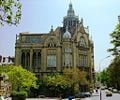
| + | [[Image:Azerbaigian-baku.jpg|right|150px|thumb|Downtown Baku]] | ||
| + | Local scientists consider the Abseron Yasaqligi (Apsheron Peninsula) (including Baku and Sumqayit) and the Caspian Sea to be the ecologically most devastated area in the world because of severe air, soil, and water pollution; soil pollution results from oil spills, from the use of DDT as a pesticide, and from toxic defoliants used in the production of cotton | ||
| + | |||
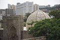
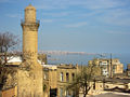
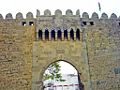
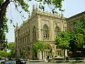
| + | The capital of Azerbaijan is the ancient city of Baku, which has the largest and best harbor on the Caspian Sea and has long been the center of the republic's oil industry. Modern Baku consists of three parts: the Old Town (İçəri Şəhər), the boomtown and the [[Soviet Union|Soviet]]-built town. The population of Baku in 2003 was 2,074,300. | ||
== History == | == History == | ||
| Line 105: | Line 133: | ||
{{main|Subdivisions of Azerbaijan}} | {{main|Subdivisions of Azerbaijan}} | ||
Azerbaijan is divided into fifty-nine [[raion]]s (''rayonlar'', singular ''rayon''), eleven [[cities]] (''şəhərlər'', singular ''şəhər''), and one [[autonomous republic]] (''muxtar respublika''), [[Nakhichevan]]. Nakhichevan itself is subdivided into seven raions and one city. The city of [[Baku]] is the capital of Azerbaijan. | Azerbaijan is divided into fifty-nine [[raion]]s (''rayonlar'', singular ''rayon''), eleven [[cities]] (''şəhərlər'', singular ''şəhər''), and one [[autonomous republic]] (''muxtar respublika''), [[Nakhichevan]]. Nakhichevan itself is subdivided into seven raions and one city. The city of [[Baku]] is the capital of Azerbaijan. | ||
| − | |||
| − | |||
| − | |||
| − | |||
| − | |||
| − | |||
| − | |||
== Economy == | == Economy == | ||
Revision as of 02:57, 24 March 2007
| Azərbaycan Respublikası Republic of Azerbaijan | |||||
| |||||
| Motto: none | |||||
| Anthem: Azərbaycan Respublikasının Dövlət Himni (March of Azerbaijan) | |||||
 | |||||
| Capital | File:Gerb Baku.GIF Baku 40°22′N 49°53′E | ||||
|---|---|---|---|---|---|
| Largest city | capital | ||||
| Official languages | Azerbaijani | ||||
| Government | Republic | ||||
| - President | Ilham Aliyev | ||||
| - Prime Minister | Artur Rasizade | ||||
| Independence | from the Soviet Union | ||||
| - Declared | August 30 1991 | ||||
| - Completed | December 25 1991 | ||||
| Area | |||||
| - Total | 86,600 km² (114th) 33,436 sq mi | ||||
| - Water (%) | negligible | ||||
| Population | |||||
| - 2005 estimate | 8,411,000 | ||||
| - 1999 census | 7,953,438 | ||||
| - Density | 97/km² 251/sq mi | ||||
| GDP (PPP) | 2005 estimate | ||||
| - Total | $38.71 billion | ||||
| - Per capita | $4,601 | ||||
| HDI (2003) | 0.729 (medium) | ||||
| Currency | Manat (AZN)
| ||||
| Internet TLD | .az | ||||
| Calling code | +994 | ||||


Azerbaijan [ɑ:zɚbai'ʤɑ:n] (Azerbaijani: Azərbaycan), officially the Republic of Azerbaijan (Azerbaijani: Azərbaycan Respublikası), is situated in the Caucasus region of Eurasia, north of Iran and east of the Caspian Sea..
The Nakhichevan Autonomous Republic (an exclave of Azerbaijan) borders Armenia to the north and east, Iran to the south and west, and Turkey to the northwest. The Nagorno-Karabakh region in the southwest of Azerbaijan proper declared itself independent from Azerbaijan in 1991, but it is not recognized by any nation and considered a legal part of Azerbaijan.
Azerbaijan is a secular state, and has been a member of the Council of Europe since 2001, EU's European Neighborhood Policy partner since 2006, NATO Partnership for Peace member since 1994, NATO Individual Partnership Action Plan (IPAP) since 2004 and Commonwealth of Independent States's member since 1991.
Geography

The name Azerbaijan itself is thought to be derived from Atropates, the Satrap (governor) of Media in the Achaemenid empire, who ruled a region found in modern Azarbaijan called Atropatene. Atropates name is believed to be derived from the Old Persian roots meaning "protected by fire."
Three physical features dominate Azerbaijan: the Caspian Sea, whose shoreline forms a natural boundary to the east; the Greater Caucasus mountain range to the north; and the extensive flatlands at the country's center.
About the size of Portugal or the state of Maine in the United States, Azerbaijan has a total land area of approximately 33,436 square miles (86,600 square kilometers, less than one percent of the land area of the former Soviet Union. Of the three Transcaucasian states, Azerbaijan has the greatest land area.
Special administrative subdivisions are the Nakhichevan Autonomous Republic, which is separated from the rest of Azerbaijan by a strip of Armenian territory, and the Nagorno-Karabakh Autonomous Region, entirely within Azerbaijan. (The status of Nagorno-Karabakh was under negotiation in 1994.)

Located in the region of the southern Caucasus Mountains, Azerbaijan borders the Caspian Sea to the east, Georgia and Russia to the north, Iran to the south, and Armenia to the southwest and west. A small part of Nakhichevan also borders Turkey to the northwest.
The elevation changes over a relatively short distance from lowlands to highlands; nearly half the country is considered mountainous. Notable physical features are the gently undulating hills of the subtropical south-eastern coast, which are covered with tea plantations, orange groves, and lemon groves; numerous mud volcanoes and mineral springs in the ravines of Kobustan Mountain near Baku; and coastal terrain that lies as much as 92 feet (28 meters) below sea level.
Except for its eastern Caspian shoreline and some areas bordering Georgia and Iran, Azerbaijan is ringed by mountains. To the northeast, bordering Russia's Dagestan Autonomous Republic, is the Greater Caucasus range; to the west, bordering Armenia, is the Lesser Caucasus range. To the extreme southeast, the Talysh Mountains form part of the border with Iran. The highest elevations occur in the Greater Caucasus, where Mount Bazar-dyuzi rises 14,714 feet (4485 meters) above sea level.
Eight large rivers flow down from the Caucasus ranges into the central Kura-Aras lowlands, alluvial flatlands and low delta areas along the sea coast designated by the Azerbaijani name for the Mtkvari River and its main tributary, the Aras. The Mtkvari, the longest river in the Caucasus region, forms the delta and drains into the Caspian a short distance downstream from the confluence with the Aras. The Mingechaur Reservoir, with an area of 234 square miles (605 square kilometres) that makes it the largest body of water in Azerbaijan, was formed by damming the Kura in western Azerbaijan. The waters of the reservoir provide hydroelectric power and irrigation of the KuraAras plain. Most of the country's rivers are not navigable. About 15 percent of the land in Azerbaijan is arable.

Azerbaijan contains nine of the 11 climatic zones. It is arid, dry, and subtropical with hot summers and mild winters. Temperatures vary by season and area. In the southeast lowland, temperatures average 43°Fahrenheit (6°Celsius) in the winter and 80°F (26°C) in the summer — though daily maxima typically reach 89°F (32°C). In the northern and western mountain ranges, temperatures average 55°F (12°C) in the summer and 20°F (–9°C) in the winter.
Annual rainfall over most of the country varies from eight to 16 inches (200 to 400 millimeters) and is generally lowest in the northeast. In the far southeast, however, the climate is much moister and annual rainfall can be as high as 51 inches (1300mm). For most of the country, the wettest periods are in spring and autumn, with summers being the driest. Droughts are a natural hazard.
Azerbaijan has a very rich flora, more than 4500 species of higher plants have been registered in the country. Due the unique climate in Azerbaijan, the flora is much richer in the number of species than the flora of the other republics of the South Caucasus. About 67 percent of the species growing in the whole Caucasus can be found in Azerbaijan.
Relict genera of the tertiary period can be frequently found in all the zones of Azerbaijan, especially in Lenkeran (Talysh regions). They are the iron tree (Parrotia persica), the Lenkoran acacia (Albizzia julibrissin), the basket oak (Quercus castaneifolia), the Caucasian persimmon (Diospyrus lotus), the evergreen shrub of Ruscus hyrcana, the box tree (Buxus hyrcana), etc. There are 240 endemic species of plants in Azerbaijan.

Local scientists consider the Abseron Yasaqligi (Apsheron Peninsula) (including Baku and Sumqayit) and the Caspian Sea to be the ecologically most devastated area in the world because of severe air, soil, and water pollution; soil pollution results from oil spills, from the use of DDT as a pesticide, and from toxic defoliants used in the production of cotton
The capital of Azerbaijan is the ancient city of Baku, which has the largest and best harbor on the Caspian Sea and has long been the center of the republic's oil industry. Modern Baku consists of three parts: the Old Town (İçəri Şəhər), the boomtown and the Soviet-built town. The population of Baku in 2003 was 2,074,300.
History
The earliest known inhabitants of what is today Azerbaijan were the Caucasian Albanians, a Caucasian-speaking people who appear to have been in the region prior to the host of peoples who would eventually invade the Caucasus. Historically Azerbaijan has been inhabited by a variety of peoples, including Persians, Greeks, Romans, Armenians, Arabs, Turks, Mongols and Russians.
The first kingdom to emerge in the territory of present-day Republic of Azerbaijan was Mannae in the ninth century B.C.E., lasting until 616 BCE when it became part of the Median Empire, which later became part of the Persian Empire in 549 BCE. The satrapies of Atropatene and Caucasian Albania were established in the fourth century B.C.E. and included the approximate territories of the present-day Azerbaijan nation-state and southern parts of Dagestan.
Islam spread rapidly in Azerbaijan following the Arab conquests during the seventh and eighth centuries. After the power of the Arab Khalifate waned, several semi-independent states have been formed, the Shirvanshah kingdom being one of them. In the eleventh century, the conquering Seljuk Turks became the dominant force in Azerbaijan and laid the ethnic foundation of contemporary Azerbaijanis. In the thirteenth and fourteenth centuries, the country experienced Mongol-Tatar invasions.
The first state with the name "Azerbaijan" was proclaimed in July 1501, when Shah Ismail Safavi, the founder of Turkic-speaking Safavid Shiite dynasty, crowned himself as the Shah of Azerbaijan.[1] Year later, Azerbaijan became part of the larger Safavid State of Iran. After Safavids, Azerbaijan underwent a brief period of feudal fragmentation in the mid-eighteenth to early nineteenth centuries, and consisted of independent khanates. Following the two wars between Qajar Iranian Empire, as well as the Ganja, Guba, Baku and other independent khanates, and the Russian Empire, Azerbaijan was acquired by Russia through the Treaty of Gulistan in 1813, and the Treaty of Turkmenchay in 1828, and several earlier treaties between the Russian tsar and the khans concluded in the first decade of the nineteenth century. In 1873, oil ("black gold") was discovered in the city of Baku, Azerbaijan's future capital. By the beginning of the twentieth century almost half of the oil reserves in the world had been extracted in Baku.
After the collapse of the Russian Empire during World War I, Azerbaijan together with Armenia and Georgia became part of the short-lived Transcaucasian Democratic Federative Republic. When the republic dissolved in May 1918, Azerbaijan declared independence as the Azerbaijan Democratic Republic. The ADR was the first parliamentary Muslim republic in the world and lasted only two years, from 1918 to 1920, before the Soviet Red Army invaded Azerbaijan. In March 1922, Azerbaijan, along with Armenia and Georgia, became part of the Transcaucasian SFSR within the newly-formed Soviet Union. In 1936, the TSFSR was dissolved and Azerbaijan became constituent republic of the USSR as the Azerbaijan SSR.
During World War II, Nazi Germany invaded the Soviet Union. The primary objective of Adolf Hitler's Operation Edelweiss offensive was to capture Azerbaijan's oil-rich capital of Baku. For the war effort, Soviet oil workers were obliged to work non-stop and citizens were to dig entrenchments and antitank obstacles into order to block a possible enemy invasion. However, Operation Edelweiss was unsuccessful. The German army was at first stalled in the mountains of Caucasus, then decisively defeated at the Battle of Stalingrad.
In 1990, Azeris gathered to protest Soviet rule and push for independence. The demonstrations were brutally suppressed by Soviet intervention in what Azeris today refer to as Black January. In 1991, however, Azerbaijan re-established its independence upon the collapse of the Soviet Union. Unfortunately, the early years of its independence were overshadowed by a war with Armenia and separatist Armenians over the region of Nagorno-Karabakh. Despite a cease-fire in place since 1994, Azerbaijan has yet to resolve its conflict with Armenia over the predominantly ethnic Armenian territory. Since the end of the war, Azerbaijan lost control of 14 – 16% of its territory including Nagorno-Karabakh itself.[2][3] As a result of the conflict, both countries faced problems with refugees and internally displaced persons as well as economic hardships.
However, former Soviet Azeri leader Heydar Aliyev changed this pattern in Azerbaijan and sought to exploit its wealthy oil reserves in Baku, something that Azerbaijan has become famous for. Aliyev also cleaned up gambling and was able to cut down the country's unemployment rate substantially. He also sought closer relations with Turkey while simultaneously making efforts to resolve the Karabakh conflict peacefully with Armenia. However, the political situation in Azerbaijan remains tense especially after Aliyev, nearing death, selected his son Ilham as his party's sole presidential candidate. Azeri opposition forces are not satisfied with this new dynastical succession and are pushing for a more democratic government.
Politics

Azerbaijan is a presidential republic. The head of state and head of government are separate from the country’s law-making body. The people elect the president for a five-year term of office. The president appoints all cabinet-level government administrators. A fifty-member elected national assembly makes the country’s laws. Azerbaijan has universal suffrage above the age of eighteen.
After the presidential elections of October 15, 2003, an official release of the Central Election Committee (CEC) gave İsa Qambar — leader of the largest opposition bloc, Bizim Azarbaycan ("Our Azerbaijan") — 14% percent of the electorate and the second place in the election. Third, with 3.6%, came Lala Shevket, leader of the National Unity Movement, the first woman to run in presidential election in Azerbaijan. Nevertheless, the OSCE, the Council of Europe, Human Rights Watch and other international organizations, as well as local independent political and NGOs voiced concern about observed vote rigging and a badly flawed counting process.
Several independent local and international organizations that had been observing and monitoring the election directly or indirectly declared Isa Gambar winner in the 15 October election. Another view shared by many international organisations is that in reality a second tour of voting should have taken place between the two opposition candidates Isa Gambar and Lala Shevket.
- Human Rights Watch commented on these elections: "Human Rights Watch research found that the government has heavily intervened in the campaigning process in favor of Prime Minister Ilham Aliev, son of current President Heidar Aliev. The government has stacked the Central Election Commission and local election commission with its supporters, and banned local non-governmental organizations from monitoring the vote. As the elections draw nearer, government officials have openly sided with the campaign of Ilham Aliev, constantly obstructing opposition rallies and attempting to limit public participation in opposition events. In some cases, local officials have closed all the roads into town during opposition rallies, or have extended working and school hours—on one occasion, even declaring Sunday a workday—to prevent participation in opposition rallies".[4][5]
Azerbaijan held parliamentary elections on Sunday, 6 November 2005.
Azerbaijan was elected as one the members of the newly established Human Rights Council (HRC) by the General Assembly on 9 May 2006. Term of office will begin on 19 June 2006.[6]
Administrative divisions

Azerbaijan is divided into fifty-nine raions (rayonlar, singular rayon), eleven cities (şəhərlər, singular şəhər), and one autonomous republic (muxtar respublika), Nakhichevan. Nakhichevan itself is subdivided into seven raions and one city. The city of Baku is the capital of Azerbaijan.
Economy
Azerbaijan's economy is largely based on industry. Industries include machine manufacture, petroleum and other mining, petroleum refining, textile production, and chemical processing. Agriculture accounts for one-third of Azerbaijan’s economy. Most of the nation’s farms are irrigated. In the lowlands, farmers grow such crops as cotton, fruit, grain, tea, tobacco, and many types of vegetables. Silkworms are raised for the production of natural silk for the clothing industry. Azerbaijan’s herders raise cattle, domestic sheep and goats near the mountain ranges. Seafood, including caviar and fish are obtained from the nearby Caspian Sea. Azerbaijan has a highly dynamic economy, mainly because of oil, and its annual gross domestic product (GDP) growth soared 34.5% to reach $20.6 billion in 2006, making it the fastest growing economy in the world for the second-year straight. GDP per capita rose 33% to make $2,373.[1] The 2007 GDP growth forecast ranges from 18% by the Economist Intelligence Unit [2] to 22% by the Asian Development Bank.[3]
Demographics
Azerbaijan has population of 8.5 million (UN data),[7] 90.6% of whom are ethnic Azerbaijani (also called Azeris; 1999 census figures). The second largest ethnic group are Russians, who now form roughly 1.8% of the population, most having emigrated since independence. Numerous 'Dagestani' peoples live around the border with Dagestan. The main peoples are the Lezgis, Avars and the Tsakhurs. Smaller groups include the Budukh, Udins, Kryts and Khinalug/Ketsh around the village of Xinalıq.
Azerbaijan also contains numerous smaller groups, such as Georgians, Kurds, Talysh, Tatars and Ukrainians. Some people argue that the number of Talysh is greater than officially recorded, as many of them are counted as Azerbaijanis[citation needed].Around the town of Quba in the north live the Tats, also known as the Mountain Jews, who are also to be found in Dagestan. Many Tats have emigrated to Israel in recent years, though this trend has slowed and even reversed more recently. The country’s large Armenian population mostly emigrated to Armenia and to other countries with the beginning of the Armenian-Azeri conflict over Nagorno-Karabakh. During the same period, Azerbaijan also received a large influx of Azerbaijanis fleeing Armenia and later Nagorno-Karabakh and adjacent provinces occupied by the Armenians. Virtually all of Azerbaijan’s Armenians now live in the separatist Nagorno-Karabakh region.
Azerbaijan is 93.4% Muslim and most Azerbaijanis are Twelver Shia Muslim. They represent about 60%[8] of the Muslim population. Other religions or beliefs that are followed by many in the country are Sunni Islam, the Armenian Apostolic Church (in Nagorno-Karabakh), the Russian Orthodox Church, and various other Christian and Muslim sects. Mountain Jews in Quba, as well as several thousand Ashkenazim Jews in Baku, follow Judaism. Adherence to religious dogmas is nominal for the majority of the population and attitudes are secular. Traditionally, villages around Baku and the Lenkoran region are considered stronghold of Shi‘ism, and in some northern regions populated by Sunni Dagestani people, the Salafi sect has gained a following. Folk Islam is widely practiced, but an organized Sufi movement is absent.
Culture

The official language of Azerbaijan is Azerbaijani, a member of the Oguz subdivision of the Turkic language family, and is spoken by around 95% of the republic’s population, as well as about a quarter of the population of Iran. Its closest relatives in language are Turkish, Turkmen and Gagauzian. As a result of the language policy of the Soviet Union, Russian is also commonly spoken as a second language among the urbane. A bid for the 2016 Summer Olympics has been placed by Azerbaijan, with Baku as the host city. However, due to strong Asian competition, it may not even make it out of its own continent's vote.
- Music of Azerbaijan
- Religion in Azerbaijan
- Azerbaijani literature
Photographs of Azerbaijan
- Azerbaigian-baku2.jpg
- Azerbaigian-baku3.jpg
- Azerbaigian-baku4.jpg
- Azerbaigian-baku5.jpg
- Baku 1.jpg
- Baku Maiden Tower.jpg
- Bank Standart.jpg
- Fuzuli monument.jpg
- Icheri sheher.jpg
- Nesimi statue.JPG
- Nizami monument.jpg
- Historic azerbaijan.jpg


See also
| Azerbaijan Portal |
|
|
|
ReferencesISBN links support NWE through referral fees
- ↑ Richard Tapper. "Shahsevan in Safavid Persia", Bulletin of the School of Oriental and African Studies, University of London, Vol. 37, No. 3, 1974, p. 324.
- ↑ Thomas De Waal. Black Garden: Armenia And Azerbaijan Through Peace and War. New York: New York University Press, p. 240. ISBN 0-8147-1945-7
- ↑ CIA — The World Factbook. Azerbaijan.
- ↑ http://www.hrw.org/backgrounder/eca/azerbaijan/index.htm
- ↑ OSCE’s final report, (PDF)
- ↑ http://www.un.org/ga/60/elect/hrc/
- ↑ http://news.bbc.co.uk/hi/russian/in_depth/newsid_3231000/3231888.stm
- ↑ http://www.state.gov/g/drl/rls/irf/2001/5545.htm
- Forrest, Brett (Nov. 28, 2005). "Over a Barrel in Baku". Fortune, pp. 54–60.
External links
- CIA World Factbook entry on Azerbaijan
- BBC Country Profile: Azerbaijan
- Azerbaijan Portal
- Library of Congress Portals to the World: Azerbaijan directory category
- Azerbaijan from A to Z
- Azerbaijan International world's largest website about Azerbaijan
- Virtual Azerbaijan Republic
- Baku Today
- Independent newspaper Azadliq
- State Statistical Committee of the Azerbaijan Republic
- United Nations Office in Azerbaijan with a country report
- IFEX: Press Freedom in Azerbaijan
- Amnesty International on Human Rights in Azerbaidjan
Template:Azerbaijan
| International membership |
|
Template:Commonwealth of Independent States |
Credits
New World Encyclopedia writers and editors rewrote and completed the Wikipedia article in accordance with New World Encyclopedia standards. This article abides by terms of the Creative Commons CC-by-sa 3.0 License (CC-by-sa), which may be used and disseminated with proper attribution. Credit is due under the terms of this license that can reference both the New World Encyclopedia contributors and the selfless volunteer contributors of the Wikimedia Foundation. To cite this article click here for a list of acceptable citing formats.The history of earlier contributions by wikipedians is accessible to researchers here:
The history of this article since it was imported to New World Encyclopedia:
Note: Some restrictions may apply to use of individual images which are separately licensed.