Wake Island
 Map of Wake Island | |
| Geography | |
|---|---|
 | |
| Location | North Pacific |
| Coordinates | Coordinates: |
| Total islands | 3 |
| Highest point | Ducks Point (20 ft) |
| Sovereignty | |
| Demographics | |
| Population | 100[1] |
| Wake Island is under the administration of the United States Air Force | |
Wake Island (also known as Wake Atoll) is a coral atoll having a coastline of 12 miles (19.3 kilometers) in the North Pacific Ocean, formerly known as Halcyon Island, or Helsion Island atoll. It is located about two-thirds of the way from Honolulu, Hawaii (2,300 statute miles, 2,004 nautical miles, or 3,700 km west) to Guam (1,510 statute miles, 1,302 nautical miles, or 2,430 km east). Wake Island is actually an atoll comprising three islands, Wake, Wilkes, and Peale, surrounding a central lagoon, and is built upon a volcano.
It is an unorganized, unincorporated territory of the United States, occupied under a caretaker permit from the U.S. Air Force, administered by the Office of Insular Affairs, U.S. Department of the Interior. Access to the island is restricted, and all current activities on the island are managed by the United States Air Force and Army. The Marshall Islands and U.S. governments have competing claims over the island, both of which are challenged by a separatist group of Marshall Island descendants who call themselves the Kingdom of EnenKio, citing "first-usage lands rights," a concept commonly held in Micronesian cultures.
There has never been a settlement of an indigenous population on Wake Island, though lore has it that Marshall Islanders traveled to the atoll in search of seabirds and flowers for use in religious rituals. Rather, the human history of the atoll has for the most part been exclusive to military use. The island was of strategic importance in World War II, was the scene of a crucial meeting between U.S. President Harry S. Truman and General Douglas MacArthur in the early months of the Korean War, and served as a refugee camp for tens of thousands of Vietnamese refugees who fled their homeland after the fall of Saigon ended the Vietnam War.
Geography

Wake Island is located to the west of the International Date Line and is one day ahead of the United States.
Although Wake is officially called an island in the singular form, it is actually an atoll comprising three islands (Wake, Wilkes, and Peale) surrounding a central lagoon, and built upon a volcano. Referring to the atoll as an island is the result of a pre-World War II desire by the United States Navy to distinguish Wake from other atolls, most of which were Japanese territory.
- Area (land): 2.5 mi² (6.5 km²)
- Coastline: Wake Atoll- 21.0 mi (33.8 km) Wake Proper-12.0 mi (19.3 km)
- Maritime claims
- exclusive economic zone: 200 nm (370 km)
- territorial sea: 12 nm (22 km)
- Elevation extremes:
- lowest point: Pacific Ocean, 0 feet (0 m)
- highest point: Ducks Point, 20 feet (6 m)
- Land Use:
- arable land: 0%
- permanent crops: 0%
- other: 100%
Environment
Climate
Wake Island lies in the tropical zone but is subject to periodic temperate storms during the winter. It receives little rainfall, averaging fewer than 40 inches per annum; two water catchments and a distillation plant for seawater provide necessary water for inhabitants. The wettest season is from July through October. There is no wide variation in temperature on the island - yearly maximum is 95 degrees °F; minimum, 68°F, with the mean monthly temperatures running from 76 to 83°F. Typhoons occasionally pass over the island.
All operations on the island were suspended and the United States Air Force evacuated all 188 residents (mostly American and Thai contractors for the Department of Defense who worked at the civilian base) on two C-17 Globemaster planes as Super Typhoon Ioke(category 5) headed toward Wake on August 28, 2006. By August 31, the southwestern eyewall of the storm passed over the island, with winds of more than 165 mph (265 km/h), gusting up to 185 mph (300 km/h) driving a storm surge and waves directly into the lagoon.[2] A U.S. Air Force assessment and repair team returned to the island in September and restored limited function to the airfield and facilities, leading ultimately to a full return to normal operations.
Flora and fauna

The surface of the three islands is a smooth roll of disintegrated coral, interspersed with boulders, most numerous on Wilkes and the southern leg of Wake Island, where they range to five or six feet in diameter. Trees, thick tropic shrub growth (often with thorns), and grasses are scattered through the islands and provide much opportunity for natural concealment. Vegetation is densest on the south leg of Wake Island, west and south of the airfield. Trees sometimes reach a height of 20 to 25 feet, but the towering coconut palms found on most atolls are missing.
The atoll's beaches are of white coral sand. At many places along the shoreline the beaches are strewn with jagged coral rocks and king-size boulders. Beaches vary in width from 20 to 170 yards but average 100 yards. The narrowest beaches are located on the north coast. Beach slope is quite gradual. Natural terraces or embankments exist only along the north coast, except along the south shore of Wilkes. At the coastline or vegetation line there is frequently a moderate rise in elevation. Exits from the beaches are available at all points.
The flightless Wake Island Rail was the island's only known nearly flightless ground-nesting shore/beachgrass land bird endemic to Wake Island. Last seen in the 1940s, it is believed to have became extinct when the Japanese garrison, cut off from resupply in 1944-1945, turned to hunting and fishing to avoid starvation.
History
Pre-European discovery
Some scant indigenous Marshallese oral tradition suggests that prior to European exploration, nearby Marshall Islanders traveled to what is now Wake Island, which the travelers called Enen-kio after a small orange shrub-flower (Kio) said to have been found on the atoll.
In ancient Marshallese religion, rituals surrounding the tattooing of tribal chiefs, called Iroijlaplap, were done using certain fresh human bones, which required a human sacrifice. A man could save himself from being sacrificed if he obtained a wing bone from a certain very large seabird said to have existed on Enen-kio. Small groups would therefore brave traveling to the atoll in hope of obtaining and returning with this bone, for any man who completed the trip was rewarded; his life was spared and honor was bestowed by the chief.
Based upon this oral tradition, along with concepts of first-usage lands rights claims commonly held in Micronesian cultures as legitimate for settling indigenous land disputes, a small separatist group of Marshall Island descendants who call themselves the Kingdom of EnenKio lay claim to Wake Island. The Marshall Islands and U.S. governments, who also have competing claims over the island, vigorously deny the claim.[3] No evidence suggests there was ever a permanent settlement of Marshall Islanders on Wake Island, for the land is too dry and not suitable for habitation.
European discovery and exploration
On October 20, 1568, Álvaro de Mendaña de Neyra, a Spanish explorer with two ships, Los Reyes and Todos Santos, discovered "a low barren island, judged to be eight leagues in circumference," to which he gave the name of "San Francisco." Originally searching to replenish their supplies of food and water, Mendaña fixed it accurately in latitude and very badly in longitude, placing it east of the Hawaiian group. The island was eventually named for Captain Samuel Wake, master of the British trading schooner, Prince William Henry, who visited in 1796.[4]
On December 20, 1840, the United States Exploring Expedition commanded by Commodore Charles Wilkes of the U.S. Navy, landed on and surveyed Wake. Wilkes described the atoll as "a low coral one, of triangular form and eight feet above the surface. It has a large lagoon in the centre, which was well filled with fish of a variety of species among these were some fine mullet." He also noted that Wake had no fresh water and that it was covered with shrubs, "the most abundant of which was the tournefortia" (or tree heliotrope). The expedition's naturalist, Titian Peale, collected many new specimens, including an egg from a short-tailed albatross and various marine life specimens.
Wreck of the Libelle
Wake Island first received international attention with the wreck of the Libelle. On the night of March 4, 1866, the barque Libelle of Bremen, Germany, struck the eastern reef of Wake Island during a gale. The ship was under the command of Captain Tobias and en route from San Francisco, California to Hong Kong, with a cargo of over $300,000. Among its passengers were opera singer Anna Bishop and three other members of an English opera troupe.
After 23 days, the 30 stranded passengers and crew set sail in a 22-foot longboat and a gig for the then Spanish island of Guam. The longboat, containing the opera troupe and other passengers, arrived on Guam 18 days later. The gig, commanded by the Libelle’s captain, was lost at sea. Once aware of their disappearance, a schooner was sent out in search of the vessel. While stranded on Wake Island, Captain Tobias had buried valuable cargo including 1,000 flasks (34,500 kg) of mercury, coins and precious stones worth approximately $145,000, and at least five ships conducted salvage operations in their recovery. The plight of the Libelle, its passengers, and cargo was reported by many newspapers.[5]
The wreck of Dashing Wave
On July 29, 1870, the British tea clipper Dashing Wave, under the command of Captain Henry Vandervord, sailed out of Foochoo, China, en route to Sydney. On August 31 "the weather was very thick, and it was blowing a heavy gale from the eastward, attended with violent squalls, and a tremendous sea." At 10:30 p.m. breakers were seen and the ship struck the reef at Wake Island. Overnight the vessel began to break up and at 10:00 a.m. the crew succeeded in launching the longboat over the leeward side. In the chaos of the evacuation, the captain secured a chart and nautical instruments, but no compass. The crew loaded a case of wine, some bread and two buckets, but no drinking water. Since Wake Island appeared to have neither food nor water, the captain and his 12-man crew quickly departed, crafting a makeshift sail by attaching a blanket to an oar. With no water, each man was allotted a glass of wine per day until a heavy rain shower came on the sixth day. After 31 days of hardship, drifting westward in the longboat, they reached Kosrae (Strong's Island) in the Caroline Islands. Captain Vandervord attributed the loss of Dashing Wave to the erroneous manner in which Wake Island "is laid down in the charts. It is very low, and not easily seen even on a clear night."[6]
American possession

Wake Island was annexed by the United States on January 17, 1899. In 1935, Pan American Airways constructed a small village, nicknamed "PAAville," to service flights on its U.S.-China clipper route. The village was the first human settlement on the island and relied upon the U.S. mainland for its food and water supplies; it remained in operation up to the day of the first Japanese air raid in World War II.
Military buildup
In January 1941, as war with Japan loomed, the United States Navy constructed a military base on the atoll. On August 19, the first permanent military garrison, elements of the 1st Marine Defense Battalion and Marine Fighting Squadron (VMF) 211, totaling 449 officers and men, were stationed on the island, commanded by Commander Winfield Scott Cunningham. Others on the island were 71 sailors, a six-man Army signal detachment and about 1,221 civilian workers.[7]
They were armed with six used 5 inch (127 mm) cannons, removed from a scrapped cruiser; twelve 3 inch (76.2 mm) M3 anti-aircraft guns (with only a single working anti-aircraft sight among them); 18 Browning M2 heavy machine guns; and 30 heavy, medium, and light, water- or air-cooled machine guns in various conditions but all operational.
World War II
| Wake Island | |
|---|---|
| (U.S. National Historic Landmark) | |
 | |
| Location: | Pacific Ocean |
| Added to NRHP: | September 16, 1985 |
| Reference #: | 85002726 |
| Governing body: | U.S. Department of the Interior, Office of Insular Affairs |
Battle of Wake Island
On December 8, 1941, within minutes of the Attack on Pearl Harbor (Wake being on the opposite side of the International Date Line), 34 Japanese medium "Nell" bombers flown from bases on Truk in the Caroline Island group attacked Wake Island, destroying seven of the twelve F4F Wildcat fighter aircraft belonging to a Marine Corps fighter squadron VMF-211 on the ground, delivered just days earlier aboard the USS Enterprise CV-6. Even though Wake Island and Peale received numerous bomb salvos, all of the Marine garrison's defensive emplacements were left intact by the raid, which primarily targeted the naval aircraft.
The garrison, supplemented by civilian volunteers, repelled several Japanese landing attempts. An American journalist reported that after the initial Japanese amphibious assault was beaten back with heavy losses, the American commander was asked by his superiors if he needed anything, to which the commander sent back the message "Send us more Japs!," a reply which became a popular legend. However, when Major Deveraux learned after the war that he was credited with that message he pointed out that he was not the commander, contrary to the reports, and denied sending that message: "As far as I know, it wasn't sent at all. None of us was that much of a damn fool. We already had more Japs than we could handle."[8] In reality, Commander Winfield S. Cunningham, USN was in charge of Wake Island, not Devereux.[9] Cunningham ordered that coded messages be sent during operations, and a junior officer had added "send us" and "more Japs" to the beginning and end of a message to confuse Japanese code breakers. This was put together at Pearl Harbor and passed on as part of the message.[10]
The bombing raids - launched from Roi, in the Kwajalein atoll some 700 miles south - continued for the next three days, taking their toll on the island's defenders, and grinding the Marine's fighter squadron down to four flyable planes. With these planes, six 5-inch and twelve 3-inch anti-aircraft guns, the Marines greeted the Japanese landing force that appeared early December 11.[11]

Despite this defiant spirit, the garrison was eventually overwhelmed by the determined and numerically superior Japanese invasion force. They were captured and most were shipped to China, while 98 men were left on Wake to construct defenses for the Japanese. American casualties were 52 military personnel killed, along with approximately 70 civilians. Japanese losses exceeded 700 killed, with some estimates ranging as high as 900; in addition, the Japanese lost four destroyers and 20 aircraft, which much of the remnants can be found along the coastline and scattered about the island.
In the aftermath of the battle, some of the captured civilian laborers were pressed into service by the Japanese and tasked with improving the island's defenses. After a successful American air raid on October 5, 1943, the Japanese garrison commander Rear Admiral Shigematsu Sakaibara ordered the execution of the 98 prisoners on the pretext that they were spies. One prisoner escaped the mass execution, but was later personally beheaded by Sakaibara. After the war, Sakaibaira was tried for war crimes, found guilty, and executed by hanging at Guam in 1947; his subordinate was sentenced to life in prison.
Captain Henry T. Elrod, one of the pilots from VMF-211, was awarded the United States Medal of Honor posthumously for shooting down two out of twenty-two Japanese Zero fighters, executing repeated bombing and strafing runs at extremely low altitude and close range, succeeded in inflicting deadly damage upon a large Japanese vessel, thereby sinking the first major warship to be destroyed by small caliber bombs delivered form a fighter-type aircraft.[12] Many of his comrades were also highly decorated for their roles in the fighting. The Wake Island Device was created for American veterans of the battle.
Japanese occupation and surrender
The Japanese-occupied island was bombed several times by American air forces; one of these raids was the first mission for future United States President George H. W. Bush. On July 25, 1944, Bush and another pilot received credit for sinking a small cargo ship.
On September 4, 1945, the remaining Japanese garrison surrendered to a detachment of the United States Marine Corps. In a brief ceremony, the handover of Wake was officially conducted.
Postwar

In June 1950, the Korean War began with the United States leading United Nations forces against a North Korean invasion of South Korea. In July, the Korean Airlift was started and the Military Air Transport Service (MATS) used the airfield and facilities at Wake as a key mid-Pacific refueling stop for its mission of transporting men and supplies to the Korean front. On October 15, U.S. President Harry S. Truman and General MacArthur met at the Wake Island Conference to discuss progress and war strategy for the Korean Peninsula. They chose to meet at Wake Island because of its close proximity to Korea so that MacArthur would not have to be away from the troops in the field for long.[13]
The island was used for strategic defense and operations during the Cold War. It was administered by the United States Army Space and Missile Defense Command (formerly known as the United States Army Space and Strategic Defense Command prior to October 1, 1997).
From late April until the middle of August 1975, Wake Island was used as a refugee camp, temporary residence and processing center for tens of thousands of Vietnamese refugees who fled their homeland after the fall of Saigon ended the Vietnam War.
Since 1974, the island's airstrip has been used by the U.S. military and some commercial cargo planes, as well as for emergency landings. There are over 700 landings a year on the island. There are also two offshore anchorages for large ships. On September 16, 1985, the World War II-related resources on Peale, Wilkes, and Wake Islands were designated a National Historic Landmark, and thereby also listed on the National Register of Historic Places.
Due to the U.S. Army's continued use of the atoll for various missile testing programs, on October 1, 1994, the U.S. Army Space and Strategic Defense Command (USASSDC) assumed administrative command of Wake Island under a caretaker permit from the U.S. Air Force. On October 1, 2002, administrative control and support of Wake Island was transferred from the U.S. Army to the U.S. Air Force's 15th Wing, an aviation unit of Pacific Air Forces based at Hickam Air Force Base in Hawaii. The 15th Wing had previously been in control of Wake from July 1, 1973 to September 30, 1994. Although the Air Force was once again in control, the Missile Defense Agency would continue to operate the Wake Island Launch Center and the U.S. Army's Ronald Reagan Ballistic Missile Defense Test Site would continue to maintain and operate the launch facilities and also provide instrumentation, communications, flight and ground safety, security, and other support.
Wake Island has no permanent inhabitants and access is restricted. However, there are approximately 100 Air Force personnel and American and Thai contractor residents at any given time.
The island remains a strategic location in the North Pacific Ocean and serves as an emergency landing location for transpacific flights. Many historic World War II facilities remain, the most significant being the "98 rock," a large piece of coral standing in the lagoon inscribed "98/U.S./P.W/5-10-43," a message carved by one of the 98 POW's later executed on Wake Island. Other significant remains include the U.S. Marine Corps command post and hospital bunkers, the Japanese command post bunker, and numerous Japanese pillboxes, fighting positions, tank traps and aircraft revetments. Only one artillery piece remains; an 8-inch British–made gun captured by the Japanese in Singapore and relocated to Wake Island. Ruins of the partially completed U.S. Naval Air Station also remain on Peale Island.[14]
Notes
- ↑ Wake Island has no indigenous inhabitants but approximately 100 military personnel and civilian contractors maintain and operate the airfield and communications facilities. CIA, Wake Island The World Factbook. Retrieved February 26, 2021.
- ↑ Hurricane Season 2006: Ioke (Pacific) NASA, August 23, 2006. Retrieved February 26, 2021.
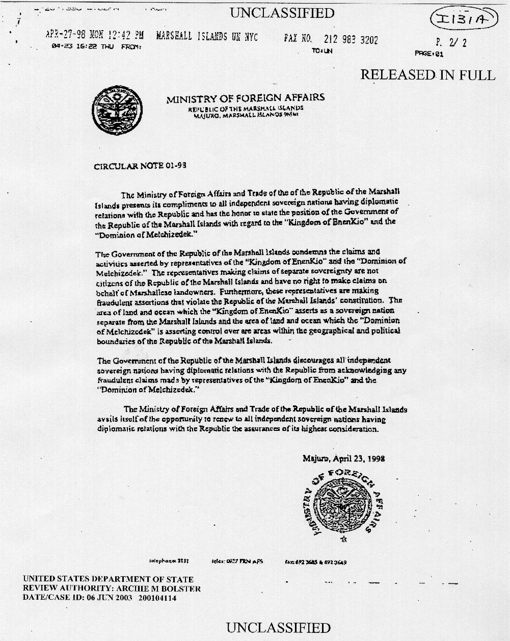
- ↑ Circular Note 01-98 Ministry of Foreign Affairs. Retrieved February 26, 2021.
- ↑ Gregory J.W. Urwin, Facing Fearful Odds: The Siege of Wake Island (University of Nebraska Press, 2002, ISBN 978-0803295629).
- ↑ Dirk H.R. Spennemann, The wreck of the Libelle The wreck of the Libelle and other early European Visitors to Wake Island, Central Pacific. Retrieved February 26, 2021.
- ↑ Total Loss of Barque Dashing Wave, and Rescue of the Crew The Sydney Morning Herald, January 26, 1871. Retrieved February 26, 2021.
- ↑ Battle of Wake Island: 1941 Olive Drab.
- ↑ Paul F. Boller, Jr. and John George. They Never Said It: A Book of Fake Quotes, Misquotes, and Misleading Attributions (New York: Oxford University Press, 1989 ISBN 0195055411), 20.
- ↑ Mitch Berg, “Send More Japs”Shot in the Dark, December 11, 2011. Retrieved February 26, 2021.
- ↑ John J. Sbrega, The War Against Japan, 1941–1945: An Annotated Bibliography (Routledge, 2015, ISBN 978-1138912311).
- ↑ 1941 - The Defense of Wake Island, USS Enterprise CV-6 The Most Decorated Ship of the Second World War. Retrieved February 26, 2021.
- ↑ Captain Henry T. Elrod The Marine Corps Medal of Honor Recipients. Retrieved February 26, 2021.
- ↑ Oral History Interview with Charles S. Murphy Harry S. Truman Library and Museum. Retrieved February 26, 2021.
- ↑ Wake Island during WWII, Information and history of Wake Island. Retrieved February 26, 2021.
ReferencesISBN links support NWE through referral fees
- Boller, Jr., Paul F., and John George. They Never Said It: A Book of Fake Quotes, Misquotes, and Misleading Attributions. New York, NY: Oxford University Press, 1989. ISBN 0195055411
- Heine, Dwight, and Jon A. Anderson. "Enen-kio: Island of the Kio Flower." Micronesia Reporter, 1971.
- Sbrega, John J. The War Against Japan, 1941–1945: An Annotated Bibliography. Routledge, 2015. ISBN 978-1138912311
- Sloan, Bill. Given up for Dead: America's Heroic Stand at Wake Island. New York, NY: Bantam Books, 2003. ISBN 0553803026
- Urwin, Gregory J.W. Facing Fearful Odds: The Siege of Wake Island. Lincoln, NE: University of Nebraska Press, 2002. ISBN 978-0803295629
External links
All links retrieved May 3, 2023.
- Wake Island Airfield. AirNav.
- Wake Island. Encyclopedia Astronautica.
- Heinl, Lieutenant Colonel R.D. United States Marine Corps historical monograph - The Defense of Wake. ibiblio.
- Wake Atoll. Pacific Wreck Database.
- "Wake Island" (1942). Internet Movie Database.
- "Wake Island: Alamo of the Pacific" (2003). Internet Movie Database.
- Wake Island. CIA World Factbook.
- The Wreck of the Libelle. Marshalls Digital Micronesia.
- About Wake Island. Wake Island 1975: Photos of Vietnam Refugees on Wake Island in 1975.
| Countries and territories of Oceania | |
| Australia : Australia · Norfolk Island | |
| Melanesia : East Timor · Fiji · Maluku Islands & Western New Guinea (part of Indonesia) · New Caledonia · Papua New Guinea · Solomon Islands · Vanuatu | |
| Micronesia : Guam · Kiribati · Marshall Islands · Northern Mariana Islands · Federated States of Micronesia · Nauru · Palau · Wake Island | |
| Polynesia : American Samoa · Cook Islands · French Polynesia · Hawaii · New Zealand · Niue · Pitcairn Islands · Samoa · Tokelau · Tonga · Tuvalu · Wallis and Futuna | |
| Political divisions of the United States | |||||||
|---|---|---|---|---|---|---|---|
| |||||||
Credits
New World Encyclopedia writers and editors rewrote and completed the Wikipedia article in accordance with New World Encyclopedia standards. This article abides by terms of the Creative Commons CC-by-sa 3.0 License (CC-by-sa), which may be used and disseminated with proper attribution. Credit is due under the terms of this license that can reference both the New World Encyclopedia contributors and the selfless volunteer contributors of the Wikimedia Foundation. To cite this article click here for a list of acceptable citing formats.The history of earlier contributions by wikipedians is accessible to researchers here:
The history of this article since it was imported to New World Encyclopedia:
Note: Some restrictions may apply to use of individual images which are separately licensed.