Difference between revisions of "Algiers" - New World Encyclopedia
Mary Anglin (talk | contribs) m (→History) |
Rosie Tanabe (talk | contribs) |
||
| (39 intermediate revisions by 5 users not shown) | |||
| Line 1: | Line 1: | ||
| − | {{Infobox | + | {{Images OK}}{{Submitted}}{{Approved}}{{copyedited}} |
| + | {{Infobox Settlement | ||
|official_name = Algiers | |official_name = Algiers | ||
| − | |native_name | + | |native_name = {{lang|ar|الجزائر}} {{Spaces|2}}<br/> ''Dzayer ⴷⵣⴰⵢⴻⵔ دزاير'' {{spaces|2}}{{resize|75%|([[Vernacular]])}} |
| − | |nickname = Algiers the White | + | |nickname = Algiers the White ; Algiers the Dazzling |
| − | | | + | |imagesize = 250px |
|image_skyline = Algiers coast.jpg | |image_skyline = Algiers coast.jpg | ||
| − | + | |image_caption = | |
| − | |image_caption = | + | |image_flag = |
| − | |image_flag = | ||
|image_seal = Blason-alger.gif | |image_seal = Blason-alger.gif | ||
|image_map = Algiers location.svg | |image_map = Algiers location.svg | ||
|mapsize = 175px | |mapsize = 175px | ||
|map_caption = Location of Algiers within [[Algeria]] | |map_caption = Location of Algiers within [[Algeria]] | ||
| − | |subdivision_type = | + | |coordinates_region = DZ |
| + | |subdivision_type = Country | ||
|subdivision_name = [[Algeria]] | |subdivision_name = [[Algeria]] | ||
|subdivision_type1 = [[Wilayas of Algeria|Wilaya]] | |subdivision_type1 = [[Wilayas of Algeria|Wilaya]] | ||
| − | |subdivision_name1 = [[Algiers Province]] | + | |subdivision_name1 = [[Algiers Province|Algiers]] |
| − | |||
| − | |||
|leader_title = [[Wali]] ([[Governor]]) | |leader_title = [[Wali]] ([[Governor]]) | ||
| − | |leader_name = Mohamed Kebir Addou | + | |leader_name = [[M. Mohamed Kebir Addou]] |
| − | |||
| − | |||
| − | |||
| − | |||
| − | |||
| − | |||
|established_title = Re-founded | |established_title = Re-founded | ||
|established_date = AD 944 | |established_date = AD 944 | ||
| − | |||
| − | |||
| − | |||
| − | |||
|area_magnitude = N/A | |area_magnitude = N/A | ||
| − | | | + | |area_total_km2 = 1190 |
| − | | | + | |area_metro_km2 = |
| − | | | + | |population_as_of = 1998 for city proper, 2011 for metro area |
| − | | | + | |population_footnotes = <ref name=citypop>{{Cite web|url=http://citypopulation.de/Algeria.html |title=Population of the city proper accoding to the 1998 census via |publisher=Citypopulation.de |date= |accessdate=June 27, 2010}}</ref><ref name=wup>{{Cite web|url=http://esa.un.org/unup/index.asp?panel=2 |title=UN World Urbanization Prospects |publisher=Esa.un.org |date= |accessdate=June 27, 2010}}</ref> |
| − | | | + | |population_total = 2,882,897 |
| − | | | + | |population_metro = 5,000,000 |
| − | | | + | |population_density_total_km2 = |
| − | | | ||
| − | | | ||
| − | | | ||
| − | | | ||
| − | | | ||
| − | | | ||
| − | |population_total = | ||
| − | |||
| − | |||
| − | |population_metro = | ||
|population_density_metro_km2 = | |population_density_metro_km2 = | ||
| − | |||
| − | |||
|timezone = [[Central European Time|CET]] | |timezone = [[Central European Time|CET]] | ||
| − | |utc_offset = +1 | + | |utc_offset = +1 |
| − | |||
| − | |||
|latd=36|latm=42|latNS=N | |latd=36|latm=42|latNS=N | ||
| − | |longd=3|longm=13|longEW=E | + | |longd=3|longm=13|longEW=E |
| − | |elevation = | + | |coordinate_type = region:DZ_type:city |
| − | |elevation_ft = | + | |coordinates_display = title |
| + | |elevation = | ||
| + | |elevation_ft = 3 | ||
|postal_code_type = Postal codes | |postal_code_type = Postal codes | ||
| − | |postal_code = | + | |postal_code = 16000–16132 |
|website = | |website = | ||
| − | |footnotes = | + | |footnotes = |
}} | }} | ||
| − | |||
| − | + | '''Algiers''' ({{lang-ar|الجزائر}} or ''Al Jaza'ir,'' {{lang-fr|Alger}}) is the capital, chief seaport, and largest city of [[Algeria]], the second largest country on the African continent. The [[city]] is the third largest in [[North Africa]] behind [[Egypt]]'s [[Cairo]] and [[Morocco]]'s [[Casablanca]]. It is also the political, economic, and cultural center of the country. Located in northern Algeria on the slopes of the [[Sahel]] hills, the city extends for 10 miles along the west side of the Bay of Algiers on the [[Mediterranean Sea]]. Its strategic location allows the city to serve the Mediterranean region as a major shipping center and an important refueling station. | |
| + | |||
| + | Its location has caused the city to play a central role throughout history. Originally settled by [[Berber]]s, the land was eventually controlled by [[Carthage|Carthaginians]], [[Vandals]], the [[Byzantine Empire]], and by the eight century, [[Arab]]s. [[Spain]] ruled the city by the early fourteenth century, and in the early sixteenth century, many [[Moors]] expelled from Spain sought [[asylum]] in Algiers. The city fell under the rule of the [[Ottoman Empire]] in 1518. In the early 1500s, Algiers became the main base of the [[Barbary pirates]], who attacked shipping in the western [[Mediterranean Basin|Mediterranean]] for the next 300 years. The United States fought two wars over Algiers' attacks on shipping—the First and Second Barbary Wars. | ||
| + | |||
| + | Algiers played a role in [[World War II]] as the headquarters of Allied forces in North Africa and was for a time the location of the Free French government of General [[Charles de Gaulle]]. It also played a decisive part during the War of Algeria (1954-1962), in particular during the Battle of Algiers. Up to 1.5 million Algerians died in the bloody independence struggle, which brought Algeria independence on July 5, 1962. | ||
| + | {{toc}} | ||
| + | While it is listed as the fifth richest city in [[Africa]], it has the highest cost of living of any city in North Africa, and its Casbah neighborhood, built on the ruins of old [[Icosium]], has degenerated, with some of the worst living conditions in North Africa. The Oued El Harrach river, which flows through Algiers, is severely polluted despite the installation of a waste water treatment facility nearby. [[Mercury (element)|Mercury]] levels present are 30 times those accepted around the world. | ||
==Geography== | ==Geography== | ||
| − | + | The city name is derived from the [[Arabic language|Arabic]] word, ''al-jazā’ir,'' which translates as "the islands," referring to several small islands that formerly existed in the bay, all but one of which have been connected to the shore or obliterated by harbor works. ''Al-jazā’ir'' is itself a truncated form of the city's older name, ''jazā’ir banī mazghannā,'' "the islands of (the tribe) Bani Mazghanna," used by early medieval geographers. | |
| − | The city name is derived from the [[Arabic language|Arabic]] word ''al-jazā’ir'' | ||
Algiers, built along the slope of the [[Sahel]] hills, extends for 10 miles (16km) along the [[Bay of Algiers]], and has an area of 105 square miles (273 square kilometers). | Algiers, built along the slope of the [[Sahel]] hills, extends for 10 miles (16km) along the [[Bay of Algiers]], and has an area of 105 square miles (273 square kilometers). | ||
| − | The coast has a pleasant [[climate]], with winter temperatures from 50°F to 54°F (10°C to 12°C) and summer temperatures from 75°F to 79°F (24°C to 26°C). Rainfall in this region is abundant - 15 to 27 inches per year. | + | The coast has a pleasant [[climate]], with winter temperatures from 50°F to 54°F (10°C to 12°C) and summer temperatures from 75°F to 79°F (24°C to 26°C). Rainfall in this region is abundant--15 to 27 inches per year. |
| − | The Oued El Harrach river, which flows through Algiers, is very polluted despite the installation of a waste water treatment facility nearby. [[Mercury]] levels present are 30 times those accepted around the world | + | The Oued El Harrach river, which flows through Algiers, is very polluted despite the installation of a waste water treatment facility nearby. [[Mercury (element)|Mercury]] levels present are 30 times those accepted around the world. |
| − | |||
| − | |||
| + | As a result of irregular [[rain]]fall, and aging, leaking [[infrastructure]], fresh water is a luxury most people enjoy only two to three hours a day. The [[Hamma project]], intended as Africa’s largest seawater desalination plant, has a goal of supplying Algiers with 53 million U.S. gallons (200,000 cubic meters) of potable water a day. | ||
| + | [[Image:Algeri03.jpg|thumb|250px|left|Commune d' El Biar]] | ||
The city consists of three sections. The lower part, the French area, characterized by numerous public squares and wide boulevards, was built after the demolition of traditional quarters, starting in 1830, when the French took control. | The city consists of three sections. The lower part, the French area, characterized by numerous public squares and wide boulevards, was built after the demolition of traditional quarters, starting in 1830, when the French took control. | ||
| − | The second area is the [[Kasbah of Alger|Casbah]], which is founded on the ruins of old Icosium. Built in the early | + | The second area is the [[Kasbah of Alger|Casbah]], which is founded on the ruins of old Icosium. Built in the early sixteenth century as an Ottoman fort and a [[palace]] for the local ruler, the ''dey,'' on the steep hill behind the modern town, the area has a number of [[mosque]]s, including Ketchaoua (built in 1794), el Djedid (1660), El Kébir (rebuilt in 1794), and Ali Betchnin (1623). Although there are labyrinths of lanes and picturesque houses, the area has degenerated, with some of the worst living conditions in [[North Africa]]. |
The third part consists of the large suburbs surrounding the city, which cover most of the surrounding Metidja plain, and which date to the post-colonial period. | The third part consists of the large suburbs surrounding the city, which cover most of the surrounding Metidja plain, and which date to the post-colonial period. | ||
==History== | ==History== | ||
| − | [[Image:Barbarossa Hayreddin Pasha.jpg|right|225px|thumb|Barbarossa Hayreddin Pasha]] | + | [[Image:Barbarossa Hayreddin Pasha.jpg|right|225px|thumb|Barbarossa Hayreddin Pasha.]] |
| − | [[Image:Sm Bombardment of Algiers, August 1816-Luny.jpg|thumb|right|225px|The bombardment of Algiers by Lord Exmouth, August 1816, painted by Thomas Luny]] | + | [[Image:Sm Bombardment of Algiers, August 1816-Luny.jpg|thumb|right|225px|The bombardment of Algiers by Lord Exmouth, August 1816, painted by Thomas Luny.]] |
[[Image:Algiers CNE-v1-p58-J.jpg|thumb|225px|right|City and harbor of Algiers, circa 1921.]] | [[Image:Algiers CNE-v1-p58-J.jpg|thumb|225px|right|City and harbor of Algiers, circa 1921.]] | ||
| − | [[Phoenicia]]ns founded a commercial outpost called ''Ikosim'' | + | [[Phoenicia]]ns founded a commercial outpost called ''Ikosim,'' around 1200 B.C.E., on what is now the marine quarter of Algiers. [[Carthage|Carthaginians]] and the [[Ancient Rome|Romans]] called it ''Icosium.'' The city became part of the [[Roman Empire]] after the [[Punic Wars]] in 146 B.C.E. [[Vandals]] overran the city in the middle of the fifth century. Next, it was ruled by the [[Byzantines]], who were in turn ousted in 650 by [[Arab]]s. |
In 944, [[Buluggin ibn Ziri]], the founder of the [[Berber]] [[Zirid]]-[[Senhaja]] dynasty, revived the city into a center of commerce under its present name. During the next three centuries the city was controlled by various European, Arabian, and Berber [[warlord]]s. | In 944, [[Buluggin ibn Ziri]], the founder of the [[Berber]] [[Zirid]]-[[Senhaja]] dynasty, revived the city into a center of commerce under its present name. During the next three centuries the city was controlled by various European, Arabian, and Berber [[warlord]]s. | ||
| − | In the | + | In the thirteenth century, Algiers came under the dominion of the Abd-el-Wadid sultans of [[Tlemcen]]. The city retained a large measure of independence under [[amir]]s of its own, [[Oran]] being the chief seaport of the Abd-el-Wahid. The islet in front of the harbor, subsequently known as the Penon, had been occupied by the Spaniards as early as 1302. Thereafter, a considerable trade grew up between Algiers and [[Spain]]. |
| − | In the early | + | In the early sixteenth century, many Moors expelled from Spain sought [[asylum]] in Algiers. In response to attacks from Algiers on Spanish seaborne commerce, Spain, in 1510, fortified the offshore island of Peñon in the Bay of Algiers. |
In 1516, the amir of Algiers, Selim b. Teumi, invited the [[corsair]] brothers [[Aruj]] and [[Barbarossa (Ottoman admiral)|Khair ad-Din]] Barbarossa to expel the Spaniards. Aruj came to Algiers, caused Selim to be assassinated, and seized the town. When Aruj was killed in battle against the Spaniards at Tlemcen in 1518, Khair ad-Din succeeded him, and placed Algiers under the [[Ottoman Empire]]. | In 1516, the amir of Algiers, Selim b. Teumi, invited the [[corsair]] brothers [[Aruj]] and [[Barbarossa (Ottoman admiral)|Khair ad-Din]] Barbarossa to expel the Spaniards. Aruj came to Algiers, caused Selim to be assassinated, and seized the town. When Aruj was killed in battle against the Spaniards at Tlemcen in 1518, Khair ad-Din succeeded him, and placed Algiers under the [[Ottoman Empire]]. | ||
| Line 104: | Line 85: | ||
Algiers from this time became the main base of the [[Barbary pirates]] who attacked shipping in the western [[Mediterranean Sea|Mediterranean]] and engaged in slave raids as far north as Cornwall, in [[England]]. | Algiers from this time became the main base of the [[Barbary pirates]] who attacked shipping in the western [[Mediterranean Sea|Mediterranean]] and engaged in slave raids as far north as Cornwall, in [[England]]. | ||
| − | European powers sent numerous expeditions against the pirates. In October 1541, the king of Spain and Holy Roman Emperor [[Charles V, Holy Roman Emperor|Charles V]] sought to capture the city, but a storm destroyed a great number of his ships, and his army was defeated. The [[United States]] fought two wars over Algiers' attacks on shipping - | + | European powers sent numerous expeditions against the pirates. In October 1541, the king of Spain and Holy Roman Emperor [[Charles V, Holy Roman Emperor|Charles V]] sought to capture the city, but a storm destroyed a great number of his ships, and his army was defeated. The [[United States]] fought two wars over Algiers' attacks on shipping--the [[First Barbary War|First]] and [[Second Barbary War]]s. In 1816, a British squadron under [[Edward Pellew, 1st Viscount Exmouth|Lord Exmouth]] (a descendant of Thomas Pellew, taken in an Algerian slave raid in 1715), assisted by [[Netherlands|Dutch]] men-of-war, bombarded the city. |
| − | On July 4, 1827, on the pretext of an affront to the French consul (whom the [[dey]] had hit with a [[fly-whisk]] in a dispute over French debts to two Algerian Jewish merchants) a French army under [[Louis-Auguste-Victor, Count de Ghaisnes de Bourmont|General de Bourmont]] attacked the city, which capitulated the following day. On June 14, 1830, the French made Algiers a | + | On July 4, 1827, on the pretext of an affront to the French consul (whom the [[dey]] had hit with a [[fly-whisk]] in a dispute over French debts to two Algerian Jewish merchants) a French army under [[Louis-Auguste-Victor, Count de Ghaisnes de Bourmont|General de Bourmont]] attacked the city, which capitulated the following day. On June 14, 1830, the French made Algiers a center to control their colonial empire in [[North Africa|North]] and [[West Africa]]. French control lasted 132 years. |
| − | During [[World War II]], Algiers became the headquarters of Allied forces in North Africa and was for a time the location of the Free French government of [[General Charles de Gaulle|de Gaulle]]. | + | During [[World War II]], Algiers became the headquarters of Allied forces in North Africa and was, for a time, the location of the Free French government of [[General Charles de Gaulle|de Gaulle]]. |
Algiers also played a decisive part during the [[Algerian War|War of Algeria]] (1954-1962), in particular during the Battle of Algiers. Up to 1.5 million Algerians died in the bloody independence struggle. Algeria became independent on July 5, 1962. | Algiers also played a decisive part during the [[Algerian War|War of Algeria]] (1954-1962), in particular during the Battle of Algiers. Up to 1.5 million Algerians died in the bloody independence struggle. Algeria became independent on July 5, 1962. | ||
| − | In October 1988, one year before the fall of the [[Berlin Wall]], Algiers was the | + | In October 1988, one year before the fall of the [[Berlin Wall]], Algiers was the theater of demonstrations to end the single party system. Harsh repression left more than 300 dead. |
Algiers has been the target of Islamic [[terrorism|terrorist]] attacks. On April 11, 2007, the palace of the Prime Minister and the Minister of Interior Department, as well as a police station were bombed. Islamic terrorist group [[Al-Qaïda]] claimed responsibility. On December 11 of that year, twin blasts struck [[United Nations]] offices and a Government building in Algiers, causing dozens of deaths. | Algiers has been the target of Islamic [[terrorism|terrorist]] attacks. On April 11, 2007, the palace of the Prime Minister and the Minister of Interior Department, as well as a police station were bombed. Islamic terrorist group [[Al-Qaïda]] claimed responsibility. On December 11 of that year, twin blasts struck [[United Nations]] offices and a Government building in Algiers, causing dozens of deaths. | ||
==Administration== | ==Administration== | ||
| − | [[Image:DZ-16-Districts.svg| | + | [[Image:DZ-16-Districts.svg|250px|thumb|right|Map showing the 13 districts of Algiers Province]] |
| − | Algiers serves as the capital city of the nation of the [[People's Democratic Republic of Algeria]], as well as of the ''Province of Algiers'' within that nation, which consists of 48 provinces. | + | Algiers serves as the capital city of the nation of the [[People's Democratic Republic of Algeria]], as well as of the ''Province of Algiers'' within that nation, which consists of 48 provinces. |
The ''Province of Algiers'' is divided into 13 districts and 57 municipalities. The districts are, according to official numbering: Zéralda 1, Chéraga 2, Draria 3, Birtouta 4, Bir Mourad Raïs 5, Bouzaréah 6, Bab El Oued 7, Hussein Dey 8, Sidi M'Hamed 9, El Harrach 10, Baraki 11, Dar El Beïda 12, and Rouïba 13. | The ''Province of Algiers'' is divided into 13 districts and 57 municipalities. The districts are, according to official numbering: Zéralda 1, Chéraga 2, Draria 3, Birtouta 4, Bir Mourad Raïs 5, Bouzaréah 6, Bab El Oued 7, Hussein Dey 8, Sidi M'Hamed 9, El Harrach 10, Baraki 11, Dar El Beïda 12, and Rouïba 13. | ||
== Economy == | == Economy == | ||
| − | + | Algiers' strategic location and harbor make it a major shipping center and an important Mediterranean refueling station. Principal activities include the import of raw materials, industrial goods, and general supplies, as well as an administrative and financial center. [[Grain]], [[iron ore]], [[phosphate]]s, [[wine]]s, early [[citrus fruit]]s and [[vegetable]]s, and [[oil]] from central Algeria are the main exports. | |
| − | Algiers' strategic location and harbor make it a major shipping | ||
| − | Algiers is listed as the fifth richest city in [[Africa]], with a GDP of $ | + | Algiers is listed as the fifth richest city in [[Africa]], with a GDP of US$35 billion in 2005. Its stock exchange had a capitalization of 60 billion [[euro]]s. The city had the highest cost of living of any [[city]] in [[North Africa]], as well as the 50th highest worldwide, as of March 2007. |
| − | The Kasbah (Qasbah), designated a World Heritage | + | The Kasbah (Qasbah), designated a [[World Heritage Site]] in 1992, along with the claim that Algiers is the crossroads of three worlds--Mediterranean, Islamic, and African—as well as numerous sandy beaches, has helped make Algiers a popular [[tourism|tourist]] destination. |
| − | Algiers has a major international airport, the Houari Boumedienne Airport, and is the hub of a network of | + | Algiers has a major international [[airport]], the Houari Boumedienne Airport, and is the hub of a network of [[railway]]s and [[road]]s. The port of Algiers is sheltered from all winds. There are two harbors, both artificial—the old, or northern, harbor and the southern or Agha harbor. |
==Demographics== | ==Demographics== | ||
[[Image:Nouveau aeroport alger 1.png|thumb|right|250px|Entrance to the terminal of Houari Boumedienne Airport.]] | [[Image:Nouveau aeroport alger 1.png|thumb|right|250px|Entrance to the terminal of Houari Boumedienne Airport.]] | ||
| − | The metropolitan population of Algiers was 3,518,083 in 2005, the 85th largest in the world, according to Demographia. | + | The metropolitan [[population]] of Algiers was 3,518,083 in 2005, the 85th largest in the world, according to Demographia. |
| − | The ethnic distribution is 59 percent [[ | + | The ethnic distribution is 59 percent [[Arab]], 38 percent [[kabyle]], and three percent "foreigners," most of whom are from [[China]], [[Vietnam]], and [[Mali]]. The official [[language]]s are [[Arabic language|Arabic]] and Berber (Tamazight), but [[French language|French]] is still used for most official and business transactions, while [[English language|English]] is rarely spoken outside of business or tourist centers. About 99 percent of the population are Sunni [[Muslim]], which is the state [[religion]], while the remaining one percent are [[Christian]] and [[Jewish]]. |
| − | The University of Algiers, the first Algerian [[university]], established in 1909, has seven faculties — [[political sciences]] and [[information]], [[humanities|human]] and [[social sciences]], [[economics]] and [[management science]]s, [[letters]] and [[languages]], [[law]], [[Medicine]], and [[Islamic science]]s | + | The University of Algiers, the first Algerian [[university]], established in 1909, has seven faculties—[[political sciences]] and [[information]], [[humanities|human]] and [[social sciences]], [[economics]] and [[management science]]s, [[letters]] and [[languages]], [[law]], [[Medicine]], and [[Islamic science]]s |
| − | The [[Bardo]] | + | The [[Bardo Museum]] holds some of the ancient sculptures and mosaics discovered in Algeria, together with medals and Algerian money. |
==Architecture== | ==Architecture== | ||
| − | + | [[Image:Mosquée Ketchaoua.jpg|thumb|right|200px|The Ketchaoua mosque.]] | |
| − | [[Image:Mosquée Ketchaoua.jpg|thumb|right| | + | There are numerous old buildings of interest in Algiers, including the whole [[Kasbah]] quarter, Martyrs Square (''Sahat ech-Chouhada'' ساحة الشهداء), the government offices (formerly the [[United Kingdom|British]] consulate), the "Grand," "New," and Ketchaoua [[Mosque]]s, the [[Roman Catholic]] cathedral of [[Notre Dame d'Afrique]], the [[Bardo Museum]] (a former Turkish mansion), the old ''Bibliotheque Nationale d'Alger''—a [[Turkey|Turkish]] palace built in 1799–1800—and the new National Library, built in a style reminiscent of the [[British Library]]. |
| − | There are numerous old buildings of interest in Algiers, including the whole [[Kasbah]] quarter, Martyrs Square (''Sahat ech-Chouhada'' ساحة الشهداء), the government offices (formerly the [[United Kingdom|British]] consulate), the "Grand" | ||
| − | The main building in the [[Kasbah]] was begun in 1516 on the site of an older building, and served as the palace of the deys until the [[France|French]] conquest. The Grand Mosque (''Jamaa-el-Kebir'' الجامع الكبير) is traditionally said to be the oldest mosque in Algiers. The pulpit (''[[minbar]]'' منبر) bears an inscription showing that the building existed in 1018. The minaret was built by [[Abu Tachfin]], sultan of [[Tlemcen]], in 1324. The interior of the mosque is square and is divided into aisles by columns joined by [[Moors|Moorish]] arches. | + | The main building in the [[Kasbah]] was begun in 1516, on the site of an older building, and served as the palace of the deys until the [[France|French]] conquest. The Grand Mosque (''Jamaa-el-Kebir'' الجامع الكبير) is traditionally said to be the oldest mosque in Algiers. The pulpit (''[[minbar]]'' منبر) bears an inscription showing that the building existed in 1018. The minaret was built by [[Abu Tachfin]], sultan of [[Tlemcen]], in 1324. The interior of the mosque is square and is divided into aisles by columns joined by [[Moors|Moorish]] arches. |
| − | The New Mosque (''Jamaa-el-Jedid'' الجامع الجديد), dating from the | + | The New Mosque (''Jamaa-el-Jedid'' الجامع الجديد), dating from the seventeenth century, is in the form of a [[Greek cross]], surmounted by a large white cupola, with four small cupolas at the corners. |
| − | The Church of the Holy Trinity (built in 1870) stands at the southern end of the ''rue d'Isly'' near the site of the demolished Fort Bab Azoun باب عزون. The interior is richly decorated with | + | The Church of the Holy Trinity (built in 1870) stands at the southern end of the ''rue d'Isly'' near the site of the demolished Fort Bab Azoun باب عزون. The interior is richly decorated with variously colored [[marble]]. Many contain memorial inscriptions relating to the English residents (voluntary and involuntary) of Algiers from the time of [[John Tipton]], British consul in 1580. |
| + | :[[Image:Alger front de mer.jpg|thumb|right|450px|Algiers waterfront.]] | ||
| + | The Ketchaoua mosque, at the foot of the Casbah, was before independence in 1962, the Cathedral of St Philippe, itself made, in 1845, from a mosque dating from 1612. The principal entrance, reached by a flight of 23 steps, is ornamented with a [[portico]] supported by four black-veined marble columns. The roof of the nave is of [[Moorish Empire|Moorish]] [[plaster]] work. In one of the chapels was a tomb containing the bones of [[San Geronimo]]. The building seems a curious blend of Moorish and [[Byzantine Empire|Byzantine]] styles. | ||
| − | + | [[Notre-Dame d'Afrique]], a church built (1858–1872) in a mixture of the [[Roman Empire|Roman]] and [[Byzantine Empire|Byzantine]] styles, is conspicuously situated, overlooking the sea, on the shoulder of the [[Bouzareah]] hills, two miles (3.2 km) to the north of the city. Above the altar is a statue of [[Mary, the mother of Jesus|Virgin]] depicted as a black woman. The church also contains a solid [[silver]] statue of the [[archangel Michael]], belonging to the confraternity of [[Naples|Neapolitan]] fishermen. | |
| − | + | ==Notes== | |
| + | <references/> | ||
==References== | ==References== | ||
| − | * ''Algiers'' | + | * ''Algiers.'' 2007. Gardners Books. ISBN 9780548293539. |
| − | * Baepler, Paul Michel. 1999. ''White | + | * Baepler, Paul Michel. 1999. ''White Slaves, African Masters: An Anthology of American Barbary Captivity Narratives''. Chicago: University of Chicago Press. ISBN 9780226034041. |
| − | * Kagda, Falaq, and Zawiah Abdul Latif. 2007. ''Algeria''. New York | + | * ''CIA World Fact Book''.#Geo Algeria. |
| − | * Morgan, Joseph. 1728. ''History of Algiers.'' | + | * ''Demographia''. Demographia World Urban Area Projections 2007 and 2020. |
| − | * Pontecorvo, Gillo, Franco Solinas, Brahim Haggiag, Jean Martin, Yacef Saadi, Samia Kerbash, Ugo Paletti, M. Gatti, and Ennio Morricone. 2004. ''La bataille d'Alger The | + | * ''Encyclopaedia Britannica Online''. 2008. [http://www.britannica.com/eb/article-9005698/Algiers.htm Algiers.] Retrieved June 23, 2008. |
| + | * Kagda, Falaq, and Zawiah Abdul Latif. 2007. ''Algeria''. New York: Marshall Cavendish Benchmark. ISBN 0761420851. | ||
| + | * ''Looklex Encyclopaedia''. [http://i-cias.com/e.o/algiers.htm Algiers.] Retrieved June 23, 2008. | ||
| + | * Morgan, Joseph. 1728. ''History of Algiers.'' | ||
| + | * Pontecorvo, Gillo, Franco Solinas, Brahim Haggiag, Jean Martin, Yacef Saadi, Samia Kerbash, Ugo Paletti, M. Gatti, and Ennio Morricone. 2004. ''La bataille d'Alger The Battle of Algiers''. Irvington, NY: Criterion Collection. ISBN 9780780028876. | ||
| + | |||
| + | ==Photo gallery== | ||
| + | |||
| + | <center><gallery> | ||
| + | Image:Makamelchahid.JPG|The ''Monument of the Martyrs'' (Maquam E’chahid). | ||
| + | Image:Algiers mosque.jpg|The ''El Jedid mosque'' at the Place des Martyrs. | ||
| + | Image:Algeri07.jpg|Inscription in the dome of ''Our Lady of Africa Basilica,'' which says "Brotherly love comes from God. It is God himself." | ||
| + | Image:Basilique Notre-Dame d Afrique Alger.jpg|Basilica of ''Notre-Dame d'Afrique''. | ||
| + | </gallery></center> | ||
| + | |||
| − | |||
| − | |||
| − | |||
| − | |||
| − | |||
| − | |||
| + | {{List of African capitals}} | ||
[[Category:Geography]] | [[Category:Geography]] | ||
[[Category:Cities]] | [[Category:Cities]] | ||
| + | [[category:Africa]] | ||
{{credit|Algiers|141230951|Algiers_Province|195427642|}} | {{credit|Algiers|141230951|Algiers_Province|195427642|}} | ||
Latest revision as of 00:36, 9 January 2023
| Algiers الجزائر Dzayer ⴷⵣⴰⵢⴻⵔ دزاير (Vernacular) |
|||
 |
|||
|
|||
| Nickname: Algiers the White ; Algiers the Dazzling | |||
 |
|||
| Coordinates: 36°42′N 3°13′E | |||
|---|---|---|---|
| Country | Algeria | ||
| Wilaya | Algiers | ||
| Re-founded | AD 944 | ||
| Government | |||
| - Wali (Governor) | M. Mohamed Kebir Addou | ||
| Area | |||
| - City | 1,190 km² (459.5 sq mi) | ||
| Elevation | 1 m (3 ft) | ||
| Population (1998 for city proper, 2011 for metro area)[1][2] | |||
| - City | 2,882,897 | ||
| - Metro | 5,000,000 | ||
| Time zone | CET (UTC+1) | ||
| Postal codes | 16000–16132 | ||

Algiers (Arabic: الجزائر or Al Jaza'ir, French: Alger) is the capital, chief seaport, and largest city of Algeria, the second largest country on the African continent. The city is the third largest in North Africa behind Egypt's Cairo and Morocco's Casablanca. It is also the political, economic, and cultural center of the country. Located in northern Algeria on the slopes of the Sahel hills, the city extends for 10 miles along the west side of the Bay of Algiers on the Mediterranean Sea. Its strategic location allows the city to serve the Mediterranean region as a major shipping center and an important refueling station.
Its location has caused the city to play a central role throughout history. Originally settled by Berbers, the land was eventually controlled by Carthaginians, Vandals, the Byzantine Empire, and by the eight century, Arabs. Spain ruled the city by the early fourteenth century, and in the early sixteenth century, many Moors expelled from Spain sought asylum in Algiers. The city fell under the rule of the Ottoman Empire in 1518. In the early 1500s, Algiers became the main base of the Barbary pirates, who attacked shipping in the western Mediterranean for the next 300 years. The United States fought two wars over Algiers' attacks on shipping—the First and Second Barbary Wars.
Algiers played a role in World War II as the headquarters of Allied forces in North Africa and was for a time the location of the Free French government of General Charles de Gaulle. It also played a decisive part during the War of Algeria (1954-1962), in particular during the Battle of Algiers. Up to 1.5 million Algerians died in the bloody independence struggle, which brought Algeria independence on July 5, 1962.
While it is listed as the fifth richest city in Africa, it has the highest cost of living of any city in North Africa, and its Casbah neighborhood, built on the ruins of old Icosium, has degenerated, with some of the worst living conditions in North Africa. The Oued El Harrach river, which flows through Algiers, is severely polluted despite the installation of a waste water treatment facility nearby. Mercury levels present are 30 times those accepted around the world.
Geography
The city name is derived from the Arabic word, al-jazā’ir, which translates as "the islands," referring to several small islands that formerly existed in the bay, all but one of which have been connected to the shore or obliterated by harbor works. Al-jazā’ir is itself a truncated form of the city's older name, jazā’ir banī mazghannā, "the islands of (the tribe) Bani Mazghanna," used by early medieval geographers.
Algiers, built along the slope of the Sahel hills, extends for 10 miles (16km) along the Bay of Algiers, and has an area of 105 square miles (273 square kilometers).
The coast has a pleasant climate, with winter temperatures from 50°F to 54°F (10°C to 12°C) and summer temperatures from 75°F to 79°F (24°C to 26°C). Rainfall in this region is abundant—15 to 27 inches per year.
The Oued El Harrach river, which flows through Algiers, is very polluted despite the installation of a waste water treatment facility nearby. Mercury levels present are 30 times those accepted around the world.
As a result of irregular rainfall, and aging, leaking infrastructure, fresh water is a luxury most people enjoy only two to three hours a day. The Hamma project, intended as Africa’s largest seawater desalination plant, has a goal of supplying Algiers with 53 million U.S. gallons (200,000 cubic meters) of potable water a day.

The city consists of three sections. The lower part, the French area, characterized by numerous public squares and wide boulevards, was built after the demolition of traditional quarters, starting in 1830, when the French took control.
The second area is the Casbah, which is founded on the ruins of old Icosium. Built in the early sixteenth century as an Ottoman fort and a palace for the local ruler, the dey, on the steep hill behind the modern town, the area has a number of mosques, including Ketchaoua (built in 1794), el Djedid (1660), El Kébir (rebuilt in 1794), and Ali Betchnin (1623). Although there are labyrinths of lanes and picturesque houses, the area has degenerated, with some of the worst living conditions in North Africa.
The third part consists of the large suburbs surrounding the city, which cover most of the surrounding Metidja plain, and which date to the post-colonial period.
History


Phoenicians founded a commercial outpost called Ikosim, around 1200 B.C.E., on what is now the marine quarter of Algiers. Carthaginians and the Romans called it Icosium. The city became part of the Roman Empire after the Punic Wars in 146 B.C.E. Vandals overran the city in the middle of the fifth century. Next, it was ruled by the Byzantines, who were in turn ousted in 650 by Arabs.
In 944, Buluggin ibn Ziri, the founder of the Berber Zirid-Senhaja dynasty, revived the city into a center of commerce under its present name. During the next three centuries the city was controlled by various European, Arabian, and Berber warlords.
In the thirteenth century, Algiers came under the dominion of the Abd-el-Wadid sultans of Tlemcen. The city retained a large measure of independence under amirs of its own, Oran being the chief seaport of the Abd-el-Wahid. The islet in front of the harbor, subsequently known as the Penon, had been occupied by the Spaniards as early as 1302. Thereafter, a considerable trade grew up between Algiers and Spain.
In the early sixteenth century, many Moors expelled from Spain sought asylum in Algiers. In response to attacks from Algiers on Spanish seaborne commerce, Spain, in 1510, fortified the offshore island of Peñon in the Bay of Algiers.
In 1516, the amir of Algiers, Selim b. Teumi, invited the corsair brothers Aruj and Khair ad-Din Barbarossa to expel the Spaniards. Aruj came to Algiers, caused Selim to be assassinated, and seized the town. When Aruj was killed in battle against the Spaniards at Tlemcen in 1518, Khair ad-Din succeeded him, and placed Algiers under the Ottoman Empire.
Algiers from this time became the main base of the Barbary pirates who attacked shipping in the western Mediterranean and engaged in slave raids as far north as Cornwall, in England.
European powers sent numerous expeditions against the pirates. In October 1541, the king of Spain and Holy Roman Emperor Charles V sought to capture the city, but a storm destroyed a great number of his ships, and his army was defeated. The United States fought two wars over Algiers' attacks on shipping—the First and Second Barbary Wars. In 1816, a British squadron under Lord Exmouth (a descendant of Thomas Pellew, taken in an Algerian slave raid in 1715), assisted by Dutch men-of-war, bombarded the city.
On July 4, 1827, on the pretext of an affront to the French consul (whom the dey had hit with a fly-whisk in a dispute over French debts to two Algerian Jewish merchants) a French army under General de Bourmont attacked the city, which capitulated the following day. On June 14, 1830, the French made Algiers a center to control their colonial empire in North and West Africa. French control lasted 132 years.
During World War II, Algiers became the headquarters of Allied forces in North Africa and was, for a time, the location of the Free French government of de Gaulle.
Algiers also played a decisive part during the War of Algeria (1954-1962), in particular during the Battle of Algiers. Up to 1.5 million Algerians died in the bloody independence struggle. Algeria became independent on July 5, 1962.
In October 1988, one year before the fall of the Berlin Wall, Algiers was the theater of demonstrations to end the single party system. Harsh repression left more than 300 dead.
Algiers has been the target of Islamic terrorist attacks. On April 11, 2007, the palace of the Prime Minister and the Minister of Interior Department, as well as a police station were bombed. Islamic terrorist group Al-Qaïda claimed responsibility. On December 11 of that year, twin blasts struck United Nations offices and a Government building in Algiers, causing dozens of deaths.
Administration

Algiers serves as the capital city of the nation of the People's Democratic Republic of Algeria, as well as of the Province of Algiers within that nation, which consists of 48 provinces.
The Province of Algiers is divided into 13 districts and 57 municipalities. The districts are, according to official numbering: Zéralda 1, Chéraga 2, Draria 3, Birtouta 4, Bir Mourad Raïs 5, Bouzaréah 6, Bab El Oued 7, Hussein Dey 8, Sidi M'Hamed 9, El Harrach 10, Baraki 11, Dar El Beïda 12, and Rouïba 13.
Economy
Algiers' strategic location and harbor make it a major shipping center and an important Mediterranean refueling station. Principal activities include the import of raw materials, industrial goods, and general supplies, as well as an administrative and financial center. Grain, iron ore, phosphates, wines, early citrus fruits and vegetables, and oil from central Algeria are the main exports.
Algiers is listed as the fifth richest city in Africa, with a GDP of US$35 billion in 2005. Its stock exchange had a capitalization of 60 billion euros. The city had the highest cost of living of any city in North Africa, as well as the 50th highest worldwide, as of March 2007.
The Kasbah (Qasbah), designated a World Heritage Site in 1992, along with the claim that Algiers is the crossroads of three worlds—Mediterranean, Islamic, and African—as well as numerous sandy beaches, has helped make Algiers a popular tourist destination.
Algiers has a major international airport, the Houari Boumedienne Airport, and is the hub of a network of railways and roads. The port of Algiers is sheltered from all winds. There are two harbors, both artificial—the old, or northern, harbor and the southern or Agha harbor.
Demographics

The metropolitan population of Algiers was 3,518,083 in 2005, the 85th largest in the world, according to Demographia.
The ethnic distribution is 59 percent Arab, 38 percent kabyle, and three percent "foreigners," most of whom are from China, Vietnam, and Mali. The official languages are Arabic and Berber (Tamazight), but French is still used for most official and business transactions, while English is rarely spoken outside of business or tourist centers. About 99 percent of the population are Sunni Muslim, which is the state religion, while the remaining one percent are Christian and Jewish.
The University of Algiers, the first Algerian university, established in 1909, has seven faculties—political sciences and information, human and social sciences, economics and management sciences, letters and languages, law, Medicine, and Islamic sciences
The Bardo Museum holds some of the ancient sculptures and mosaics discovered in Algeria, together with medals and Algerian money.
Architecture

There are numerous old buildings of interest in Algiers, including the whole Kasbah quarter, Martyrs Square (Sahat ech-Chouhada ساحة الشهداء), the government offices (formerly the British consulate), the "Grand," "New," and Ketchaoua Mosques, the Roman Catholic cathedral of Notre Dame d'Afrique, the Bardo Museum (a former Turkish mansion), the old Bibliotheque Nationale d'Alger—a Turkish palace built in 1799–1800—and the new National Library, built in a style reminiscent of the British Library.
The main building in the Kasbah was begun in 1516, on the site of an older building, and served as the palace of the deys until the French conquest. The Grand Mosque (Jamaa-el-Kebir الجامع الكبير) is traditionally said to be the oldest mosque in Algiers. The pulpit (minbar منبر) bears an inscription showing that the building existed in 1018. The minaret was built by Abu Tachfin, sultan of Tlemcen, in 1324. The interior of the mosque is square and is divided into aisles by columns joined by Moorish arches.
The New Mosque (Jamaa-el-Jedid الجامع الجديد), dating from the seventeenth century, is in the form of a Greek cross, surmounted by a large white cupola, with four small cupolas at the corners.
The Church of the Holy Trinity (built in 1870) stands at the southern end of the rue d'Isly near the site of the demolished Fort Bab Azoun باب عزون. The interior is richly decorated with variously colored marble. Many contain memorial inscriptions relating to the English residents (voluntary and involuntary) of Algiers from the time of John Tipton, British consul in 1580.

The Ketchaoua mosque, at the foot of the Casbah, was before independence in 1962, the Cathedral of St Philippe, itself made, in 1845, from a mosque dating from 1612. The principal entrance, reached by a flight of 23 steps, is ornamented with a portico supported by four black-veined marble columns. The roof of the nave is of Moorish plaster work. In one of the chapels was a tomb containing the bones of San Geronimo. The building seems a curious blend of Moorish and Byzantine styles.
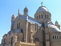
Notre-Dame d'Afrique, a church built (1858–1872) in a mixture of the Roman and Byzantine styles, is conspicuously situated, overlooking the sea, on the shoulder of the Bouzareah hills, two miles (3.2 km) to the north of the city. Above the altar is a statue of Virgin depicted as a black woman. The church also contains a solid silver statue of the archangel Michael, belonging to the confraternity of Neapolitan fishermen.
Notes
- ↑ Population of the city proper accoding to the 1998 census via. Citypopulation.de. Retrieved June 27, 2010.
- ↑ UN World Urbanization Prospects. Esa.un.org. Retrieved June 27, 2010.
ReferencesISBN links support NWE through referral fees
- Algiers. 2007. Gardners Books. ISBN 9780548293539.
- Baepler, Paul Michel. 1999. White Slaves, African Masters: An Anthology of American Barbary Captivity Narratives. Chicago: University of Chicago Press. ISBN 9780226034041.
- CIA World Fact Book.#Geo Algeria.
- Demographia. Demographia World Urban Area Projections 2007 and 2020.
- Encyclopaedia Britannica Online. 2008. Algiers. Retrieved June 23, 2008.
- Kagda, Falaq, and Zawiah Abdul Latif. 2007. Algeria. New York: Marshall Cavendish Benchmark. ISBN 0761420851.
- Looklex Encyclopaedia. Algiers. Retrieved June 23, 2008.
- Morgan, Joseph. 1728. History of Algiers.
- Pontecorvo, Gillo, Franco Solinas, Brahim Haggiag, Jean Martin, Yacef Saadi, Samia Kerbash, Ugo Paletti, M. Gatti, and Ennio Morricone. 2004. La bataille d'Alger The Battle of Algiers. Irvington, NY: Criterion Collection. ISBN 9780780028876.
Photo gallery
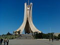
The Monument of the Martyrs (Maquam E’chahid).
The El Jedid mosque at the Place des Martyrs.
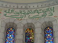
Inscription in the dome of Our Lady of Africa Basilica, which says "Brotherly love comes from God. It is God himself."
Basilica of Notre-Dame d'Afrique.


| |||||||||||||
Credits
New World Encyclopedia writers and editors rewrote and completed the Wikipedia article in accordance with New World Encyclopedia standards. This article abides by terms of the Creative Commons CC-by-sa 3.0 License (CC-by-sa), which may be used and disseminated with proper attribution. Credit is due under the terms of this license that can reference both the New World Encyclopedia contributors and the selfless volunteer contributors of the Wikimedia Foundation. To cite this article click here for a list of acceptable citing formats.The history of earlier contributions by wikipedians is accessible to researchers here:
The history of this article since it was imported to New World Encyclopedia:
Note: Some restrictions may apply to use of individual images which are separately licensed.