Difference between revisions of "Caracas" - New World Encyclopedia
Mike Butler (talk | contribs) |
Rosie Tanabe (talk | contribs) |
||
| (108 intermediate revisions by 7 users not shown) | |||
| Line 1: | Line 1: | ||
| + | {{Images OK}}{{Submitted}}{{Approved}}{{copyedited}} | ||
{{Infobox Settlement | {{Infobox Settlement | ||
| − | + | <!-- See Template:Infobox settlement for additional fields and descriptions —> | |
| − | + | | name = Caracas | |
| − | La Sucursal del Cielo | + | | official_name = Santiago de León de Caracas |
| − | ( | + | | native_name = <!-- if different from the English name —> |
| − | + | | native_name_lang = <!-- ISO 639-2 code e.g. "fr" for French. If more than one, use {{lang}} instead —> | |
| − | + | | other_name = | |
| − | | | + | | settlement_type = City |
| − | | | + | <!-- images, nickname, motto ---> |
| − | | | + | | image_skyline = Caracas from El Calvario.jpg |
| − | + | | imagesize = | |
| − | + | | image_alt = | |
| − | + | | image_caption = Caracas from El Calvario | |
| − | + | | image_flag = Flag of Caracas.png | |
| − | + | | flag_size = | |
| − | + | | flag_alt = | |
| − | + | | flag_link = | |
| − | + | | image_seal = | |
| − | + | | seal_size = | |
| − | + | | seal_alt = | |
| − | + | | seal_link = | |
| − | + | | image_shield = Caracas coat of arms.gif | |
| − | + | | shield_size = | |
| − | + | | shield_alt = | |
| − | + | | shield_link = | |
| − | + | | image_blank_emblem = | |
| − | + | | blank_emblem_type = <!-- defaults to Logo —> | |
| − | + | | blank_emblem_size = | |
| − | + | | blank_emblem_alt = | |
| − | + | | blank_emblem_link = | |
| − | + | | nickname = ''La Odalisca del Ávila'' (The Avila's Odalisque)<br/>''La Sucursal del Cielo ''(Heaven's Branch on Earth)<br/>"La Ciudad de la Eterna Primavera"(The City of Eternal Spring) | |
| − | | | + | | motto = ''Ave María Purísima, sin pecado concebida, en el primer instante de su ser natural'' |
| − | | | + | | anthem = |
| − | + | <!-- maps and coordinates ------> | |
| − | + | | image_map = | |
| − | + | | map_caption = Location of Caracas in Venezuela | |
| − | + | | mapsize = | |
| − | + | | map_alt = | |
| − | + | | image_map1 = | |
| − | + | | mapsize1 = | |
| − | + | | map_alt1 = | |
| − | + | | map_caption1 = | |
| − | + | | image_dot_map = | |
| − | + | | dot_mapsize = | |
| − | + | | dot_map_base_alt = | |
| − | + | | dot_map_alt = | |
| − | + | | dot_map_caption = | |
| − | + | | dot_x = |dot_y = | |
| − | + | | pushpin_map = | |
| − | + | | pushpin_label_position = | |
| − | + | | pushpin_label = | |
| − | + | | pushpin_map_alt = | |
| − | + | | pushpin_mapsize = | |
| + | | pushpin_map_caption = | ||
| + | | pushpin_map1 = | ||
| + | | pushpin_label_position1 = | ||
| + | | pushpin_label1 = <!-- only necessary if "name" or "official_name" are too long —> | ||
| + | | pushpin_map_alt1 = | ||
| + | | pushpin_mapsize1 = | ||
| + | | pushpin_map_caption1 = | ||
| + | | latd = 10 |latm = 30 |lats = |latNS = N | ||
| + | | longd = 66 |longm = 55 |longs = |longEW = W | ||
| + | | coor_pinpoint = <!-- to specify exact location of coordinates (was coor_type) —> | ||
| + | | coordinates_region = VE-A | ||
| + | | coordinates_type = <!-- parameter list passed to Coord template, overrides coordinates_region —> | ||
| + | | coordinates_display = inline,title | ||
| + | | coordinates_footnotes = <!-- for references: use<ref> tags —> | ||
| + | <!-- location ------------------> | ||
| + | | subdivision_type = Country | ||
| + | | subdivision_name = {{flagicon|Venezuela}} [[Venezuela]] | ||
| + | | subdivision_type1 = [[States of Venezuela|State]] | ||
| + | | subdivision_name1 = [[Venezuelan Capital District]]<br />[[Miranda (state)|Miranda]] | ||
| + | | subdivision_type2 = [[Municipalities of Venezuela|Municipality]] | ||
| + | | subdivision_name2 = [[Libertador Municipality (Venezuelan Capital District)|Libertador]] | ||
| + | <!-- established ---------------> | ||
| + | | established_title = Founded | ||
| + | | established_date = 25 July 1567 | ||
| + | | established_title1 = <!-- Incorporated (town) —> | ||
| + | | established_date1 = | ||
| + | | established_title2 = <!-- Incorporated (city) —> | ||
| + | | established_date2 = | ||
| + | | established_title3 = | ||
| + | | established_date3 = | ||
| + | | extinct_title = | ||
| + | | extinct_date = | ||
| + | | founder = [[Diego de Losada]] | ||
| + | | named_for = | ||
| + | <!-- seat, smaller parts -------> | ||
| + | | seat_type = <!-- defaults to: Seat —> | ||
| + | | seat = | ||
| + | | parts_type = Metropolitan | ||
| + | | parts_style = para | ||
| + | | parts = Municipalities | ||
| + | | p1 = [[Libertador Municipality (Venezuelan Capital District)|Libertador]] | ||
| + | | p2 = [[Chacao Municipality|Chacao]] | ||
| + | | p3 = [[Baruta Municipality|Baruta]] | ||
| + | | p4 = [[Sucre Municipality, Miranda|Sucre]] | ||
| + | | p5 = [[El Hatillo Municipality|El Hatillo]] | ||
| + | <!-- government type, leaders —> | ||
| + | | government_footnotes = <!-- for references: use<ref> tags —> | ||
| + | | government_type = [[Mayor-council government|Mayor-council]] | ||
| + | | governing_body = Government of the Capital District / Mayorship of the Metropolitan District | ||
| + | | leader_party = | ||
| + | | leader_title = Chief of Government / Mayor | ||
| + | | leader_name = Jacqueline Faría / [[Antonio Ledezma]] | ||
| + | | leader_title1 = | ||
| + | | leader_name1 = <!-- etc., up to leader_title4 / leader_name4 —> | ||
| + | <!-- display settings ---------> | ||
| + | | total_type = <!-- to set a non-standard label for total area and population rows —> | ||
| + | | unit_pref = <!-- enter: Imperial, to display imperial before metric —> | ||
| + | <!-- area ----------------------> | ||
| + | | area_footnotes = <!-- for references: use<ref> tags —> | ||
| + | | area_magnitude = <!-- use only to set a special wikilink —> | ||
| + | | area_total_km2 = 433 | ||
| + | | area_land_km2 = | ||
| + | | area_water_km2 = | ||
| + | | area_water_percent = | ||
| + | | area_urban_footnotes = <!-- for references: use<ref> tags —> | ||
| + | | area_urban_km2 = | ||
| + | | area_metro_footnotes = <!-- for references: use<ref> tags —> | ||
| + | | area_metro_km2 = 1930 | ||
| + | | area_rank = | ||
| + | | area_blank1_title = | ||
| + | | area_blank1_km2 = | ||
| + | | area_blank2_title = | ||
| + | | area_blank2_km2 = | ||
| + | | area_note = | ||
| + | <!-- elevation -----------------> | ||
| + | | elevation_footnotes = <!-- for references: use<ref> tags —> | ||
| + | | elevation_m = 900 | ||
| + | | elevation_max_footnotes = <!-- for references: use<ref> tags —> | ||
| + | | elevation_max_m = | ||
| + | | elevation_min_footnotes = <!-- for references: use<ref> tags —> | ||
| + | | elevation_min_m = | ||
| + | <!-- population ----------------> | ||
| + | | population_footnotes = | ||
| + | | population_total =5.905.463 Instituto Nacional de Estadística (Municipio Libertador) | ||
| + | | population_as_of = 2009 | ||
| + | | population_rank = | ||
| + | | population_density_km2 = 1431.5 | ||
| + | | population_est = | ||
| + | | pop_est_as_of = | ||
| + | | population_urban = | ||
| + | | population_density_urban_km2 = | ||
| + | | population_metro = 6,474,367 Instituto Nacional de Estadística (Municipio Libertador) | ||
| + | | population_density_metro_km2 = | ||
| + | | population_density = | ||
| + | | population_density_rank = | ||
| + | | population_blank1_title = | ||
| + | | population_blank1 = | ||
| + | | population_density_blank1_km2 = | ||
| + | | population_blank2_title = | ||
| + | | population_blank2 = | ||
| + | | population_density_blank2_km2 = | ||
| + | | population_demonym = ''[[caraqueño]]'' (m), ''caraqueña'' (f) | ||
| + | | population_note = | ||
| + | <!-- demographics (section 1) —> | ||
| + | | demographics_type1 = | ||
| + | | demographics1_footnotes = <!-- for references: use<ref> tags —> | ||
| + | | demographics1_title1 = | ||
| + | | demographics1_info1 = <!-- etc., up to demographics1_title5 / demographics1_info5 —> | ||
| + | <!-- demographics (section 2) —> | ||
| + | | demographics_type2 = | ||
| + | | demographics2_footnotes = <!-- for references: use<ref> tags —> | ||
| + | | demographics2_title1 = | ||
| + | | demographics2_info1 = <!-- etc., up to demographics2_title5 / demographics2_info5 —> | ||
| + | <!-- time zone(s) --------------> | ||
| + | | timezone1 = [[Venezuelan Standard Time Zone|VST]] | ||
| + | | utc_offset1 = – 04:30 | ||
| + | | timezone1_DST = not observed | ||
| + | | utc_offset1_DST = – 04:30 | ||
| + | | timezone2 = | ||
| + | | utc_offset2 = | ||
| + | | timezone2_DST = | ||
| + | | utc_offset2_DST = | ||
| + | <!-- postal codes, area code ---> | ||
| + | | postal_code_type = Postal coded | ||
| + | | postal_code = 1010-A | ||
| + | | area_code_type = [[Telephone numbers in Venezuela|Area code]] | ||
| + | | area_code = 212 | ||
| + | | geocode = | ||
| + | | iso_code = VE-A | ||
| + | | registration_plate = | ||
| + | <!-- blank fields (section 1) —> | ||
| + | | blank_name_sec1 = | ||
| + | | blank_info_sec1 = | ||
| + | | blank1_name_sec1 = | ||
| + | | blank1_info_sec1 = | ||
| + | | blank2_name_sec1 = | ||
| + | | blank2_info_sec1 = <!-- etc., up to blank7_name_sec1 / blank7_info_sec1 —> | ||
| + | <!-- blank fields (section 2) —> | ||
| + | | blank_name_sec2 = | ||
| + | | blank_info_sec2 = | ||
| + | | blank1_name_sec2 = | ||
| + | | blank1_info_sec2 = | ||
| + | | blank2_name_sec2 = | ||
| + | | blank2_info_sec2 = <!-- etc., up to blank7_name_sec2 / blank7_info_sec2 —> | ||
| + | <!-- website, footnotes --------> | ||
| + | | website = [http://www.gdc.gob.ve/ Capital District] [http://www.alcaldiamayor.gob.ve/ Metropolitan District] | ||
| + | | footnotes = The area and population figures are the sum of the figures of the five municipalities (listed above) that make up the Distrito Metropolitano. | ||
| + | }} | ||
| − | |||
| + | '''Caracas''' ({{pronounced|kaˈɾakas}}) is the [[capital]] and largest city of [[Venezuela]], and one of the principal cities of [[South America]]. It is the country's leading center of [[education]], [[culture]], [[industry]], and commerce. It is also the seat of government for the Capital District, which occupies 167 of the city's 745 square miles (433 and 1,930 sq km, respectively). The Metropolitan District of Caracas includes the [[Venezuelan Capital District]] and four other municipalities in [[Miranda State]] including [[Chacao Municipality|Chacao]], [[Baruta Municipality|Baruta]], [[Sucre Municipality, Miranda|Sucre]], and [[El Hatillo Municipality|El Hatillo]]. The city of Caracas has a population of close to 6 million. | ||
| + | |||
| + | Caracas is located in the north of the country, contained within and following the contours of the narrow Caracas Valley on the Venezuelan coastal range. It is separated from the [[Caribbean Sea]], seven miles (11.26 km) to its north, by the steep Cerro Ávila Mountain Range—the northernmost tip of the [[Andes]]—and is bounded by hills and mountains to its south. | ||
| + | {{toc}} | ||
| + | In the early twenty-first century Venezuela's government had difficulty effectively dealing with the attendant problems of [[poverty]]. While Caracas has prosperous neighborhoods, there are also barrios lacking running [[water]], [[electricity]], and [[social services]]. The resulting discontent and disillusion caused extreme lawlessness in some areas of the city, giving it the reputation as being one of the most dangerous cities in [[Latin America]]. | ||
==Geography== | ==Geography== | ||
| − | [[ | + | Caracas is contained within a valley of the [[Cordillera de la Costa Central|Venezuelan central range]], and separated from the [[Caribbean Sea|Caribbean]] coast by a steep [[mountain]] range (Cerro Ávila) that rises above 7,400 feet (2,200 meters), and by a roughly 15 km expanse of El Ávila National Park. The valley is relatively small and quite irregular. To the south lies further hills and mountains. |
| − | [[ | ||
| − | + | The urbanized terrain of the Caracas Valley lies between 2,854 to 3,422 feet (870 and 1,043 meters), with 2,953 feet (900 meters) in the historic zone. This, along with the rapid [[population]] growth, has profoundly influenced the urban development of the city. The most elevated point of the Capital District, wherein the city is located, is the ''Pico El Ávila,'' which rises to 7,083 feet (2,159 meters). | |
| − | |||
| − | The | + | The valley's temperatures are spring-like, with the climate described as intertropical. The average maximum daytime [[temperature]] of the coldest month, January, is 72°F (22°C), and the average of the warmest month, May, 75°F (24°C). Abundant [[fog]] may appear in December and January, with a sudden nightly drop in temperature to 55°F (13°C). Caracas natives call this weather the ''[[Pacheco (weather)|Pacheco]]''. Precipitation varies between 35 and 51 inches (900 and 1,300 mm) annually, in the city proper, and up to 79 inches (2,000 mm) in some parts of the mountain range. Hail storms occur rarely, while [[electrical storm]]s are more frequent. |
| − | The | + | The [[Guaire River]] flows across the [[city]] and empties into the Tuy River, which is also fed by the El Valle and San Pedro Rivers, in addition to numerous streams which descend from El Ávila. The ''La Mariposa'' and ''Camatagua'' [[reservoir]]s provide [[water]] to the city. |
| − | The | + | Caracas covers 745 square miles (1,930 sq km). The city's continued growth means water supply is a critical problem. Other environmental issues concern raw sewage that is discharged into the Guaire River, and [[air pollution]] from industry and traffic congestion in the small valley. The Caracas valley suffers [[earthquake]]s, most notably in 1755, 1812, and 1967. |
| − | + | The center of Caracas is at the western edge of the valley by the hill of El Calvario Park. There, the leafy Plaza Bolívar has a monument to Simon Bolívar. Numerous historic buildings are in this area and include Caracas Cathedral, the National Capitol, the Municipal Council building, a neatly proportioned reconstruction of the house where national hero [[Simón Bolívar]] was born, and Miraflores Palace, which serves as the president’s official residence. | |
| − | + | Nearby is the National Pantheon containing Bolívar’s bronze [[sarcophagus]] and monuments to other national heroes. The twin towers of the Simón Bolívar Centre are also located nearby. | |
| − | + | The civic center is further east, by the Parque Central, which is Caracas' [[art]] and [[culture]] hub. This is a concrete complex of five high-rise residential blocks, crowned by two 56 story octagonal towers, one of which was damaged by fire in 2004. The complex includes [[museum]]s, cinemas, the Teresa Carreño Cultural Complex, and the Caracas Athenaeum, home to the Rajatabla Theatre Company. | |
| − | [[Image: | + | Nearby are the Botanical Garden, several [[museum]]s, the Parque Los Caobos, and the Central University of Venezuela. Further east are the Caracas Country Club, the Parque Nacional del Este, and the Francisco de Miranda Airport. |
| + | <center> | ||
| + | {| | ||
| + | |+ | ||
| + | |- | ||
| + | | valign="top"| | ||
| + | [[Image:EstatuaDelLibertadorEnLaPlazaBolivar2004-6.jpg|180px|thumb|Mounted statue of Simón Bolívar in Plaza Bolívar.]] | ||
| + | | valign="top"| | ||
| + | [[Image:Caracas 070.jpg|thumb|180px|East Park of Caracas]] | ||
| + | | valign="top"| | ||
| + | [[Image:Caracas.jpg|thumb|180px|Generalissimo Francisco de Miranda air base, and El Ávila National Park]] | ||
| + | |- | ||
| + | |} | ||
| + | </center> | ||
==History== | ==History== | ||
| − | [[Image:First Map of Caracas, 1578.jpg|thumb|right| | + | [[Image:Espejo Acuático - Los Próceres.jpg|thumb|right|250px|''Los Próceres'' Monument]] |
| − | + | [[Image:First Map of Caracas, 1578.jpg|thumb|right|250px|First Map of Caracas by Governor Juan de Carvajal, 1578]] | |
| + | [[Image:View of Caracas, 1812.jpg|thumb|right|250px|View of Caracas in 1812]] | ||
| + | [[Image:Rómulo Betancourt.jpg|thumb|right|250px|Rómulo Betancourt.]] | ||
| − | + | The western area of what became [[Venezuela]] was inhabited 15,000 years ago, according to [[radio carbon dating]] of stone implements found there. More than 500 years ago, [[Indigenous peoples of the Americas|indigenous peoples]] who were agriculturists and hunters lived in groups along the coast, including the Caracas area. [[Spain|Spanish]] colonization began in 1522, with the first settlement at Cumana, 250 miles (402 km) east of Caracas. | |
| − | + | The opening of [[gold]] mines at Yaracuy led to the introduction of [[slavery]], at first with the indigenous population, then with imported [[Africa]]ns. The first real success of the colony was the raising of livestock, much helped by the grassy plains known as ''llanos''. | |
| − | [[ | ||
| − | |||
| − | + | [[Francisco Fajardo]], a Spanish colonel, attempted to establish a plantation in the Caracas area in 1562, but was expelled by the locals. This was the last indigenous rebellion, for on July 25, 1567, the Spanish captain [[Diego de Losada]] defeated the [[Mariche]] chief, [[Tamanaco]] and laid the foundations of the city of ''Santiago de León de Caracas''. The cultivation of [[cocoa]] stimulated the development of the city which became the capital of the province of Venezuela. The cocoa plantations were manned by imported African slaves. | |
| − | + | During the sixteenth and seventeenth centuries, the provinces that constitute today's Venezuela were neglected, since the vice-royalties of [[New Spain]] and [[Peru]] were more interested in their nearby [[gold]] and [[silver]] mines than in [[agriculture|agricultural]] Venezuela. | |
| − | |||
| − | Venezuela | ||
| − | The | + | The Province of Venezuela, under the jurisdiction of the [[Viceroyalty of New Granada]] (created in 1717), was transformed into the Captaincy General of Venezuela in 1777. The Guipuzcoana Company held a monopoly on trade with [[Europe]], and stimulated the Venezuelan economy through the cultivation of cacao beans, which became Venezuela’s principal export. |
| − | + | Caracas became an intellectual powerhouse. It had its own [[university]] since 1721, teaching [[Latin]], [[medicine]], [[engineering]], and the [[humanities]]. Its most illustrious graduate was [[Andrés Bello]], the greatest Spanish-American [[polymath]] in his time. | |
| − | + | Some Venezuelans began to grow restive under colonial control toward the end of the eighteenth century. Inspired by the [[French Revolution]], Manuel Gual and José María España led the first rebellion in 1797, which was put down on July 13 of that year, with the collaboration of the ''mantuanos,'' the white creole elite. Meanwhile, the [[Napoleonic Wars]] in [[Europe]] weakened Spain's imperial power, and the Venezuelans achieved home rule after a coup on April 19, 1810, and declared independence from [[Spain]] on July 5, 1811. | |
| − | [[ | ||
| − | |||
| − | + | Caracas was the birthplace of two of [[Latin America]]'s most important figures: [[Francisco de Miranda]] and ''"El Libertador"'' [[Simón Bolívar]]. An [[earthquake]], portrayed by authorities as a divine punishment for rebelling against the Spanish Crown, destroyed Caracas on March 26, 1812. The valley became a cemetery, and the [[war]], which killed half of Venezuela's white population, continued until June 24, 1821, when Bolívar gained a decisive victory over the Royalists at ''Carabobo''. | |
| − | + | [[Venezuela]], along with what are now [[Colombia]], [[Panama]], and [[Ecuador]], was part of the [[Republic of Gran Colombia]] until 1830, when Venezuela separated and became a sovereign country. Much of Venezuela's nineteenth century history was characterized by periods of political instability, dictatorial rule of the ''caudillos'', and revolutionary turbulence. | |
| − | + | Despite the knowledge of oil in Venezuela for centuries, the first oil wells of significance were not drilled until the early 1910s. Authoritarian president [[Juan Vicente Gómez]] (1857-1935) granted concessions to explore, produce, and refine oil. On April 15, 1914, Caribbean Petroleum discovered the first Venezuelan oilfield of importance, Mene Grande. | |
| − | + | By the end of 1917, refining began at the San Lorenzo refinery, and Caribbean Petroleum's oil exports started. By 1929, Venezuela was the second largest oil producing country (behind only the [[United States]]) and the largest oil exporter in the world. | |
| − | + | As the economy of oil-rich Venezuela grew steadily during the first part of the twentieth century, Caracas became one of Latin America's economic centers, and was also known as the preferred hub between [[Europe]] and [[South America]]. A military junta ruled after Gómez's death. Leftist Dr. [[Rómulo Betancourt]] (1908-1981) and the Democratic Action Party won a majority of seats in a Constituent Assembly to draft a new constitution in 1946. A writer, [[Rómulo Gallegos]] (1884-1969), a candidate of Betancourt's party, became Venezuela's first democratically elected president in 1947, to be overthrown by a military-backed coup led by [[Marcos Pérez Jiménez]] (1914-2001), who was himself ousted in 1958. | |
| − | + | Betancourt was president from 1958 to 1964. In the 1960s, the Democratic Action Party and the Christian Democratic Comité de Organización Política Electoral Independiente parties agreed to limit Venezuela's elections to an exclusive competition between these two parties, in an accord known as the ''Pacto de Punto Fijo''. | |
| − | + | During the 1950s, Caracas began an intensive modernization program which continued throughout the 1960s and early 1970s. The Universidad Central de Venezuela building, designed by modernist [[architecture|architect]] Carlos Raúl Villanueva, later a [[UNESCO]] monument, was built as El Silencio Redevelopment and included 7,797 apartments and 207 shop premises. | |
| − | |||
| − | |||
| − | |||
| − | |||
| − | |||
| − | + | Joining El Silencio, several workers' districts (23 de Enero, Simon Rodriguez) and new middle class residential districts (Bello Monte, Los Palos Grandes, Chuao, Cafetal) sprouted in the valley, extending its limits towards the east and southeast. | |
| − | The | + | Venezuela's prevailing political calm came to an end in 1989, when the country experienced riots in which more than 200 people were killed in Caracas. The so-called Caracazo was a response to an economic austerity program. Three years later, in February 1992, a group of army lieutenant colonels led by future President [[Hugo Chavez]] (b. 1954) mounted an unsuccessful coup attempt. A second, equally unsuccessful coup attempt by other officers followed in November 1992. A year later, Congress impeached the president on corruption charges. |
| − | + | In December 1998, Chavez won the presidency on a platform that called for the creation of a "Fifth Republic," a new constitution, a new name ("the Bolivarian Republic of Venezuela"). In 1999, voters approved a referendum on a new constitution, and in 2000, re-elected Chávez, also placing many members of his Fifth Republic Movement political party in the National Assembly. | |
| − | + | Chavez has continued to implement his vision of "Twenty-first Century Socialism" by obtaining powers to rule by decree, nationalizing the [[telecommunications]] and [[electricity]] sectors, as well as taking a majority government share in many [[petroleum|oil]] projects. In December 2007, Chavez suffered his first electoral defeat as constitutional changes proposed by the president, some of which would have increased the power of the presidency, were voted down. The referendum saw a high level of abstention. | |
| − | |||
| − | |||
| − | + | The change in the oil dependent economic structure of the country, and the fast development of Caracas made it a magnet for the rural communities who migrated to the capital city in an unplanned fashion, creating the ''ranchos'' (slum) belt in the valley of Caracas. | |
| − | |||
| − | |||
| − | |||
| − | + | ==Government== | |
| + | [[Image:Casa natal del Libertador.JPG|thumbnail|right|250px|Casa del Libertador, or [[Simón Bolívar]]'s birthplace.]] | ||
| + | [[Venezuela]] is a federal republic. The president is both the chief of state and head of government, and is elected by popular vote for a six-year term. The Council of Ministers is appointed by the president. The unicameral National Assembly has 167 members elected by popular vote to serve five year terms. Three seats are reserved for the [[Indigenous peoples of the Americas|indigenous peoples]] of Venezuela. | ||
| − | + | Concerns by the international community about Venezuela include: A weakening of [[Democracy|democratic]] institutions, political polarization, a politicized military, drug-related violence along the [[Colombia]]n border, increasing internal drug consumption, over-dependence on the [[petroleum]] industry with its price fluctuations, and irresponsible [[mining]] operations that are endangering the [[rainforest]] and indigenous peoples. | |
| − | |||
| − | |||
| − | + | The Metropolitan District of Caracas is the official name of the district governed as Caracas, which has five municipalities: Baruta, El Hatillo, Chacao, Libertador and Sucre. | |
| − | + | The constitution of Venezuela specifies that municipal governments be divided into executive and legislative branches. The mayor manages executive government, while the municipal council manages legislative government. On March 8, 2000, the year after a new constitution was introduced, it was decreed that some of the powers of these municipalities would be delegated to the ''Alcaldía Mayor,'' physically located in Libertador municipality. | |
| − | + | ==Economy== | |
| + | [[Image:Caracas 94.jpg|thumb|right|250px|Chacaito, a commercial district of Caracas.]] | ||
| + | [[Image:Caracas desde El Avila.jpg|thumb|350px|North-south view of central Caracas from Cerro El Ávila.]] | ||
| + | [[Venezuela]] remains highly dependent on [[petroleum|oil]] revenues, which account for roughly 90 percent of export earnings, more than 50 percent of the federal budget revenues, and around 30 percent of GDP. Fueled by high oil prices, record government spending helped boost gross domestic product in 2006, by about nine percent and in 2007, by about eight percent. This spending, combined with minimum wage hikes and improved access to domestic credit, has created a consumption boom but has come at the cost of higher [[inflation]], at roughly 20 percent in 2007. | ||
| + | As the national capital, and as host to embassies of all countries of the world, government services are especially important in the Caracas economy, as is the entire service sector, including wholesale and retail trade, transportation and public utilities, [[education]] and health care. The city is the location for the head offices for Venezuela’s corporations, [[Banking|banks]], and insurance companies, as well as the Caracas [[Stock Exchange]]. | ||
| + | Caracas also hosts Petróleos de Venezuela (PDVSA) which is the main company of the country that negotiates all the international agreements for the distribution and export of petroleum. | ||
| + | Caracas is Venezuela's leading manufacturing center, producing [[chemical]]s, [[textile]]s, [[leather]], food and beverages, [[iron]] and [[wood]], [[paper]], and printing products, chemicals, and [[pharmaceuticals]], as well as metalware and [[plastic]]s. There are also important [[rubber]] and [[cement]] factories. | ||
| + | Venezuala's per capita GDP was estimated at US$12,200 in 2007. | ||
| + | A super highway leads from Caracas to Maiquetía, La Guaira, and various beaches and resort areas. There are two long tunnels through the [[mountain]]s. Buses are the main means of [[Public transport|mass transportation]], including large and medium-sized buses, as well as minivans. The [[Caracas Metro]] has been in operation since 1981. Train services run to and from Tuy Valley cities of Charallave and Cúa. | ||
| + | Simón Bolívar International Airport, located in [[Maiquetía]], about 13 miles (21km) from the city center, provides international and domestic flights, as do two smaller [[airport]]s, La Carlota and Francisco de Miranda. The [[seaport]]s La Guaira and Puerto Cabello handle imports and exports. | ||
| + | ==Demographics== | ||
| + | [[Image:Clock-Armando Barrios UCV.JPG|thumb|right|250px|Central University of Venezuela.]] | ||
| + | [[Image:Cerros de caracas 2.jpg|thumb|right|250px|Housing known as ''barrios'' crowd some hillsides of the city.]] | ||
| + | The city of Caracas had an estimated [[population]] of 3,007,000 in 2005. The population of Greater Caracas' urban agglomeration (including neighboring cities out of the Capital District) was approximately 5.1 million people.<ref name=nationmaster>''Nation Master,'' [http://www.nationmaster.com/red/country/ve-venezuela/geo-geography&all=1 Statistics, Venezuela.] Retrieved September 22, 2008.</ref> | ||
| + | The mixture of races and [[culture]]s has been an accepted part of life in Caracas. During colonial times, Spaniards mixed with local natives and again with [[History of slavery|African slaves]] brought to work in the [[cocoa]] and [[coffee]] fields. Independence and the discovery of [[petroleum]] brought [[Europe]]an immigrants. The 1980s and 1990s saw growing numbers of immigrants hailing from neighboring countries such as [[Colombia]], [[Ecuador]], [[Peru]], [[Bolivia]], [[Trinidad and Tobago]], and [[Haiti]]. Therefore, it is not difficult to find blond people with dark eyes, as well as very dark people with blondish hair and blue eyes. Nevertheless, the common ethnicity would be "mulatos" (people of mixed black and white ancestry), "mestizos" (mixed white and native Indian), and "criollos" (an amalgamation of three races). | ||
| − | + | The [[city]] has grown haphazardly. No demographic planning has ever been carried out, thus there are entire districts, known as ''barrios'' ([[ghetto]]s), lacking [[water]] and electrical systems, not to mention other services such as [[school]]s, [[hospital]]s, police, and fire departments. Therefore, some suburbs and districts are lawless. | |
| − | The | ||
| − | The | + | The most widely-spoken and official [[language]] is [[Spanish language|Spanish]], although [[English language|English]] is used in tourist areas. About 31 indigenous languages are spoken. European immigrant communities and their descendants commonly use their own native languages. |
| − | |||
| − | |||
| − | |||
| − | |||
| − | |||
| − | |||
| − | |||
| − | |||
| − | |||
| − | |||
| − | |||
| − | |||
| − | |||
| − | |||
| − | |||
| − | |||
| − | |||
| − | |||
| − | |||
| − | |||
| − | |||
| − | |||
| − | |||
| − | |||
| − | |||
| − | |||
| − | |||
| − | |||
| − | |||
| − | |||
| − | |||
| − | |||
| + | Nominally 96 percent of the population is [[Roman Catholic]], two percent are [[Protestant]], and the remainder follow other [[religion]]s. | ||
| + | |||
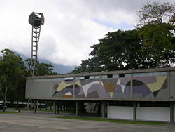
| + | The Central University of Venezuela is a premier public [[university]], one of 13 universities located in Caracas. Founded in 1721, it is the oldest university in Venezuela and one of the first in [[Latin America]]. Universidad Simón Bolívar is a public institution located in Caracas, with a scientific and technological orientation. | ||
| − | == | + | ==Society and culture== |
[[Image:HPIM3787a.JPG|thumb|right|250px|Bolivarian Museum of Caracas.]] | [[Image:HPIM3787a.JPG|thumb|right|250px|Bolivarian Museum of Caracas.]] | ||
| − | Caracas | + | Caracas is Venezuela's [[cultural capital]], boasting numerous [[restaurant]]s, [[theater]]s, [[museum]]s, and [[shopping]] centers. The city hosts the [[National Institute of Sports]] and the Venezuelan [[International Olympic Committee|Olympic Committee]] as well as two [[soccer|football]] stadiums: Estadio Olímpico (Caracas), with capacity of 30,000 spectators, and [[Estadio Brígido Iriarte]], with a capacity of 12,000 spectators. Other areas and facts of interest include: |
| + | |||
| + | * The Capitolio Federal, which occupies an entire city block, was commissioned by Antonio Guzmán Blanco in the 1870s, and is famous for its Salón Elíptico, an oval hall with a mural-covered dome and walls lined with portraits of the country's luminaries. | ||
| − | + | * Caracas Cathedral, which is located in a corner of the Plaza Bolívar, was founded in 1594. The parents of [[Simón Bolívar]] are buried there. Besides its hand carved altars, it has some magnificent works of [[art]], a ''Resurrection'' by [[Peter Paul Rubens|Rubens]], the ''Presentation of the Virgin'' by [[Murillo]], and the ''Last Supper,'' an [[unfinished work]] by the Venezuelan painter [[Arturo Michelena]]. | |
| − | |||
| − | Caracas | ||
| − | + | * The Church of San Francisco houses, which has some seventeenth century masterpieces of art, carvings, [[sculpture]]s and oil paintings. The Central University of Venezuela, created in the time of [[Philip V of Spain|Philip V]], was lodged in the church cloisters, which today is the seat of the Language Academy, and the academies of [[history]], [[physics]], and [[mathematics]]. | |
| − | |||
| + | * The Parque del Este, which is a green paradise in the middle of the city, includes a small [[zoo]]. A replica of the Santa Maria ship, used by [[Christopher Colombus]] in his voyages to discover America was located in the park before it was destroyed by the government of [[Hugo Chavez]]. | ||
| + | * The main campus of the Central University of Venezuela, which was designed by architect Carlos Raúl Villanueva and declared [[World Heritage Site]] by [[UNESCO]] in 2000, is considered to be a masterwork of Modern Architecture and Art. | ||
| − | + | * Las Mercedes, which has the best restaurants of the city, along with pleasant pubs, bars, and pools. It is the favorite meeting place of the Caracas youth, and has some of the most exclusive stores of the city. | |
| − | |||
| − | |||
| − | |||
| − | |||
| − | |||
| − | + | * La Candelaria, which is well-known for its Spanish restaurants. Typical foods include ''Pabellón Criollo,'' [[empanada]]s, [[arepa]]s, [[hallaca]], ''black roast beef,'' and ''chicken salad''. Typical drinks include [[chicha]],'' guarapo,'' ''carato,'' and ''tizana'' (mixed beverage with fruits). | |
| − | * | + | * On September 15, 2007, Caracas [[chefs]] broke the [[Guinness World Records]] by serving a 3,299 gallon (15,000 liter), largest [[stew]] ([[Sancocho]]—enough to feed 70,000 people). It took 13 hours cooking in a 16 foot (five meter)-high pot. One hundred helpers used 15,340 pounds (7000 kg) of [[vegetable]]s and 11,000 pounds (5000 kg) of [[beef]] and [[chicken]].<ref>''BBC News,'' September 15, 2007, [http://news.bbc.co.uk/2/hi/americas/6996104.stm Venezuela serves up record stew.] Retrieved August 29, 2008. </ref> |
| − | |||
| − | Caracas | + | ==Looking to the future== |
| − | + | Caracas, the capital and largest city of [[Venezuela]], is the nation’s [[cultural capital]], boasting numerous [[restaurants]], [[theaters]], [[museums]], and [[shopping]] centers. However, as President Chavez implements his vision of twenty-first century [[socialism]], the international community has increasing concerns about a weakening of democratic institutions, political polarization, and a politicized military. For Caracas, a socialist political system means an increasingly big government that requires an increasing inflow of money. | |
| − | + | The city grew haphazardly. No demographic planning was carried out, thus there are entire districts, known as ''barrios'' ([[ghetto]]s), lacking [[water]] and [[electricity|electrical systems]], not to mention other services like [[school]]s, [[hospital]]s, or police and fire departments.<ref>James Ingham, [http://news.bbc.co.uk/2/hi/americas/6576413.stm Airships to tackle Caracas crime,] ''BBC News''. Retrieved September 19, 2008. </ref> Therefore, some suburbs and districts are lawless, giving the city the reputation as being one of the most dangerous cities in [[Latin America]].<ref> ''U.S. Department of State,'' [http://travel.state.gov/travel/cis_pa_tw/cis/cis_1059.html Venezuela Country Specific Information.] Retrieved September 19, 2008.</ref> | |
| − | [[ | ||
| − | [[ | ||
| − | [ | ||
| − | |||
| − | |||
| − | + | ==Notes== | |
| − | + | <references/> | |
| − | |||
| − | |||
| − | |||
| − | |||
| − | |||
| − | |||
| − | |||
| − | |||
| − | ''' | + | ==References== |
| − | + | * Ferry, Robert J. 1989. ''The Colonial Elite of Early Caracas: Formation & Crisis, 1567-1767''. Berkeley: University of California Press. ISBN 9780520063990. | |
| − | + | * Gazsó, Gabriel. 1993. ''Caracas''. Caracas, Venezuela: Editorial Aurora. ISBN 9789803009588. | |
| − | + | * "Venezuela--Crime in Caracas." 2008. ''The Economist'' 388 (8589): 50. {{OCLC|236476233}} | |
| + | * ''World Fact Book''. 2008. Venezuela. | ||
| − | + | ==External links== | |
| − | + | All links retrieved November 25, 2023. | |
| + | * [http://www.caracasnews.com/ Caracas News] | ||
| − | |||
| − | |||
| − | |||
| − | |||
| − | |||
| − | |||
| − | |||
| − | |||
| − | |||
| − | |||
| − | |||
| − | |||
| − | |||
| − | |||
| − | |||
| − | |||
| − | |||
| − | |||
| − | |||
| − | |||
| − | |||
| − | |||
| − | |||
| − | |||
| − | |||
| + | {{South American capitals}} | ||
[[Category:Geography]] | [[Category:Geography]] | ||
| − | [[Category: | + | [[Category:Cities]] |
| + | [[Category:The Americas]] | ||
| + | [[Category:South America]] | ||
{{credits|Caracas|178064496}} | {{credits|Caracas|178064496}} | ||
Latest revision as of 22:11, 25 November 2023
| Caracas | |||
| — City — | |||
| Santiago de León de Caracas | |||
| Caracas from El Calvario | |||
|
|||
| Nickname: La Odalisca del Ávila (The Avila's Odalisque) La Sucursal del Cielo (Heaven's Branch on Earth) "La Ciudad de la Eterna Primavera"(The City of Eternal Spring) |
|||
| Motto: Ave María Purísima, sin pecado concebida, en el primer instante de su ser natural | |||
| Coordinates: 10°30′N 66°55′W | |||
|---|---|---|---|
| Country | |||
| State | Venezuelan Capital District Miranda | ||
| Municipality | Libertador | ||
| Founded | 25 July 1567 | ||
| Founder | Diego de Losada | ||
| Metropolitan | Municipalities: Libertador, Chacao, Baruta, Sucre, El Hatillo | ||
| Government | |||
| - Type | Mayor-council | ||
| - Chief of Government / Mayor | Jacqueline Faría / Antonio Ledezma | ||
| Area | |||
| - City | 433 km² (167.2 sq mi) | ||
| - Metro | 1,930 km² (745.2 sq mi) | ||
| Elevation | 900 m (2,953 ft) | ||
| Population (2009) | |||
| - City | 5.905.463 Instituto Nacional de Estadística (Municipio Libertador) | ||
| - Density | 1,431.5/km² (3,707.6/sq mi) | ||
| - Metro | 6,474,367 Instituto Nacional de Estadística (Municipio Libertador) | ||
| Postal coded | 1010-A | ||
| Area code(s) | 212 | ||
| The area and population figures are the sum of the figures of the five municipalities (listed above) that make up the Distrito Metropolitano. | |||
| Website: Capital District Metropolitan District | |||
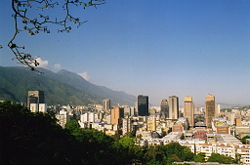
Caracas (pronounced [kaˈɾakas]) is the capital and largest city of Venezuela, and one of the principal cities of South America. It is the country's leading center of education, culture, industry, and commerce. It is also the seat of government for the Capital District, which occupies 167 of the city's 745 square miles (433 and 1,930 sq km, respectively). The Metropolitan District of Caracas includes the Venezuelan Capital District and four other municipalities in Miranda State including Chacao, Baruta, Sucre, and El Hatillo. The city of Caracas has a population of close to 6 million.
Caracas is located in the north of the country, contained within and following the contours of the narrow Caracas Valley on the Venezuelan coastal range. It is separated from the Caribbean Sea, seven miles (11.26 km) to its north, by the steep Cerro Ávila Mountain Range—the northernmost tip of the Andes—and is bounded by hills and mountains to its south.
In the early twenty-first century Venezuela's government had difficulty effectively dealing with the attendant problems of poverty. While Caracas has prosperous neighborhoods, there are also barrios lacking running water, electricity, and social services. The resulting discontent and disillusion caused extreme lawlessness in some areas of the city, giving it the reputation as being one of the most dangerous cities in Latin America.
Geography
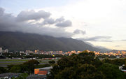
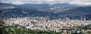
Caracas is contained within a valley of the Venezuelan central range, and separated from the Caribbean coast by a steep mountain range (Cerro Ávila) that rises above 7,400 feet (2,200 meters), and by a roughly 15 km expanse of El Ávila National Park. The valley is relatively small and quite irregular. To the south lies further hills and mountains.
The urbanized terrain of the Caracas Valley lies between 2,854 to 3,422 feet (870 and 1,043 meters), with 2,953 feet (900 meters) in the historic zone. This, along with the rapid population growth, has profoundly influenced the urban development of the city. The most elevated point of the Capital District, wherein the city is located, is the Pico El Ávila, which rises to 7,083 feet (2,159 meters).
The valley's temperatures are spring-like, with the climate described as intertropical. The average maximum daytime temperature of the coldest month, January, is 72°F (22°C), and the average of the warmest month, May, 75°F (24°C). Abundant fog may appear in December and January, with a sudden nightly drop in temperature to 55°F (13°C). Caracas natives call this weather the Pacheco. Precipitation varies between 35 and 51 inches (900 and 1,300 mm) annually, in the city proper, and up to 79 inches (2,000 mm) in some parts of the mountain range. Hail storms occur rarely, while electrical storms are more frequent.
The Guaire River flows across the city and empties into the Tuy River, which is also fed by the El Valle and San Pedro Rivers, in addition to numerous streams which descend from El Ávila. The La Mariposa and Camatagua reservoirs provide water to the city.
Caracas covers 745 square miles (1,930 sq km). The city's continued growth means water supply is a critical problem. Other environmental issues concern raw sewage that is discharged into the Guaire River, and air pollution from industry and traffic congestion in the small valley. The Caracas valley suffers earthquakes, most notably in 1755, 1812, and 1967.
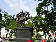
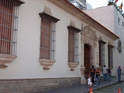
The center of Caracas is at the western edge of the valley by the hill of El Calvario Park. There, the leafy Plaza Bolívar has a monument to Simon Bolívar. Numerous historic buildings are in this area and include Caracas Cathedral, the National Capitol, the Municipal Council building, a neatly proportioned reconstruction of the house where national hero Simón Bolívar was born, and Miraflores Palace, which serves as the president’s official residence.
Nearby is the National Pantheon containing Bolívar’s bronze sarcophagus and monuments to other national heroes. The twin towers of the Simón Bolívar Centre are also located nearby.
The civic center is further east, by the Parque Central, which is Caracas' art and culture hub. This is a concrete complex of five high-rise residential blocks, crowned by two 56 story octagonal towers, one of which was damaged by fire in 2004. The complex includes museums, cinemas, the Teresa Carreño Cultural Complex, and the Caracas Athenaeum, home to the Rajatabla Theatre Company.
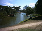
Nearby are the Botanical Garden, several museums, the Parque Los Caobos, and the Central University of Venezuela. Further east are the Caracas Country Club, the Parque Nacional del Este, and the Francisco de Miranda Airport.
History
The western area of what became Venezuela was inhabited 15,000 years ago, according to radio carbon dating of stone implements found there. More than 500 years ago, indigenous peoples who were agriculturists and hunters lived in groups along the coast, including the Caracas area. Spanish colonization began in 1522, with the first settlement at Cumana, 250 miles (402 km) east of Caracas.
The opening of gold mines at Yaracuy led to the introduction of slavery, at first with the indigenous population, then with imported Africans. The first real success of the colony was the raising of livestock, much helped by the grassy plains known as llanos.
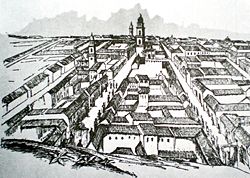
Francisco Fajardo, a Spanish colonel, attempted to establish a plantation in the Caracas area in 1562, but was expelled by the locals. This was the last indigenous rebellion, for on July 25, 1567, the Spanish captain Diego de Losada defeated the Mariche chief, Tamanaco and laid the foundations of the city of Santiago de León de Caracas. The cultivation of cocoa stimulated the development of the city which became the capital of the province of Venezuela. The cocoa plantations were manned by imported African slaves.
During the sixteenth and seventeenth centuries, the provinces that constitute today's Venezuela were neglected, since the vice-royalties of New Spain and Peru were more interested in their nearby gold and silver mines than in agricultural Venezuela.
The Province of Venezuela, under the jurisdiction of the Viceroyalty of New Granada (created in 1717), was transformed into the Captaincy General of Venezuela in 1777. The Guipuzcoana Company held a monopoly on trade with Europe, and stimulated the Venezuelan economy through the cultivation of cacao beans, which became Venezuela’s principal export.
Caracas became an intellectual powerhouse. It had its own university since 1721, teaching Latin, medicine, engineering, and the humanities. Its most illustrious graduate was Andrés Bello, the greatest Spanish-American polymath in his time.
Some Venezuelans began to grow restive under colonial control toward the end of the eighteenth century. Inspired by the French Revolution, Manuel Gual and José María España led the first rebellion in 1797, which was put down on July 13 of that year, with the collaboration of the mantuanos, the white creole elite. Meanwhile, the Napoleonic Wars in Europe weakened Spain's imperial power, and the Venezuelans achieved home rule after a coup on April 19, 1810, and declared independence from Spain on July 5, 1811.
Caracas was the birthplace of two of Latin America's most important figures: Francisco de Miranda and "El Libertador" Simón Bolívar. An earthquake, portrayed by authorities as a divine punishment for rebelling against the Spanish Crown, destroyed Caracas on March 26, 1812. The valley became a cemetery, and the war, which killed half of Venezuela's white population, continued until June 24, 1821, when Bolívar gained a decisive victory over the Royalists at Carabobo.
Venezuela, along with what are now Colombia, Panama, and Ecuador, was part of the Republic of Gran Colombia until 1830, when Venezuela separated and became a sovereign country. Much of Venezuela's nineteenth century history was characterized by periods of political instability, dictatorial rule of the caudillos, and revolutionary turbulence.
Despite the knowledge of oil in Venezuela for centuries, the first oil wells of significance were not drilled until the early 1910s. Authoritarian president Juan Vicente Gómez (1857-1935) granted concessions to explore, produce, and refine oil. On April 15, 1914, Caribbean Petroleum discovered the first Venezuelan oilfield of importance, Mene Grande.
By the end of 1917, refining began at the San Lorenzo refinery, and Caribbean Petroleum's oil exports started. By 1929, Venezuela was the second largest oil producing country (behind only the United States) and the largest oil exporter in the world.
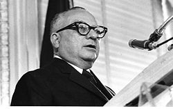
As the economy of oil-rich Venezuela grew steadily during the first part of the twentieth century, Caracas became one of Latin America's economic centers, and was also known as the preferred hub between Europe and South America. A military junta ruled after Gómez's death. Leftist Dr. Rómulo Betancourt (1908-1981) and the Democratic Action Party won a majority of seats in a Constituent Assembly to draft a new constitution in 1946. A writer, Rómulo Gallegos (1884-1969), a candidate of Betancourt's party, became Venezuela's first democratically elected president in 1947, to be overthrown by a military-backed coup led by Marcos Pérez Jiménez (1914-2001), who was himself ousted in 1958.
Betancourt was president from 1958 to 1964. In the 1960s, the Democratic Action Party and the Christian Democratic Comité de Organización Política Electoral Independiente parties agreed to limit Venezuela's elections to an exclusive competition between these two parties, in an accord known as the Pacto de Punto Fijo.
During the 1950s, Caracas began an intensive modernization program which continued throughout the 1960s and early 1970s. The Universidad Central de Venezuela building, designed by modernist architect Carlos Raúl Villanueva, later a UNESCO monument, was built as El Silencio Redevelopment and included 7,797 apartments and 207 shop premises.
Joining El Silencio, several workers' districts (23 de Enero, Simon Rodriguez) and new middle class residential districts (Bello Monte, Los Palos Grandes, Chuao, Cafetal) sprouted in the valley, extending its limits towards the east and southeast.
Venezuela's prevailing political calm came to an end in 1989, when the country experienced riots in which more than 200 people were killed in Caracas. The so-called Caracazo was a response to an economic austerity program. Three years later, in February 1992, a group of army lieutenant colonels led by future President Hugo Chavez (b. 1954) mounted an unsuccessful coup attempt. A second, equally unsuccessful coup attempt by other officers followed in November 1992. A year later, Congress impeached the president on corruption charges.
In December 1998, Chavez won the presidency on a platform that called for the creation of a "Fifth Republic," a new constitution, a new name ("the Bolivarian Republic of Venezuela"). In 1999, voters approved a referendum on a new constitution, and in 2000, re-elected Chávez, also placing many members of his Fifth Republic Movement political party in the National Assembly.
Chavez has continued to implement his vision of "Twenty-first Century Socialism" by obtaining powers to rule by decree, nationalizing the telecommunications and electricity sectors, as well as taking a majority government share in many oil projects. In December 2007, Chavez suffered his first electoral defeat as constitutional changes proposed by the president, some of which would have increased the power of the presidency, were voted down. The referendum saw a high level of abstention.
The change in the oil dependent economic structure of the country, and the fast development of Caracas made it a magnet for the rural communities who migrated to the capital city in an unplanned fashion, creating the ranchos (slum) belt in the valley of Caracas.
Government
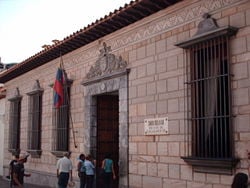
Venezuela is a federal republic. The president is both the chief of state and head of government, and is elected by popular vote for a six-year term. The Council of Ministers is appointed by the president. The unicameral National Assembly has 167 members elected by popular vote to serve five year terms. Three seats are reserved for the indigenous peoples of Venezuela.
Concerns by the international community about Venezuela include: A weakening of democratic institutions, political polarization, a politicized military, drug-related violence along the Colombian border, increasing internal drug consumption, over-dependence on the petroleum industry with its price fluctuations, and irresponsible mining operations that are endangering the rainforest and indigenous peoples.
The Metropolitan District of Caracas is the official name of the district governed as Caracas, which has five municipalities: Baruta, El Hatillo, Chacao, Libertador and Sucre.
The constitution of Venezuela specifies that municipal governments be divided into executive and legislative branches. The mayor manages executive government, while the municipal council manages legislative government. On March 8, 2000, the year after a new constitution was introduced, it was decreed that some of the powers of these municipalities would be delegated to the Alcaldía Mayor, physically located in Libertador municipality.
Economy
Venezuela remains highly dependent on oil revenues, which account for roughly 90 percent of export earnings, more than 50 percent of the federal budget revenues, and around 30 percent of GDP. Fueled by high oil prices, record government spending helped boost gross domestic product in 2006, by about nine percent and in 2007, by about eight percent. This spending, combined with minimum wage hikes and improved access to domestic credit, has created a consumption boom but has come at the cost of higher inflation, at roughly 20 percent in 2007.
As the national capital, and as host to embassies of all countries of the world, government services are especially important in the Caracas economy, as is the entire service sector, including wholesale and retail trade, transportation and public utilities, education and health care. The city is the location for the head offices for Venezuela’s corporations, banks, and insurance companies, as well as the Caracas Stock Exchange.
Caracas also hosts Petróleos de Venezuela (PDVSA) which is the main company of the country that negotiates all the international agreements for the distribution and export of petroleum.
Caracas is Venezuela's leading manufacturing center, producing chemicals, textiles, leather, food and beverages, iron and wood, paper, and printing products, chemicals, and pharmaceuticals, as well as metalware and plastics. There are also important rubber and cement factories.
Venezuala's per capita GDP was estimated at US$12,200 in 2007.
A super highway leads from Caracas to Maiquetía, La Guaira, and various beaches and resort areas. There are two long tunnels through the mountains. Buses are the main means of mass transportation, including large and medium-sized buses, as well as minivans. The Caracas Metro has been in operation since 1981. Train services run to and from Tuy Valley cities of Charallave and Cúa.
Simón Bolívar International Airport, located in Maiquetía, about 13 miles (21km) from the city center, provides international and domestic flights, as do two smaller airports, La Carlota and Francisco de Miranda. The seaports La Guaira and Puerto Cabello handle imports and exports.
Demographics
The city of Caracas had an estimated population of 3,007,000 in 2005. The population of Greater Caracas' urban agglomeration (including neighboring cities out of the Capital District) was approximately 5.1 million people.[1]
The mixture of races and cultures has been an accepted part of life in Caracas. During colonial times, Spaniards mixed with local natives and again with African slaves brought to work in the cocoa and coffee fields. Independence and the discovery of petroleum brought European immigrants. The 1980s and 1990s saw growing numbers of immigrants hailing from neighboring countries such as Colombia, Ecuador, Peru, Bolivia, Trinidad and Tobago, and Haiti. Therefore, it is not difficult to find blond people with dark eyes, as well as very dark people with blondish hair and blue eyes. Nevertheless, the common ethnicity would be "mulatos" (people of mixed black and white ancestry), "mestizos" (mixed white and native Indian), and "criollos" (an amalgamation of three races).
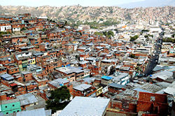
The city has grown haphazardly. No demographic planning has ever been carried out, thus there are entire districts, known as barrios (ghettos), lacking water and electrical systems, not to mention other services such as schools, hospitals, police, and fire departments. Therefore, some suburbs and districts are lawless.
The most widely-spoken and official language is Spanish, although English is used in tourist areas. About 31 indigenous languages are spoken. European immigrant communities and their descendants commonly use their own native languages.
Nominally 96 percent of the population is Roman Catholic, two percent are Protestant, and the remainder follow other religions.
The Central University of Venezuela is a premier public university, one of 13 universities located in Caracas. Founded in 1721, it is the oldest university in Venezuela and one of the first in Latin America. Universidad Simón Bolívar is a public institution located in Caracas, with a scientific and technological orientation.
Society and culture
Caracas is Venezuela's cultural capital, boasting numerous restaurants, theaters, museums, and shopping centers. The city hosts the National Institute of Sports and the Venezuelan Olympic Committee as well as two football stadiums: Estadio Olímpico (Caracas), with capacity of 30,000 spectators, and Estadio Brígido Iriarte, with a capacity of 12,000 spectators. Other areas and facts of interest include:
- The Capitolio Federal, which occupies an entire city block, was commissioned by Antonio Guzmán Blanco in the 1870s, and is famous for its Salón Elíptico, an oval hall with a mural-covered dome and walls lined with portraits of the country's luminaries.
- Caracas Cathedral, which is located in a corner of the Plaza Bolívar, was founded in 1594. The parents of Simón Bolívar are buried there. Besides its hand carved altars, it has some magnificent works of art, a Resurrection by Rubens, the Presentation of the Virgin by Murillo, and the Last Supper, an unfinished work by the Venezuelan painter Arturo Michelena.
- The Church of San Francisco houses, which has some seventeenth century masterpieces of art, carvings, sculptures and oil paintings. The Central University of Venezuela, created in the time of Philip V, was lodged in the church cloisters, which today is the seat of the Language Academy, and the academies of history, physics, and mathematics.
- The Parque del Este, which is a green paradise in the middle of the city, includes a small zoo. A replica of the Santa Maria ship, used by Christopher Colombus in his voyages to discover America was located in the park before it was destroyed by the government of Hugo Chavez.
- The main campus of the Central University of Venezuela, which was designed by architect Carlos Raúl Villanueva and declared World Heritage Site by UNESCO in 2000, is considered to be a masterwork of Modern Architecture and Art.
- Las Mercedes, which has the best restaurants of the city, along with pleasant pubs, bars, and pools. It is the favorite meeting place of the Caracas youth, and has some of the most exclusive stores of the city.
- La Candelaria, which is well-known for its Spanish restaurants. Typical foods include Pabellón Criollo, empanadas, arepas, hallaca, black roast beef, and chicken salad. Typical drinks include chicha, guarapo, carato, and tizana (mixed beverage with fruits).
- On September 15, 2007, Caracas chefs broke the Guinness World Records by serving a 3,299 gallon (15,000 liter), largest stew (Sancocho—enough to feed 70,000 people). It took 13 hours cooking in a 16 foot (five meter)-high pot. One hundred helpers used 15,340 pounds (7000 kg) of vegetables and 11,000 pounds (5000 kg) of beef and chicken.[2]
Looking to the future
Caracas, the capital and largest city of Venezuela, is the nation’s cultural capital, boasting numerous restaurants, theaters, museums, and shopping centers. However, as President Chavez implements his vision of twenty-first century socialism, the international community has increasing concerns about a weakening of democratic institutions, political polarization, and a politicized military. For Caracas, a socialist political system means an increasingly big government that requires an increasing inflow of money.
The city grew haphazardly. No demographic planning was carried out, thus there are entire districts, known as barrios (ghettos), lacking water and electrical systems, not to mention other services like schools, hospitals, or police and fire departments.[3] Therefore, some suburbs and districts are lawless, giving the city the reputation as being one of the most dangerous cities in Latin America.[4]
Notes
- ↑ Nation Master, Statistics, Venezuela. Retrieved September 22, 2008.
- ↑ BBC News, September 15, 2007, Venezuela serves up record stew. Retrieved August 29, 2008.
- ↑ James Ingham, Airships to tackle Caracas crime, BBC News. Retrieved September 19, 2008.
- ↑ U.S. Department of State, Venezuela Country Specific Information. Retrieved September 19, 2008.
ReferencesISBN links support NWE through referral fees
- Ferry, Robert J. 1989. The Colonial Elite of Early Caracas: Formation & Crisis, 1567-1767. Berkeley: University of California Press. ISBN 9780520063990.
- Gazsó, Gabriel. 1993. Caracas. Caracas, Venezuela: Editorial Aurora. ISBN 9789803009588.
- "Venezuela—Crime in Caracas." 2008. The Economist 388 (8589): 50. OCLC 236476233
- World Fact Book. 2008. Venezuela.
External links
All links retrieved November 25, 2023.
Asunción, Paraguay · Bogotá, Colombia · Brasília, Brasil · Buenos Aires, Argentina · Caracas, Venezuela · Cayenne, French Guiana · Georgetown, Guyana · Grytviken, South Georgia and the South Sandwich Islands · La Paz, Bolivia · Lima, Peru · Montevideo, Uruguay · Paramaribo, Suriname · Quito, Ecuador · Santiago, Chile · Sucre, Bolivia · Stanley, Falkland Islands
Credits
New World Encyclopedia writers and editors rewrote and completed the Wikipedia article in accordance with New World Encyclopedia standards. This article abides by terms of the Creative Commons CC-by-sa 3.0 License (CC-by-sa), which may be used and disseminated with proper attribution. Credit is due under the terms of this license that can reference both the New World Encyclopedia contributors and the selfless volunteer contributors of the Wikimedia Foundation. To cite this article click here for a list of acceptable citing formats.The history of earlier contributions by wikipedians is accessible to researchers here:
The history of this article since it was imported to New World Encyclopedia:
Note: Some restrictions may apply to use of individual images which are separately licensed.
