Difference between revisions of "Maine" - New World Encyclopedia
Mary Anglin (talk | contribs) m (→Etymology) |
Rosie Tanabe (talk | contribs) |
||
| (20 intermediate revisions by 6 users not shown) | |||
| Line 1: | Line 1: | ||
| − | {{ | + | {{Approved}}{{Submitted}}{{Images OK}}{{Paid}}{{Copyedited}} |
| − | {{ | + | {{Infobox U.S. state |
| − | |Name = Maine | + | | Name = Maine |
| − | |Fullname = State of Maine | + | | Fullname = State of Maine |
| − | |Flag = Flag of Maine.svg | + | | Flag = Flag of Maine.svg |
| − | |Flaglink = [[Flag of Maine]] | + | | Flaglink = [[Flag of Maine|Flag]] |
| − | |Seal = Mainestateseal.jpg | + | | Seal = Mainestateseal.jpg |
| − | |Map = Map of USA ME.svg | + | | Map = Map of USA ME.svg |
| − | |Nickname = The Pine Tree State | + | | Nickname = "The Pine Tree State" |
| − | |Motto = [[Dirigo]] | + | | Demonym = Mainer<ref name=mainer_definition /> |
| − | |State number = 23rd state | + | | Motto = "[[Dirigo]]" (Latin for "I lead" or "I direct") |
| − | |Capital = [[Augusta, Maine|Augusta]] | + | | Former = District of Maine |
| − | |LargestCity = [[Portland, Maine|Portland]] | + | | State number = 23rd state |
| − | |LargestMetro = [[Portland | + | | Capital = [[Augusta, Maine|Augusta]] |
| − | |Governor = [[ | + | | LargestCity = [[Portland, Maine|Portland]] |
| − | |Senators = [[Olympia Snowe]] (R)<br />[[Susan Collins]] (R) | + | | LargestMetro = [[Portland-South Portland-Biddeford metropolitan area|Portland-South Portland-Biddeford]] |
| − | | | + | | Governor = [[Paul LePage]] (R) |
| − | |PostalAbbreviation = ME | + | | Lieutenant Governor = [[Kevin Raye]] (R)<ref>In the event of a vacancy in the office of Governor, the President of the [[Maine Senate|State Senate]] is first in line for succession.</ref> |
| − | |OfficialLang=None | + | | Lieutenant Governor_alt = President of the Senate |
| − | |AreaRank = | + | | Legislature = [[Maine Legislature]] |
| − | |TotalAreaUS = | + | | Upperhouse = [[Maine Senate|Senate]] |
| − | |TotalArea = | + | | Lowerhouse = [[Maine House of Representatives|House of Representatives]] |
| − | |LandAreaUS = 30, | + | | Senators = [[Olympia Snowe]] (R)<br />[[Susan Collins]] (R) |
| − | |LandArea = 80,005 | + | | Representative= [[Chellie Pingree]] (D)<br />[[Michael Michaud]] (D) |
| − | |WaterAreaUS = 4, | + | | PostalAbbreviation = ME |
| − | |WaterArea = 11,724 | + | | OfficialLang = None |
| − | |PCWater = 13.5 | + | | AreaRank = 39th |
| − | |PopRank = | + | | TotalAreaUS = 35,385 |
| − | | | + | | TotalArea = 91,646 |
| − | | | + | | LandAreaUS = 30,862 |
| − | | | + | | LandArea = 80,005 |
| − | | | + | | WaterAreaUS = 4,523 |
| − | |AdmittanceOrder = | + | | WaterArea = 11,724 |
| − | |AdmittanceDate = March 15, 1820 | + | | PCWater = 13.5 |
| − | |TimeZone = [[Eastern Standard Time Zone|Eastern]]: [[UTC]]-5/[[Daylight saving time|-4]] | + | |PopRank = 42nd |
| − | |Longitude = 66° 57′ W to 71° 5′ W | + | |2010Pop = 1,335,907 (2017 est.)<ref>{{cite web|url=https://www.census.gov/quickfacts/fact/table/ME,US/PST045217 |date=July 1, 2017 |accessdate=May 6, 2017|publisher=[[U.S. Census Bureau]]|title=Maine: Population estimates}}</ref> |
| − | |Latitude = 42° 58′ N to 47° 28′ N | + | |DensityRank = 38th |
| − | |WidthUS = 210 | + | |2010DensityUS = 43.0 |
| − | |Width = 338 | + | |2010Density = 16.6 |
| − | |LengthUS = 320 | + | | AdmittanceOrder = 23rd |
| − | |Length = 515 | + | | AdmittanceDate = March 15, 1820 |
| − | |HighestPoint=[[Mount Katahdin]]<ref name= | + | | TimeZone = [[Eastern Standard Time Zone|Eastern]]: [[UTC]]-5/[[Daylight saving time|-4]] |
| − | |HighestElevUS = 5, | + | | Longitude = 66° 57′ W to 71° 5′ W |
| − | |HighestElev = | + | | Latitude = 42° 58′ N to 47° 28′ N |
| − | |MeanElevUS = | + | | WidthUS = 210 |
| − | |MeanElev = 180 | + | | Width = 338 |
| − | |LowestPoint = [[Atlantic Ocean]]<ref name= | + | | LengthUS = 320 |
| − | |LowestElevUS = 0 | + | | Length = 515 |
| − | |LowestElev = 0 | + | | HighestPoint = [[Mount Katahdin]]<ref name=USGS>{{cite web|url=http://egsc.usgs.gov/isb/pubs/booklets/elvadist/elvadist.html|title=Elevations and Distances in the United States|publisher=[[United States Geological Survey]]|date=2001|accessdate=October 21, 2011}}</ref><ref name=NAVD88>Elevation adjusted to [[North American Vertical Datum of 1988]].</ref> |
| − | |ISOCode = US-ME | + | | HighestElevUS = 5,270 |
| − | |Website = www.maine.gov | + | | HighestElev = 1606.4 |
| + | | MeanElevUS = 600 | ||
| + | | MeanElev = 180 | ||
| + | | LowestPoint = [[Atlantic Ocean]]<ref name=USGS/> | ||
| + | | LowestElevUS = 0 | ||
| + | | LowestElev = 0 | ||
| + | | ISOCode = US-ME | ||
| + | | Website = www.maine.gov | ||
| + | | ElectoralVotes = 4 | ||
}} | }} | ||
| − | |||
| − | The original inhabitants of the territory that is now Maine were [[Algonquian]]-speaking peoples. The first European settlement in Maine was in 1604 by a French party. The first English settlement in Maine was established by the [[Plymouth Company]] at Popham in 1607, the same year as the settlement at [[Jamestown, Virginia]]. | + | The '''State of Maine''' is a [[U.S. state|state]] in the northernmost portion of the [[New England]] region of the [[Northeastern United States]]. The state is known for its scenery—its jagged, mostly rocky coastline, its low, rolling mountains, and its heavily forested interior—as well as for its seafood cuisine, especially [[American lobster|lobsters]] and [[clam]]s. |
| + | |||
| + | The original inhabitants of the territory that is now Maine were [[Algonquian]]-speaking peoples. The first European settlement in Maine was in 1604 by a French party. The first English settlement in Maine was established by the [[Plymouth Company]] at Popham in 1607, the same year as the settlement at [[Jamestown, Virginia]]. However, the Popham Colony did not survive the harsh Maine winters. A number of English settlements were established along the coast of Maine in the 1620s, although the rugged climate, deprivations and Indian attacks wiped out many of them over the years. As Maine entered the eighteenth century, only a half dozen settlements still survived. | ||
| + | {{toc}} | ||
| + | American and British forces contended for Maine's territory during the [[American Revolution]] and the [[War of 1812]]. Because it was physically separated from the rest of [[Massachusetts]] (properly speaking, the ''Department'' of Maine was an ''[[exclave]]'' of Massachusetts) and because it was growing in population at a rapid rate, Maine became the twenty-third state on March 15, 1820 as a component of the [[Missouri Compromise]]. | ||
==Etymology== | ==Etymology== | ||
| − | There continues to be much interest in the origin of the name of Maine, as there is not a definitive answer. The Maine legislature in 2002 adopted a resolution establishing Franco-American Day which stated that the state was named after the ancient French province of Maine. Other theories mention earlier places with similar names, or claim it's a nautical reference to the mainland. Whatever the origin, the name was fixed in 1665 when the King's Commissioners ordered that the "Province of Maine" be entered from then on in official records. | + | There continues to be much interest in the origin of the name of Maine, as there is not a definitive answer. The Maine legislature in 2002 adopted a resolution establishing Franco-American Day which stated that the state was named after the ancient French province of Maine. Other theories mention earlier places with similar names, or claim it's a nautical reference to the mainland. Whatever the origin, the name was fixed in 1665 when the King's Commissioners ordered that the "Province of Maine" be entered from then on in official records. <ref> George R. Stuart, 1958. ''Names on the Land''. Boston: Houghton Mifflin. ISBN 9780938530022 </ref> |
| − | ==Geography== | + | ==Geography== |
| − | + | [[Image:National-atlas-maine.png|thumb|300px|Maine]] | |
| − | + | [[Image:52402a.jpg|thumb|300px|Boothbay Harbor]] | |
| − | Mine is bounded to the south and east by the Atlantic Ocean, and to the north and northeast by [[New Brunswick]], a province of [[Canada]]. The Canadian province of [[Quebec]] is to the northwest. Maine is both the northernmost state in [[New England (U.S.)|New England]] and the largest, accounting for nearly half the region's entire land area. Maine also has the distinction of being the only state to border just one other state ([[New Hampshire]] to the west). The municipalities of [[Eastport, Maine|Eastport]] and [[Lubec, Maine|Lubec]] are, respectively, the easternmost city and town in the 48 contiguous states. Maine's [[Moosehead Lake]] is the largest lake in New England ([[Lake Champlain]] being partially in [[New York]]). | + | [[Image:mainecoast.jpg|thumb|300px|The rocky coast around Kennebunk.]] |
| + | |||
| + | Mine is bounded to the south and east by the Atlantic Ocean, and to the north and northeast by [[New Brunswick]], a province of [[Canada]]. The Canadian province of [[Quebec]] is to the northwest. Maine is both the northernmost state in [[New England (U.S.)|New England]] and the largest, accounting for nearly half the region's entire land area. Maine also has the distinction of being the only state to border just one other state ([[New Hampshire]] to the west). The municipalities of [[Eastport, Maine|Eastport]] and [[Lubec, Maine|Lubec]] are, respectively, the easternmost city and town in the 48 contiguous states. Maine's [[Moosehead Lake]] is the largest lake in New England ([[Lake Champlain]] being partially in [[New York]]). Mount Katahdin is both the northern terminus of the [[Appalachian Trail]], which extends to [[Springer Mountain]], [[Georgia (U.S. state)|Georgia]], and the southern terminus of the new [[International Appalachian Trail]], which, when complete, will run to [[Belle Isle (Newfoundland and Labrador)|Belle Isle]], [[Newfoundland and Labrador]]. At 33,215 square miles (86,027 sq km), Maine is thiry-ninth of the 50 states in area. | ||
| − | [[ | + | [[Machias Seal Island]] and [[North Rock]], off its easternmost point, are claimed by both the [[United States]] and [[Canada]] and are within one of [[List of areas disputed by Canada and the United States|four areas between the two countries whose sovereignty is still in dispute]], but is the only one of the disputed areas containing land. Also in this easternmost area is the [[Old Sow]], the largest [[tidal]] [[whirlpool]] in the [[Western Hemisphere]]. |
| − | [[ | + | Maine is the most sparsely populated state east of the [[Mississippi River]]. Ninety percent of its land is forested; It is known as the [[List of U.S. state nicknames|Pine Tree State]]. Much of the interior and forested lands are uninhabited; some of these areas do not have formal local political organization. For example, the [[Northwest Aroostook, Maine]] [[unorganized territory]] in the northern part of the state has an area of 2,668 square miles (6,910 km²) and a population of 27, or one person for every 100 square miles (255 km²). |
| − | + | Maine is well known for its dramatic ocean scenery, with almost {{convert|3500|mi|km|-2}} of shoreline. [[West Quoddy Head]] is the easternmost piece of land in the contiguous 48 United States. Along the rock-bound coast of Maine are lighthouses, sandy beaches, quiet fishing villages and thousands of offshore islands, including the [[Isles of Shoals]], shared with New Hampshire. Jagged rocks and cliffs and thousands of bays and inlets add to the rugged beauty of Maine's coast. Just inland, by contrast, are sparkling lakes, rushing rivers, green forests and towering mountains. This visual contrast, forested slopes sweeping down to the sea, has been aptly summed up by American poet [[Edna St. Vincent Millay]] of Rockland and [[Camden, Maine|Camden]], Maine in "Renascence": | |
| − | |||
| − | Maine is well known for its dramatic ocean scenery, with almost {{convert|3500|mi|km|-2}} of shoreline | ||
:"All I could see from where I stood | :"All I could see from where I stood | ||
:was three long mountains and a wood | :was three long mountains and a wood | ||
| Line 78: | Line 89: | ||
Millions of people have enjoyed this coastal scenery at Maine's [[Acadia National Park]], the only national park in New England. | Millions of people have enjoyed this coastal scenery at Maine's [[Acadia National Park]], the only national park in New England. | ||
| − | + | ||
| − | |||
| − | |||
Areas under the protection and management of the [[National Park Service]] include: | Areas under the protection and management of the [[National Park Service]] include: | ||
*Acadia National Park near [[Bar Harbor (town), Maine|Bar Harbor]] | *Acadia National Park near [[Bar Harbor (town), Maine|Bar Harbor]] | ||
| Line 89: | Line 98: | ||
===Climate=== | ===Climate=== | ||
| − | Maine has a [[humid continental climate]] ([[Köppen climate classification]] ''Dfb''), with warm (although generally not hot), humid summers. | + | Maine has a [[humid continental climate]] ([[Köppen climate classification]] ''Dfb''), with warm (although generally not hot), humid summers. [[Winter]]s are cold and snowy throughout the state, and are especially severe in the northern parts of Maine. Coastal area weather is moderated somewhat by the Atlantic Ocean. Daytime highs are generally in the 75-80 [[Fahrenheit|°F]] (24-27 [[Celsius|°C]]) range throughout the state in July, with overnight lows in the high 50s°F (around 15 °C). January temperatures range from highs near 32 °F, (0 °C) on the southern coast to overnight lows below 0 °F (-18 °C) in the far north. |
| − | Maine is occasionally affected by [[hurricane]]s and tropical storms; by the time they reach the state, though, many have become [[extratropical]]. | + | Maine is occasionally affected by [[hurricane]]s and tropical storms; by the time they reach the state, though, many have become [[extratropical]]. Few hurricanes have made landfall in Maine. Maine has fewer days of [[thunderstorm]]s than any other state east of the [[Rockies]], with most of the state averaging less than 20 days of thunderstorms a year. [[Tornado]]es are rare in Maine with the state averaging less than two a year, mostly occurring in the southern part of the state. |
| − | + | ==History== | |
| − | + | [[Image:PaulKane-Sketch-Canoe-ROM.jpg|thumb|250 px|Sketch of birchbark canoe, used by the Passamaquoddy Indians]] | |
| − | + | The original inhabitants of the territory that is now Maine were Algonquian-speaking [[Wabanaki]] peoples including the [[Abenaki]], [[Passamaquoddy]], and [[Penobscot]]s. The area's native peoples were generally peaceful, mostly farmers and hunters. They kept a somewhat nomadic existence in the well-watered woods and mountains. They dispersed and hunted inland in the winter; in the summer, they gathered more closely together on the coast and islands and farmed [[corn]], [[bean]]s, and [[squash]], and harvested seafood, including [[porpoise]]. | |
| − | |||
| − | |||
| − | |||
| − | |||
| − | |||
| − | |||
| − | |||
| − | |||
| − | |||
| − | |||
| − | |||
| − | |||
| − | |||
| − | |||
| − | |||
| − | |||
| − | |||
| − | |||
| − | | | ||
| − | |||
| − | |||
| − | |||
| − | |||
| − | |||
| − | |||
| − | |||
| − | |||
| − | |||
| − | |||
| − | |||
| − | |||
| − | |||
| − | |||
| − | |||
| − | |||
| − | |||
| − | |||
| − | |||
| − | |||
| − | |||
| − | |||
| − | |||
| − | |||
| − | |||
| − | + | The first European settlement in Maine was started in 1604 by a French group that included explorer [[Samuel de Champlain]]. The French named the entire area, including what later became the state of Maine, [[Acadia]]. English colonists sponsored by the [[Plymouth Company]] settled there in 1607. The coastal areas of southern Maine, near the mouth of the Sagadahoc (Kennebec), first became the [[Province of Maine]] in a 1622 land patent. Eastern Maine north of the [[Kennebec River]] was more sparsely settled and was known as the [[Territory of Sagadahock]]. | |
| − | |||
| − | [[ | + | The Province, within its current boundaries, became part of [[Massachusetts Bay Colony]] in 1652. Maine was much fought over by the French and English during the seventeenth and early eighteenth centuries. After the defeat of the French in the 1740s, the territory from the Penobscot River east fell under the nominal authority of the Province of [[Nova Scotia]], and together with present day New Brunswick formed the Nova Scotia county of [[Sunbury County, Nova Scotia|Sunbury]], with its court of general sessions at Campobello. American and British forces contended for Maine's territory during the [[American Revolution]] and the [[War of 1812]]. The territory of Maine was confirmed as part of [[Massachusetts]] when the [[United States]] was formed, although the final border with the British was not established until the [[Webster-Ashburton Treaty]] of 1842. |
| − | |||
| − | + | Because it was physically separated from the rest of Massachusetts and its population was growing at a rapid rate, Maine became the twenty-third state on March 15, 1820 through the [[Missouri Compromise]]. This compromise allowed admitting both Maine and [[Missouri]] (in 1821) into the union to keep a balance between [[slave state|slave]] and free states. Maine's original [[capital]] was Portland until 1832, when it was moved to Augusta. | |
| − | Because it was physically separated from the rest of Massachusetts and its population was growing at a rapid rate, Maine became the | ||
==Law and government== | ==Law and government== | ||
| + | [[Image:Maine state capitol.jpg|200px|thumb|right|Maine State House, designed by [[Charles Bulfinch]], built 1829–1832]] | ||
| + | '''Augusta''' is the capital of Maine, county seat of Kennebec County, and center of population for the state. It was first inhabited by English settlers from the Plymouth Colony in 1629 as a trading post on the Kennebec River. The city's population was 18,560 according to a July 2006 estimate. Located on the Kennebec River at the head of tide, it is home to the University of Maine at Augusta. | ||
| − | Maine's state government is composed of three co-equal | + | Maine's state government is composed of three co-equal branches—the executive, legislative, and judicial branches, as outlined in the [[Maine Constitution]]. Maine also has three Constitutional Officers (the Secretary of State, the State Treasurer, and the State Attorney General) and one Statutory Officer (the State Auditor). |
| − | The [[executive branch]] is responsible for the execution of the laws created by the Legislature and is headed by the [[Governor of Maine]]. The Governor is elected every four years; no individual may serve more than two consecutive terms in this office. | + | The [[executive branch]] is responsible for the execution of the laws created by the Legislature and is headed by the [[Governor of Maine]]. The Governor is elected every four years; no individual may serve more than two consecutive terms in this office. As with other [[State legislature (United States)|state legislature]]s, the Maine Legislature can, with a two-thirds majority vote from both the House and Senate, override a gubernatorial veto. |
The [[legislative branch]] is the [[Maine Legislature]], a bicameral body composed of the [[Maine House of Representatives]], with 151 members, and the [[Maine Senate]], with 35 members. The Legislature is charged with introducing and passing laws. | The [[legislative branch]] is the [[Maine Legislature]], a bicameral body composed of the [[Maine House of Representatives]], with 151 members, and the [[Maine Senate]], with 35 members. The Legislature is charged with introducing and passing laws. | ||
| − | The [[judicial branch]] is responsible for interpreting state laws. The highest court of the state is the [[Maine Supreme Judicial Court]]. | + | The [[judicial branch]] is responsible for interpreting state laws. The highest court of the state is the [[Maine Supreme Judicial Court]]. The lower courts are the District Court, [[Maine Superior Court|Superior Court]] and Probate Court. All judges, except for probate judges, are nominated by the Governor and confirmed by the Legislature for full-time terms of seven years. Probate judges serve part-time and are elected by the voters of each county for four-year terms. |
===Local government=== | ===Local government=== | ||
| − | An organized municipality has a form of elected local government which administers and provides local services, keeps records, collects licensing fees, and can pass locally binding ordinances among other responsibilities of self-government. The governmental format of most organized towns and [[Plantation (Maine)|plantations]] is the Town Meeting while the format of most cities is the Council-Manager form. | + | An organized municipality has a form of elected local government which administers and provides local services, keeps records, collects licensing fees, and can pass locally binding ordinances among other responsibilities of self-government. The governmental format of most organized towns and [[Plantation (Maine)|plantations]] is the Town Meeting while the format of most cities is the Council-Manager form. As of 2007 the organized municipalities of Maine consists of 22 ''cities,'' 432 ''towns,'' and 34 ''plantations''. Collectively these 488 organized municipalities cover less than half of the state's territory. Maine also has three [[Native American]] Reservations: Indian Island, Indian Township Reservation, and Pleasant Point Indian Reservation. <ref> ''Maine Local Government Portal''. [http://www.maine.gov/local/ Maine City and Town Index], Informe. Retrieved December 21, 2007. </ref> |
| − | Unorganized territory has no local government. Administration, services, licensing, and ordinances are handled by the State Government. The Unorganized Territory of Maine consists of over 400 townships (towns are incorporated, townships are unincorporated), plus many coastal islands that do not lie within any municipal bounds. The UT land area is slightly over one half the entire area of the State of Maine. Year round residents in the UT number approximately 9,000, about 1.3 | + | Unorganized territory has no local government. Administration, services, licensing, and ordinances are handled by the State Government. The Unorganized Territory of Maine consists of over 400 townships (towns are incorporated, townships are unincorporated), plus many coastal islands that do not lie within any municipal bounds. The UT land area is slightly over one half the entire area of the State of Maine. Year round residents in the UT number approximately 9,000, about 1.3 percent of the state's total population, with many more people residing seasonally within the UT. Only four of Maine's sixteen counties are entirely incorporated, although a few others are nearly so, and most of the unincorporated area is in the vast and sparsely populated Great North Woods of Maine. <ref> ''Maine Revenue Services''. [http://www.maine.gov/revenue/propertytax/unorganizedterritory/unorganized.htm Unorganized Territory], Informe. Retrieved December 21, 2007.</ref> |
===State and local politics=== | ===State and local politics=== | ||
| Line 171: | Line 135: | ||
===Federal politics=== | ===Federal politics=== | ||
| − | In the 1930s, Maine was one of very few states which remained dominated by the [[United States Republican Party|Republican Party]]. In the [[U.S. presidential election, 1936|1936 Presidential election]], [[Franklin D. Roosevelt]] received the [[U.S. Electoral College|electoral votes]] of every state other than Maine and [[Vermont]]. In the 1960s, Maine began to lean toward the [[United States Democratic Party|Democrats]], especially in [[President of the United States|Presidential]] elections. In [[U.S. presidential election, 1968|1968]], [[Hubert Humphrey]] became just the second Democrat in half a century to carry Maine thanks to the presence of his running mate, Maine Senator [[Edmund Muskie]]. Maine has since become a left-leaning [[swing state]] and has voted Democratic in four successive Presidential elections, casting its votes for [[William J. Clinton|Bill Clinton]] twice, [[Al Gore]] in [[U.S. presidential election, 2000|2000]] and [[John Kerry]] (with 53.6 | + | In the 1930s, Maine was one of very few states which remained dominated by the [[United States Republican Party|Republican Party]]. In the [[U.S. presidential election, 1936|1936 Presidential election]], [[Franklin D. Roosevelt]] received the [[U.S. Electoral College|electoral votes]] of every state other than Maine and [[Vermont]]. In the 1960s, Maine began to lean toward the [[United States Democratic Party|Democrats]], especially in [[President of the United States|Presidential]] elections. In [[U.S. presidential election, 1968|1968]], [[Hubert Humphrey]] became just the second Democrat in half a century to carry Maine thanks to the presence of his running mate, Maine Senator [[Edmund Muskie]]. Maine has since become a left-leaning [[swing state]] and has voted Democratic in four successive Presidential elections, casting its votes for [[William J. Clinton|Bill Clinton]] twice, [[Al Gore]] in [[U.S. presidential election, 2000|2000]] and [[John Kerry]] (with 53.6 percent of the vote) in [[U.S. presidential election, 2004|2004]]. Republican strength is greatest in Washington and Piscataquis counties. Though Democrats have carried the state in presidential elections in recent years, Republicans have largely maintained their control of the state's [[United States Senate|US Senate]] seats, with [[Edmund S. Muskie|Ed Muskie]], [[William Hathaway]], and [[George Mitchell]] being the only Maine Democrats serving in the U.S. Senate in the past 50 years. |
The [[United States Reform Party|Reform Party]] of [[Ross Perot]] achieved a great deal of success in Maine in the presidential elections of [[U.S. presidential election, 1992|1992]] and [[U.S. presidential election, 1996|1996]]: in 1992 Perot came in second to Bill Clinton, despite the longtime presence of the Bush family summer home in [[Kennebunkport, Maine|Kennebunkport]], and in 1996, Maine was again Perot's best state. | The [[United States Reform Party|Reform Party]] of [[Ross Perot]] achieved a great deal of success in Maine in the presidential elections of [[U.S. presidential election, 1992|1992]] and [[U.S. presidential election, 1996|1996]]: in 1992 Perot came in second to Bill Clinton, despite the longtime presence of the Bush family summer home in [[Kennebunkport, Maine|Kennebunkport]], and in 1996, Maine was again Perot's best state. | ||
| Line 178: | Line 142: | ||
==Economy== | ==Economy== | ||
| − | [[Image:Maine quarter, reverse side, 2003.jpg|thumb | + | [[Image:Maine quarter, reverse side, 2003.jpg|thumb|150px|Maine [[50 State Quarters|State Quarter]]]] |
| − | The [[Bureau of Economic Analysis]] estimates that Maine's total gross state product for 2003 was US$41 billion. Its per capita personal income for 2003 was US$29,164, | + | The [[Bureau of Economic Analysis]] estimates that Maine's total gross state product for 2003 was US$41 billion. Its per capita personal income for 2003 was US$29,164, twenty-ninth in the nation. Tourism and outdoor recreation play a major and increasingly important role in Maine's economy. The state is a popular destination for sport [[hunting]] (particularly deer, moose and bear), [[sport fishing]], [[snowmobile|snowmobiling]], [[skiing]], boating, [[camping]] and [[hiking]], among other activities. |
===Agriculture and industry=== | ===Agriculture and industry=== | ||
| − | Maine's [[agriculture|agricultural]] outputs include poultry, eggs, dairy products, cattle, wild blueberries, | + | Maine's [[agriculture|agricultural]] outputs include [[poultry]], eggs, dairy products, [[cattle]], wild [[blueberry|blueberries]], [[apple]]s, [[maple syrup]], and [[maple sugar]]. Aroostook County is known for its [[potato]] crops. [[Commercial fishing]], once a mainstay of the state's economy, remains important, particularly lobstering and groundfishing. Western Maine aquifers and springs are a major source of bottled water. Maine's industrial outputs consist chiefly of paper, lumber and wood products, electronic equipment, leather products, food products, textiles, and bio-technology. Naval shipbuilding and construction remain key as well, with [[Bath Iron Works]] in Bath and [[Portsmouth Naval Shipyard]] in Kittery. [[Naval Air Station Brunswick]] is also in Maine, and serves as a large support base for the U.S. Navy. However, the [[Base Realignment and Closure|BRAC]] campaign recommended Brunswick's closing, despite a recent government-funded effort to upgrade its facilities. |
| − | + | [[Image:PenobscotNarrowsBridgeBucksport.jpg|thumb|275px|[[Penobscot Narrows Bridge]], carrying U.S. 1]] | |
Maine ports play a key role in national transportation. Beginning around 1880, Portland's rail link and [[ice-free port]] made it Canada's principal winter port, until the aggressive development of [[Halifax Regional Municipality, Nova Scotia|Halifax]], Nova Scotia, in the mid-1900s. In 2001, Portland, Maine's largest city, surpassed [[Boston, Massachusetts|Boston]] as New England's busiest port (by tonnage), due to its ability to handle large tankers. Maine's [[Portland International Jetport]] was recently expanded, providing the state with increased air traffic. | Maine ports play a key role in national transportation. Beginning around 1880, Portland's rail link and [[ice-free port]] made it Canada's principal winter port, until the aggressive development of [[Halifax Regional Municipality, Nova Scotia|Halifax]], Nova Scotia, in the mid-1900s. In 2001, Portland, Maine's largest city, surpassed [[Boston, Massachusetts|Boston]] as New England's busiest port (by tonnage), due to its ability to handle large tankers. Maine's [[Portland International Jetport]] was recently expanded, providing the state with increased air traffic. | ||
| − | Maine has few large companies that maintain headquarters in the state, traditionally in the pulp and paper industry. | + | Maine has few large companies that maintain headquarters in the state, traditionally in the pulp and paper industry. Some of the larger companies that maintain headquarters in Maine include [[Fairchild Semiconductor]] in South Portland; [[IDEXX Laboratories]], in Westbrook; [[Unum]], in Portland; [[L.L. Bean]] in Freeport; and [[Delorme]], in Yarmouth. Maine is also the home of [[Jackson Laboratory|The Jackson Laboratory]], the world's largest non-profit mammalian genetic research facility and the world's largest supplier of genetically purebred mice. |
| − | Maine has an [[income tax]] structure containing 4 brackets, which range from 2 | + | Maine has an [[income tax]] structure containing 4 brackets, which range from 2 percent to 8.5 percent of personal income. Maine's general [[sales tax]] rate is 5 percent. The state also levies charges of 7 percent on lodging and prepared food and 10 percent on short-term auto rentals. Commercial sellers of blueberries, a Maine staple, must keep records of their transactions and pay the state 1.5 cents per pound ($1.50 per 100 pounds) of the fruit sold each season. All real and tangible [[personal property]] located in the state of Maine is taxable unless specifically exempted by statute. The administration of property taxes is handled by the local assessor in incorporated cities and towns, while property taxes in the unorganized territories are handled by the State Tax Assessor. |
===Transportation=== | ===Transportation=== | ||
| − | Maine has [[Jet airliner|passenger jet]] service at its two largest | + | [[Image:Amtrak downeaster ocean park 2005.jpg|200px|thumb|right|The Downeaster]] |
| + | Maine has [[Jet airliner|passenger jet]] service at its two largest [[airport]]s, the [[Portland International Jetport]] in Portland, and the [[Bangor International Airport]] in Bangor. Both are served daily by many major [[airline]]s. [[Essential Air Service]] also subsidizes service to a number of smaller airports in Maine, bringing small [[turboprop]] aircraft to regional airports such as the [[Augusta State Airport]], [[Hancock County-Bar Harbor Airport]], [[Knox County Regional Airport]], and the [[Northern Maine Regional Airport at Presque Isle]]. These airports are served by [[US Airways Express]] with small 19 to 30 seat planes. Many smaller airports are scattered throughout Maine, only serving [[general aviation]] traffic. | ||
| − | + | [[Interstate 95 in Maine|Interstate 95]] runs through Maine, as well as its easterly branch [[Interstate 295 (Maine)|I-295]]. In addition, [[U.S. Route 1]] starts in Maine and runs to [[Florida]]. The eastern terminus of the eastern section of [[U.S. Route 2]] starts in Houlton, near the New Brunswick, Canada border to [[Rouses Point, New York|Rouses Point]], New York, at [[U.S. Route 11|US 11]] . There is also another US 2A connecting Old Town and Orono, Maine, primarily serving the [[University of Maine]] campus. U.S. Route 2, [[Maine State Route 6|Route 6]] and [[Maine State Route 9|Route 9]] are often used by truckers and other motorists of the [[Maritime Provinces]] ''en route'' to other destinations in the United States or as a short cut to [[Central Canada]]. | |
| − | [[Interstate 95 in Maine|Interstate 95]] runs through Maine, as well as its easterly branch [[Interstate 295 (Maine)|I-295]]. In addition, [[U.S. Route 1]] starts in Maine and runs to [[Florida]]. The eastern terminus of the eastern section of [[U.S. Route 2]] starts in Houlton, near the New Brunswick, Canada border to [[Rouses Point, New York|Rouses Point]], New York, at [[U.S. Route 11|US 11]] . | ||
| − | + | The [[Downeaster]] passenger train, operated by [[Amtrak]], provides passenger service between Portland and Boston's [[North Station]], with stops in Old Orchard Beach, Saco, and Wells. The Downeaster makes five southbound trips and five northbound trips every day. | |
| − | The [[Downeaster]] passenger train, operated by [[Amtrak]], provides passenger service between Portland and Boston's [[North Station]], with stops in Old Orchard Beach, Saco, and Wells. | ||
Seasonal passenger excursions between Brunswick and Rockland are operated by the Maine Eastern Railroad, which leases the state-owned Rockland Branch rail corridor. | Seasonal passenger excursions between Brunswick and Rockland are operated by the Maine Eastern Railroad, which leases the state-owned Rockland Branch rail corridor. | ||
| Line 204: | Line 167: | ||
==Education== | ==Education== | ||
| − | Maine's constitution required the establishment of public schools, supported by local towns. | + | Maine's constitution required the establishment of public schools, supported by local towns. In the first session of the Maine Legislature in 1820, appropriations were made for Bowdoin College and the Maine Institute for Literature and Theology. In the second session of the Legislature, a law was passed requiring towns to raise money to support schools; by 1828, the state was contributing to the financial support of public education. Currently, the state supplies one-third of the funding for the public schools. A state Department of Education<ref>[http://www.maine.gov/education/150yrs/150part1.htm Department of Education], InforME. Retrieved May 6, 2008.</ref> was created in 1854. A State Board of Education was established in 1949. |
===Colleges and universities=== | ===Colleges and universities=== | ||
| − | The University of Maine System and the Maine Community College System are independent bodies, governed by boards of trustees, even though the state Department of Education | + | The University of Maine System and the Maine Community College System are independent bodies, governed by boards of trustees, even though the state Department of Education<Ref>[http://www.maine.gov/education/highered/index.htm Department of Education], InforME. Retrieved May 6, 2008.</ref> retains limited oversight. Among Maine's public and private institutions are, in addition to the University of Maine system, Bowdoin College, Colby College, and the University of Southern Maine. |
==Demographics== | ==Demographics== | ||
| − | + | [[Image:Maine population map.png|thumb|right|250px|Maine Population Density Map]] | |
| − | + | As of 2005, Maine had an estimated population of 1,321,505, an increase of 6,520, or 0.5 percent, from the prior year and an increase of 46,582, or 3.7 percent, since the year 2000. This includes a natural increase since the last census of 6,413 people (that is 71,276 births minus 64,863 deaths) and an increase due to net migration of 41,808 people into the state. Immigration from outside the United States resulted in a net increase of 5,004 people, and migration within the country produced a net increase of 36,804 people. | |
| − | |||
| − | |||
| − | |||
| − | |||
| − | |||
| − | |||
| − | |||
| − | |||
| − | |||
| − | |||
| − | |||
| − | |||
| − | |||
| − | |||
| − | |||
| − | |||
| − | | | ||
| − | | | ||
| − | | | ||
| − | | | ||
| − | |||
| − | |||
| − | + | Maine is a popular [[tourism|tourist]] destination in the summer months. Many summer visitors establish an alternate secondary residence in Maine and then depart for their primary residence in the off-season. These are the ''summer people'' of Maine lore, often referred to, along with all other out-of-staters, as "flatlanders." Official census figures normally count a person as a resident only once, at the place of the primary home. Therefore, there are some situations in which official census figures could be misleading for Maine. For example, some communities may have a much larger seasonal retail sector than their official, small population figure would imply. | |
| − | Maine is | + | The mean population center of Maine is in [[Kennebec County, Maine|Kennebec County]], in or near the town of [[Mount Vernon, Maine|Mount Vernon]]. The Greater Portland metropolitan area is the most densely populated with nearly 20 percent of Maine's population. <ref name="Portland city"> ''Portland, Maine''. [http://www.ci.portland.me.us City of Portland], City of Portland. Retrieved December 21, 2007. </ref>. |
| − | The | + | The widest reported ancestries in the state are: [[England|English]], [[Scotland|Scottish]], and other [[Briton|British]] (30.8 percent), [[French American|French or French Canadian]] (22.8 percent), [[Irish American|Irish]] (15.1 percent), [[American ancestry|American]] (9.4 percent), and [[German American|German]] (6.7 percent). |
| − | [[ | ||
| − | + | Maine is second only to [[New Hampshire]] in the percentage of French Americans among United States. It also has the largest percentage of non-Hispanic [[White American|whites]] of any state and the highest percentage of current French-speakers. Franco-Mainers tended to settle in rural northern Maine (particularly Aroostook County) and the industrial cities of inland Maine (especially Lewiston) whereas much of the midcoast and downeast sections remain strongly Anglo. | |
| − | |||
| − | + | The 2000 Census reported 92.25 percent of Maine residents age 5 and older speak English at home. Census figures show Maine has a greater proportion of people speaking French at home than any other state in the nation, a result of Maine's large French-Canadian community, who migrated from adjacent [[Quebec]] and [[New Brunswick]]. The state has 5.28 percent of its households being French-speaking, compared with 4.68 percent in [[Louisiana]]. [[Spanish language|Spanish]] is the third most spoken language at 0.79 percent, followed by [[German language|German]] at 0.33 percent and [[Italian language|Italian]] at 0.12 percent. <ref>''MLA Language Map Data Center''. [http://www.mla.org/map_data_results&state_id=23&mode=state_tops Most Spoken languages in Maine], Modern Language Association. Retrieved December 21, 2007.</ref> | |
| − | |||
| − | The 2000 Census reported 92.25 | ||
==Miscellaneous== | ==Miscellaneous== | ||
| + | {{MetaSidebar|250px|#ffffaa|right|[[Maine State symbols]]| | ||
| + | * '''[[State berry]]:''' Wild [[Blueberry]] | ||
| + | * '''[[State bird]]:''' [[Black-capped Chickadee]] | ||
| + | * '''[[State cat]]:''' [[Maine Coon]] | ||
| + | * '''[[State fish]]:''' [[Land-locked salmon]] | ||
| + | * '''[[State flower]]:''' [[Eastern White Pine|White Pinecone and Tassel]] | ||
| + | * '''[[State fossil]]:''' ''[[Pertica Quadrifaria]]'' | ||
| + | * '''[[State gemstone]]:''' [[Tourmaline]] | ||
| + | * '''[[State herb]]:''' [[Pyrolaceae|Wintergreen]] | ||
| + | * '''[[State insect]]:''' [[Western honey bee|European honey bee]] | ||
| + | * '''[[State mammal]]:''' [[Moose]] | ||
| + | * '''[[State animal]]:''' [[Moose]] | ||
| + | * '''[[State Beverage]]:''' [[Moxie]] | ||
| + | * '''[[State soil]]:''' [[Chesuncook soil series]] | ||
| + | * '''[[State song]]:''' [[State of Maine Song]] | ||
| + | * '''[[State tree]]:''' [[Eastern white pine|Eastern White Pine]] | ||
| + | * '''[[State vessel]]:''' Arctic exploration schooner ''Bowdoin'' | ||
| + | * '''[[State motto]]:''' Dirigo ("I lead" or "I direct") | ||
| + | }} | ||
* Four [[United States Navy|U.S. Navy]] ships have been named [[USS Maine|USS ''Maine'']] in honor of the state. | * Four [[United States Navy|U.S. Navy]] ships have been named [[USS Maine|USS ''Maine'']] in honor of the state. | ||
* The noted American ecologist [[Rachel Carson]] did much of her research at one of the Maine seacoast's most characteristic features, a [[tide pool]] for her classic "The Edge of the Sea." The spot where she conducted observations is now preserved as the Rachel Carson Salt Pond Reserve at Pemaquid Point. | * The noted American ecologist [[Rachel Carson]] did much of her research at one of the Maine seacoast's most characteristic features, a [[tide pool]] for her classic "The Edge of the Sea." The spot where she conducted observations is now preserved as the Rachel Carson Salt Pond Reserve at Pemaquid Point. | ||
| − | * [[George Lorenzo Noyes]], known as the Thoreauvian of Maine is a noted state [[natural history|naturalist]], [[mineralogist]], [[development criticism|development critic]], writer and landscape artist. | + | * [[George Lorenzo Noyes]], known as the Thoreauvian of Maine is a noted state [[natural history|naturalist]], [[mineralogist]], [[development criticism|development critic]], writer and landscape artist. He lived a devout wilderness lifestyle in the mountains of Norway, Maine, expressing in his paintings his spiritual reverence for nature and writing of the values of a simple life of [[sustainable living]]. |
* Maine is the only U.S. state to only be bordered by one state (New Hampshire); all other 49 states have multiple or zero bordering states. | * Maine is the only U.S. state to only be bordered by one state (New Hampshire); all other 49 states have multiple or zero bordering states. | ||
| − | * The town of Lubec, Maine is the eastern-most point within the contiguous [[United States]] - for more information see [[extreme points of the United States]]. Eastport, Maine is the eastern-most city in the United States. | + | * The town of Lubec, Maine is the eastern-most point within the contiguous [[United States]] - for more information see [[extreme points of the United States]]. Eastport, Maine is the eastern-most city in the United States. |
* [[Estcourt Station, Maine|Estcourt Station]] is Maine's northernmost point and also the northernmost point in the New England region of the United States. | * [[Estcourt Station, Maine|Estcourt Station]] is Maine's northernmost point and also the northernmost point in the New England region of the United States. | ||
| − | * Maine is the number one exporter of [[blueberry|blueberries]] and [[toothpick]]s. | + | * Maine is the number one exporter of [[blueberry|blueberries]] and [[toothpick]]s. The largest toothpick manufacturing plant in the United States is located in [[Strong, Maine]]. The Strong Wood Products Incorporated plant produces twenty million toothpicks a day.<ref> ''The Center For Land Use Interpretation''. [http://ludb.clui.org/ex/i/ME3145/ Toothpick Capital of the World] Retrieved December 21, 2007. </ref> |
| − | * [[Cadillac Mountain]] in Bar Harbor, [[Mt. Katahdin]] in [[Baxter State Park]], and [[Mars Hill Mountain]] in the town of [[Mars Hill]] each battle to be the first site in the contiguous United States to see the morning's sunlight. | + | * [[Cadillac Mountain]] in Bar Harbor, [[Mt. Katahdin]] in [[Baxter State Park]], and [[Mars Hill Mountain]] in the town of [[Mars Hill]] each battle to be the first site in the contiguous United States to see the morning's sunlight. Maine's first light depends on the time of year, as the sunrise moves from South to North. From October 7 to March 6, Cadillac Mountain is first. From March 7 to March 24, [[West Quoddy Head]] is first in the country. Warmer months, March 25 to September 18, Mars Hill sees first light. Then, when the sun starts getting lower in the sky, The country's day begins between September 19 to October 6 back at West Quoddy Head. |
| − | * [[Noyes Mountain]] in [[Greenwood, Maine]], and the Harvard Quarry at its summit. Excellent panoramic views and popular destination for rock and mineral collectors. | + | * [[Noyes Mountain]] in [[Greenwood, Maine]], and the Harvard Quarry at its summit. Excellent panoramic views and popular destination for rock and mineral collectors. |
* Maine has 62 [[lighthouses]], of which more than 50 are still in use. | * Maine has 62 [[lighthouses]], of which more than 50 are still in use. | ||
| − | |||
| − | |||
| − | |||
| − | |||
| − | |||
| − | |||
| − | |||
| − | |||
| − | |||
| − | |||
| − | |||
| − | |||
| − | |||
| − | |||
| − | |||
| − | |||
| − | |||
| − | |||
| − | |||
| − | |||
===Famous Mainers=== | ===Famous Mainers=== | ||
| − | A citizen of Maine is known as a "Mainer," though | + | A citizen of Maine is known as a "Mainer," though they sometimes affectionately refer to one another as "Mainiacs." The term "Downeaster" may be applied to residents of the northeast coast of the state. Some well-known Mainers are: |
| + | {{col-begin}} | ||
{{col-break}} | {{col-break}} | ||
| − | |||
** [[L. L. Bean|Leon Leonwood (L.L.) Bean]], clothing maker and retailer | ** [[L. L. Bean|Leon Leonwood (L.L.) Bean]], clothing maker and retailer | ||
** [[Milton Bradley]], board game inventor | ** [[Milton Bradley]], board game inventor | ||
** [[Reuben Colburn]], shipbuilder from Pittston, and guide for [[Benedict Arnold]]'s March to Quebec, part of the [[Invasion of Canada (1775)]] | ** [[Reuben Colburn]], shipbuilder from Pittston, and guide for [[Benedict Arnold]]'s March to Quebec, part of the [[Invasion of Canada (1775)]] | ||
| − | |||
| − | |||
| − | |||
| − | |||
| − | |||
** [[Winslow Homer]], artist (27 year resident) | ** [[Winslow Homer]], artist (27 year resident) | ||
| − | |||
| − | |||
** [[Henry Wadsworth Longfellow]], poet | ** [[Henry Wadsworth Longfellow]], poet | ||
| − | |||
** [[Edna St. Vincent Millay]], poet | ** [[Edna St. Vincent Millay]], poet | ||
| − | |||
| − | |||
** [[Walter Piston]], composer | ** [[Walter Piston]], composer | ||
| − | |||
| − | |||
** [[Edwin Arlington Robinson]], poet | ** [[Edwin Arlington Robinson]], poet | ||
| − | ** [[Harriet Beecher Stowe]], novelist | + | ** [[Harriet Beecher Stowe]], novelist and abolitionist |
** [[E.B. White]], writer (28 year resident) | ** [[E.B. White]], writer (28 year resident) | ||
** [[Andrew Wyeth]], artist | ** [[Andrew Wyeth]], artist | ||
{{col-break}} | {{col-break}} | ||
| − | |||
| − | |||
| − | |||
| − | |||
| − | |||
| − | |||
** [[Dorothea Dix]], civil rights reformer | ** [[Dorothea Dix]], civil rights reformer | ||
** [[Hannibal Hamlin]], politician ([[Abraham Lincoln]]'s first Vice President) | ** [[Hannibal Hamlin]], politician ([[Abraham Lincoln]]'s first Vice President) | ||
| + | ** [[Stephen King]], novelist | ||
** [[George J. Mitchell]], politician (former [[United States Senate Majority Leader|U.S. Senate Majority Leader]]) | ** [[George J. Mitchell]], politician (former [[United States Senate Majority Leader|U.S. Senate Majority Leader]]) | ||
** [[Edmund Muskie]], politician, Secretary of State to [[Jimmy Carter]], 1980 | ** [[Edmund Muskie]], politician, Secretary of State to [[Jimmy Carter]], 1980 | ||
| − | |||
** [[Margaret Chase Smith]], politician, first woman elected to both houses of the [[United States Congress]] | ** [[Margaret Chase Smith]], politician, first woman elected to both houses of the [[United States Congress]] | ||
** [[Samantha Smith]], "America's Youngest Ambassador" | ** [[Samantha Smith]], "America's Youngest Ambassador" | ||
| − | |||
| − | |||
| − | |||
| − | |||
| − | |||
| − | |||
** [[Henry Knox]], first U.S. [[United States Secretary of War|Secretary of War]] | ** [[Henry Knox]], first U.S. [[United States Secretary of War|Secretary of War]] | ||
| − | |||
| − | |||
| − | |||
| − | |||
| − | |||
| − | |||
| − | |||
| − | |||
| − | |||
| − | |||
{{col-end}} | {{col-end}} | ||
| − | + | <center><gallery> | |
| − | |||
| − | |||
| − | |||
| − | |||
| − | |||
| − | |||
| − | |||
| − | |||
| − | |||
| − | |||
| − | |||
| − | |||
| − | <gallery> | ||
Image:Portland_Headlight_2000_3.jpg|Portland Head Light | Image:Portland_Headlight_2000_3.jpg|Portland Head Light | ||
Image:Maine_shack_winter.jpg|Maine winter | Image:Maine_shack_winter.jpg|Maine winter | ||
Image:Maine_snowplows.jpg|Snowplows for sale | Image:Maine_snowplows.jpg|Snowplows for sale | ||
Image:Maine_snow_3.jpg|Maine winter | Image:Maine_snow_3.jpg|Maine winter | ||
| − | </gallery> | + | </gallery></center> |
| + | |||
== Notes == | == Notes == | ||
| − | + | <references/> | |
| − | |||
== References == | == References == | ||
| − | * Heinrichs, Ann, and Matt Kania | + | * Heinrichs, Ann, and Matt Kania. ''Maine''. Chanhassen, MN: Child's World, 2006. ISBN 978-1592964444 |
| − | * Kent, Deborah | + | * Kent, Deborah. ''Maine''. America the beautiful. New York: Children's Press, 1999. ISBN 978-0516209944 |
| − | * Webster, Christine | + | * Webster, Christine. ''Maine''. From sea to shining sea. New York: Children's Press, 2003. ISBN 978-0516223230 |
| − | * Dornfeld, Margaret | + | * Dornfeld, Margaret. ''Maine''. Celebrate the states. New York: Benchmark Books, 2001. ISBN 978-0761410713 |
| − | * Hicks, Terry Allan | + | * Hicks, Terry Allan. ''Maine''. It's my state!. New York: Marshall Cavendish Benchmark, 2006. ISBN 978-0761419105 |
== External links == | == External links == | ||
| − | + | All links retrieved November 5, 2022. | |
| − | + | * [https://www.usgs.gov/science/regions/northeast/maine?qt-states_l2_landing_page_tabs=0#qt-states_l2_landing_page_tabs Maine] – ''United States Geological Survey''. | |
| − | * | ||
| − | |||
| − | |||
| − | |||
| − | |||
| − | |||
| − | |||
| − | |||
| − | |||
| − | |||
| − | |||
{{United States}} | {{United States}} | ||
| Line 394: | Line 272: | ||
[[Category:North America]] | [[Category:North America]] | ||
| − | {{credit|169433500}} | + | {{credit|Maine|169433500|Augusta,_Maine|178422510}} |
Latest revision as of 05:31, 5 November 2022
| State of Maine | |||||||||||
| |||||||||||
| Official language(s) | None | ||||||||||
| Capital | Augusta | ||||||||||
| Largest city | Portland | ||||||||||
| Largest metro area | Portland-South Portland-Biddeford | ||||||||||
| Area | Ranked 39th | ||||||||||
| - Total | 35,385 sq mi (91,646 km²) | ||||||||||
| - Width | 210 miles (338 km) | ||||||||||
| - Length | 320 miles (515 km) | ||||||||||
| - % water | 13.5 | ||||||||||
| - Latitude | 42° 58′ N to 47° 28′ N | ||||||||||
| - Longitude | 66° 57′ W to 71° 5′ W | ||||||||||
| Population | Ranked 42nd in the U.S. | ||||||||||
| - Total | 1,335,907 (2017 est.)[1] | ||||||||||
| - Density | 43.0/sq mi (16.6/km2) Ranked 38th in the U.S. | ||||||||||
| Elevation | |||||||||||
| - Highest point | Mount Katahdin[2][3] 5,270 ft (1606.4 m) | ||||||||||
| - Mean | 600 ft (180 m) | ||||||||||
| - Lowest point | Atlantic Ocean[2] 0 ft (0 m) | ||||||||||
| Admission to Union | March 15, 1820 (23rd) | ||||||||||
| Governor | Paul LePage (R) | ||||||||||
| Lieutenant Governor | Kevin Raye (R)[4] | ||||||||||
| U.S. Senators | Olympia Snowe (R) Susan Collins (R) | ||||||||||
| Time zone | Eastern: UTC-5/-4 | ||||||||||
| Abbreviations | ME US-ME | ||||||||||
| Web site | www.maine.gov | ||||||||||


The State of Maine is a state in the northernmost portion of the New England region of the Northeastern United States. The state is known for its scenery—its jagged, mostly rocky coastline, its low, rolling mountains, and its heavily forested interior—as well as for its seafood cuisine, especially lobsters and clams.
The original inhabitants of the territory that is now Maine were Algonquian-speaking peoples. The first European settlement in Maine was in 1604 by a French party. The first English settlement in Maine was established by the Plymouth Company at Popham in 1607, the same year as the settlement at Jamestown, Virginia. However, the Popham Colony did not survive the harsh Maine winters. A number of English settlements were established along the coast of Maine in the 1620s, although the rugged climate, deprivations and Indian attacks wiped out many of them over the years. As Maine entered the eighteenth century, only a half dozen settlements still survived.
American and British forces contended for Maine's territory during the American Revolution and the War of 1812. Because it was physically separated from the rest of Massachusetts (properly speaking, the Department of Maine was an exclave of Massachusetts) and because it was growing in population at a rapid rate, Maine became the twenty-third state on March 15, 1820 as a component of the Missouri Compromise.
Etymology
There continues to be much interest in the origin of the name of Maine, as there is not a definitive answer. The Maine legislature in 2002 adopted a resolution establishing Franco-American Day which stated that the state was named after the ancient French province of Maine. Other theories mention earlier places with similar names, or claim it's a nautical reference to the mainland. Whatever the origin, the name was fixed in 1665 when the King's Commissioners ordered that the "Province of Maine" be entered from then on in official records. [5]
Geography


Mine is bounded to the south and east by the Atlantic Ocean, and to the north and northeast by New Brunswick, a province of Canada. The Canadian province of Quebec is to the northwest. Maine is both the northernmost state in New England and the largest, accounting for nearly half the region's entire land area. Maine also has the distinction of being the only state to border just one other state (New Hampshire to the west). The municipalities of Eastport and Lubec are, respectively, the easternmost city and town in the 48 contiguous states. Maine's Moosehead Lake is the largest lake in New England (Lake Champlain being partially in New York). Mount Katahdin is both the northern terminus of the Appalachian Trail, which extends to Springer Mountain, Georgia, and the southern terminus of the new International Appalachian Trail, which, when complete, will run to Belle Isle, Newfoundland and Labrador. At 33,215 square miles (86,027 sq km), Maine is thiry-ninth of the 50 states in area.
Machias Seal Island and North Rock, off its easternmost point, are claimed by both the United States and Canada and are within one of four areas between the two countries whose sovereignty is still in dispute, but is the only one of the disputed areas containing land. Also in this easternmost area is the Old Sow, the largest tidal whirlpool in the Western Hemisphere.
Maine is the most sparsely populated state east of the Mississippi River. Ninety percent of its land is forested; It is known as the Pine Tree State. Much of the interior and forested lands are uninhabited; some of these areas do not have formal local political organization. For example, the Northwest Aroostook, Maine unorganized territory in the northern part of the state has an area of 2,668 square miles (6,910 km²) and a population of 27, or one person for every 100 square miles (255 km²).
Maine is well known for its dramatic ocean scenery, with almost 3,500 miles (5,600 km) of shoreline. West Quoddy Head is the easternmost piece of land in the contiguous 48 United States. Along the rock-bound coast of Maine are lighthouses, sandy beaches, quiet fishing villages and thousands of offshore islands, including the Isles of Shoals, shared with New Hampshire. Jagged rocks and cliffs and thousands of bays and inlets add to the rugged beauty of Maine's coast. Just inland, by contrast, are sparkling lakes, rushing rivers, green forests and towering mountains. This visual contrast, forested slopes sweeping down to the sea, has been aptly summed up by American poet Edna St. Vincent Millay of Rockland and Camden, Maine in "Renascence":
- "All I could see from where I stood
- was three long mountains and a wood
- I turned and looked the other way
- and saw three islands and a bay"
More prosaic geologists describe this type of landscape as a drowned coast, where a rising sea level has invaded former land features, creating bays out of valleys and islands out of mountain tops. A rise in the elevation of the land, due to the melting of heavy glacier ice, caused a slight rebounding effect of underlying rock; however, this land rise was not strong enough to eliminate all the effect of the rising sea level and its invasion of former land features.
Millions of people have enjoyed this coastal scenery at Maine's Acadia National Park, the only national park in New England.
Areas under the protection and management of the National Park Service include:
- Acadia National Park near Bar Harbor
- Appalachian National Scenic Trail
- Maine Acadian Culture in St. John Valley
- Roosevelt Campobello International Park near Lubec
- Saint Croix Island International Historic Site at Calais
Climate
Maine has a humid continental climate (Köppen climate classification Dfb), with warm (although generally not hot), humid summers. Winters are cold and snowy throughout the state, and are especially severe in the northern parts of Maine. Coastal area weather is moderated somewhat by the Atlantic Ocean. Daytime highs are generally in the 75-80 °F (24-27 °C) range throughout the state in July, with overnight lows in the high 50s°F (around 15 °C). January temperatures range from highs near 32 °F, (0 °C) on the southern coast to overnight lows below 0 °F (-18 °C) in the far north.
Maine is occasionally affected by hurricanes and tropical storms; by the time they reach the state, though, many have become extratropical. Few hurricanes have made landfall in Maine. Maine has fewer days of thunderstorms than any other state east of the Rockies, with most of the state averaging less than 20 days of thunderstorms a year. Tornadoes are rare in Maine with the state averaging less than two a year, mostly occurring in the southern part of the state.
History

The original inhabitants of the territory that is now Maine were Algonquian-speaking Wabanaki peoples including the Abenaki, Passamaquoddy, and Penobscots. The area's native peoples were generally peaceful, mostly farmers and hunters. They kept a somewhat nomadic existence in the well-watered woods and mountains. They dispersed and hunted inland in the winter; in the summer, they gathered more closely together on the coast and islands and farmed corn, beans, and squash, and harvested seafood, including porpoise.
The first European settlement in Maine was started in 1604 by a French group that included explorer Samuel de Champlain. The French named the entire area, including what later became the state of Maine, Acadia. English colonists sponsored by the Plymouth Company settled there in 1607. The coastal areas of southern Maine, near the mouth of the Sagadahoc (Kennebec), first became the Province of Maine in a 1622 land patent. Eastern Maine north of the Kennebec River was more sparsely settled and was known as the Territory of Sagadahock.
The Province, within its current boundaries, became part of Massachusetts Bay Colony in 1652. Maine was much fought over by the French and English during the seventeenth and early eighteenth centuries. After the defeat of the French in the 1740s, the territory from the Penobscot River east fell under the nominal authority of the Province of Nova Scotia, and together with present day New Brunswick formed the Nova Scotia county of Sunbury, with its court of general sessions at Campobello. American and British forces contended for Maine's territory during the American Revolution and the War of 1812. The territory of Maine was confirmed as part of Massachusetts when the United States was formed, although the final border with the British was not established until the Webster-Ashburton Treaty of 1842.
Because it was physically separated from the rest of Massachusetts and its population was growing at a rapid rate, Maine became the twenty-third state on March 15, 1820 through the Missouri Compromise. This compromise allowed admitting both Maine and Missouri (in 1821) into the union to keep a balance between slave and free states. Maine's original capital was Portland until 1832, when it was moved to Augusta.
Law and government

Augusta is the capital of Maine, county seat of Kennebec County, and center of population for the state. It was first inhabited by English settlers from the Plymouth Colony in 1629 as a trading post on the Kennebec River. The city's population was 18,560 according to a July 2006 estimate. Located on the Kennebec River at the head of tide, it is home to the University of Maine at Augusta.
Maine's state government is composed of three co-equal branches—the executive, legislative, and judicial branches, as outlined in the Maine Constitution. Maine also has three Constitutional Officers (the Secretary of State, the State Treasurer, and the State Attorney General) and one Statutory Officer (the State Auditor).
The executive branch is responsible for the execution of the laws created by the Legislature and is headed by the Governor of Maine. The Governor is elected every four years; no individual may serve more than two consecutive terms in this office. As with other state legislatures, the Maine Legislature can, with a two-thirds majority vote from both the House and Senate, override a gubernatorial veto.
The legislative branch is the Maine Legislature, a bicameral body composed of the Maine House of Representatives, with 151 members, and the Maine Senate, with 35 members. The Legislature is charged with introducing and passing laws.
The judicial branch is responsible for interpreting state laws. The highest court of the state is the Maine Supreme Judicial Court. The lower courts are the District Court, Superior Court and Probate Court. All judges, except for probate judges, are nominated by the Governor and confirmed by the Legislature for full-time terms of seven years. Probate judges serve part-time and are elected by the voters of each county for four-year terms.
Local government
An organized municipality has a form of elected local government which administers and provides local services, keeps records, collects licensing fees, and can pass locally binding ordinances among other responsibilities of self-government. The governmental format of most organized towns and plantations is the Town Meeting while the format of most cities is the Council-Manager form. As of 2007 the organized municipalities of Maine consists of 22 cities, 432 towns, and 34 plantations. Collectively these 488 organized municipalities cover less than half of the state's territory. Maine also has three Native American Reservations: Indian Island, Indian Township Reservation, and Pleasant Point Indian Reservation. [6]
Unorganized territory has no local government. Administration, services, licensing, and ordinances are handled by the State Government. The Unorganized Territory of Maine consists of over 400 townships (towns are incorporated, townships are unincorporated), plus many coastal islands that do not lie within any municipal bounds. The UT land area is slightly over one half the entire area of the State of Maine. Year round residents in the UT number approximately 9,000, about 1.3 percent of the state's total population, with many more people residing seasonally within the UT. Only four of Maine's sixteen counties are entirely incorporated, although a few others are nearly so, and most of the unincorporated area is in the vast and sparsely populated Great North Woods of Maine. [7]
State and local politics
In state general elections, Maine voters tend to accept independent and third-party candidates more frequently than most states. Maine has had two independent governors recently (James B. Longley, 1975–1979 and Angus King, 1995–2003). The Green Party candidate won nine percent of the vote in the 2002 gubernatorial election, more than in any election for a statewide office for that party until the 2006 Illinois gubernatorial election. The locally organized Maine Green Independent Party also elected John Eder to the office of State Representative in the Maine House of Representatives, the highest elected Green official nationwide. Pat LaMarche, 2004 Green Party vice-presidential candidate, resides in the southern coastal town of Yarmouth. Maine state politicians, Republicans and Democrats alike, are noted for having more moderate views than many in the national wings of their respective parties.
Maine is an Alcoholic beverage control state.
Federal politics
In the 1930s, Maine was one of very few states which remained dominated by the Republican Party. In the 1936 Presidential election, Franklin D. Roosevelt received the electoral votes of every state other than Maine and Vermont. In the 1960s, Maine began to lean toward the Democrats, especially in Presidential elections. In 1968, Hubert Humphrey became just the second Democrat in half a century to carry Maine thanks to the presence of his running mate, Maine Senator Edmund Muskie. Maine has since become a left-leaning swing state and has voted Democratic in four successive Presidential elections, casting its votes for Bill Clinton twice, Al Gore in 2000 and John Kerry (with 53.6 percent of the vote) in 2004. Republican strength is greatest in Washington and Piscataquis counties. Though Democrats have carried the state in presidential elections in recent years, Republicans have largely maintained their control of the state's US Senate seats, with Ed Muskie, William Hathaway, and George Mitchell being the only Maine Democrats serving in the U.S. Senate in the past 50 years.
The Reform Party of Ross Perot achieved a great deal of success in Maine in the presidential elections of 1992 and 1996: in 1992 Perot came in second to Bill Clinton, despite the longtime presence of the Bush family summer home in Kennebunkport, and in 1996, Maine was again Perot's best state.
Since 1969, two of Maine's four electoral votes are awarded based on the winner of the statewide election. The other two go to the highest vote-winner in each of the state's two congressional districts.
Economy

The Bureau of Economic Analysis estimates that Maine's total gross state product for 2003 was US$41 billion. Its per capita personal income for 2003 was US$29,164, twenty-ninth in the nation. Tourism and outdoor recreation play a major and increasingly important role in Maine's economy. The state is a popular destination for sport hunting (particularly deer, moose and bear), sport fishing, snowmobiling, skiing, boating, camping and hiking, among other activities.
Agriculture and industry
Maine's agricultural outputs include poultry, eggs, dairy products, cattle, wild blueberries, apples, maple syrup, and maple sugar. Aroostook County is known for its potato crops. Commercial fishing, once a mainstay of the state's economy, remains important, particularly lobstering and groundfishing. Western Maine aquifers and springs are a major source of bottled water. Maine's industrial outputs consist chiefly of paper, lumber and wood products, electronic equipment, leather products, food products, textiles, and bio-technology. Naval shipbuilding and construction remain key as well, with Bath Iron Works in Bath and Portsmouth Naval Shipyard in Kittery. Naval Air Station Brunswick is also in Maine, and serves as a large support base for the U.S. Navy. However, the BRAC campaign recommended Brunswick's closing, despite a recent government-funded effort to upgrade its facilities.

Maine ports play a key role in national transportation. Beginning around 1880, Portland's rail link and ice-free port made it Canada's principal winter port, until the aggressive development of Halifax, Nova Scotia, in the mid-1900s. In 2001, Portland, Maine's largest city, surpassed Boston as New England's busiest port (by tonnage), due to its ability to handle large tankers. Maine's Portland International Jetport was recently expanded, providing the state with increased air traffic.
Maine has few large companies that maintain headquarters in the state, traditionally in the pulp and paper industry. Some of the larger companies that maintain headquarters in Maine include Fairchild Semiconductor in South Portland; IDEXX Laboratories, in Westbrook; Unum, in Portland; L.L. Bean in Freeport; and Delorme, in Yarmouth. Maine is also the home of The Jackson Laboratory, the world's largest non-profit mammalian genetic research facility and the world's largest supplier of genetically purebred mice.
Maine has an income tax structure containing 4 brackets, which range from 2 percent to 8.5 percent of personal income. Maine's general sales tax rate is 5 percent. The state also levies charges of 7 percent on lodging and prepared food and 10 percent on short-term auto rentals. Commercial sellers of blueberries, a Maine staple, must keep records of their transactions and pay the state 1.5 cents per pound ($1.50 per 100 pounds) of the fruit sold each season. All real and tangible personal property located in the state of Maine is taxable unless specifically exempted by statute. The administration of property taxes is handled by the local assessor in incorporated cities and towns, while property taxes in the unorganized territories are handled by the State Tax Assessor.
Transportation

Maine has passenger jet service at its two largest airports, the Portland International Jetport in Portland, and the Bangor International Airport in Bangor. Both are served daily by many major airlines. Essential Air Service also subsidizes service to a number of smaller airports in Maine, bringing small turboprop aircraft to regional airports such as the Augusta State Airport, Hancock County-Bar Harbor Airport, Knox County Regional Airport, and the Northern Maine Regional Airport at Presque Isle. These airports are served by US Airways Express with small 19 to 30 seat planes. Many smaller airports are scattered throughout Maine, only serving general aviation traffic.
Interstate 95 runs through Maine, as well as its easterly branch I-295. In addition, U.S. Route 1 starts in Maine and runs to Florida. The eastern terminus of the eastern section of U.S. Route 2 starts in Houlton, near the New Brunswick, Canada border to Rouses Point, New York, at US 11 . There is also another US 2A connecting Old Town and Orono, Maine, primarily serving the University of Maine campus. U.S. Route 2, Route 6 and Route 9 are often used by truckers and other motorists of the Maritime Provinces en route to other destinations in the United States or as a short cut to Central Canada.
The Downeaster passenger train, operated by Amtrak, provides passenger service between Portland and Boston's North Station, with stops in Old Orchard Beach, Saco, and Wells. The Downeaster makes five southbound trips and five northbound trips every day.
Seasonal passenger excursions between Brunswick and Rockland are operated by the Maine Eastern Railroad, which leases the state-owned Rockland Branch rail corridor.
Freight service throughout the state is provided by a handful of regional and shortline carriers: Pan Am Railways (formerly known as Guilford Rail System), which operates the former Boston & Maine and Maine Central railroads; St. Lawrence and Atlantic Railroad; Maine Eastern Railroad; Montreal, Maine and Atlantic Railway; and New Brunswick Southern Railway.
Education
Maine's constitution required the establishment of public schools, supported by local towns. In the first session of the Maine Legislature in 1820, appropriations were made for Bowdoin College and the Maine Institute for Literature and Theology. In the second session of the Legislature, a law was passed requiring towns to raise money to support schools; by 1828, the state was contributing to the financial support of public education. Currently, the state supplies one-third of the funding for the public schools. A state Department of Education[8] was created in 1854. A State Board of Education was established in 1949.
Colleges and universities
The University of Maine System and the Maine Community College System are independent bodies, governed by boards of trustees, even though the state Department of Education[9] retains limited oversight. Among Maine's public and private institutions are, in addition to the University of Maine system, Bowdoin College, Colby College, and the University of Southern Maine.
Demographics

As of 2005, Maine had an estimated population of 1,321,505, an increase of 6,520, or 0.5 percent, from the prior year and an increase of 46,582, or 3.7 percent, since the year 2000. This includes a natural increase since the last census of 6,413 people (that is 71,276 births minus 64,863 deaths) and an increase due to net migration of 41,808 people into the state. Immigration from outside the United States resulted in a net increase of 5,004 people, and migration within the country produced a net increase of 36,804 people.
Maine is a popular tourist destination in the summer months. Many summer visitors establish an alternate secondary residence in Maine and then depart for their primary residence in the off-season. These are the summer people of Maine lore, often referred to, along with all other out-of-staters, as "flatlanders." Official census figures normally count a person as a resident only once, at the place of the primary home. Therefore, there are some situations in which official census figures could be misleading for Maine. For example, some communities may have a much larger seasonal retail sector than their official, small population figure would imply.
The mean population center of Maine is in Kennebec County, in or near the town of Mount Vernon. The Greater Portland metropolitan area is the most densely populated with nearly 20 percent of Maine's population. [10].
The widest reported ancestries in the state are: English, Scottish, and other British (30.8 percent), French or French Canadian (22.8 percent), Irish (15.1 percent), American (9.4 percent), and German (6.7 percent).
Maine is second only to New Hampshire in the percentage of French Americans among United States. It also has the largest percentage of non-Hispanic whites of any state and the highest percentage of current French-speakers. Franco-Mainers tended to settle in rural northern Maine (particularly Aroostook County) and the industrial cities of inland Maine (especially Lewiston) whereas much of the midcoast and downeast sections remain strongly Anglo.
The 2000 Census reported 92.25 percent of Maine residents age 5 and older speak English at home. Census figures show Maine has a greater proportion of people speaking French at home than any other state in the nation, a result of Maine's large French-Canadian community, who migrated from adjacent Quebec and New Brunswick. The state has 5.28 percent of its households being French-speaking, compared with 4.68 percent in Louisiana. Spanish is the third most spoken language at 0.79 percent, followed by German at 0.33 percent and Italian at 0.12 percent. [11]
Miscellaneous
| Maine State symbols |
|
- Four U.S. Navy ships have been named USS Maine in honor of the state.
- The noted American ecologist Rachel Carson did much of her research at one of the Maine seacoast's most characteristic features, a tide pool for her classic "The Edge of the Sea." The spot where she conducted observations is now preserved as the Rachel Carson Salt Pond Reserve at Pemaquid Point.
- George Lorenzo Noyes, known as the Thoreauvian of Maine is a noted state naturalist, mineralogist, development critic, writer and landscape artist. He lived a devout wilderness lifestyle in the mountains of Norway, Maine, expressing in his paintings his spiritual reverence for nature and writing of the values of a simple life of sustainable living.
- Maine is the only U.S. state to only be bordered by one state (New Hampshire); all other 49 states have multiple or zero bordering states.
- The town of Lubec, Maine is the eastern-most point within the contiguous United States - for more information see extreme points of the United States. Eastport, Maine is the eastern-most city in the United States.
- Estcourt Station is Maine's northernmost point and also the northernmost point in the New England region of the United States.
- Maine is the number one exporter of blueberries and toothpicks. The largest toothpick manufacturing plant in the United States is located in Strong, Maine. The Strong Wood Products Incorporated plant produces twenty million toothpicks a day.[12]
- Cadillac Mountain in Bar Harbor, Mt. Katahdin in Baxter State Park, and Mars Hill Mountain in the town of Mars Hill each battle to be the first site in the contiguous United States to see the morning's sunlight. Maine's first light depends on the time of year, as the sunrise moves from South to North. From October 7 to March 6, Cadillac Mountain is first. From March 7 to March 24, West Quoddy Head is first in the country. Warmer months, March 25 to September 18, Mars Hill sees first light. Then, when the sun starts getting lower in the sky, The country's day begins between September 19 to October 6 back at West Quoddy Head.
- Noyes Mountain in Greenwood, Maine, and the Harvard Quarry at its summit. Excellent panoramic views and popular destination for rock and mineral collectors.
- Maine has 62 lighthouses, of which more than 50 are still in use.
Famous Mainers
A citizen of Maine is known as a "Mainer," though they sometimes affectionately refer to one another as "Mainiacs." The term "Downeaster" may be applied to residents of the northeast coast of the state. Some well-known Mainers are:
|
|
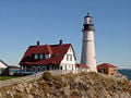
Portland Head Light
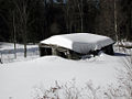
Maine winter

Snowplows for sale
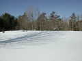
Maine winter


Notes
- ↑ Maine: Population estimates. U.S. Census Bureau (July 1, 2017). Retrieved May 6, 2017.
- ↑ 2.0 2.1 Elevations and Distances in the United States. United States Geological Survey (2001). Retrieved October 21, 2011.
- ↑ Elevation adjusted to North American Vertical Datum of 1988.
- ↑ In the event of a vacancy in the office of Governor, the President of the State Senate is first in line for succession.
- ↑ George R. Stuart, 1958. Names on the Land. Boston: Houghton Mifflin. ISBN 9780938530022
- ↑ Maine Local Government Portal. Maine City and Town Index, Informe. Retrieved December 21, 2007.
- ↑ Maine Revenue Services. Unorganized Territory, Informe. Retrieved December 21, 2007.
- ↑ Department of Education, InforME. Retrieved May 6, 2008.
- ↑ Department of Education, InforME. Retrieved May 6, 2008.
- ↑ Portland, Maine. City of Portland, City of Portland. Retrieved December 21, 2007.
- ↑ MLA Language Map Data Center. Most Spoken languages in Maine, Modern Language Association. Retrieved December 21, 2007.
- ↑ The Center For Land Use Interpretation. Toothpick Capital of the World Retrieved December 21, 2007.
ReferencesISBN links support NWE through referral fees
- Heinrichs, Ann, and Matt Kania. Maine. Chanhassen, MN: Child's World, 2006. ISBN 978-1592964444
- Kent, Deborah. Maine. America the beautiful. New York: Children's Press, 1999. ISBN 978-0516209944
- Webster, Christine. Maine. From sea to shining sea. New York: Children's Press, 2003. ISBN 978-0516223230
- Dornfeld, Margaret. Maine. Celebrate the states. New York: Benchmark Books, 2001. ISBN 978-0761410713
- Hicks, Terry Allan. Maine. It's my state!. New York: Marshall Cavendish Benchmark, 2006. ISBN 978-0761419105
External links
All links retrieved November 5, 2022.
- Maine – United States Geological Survey.
| Political divisions of the United States | |||||||
|---|---|---|---|---|---|---|---|
| |||||||
Credits
New World Encyclopedia writers and editors rewrote and completed the Wikipedia article in accordance with New World Encyclopedia standards. This article abides by terms of the Creative Commons CC-by-sa 3.0 License (CC-by-sa), which may be used and disseminated with proper attribution. Credit is due under the terms of this license that can reference both the New World Encyclopedia contributors and the selfless volunteer contributors of the Wikimedia Foundation. To cite this article click here for a list of acceptable citing formats.The history of earlier contributions by wikipedians is accessible to researchers here:
The history of this article since it was imported to New World Encyclopedia:
Note: Some restrictions may apply to use of individual images which are separately licensed.