Western United States

The Western United States—commonly referred to as the American West or simply The West—traditionally refers to the region comprising the westernmost states of the United States. Since the United States has expanded westward since its founding, the definition of the West has evolved over time. The Mississippi River is often referenced as the easternmost possible boundary of the West.
The region encompasses some of the Louisiana Purchase, most of the land ceded by Britain in 1818, some of the land acquired when the Republic of Texas joined the United States, all of the land ceded by Britain in 1846, all of the land ceded by Mexico in 1848, and all of the Gadsden Purchase.
The "West" played an important part in American history and is embedded in America's folklore.

Geography

In its most expansive definition, the western United States is the largest region, covering more than half the nation's land area. It is also the most geographically diverse, incorporating regions such as the Pacific Coast, the temperate rainforests of the Northwest, the Rocky Mountains, the Great Plains, most of the tall-grass prairie eastward to Illinois, the western Ozark plateau, the western portions of the southern forests, the Gulf Coast, and all of the desert areas located in the United States (the Mojave, Sonoran, Great Basin, and Chihuahua deserts).
Variation and regionalism
As the largest region in the United States there is variation to such an extent that the West is often broken down into regions. Arizona, Colorado, California, New Mexico, Nevada, Oklahoma, Texas, and Utah or sections of those states are sometimes considered the Southwest, while all or part of Idaho, Montana, Oregon, Washington, and Wyoming can be considered the Northwest; more narrowly, part or all of those same states, with the exception of Wyoming and the eastern portions of Montana and Idaho and the addition of the Canadian province of British Columbia, comprise the Pacific Northwest.
The term West Coast is usually restricted to California, Oregon, and Washington. The Mountain States include Arizona, Colorado, Idaho, Montana, Nevada, New Mexico, Utah, andWyoming. Alaska and Hawaii, being detached from the other western states, have few similarities with them but are usually also classified as part of the West.
Some western states are grouped into regions with eastern states. Kansas, Nebraska, South Dakota, and North Dakota are often included in the Midwest, which also includes states like Iowa, Illinois, and Wisconsin. Texas and Oklahoma are often considered part of the Southwest, and Texas and Louisiana are also considered part of the South.
Historically, the Northwest Territory was an important early territory of the United States, comprising the modern states of Ohio, Indiana, Illinois, Michigan, and Wisconsin, as well as the northeastern part of Minnesota.
Mountains


Along the Pacific coast lie the Coast Ranges, which, while not approaching the scale of the Rockies, are formidable. They collect a large part of the airborne moisture moving in from the ocean. Even in the relatively arid climate of central California, the Coast Ranges squeeze enough water out of the clouds to support the growth of redwoods. East of the Coast Ranges lie several cultivated fertile valleys, notably the San Joaquin Valley of California and the Willamette Valley of Oregon.
Beyond the valleys lie the Sierra Nevada in the south and the Cascade Range in the north. These mountains are some of the highest in the United States. Mount Whitney, at 14,505 feet (4,421 meters) the tallest peak in the contiguous 48 states, is in the Sierra Nevada. The Cascades are also volcanic. Mount Rainier, a volcano in Washington, is 14,410 feet (4,392 m). Mount Saint Helens, a volcano in the Cascades, erupted explosively in 1980. A major volcanic eruption at Mount Mazama around 4,860 B.C.E., formed Crater Lake. These mountain ranges see heavy precipitation, capturing most of the moisture that remains after the Coast Ranges and creating a rain shadow to the east that creates vast stretches of arid land. These dry areas encompass much of Nevada, Utah, and Arizona. The Mojave Desert and Sonoran Desert, along with other deserts, are found here.
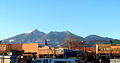
Beyond the deserts lie the Rocky Mountains. In the north, they run immediately east of the Cascade Range, so that the desert region does not reach all the way to the Canadian border. The Rockies are hundreds of miles wide and run uninterrupted from New Mexico to Alaska. The tallest peaks of the Rockies, some of which are over 14,000 feet (c. 4,250 meters), are found in central Colorado.
Rivers
The West has several long rivers that empty into the Pacific Ocean, while the eastern rivers run into the Gulf of Mexico. The Mississippi River forms the easternmost boundary for the West today. The Missouri River, a tributary of the Mississippi, flows from its headwaters in the Rocky Mountains eastward across the Great Plains, a vast grassy plateau, before sloping gradually down to the forests and then the Mississippi.
The Colorado River snakes through the Mountain states, forming the Grand Canyon. The Colorado is a major source of water in the Southwest and many dams, such as the Hoover Dam, form reservoirs along it. So much water is drawn for drinking water throughout the West and irrigation in California that in some years, water from the Colorado no longer reaches the Gulf of California. The Columbia River, the largest river in volume flowing into the Pacific Ocean from North America, and its tributary, the Snake River, water the Pacific Northwest. The Platte runs through Nebraska and is a mile (2 km) wide but only a half-inch (1 cm) deep. The Rio Grande River forms the border between Texas and Mexico before turning north and splitting New Mexico in half.
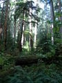
Olympic National Park

Antelope Canyon
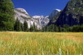
Yosemite
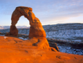
Delicate Arch
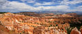
Bryce Canyon
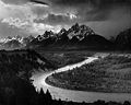
The Tetons
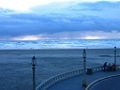
Pacific Ocean
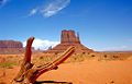
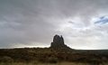
Monument Valley

Rogue River
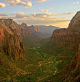
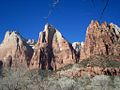
Angels Landing in Zion NP
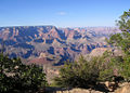
Grand Canyon
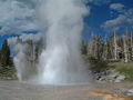
Geyser at Yellowstone
Extinct Volcano, Utah

Alaska
El Capitan, Texas
Zion National Park
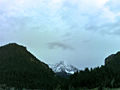
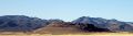
Western Rocky Mountains

Pacific Ocean at Pebble Beach, CA
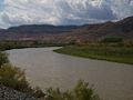
Colorado River
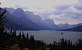
Glacier NP
Colorado Plateau in northwest New Mexico
United States/Mexico border
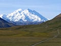
Mount McKinley, Alaska: highest point in North America.
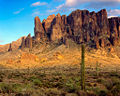
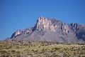
Superstition Mountains


Climate and agriculture


The seasonal temperatures vary greatly throughout the West. Annual rainfall is greater in the eastern portions, gradually tapering off until reaching the Pacific Coast, where it again increases. In fact, the greatest annual rainfall in the United States falls in the coastal regions of the Pacific Northwest. The heaviest snows in the nation fall in the Rockies. Drought is much more common in the West than the rest of the United States; the driest place recorded is Death Valley, California.
Violent thunderstorms occur east of the Rockies. Tornadoes occur every spring on the southern plains, with the most common and most destructive centered on Tornado Alley, which covers eastern portions of the West (Texas to North Dakota) and all states in between and to the east.
Agriculture varies depending on rainfall, irrigation, soil, elevation, and temperature extremes. The arid regions generally support only livestock grazing, chiefly beef cattle. The wheat belt extends from Texas through the Dakotas, producing most of the wheat and soybeans in the U.S. and exporting more to the rest of the world. Irrigation in the Southwest allows the growing of great quantities of fruits, nuts, and vegetables as well as grain, hay, and flowers. Texas is a major cattle and sheep raising area, as well as the nation's largest producer of cotton. Washington is famous for its apples and Idaho for its potatoes. California and Arizona are major producers of citrus crops, although growing metropolitan sprawl is absorbing much of this land.
Local state and government officials started to understand, after several surveys made during the latter part of the nineteenth century, that only action by the federal government could provide water resources needed to support the development of the West. Starting in 1902, Congress passed a series of acts authorizing the establishment of the Bureau of Reclamation to oversee water development projects in seventeen western states.
During the first half of the twentieth century, dams and irrigation projects provided water for rapid agricultural growth throughout the West and brought prosperity for several states, where agriculture had previously only been at the subsistence level. Following World War II, the West's cities experienced an economic and population boom. The population growth, mostly in the Southwest, has strained water and power resources, with water diverted from agricultural uses to major population centers, such as Las Vegas and Los Angeles.
Geology
Plains make up most of the eastern half of the West, underlain with sedimentary rock from the Upper Paleozoic, Mesozoic, and Cenozoic eras. The Rocky Mountains expose igneous and metamorphic rock from both the Precambrian and the Post-Precambrian periods. The Inter-mountain States and Pacific Northwest have huge expanses of volcanic rock from the Cenozoic period. Salt flats and salt lakes reveal a time when great inland seas covered much of what is now the West.
The Pacific states are the most geologically active areas in the United States. Earthquakes cause major damage every few years in California. While the Pacific states are the most volcanically active areas, extinct volcanoes and lava flows are found throughout most of the western half of the West.
Demographics
As defined by the United States Census Bureau, the Western region includes thirteen states and is split into two smaller units:
- The Mountain States: Montana, Wyoming, Colorado, New Mexico, Idaho, Utah, Arizona, and Nevada
- The Pacific States: Washington, Oregon, California, Alaska, and Hawaii
However, its definition of the West may not coincide with what may be historically or culturally considered the West. The entire Western region has been strongly influenced by Asian, Native, and Latino culture.
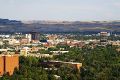
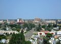
The West is still one of the most sparsely settled areas in the United States. The largest city in the region is Los Angeles, located on the West Coast. Other West Coast cities include San Diego, San Jose, San Francisco, Seattle, and Portland. Prominent cities in the Mountain States include Denver, Colorado Springs, Phoenix, Tucson, Albuquerque, Las Vegas, and Salt Lake City.
Because the tide of development had not yet reached most of the West when conservation became a national issue, agencies of the federal government own and manage vast areas of land. (The most important among these are the National Park Service and the Bureau of Land Management within the Interior Department, and the U.S. Forest Service within the Agriculture Department.)
National parks are reserved for recreational activities such as fishing, camping, hiking, and boating, but other government lands also allow commercial activities like ranching, logging, and mining. In recent years, some local residents who earn their livelihoods on federal land have come into conflict with the land's managers, who are required to keep land use within environmentally acceptable limits.
Culture


Facing both the Pacific Ocean and the Mexican border, the West has been shaped by a variety of ethnic groups. Hawaii is the only state in the union in which Asian Americans outnumber European Americans. Asians from many countries have settled in California and other coastal states in several waves of immigration since the 1800s, contributing to the Gold Rush, the building of the transcontinental railroad, agriculture, and more recently, high technology.
The southwestern border states — California, Arizona, New Mexico, and Texas—all have large Mexican-American populations, and the many Spanish place names attest to their history as former Mexican territories.
The West also contains much of the Native American population, particularly in the large reservations in the mountain and desert states.
Having once been a slave state, Texas has a sizable, non-migrant and rural, African-American population, particularly in the eastern half.
Alaska—the northernmost state—is a vast land with great stretches of wilderness, protected in national parks and wildlife refuges. Hawaii's location makes it a major gateway between the U.S. and Asia, as well as a center for tourism.
In the Pacific Coast states, the wide areas filled with small towns, farms, and forests are supplemented by a few big port cities which have evolved into world centers for the media and technology industries. Now the second largest city in the nation, Los Angeles is best known as the home of the Hollywood film industry; the area around Los Angeles also was a major center for the aerospace industry by World War II, though Boeing, located in Washington state, would come to lead the aerospace industry. Fueled by the growth of Los Angeles—as well as the San Francisco Bay Area, including Silicon Valley – California has become the most populous state. Oregon and Washington have also seen rapid growth with the rise of Boeing and Microsoft along with agriculture and resource-based industries.
The desert and mountain states have relatively low population densities and were developed as ranching and mining areas that are only recently becoming urbanized. Most of them have highly individualistic cultures and have worked to balance the interests of urban development, recreation, and the environment.
Culturally distinctive points include the large Mormon population of southeastern Idaho, Utah, northern Arizona, and Nevada; the extravagant casino resort towns of Las Vegas and Reno, Nevada; and, of course, the many Native American tribal reservations.
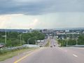
The advent of the automobile enabled the average American to tour the West. Several transcontinental interstate highways crossed the West, bringing more trade and tourists from the East.
American Old West
Major settlement of the western territories by migrants from the states in the East developed rapidly in the 1840s, largely through the Oregon Trail and the California Gold Rush of 1849; California experienced such a rapid growth in a few months that it was admitted to statehood in 1850 without the normal transitory phase of becoming an official territory. The 1850s were marked by political controversies related to the national issues leading to the Civil War. California had been established as a non-slave state and played little role in the war itself due to its geographical distance from the major campaigns. In the aftermath of the Civil War, many former Confederate partisans migrated to the West during the Reconstruction period.

The history of the American West in the late nineteenth and early twentieth centuries has acquired a cultural mythos in the literature and cinema of the United States. The image of the cowboy, the homesteader, and westward expansion took real events and transmuted them into a myth of the West that has influenced American culture since at least the 1920s.
Writers as diverse as Mark Twain, Bret Harte, and Zane Grey celebrated or derided cowboy culture, while artists such as Frederic Remington created western art as a method of recording the expansion into the West. American cinema, in particular, created the genre of the western movie, which, in many cases uses the West as a metaphor for the virtue of self-reliance. Cowboy culture has become embedded in the American experience as a common cultural touchstone, and modern forms as diverse as country and western music and the works of artist Georgia O'Keefe have celebrated the supposed sense of isolation and independence of spirit inspired by the unpopulated and relatively harsh climate of the region.
As a result of the various periods of rapid growth, many new residents were migrants who were seeking to make a new start. Other migrants harbored commercial goals in the opening country. The area developed a strong ethos of self-determinism and individual freedom, as communities were created whose residents shared no prior connection or common set of ideals and allegiances. The open land of the region allowed residents to live at a much greater distance from neighbors than had been possible in eastern cities, and an ethic of tolerance for the different values and goals of other residents developed. California's state constitutions (of both 1849 and 1879) were largely drafted by groups that placed a strong emphasis on individual property rights and personal freedom, arguably at the expense of ideals tending toward civic community.
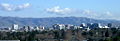
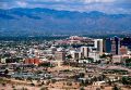
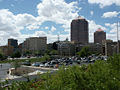
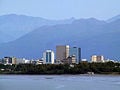
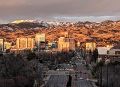
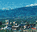
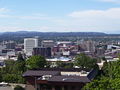
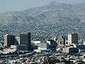
Major population centers

San Francisco, California

Portland, Oregon

Sacramento, California
San Jose, California

Las Vegas, Nevada
Tucson, Arizona
Albuquerque, New Mexico
Anchorage, Alaska

Oakland, California
Boise, Idaho
Reno, Nevada
Spokane, Washington
El Paso, Texas

Provo, Utah
Colorado Springs, Colorado
Billings, Montana
Cheyenne, Wyoming

Fort Collins, Colorado
Flagstaff, Arizona

Ogden, Utah


.jpg)


Politics
The West is far from homogeneous. With the notable exception of Orange County, California and San Diego, California, major urban centers on the Pacific Coast lean toward the Democratic Party. Seattle has historically been a center of radical left-wing politics; the union Industrial Workers of the World is particularly active, and it is one of the few American cities with a monument to the communist Vladimir Lenin.
Interior areas, especially in the Rocky Mountains, lean toward the Republican Party. Broadly speaking, the western GOP is less-influenced by conservative evangelical Christians than elsewhere in the country.
As the fastest-growing demographic group, Hispanics are hotly contested by both parties; immigration remains an important political issue for this group.
ReferencesISBN links support NWE through referral fees
- Beck, Warren A., and Tnez D. Haase. Historical Atlas of the American West. Norman, OK: University of Oklahoma Press, 1989. ISBN 0806121939
- Lamar, Howard R. The New Encyclopedia of the American West. Yale University Press, 1998. ISBN 0300070888
- Milner, Clyde A. II, Carol A. O'Connor, and Martha A. Sandweiss (eds.). The Oxford History of the American West. Oxford University Press, 1996. ISBN 0195112121
- Phillips, Charles, and Alan Axlerod (eds.). The Encyclopedia of the American West. New York: Simon & Schuster, 1996. ISBN 0028974956
- White, Richard. "It's Your Misfortune and None of My Own": A New History of the American West. University of Oklahoma Press, 1993. ISBN 0806125675
External links
All links retrieved May 4, 2023.
Credits
New World Encyclopedia writers and editors rewrote and completed the Wikipedia article in accordance with New World Encyclopedia standards. This article abides by terms of the Creative Commons CC-by-sa 3.0 License (CC-by-sa), which may be used and disseminated with proper attribution. Credit is due under the terms of this license that can reference both the New World Encyclopedia contributors and the selfless volunteer contributors of the Wikimedia Foundation. To cite this article click here for a list of acceptable citing formats.The history of earlier contributions by wikipedians is accessible to researchers here:
The history of this article since it was imported to New World Encyclopedia:
Note: Some restrictions may apply to use of individual images which are separately licensed.