Kampala
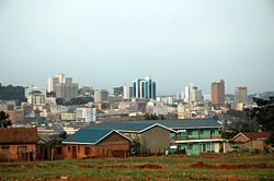
| Kampala, Uganda | |
| Kampala, Uganda | |
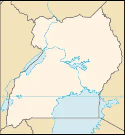
| Map of Uganda showing the location of Kampala. | |
| Coordinates: 0°19′N 32°35′E | |
|---|---|
| Province | Kampala (district) |
| Area | |
| - Total | 189 km² (73 sq mi) |
| - Land | 176 km² (68 sq mi) |
| - Water | 13 km² (5 sq mi) |
| Elevation | 1,190 m (3,904 ft) |
| Population (2002 est.) | |
| - Total | 1,208,544 |
| Time zone | EAT (UTC+3) |
Kampala is the capital city, and largest city, of Uganda. It is coterminous with the district of Kampala. The city is divided into five boroughs that oversee local planning: Central, Kawempe, Makindye, Nakawa and Rubaga.
Geography
The origin of the word impala is likely from the Zulu language in South Africa, adapted into English. The British called the area the hills of the Impala. Translated to Luganda it became "kasozi ka Impala". With time, local usage took to referring to the Kabaka's hunting expeditions as "Kabaka agenze e ka´empala ("The Kabaka has gone to Ka'mpala"). Eventually the hills became known as Kampala.[1]
Topography: Physical qualities of a particular place. Example: Mexico City a. Mountain flanked basin b. on dry lake bed c. vulnerability to earthquakes d. trapped air pollution (also true in L.A. and Athens) Elevation Climate (not required unless it makes the city a resort) The city (Johannesburg) enjoys a dry, sunny climate, with the exception of occasional late afternoon downpours in the summer months of October to April. Temperatures are usually fairly mild due to the city's high altitude, with the average maximum daytime temperature in January of 79°F (26°C), dropping to an average maximum of around 61°F (16°C) in June. Winter is the sunniest time of the year, with cool days and cold nights. The temperature occasionally drops to below freezing at night, causing frost. Snow is rare. Mean annual precipitation is 28 inches (716mm). Rivers and canals Size – land area, size comparison Environmental issues Districts
History
Before the arrival of the British, Mutesa I the Kabaka (king) of Buganda had chosen the area that was to become Kampala as one of his favourite hunting grounds. The area was made up of numerous rolling hills and lush wetlands. It was an ideal breeding ground for various game, particularly a species of antelope, the Impala (Aepyceros melampus).
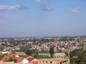
The city grew as the capital of the Buganda kingdom, from which several buildings survive, including the Kasubi Tombs (built in 1881), the Buganda Parliament, the Buganda Court of Justice and the Naggalabi Buddo Coronation Site. Severely damaged in the Uganda-Tanzania War, the city has since then been rebuilt, with constructions of new buildings including hotels, banks, shopping malls, educational institutions, hospitals and improvement of war torn buildings and infrastructure. Traditionally, Kampala was a city of seven hills, but overtime it has come to have a lot more.
Government
Economy
Uganda has substantial natural resources, including fertile soils, regular rainfall, and sizable mineral deposits of copper, cobalt, gold, and other minerals. Agriculture is the most important sector of the economy, employing over 80% of the work force. Coffee accounts for the bulk of export revenues.
Per capita GDP was estimated at $1000 in 2007.
Financial and business services sector Tourism Manufacturing Transport: Road, rail, air, sea The city is a hub for Germany’s and Europe’s high-speed passenger rail network. Autobahns radiate from Cologne's ring road. Cologne's international airport is Cologne Bonn Airport, also called Konrad Adenauer Airport. The Rhine harbor is one of the larger inland ports in Germany. Public transport within the city includes buses, a subway system, and the Rheinseilbahn aerial tramway crossing the Rhine. Cologne has pavement-edge cycle lanes linked by cycle priority crossings.
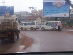
In early 2007, it was announced that Kampala would remove commuter taxis from its streets and replace them with a comprehensive city bus service, [citation needed] which will also cover the greater Kampala metropolitan area including Mukono, Mpigi, Bombo, Entebbe, Wakiso and Gayaza. The decision is yet to be implemented. Boda-bodas -local motorcycle transportation are a popular mode of transport that gives access to many areas with in and outside the city. Standard fees for these range from UGX 500 to 1000 or more. They are quite handy for those who do not want to be stuck in traffic for long. Passengers always need to ask the rider to slow down or rather take it slow so as to avert any accidents. [citation needed]
The Kampala City Council will introduce a congestion fee of sh30,000 per vehicle per day when the bus network is implemented.[2] This decision is also yet to be implemented.
Demographics
With a population of 1,208,544 (2002)[3]
Race/ethnicity - historical background of ethnic groups Language Religion Colleges and universities
Kampala has a diverse ethnic population, although the Baganda - the local tribe make up over 60% of the Greater Kampala region. The city's ethnic make up has been defined by political and economic factors. During the rule of Milton Obote and Idi Amin in the 1960s, 70's and 80's who were both from northern Uganda, a significant number of northern Ugandans moved into Kampala. Most served in the armed forces and the police. Most settled around the areas where the Military and Police barracks were located - Naguru, Bugolobi and Mbuya. With the overthrow of Milton Obote in 1986, many northern Ugandans fled the city. At the same time a large number of western Ugandans (particularly the Banyankole) moved in reflecting the large proportion of western Ugandans in the new government of Yoweri Museveni.
The mismanagement of Uganda's economy during the 1970s and 1980's meant that there were fewer employment opportunities outside Kampala. This encouraged many people from around the country to move into the city, and most have not moved back to their home districts after the revitalization of the economy in the 1990s.
Inter-tribal marriage in Uganda is still rare, and although many Kampala residents have been born and bred in the city they still define themselves by their tribal roots. This is more evident in the suburbs of the city, where local languages are spoken widely alongside English, Swahili and Luganda. Apart from the Baganda and Banyankole, other large ethnic groups include the Basoga, Bafumbira, Batoro, Bakiga, Alur, Banyoro, Iteso and Acholi.
Of interest
The main campus of Makerere University, one of East and Central Africa's premier institutes of higher learning, can be found in the Makerere Hill area of the City. Kampala is also home to the headquarters of the East African Development Bank.
Like many cities, KAPALA is said to be built on seven hills, although this isn't quite accurate.
- The first hill in historical importance is Kasubi Hill, which is where the Kasubi Tombs of the previous Kabakas are housed.
- The second is Mengo Hill where the present Kabaka's Palace is and the Headquarters of the Buganda Court of Justice.
- The third is Kibuli Hill, which is home to the Kibuli Mosque. Islam was brought to Uganda before the Christian missionaries came.
- The fourth is Namirembe Hill, home to the Namirembe Protestant Cathedral. The Protestants were the first of the Christian Missions to arrive.
- The fifth is Rubaga Hill, where the Rubaga Catholic Cathedral is, and was the headquarters of the White Fathers.
- The sixth Nsambya, was the Headquarters of the Mill Hill Mission. It now houses Nsambya Hospital.
- The seventh, the little hill of Kampala, the hill of the Impala is where the ruins of Lugard's Fort were. However, the ruins were recently destroyed (2003), when the Uganda Muslim Supreme Council (UMSC) started on reconstruction of a 15,000-seater mosque on land that included the fort. The mosque was began by President Amin but was never completed. The fort was then re-located to a nearby area (a new and similar one constructed), a move that has since been a source of controversy between The Historic Buildings Conservation Trust (HBCT) of Uganda and the UMSC. The UMSC was given the gazetted land as a gift by President Idi Amin in 1972 during its inauguration. This hill is where Kampala got its name.
The City spread to Nakasero Hill where the administrative centre and the wealthiest residential area is. There is also Tank Hill, where there is a water tank. Mulago Hill is the site of Mulago Hospital, which is the largest hospital in Uganda. Makerere Hill, where Makerere University is situated. The city is now rapidly expanding along both sides of the Makindye Hill and Konge Hill. Makindye Division incorporating Kibuli, Tank Hill and Makindye now has 300,000 residents. Medical provision in this part of town, being more recently developed, is limited. Hospitals include Kibuli Hospital, St Francis Nsambya and the International Hospital (IHK). Philanthropic health services are provided by Hope Clinic Lukuli situated between Makindye/ Konge and Tank Hills.
Suburbs include Kololo in the East on Kololo Hill the highest hill, home to the Uganda Museum; Namirembe; Kibuli; Kabalagala; Rubaga; Ntinda; Najjera; Kisassi; Nateete; Kireka; Namugongo; Najjanakumbi among others.
Other features of the city include the Ssezibwa Falls, Ugandan National Theatre, St. Balikuddembe Market (formerly Owino Market) and Nakasero Market. Kampala is also known for its nightlife, which includes a casino. Entebbe International Airport is located at Entebbe, 35 km (22 miles) away, while Port Bell on the shore of Lake Victoria is 10 km (7 miles) away.
Also to note is that Kampala hosts one of only seven Bahá'í Houses of Worship in the world. It is known as the Mother Temple of Africa and is situated on Kikaya Hill on the outskirts of the city. Its foundation stone was laid in January 1958, and was dedicated on January 13, 1961. See Bahá'í Faith in Uganda.
ReferencesISBN links support NWE through referral fees
External links
- Encyclopaedia Britannica Kampala Retrieved December 9, 2008.
- World Fact Book 2008 Uganda Retrieved December 9, 2008.
- Kampala City council Website
- Kampala Online - Website about Kampala
- Kampala Street Map
Coordinates:
| |||||||||||||
Credits
New World Encyclopedia writers and editors rewrote and completed the Wikipedia article in accordance with New World Encyclopedia standards. This article abides by terms of the Creative Commons CC-by-sa 3.0 License (CC-by-sa), which may be used and disseminated with proper attribution. Credit is due under the terms of this license that can reference both the New World Encyclopedia contributors and the selfless volunteer contributors of the Wikimedia Foundation. To cite this article click here for a list of acceptable citing formats.The history of earlier contributions by wikipedians is accessible to researchers here:
The history of this article since it was imported to New World Encyclopedia:
Note: Some restrictions may apply to use of individual images which are separately licensed.


