|
|
| (97 intermediate revisions by 5 users not shown) |
| Line 1: |
Line 1: |
| − | {{Images OK}} | + | {{Images OK}}{{Submitted}}{{Approved}}{{Copyedited}} |
| | {| class="infobox" border="1" cellpadding="4" style="width: 300px; border-collapse:collapse; font-size: 95%;" | | {| class="infobox" border="1" cellpadding="4" style="width: 300px; border-collapse:collapse; font-size: 95%;" |
| | |- | | |- |
| Line 10: |
Line 10: |
| | ! colspan=2 | Political history | | ! colspan=2 | Political history |
| | |- | | |- |
| − | | '''Chartering as<br/>[[Plymouth Council for New England]]''' | + | | '''Chartering as<br/>Plymouth Council for New England''' |
| − | | 1620-11-03<ref>Swindler, William F., ed; ''Sources and Documents of United States Constitutions.'' 10 Volumes; [[Dobbs Ferry, New York]]; [[Oceana Publications]], 1973-1979. Volume 5: Pages 16-26.</ref> | + | | 1620-11-03<ref>William F. Swindler, (ed.) ''Sources and Documents of United States Constitutions.'' 10 Volumes; (Dobbs Ferry, New York; Oceana Publications, 1973-1979), Volume 5: 16-26.</ref> |
| | |- | | |- |
| − | | '''Formation as<br/>[[United Colonies of New England]]''' | + | | '''Formation as<br/>United Colonies of New England''' |
| | | 1643 | | | 1643 |
| | |- | | |- |
| − | | '''Formation as<br/>[[Dominion of New England]]''' | + | | '''Formation as<br/>Dominion of New England''' |
| | | 1686 | | | 1686 |
| | |- | | |- |
| − | | '''[[New York]] formally<br/>incorporated into the<br/>[[Dominion of New England]]''' | + | | '''New York formally<br/>incorporated into the<br/>Dominion of New England''' |
| − | | 1688-08-11<ref name="OCALLAGHAN">O’Callaghan, E. B., ed; ''Documents Relative to the Colonial History of the State of New York, Volumes 1 - 11.'';[[Albany, New York]]; 1853-1887 ; Volume 3: Page 537</ref> | + | | 1688-08-11<ref name="OCALLAGHAN">E. B. O’Callaghan, (ed.) ''Documents Relative to the Colonial History of the State of New York, Volumes 1 - 11.'' (Albany, NY: 1853-1887), Volume 3: 537</ref> |
| | |- | | |- |
| − | | '''As a result of the<br/>[[Glorious Revolution]], Bostonians imprisoned the royal governor and others loyal to King James II, thereby ending the [[Dominion of New England]].''' | + | | '''As a result of the<br/>Glorious Revolution, Bostonians imprisoned the royal governor and others loyal to King James II, thereby ending the Dominion of New England.''' |
| − | | 1689-04-18<ref NAME="CRAVEN">Craven, Wesley Frank; ''Colonies in Transition, 1660 – 1713.'';[[New York, New York]]: [[Harper and Row]], 1968. Page 224.</ref><ref name="MORRIS AND KELLY">Morris, Gerald E., and Kelly, Richard D., eds; Maine Bicentennial Atlas: An Historical Survey. Plate 11. [[Portland, Maine]]; [[Portland Historical Society]]; 1976.</ref> | + | | 1689-04-18<ref NAME="CRAVEN">Wesley Frank Craven. 1968. ''Colonies in Transition, 1660 – 1713.'' (New York, NY: Harper and Row), 224.</ref><ref name="MORRIS AND KELLY">Gerald E. Morris, and Richard D. Kelly, (eds.) 1976. ''Maine Bicentennial Atlas: An Historical Survey.'' Plate 11. (Portland, ME: Portland Historical Society).</ref> |
| | |- | | |- |
| | ! colspan=2 | Regional statistics | | ! colspan=2 | Regional statistics |
| Line 37: |
Line 37: |
| | |- style="vertical-align: bottom;" | | |- style="vertical-align: bottom;" |
| | | '''Population'''<br /> - Total (2006)<br /> - Density | | | '''Population'''<br /> - Total (2006)<br /> - Density |
| − | | <br /> 14,269,989<ref>{{cite web | + | | <br /> 14,269,989<ref>''US Census Bureau''. [http://quickfacts.census.gov/qfd/index.html State & County QuickFacts] Retrieved November 5, 2008.</ref><br />198.2 people/sq mi (87.7 people/km²) |
| − | |publisher=US Census Bureau
| |
| − | |title=State & County QuickFacts
| |
| − | |url=http://quickfacts.census.gov/qfd/index.html
| |
| − | |accessdate=2008-07-24}}</ref><br />198.2 people/sq mi (87.7 people/km²)
| |
| | |- style="vertical-align: bottom;" | | |- style="vertical-align: bottom;" |
| | |} | | |} |
| − | '''New England''' is a region of the [[United States]] located in the northeastern corner of the country, consisting of the modern states of [[Maine]], [[New Hampshire]], [[Vermont]], [[Massachusetts]], [[Rhode Island]], and [[Connecticut]].<ref>{{cite web|url=http://www.britannica.com/EBchecked/topic/411409/New-England|title=New England|publisher=Encyclopædia Britannica, Inc.|accessdate=2008-07-24}}</ref> | + | '''New England''' is a region of the [[United States]] located in the northeastern corner of the country, comprised of [[Maine]], [[New Hampshire]], [[Vermont]], [[Massachusetts]], [[Rhode Island]], and [[Connecticut]]. |
| | | | |
| − | In one of the earliest English settlements in the [[New World]], English [[Pilgrims]] fleeing [[religious]] persecution in Europe first settled in New England in 1620, in the colony of [[Plymouth Colony|Plymouth]]. In the late 18th century, the New England colonies would be among the first North American [[British Empire|British]] colonies to demonstrate ambitions of [[American Revolution|independence]] from the [[Monarchy of the United Kingdom|British Crown]], although they would later oppose the [[War of 1812]] between the United States and [[United Kingdom of Great Britain and Ireland|Britain]]. | + | In one of the earliest English settlements in the [[New World]], English [[Pilgrims]] fleeing [[religion|religious]] persecution in [[Europe]] first settled in New England in November 1620, establishing [[Plymouth Colony]]. In the mid-eighteenth century, the New England colonies became the first North American [[British Empire|British]] colonies to demonstrate ambitions of independence. |
| | | | |
| − | In the 19th century, it played a prominent role in the movement to [[Abolitionism|abolish]] [[slavery]] in the United States, hosted the first pieces of [[American literature]] and [[philosophy]], was home to the beginnings of free public education, and was the first region of the United States to be transformed by the North American [[Industrial Revolution]].<ref name=autogenerated1>"New England," Microsoft Encarta Online Encyclopedia 2006 http://encarta.msn.com © 1997–2006 Microsoft Corporation. All Rights Reserved.</ref> | + | In the nineteenth century, citizens of the region, along with those of the [[Seneca Falls Convention]] in [[New York]], played a prominent role in the [[United States]] [[Abolitionism|abolitionist]] movement. New England is the birthplace of distinctly [[American literature]] and the [[philosophy]] termed [[transcendentalism]]. It is considered home to the beginnings of [[public education]] and the first region of the United States to be transformed by the [[Industrial Revolution]]. |
| | + | {{toc}} |
| | + | New England is the traditional center of ethnic [[England|English]] [[culture]] and [[ancestor|ancestry]] in the United States. |
| | | | |
| − | ==History== | + | == Geography == |
| − | [[Image:New England blank flag.svg|thumb|right|An early flag of the Massachusetts Bay Colony.<ref>{{cite web | + | [[Image:New england ref 2001.jpg|thumb|New England. Geographical map, 2001]] |
| − | |author=David B. Martucci
| + | |
| − | |url=http://www.midcoast.com/~martucci/flags/NEFlag.html
| + | New England's rolling hills, [[mountain]]s, and jagged coastline are a consequence of retreating ice sheets. The coastline, extending from southwestern [[Connecticut]] to northeastern [[Maine]], is dotted with [[lake]]s, hills, [[swamp]]s, and sandy beaches. Further inland are the [[Appalachian Mountains]], extending through Connecticut, [[Massachusetts]], [[Vermont]], [[New Hampshire]], and Maine. Among them, in the [[White Mountains (New Hampshire)|White Mountains]] of New Hampshire is [[Mount Washington (New Hampshire)|Mount Washington]], which at 6,288 feet (1,917 m), is the highest peak in the northeastern [[United States]]. It is also the site of the highest recorded wind speed on Earth: during an April 1934 storm, a wind gust measured at 231 miles per hour (372 kilometers per hour) pushed across the summit of Mount Washington.<ref> ''Mount Washington Observatory''. [http://www.mountwashington.org/about/visitor/recordwind.php The Story of the World Record Wind] Retrieved November 5, 2008.</ref> Vermont's [[Green Mountains]], which become the Berkshires in western Massachusetts, are smaller than the White Mountains. |
| − | |title=THE NEW ENGLAND FLAG
| |
| − | |accessdate=2008-07-25
| |
| − | |publisher=D. MARTUCCI}}</ref>]]
| |
| − | [[Image:New England pine flag.svg|thumb|The Flag of New England during the [[Revolutionary War]]. [http://www.crwflags.com/fotw/flags/us-neng.html] ]] | |
| − | New England's earliest inhabitants were [[Algonquian]]-speaking [[Native Americans in the United States|Native Americans]] including the [[Abenaki]], the [[Penobscot]], and the [[Wampanoag]]. Prior to the arrival of Europeans, the Western Abenakis inhabited New Hampshire and Vermont, as well as parts of [[Québec]] and western Maine. Their principal town was Norridgewock, in present-day Maine. The Penobscot were settled along the [[Penobscot River]] in Maine. The Wampanoag occupied southeastern Massachusetts, Rhode Island, and the islands of [[Martha's Vineyard]] and [[Nantucket]].
| |
| | | | |
| − | Compared to other North American settlements, New England was sparsely populated and densely forested, leading European settlers to believe North America was a "virgin land."<ref>{{cite web|url=http://www.sciam.com/article.cfm?chanID=sa006&articleID=2691D716-E7F2-99DF-38F54EF6075AAB4D&pageNumber=3&catID=2&colId=1|publisher=Scientific American, Inc.|title=An Earth Without People|accessdate=2007-08-13}}</ref>
| + | The longest [[river]] is the [[Connecticut River]], which flows from northeastern New Hampshire for 407 miles (655 km), emptying into [[Long Island Sound]]. [[Lake Champlain]], wedged between Vermont and New York, is the largest lake in the region. |
| | | | |
| − | ===The Virginia Companies compete=== | + | ===Climate=== |
| − | On April 10, 1606, King [[James I of England]] issued two charters, one each for the [[Virginia Company|Virginia Companies]], of [[London]] and [[Plymouth]], respectively.<ref name="PAULLIN1">Paullin, Charles O.; ''Atlas of the Historical Geography of the United States.''; Edited by John K. Wright; New York, New York and Washington, D.C.: Carnegie Institution of Washington and American Geographical Society of New York, 1932:Plate 42.; ; Excellent section on International and interstate boundary disputes.</ref><ref name="SWINDLER1">Swindler, William F.., ed. ''Sources and Documents of United States Constitutions.'' 10 Volumes; Dobbs Ferry, New York; Oceana Publications, 1973-1979; Vol. 10; Pps. 17-23; The most complete and up-to-date compilation for the states.</ref><ref name="VAN ZANDT1">Van Zandt, Franklin K.; ''Boundaries of the United States and the Several States''; Geological Survey Professional Paper 909. Washington, D.C.; Government Printing Office; 1976. The standard compilation for its subject.; Page 92.</ref>
| + | Weather patterns are highly variable, and the [[climate]] varies throughout the region. Maine, New Hampshire, and Vermont have a humid continental short summer climate, with cooler [[summer]]s and long, cold [[winter]]s. Connecticut, Massachusetts, and Rhode Island have a humid continental long summer climate, with hot summers and cold winters. Owing to thick [[deciduous]] [[forest]]s, fall in New England brings bright and colorful [[foliage]], which comes earlier than in other regions, attracting tourists. Average [[rain]]fall generally ranges from 40 to 60 inches (1,000 to 1,500 mm) a year. [[Snow]]fall can often exceed 100 inches (2,500 mm) annually. As a result, the mountains of Vermont and New Hampshire are popular destinations in the winter, with numerous commercial [[skiing|ski]] resorts.<ref>''Climate Change Research Center''. [http://www.neci.sr.unh.edu/neccwaq.html#4 A Climate Primer for New England] Retrieved November 5, 2008.</ref> |
| | | | |
| − | *Under the charters, the territory allocated was defined as follows:
| + | ==History== |
| − | #'''Virginia Company of London''': All land, including islands within 100 Miles from the coast and implying a westward limit of 100 Miles, between 34 Degrees (Cape Fear, North Carolina) and 41 Degrees (Long Island Sound, New York) north latitude.<ref name="PAULLIN1"/><ref name="SWINDLER1"/><ref name="VAN ZANDT1"/>
| + | [[Image:New England blank flag.svg|thumb|right|An early flag of the [[Massachusetts Bay Colony]].]] |
| − | #'''Virginia Company of Plymouth''': All land, including islands within 100 Miles from the coast and implying a westward limit of 100 Miles, between 38 Degrees (Chesapeake Bay, Virginia) and 45 Degrees (Border between Canada and Maine) north latitude.<ref name="PAULLIN1"/><ref name="SWINDLER1"/><ref name="VAN ZANDT1"/>
| + | [[Image:New England pine flag.svg|thumb|The Flag of New England during the [[Revolutionary War]].]] |
| | + | New England's earliest inhabitants were [[Algonquian]]-speaking [[Native American]]s including the [[Abenaki]], the [[Penobscot]], and the [[Wampanoag]]. Prior to the arrival of [[Europe]]ans, the Western Abenakis inhabited [[New Hampshire]] and [[Vermont]], as well as parts of [[Québec]] and western [[Maine]]. The Penobscot were settled along the Penobscot River in Maine. The Wampanoag occupied southeastern [[Massachusetts]], [[Rhode Island]], and the islands of [[Martha's Vineyard]] and [[Nantucket]]. |
| | | | |
| − | *Realizing the obvious duplication (between Chesapeake Bay and Long Island Sound), the two companies were required to maintain a separation of 100 Miles, even where the two charters overlapped.<ref name="PAULLIN1"/><ref name="SWINDLER1"/><ref name="VAN ZANDT1"/>
| + | ===The Virginia Companies compete=== |
| | + | On April 10, 1606, King [[James I of England]] issued two charters, one each for the [[Virginia Company|Virginia Companies]], of [[London]] and [[Plymouth]], respectively. |
| | | | |
| − | These were privately funded proprietary ventures, and the purpose of each was to claim land for England, trade, and return a profit.<ref>"In addition to claiming land for England and bringing the faith of the Church of England to the native peoples, each of the Virginia Companies was also enjoined both by the crown and its members to make a tidy profit by whatever means it found expedient." http://www.nps.gov/colo/Jthanout/TobaccoHistory.html</ref> Competition between the two companies grew to where their potential New World territory overlapped, and would be finalized based upon results. | + | These were privately funded proprietary ventures, the purpose of each being to claim land for [[England]], trade, and return a profit. Competition between the two companies grew to where their potential [[New World]] territory overlapped and would be finalized based upon results. |
| | | | |
| − | The London Company was authorized to make settlements from North Carolina to New York (31 to 41 degrees North Latitude), provided there was no conflict with the Plymouth Company’s charter. | + | The London Company was authorized to make settlements from [[North Carolina]] to [[New York]], provided there was no conflict with the Plymouth Company’s charter. |
| | | | |
| − | The Popham Colony was planted by the [[Virginia Company of Plymouth]]. Unlike the Jamestown Settlement, it was not initially successful, and was abandoned after one year, though would later be revived. The Virginia Company of Plymouth's charter included land extending as far as present-day northern Maine.<ref>{{cite web | + | The Popham Colony was planted by the [[Virginia Company of Plymouth]]. It was not initially successful and was abandoned after one year, though would later be revived. The Virginia Company of Plymouth's charter included land extending as far as present-day northern [[Maine]]. [[John Smith of Jamestown|Captain John Smith]], exploring the shores of the region in 1614, named the region "New England" in his account of two voyages there, published as ''A Description of New England''.<ref>''University of Nebraska-Lincoln''. [http://digitalcommons.unl.edu/etas/4/ ''A Description of New England'']. Retrieved November 5, 2008.</ref> |
| − | |url=http://www.learner.org/channel/workshops/primarysources/virginia/transcript01.html|title=The Virginia Company: Lecture Transcript One|accessdate=2008-08-25|publisher=Annenberg Media}}</ref> [[Captain John Smith]], exploring the shores of the region in 1614, named the region "New England"<ref>{{cite web|url=http://www.britannica.com/eb/article?tocId=9055457|title=New England|accessdate=2008-08-25|publisher=Encyclopædia Britannica, Inc.}}</ref> in his account of two voyages there, published as [http://digitalcommons.unl.edu/etas/4/ ''A Description of New England''].
| |
| | | | |
| | ===Plymouth Council for New England=== | | ===Plymouth Council for New England=== |
| | [[Image:New-England-coin.jpg|150px|thumb|right|The first coins struck in the Colonies were the silver New England coins.]] | | [[Image:New-England-coin.jpg|150px|thumb|right|The first coins struck in the Colonies were the silver New England coins.]] |
| | + | The name "New England" was officially sanctioned on November 3, 1620, when the charter of the Virginia Company of Plymouth was replaced by a [[royal charter]] for the [[Plymouth Council for New England]], a [[joint stock]] company established to colonize and govern the region. |
| | | | |
| − | The "first landing" of the Mayflower Pilgrims was in [[Provincetown, Massachusetts]] on November 21, 1620, and their signing of the Mayflower Compact here. | + | The "first landing" of the [[Pilgrims]], English religious separatists, was in Provincetown, Massachusetts, on November 21, 1620, and their signing of the [[Mayflower Compact]] took place there. Shortly afterward, in December 1620, a permanent settlement was established at present-day Plymouth. The [[Massachusetts Bay Colony]], which would come to dominate the area, was established in 1628, with its major city of [[Boston]] established in 1630. |
| − | | |
| − | The name "New England" was officially sanctioned on November 3, 1620, when the charter of the Virginia Company of Plymouth was replaced by a [[royal charter]] for the [[Plymouth Council for New England]], a [[joint stock]] company established to colonize and govern the region.<ref>"...joint stock company organized in 1620 by a charter from the British crown with authority to colonize and govern the area now known as New England." New England, Council for. (2006). In Encyclopædia Britannica. Retrieved July 13, 2006, from Encyclopædia Britannica Premium Service: http://www.britannica.com/eb/article?tocId=9055458</ref> Shortly afterwards, in December 1620, a permanent settlement was established at present-day [[Plymouth, MA]] by the [[Pilgrims]], English religious separatists arriving via [[Netherlands|Holland]]. The [[Massachusetts Bay Colony]], which would come to dominate the area, was established in 1628 with its major city of [[Boston]] established in 1630.
| |
| | | | |
| − | Banished from Massachusetts, [[Roger Williams (theologian)|Roger Williams]] led a group south, and founded [[Providence, Rhode Island]] in 1636. On March 3 of the same year, the Connecticut Colony was granted a charter, and established its own government. At this time, Vermont was yet unsettled, and the territories of [[New Hampshire]] and [[Maine]] were governed by [[Massachusetts]]. | + | Banished from Massachusetts, [[Williams, Roger (theologian)|Roger Williams]] led a group south and founded Providence, [[Rhode Island]], in 1636. On March 3 of the same year, the [[Connecticut]] Colony was granted a charter and established its own government. At this time, [[Vermont]] was unsettled, and the territories of [[New Hampshire]] and [[Maine]] were governed by [[Massachusetts]]. |
| | | | |
| | ===New England Confederation=== | | ===New England Confederation=== |
| − | In these early years, relationships between colonists and Native Americans alternated between peace and armed skirmishes. Six years after the bloodiest of these, the [[Pequot War]], in 1643 the colonies of [[Massachusetts Bay Colony|Massachusetts Bay]], [[Plymouth Colony|Plymouth]], [[New Haven Colony|New Haven]], and [[Connecticut Colony|Connecticut]] joined together in a loose compact called the [[New England Confederation]] (officially "The United Colonies of New England"). The confederation was designed largely to coordinate mutual defense against possible wars with [[Native Americans in the United States|Native Americans]], the [[Netherlands|Dutch]] in the [[New Netherland]] colony to the west, the [[New Spain|Spanish]] in the south, and the French in [[New France]] to the north, as well as to assist in the return of runaway [[slave]]s. The confederation lost its influence when Massachusetts refused to commit itself to a war against the Dutch. | + | In these early years, relationships between colonists and [[Native American]]s alternated between [[peace]] and armed skirmishes. Six years after the bloodiest of these, the [[Pequot War]], in 1643 the colonies of [[Massachusetts Bay Colony|Massachusetts Bay]], [[Plymouth Colony|Plymouth]], New Haven, and [[Connecticut Colony|Connecticut]] joined together in a loose compact called the [[New England Confederation]] (officially "The United Colonies of New England"). The confederation was designed largely to coordinate mutual defense against possible [[war]]s with Native Americans, the [[Netherlands|Dutch]] in the [[New Netherland]] colony to the west, the [[New Spain|Spanish]] in the south, and the French in [[New France]] to the north, as well as to assist in the return of runaway [[slave]]s. The confederation lost its influence when Massachusetts refused to commit itself to a war against the Dutch. |
| − | | |
| − | The first [[coin]]s struck in the Colonies, prompted by a shortage of change, were the New England coins produced by the Massachusetts Bay Colony. The first series was a simple design including "NE" on the obverse and the various denominations on the reverse. Other series included the "Willow," "Oak," and "Pine Tree." The "Pine Tree" coinage was the last type in the series, struck by coiner John Hull. Although the majority were dated 1652, it is generally acknowledged that production spanned about thirty years, despite the disapproval of [[Charles II of England|King Charles II]].<ref>Charles French and Scott Mitchell. ''American Guide To U.S. Coins: The Most Up-to-Date Coin Prices Available''. Available at: http://www.coin-collecting.info/American/early.html (Accessed August 14, 2006).</ref>
| |
| | | | |
| | ===Dominion of New England=== | | ===Dominion of New England=== |
| | [[Image:Pieter van der Aa New England 1707.jpg|thumb|left|New England map of 1707]] | | [[Image:Pieter van der Aa New England 1707.jpg|thumb|left|New England map of 1707]] |
| − | In 1686, [[James II of England|King James II]], concerned about the increasingly independent ways of the colonies, including their self-governing charters, open flouting of the [[Navigation Acts]], and increasing military power, established the [[Dominion of New England]], an administrative union comprising all of the New England colonies. On August 11, 1688, the provinces of [[Province of New York|New York]] and [[Province of New Jersey|New Jersey]], seized from the Dutch in 1664, and confirmed on September 12, 1673, were added<ref name="OCALLAGHAN"/>. The union, imposed from the outside and contrary to the rooted democratic tradition of the region, was highly unpopular among the colonists.<!---appears to tell when these two states were added but never tells when they were subtracted. If it's important enough to be here when added, it should be important enough to be here when subtracted IMO---> | + | In 1686, [[James II of England|King James II]], concerned about the increasingly independent ways of the colonies, including their self-governing charters, open flouting of the [[Navigation Acts]], and increasing military power, established the [[Dominion of New England]], an administrative union comprising all of the New England colonies. On August 11, 1688, the provinces of New York and New Jersey, seized from the Dutch in 1664, were added. The union, imposed from the outside and contrary to the rooted democratic tradition of the region, was highly unpopular among the colonists. |
| | | | |
| − | Nevertheless, those two present states are reckoned as "greater New England" in a social or cultural context, as that is where Yankee colonists expanded to; before 1776. Indeed, the identity in that era changed once one moved to [[Pennsylvania]], as the Pennamite-Yankee War attests to. Colonists from New England proper in that era, were rather well received in the [[Mohawk Valley]] and on [[Long Island]] in New York. To this day, the cultural legacy of New England is easy to detect by the vast majority of other Americans.
| + | After the [[Glorious Revolution]] in 1689, [[Boston]]ians imprisoned the Royal Governor and other sympathizers of King [[James II]], thus ending the Dominion Of New England de facto. The charters of the colonies were significantly modified after this change in English politics, with the appointment of Royal Governors to nearly every colony. An uneasy tension existed between the Royal Governors, their officers, and the elected governing bodies of the colonies. The governors wanted unlimited authority, and the different layers of locally elected officials would often resist them. In most cases, the local town governments continued operating as self-governing bodies. This tension culminated in the [[American Revolution]]. |
| | | | |
| − | After the [[Glorious Revolution]] in 1689, Bostonians imprisoned the Royal Governor and other sympathizers of King James II on [[April 18, 1689]], thus ending the Dominion Of New England ''de facto'' <ref name="CRAVEN"/><ref name="MORRIS AND KELLY"/>. The charters of the colonies were significantly modified after this change in English politics, with the appointment of Royal Governors to nearly every colony. An uneasy tension existed between the Royal Governors, their officers, and the elected governing bodies of the colonies. The governors wanted unlimited authority, and the different layers of locally elected officials would often resist them. In most cases, the local town governments continued operating as self-governing bodies, just as they had before the appointment of the Royal Governors. This tension culminated itself in the [[American Revolution]], boiling over with the breakout of the [[American War of Independence]] in 1775.
| + | ===New England and political thought=== |
| − | | + | [[Image:SamuelAdamsLarge.jpeg|thumb|right|[[Samuel Adams]], a brewer and [[Patriotism|patriot]] during the revolutionary period]] |
| − | ===Region of the United States===
| + | [[Image:BCburnslawnsunset.jpg|250px|thumb|right|Boston College: The Old World's enduring influence over New England is evident in its [[architecture]].]] |
| − | [[Image:BCburnslawnsunset.jpg|300px|thumb|right|Boston College: The Old World's enduring influence over New England is evident in the architecture]] The colonies were now formally united as newly-formed states in a larger (but not yet federalist) union [[United States of America]]. | |
| − | In the 18th century and the early 19th century, New England was still considered to be a very distinct region of the colony and country, as it is today. During the [[War of 1812]], there was a limited amount of talk of secession from the Union, as New England merchants, just getting back on their feet, opposed the war with their greatest trading partner - [[Kingdom of Great Britain and Ireland|Great Britain]].<ref>James Schouler, History of the United States vol 1 (New York: Dodd, Mead & Company. 1891; copyright expired).</ref> The [[Hartford Convention]] of 1814 considered secession, but failed to act on it.
| |
| − | | |
| − | For the remainder of the Antebellum period, New England remained distinct. Politically, it often went against the grain of the rest of the country. Massachusetts and Connecticut were among the last refuges of the Federalist Party, and when the Second Party System began in the 1830s, New England became the strongest bastion of the new [[Whig Party (United States)|Whig Party]] - the Whigs were usually dominant throughout New England, except in the more Democratic Maine and New Hampshire. Many of the leading statesmen - including most prominently [[Daniel Webster]] - hailed from the region. New England was also distinct in other ways. It was, as a whole, the most urbanized part of the country (the 1860 Census showed that 32 of the 100 largest cities in the country were in New England), as well as the most educated. Many of the major literary and intellectual figures produced by the United States in the Antebellum period were New Englanders, including [[Ralph Waldo Emerson]], [[Henry David Thoreau]], [[Nathaniel Hawthorne]], [[Henry Wadsworth Longfellow]], [[John Greenleaf Whittier]], [[George Bancroft]], [[William H. Prescott]], and others.
| |
| | | | |
| − | New England was also an early center of the industrial revolution. Towns like [[Lawrence, Massachusetts|Lawrence]] and [[Lowell, Massachusetts|Lowell]], Massachusetts and [[Lewiston, Maine]] became famed as centers of the textile industry.
| + | During the colonial period and the early years of the American republic, New England leaders like [[John Hancock]], [[John Adams]], and [[Samuel Adams]] joined those in [[Philadelphia]] and [[Virginia]] to assist and lead the newly forming country. |
| | | | |
| − | New England and areas settled from New England, like Upstate New York, Ohio's [[Western Reserve]] and the upper midwestern states of [[Michigan]] and [[Wisconsin]], also proved to be the center of the strongest [[abolitionist]] sentiment in the country. Prominent abolitionists like [[William Lloyd Garrison]] and [[Wendell Phillips]] were New Englanders, and the region was also home to prominent anti-slavery politicians like [[John Quincy Adams]], [[Charles Sumner]], and [[John P. Hale]]. When the anti-slavery [[Republican Party (United States)|Republican Party]] was formed in the 1860s, all of New England, including areas which had previously been strongholds for both the Whig and the Democratic Parties, became strongly Republican, as it would remain until the early 20th century, when immigration would begin to turn the formerly solidly Republican states of Lower New England towards the Democrats.
| + | The colonies were now formally united as newly formed states in a larger (but not yet federalist) union, the [[United States of America]]. During the [[War of 1812]], there was a limited amount of talk of secession from the Union, as New England merchants, just getting back on their feet, opposed the war with their greatest trading partner - [[Kingdom of Great Britain and Ireland|Great Britain]].<ref>James Schouler. 1891. ''History of the United States vol 1.'' (New York: Dodd, Mead & Company.)</ref> |
| | | | |
| − | Aside from the Canadian province of [[Nova Scotia]], or "New Scotland," New England is the only North American region to inherit the name of a kingdom in the [[British Isles]]. New England has largely preserved its regional character, especially in its historic places. Its name is a reminder of the past, as many of the original English-Americans have migrated further west. Today, the region is more ethnically [[Diversity (politics)|diverse]], having seen waves of [[immigration]] from Ireland, [[Québec]], Italy, [[Portugal]], Asia, [[Latin America]], Africa, other parts of the United States, and elsewhere. The enduring European influence can be seen in the region, from Massachusetts' use of traffic [[roundabout|rotaries]] to the bilingual French and English towns of northern Vermont, Maine, and New Hampshire, as innocuous as the sprinkled use of [[American and British English spelling differences|British spelling]], and as obvious as the region's heavy prevalence of English town and county names, and its unique, often non-[[Rhotic and non-rhotic accents|rhotic]] coastal dialect reminiscent of southeastern England.
| + | For the remainder of the Antebellum period, New England remained distinct. Politically, it often went against the grain of the rest of the country. Massachusetts and Connecticut were among the last refuges of the [[Federalist Party]]. Many of the leading statesmen - including most prominently [[Daniel Webster]] - hailed from the region. New England was also distinct in other ways. It was, as a whole, the most urbanized part of the country (the 1860 census showed that 32 of the 100 largest cities in the country were in New England), as well as the most educated. |
| | | | |
| − | New England is the traditional center of [[English people|ethnic English]] ancestry and culture in the United States. The only place in the U.S. outside New England with a significant majority English ethnicity is [[Utah]]-[[Eastern Idaho]]—the traditional core of the [[Jello Belt]] region, whose proportion of [[English American]]s is actually ''higher'' today than New England, with Utah being the most English of U.S. states with 29.0% English ancestry, followed by New England states Maine with 21.5% and Vermont with 18.4%. This population is contrastingly far more conservative than modern New England and is mainly [[Church of Jesus Christ of Latter-day Saints|LDS]] in religion, but its substratal cultural character is largely reminiscent of both early 19th century New England and [[Victorian England]] (due to later direct [[handcart]] immigration). | + | New England was also an early center of the [[industrial revolution]]. Towns like Lawrence and Lowell, Massachusetts, and Lewiston, Maine, became famed as centers of the [[textile]] industry. |
| | | | |
| − | {{see also|List of place names in New England of aboriginal origin}}
| + | New England and areas settled from New England, like Upstate New York, Ohio's Western Reserve and the [[Upper Midwest]] states of [[Michigan]] and [[Wisconsin]], also proved to be the center of the strongest [[Abolitionism|abolitionist]] sentiment in the country. Prominent abolitionists like [[William Lloyd Garrison]] and [[Wendell Phillips]] were New Englanders, and the region was also home to prominent anti-[[slavery]] politicians like [[John Quincy Adams]], [[Charles Sumner]], and [[John P. Hale]]. When the anti-slavery [[Republican Party (United States)|Republican Party]] was formed in the 1860s, all of New England, including areas that had previously been strongholds for both the Whig and the Democratic Parties, became strongly Republican (as it would remain until the early twentieth century, when immigration would begin to turn the formerly solidly Republican states of Lower New England toward the Democrats). |
| | | | |
| − | == Geography and climate ==
| + | At the time of the [[American Civil War]], New England, the [[Mid-Atlantic States|mid-Atlantic]], and the Midwest, which had long since abolished [[slavery]], united against the [[Confederate States of America]], ending the practice in the United States. |
| − | [[Image:New england ref 2001.jpg|thumb|New England. Geographical map, 2001]] | |
| − | [[Image:Maine-coast-USGS.jpg|125px|thumb|left|A [[USGS]] map depicts a small piece of Maine's fjordlike coast.]] | |
| | | | |
| − | New England's long rolling hills, mountains, and jagged coastline are a consequence of retreating ice sheets from prehistoric times. The coast of the region, extending from southwestern Connecticut to northeastern Maine, is dotted with lakes, hills, swamps, and sandy beaches. Further inland are the [[Appalachian Mountains]], extending through Connecticut, Massachusetts, Vermont, New Hampshire, and Maine. Among them, in the [[White Mountains (New Hampshire)|White Mountains]] of New Hampshire is [[Mount Washington (New Hampshire)|Mount Washington]], which at 1,917 m (6,288 ft), is the highest peak in the northeast United States. It is also the site of the highest recorded wind speed on Earth.<ref>{{cite web|url=http://www.mountwashington.org/about/visitor/recordwind.php|title=The Story of the World Record Wind|publisher=Mount Washington Observatory|accessdate=2007-08-13}}</ref> Vermont's [[Green Mountains]], which become the [[The Berkshires|Berkshire Hills]] in western Massachusetts, are smaller than the White Mountains. Valleys in the region include the [[Connecticut River Valley]] and the [[Merrimack Valley]]. | + | New England has largely preserved its regional character, especially in its historic places. Its name is a reminder of the past, as many of the original English-Americans have migrated farther west. Today, the region is more ethnically diverse, having seen waves of [[immigration]] from [[Ireland]], [[Québec]], [[Italy]], [[Portugal]], [[Asia]], [[Latin America]], [[Africa]], other parts of the United States, and elsewhere. The enduring European influence can be seen in the region's heavy prevalence of English town and county names, and its unique, often non-rhotic coastal dialect reminiscent of southeastern [[England]]. |
| − | | |
| − | The longest river is the [[Connecticut River]], which flows from northeastern New Hampshire for 655 km (407 mi), emptying into the [[Long Island Sound]]. [[Lake Champlain]], wedged between Vermont and New York, is the largest lake in the region, followed by [[Moosehead Lake]] (Maine), [[Lake Winnipesaukee]] (New Hampshire), [[Quabbin Reservoir]] (Massachusetts), and [[Candlewood Lake]] (Connecticut).
| |
| − | | |
| − | Weather patterns are highly variable and climate varies throughout the region. Maine, New Hampshire, and Vermont have a humid continental short summer climate, with cooler summers and long, cold winters. Connecticut, Massachusetts, and Rhode Island, have a humid continental long summer climate, with hot summers and cold winters. Owing to thick [[deciduous]] forests, fall in New England brings bright and colorful [[foliage]], which comes earlier than in other regions, attracting tourism by 'leaf peepers'.<ref>{{cite web|url=http://www.discovernewengland.org/foliage/index.shtml|title=New England's Fall Foliage|publisher=Discover New England|accessdate=2007-08-13}}</ref> Springs are generally wet and cloudy. Average rainfall generally ranges from 1,000 to 1,500 mm (40 to 60 in) a year, although the northern parts of Vermont and Maine see slightly less, from 500 to 1,000 mm (20 to 40 in). Snowfall can often exceed 2,500 mm (100 in) annually. As a result, the mountains of Vermont and New Hampshire are popular destinations in the winter, with numerous commercial ski resorts.<ref name=autogenerated1 /><ref>New England Climate Initiative. Available at: http://www.neci.sr.unh.edu/neccwaq.html#4 (Accessed July 26, 2006).</ref>
| |
| | | | |
| | ==Population== | | ==Population== |
| | + | [[Image:DowntownBoston.jpg|225px|thumb|right|[[Boston]] is considered to be the cultural and historical capital of New England.]] |
| | + | [[Image:Providence skyline2crop.jpg|225px|thumb|Providence, one of the first cities in the United States, is estimated to be the third-largest city in New England.]] |
| | + | [[Image:WorcesterMA Downtown.jpg|225px|thumb|right|Downtown Worcester, Massachusetts, with City Hall at the right]] |
| | + | [[Image:Hartford, Connecticut (1175).jpg|thumb|225px|Hartford, the "Insurance Capital of the World."]] |
| | | | |
| − | [[Image:DowntownBoston.jpg|300px|thumb|right|[[Boston, Massachusetts|Boston]] is considered to be the cultural and historical capital of New England, though today [[New York City]] exerts strong influence on the region's southwest corner.]] | + | In 2000, the total population of New England was 13,922,517, roughly twice its 1910 population of 6,552,681.<ref>''Rhode Island Division of Planning''. [http://www.planning.state.ri.us/census/pdf%20files/pdf/NE1800-2000.PDF NEW ENGLAND POPULATION BY STATE: 1800 - 2000] Retrieved November 5, 2008.</ref> Three-quarters of New England's population and most of its major cities are concentrated in its three southernmost states: [[Connecticut]], [[Massachusetts]], and [[Rhode Island]]. These three are among the four most densely populated states in the [[United States]]; only [[New Jersey]] has a higher population density. Their combined population density is 786.83/sq mi, compared to northern New England's 63.56/sq mi (2000 census). The most populous state is Massachusetts, and the most populous city is Massachusetts' political and cultural capital, [[Boston]]. |
| | | | |
| − | In 2000, the total population of New England was 13,922,517, roughly twice its 1910 population of 6,552,681.<ref>{{cite web|url=http://www.planning.state.ri.us/census/pdf%20files/pdf/NE1800-2000.PDF|title=NEW ENGLAND POPULATION BY STATE: 1800 - 2000|accessdate=2008-08-25|publisher=Rhode Island Division of Planning}}</ref> If New England were one state, its population would rank 5th in the nation, behind [[Florida]]. Its land area, at 62,808.96 sq mi (162,672.45 km²), would rank 21st, behind [[Washington]] and ahead of [[Georgia (U.S. state)|Georgia]]. The region's average [[population density]] is 221.66 inhabitants/sq mi (85.59/km²), although a great disparity exists between its northern and southern portions, as noted below. It is much greater than that of the United States as a whole (79.56/sq mi) or even just the contiguous 48 states (94.48/sq mi).
| + | The coastline is more urban than western New England, which is typically rural, even in urban states like Massachusetts. This characteristic of the region's population is due mainly to historical factors; the original colonists settled mostly on the coastline of [[Massachusetts Bay]]. The only New England state without access to the [[Atlantic Ocean]], [[Vermont]], is also the least populated. New England's coast is dotted with urban centers. |
| | | | |
| − | ===Southern New England===
| + | The Boston metropolitan area had an estimated population of approximately 4.4 million in 2006.<ref>''U.S. Census Bureau''. Metropolitan and micropolitan statistical area population and estimated components of change: April 1, 2000 to July 1, 2006.</ref> |
| | | | |
| − | Three quarters of New England's population and most of its major cities are concentrated in its three southernmost states: Connecticut, Massachusetts, and Rhode Island. Their combined population density is 786.83/sq mi, compared to northern New England's 63.56/sq mi (2000 census). The most populous state is Massachusetts, and the most populous city is Massachusetts' political and cultural capital, [[Boston, Massachusetts|Boston]]. [[Western Massachusetts]] and Northwestern Connecticut are less densely populated than the rest of Southern New England.
| + | ==Economy== |
| − | [[Image:Providence skyline2crop.jpg|200px|thumb|left|[[Providence, RI|Providence]] claims the largest contiguous area of [[National Register of Historic Places]]-listed buildings in the U.S.]]
| + | Several factors contributed to the unique New England economy. The region |
| − | | + | *is geographically isolated from the rest of the United States and is relatively small |
| − | ===Coastal New England===
| + | *has a climate and a supply of [[natural resource]]s, such as [[granite]], [[lobster]], and [[codfish]], that are different from other parts of the country |
| − | The coastline is more urban than western New England, which is typically rural, even in urban states like Massachusetts. This characteristic of the region's population is due mainly to historical factors; the original colonists settled mostly on the coastline of [[Massachusetts Bay]]. The only New England state without access to the [[Atlantic Ocean]], Vermont, is also the least populated. After nearly 400 years, the region still maintains, for the most part, its historical population layout.
| + | *has its population concentrated on the coast and in its southern states, and its residents have a strong regional identity. |
| − | | + | *America's [[textile]] industry began along the Blackstone River with the Slater Mill at Pawtucket, Rhode Island, and was duplicated at similar sources of water power. |
| − | New England's coast is dotted with urban centers, such as [[Portland, Maine|Portland]], [[Portsmouth, New Hampshire|Portsmouth]], [[Boston, Massachusetts|Boston]], [[New Bedford, Massachusetts|New Bedford]], [[Fall River, Massachusetts|Fall River]], [[Newport, Rhode Island|Newport]], [[Providence, Rhode Island|Providence]], [[New Haven, Connecticut|New Haven]], [[Bridgeport, Connecticut|Bridgeport]], and [[Stamford, Connecticut|Stamford]] as well as smaller cities, like [[Newburyport, Massachusetts|Newburyport]], [[Gloucester, Massachusetts|Gloucester]], [[Biddeford, Maine|Biddeford]], [[Bath, Maine|Bath]], [[Rockland, Maine|Rockland]], and [[New London, Connecticut|New London]].
| |
| − | <!---what is statement about tourism doing here anyway?—>
| |
| − | | |
| − | ===Urban New England===
| |
| − | Southern New England forms an integral part of the [[BosWash]] [[megalopolis]], a conglomeration of urban centers that spans from Boston to [[Washington, D.C.]]. The region includes three of the four [[List of U.S. states by population density|most densely populated states in the United States]]; only New Jersey has a higher population density than the states of Rhode Island, Massachusetts, and Connecticut.
| |
| − | [[Image:WorcesterMA Downtown.jpg|250px|thumb|right|[[Worcester, Massachusetts|Worcester]], Massachusetts]]
| |
| − | The [[Greater Boston|Boston metropolitan area]], which includes parts of southern New Hampshire, has a total population of approximately 4.4 million.<ref>[http://www.census.gov/population/estimates/metro_general/2006/CBSA-EST2006-alldata.csv U.S. Census Bureau] - Metropolitan and micropolitan statistical area population and estimated components of change: April 1, 2000 to July 1, 2006</ref> The [[cities by population in New England|most populous cities]] are as of 2000 Census (2006 estimates in parenthesis):<ref>({{cite web|publisher=US Census Bureau|title=Population Estimates for Places over 100,000: 2000 to 2006|url=http://www.census.gov/popest/cities/SUB-EST2006.html|accessdate=2007-06-29}})
| |
| − | </ref>
| |
| − | | |
| − | #[[Boston, Massachusetts]]: 589,141<ref>All population information for Massachusetts cities is as of 2000 and comes from the web site of the Commonwealth of Massachusetts, available [http://www.mass.gov/?pageID=mg2terminal&L=3&L0=Home&L1=State+Government&L2=Local+Government&sid=massgov2&b=terminalcontent&f=cc_landing&csid=massgov2 here]. Last accessed: August 11, 2006.</ref> (590,763)
| |
| − | #[[Providence, Rhode Island]]: 173,618 (175,255)
| |
| − | #[[Worcester, Massachusetts]]: 172,648 (175,454)
| |
| − | #[[Springfield, Massachusetts]]: 152,082 (151,176)
| |
| − | #[[Bridgeport, Connecticut]]: 139,529 (137,912)
| |
| − | #[[Hartford, Connecticut]]: 124,558 (124,512)
| |
| − | #[[New Haven|New Haven, Connecticut]]: 123,626 (124,001)
| |
| − | #[[Stamford, Connecticut]]: 117,083 (119,261)
| |
| − | #[[Waterbury, Connecticut]]: 107,271 (107,251)
| |
| − | #[[Manchester, New Hampshire]]: 107,006 (109,497)
| |
| − | #[[Lowell, Massachusetts]]: 105,167 (103,229)
| |
| − | #[[Cambridge, Massachusetts]]: 101,355 (101,365)
| |
| | | | |
| − | During the 20th century, urban expansion in regions surrounding New York City has become an important economic influence on neighboring Connecticut, parts of which belong to the [[New York Metropolitan Area]]. The US Census Bureau groups [[Fairfield County, Connecticut|Fairfield]], [[New Haven County, Connecticut|New Haven]] and [[Litchfield County, Connecticut|Litchfield]] counties in western Connecticut together with [[New York City]], and other parts of [[New York]] and [[New Jersey]] as a [[combined statistical area]].<ref>{{cite web
| + | Exports consist mostly of industrial products, including specialized [[machine]]s and [[weaponry]], built by the region's educated workforce. About half the region's exports consist of industrial and commercial machinery, such as [[computer]]s and electronic and electrical equipment. This, when combined with instruments, [[chemical]]s, and transportation equipment, makes up about three-quarters of the region's exports. |
| − | |url=http://www.census.gov/population/estimates/metro_general/List6.txt
| |
| − | |title=Combined Statistical Areas and Component Core Based Statistical Areas, December 2005
| |
| − | |author=Population Division, U.S. Census Bureau
| |
| − | |accessdate=2006-06-15
| |
| − | }}</ref>
| |
| | | | |
| − | ==Economy==
| + | New England also exports [[food]] products, ranging from [[fish]] to [[lobster]], [[cranberry|cranberries]], Maine [[potato]]es, and [[maple syrup]]. The service industry is also highly important, including [[tourism]], [[education]], financial and [[insurance]] services, plus [[architecture|architectural]], building, and construction services. Insurance is especially a driving force in and around Hartford, Connecticut. |
| − | Several factors contribute to the uniquenesses of the New England [[economy]]. The region is geographically isolated from the rest of the United States, and is relatively small. It has a climate and a supply of natural resources such as granite, lobster, and codfish, that are different from many other parts of the country. Its population is concentrated on the coast and in its southern states, and its residents have a strong regional identity. America's textile industry began along the [[Blackstone River]] with the [[Slater Mill]] at [[Pawtucket, Rhode Island]],<ref>{{cite web
| |
| − | |url=http://www.nps.gov/blac/historyculture/index.htm | |
| − | |title=Blackstone River Valley National Heritage Corridor - History & Culture (U.S. National Park Service)
| |
| − | |accessdate=2008-09-21
| |
| − | |publisher=Department of the Interior}}</ref> and was duplicated at similar sources of water power such as [[Woonsocket, Rhode Island]], [[Uxbridge, Massachusetts]], and [[Lawrence, Massachusetts]]. [[Export]]s consist mostly of industrial products, including specialized [[machines]] and [[weaponry]], built by the region's educated workforce. About half of the region's exports consist of industrial and commercial machinery, such as [[computer]]s and electronic and electrical equipment. This, when combined with instruments, [[chemicals]], and transportation equipment, makes up about three-quarters of the region's exports. Granite is quarried at [[Barre (town), Vermont|Barre, Vermont]],<ref>{{cite book|last=Rich|first=Jack C|date=1988|title=Materials and Methods of Sculpture|publisher=Dover Publications}}</ref> guns made at [[Springfield, Massachusetts]], boats at [[Groton, Connecticut]] and [[Bath, Maine]], and hand tools at [[Turners Falls]], Massachusetts. Insurance is a driving force in and around [[Hartford, Connecticut]].
| |
| − | [[Image:Hartford, Connecticut (1175).jpg|thumb|[[Hartford]], the "Insurance Capital of the World".]]
| |
| − | New England also exports food products, ranging from [[fish]] to lobster, cranberries, Maine potatoes, and [[maple syrup]]. The service industry is also highly important, including tourism, education, financial and insurance services, plus architectural, building, and construction services. The [[U.S. Department of Commerce]] has called the New England economy a microcosm for the entire United States economy.<ref>{{cite web
| |
| − | |title=Background on the New England Economy.
| |
| − | |publisher=U.S. Department of Commerce
| |
| − | |url=http://www.buyusa.gov/newengland/background.html
| |
| − | |accessdate=2006-07-19}}</ref>
| |
| | | | |
| − | As of May 2006, the unemployment rate in New England was 4.5%, below the national average. Vermont, with the lowest of the six states, had a rate of 3%. The highest was Rhode Island, with 5.5%. The [[metropolitan statistical area]] (MSA) with the lowest rate, 2.5%, was [[Burlington, Vermont|Burlington-South Burlington]], in Vermont; the MSA with the highest rate, 7.9%, was [[Lawrence, Massachusetts|Lawrence-Methuen-Salem]], in Massachusetts and southern New Hampshire.<ref>{{cite web | + | As of May 2006, the [[unemployment]] rate in New England was 4.5 percent, below the national average. The highest was Rhode Island, with 5.5 percent.<ref>''U.S. Bureau of Labor Statistics''. [http://www.bls.gov/xg_shells/ro1xg02.htm#lf New England - Labor Force Statistics] Retrieved November 5, 2008.</ref> |
| − | |url=http://www.bls.gov/xg_shells/ro1xg02.htm#lf
| |
| − | |title= New England - Labor Force Statistics
| |
| − | |publisher=U.S. Dept. of Labor
| |
| − | |accessdate=2008-09-21}}</ref>
| |
| | | | |
| − | New England is home to two of the ten poorest cities (by percentage living below the poverty line) in the United States: the state capital cities of [[Providence, Rhode Island]] and [[Hartford, Connecticut]].<ref>{{PDFlink|http://www.census.gov/prod/2003pubs/c2kbr-19.pdf|850 KB}}</ref> These cities have struggled as manufacturing, their traditional economic mainstay, has declined.<ref>{{cite web|url=http://www.carseyinstitute.unh.edu/documents/IncomeInequality_final.pdf|publisher=The Carsey Institute: University of New Hampshire|title=New England has the Highest Increase in Income Disparity in the Nation|accessdate=2007-06-06}}</ref> | + | New England is home to two of the ten poorest cities (by percentage living below the [[poverty]] line) in the United States: the state capital cities of Providence, Rhode Island, and Hartford, Connecticut.<ref>''US Census Bureau''. May 2003. Poverty: 1999. </ref> These cities have struggled as manufacturing, their traditional economic mainstay, has declined. |
| | | | |
| − | With its rocky soil and climate, New England is not a strong agricultural region. Some New England states, however, are ranked highly among U.S. states for particular areas of production. Maine is ranked ninth for [[aquaculture]],<ref>U.S. Department of Agriculture, National Agricultural Statistics Service, and has abundant potato fields in its northeast part. Available at: {{PDFlink|http://www.nass.usda.gov/Statistics_by_State/Ag_Overview/AgOverview_ME.pdf|34.3 KB}}</ref> Vermont fifteenth for dairy products,<ref>U.S. Department of Agriculture, National Agricultural Statistics Service. Available at: {{PDFlink|http://www.nass.usda.gov/Statistics_by_State/Ag_Overview/AgOverview_VT.pdf|34.1 KB}}</ref> and Connecticut and Massachusetts seventh and eleventh for [[tobacco]], respectively.<ref>U.S. Department of Agriculture, National Agricultural Statistics Service. Available at: {{PDFlink|http://www.nass.usda.gov/Statistics_by_State/Ag_Overview/AgOverview_CT.pdf|34.3 KB}}</ref><ref>U.S. Department of Agriculture, National Agricultural Statistics Service. Available at: {{PDFlink|http://www.nass.usda.gov/Statistics_by_State/Ag_Overview/AgOverview_MA.pdf|34.5 KB}}</ref> Cranberries are grown in the Cape Cod - Plymouth area, and blueberries in Maine.
| + | As of 2005, the inflation-adjusted combined GSPs of the six states of New England was $623.1 billion, with Massachusetts contributing the most and Vermont the least.<ref>''Bureau of Economic Analysis''. [http://www.bea.gov/bea/newsrel/gspnewsrelease.htm News Release: Gross Domestic Product (GDP) by State, 2005] Retrieved November 5, 2008.</ref> |
| − | As of 2005, the inflation-adjusted combined [[Gross state product|GSP]]s of the six states of New England was $623.1 billion, with Massachusetts contributing the most, and Vermont the least.<ref>Bureau of Economic Analysis. Available at: http://www.bea.gov/bea/newsrel/gspnewsrelease.htm (Accessed July 19, 2005).</ref> If a single state, this would [[List of U.S. states by GDP (nominal)|rank fifth]], just behind [[Florida]]. | |
| | | | |
| | ===Energy=== | | ===Energy=== |
| − | The region is mostly very energy efficient compared to the country at large. Rhode Island has the lowest per capita energy consumption of any state in the country and five of the New England states placed in the lowest eleven. Maine, by contrast, had the 17th-highest per capita consumption.<ref>{{cite web|url=http://www.sustainablemiddleclass.com/energy-consumption.html|title=Energy Consumption: Red State and Blue State Comparisons|publisher=sustainablemiddleclass.com|accessdate-2008-06-26}}</ref> | + | The region is mostly very energy efficient compared to the country at large. Rhode Island has the lowest per capita energy consumption of any state. The six New England states collectively have the highest [[electricity]] costs in the nation. |
| − | | |
| − | The six New England states collectively have the highest electricity costs in the nation. The best rates are in Vermont which stands 41st in the country; the worst, Rhode Island, is 50th (out of 51).<ref>{{cite web|url=http://www.neo.ne.gov/statshtml/115.htm|title=Electricity Rate Comparison by State|publisher=Government of Nebraska|accessdate=2008-08-20}}</ref> | |
| | | | |
| − | Three of the six New England states are among the country highest consumers of nuclear power: Vermont (first, 73.7%), Connecticut (fourth, 48.9%), and New Hampshire (sixth, 46%).<ref>{{cite book | author = Hemmingway, Sam |title = Nukes by the numbers | publisher = Burlington Free Press | year = July 20, 2008}}</ref> | + | Three of the six New England states are among the country's highest consumers of [[nuclear power]]: [[Vermont]] (first, 73.7 percent), [[Connecticut]] (fourth, 48.9 percent), and [[New Hampshire]] (sixth, 46 percent).<ref>Sam Hemmingway. July 20, 2008. "Nukes by the numbers." ''Burlington Free Press''. </ref> |
| | | | |
| | ==Politics== | | ==Politics== |
| − | The early European settlers of New England were English [[Protestantism|Protestants]] fleeing religious persecution. This, however, did not prevent them from establishing colonies where religion was legislated to an extreme, and where those who deviated from the established doctrine were persecuted greatly. The early history of much of New England is marked by religious intolerance and harsh laws. In the beginning, there was no [[separation of church and state]] in these places, and the activities of the individual were severely restricted.<ref>History of the United States of America, by Henry William Elson, The MacMillan Company, New York, 1904. Chapter VI p. 127–130. Available at: http://www.usgennet.org/usa/topic/colonial/book/chap6_3.html (Accessed July 19, 2006).</ref> This contrasts sharply with the strong separation of church and state upon which Rhode Island was founded. Providence had no [[North Burial Ground|public burial ground]] and no Common until the year 1700 (64 years after its founding) because religious and government institutions were so rigorously kept distinct.<ref>Woodward, W<sup>m</sup> McKenzie. ''Guide to Providence Architecture''. 1st ed. 2003: United States. p135.</ref>
| |
| − |
| |
| − | ===New England and political thought===
| |
| − | [[Image:SamuelAdamsLarge.jpeg|thumb|right|[[Samuel Adams]], a brewer and [[Patriot (American Revolution)|patriot]] during the revolutionary period]]
| |
| − |
| |
| − | During the colonial period and the early years of the American republic, New England leaders like [[John Hancock]], [[John Adams]], and [[Samuel Adams]] joined those in Philadelphia and Virginia to assist and lead the newly-forming country. [[Daniel Webster]] was influential in expressing the political views of many New-Englanders in the early 19th century. At the time of the [[American Civil War]], New England, the mid-Atlantic, and the Midwest, which had long since abolished slavery, united against the [[Confederate States of America]], ending the practice in the United States. [[Henry David Thoreau]], iconic New England writer and philosopher, made the case for [[civil disobedience]] and [[individualism]], and has been adopted by the [[anarchist]] tradition. [[Benjamin Tucker]], of Massachusetts, was a proponent of [[individualist anarchism]]. A modern example of this individualist spirit is the [[Free State Project]] in New Hampshire, and The [[Second Vermont Republic]] in Vermont.
| |
| − |
| |
| − | While modern New England is known for its liberal tendencies, Puritan New England was highly intolerant of any deviation from strict social norms. During the 1960s civil rights era, Boston brewed with racial tension over school busing to end ''de facto'' segregation of its public schools.<ref>"School Integration in Boston: Introduction." Available at: http://www.watson.org/~lisa/blackhistory/school-integration/boston/index.html (Accessed July 19, 2006)</ref>
| |
| − |
| |
| − | Eight presidents of the United States have been born in New England, however only five are usually affiliated with the area. They are, in chronological order: [[John Adams]] (Massachusetts), [[John Quincy Adams]] (Massachusetts), [[Franklin Pierce]] (New Hampshire), [[Chester A. Arthur]] (born in Vermont, affiliated with New York), [[Calvin Coolidge]] (born in Vermont, affiliated with Massachusetts), [[John F. Kennedy]] (Massachusetts), [[George H. W. Bush]] (born in Massachusetts, affiliated with Texas) and [[George W. Bush]] (born in Connecticut, affiliated with Texas).
| |
| − |
| |
| − | Ten of the Speakers of the United States House of Representatives have been elected from New England. They are, in chronological order: [[Theodore Sedgwick]] (5th Speaker, Massachusetts), [[Joseph Bradley Varnum]] (7th Speaker, Massachuetts), [[Robert Charles Winthrop]] (22nd Speaker, Massachusetts), [[Nathaniel Prentice Banks]] (25th Speaker, Massachusetts), [[James G. Blaine]] (31st Speaker, Maine), [[Thomas Brackett Reed]] (36th and 38th, Maine), [[Frederick Gillett]] (42nd, Massachusetts), [[Joseph William Martin, Jr.]] (49th and 51st, Massachusetts), [[John McCormack]] (53rd, Massachusetts) and [[Tip O'Neill]] (55th, Massachusetts).
| |
| − |
| |
| | ===Contemporary politics=== | | ===Contemporary politics=== |
| − | The dominant party in New England has been the [[Democratic Party (United States)|Democratic Party]]. In every New England state, both legislative houses have a majority of Democratic representatives. Democrats hold half of New England's governor's positions: Maine, New Hampshire, and Massachusetts. While the governors of Connecticut, Vermont and Rhode Island are Republicans, the legislatures have veto-overriding Democratic super-majorities.<ref>{{cite web | + | The dominant party in New England has long been the [[Democratic Party (United States)|Democratic Party]]. In every New England state, both legislative houses have a majority of Democratic representatives. In 2007, Democrats held half of New England's governor's positions: [[Maine]], [[New Hampshire]], and [[Massachusetts]]. While the governors of [[Connecticut]], [[Vermont]] and [[Rhode Island]] were Republicans, the legislatures had veto-overriding Democratic super-majorities.<ref>''National Conference of State Legislatures''. [http://www.ncsl.org/statevote/StateVote2006.htm# StateVote 2006] Retrieved November 5, 2008.</ref> |
| − | |url=http://www.courant.com/news/local/hc-vetoproof1109.artnov09,0,163486.story?coll=hc-headlines-local
| |
| − | |title=State Democrats Have Veto-Proof Majorities
| |
| − | |publisher=Hartford Courant
| |
| − | |author=Christopher Keating|accessdate=2007-11-15}}
| |
| − | </ref><ref>{{cite web
| |
| − | |url=http://www.ncsl.org/statevote/StateVote2006.htm#
| |
| − | |title=StateVote 2006
| |
| − | |publisher=''State Legislatures Magazine'' National Conference of State Legislatures;
| |
| − | |accessdate=2006-11-15}}</ref><ref>{{cite web
| |
| − | |url=http://www.nytimes.com/2006/11/12/opinion/nyregionopinions/CT-elections.html?ex=1164344400&en=ed6cd6958897ed95&ei=5070&emc=eta1
| |
| − | |title="Connecticut: The Slow Death of the State G.O.P."
| |
| − | |publisher= ''New York Times,"
| |
| − | |accessdate=2007-11-15}}</ref>
| |
| | | | |
| − | Due to the liberal lean of the region, the state Republican parties and the elected Republican officials have been more politically and socially moderate than the national Republican Party, including Congressman [[Christopher Shays]] of Connecticut, Senators [[Susan Collins]] and [[Olympia Snowe]] of [[Maine]] as well as Governors [[Donald Carcieri]] (RI), [[Jodi Rell]] (CT) and [[Jim Douglas]] (VT). Republican Senators [[John E. Sununu]] and [[Judd Gregg]] of New Hampshire have been moderate-to-conservative, but this is reflective of New Hampshire being the most conservative state in the region, as New Hampshire, prior to the 2006 election, had the only Republican-controlled legislature in New England. | + | Due to the liberal lean of the region, the state Republican parties and the elected Republican officials have been more politically and socially moderate than the national Republican Party. New Hampshire is the most conservative state in the region and, prior to the 2006 election, had the only Republican-controlled legislature in New England. |
| | | | |
| − | Collectively, New England has [[List of U.S. states by population|as many]] electoral votes (34) as [[Texas]], though they are decided by each state. Comparatively, New England has better electoral representation — the population of New England is over 14 million while the population of Texas just under 24 million. In the 2000 presidential election, Democratic candidate Al Gore carried all of the New England states except for [[New Hampshire]], and in [[U.S. presidential election, 2004|2004]], [[John Kerry]], a New Englander himself, won all six New England states.<ref>{{cite web
| + | ===Town meetings=== |
| − | |url=http://www.thegreenpapers.com/G06/PPBDTraditional.phtml
| |
| − | |title="2006 Political Party Breakdown by State."
| |
| − | |accessdate=2006-07-19
| |
| − | |publisher=The Green Papers}}</ref> In both the 2000 and 2004 presidential elections, every congressional district with the exception of [[New Hampshire's 1st congressional district|New Hampshire's 1st district]] were won by Gore and Kerry respectively. During the 2008 Democratic primaries, Hillary Clinton won the three New England states containing [[Greater Boston]] (Massachusetts, Rhode Island, and New Hampshire), while Barack Obama won the three that did not (Connecticut, Maine, and Vermont). In the [[U.S. presidential election, 2008|2008 presidential election]], the Democratic candidate, Barack Obama, has consistently polled as the winner in New England states by a large margin except in New Hampshire.<ref>{{cite web|url=http://www.electoral-vote.com/|title=Track the electoral college and congressional elections with a red/blue map of the US updated daily using the latest state polls.|accessdate=2008-06-10}}</ref><ref>{{cite web|url=http://www.fivethirtyeight.com/|title=FiveThirtyEight: Electoral Projections Done Right.|accessdate=2008-06-10}}</ref>
| |
| − | | |
| − | ===Government===
| |
| − | ====Town meetings====
| |
| | [[Image:Church in Bolton Landing NY.JPG|thumb|right|250px|Typical village in New England]] | | [[Image:Church in Bolton Landing NY.JPG|thumb|right|250px|Typical village in New England]] |
| − | A derivative of meetings held by church elders, [[town meeting]]s were and are an integral part of governance of many [[New England town]]s. At such meetings, any citizen of the town may discuss issues with other members of the community and vote on them. This is the strongest example of [[direct democracy]] in the United States today, and the form of dialogue has been adopted under certain circumstances elsewhere, most strongly in the states closest to the region, such as [[New York]], [[New Jersey]] and [[Pennsylvania]]. Such a strong democratic tradition was even apparent in the early 19th century, when [[Alexis de Tocqueville]] wrote in ''[[Democracy in America]]'' that in | + | A derivative of meetings held by church elders, town meetings were and are an integral part of governance of many New England towns. At such meetings, any citizen of the town may discuss issues with other members of the community and vote on them. This is the strongest example of direct [[democracy]] in the United States today, and the form of dialogue has been adopted under certain circumstances elsewhere, most strongly in the states closest to the region, such as [[New York]], [[New Jersey]], and [[Pennsylvania]]. |
| | | | |
| − | :''New England, where education and liberty are the daughters of morality and religion, where society has acquired age and stability enough to enable it to form principles and hold fixed habits, the common people are accustomed to respect intellectual and moral superiority and to submit to it without complaint, although they set at naught all those privileges which wealth and birth have introduced among mankind. In New England, consequently, the democracy makes a more judicious choice than it does elsewhere.''
| + | === Notable laws === |
| | | | |
| − | [[James Madison]], a critic of town meetings, however, wrote in ''[[Federalist Papers|Federalist No. 55]]'' that, regardless of the assembly, "passion never fails to wrest the scepter from reason. Had every Athenian citizen been a Socrates, every Athenian assembly would still have been a mob."<ref>Madison, James. ''Federalist No. 55''. Quotation attributed at http://www.ilsr.org/newrules/gov/townmtg.html (Accessed July 19, 2006).</ref> Today, the use and effectiveness of town meetings, as well as the possible application of the format to other regions and countries, is still discussed by scholars.<ref>See Harvard lecturer Robert I. Rotberg review ''REAL DEMOCRACY: THE NEW ENGLAND TOWN MEETING AND HOW IT WORKS'' at http://democraciaparticipativa.net/mambo/content/view/79/36/ (Accessed July 19, 2006).</ref> | + | New England abolished the [[death penalty]] for crimes like robbery and burglary in the nineteenth century, before much of the rest of the United States did. New Hampshire and Connecticut are the only New England states that allow [[capital punishment]],<ref>''Death Penalty Information Center''. [http://www.deathpenaltyinfo.org/state/ State by State Information] Retrieved November 5, 2008.</ref> although New Hampshire has not held an execution since 1939. Connecticut held an execution in 2005, the first in New England since 1960.<ref>''FOXNews.com''. January 29, 2005. [http://www.foxnews.com/story/0,2933,145681,00.html Supreme Court Lifts Order Blocking Connecticut Execution] Retrieved November 5, 2008.</ref> |
| − | ==== Notable laws ====
| |
| | | | |
| − | New England abolished the [[death penalty]] for crimes like robbery and burglary in the 19th century, before much of the rest of the United States did. New Hampshire and Connecticut are the only New England states that allow [[capital punishment]],<ref>"Death Penalty Information Center." Available at: http://www.deathpenaltyinfo.org/state/ (Accessed July 19, 2006).</ref> although New Hampshire currently has no [[death row]] inmates and has not held an execution since 1939. Connecticut held an execution in 2005, the first in New England since 1960, when Connecticut last executed a prisoner.<ref>"New Hampshire has not executed anyone since 1939 and has no one on death row. Seven inmates are waiting to die in Connecticut, which conducted New England's last execution in 1960." FOXNews.com. "Supreme Court Lifts Order Blocking Connecticut Execution." Available at: http://www.foxnews.com/story/0,2933,145681,00.html (Accessed July 19, 2006).</ref>
| + | Vermont was the first state to allow [[civil unions]] between same sex couples, and Massachusetts was the first state to allow [[same-sex marriage]]. In 2005, [[Connecticut]] also began to allow civil unions. In 2008, some form of same-sex unions will be in all New England states except Rhode Island, though the state does recognize Massachusetts marriages for its residents. |
| − | | |
| − | Vermont was the first state to allow [[civil unions]] between same sex couples, and Massachusetts was the first state to allow [[same-sex marriage]]. In 2005, [[Connecticut]] also began to allow civil unions. In 2008, some form of same-sex unions will be in all New England states except Rhode Island, though the state does recognize Massachusetts marriages for its residents.<ref>{{cite web|url=http://www.glad.org/rights/Marriage_Guide_for_RI_Couples.pdf|title=Marrying in Massachusetts: A Guide for Same-Sex Couples|publisher=glad.org|accessdate=2007-06-11}}</ref> | |
| − | | |
| − | In 2006, Massachusetts adopted a [[Massachusetts 2006 Health Reform Statute|health care reform]] that requires nearly all state residents obtain health insurance.<ref>Fahrenthold, David A. [http://www.washingtonpost.com/wp-dyn/content/article/2006/04/04/AR2006040401937.html "Mass. Bill Requires Health Coverage, "] ''The Washington Post'' April 5, 2006; Page A01. Retrieved December 6, 2006. See also [[Massachusetts 2006 Health Reform Statute]]. </ref>
| |
| | | | |
| | ==Education== | | ==Education== |
| Line 258: |
Line 161: |
| | [[Image:Dartmouth-hall.jpg|200px|thumb|right|New England is home to four of the eight [[Ivy League]] universities. Pictured here is Dartmouth Hall on the campus of [[Dartmouth College]].]] | | [[Image:Dartmouth-hall.jpg|200px|thumb|right|New England is home to four of the eight [[Ivy League]] universities. Pictured here is Dartmouth Hall on the campus of [[Dartmouth College]].]] |
| | | | |
| − | New England contains some of the oldest and most renowned institutions of higher learning in the United States. The first such institution, subsequently named [[Harvard|Harvard College]], was founded at [[Cambridge, Massachusetts]], to train preachers, in 1636. [[Yale University]] was founded in [[Branford, Connecticut]], in 1701, and awarded the nation's first doctoral (Ph.D.) degree in 1861. Yale moved to [[New Haven, Connecticut]], in 1718 where it has remained to the present day. [[Brown University]], the first college in the nation to accept students of all religious affiliations and seventh-oldest institution of higher learning, was founded in [[Providence, Rhode Island]], in 1764. [[Dartmouth College]] was founded five years later in [[Hanover, New Hampshire]], with the mission of educating the local [[Native Americans in the United States|American Indian]] population as well as English youth. | + | New England contains some of the oldest and most renowned institutions of higher learning in the United States. The first such institution, subsequently named [[Harvard|Harvard College]], was founded to train preachers, in 1636. [[Yale University]] was founded in 1701 and awarded the nation's first doctoral (Ph.D.) degree in 1861. [[Brown University]], the first college in the nation to accept students of all religious affiliations and its seventh-oldest institution of higher learning, was founded in Providence, Rhode Island, in 1764. [[Dartmouth College]] was founded five years later with the mission of educating the local [[Native Americans in the United States|American Indian]] population as well as English youth. New England also contains the [[Massachusetts Institute of Technology]] (MIT). |
| − | | |
| − | In addition to four out of eight [[Ivy League]] schools, New England also contains the [[Massachusetts Institute of Technology]] (MIT), four of the original [[Seven Sisters (colleges)|seven sisters]], the bulk of institutions identified as the [[Little Ivies]], and the [[Five Colleges (Massachusetts)|Five Colleges]] consortium in western Massachusetts.
| |
| − | | |
| − | ===Private and independent secondary schools===
| |
| − | At the pre-college level, New England is home to a number of prominent American [[independent school]]s (also known as [[private school]]s). The concept of the elite "New England prep school" (preparatory school) and the "[[preppy]]" lifestyle is an iconic part of the region's image.
| |
| | | | |
| | ===Public education=== | | ===Public education=== |
| − | New England states fund their public schools well, with expenditures per student, and teacher salaries above the national median. As of 2005, the [[National Education Association]] ranked Connecticut with the highest-paid teachers in the country. Massachusetts and Rhode Island ranked eighth and ninth, respectively. Every state but New Hampshire is in the top ten for educational spending per student. [[Boston Latin School]] is the oldest public high school in America. Several signers of the Declaration of Independence attended Boston Latin.<ref>"She graduated from the elite Boston Latin School, the oldest high school in America, in 1999." Taken from the ''New York Post'', available at: http://www.nypost.com/news/regionalnews/64304.htm (Accessed July 19, 2006).</ref> | + | New England states fund their public schools well, with expenditures per student, and teacher salaries above the national median. As of 2005, the [[National Education Association]] ranked Connecticut with the highest-paid teachers in the country. Massachusetts and Rhode Island ranked eighth and ninth, respectively. Every state but New Hampshire is in the top ten for educational spending per student. [[Boston Latin School]] is the oldest public high school in America. Several signers of the [[Declaration of Independence]] attended Boston Latin. |
| − | | |
| − | ===Academic journals and press===
| |
| − | New England is home to several prominent academic journals and publishing companies, including ''[[The New England Journal of Medicine]]'', [[Harvard University Press]], and [[Yale University Press]]. Also, many of its institutions lead the [[open access]] alternative to conventional academic publication, including [[MIT]], the [[University of Connecticut]], and the [[University of Maine]]. The [[Federal Reserve Bank of Boston]] publishes the ''New England Economic Review''.<ref>{{cite web
| |
| − | |url=http://www.bos.frb.org/economic/neer/neer.htm
| |
| − | |title=FRBB: New England Economic Review
| |
| − | |accessdate=2008-07-25
| |
| − | |publisher=Federal Reserve Bank of Boston}}</ref>
| |
| − | | |
| − | ==Health==
| |
| − | The six states ranked within the top thirteen "healthiest states" in 2007.<ref>{{cite web
| |
| − | |url=http://www.infoplease.com/ipa/A0921974.html
| |
| − | |publisher=Pearson Education
| |
| − | |accessdate=2008-07-25
| |
| − | |title=Healthiest States, 2007}}</ref> In 2008 they all placed within the top eleven states. New England<!---in 2008—> had the largest proportion of its population covered by health insurance.<ref>{{cite web
| |
| − | |url=http://news.aol.com/health/story/_a/health-insurance-lags-most-in-southwest/n20080625120609990013
| |
| − | |title=Health insurance lags most in Southwest, CDC says
| |
| − | |accessdate=2008-07-25
| |
| − | |publisher=AOL LLC
| |
| − | |author=MIKE STOBBE}}</ref>
| |
| − | | |
| − | In comparing national [[obesity]] rates by state, four of the six lowest obesity states were Connecticut, Massachusetts, Vermont and Rhode Island. New Hampshire and Maine had the 15th and 18th lowest obesity rates, making New England the least overweight part of the country.<ref>{{cite web
| |
| − | |url=http://calorielab.com/news/2008/07/02/fattest-states-2008/
| |
| − | |accessdate=2008-07-18
| |
| − | |title=Mississippi is the fattest state for 3rd straight year, Colorado still leanest, D.C. loses weight
| |
| − | |publisher=CalorieLab, Inc.}}</ref>
| |
| | | | |
| | ==Culture== | | ==Culture== |
| − | New England has a history of shared heritage and culture primarily shaped by waves of immigration from Europe. A cultural divide, however, also exists between urban New Englanders living along the densely-populated coastline and rural New Englanders in western Massachusetts, Northwestern Connecticut, Vermont, New Hampshire, and Maine, where population density is low.<ref>{{cite web | + | [[Image:Festival.jpg|200px|right|thumb|The New Haven Green, created in 1638, remains preserved today as the heart of what could be considered to be the first planned city in the U.S. <ref>''YahooTravel''. New Haven Travel Guide. </ref>]] |
| − | |url=http://www.brown.edu/Research/Earthlab/lulchistory/nepopulationgrowth.htm
| + | New England has a history of shared heritage and [[culture]] primarily shaped by waves of immigration from [[Europe]]. A cultural divide, however, also exists between urban New Englanders living along the densely populated coastline and rural New Englanders in western Massachusetts, northwestern Connecticut, Vermont, New Hampshire, and Maine. |
| − | |title=New England Population History
| |
| − | |accessdate=8-26-2008
| |
| − | |publisher=Brown University}}
| |
| − | </ref>
| |
| − | | |
| − | Connecticut has two cultural and demographic trends: the southwestern part of the state is largely suburban (a contains most of the state's population), alongside the cities [[Bridgeport]], [[New Haven]], [[Waterbury]], [[Stamford]], and [[Danbury]], and as part of the [[New York metropolitan area]], is greatly influenced by [[New York City]]. Eastern Connecticut is culturally similar to neighboring [[Massachusetts]] and [[Rhode Island]]. Long-time residents of this area are often referred to as "Swamp Yankees."<ref> Ruth Schell, "Swamp Yankee," ''American Speech'', 1963, Volume 38, No.2 (The [[American Dialect Society]], Published by Duke University Press), pg. 121–123. accessed through [[JSTOR]]
| |
| − | </ref> Caught in between these two cultures lies central Connecticut. The region is split fairly evenly between New York oriented people and Boston oriented people, making for an interesting mix (or clash) of culture. An example of Connecticut's cultural dichotomy can be found in residents' allegiance to sports teams. Eastern Connecticut residents tend to support Boston teams, unlike the rest of the state who tend to be loyal to New York teams.<ref>{{cite web
| |
| − | |url=http://www.baseballlibrary.com/baseballlibrary/submit/Mullen_Dan1.stm
| |
| − | |title=Does a Connecticut Yankee Wear Red Sox?
| |
| − | |publisher=The Idea Logical Company, Inc.
| |
| − | |accessdate=2008-08-26}}</ref> Television broadcasts in Hartford and New Haven typically give equal coverage to sports teams from both Boston and New York.
| |
| | | | |
| − | ===Cultural roots===
| + | The first European colonists of New England were focused on [[Sea|maritime]] affairs such as [[whaling]] and [[fishing]]. One of the older American regions, New England has developed a distinct [[cuisine]], [[dialect]], [[architecture]], and [[government]]. New England cuisine is known for its emphasis on seafood and dairy; [[clam chowder]], [[lobster]], and other products of the sea are among some of the region's most popular foods. |
| − | The first European colonists of New England were focused on [[Sea|maritime]] affairs such as [[whaling]] and [[fishing]], rather than more [[continental]] inclinations such as [[economic surplus|surplus]] [[farming]]. One of the older American regions, New England has developed a distinct [[New England cuisine|cuisine]], [[Eastern New England English|dialect]], [[Connected farm|architecture]], and government. New England cuisine is known for its emphasis on seafood and dairy; [[clam chowder]], lobster, and other products of the sea are among some of the region's most popular foods, such as New Haven's famous white clam pizza. | |
| | | | |
| − | ===Accents===
| + | In much of rural New England, particularly Maine, Acadian and Québécois culture dominate the region's [[music]] and [[dance]]. [[Contra dancing]] and country [[square dancing]] are popular throughout New England, usually backed by live Irish, [[Acadian]], or other folk music. In some towns of Massachusetts, Rhode Island, and Connecticut, Portuguese music is preserved by Portuguese-American communities. |
| − | The often-parodied Boston accent (see Mayor Quimby of ''The Simpsons'') is native to the region. Many of its most stereotypical features (such as [[rhotic and non-rhotic accents|r-dropping]] and the so-called [[broad A]]) are believed to have originated in Boston from the influence of south-eastern [[British English]], which shares those features. While at one point Boston accents were most strongly associated with the so-called "[[the establishment|Eastern Establishment]]" and [[Boston Brahmin|Boston's upper class]], today the accent is predominantly associated with blue-collar natives as exemplified by movies like ''[[Good Will Hunting]].'' The Boston accent and accents closely related to it cover eastern Massachusetts, New Hampshire, and Maine, though there is of course significant dialect variation within this area.<ref>{{cite book|title=How We Talk: American Regional English Today.|publisher=Houghton Mifflin|last=Metcalf|first=Allan|url=http://www.houghtonmifflinbooks.com/epub/how_we_talk.shtml}}</ref>
| |
| − | | |
| − | Also found in New England is the distinctively conservative [[dialect]] of Rhode Island (parodied by [[Peter Griffin]] and [[Lois Griffin]] of ''[[Family Guy]]''). This particular accent resembles the Boston accent in being non-rhotic, but resembles the [[New York dialect]] in (unlike Boston) avoiding the [[Phonological history of English low back vowels#Caught-cot merger|caught-cot merger]] by raising the phoneme of ''caught'' to the vicinity of {{IPA|[oə]}}.{{Fact|date=September 2008}}
| |
| − | | |
| − | The accent family of western New England (eastern Connecticut—sometimes central, western Massachusetts, and Vermont) differs sharply from the Boston accent to its east and the [[New York-New Jersey English|New York accent]] to its southwest, but is thought to be closely related to the so-called [[Inland Northern American English|Inland North]] accent of the [[Great Lakes]] region due west of it, to which western New England contributed many early settlers. Due to the influx of New York culture into southwestern Connecticut, local dialects are much closer to those of New York City and New Jersey than the western New England accent.{{Fact|date=September 2008}}
| |
| − | | |
| − | ===Social activities and music===
| |
| − | [[Bar (establishment)|Bar]]s and [[pub]]s, especially those with Irish themes, are popular social venues. Closer to Boston, [[musician]]s from Ireland often tour pubs, playing [[traditional]] Irish [[folk music]], usually with a singer, a [[fiddle]]r, and a [[guitarist]]. This area also has thriving [[hardcore punk|hardcore]], [[punk rock|punk]], and [[indie rock]] music scenes. [[Surf rock]] was pioneered by [[Dick Dale]] of [[Quincy, Massachusetts]], and the [[Pixies (band)|Pixies]], of Boston, influenced the [[grunge (music)|grunge movement]] of the 1990s. [[Dropkick Murphys]], from Quincy, Massachusetts, mix hardcore and punk music with Irish music in a style known as [[Celtic Punk]]. Also, both [[Boston]] and [[New Haven]] have had a big influence on [[ska]] musicians from the Northeast.{{Fact|date=June 2008}}
| |
| − | | |
| − | In much of rural New England, particularly Maine, Acadian and Québécois culture also dominate the region's music and dance. [[Contra dancing]] and country [[square dancing]] are popular throughout New England, usually backed by live Irish, [[Acadian]], or other folk music. In some towns of Massachusetts, Rhode Island and Connecticut, the [[Portuguese music]] is preserved by [[Portuguese American]] communities. A number of Portuguese American musicians live in the Boston area. The most famous in New England is [[world music]]'s [[singer/songwriter]] [[Jorge Ferreira]], from Massachusetts.{{Fact|date=June 2008}} | |
| − | | |
| − | Traditional [[knitting]], [[quilting]] and [[Traditional Rug Hooking|rug hooking]] circles in rural New England have become less common; [[Church service|church]], [[sports]], and [[town meeting|town government]] are more typical social activities. New Englanders of all ages also enjoy [[ice cream]] socials.{{Fact|date=May 2008}} These traditional gatherings are often hosted in individual homes or civic centers; larger groups regularly assemble at special-purpose [[ice cream parlors]] that dot the countryside. In fact, New England leads the country in ice cream consumption per capita.<ref>{{cite web|url=http://boston.com/travel/explorene/specials/summer/gallery/new_england_ice_cream/|title=New England's best ice cream|publisher=The Boston Globe|accessdate=2008-01-14}}</ref><ref>{{cite web|url=http://media.www.harbus.org/media/storage/paper343/news/2005/12/05/Ae/Surviving.The.New.England.Winter.You.Scream.I.Scream.Ice.Cream-1120462.shtml|title=Surviving the New England Winter: You Scream, I Scream, Ice Cream!|publisher=The Harvard Harbus|accessdate=2008-01-14}}</ref>
| |
| − | | |
| − | In the United States, [[Candlepin bowling]] is essentially confined to New England, an activity invented there in the 19th century.<ref>{{cite web|url=http://www.masscandlepin.com/id14.html|title=History of Candlepin Bowling|publisher=Massachusetts Bowling Association|accessdate=2007-08-23}}</ref> <!---Canada isn't in the US yet. one town in Ohio is covered by "essentially."---->
| |
| − | | |
| − | ===Media===
| |
| − | The leading national cable sports broadcaster [[ESPN]] is headquartered in [[Bristol, Connecticut]].New England has several regional broadcasting companies, including [[New England Cable News]] (NECN) and the [[New England Sports Network]] (NESN). NESN is the largest regional news network in the United States, broadcasting to more than 3.2 million homes in all of the New England states. Its studios are located in [[Newton, Massachusetts]], outside of Boston, although it maintains bureaus in [[Manchester, New Hampshire]]; [[Hartford, Connecticut]]; [[Worcester, Massachusetts]]; [[Portland, Maine]]; and [[Burlington, Vermont]].<ref>New England Cable News. Available at: http://www.boston.com/news/necn/About/ (Accessed July 19, 2006).</ref> In Connecticut, Litchfield, Fairfield, and New Haven counties broadcast New York based news programs—this is due to the immense influence New York has on this region's economy and culture.
| |
| − | | |
| − | The New England Sports Network covers New England sports teams throughout the region, save for Fairfield County, Connecticut.<ref>New England Sports Network. Available at: http://www.boston.com/sports/nesn/aboutus/FAQ/ (Accessed July 19, 2006).</ref> Most of Connecticut (save for Tolland and Windham counties in the state's northeast corner) and even southern Rhode Island gets YES network, the channel which the New York Yankees are broadcasted on. For the most part, the same areas also carry SNY, Sports New York, which is the channel New York Mets games are broadcasted on.
| |
| − | | |
| − | While most New England cities have daily newspapers, the ''[[Boston Globe]]'' and ''[[New York Times]]'' are distributed widely throughout the region.
| |
| | | | |
| | ===Literature=== | | ===Literature=== |
| − | [[Image:RWEmerson.jpg|thumb|right|Ralph Waldo Emerson was born in Boston and spent most of his literary career in Concord, Massachusetts.]] | + | [[Image:RWEmerson.jpg|thumb|150px|[[Ralph Waldo Emerson]] was born in [[Boston]] and spent most of his literary career in [[Concord, Massachusetts]].]] |
| − | | + | New England has been the birthplace of many American authors and poets. [[Ralph Waldo Emerson]] was born near [[Boston]]. [[Henry David Thoreau]] was born in Concord, Massachusetts, where he famously lived for some time by [[Walden Pond]], on Emerson's land. [[Nathaniel Hawthorne]] was born in historical Salem; later, he would live in Concord at the same time as Emerson and Thoreau. [[Emily Dickinson]] lived most of her life in Amherst, Massachusetts. [[Henry Wadsworth Longfellow]] was from Portland, Maine. [[Noah Webster]], the Father of American scholarship and education, was born in West Hartford, Connecticut. |
| − | New England has been the birthplace of many American authors and poets. [[Ralph Waldo Emerson]] was born near [[Boston, Massachusetts|Boston]]. [[Henry David Thoreau]] was born in [[Concord, Massachusetts]], where he famously lived, for some time, by [[Walden Pond]], on Emerson's land. [[Nathaniel Hawthorne]], [[romantic era]] writer, was born in historical [[Salem, Massachusetts|Salem]]; later, he would live in Concord at the same time as Emerson and Thoreau. [[Emily Dickinson]] lived most of her life in [[Amherst, Massachusetts]]. [[Henry Wadsworth Longfellow]] was from Portland, Maine. [[Edgar Allan Poe]] was born in Boston. According to many reports, the famed [[Mother Goose]], the author of fairy tales and nursery rhymes was originally a person named Elizabeth Foster Goose or Mary Goose who lived in Boston. Poets [[James Russell Lowell]], [[Amy Lowell]], and [[Robert Lowell]], a [[Confessionalism (poetry)|Confessionalist]] poet and teacher of [[Sylvia Plath]], were all New England natives. [[Anne Sexton]], also taught by Lowell, was born and died in Massachusetts. Much of the work of Nobel Prize laureate [[Eugene O'Neill]] is often associated with the city of [[New London, Connecticut]] where he spent many summers. The 14th U.S. [[Poet Laureate]] [[Donald Hall]], a New Hampshire resident, continues the line of renowned New England poets. [[Noah Webster]], the Father of American Scholarship and Education, was born in [[West Hartford, Connecticut]]. [[Pulitzer Prize for Poetry|Pulitzer Prize winning]] poets [[Edwin Arlington Robinson]], [[Edna St. Vincent Millay]] and [[Robert P. T. Coffin]] were born in [[Maine]]. Poets [[Stanley Kunitz]] and [[Elizabeth Bishop]] were both born in [[Worcester, Massachusetts]]. Pulitzer Prize winning poet [[Galway Kinnell]] was born in [[Providence, Rhode Island]]. [[Oliver La Farge]] was a New Englander of French and Narragansett descent, won the [[Pulitzer Prize for the Novel]], the predecessor to the [[Pulitzer Prize for Fiction]], in 1930 for his book [[Laughing Boy]]. [[John P. Marquand]] grew up in [[Newburyport, Massachusetts]]. Novelist [[Edwin O'Connor]], who was also known as a radio personality and journalist, won the Pulitzer Prize for Fiction for his novel [[The Edge of Sadness]]. Pulitzer Prize winner [[John Cheever]], a novelist and short story writer, was born in [[Quincy, Massachusetts]] set most of his fiction in old New England villages based on various South Shore towns around his birthcity. [[E. Annie Proulx]] was born in [[Norwich, Connecticut]]. [[David Lindsay-Abaire]] won the [[Pulitzer Prize for Drama]] in 2007 for his play [[Rabbit Hole]] was raised in Boston. | |
| − | | |
| − | ''[[Ethan Frome]]'', written in 1911 by [[Edith Wharton]], is set in turn-of-the-century New England, in the fictitious town of Starkfield, Massachusetts. Like much literature of the region, it plays off themes of isolation and hopelessness. New England is also the setting for most of the [[gothic novel|gothic]] horror stories of [[H. P. Lovecraft]], who lived his life in [[Providence, Rhode Island]]. Real New England towns such as [[Ipswich, Massachusetts|Ipswich]], [[Newburyport, Massachusetts|Newburyport]], [[Rowley, Massachusetts|Rowley]], and [[Marblehead, Massachusetts|Marblehead]] are given fictional names such as Dunwich, Arkham, Innsmouth, Kingsport, and Miskatonic and then featured quite often in his stories. Lovecraft had an immense appreciation for the New England area, and when he had to re-locate to New York City, he longed to return to his beloved native land.
| |
| − | | |
| − | The region has also drawn the attention of authors and poets from other parts of the United States. [[Mark Twain]] found [[Hartford, Connecticut|Hartford]] to be the most beautiful city in the United States and made it his home, and wrote his masterpieces there. He lived directly next door to [[Harriett Beecher Stowe]], a local whose most famous work is [[Uncle Tom's Cabin]]. [[John Updike]], originally from [[Pennsylvania]], eventually moved to [[Ipswich, Massachusetts]], which served as the model for the fictional New England town of [[Tarbox]] in his 1968 novel ''Couples''. [[Robert Frost]] was born in [[California]], but moved to Massachusetts during his teen years and published his first poem in [[Lawrence, Massachusetts|Lawrence]]; his frequent use of New England settings and themes ensured that he would be associated with the region. [[Arthur Miller]], a [[New York City]] native, used New England as the setting for some of his works, most notably ''[[The Crucible]]''. [[Herman Melville]], originally for New York City, bought the house now known as [[Arrowhead (Herman Melville)|Arrowhead]] in [[Pittsfield, Massachusetts]], and while he lived there he wrote his greatest novel ''[[Moby-Dick]]''. Poet [[Maxine Kumin]] was born in [[Philadelphia]], currently resides in [[Warner, New Hampshire]]. Pulitzer Prize winning poet [[Mary Oliver]] was born in [[Maple Heights, Ohio]] has lived in [[Provincetown, Massachusetts]] for the last forty years. [[Charles Simic]] who was born in [[Belgrade]], [[Serbia]] (at that time [[Yugoslavia]]) grew up in [[Chicago]] and lives in [[Strafford, New Hampshire]], on the shore of [[Bow Lake (New Hampshire)|Bow Lake]] and is the [[professor emeritus]] of [[American literature]] and [[creative writing]] at the [[University of New Hampshire]]. Pulitzer Prize winning novelist and short story writer [[Steven Millhauser]], who was born in New York City and short story Eisenheim the Illusionist was adapted into the [[The Illusionist|2006 film]] was raised in [[Connecticut]].
| |
| − | | |
| − | More recently, [[Stephen King]], born in [[Portland, Maine]], has used the small towns of his home state as the setting for much of his horror fiction, with several of his stories taking place in or near the fictional town of Castle Rock. Just to the south, [[Exeter, New Hampshire]] was the birthplace of best-selling novelist [[John Irving]] and [[Dan Brown]], author of ''[[The Da Vinci Code]]''. [[Rick Moody]] has set many of his works in southern New England, focusing on wealthy families of suburban Connecticut's [[Gold Coast, Connecticut|Gold Coast]] and their battles with addiction and anomie. [[Derek Walcott]], a playwright and poet, who won [[Nobel Prize for Literature]] in 1992, teaches poetry at [[Boston University]]. Pulitzer Prize winner [[Cormac McCarthy]], whose novel [[No Country for Old Men]] was made into the [[Academy Award for Best Picture]] winning film in [[No Country for Old Men (film)|2007]], was born in [[Providence, Rhode Island|Providence]] (although he moved to Tennessee when he was a boy).
| |
| − | | |
| − | Largely on the strength of its local writers, Boston was for some years the center of the U.S. publishing industry, before being overtaken by [[New York City|New York]] in the middle of the nineteenth century. Boston remains the home of publishers [[Houghton Mifflin]] and [[Pearson Education]], and was the longtime home of literary magazine ''[[The Atlantic Monthly]]''. [[Merriam-Webster]] is based in [[Springfield, Massachusetts]]. ''[[Yankee Magazine|Yankee]]'', a magazine for New Englanders, is based in [[Dublin, New Hampshire]].
| |
| − | | |
| − | === Sports ===
| |
| − | Two popular American sports were invented in New England. [[Basketball]] was invented by [[James Naismith]] in [[Springfield, Massachusetts]], in 1891.<ref>[http://inventors.about.com/library/inventors/blbasketball.htm History of Basketball - James Naismith<!-- Bot generated title —>]</ref> [[Volleyball]] was invented by [[William G. Morgan]] in [[Holyoke, Massachusetts]], in 1895.<ref>[http://www.volleyball.org/history.html History Of Volleyball<!-- Bot generated title —>]</ref>
| |
| − | {{-}}
| |
| − | ====Professional and semi-professional sports teams in New England====
| |
| − | Most New Englanders tend towards support of the local professional sports teams: the [[Boston Red Sox]], the [[New England Patriots]] (based in [[Foxborough, Massachusetts]]), the [[Boston Celtics]], the [[Boston Bruins]] and the [[New England Revolution]] (also based in Foxborough).
| |
| − | | |
| − | Most Connecticut residents to the west of the Connecticut river support the [[New York Yankees]] and other New York based professional sports teams. This is due to geographical proximity and the high rate of southwestern Connecticut residents with business or employment ties to New York City.{{Fact|date=September 2008}} Because New York City is so much bigger, and more popular in Connecticut, than Boston, its area of influence extends deep into Connecticut.[[Hartford]] had a professional NHL hockey team from 1972 through 1997 called the [[Hartford Whalers]] (more affectionately known locally as "The Whale"). However, in 1997, the owner moved the team to North Carolina (changing the name to the [[Carolina Hurricanes]]) for financial reasons.
| |
| − | | |
| − | There are also numerous minor league baseball and hockey teams based in larger cities such as the Pawtucket Red Sox (baseball), the Worcester Tornadoes (baseball) and the Worcester Sharks (hockey), the Lowell Spinners (baseball) and the Lowell Devils (hockey), the Portland Sea Dogs (baseball), the Nashua Pride (baseball), the Portland Pirates (hockey), and others.
| |
| − | | |
| − | Thanksgiving day high school football rivalries date back to the 19th century, and the Harvard-Yale rivalry ("[[Harvard-Yale football games (The Game)|The Game]]") is the oldest active rivalry in college football. The [[Boston Marathon]], run on [[Patriot's Day]] every year, is a New England cultural institution and the oldest annual marathon in the world. While the race offers far less prize money than many other marathons, and the [[Newton, Massachusetts|Newton]] hills have helped ensure that no world record has been set on the course since 1947, the race's difficulty and long history make it one of the world's most prestigious marathons.<ref> "In marathoning, it has a foothold -
| |
| − | History means Boston can give any race in the world a run for its money" by John Powers, ''The Boston Globe'', April 10, 2005 </ref>
| |
| | | | |
| − | ==Notable places==
| + | The region has also drawn the attention of authors and poets from other parts of the United States. [[Mark Twain]] found Hartford, Connecticut, to be the most beautiful city in the United States and wrote his masterpieces there. He lived next to [[Harriett Beecher Stowe]], whose most famous work is ''[[Uncle Tom's Cabin]]''. [[John Updike]], originally from [[Pennsylvania]], eventually moved to Ipswich, Massachusetts, which served as the model for the fictional New England town of Tarbox in his 1968 novel ''Couples.'' [[Robert Frost]] was born in [[California]] but moved to Massachusetts during his teen years; his frequent use of New England settings and themes ensured that he would be associated with the region. [[Herman Melville]], originally from [[New York City]], wrote his greatest novel ''[[Moby-Dick]]'' in Pittsfield, Massachusetts. |
| − | [[Image:DSCN3987 kennebunkport e.jpg|300px|right|thumb|Boats on the [[Kennebunk River]] between Kennebunk and Kennebunkport, Maine.]] | |
| − | ===Historic===
| |
| − | New England features many of the oldest cities and towns in the country. The following places are replete with historic buildings, parks, and streetscapes (following the coast from New Haven): | |
| | | | |
| − | *[[New Haven, Connecticut]]
| + | ===Recreation=== |
| − | *[[Hartford, Connecticut]]
| + | [[Image:DSCN3987 kennebunkport e.jpg|200px|left|thumb|[[Boat]]s on the [[Kennebunk River]], Maine.]] |
| − | *[[Providence, Rhode Island]]
| + | [[Image:Humpback stellwagen edit.jpg|200px|thumb|A Humpback breaching in the [[Stellwagen Bank National Marine Sanctuary]]]] |
| − | *[[Newport, Rhode Island]]
| + | The [[Appalachian Mountains|Northern Appalachian Mountains]] run through New England, which make for excellent [[skiing]]. Southern [[Vermont]], [[New Hampshire]], and [[Maine]] are home to various ski resorts. There are nearly 100 established ski resorts across each of the six states in New England. While Rhode Island has only one, Yawgoo Valley near Exeter; Vermont and New Hampshire each offer as many as two dozen established skiing locations. |
| − | *[[Plymouth, Massachusetts]]
| |
| − | *[[Boston, Massachusetts|Boston]] and its [[Greater Boston|surrounding area]]
| |
| − | *[[Salem, Massachusetts]]
| |
| − | *[[Gloucester, Massachusetts]]
| |
| − | *[[Newburyport, Massachusetts]]
| |
| − | *[[Portsmouth, New Hampshire]]
| |
| − | *[[Bangor, Maine]]
| |
| − | *[[Portland, Maine]]
| |
| | | | |
| − | [[Image:Festival.jpg|300px|right|thumb|The [[New Haven Green]] was created in 1638 and remains preserved today as the heart of what could be considered to be the first planned city in America.<ref>{{cite web|url=http://uk.holidaysguide.yahoo.com/p-travelguide-149985-new_haven_introduction-i|title=New Haven Travel Guide|publisher=wcities|accessdate=2007-12-04}}</ref>]] | + | The coastal New England states are home to many oceanfront beaches. [[Connecticut]]'s and [[Rhode Island]]'s seacoast and [[Cape Cod]], [[Nantucket]], and [[Martha's Vineyard]] in [[Massachusetts]] are popular tourist destinations. Connecticut, Rhode Island, Massachusetts, [[New Hampshire]], and [[Maine]] are all well known for their small-town charm and beaches. |
| | | | |
| − | ===Recreational===
| + | In [[New England]] and off the east coast of [[Long Island]], the [[whale watching]] attracts [[tourism|tourists]] from around the world. The season typically takes place from about mid-spring through early fall, depending both on weather and precise location. It is here that the [[Humpback Whale|Northern Humpback Whale]], [[Fin Whale]], [[Minke Whale]], and the protected [[Right Whale|North Atlantic Right Whale]] are often observed. Areas like the [[Gulf of Maine]] and [[Stellwagen Bank National Marine Sanctuary]] (part of the inner waters formed by [[Cape Cod]]'s hooked shape) have been important feeding grounds for whales. Due to the frequent visits of these mammals, a very large amount of research on large cetaceans takes place, in particular [[Woods Hole Oceanographic Institute]]. |
| − | The [[Appalachian Mountains]] run through northern New England which make for excellent skiing. Vermont, New Hampshire, and Maine are home to various ski resorts.
| |
| | | | |
| − | [[Cape Cod]], [[Nantucket]], and [[Martha's Vineyard]] in Massachusetts are popular tourist destinations for their small town charm and beaches. All have restrictive zoning laws to prevent sprawl and overdevelopment.
| + | [[Acadia National Park]], off the coast of Maine, preserves most of [[Mount Desert Island]] and includes [[mountain]]s, an [[ocean]] shoreline, [[forest|woodlands]], and [[lake]]s. |
| − | | |
| − | [[Acadia National Park]], off the coast of Maine, preserves most of [[Mount Desert Island]] and includes mountains, an ocean shoreline, woodlands, and lakes. | |
| − | | |
| − | Additionally, the coastal New England states are home to many oceanfront beaches.
| |
| − | | |
| − | The financial magazine ''[[Money (magazine)|Money]]'', in a 2006 survey entitled "Best Places to Live," ranked several New England towns and cities in the top one hundred. In Connecticut, [[Fairfield, Connecticut|Fairfield]], part of the New York, New Jersey, Connecticut area was ranked ninth, while [[Stamford, Connecticut|Stamford]] was ranked forty-sixth. In Maine, [[Portland, Maine|Portland]] ranked eighty-ninth. In Massachusetts, [[Newton, Massachusetts|Newton]] was ranked twenty-second. In New Hampshire, [[Nashua, New Hampshire|Nashua]], a past number one, was ranked eighty-seventh. In Rhode Island, [[Cranston, Rhode Island|Cranston]] was ranked seventy-eighth, while [[Warwick, Rhode Island|Warwick]] was ranked eighty-third.<ref>[http://money.cnn.com/magazines/moneymag/bplive/2006/top100/ MONEY Magazine: Best places to live 2006: Top 100 1-25<!-- Bot generated title —>]</ref>
| |
| | | | |
| | ==Notes== | | ==Notes== |
| − | {{reflist|2}}
| + | <references/> |
| | | | |
| | ==References== | | ==References== |
| − | * [http://www.dinsdoc.com/adams-1-0a.htm Adams, James Truslow. ''The Founding of New England'' (1921)] | + | * Adams, James Truslow. 1921. ''The founding of New England.'' Boston: Atlantic Monthly Press. [http://www.dinsdoc.com/adams-1-0a.htm Online edition].''dinsdoc.com''. Retrieved November 24, 2008. |
| − | * Adams, James Truslow. ''Revolutionary New England, 1691–1776'' (1923) | + | * Adams, James Truslow. 1923. ''Revolutionary New England, 1691-1776.'' Boston: Atlantic monthly Press. |
| − | * Adams, James Truslow. ''New England in the Republic, 1776–1850'' (1926) | + | * Adams, James Truslow, and James Truslow Adams. 1926. ''New England in the republic, 1776-1850.'' Boston: Little, Brown. |
| − | * Andrews, Charles M. ''The Fathers of New England: A Chronicle of the Puritan Commonwealths'' (1919), short survey. | + | * Andrews, Charles McLean. 1919. ''The fathers of New England; a chronicle of the Puritan commonwealths.'' (The Chronicles of America series, v. 6.) New Haven: Yale University Press. |
| − | * Axtell, James, ed. ''The American People in Colonial New England'' (1973), new social history | + | * Axtell, James. 1973. ''The American people in colonial New England.'' (The American people.) West Haven, CT: Pendulum Press. ISBN 9780883010693 |
| − | * [http://chla.library.cornell.edu/cgi/t/text/text-idx?c=chla;idno=2931364 Black, John D. ''The rural economy of New England: a regional study'' (1950] | + | * Black, John Donald. 1950. ''The rural economy of New England: a regional study.'' Cambridge, MA: Harvard Univ. Pr. [http://chla.library.cornell.edu/cgi/t/text/text-idx?c=chla;idno=2931364 Online edition] |
| − | * Brewer, Daniel Chauncey. ''Conquest of New England by the Immigrant (1926). | + | * Brewer, Daniel Chauncey. 1926. ''The conquest of New England by the immigrant.'' New York & London: G.P. Putnam's sons. |
| − | * Conforti, Joseph A. ''Imagining New England: Explorations of Regional Identity from the Pilgrims to the Mid-Twentieth Century'' (2001) | + | * Conforti, Joseph A. 2001. ''Imagining New England: explorations of regional identity from the pilgrims to the mid-twentieth century.'' Chapel Hill: University of North Carolina Press. ISBN 9780807849378 |
| − | * [[Timothy Dwight|Dwight, Timothy]]. ''Travels Through New England and New York'' (circa 1800) 4 vol. (1969) Online at: [http://www-gdz.sub.uni-goettingen.de/cgi-bin/digbib.cgi?PPN244525439 vol 1]; [http://dz-srv1.sub.uni-goettingen.de/sub/digbib/loader?did=D6116 vol 2]; [http://dz-srv1.sub.uni-goettingen.de/sub/digbib/loader?did=D6784 vol 3]; [http://dz-srv1.sub.uni-goettingen.de/sub/digbib/loader?did=D6003 vol 4] | + | * Craven, Wesley Frank. 1968. ''Colonies in Transition, 1660 – 1713.'' New York, NY: Harper and Row. |
| − | * Hall, Donald, foreword, Feintuch, Burt and Watters, David H., editors, ''Encyclopedia of New England'' (2005) | + | * Hemmingway, Sam. July 20, 2008. "Nukes by the numbers." ''Burlington Free Press''. |
| − | * Karlsen, Carol F. ''The Devil in the Shape of a Woman: Witchcraft in Colonial New England'' (1998) | + | * Karlsen, Carol F. 1987. ''The devil in the shape of a woman: witchcraft in colonial New England.'' New York: Norton. ISBN 9780393024784 |
| − | * [http://www.antiquebooks.net/readpage.html Lilly, Lamberth. ''History of New England'' (1847)] | + | * O’Callaghan, E.B. ed. ''Documents Relative to the Colonial History of the State of New York, Volumes 1 - 11.'' Albany, NY: 1853-1887, Volume 3: 537. |
| − | * Lockridge, Kenneth A. ''A New England Town: The First Hundred Years: Dedham, Massachusetts, 1636–1736'' (1985), new social history
| + | * Schouler, James. 1891. ''History of the United States vol 1.'' New York: Dodd, Mead & Company. |
| − | * [http://www.hti.umich.edu/cgi/t/text/text-idx?c=moa;idno=ADH0309 McPhetres, S. A. ''A political manual for the campaign of 1868, for use in the New England states, containing the population and latest election returns of every town'' (1868)]
| + | * Swindler, William F. ed. ''Sources and Documents of United States Constitutions.'' 10 Volumes; Dobbs Ferry, New York; Oceana Publications, 1973-1979, Volume 5 |
| − | * [http://www.hti.umich.edu/cgi/t/text/text-idx?c=moa;idno=AJA1967 Palfrey, John Gorham. ''History of New England'' (5 vol 1859–90)] | + | * Zimmerman, Joseph Francis. 1999. ''The New England town meeting: democracy in action.'' Westport, CT: Praeger. ISBN 9780275965235 |
| − | * Zimmerman, Joseph F. ''The New England Town Meeting: Democracy in Action'' (1999)
| |
| − | * NEW YORK: Atlas of Historical County Boundaries; John H. Long, Editor; Compiled by Kathryn Ford Thorne; A Project of the Dr. William M. Scholl Center for Family and Community History; The new Berry Library; Simon & Schuster; 1993.
| |
| − | * Contributors: U.S. Census Bureau. {{PDFlink|[http://www.census.gov/geo/www/us_regdiv.pdf "Census Regions and Divisions of the United States"]|1.06 MB}}. Retrieved May 11, 2005 | |
| − | * ''The Washington Post'', [http://www.washingtonpost.com/wp-dyn/content/article/2006/04/04/AR2006040401937.html Mass. Bill Requires Health Coverage] | |
| − | * ''The Guardian'', [http://travel.guardian.co.uk/activities/culture/story/0,7447,409938,00.html Movers and Shakers]
| |
| | | | |
| | ==External links== | | ==External links== |
| − | *Political
| + | All links retrieved November 11, 2022. |
| − | **[http://www.negc.org/ New England Governors Conference]
| + | |
| − | **[http://www.Newenglandconfederationalliance.org New England Confederation Alliance]
| + | *[http://avalon.law.yale.edu/subject_menus/statech.asp Yale Law School: Colonial Charters, Grants and Related Documents] ''Avalon Project at Yale Law School''. |
| − | *Historic
| + | * [http://www.americanmusicpreservation.com/nema.htm New England Music Archive] |
| − | **[http://religiousfreedom.lib.virginia.edu/sacred/colonies_of_ne_1643.html New England Articles of Confederation]
| |
| − | **[http://www.yale.edu/lawweb/avalon/states/mass01.htm Charter of New England]
| |
| − | **[http://www.firstparishcemetery.org Historic First Parish Cemetery and Old Burial Yard]
| |
| − | *Maps
| |
| − | **[http://docs.unh.edu/nhtopos/nhtopos.htm Historic USGS Maps of New England & NY]
| |
| − | **[http://www.salemdeeds.com/atlases_pages.asp?ImageName=PAGE_0006_0007.jpg&atlastype=MassWorld&atlastown=&atlas=MASSACHUSETTS+1871&atlas_desc=MASSACHUSETTS+1871&pageprefix= Map of New England]. From the 1871 Atlas of Massachusetts by Walling and Gray. Click on image to get VERY large image.
| |
| − | *Miscellaneous
| |
| − | **[http://www.midcoast.com/~martucci/flags/NEFlag.html Flag of New England]
| |
| − | ** [http://www.americanmusicpreservation.com/nema.htm New England Music Archive]
| |
| − | **[http://nnlm.gov/ner/ National Network of Libraries of Medicine - New England Region]
| |
| − | **[http://www.hartfordspringfield.com/ Hartford-Springfield Economic Partnership]
| |
| | | | |
| | [[Category:Geography]] | | [[Category:Geography]] |
| | [[Category:United States]] | | [[Category:United States]] |
| | | | |
| − | {{Credit|246989183}} | + | {{Credits|New_England|246989183|Whale_watching|251952636}} |
New England
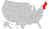 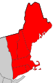
|
| Political history
|
Chartering as
Plymouth Council for New England
|
1620-11-03[1]
|
Formation as
United Colonies of New England
|
1643
|
Formation as
Dominion of New England
|
1686
|
New York formally
incorporated into the
Dominion of New England
|
1688-08-11[2]
|
As a result of the
Glorious Revolution, Bostonians imprisoned the royal governor and others loyal to King James II, thereby ending the Dominion of New England.
|
1689-04-18[3][4]
|
| Regional statistics
|
| Largest city
|
Boston
|
| U.S. States
|
Connecticut
Maine
Massachusetts
New Hampshire
Rhode Island
Vermont
|
Area
- Total
|
71,991.8 sq mi (186,458.8 km²)
|
Population
- Total (2006)
- Density
|
14,269,989[5]
198.2 people/sq mi (87.7 people/km²)
|
New England is a region of the United States located in the northeastern corner of the country, comprised of Maine, New Hampshire, Vermont, Massachusetts, Rhode Island, and Connecticut.
In one of the earliest English settlements in the New World, English Pilgrims fleeing religious persecution in Europe first settled in New England in November 1620, establishing Plymouth Colony. In the mid-eighteenth century, the New England colonies became the first North American British colonies to demonstrate ambitions of independence.
In the nineteenth century, citizens of the region, along with those of the Seneca Falls Convention in New York, played a prominent role in the United States abolitionist movement. New England is the birthplace of distinctly American literature and the philosophy termed transcendentalism. It is considered home to the beginnings of public education and the first region of the United States to be transformed by the Industrial Revolution.
New England is the traditional center of ethnic English culture and ancestry in the United States.
Geography
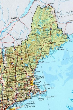
New England. Geographical map, 2001
New England's rolling hills, mountains, and jagged coastline are a consequence of retreating ice sheets. The coastline, extending from southwestern Connecticut to northeastern Maine, is dotted with lakes, hills, swamps, and sandy beaches. Further inland are the Appalachian Mountains, extending through Connecticut, Massachusetts, Vermont, New Hampshire, and Maine. Among them, in the White Mountains of New Hampshire is Mount Washington, which at 6,288 feet (1,917 m), is the highest peak in the northeastern United States. It is also the site of the highest recorded wind speed on Earth: during an April 1934 storm, a wind gust measured at 231 miles per hour (372 kilometers per hour) pushed across the summit of Mount Washington.[6] Vermont's Green Mountains, which become the Berkshires in western Massachusetts, are smaller than the White Mountains.
The longest river is the Connecticut River, which flows from northeastern New Hampshire for 407 miles (655 km), emptying into Long Island Sound. Lake Champlain, wedged between Vermont and New York, is the largest lake in the region.
Climate
Weather patterns are highly variable, and the climate varies throughout the region. Maine, New Hampshire, and Vermont have a humid continental short summer climate, with cooler summers and long, cold winters. Connecticut, Massachusetts, and Rhode Island have a humid continental long summer climate, with hot summers and cold winters. Owing to thick deciduous forests, fall in New England brings bright and colorful foliage, which comes earlier than in other regions, attracting tourists. Average rainfall generally ranges from 40 to 60 inches (1,000 to 1,500 mm) a year. Snowfall can often exceed 100 inches (2,500 mm) annually. As a result, the mountains of Vermont and New Hampshire are popular destinations in the winter, with numerous commercial ski resorts.[7]
History

An early flag of the Massachusetts Bay Colony.
New England's earliest inhabitants were Algonquian-speaking Native Americans including the Abenaki, the Penobscot, and the Wampanoag. Prior to the arrival of Europeans, the Western Abenakis inhabited New Hampshire and Vermont, as well as parts of Québec and western Maine. The Penobscot were settled along the Penobscot River in Maine. The Wampanoag occupied southeastern Massachusetts, Rhode Island, and the islands of Martha's Vineyard and Nantucket.
The Virginia Companies compete
On April 10, 1606, King James I of England issued two charters, one each for the Virginia Companies, of London and Plymouth, respectively.
These were privately funded proprietary ventures, the purpose of each being to claim land for England, trade, and return a profit. Competition between the two companies grew to where their potential New World territory overlapped and would be finalized based upon results.
The London Company was authorized to make settlements from North Carolina to New York, provided there was no conflict with the Plymouth Company’s charter.
The Popham Colony was planted by the Virginia Company of Plymouth. It was not initially successful and was abandoned after one year, though would later be revived. The Virginia Company of Plymouth's charter included land extending as far as present-day northern Maine. Captain John Smith, exploring the shores of the region in 1614, named the region "New England" in his account of two voyages there, published as A Description of New England.[8]
Plymouth Council for New England

The first coins struck in the Colonies were the silver New England coins.
The name "New England" was officially sanctioned on November 3, 1620, when the charter of the Virginia Company of Plymouth was replaced by a royal charter for the Plymouth Council for New England, a joint stock company established to colonize and govern the region.
The "first landing" of the Pilgrims, English religious separatists, was in Provincetown, Massachusetts, on November 21, 1620, and their signing of the Mayflower Compact took place there. Shortly afterward, in December 1620, a permanent settlement was established at present-day Plymouth. The Massachusetts Bay Colony, which would come to dominate the area, was established in 1628, with its major city of Boston established in 1630.
Banished from Massachusetts, Roger Williams led a group south and founded Providence, Rhode Island, in 1636. On March 3 of the same year, the Connecticut Colony was granted a charter and established its own government. At this time, Vermont was unsettled, and the territories of New Hampshire and Maine were governed by Massachusetts.
New England Confederation
In these early years, relationships between colonists and Native Americans alternated between peace and armed skirmishes. Six years after the bloodiest of these, the Pequot War, in 1643 the colonies of Massachusetts Bay, Plymouth, New Haven, and Connecticut joined together in a loose compact called the New England Confederation (officially "The United Colonies of New England"). The confederation was designed largely to coordinate mutual defense against possible wars with Native Americans, the Dutch in the New Netherland colony to the west, the Spanish in the south, and the French in New France to the north, as well as to assist in the return of runaway slaves. The confederation lost its influence when Massachusetts refused to commit itself to a war against the Dutch.
Dominion of New England
In 1686, King James II, concerned about the increasingly independent ways of the colonies, including their self-governing charters, open flouting of the Navigation Acts, and increasing military power, established the Dominion of New England, an administrative union comprising all of the New England colonies. On August 11, 1688, the provinces of New York and New Jersey, seized from the Dutch in 1664, were added. The union, imposed from the outside and contrary to the rooted democratic tradition of the region, was highly unpopular among the colonists.
After the Glorious Revolution in 1689, Bostonians imprisoned the Royal Governor and other sympathizers of King James II, thus ending the Dominion Of New England de facto. The charters of the colonies were significantly modified after this change in English politics, with the appointment of Royal Governors to nearly every colony. An uneasy tension existed between the Royal Governors, their officers, and the elected governing bodies of the colonies. The governors wanted unlimited authority, and the different layers of locally elected officials would often resist them. In most cases, the local town governments continued operating as self-governing bodies. This tension culminated in the American Revolution.
New England and political thought
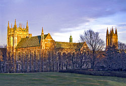
Boston College: The Old World's enduring influence over New England is evident in its
architecture.
During the colonial period and the early years of the American republic, New England leaders like John Hancock, John Adams, and Samuel Adams joined those in Philadelphia and Virginia to assist and lead the newly forming country.
The colonies were now formally united as newly formed states in a larger (but not yet federalist) union, the United States of America. During the War of 1812, there was a limited amount of talk of secession from the Union, as New England merchants, just getting back on their feet, opposed the war with their greatest trading partner - Great Britain.[9]
For the remainder of the Antebellum period, New England remained distinct. Politically, it often went against the grain of the rest of the country. Massachusetts and Connecticut were among the last refuges of the Federalist Party. Many of the leading statesmen - including most prominently Daniel Webster - hailed from the region. New England was also distinct in other ways. It was, as a whole, the most urbanized part of the country (the 1860 census showed that 32 of the 100 largest cities in the country were in New England), as well as the most educated.
New England was also an early center of the industrial revolution. Towns like Lawrence and Lowell, Massachusetts, and Lewiston, Maine, became famed as centers of the textile industry.
New England and areas settled from New England, like Upstate New York, Ohio's Western Reserve and the Upper Midwest states of Michigan and Wisconsin, also proved to be the center of the strongest abolitionist sentiment in the country. Prominent abolitionists like William Lloyd Garrison and Wendell Phillips were New Englanders, and the region was also home to prominent anti-slavery politicians like John Quincy Adams, Charles Sumner, and John P. Hale. When the anti-slavery Republican Party was formed in the 1860s, all of New England, including areas that had previously been strongholds for both the Whig and the Democratic Parties, became strongly Republican (as it would remain until the early twentieth century, when immigration would begin to turn the formerly solidly Republican states of Lower New England toward the Democrats).
At the time of the American Civil War, New England, the mid-Atlantic, and the Midwest, which had long since abolished slavery, united against the Confederate States of America, ending the practice in the United States.
New England has largely preserved its regional character, especially in its historic places. Its name is a reminder of the past, as many of the original English-Americans have migrated farther west. Today, the region is more ethnically diverse, having seen waves of immigration from Ireland, Québec, Italy, Portugal, Asia, Latin America, Africa, other parts of the United States, and elsewhere. The enduring European influence can be seen in the region's heavy prevalence of English town and county names, and its unique, often non-rhotic coastal dialect reminiscent of southeastern England.
Population
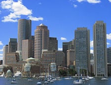
Boston is considered to be the cultural and historical capital of New England.
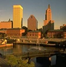
Providence, one of the first cities in the United States, is estimated to be the third-largest city in New England.
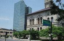
Downtown Worcester, Massachusetts, with City Hall at the right
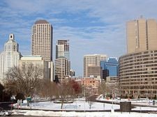
Hartford, the "Insurance Capital of the World."
In 2000, the total population of New England was 13,922,517, roughly twice its 1910 population of 6,552,681.[10] Three-quarters of New England's population and most of its major cities are concentrated in its three southernmost states: Connecticut, Massachusetts, and Rhode Island. These three are among the four most densely populated states in the United States; only New Jersey has a higher population density. Their combined population density is 786.83/sq mi, compared to northern New England's 63.56/sq mi (2000 census). The most populous state is Massachusetts, and the most populous city is Massachusetts' political and cultural capital, Boston.
The coastline is more urban than western New England, which is typically rural, even in urban states like Massachusetts. This characteristic of the region's population is due mainly to historical factors; the original colonists settled mostly on the coastline of Massachusetts Bay. The only New England state without access to the Atlantic Ocean, Vermont, is also the least populated. New England's coast is dotted with urban centers.
The Boston metropolitan area had an estimated population of approximately 4.4 million in 2006.[11]
Economy
Several factors contributed to the unique New England economy. The region
- is geographically isolated from the rest of the United States and is relatively small
- has a climate and a supply of natural resources, such as granite, lobster, and codfish, that are different from other parts of the country
- has its population concentrated on the coast and in its southern states, and its residents have a strong regional identity.
- America's textile industry began along the Blackstone River with the Slater Mill at Pawtucket, Rhode Island, and was duplicated at similar sources of water power.
Exports consist mostly of industrial products, including specialized machines and weaponry, built by the region's educated workforce. About half the region's exports consist of industrial and commercial machinery, such as computers and electronic and electrical equipment. This, when combined with instruments, chemicals, and transportation equipment, makes up about three-quarters of the region's exports.
New England also exports food products, ranging from fish to lobster, cranberries, Maine potatoes, and maple syrup. The service industry is also highly important, including tourism, education, financial and insurance services, plus architectural, building, and construction services. Insurance is especially a driving force in and around Hartford, Connecticut.
As of May 2006, the unemployment rate in New England was 4.5 percent, below the national average. The highest was Rhode Island, with 5.5 percent.[12]
New England is home to two of the ten poorest cities (by percentage living below the poverty line) in the United States: the state capital cities of Providence, Rhode Island, and Hartford, Connecticut.[13] These cities have struggled as manufacturing, their traditional economic mainstay, has declined.
As of 2005, the inflation-adjusted combined GSPs of the six states of New England was $623.1 billion, with Massachusetts contributing the most and Vermont the least.[14]
Energy
The region is mostly very energy efficient compared to the country at large. Rhode Island has the lowest per capita energy consumption of any state. The six New England states collectively have the highest electricity costs in the nation.
Three of the six New England states are among the country's highest consumers of nuclear power: Vermont (first, 73.7 percent), Connecticut (fourth, 48.9 percent), and New Hampshire (sixth, 46 percent).[15]
Politics
Contemporary politics
The dominant party in New England has long been the Democratic Party. In every New England state, both legislative houses have a majority of Democratic representatives. In 2007, Democrats held half of New England's governor's positions: Maine, New Hampshire, and Massachusetts. While the governors of Connecticut, Vermont and Rhode Island were Republicans, the legislatures had veto-overriding Democratic super-majorities.[16]
Due to the liberal lean of the region, the state Republican parties and the elected Republican officials have been more politically and socially moderate than the national Republican Party. New Hampshire is the most conservative state in the region and, prior to the 2006 election, had the only Republican-controlled legislature in New England.
Town meetings
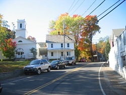
Typical village in New England
A derivative of meetings held by church elders, town meetings were and are an integral part of governance of many New England towns. At such meetings, any citizen of the town may discuss issues with other members of the community and vote on them. This is the strongest example of direct democracy in the United States today, and the form of dialogue has been adopted under certain circumstances elsewhere, most strongly in the states closest to the region, such as New York, New Jersey, and Pennsylvania.
Notable laws
New England abolished the death penalty for crimes like robbery and burglary in the nineteenth century, before much of the rest of the United States did. New Hampshire and Connecticut are the only New England states that allow capital punishment,[17] although New Hampshire has not held an execution since 1939. Connecticut held an execution in 2005, the first in New England since 1960.[18]
Vermont was the first state to allow civil unions between same sex couples, and Massachusetts was the first state to allow same-sex marriage. In 2005, Connecticut also began to allow civil unions. In 2008, some form of same-sex unions will be in all New England states except Rhode Island, though the state does recognize Massachusetts marriages for its residents.
Education
Colleges and universities
New England contains some of the oldest and most renowned institutions of higher learning in the United States. The first such institution, subsequently named Harvard College, was founded to train preachers, in 1636. Yale University was founded in 1701 and awarded the nation's first doctoral (Ph.D.) degree in 1861. Brown University, the first college in the nation to accept students of all religious affiliations and its seventh-oldest institution of higher learning, was founded in Providence, Rhode Island, in 1764. Dartmouth College was founded five years later with the mission of educating the local American Indian population as well as English youth. New England also contains the Massachusetts Institute of Technology (MIT).
Public education
New England states fund their public schools well, with expenditures per student, and teacher salaries above the national median. As of 2005, the National Education Association ranked Connecticut with the highest-paid teachers in the country. Massachusetts and Rhode Island ranked eighth and ninth, respectively. Every state but New Hampshire is in the top ten for educational spending per student. Boston Latin School is the oldest public high school in America. Several signers of the Declaration of Independence attended Boston Latin.
Culture
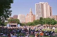
The New Haven Green, created in 1638, remains preserved today as the heart of what could be considered to be the first planned city in the U.S.
[19]New England has a history of shared heritage and culture primarily shaped by waves of immigration from Europe. A cultural divide, however, also exists between urban New Englanders living along the densely populated coastline and rural New Englanders in western Massachusetts, northwestern Connecticut, Vermont, New Hampshire, and Maine.
The first European colonists of New England were focused on maritime affairs such as whaling and fishing. One of the older American regions, New England has developed a distinct cuisine, dialect, architecture, and government. New England cuisine is known for its emphasis on seafood and dairy; clam chowder, lobster, and other products of the sea are among some of the region's most popular foods.
In much of rural New England, particularly Maine, Acadian and Québécois culture dominate the region's music and dance. Contra dancing and country square dancing are popular throughout New England, usually backed by live Irish, Acadian, or other folk music. In some towns of Massachusetts, Rhode Island, and Connecticut, Portuguese music is preserved by Portuguese-American communities.
Literature
New England has been the birthplace of many American authors and poets. Ralph Waldo Emerson was born near Boston. Henry David Thoreau was born in Concord, Massachusetts, where he famously lived for some time by Walden Pond, on Emerson's land. Nathaniel Hawthorne was born in historical Salem; later, he would live in Concord at the same time as Emerson and Thoreau. Emily Dickinson lived most of her life in Amherst, Massachusetts. Henry Wadsworth Longfellow was from Portland, Maine. Noah Webster, the Father of American scholarship and education, was born in West Hartford, Connecticut.
The region has also drawn the attention of authors and poets from other parts of the United States. Mark Twain found Hartford, Connecticut, to be the most beautiful city in the United States and wrote his masterpieces there. He lived next to Harriett Beecher Stowe, whose most famous work is Uncle Tom's Cabin. John Updike, originally from Pennsylvania, eventually moved to Ipswich, Massachusetts, which served as the model for the fictional New England town of Tarbox in his 1968 novel Couples. Robert Frost was born in California but moved to Massachusetts during his teen years; his frequent use of New England settings and themes ensured that he would be associated with the region. Herman Melville, originally from New York City, wrote his greatest novel Moby-Dick in Pittsfield, Massachusetts.
Recreation

Boats on the Kennebunk River, Maine.

A Humpback breaching in the Stellwagen Bank National Marine Sanctuary
The Northern Appalachian Mountains run through New England, which make for excellent skiing. Southern Vermont, New Hampshire, and Maine are home to various ski resorts. There are nearly 100 established ski resorts across each of the six states in New England. While Rhode Island has only one, Yawgoo Valley near Exeter; Vermont and New Hampshire each offer as many as two dozen established skiing locations.
The coastal New England states are home to many oceanfront beaches. Connecticut's and Rhode Island's seacoast and Cape Cod, Nantucket, and Martha's Vineyard in Massachusetts are popular tourist destinations. Connecticut, Rhode Island, Massachusetts, New Hampshire, and Maine are all well known for their small-town charm and beaches.
In New England and off the east coast of Long Island, the whale watching attracts tourists from around the world. The season typically takes place from about mid-spring through early fall, depending both on weather and precise location. It is here that the Northern Humpback Whale, Fin Whale, Minke Whale, and the protected North Atlantic Right Whale are often observed. Areas like the Gulf of Maine and Stellwagen Bank National Marine Sanctuary (part of the inner waters formed by Cape Cod's hooked shape) have been important feeding grounds for whales. Due to the frequent visits of these mammals, a very large amount of research on large cetaceans takes place, in particular Woods Hole Oceanographic Institute.
Acadia National Park, off the coast of Maine, preserves most of Mount Desert Island and includes mountains, an ocean shoreline, woodlands, and lakes.
Notes
- ↑ William F. Swindler, (ed.) Sources and Documents of United States Constitutions. 10 Volumes; (Dobbs Ferry, New York; Oceana Publications, 1973-1979), Volume 5: 16-26.
- ↑ E. B. O’Callaghan, (ed.) Documents Relative to the Colonial History of the State of New York, Volumes 1 - 11. (Albany, NY: 1853-1887), Volume 3: 537
- ↑ Wesley Frank Craven. 1968. Colonies in Transition, 1660 – 1713. (New York, NY: Harper and Row), 224.
- ↑ Gerald E. Morris, and Richard D. Kelly, (eds.) 1976. Maine Bicentennial Atlas: An Historical Survey. Plate 11. (Portland, ME: Portland Historical Society).
- ↑ US Census Bureau. State & County QuickFacts Retrieved November 5, 2008.
- ↑ Mount Washington Observatory. The Story of the World Record Wind Retrieved November 5, 2008.
- ↑ Climate Change Research Center. A Climate Primer for New England Retrieved November 5, 2008.
- ↑ University of Nebraska-Lincoln. A Description of New England. Retrieved November 5, 2008.
- ↑ James Schouler. 1891. History of the United States vol 1. (New York: Dodd, Mead & Company.)
- ↑ Rhode Island Division of Planning. NEW ENGLAND POPULATION BY STATE: 1800 - 2000 Retrieved November 5, 2008.
- ↑ U.S. Census Bureau. Metropolitan and micropolitan statistical area population and estimated components of change: April 1, 2000 to July 1, 2006.
- ↑ U.S. Bureau of Labor Statistics. New England - Labor Force Statistics Retrieved November 5, 2008.
- ↑ US Census Bureau. May 2003. Poverty: 1999.
- ↑ Bureau of Economic Analysis. News Release: Gross Domestic Product (GDP) by State, 2005 Retrieved November 5, 2008.
- ↑ Sam Hemmingway. July 20, 2008. "Nukes by the numbers." Burlington Free Press.
- ↑ National Conference of State Legislatures. StateVote 2006 Retrieved November 5, 2008.
- ↑ Death Penalty Information Center. State by State Information Retrieved November 5, 2008.
- ↑ FOXNews.com. January 29, 2005. Supreme Court Lifts Order Blocking Connecticut Execution Retrieved November 5, 2008.
- ↑ YahooTravel. New Haven Travel Guide.
References
ISBN links support NWE through referral fees
- Adams, James Truslow. 1921. The founding of New England. Boston: Atlantic Monthly Press. Online edition.dinsdoc.com. Retrieved November 24, 2008.
- Adams, James Truslow. 1923. Revolutionary New England, 1691-1776. Boston: Atlantic monthly Press.
- Adams, James Truslow, and James Truslow Adams. 1926. New England in the republic, 1776-1850. Boston: Little, Brown.
- Andrews, Charles McLean. 1919. The fathers of New England; a chronicle of the Puritan commonwealths. (The Chronicles of America series, v. 6.) New Haven: Yale University Press.
- Axtell, James. 1973. The American people in colonial New England. (The American people.) West Haven, CT: Pendulum Press. ISBN 9780883010693
- Black, John Donald. 1950. The rural economy of New England: a regional study. Cambridge, MA: Harvard Univ. Pr. Online edition
- Brewer, Daniel Chauncey. 1926. The conquest of New England by the immigrant. New York & London: G.P. Putnam's sons.
- Conforti, Joseph A. 2001. Imagining New England: explorations of regional identity from the pilgrims to the mid-twentieth century. Chapel Hill: University of North Carolina Press. ISBN 9780807849378
- Craven, Wesley Frank. 1968. Colonies in Transition, 1660 – 1713. New York, NY: Harper and Row.
- Hemmingway, Sam. July 20, 2008. "Nukes by the numbers." Burlington Free Press.
- Karlsen, Carol F. 1987. The devil in the shape of a woman: witchcraft in colonial New England. New York: Norton. ISBN 9780393024784
- O’Callaghan, E.B. ed. Documents Relative to the Colonial History of the State of New York, Volumes 1 - 11. Albany, NY: 1853-1887, Volume 3: 537.
- Schouler, James. 1891. History of the United States vol 1. New York: Dodd, Mead & Company.
- Swindler, William F. ed. Sources and Documents of United States Constitutions. 10 Volumes; Dobbs Ferry, New York; Oceana Publications, 1973-1979, Volume 5
- Zimmerman, Joseph Francis. 1999. The New England town meeting: democracy in action. Westport, CT: Praeger. ISBN 9780275965235
External links
All links retrieved November 11, 2022.
Credits
New World Encyclopedia writers and editors rewrote and completed the Wikipedia article
in accordance with New World Encyclopedia standards. This article abides by terms of the Creative Commons CC-by-sa 3.0 License (CC-by-sa), which may be used and disseminated with proper attribution. Credit is due under the terms of this license that can reference both the New World Encyclopedia contributors and the selfless volunteer contributors of the Wikimedia Foundation. To cite this article click here for a list of acceptable citing formats.The history of earlier contributions by wikipedians is accessible to researchers here:
The history of this article since it was imported to New World Encyclopedia:
Note: Some restrictions may apply to use of individual images which are separately licensed.


.jpg)


