Difference between revisions of "Tibet" - New World Encyclopedia
Mike Butler (talk | contribs) |
Mike Butler (talk | contribs) m |
||
| Line 56: | Line 56: | ||
'''Tibet''' (older spelling '''Thibet'''; {{bo|t=<font face="jomolhari">བོད་</font>|w=Bod|l=pʰø̀ʔ}}; [[Simplified Chinese|Simplified]] and [[Traditional Chinese|Traditional]] [[Chinese language|Chinese]]: 西藏, [[Hanyu Pinyin]]: Xīzàng; also referred to as 藏区 ([[Simplified Chinese]]), 藏區 ([[Traditional Chinese]]), Zàngqū is a [[plateau]] region in [[Central Asia]] and the indigenous home to the [[Tibetan people]]. | '''Tibet''' (older spelling '''Thibet'''; {{bo|t=<font face="jomolhari">བོད་</font>|w=Bod|l=pʰø̀ʔ}}; [[Simplified Chinese|Simplified]] and [[Traditional Chinese|Traditional]] [[Chinese language|Chinese]]: 西藏, [[Hanyu Pinyin]]: Xīzàng; also referred to as 藏区 ([[Simplified Chinese]]), 藏區 ([[Traditional Chinese]]), Zàngqū is a [[plateau]] region in [[Central Asia]] and the indigenous home to the [[Tibetan people]]. | ||
| − | With an average elevation of 16,000 feet, | + | With an average elevation of 16,000 feet, (4900 meters) it is the highest region on Earth and is commonly referred to as the "Roof of the World." |
Tibet is today controlled by the [[People's Republic of China]] (PRC). As an [[exclusive mandate]], Tibet is also officially claimed by the [[Republic of China]] (Taiwan). However in the [[Tibetan sovereignty debate]], the government of the People's Republic of China and the [[Government of Tibet in Exile]] disagree over when Tibet became a part of China, and whether this incorporation into China is legitimate according to international law. | Tibet is today controlled by the [[People's Republic of China]] (PRC). As an [[exclusive mandate]], Tibet is also officially claimed by the [[Republic of China]] (Taiwan). However in the [[Tibetan sovereignty debate]], the government of the People's Republic of China and the [[Government of Tibet in Exile]] disagree over when Tibet became a part of China, and whether this incorporation into China is legitimate according to international law. | ||
The Tibetan Empire came into existence in the seventh century when Emperor [[Songtsän Gampo]] united many areas and tribes of the region. From the early 1600s the [[Dalai Lama]]s, commonly known as spiritual leaders of the region The historical status of the Dalai Lamas as actual rulers is disputed. | The Tibetan Empire came into existence in the seventh century when Emperor [[Songtsän Gampo]] united many areas and tribes of the region. From the early 1600s the [[Dalai Lama]]s, commonly known as spiritual leaders of the region The historical status of the Dalai Lamas as actual rulers is disputed. | ||
| − | |||
| − | |||
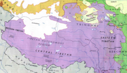
When the [[Government of Tibet in Exile]] and the Tibetan refugee community abroad refer to Tibet, they mean the areas consisting of the traditional provinces of [[Amdo]], [[Kham]], and [[Ü-Tsang]], but excluding [[Sikkim]], [[Bhutan]], and [[Ladakh]] that have also formed part of the Tibetan cultural sphere. | When the [[Government of Tibet in Exile]] and the Tibetan refugee community abroad refer to Tibet, they mean the areas consisting of the traditional provinces of [[Amdo]], [[Kham]], and [[Ü-Tsang]], but excluding [[Sikkim]], [[Bhutan]], and [[Ladakh]] that have also formed part of the Tibetan cultural sphere. | ||
| Line 70: | Line 68: | ||
The difference in definition is a major source of dispute. | The difference in definition is a major source of dispute. | ||
| − | == Geography == | + | ==Geography== |
| − | + | [[Image:Yamdrok-tso-2.jpg|thumb|left|250px|Yamdrok tso lake.]] | |
| − | [[ | + | [[Image:TibetanMountains13.jpg|thumb|200px|right|Snow mountains in Tibet.]] |
| + | Located on the [[Tibetan Plateau]], the world's highest region, Tibet is bordered on the north and east by [[China]], on the west by the [[Kashmir]] Region of [[India]] and on the south by [[Nepal]], [[Bangladesh]] and [[Bhutan]]. Tibet occupies about 471,700 square miles (1,221,600 square kilometers) on the high Plateau of Tibet surrounded by enormous mountains. | ||
| − | + | The Ch’iang-t’ang in the north extends more than 800 miles (1300km) across with an average elevation of 15,000 feet (4500 meters) above sea level. It has brackish lakes and no river systems there. The plateau descends in elevation towards the east. Mountain ranges in the south-east create a north- south barrier to travel and communication. | |
| − | |||
| − | |||
The Kunlun Mountains, with its highest peak Mu-tzu-t’a-ko reaching 25,338 feet (7723 meters) form a border to the north. The Himalaya mountains, one of the youngest mountain ranges in the world at only four million years old, form the western and southern border — the highest peak is Mount Everest, which rises to 29,035 feet (8850 meters) on the Tibet–Nepal border. North of Ma-fa-mu Lake and stretching east is the Kang-ti-ssu Range, with several peaks, exceeding 20,000 feet. The Brahmaputra River, which flows across southern Tibet to India, separates this range from the Himalayas. | The Kunlun Mountains, with its highest peak Mu-tzu-t’a-ko reaching 25,338 feet (7723 meters) form a border to the north. The Himalaya mountains, one of the youngest mountain ranges in the world at only four million years old, form the western and southern border — the highest peak is Mount Everest, which rises to 29,035 feet (8850 meters) on the Tibet–Nepal border. North of Ma-fa-mu Lake and stretching east is the Kang-ti-ssu Range, with several peaks, exceeding 20,000 feet. The Brahmaputra River, which flows across southern Tibet to India, separates this range from the Himalayas. | ||
The Indus River, known in Tibet as the Shih-ch'üan Ho, has its source in western Tibet near the sacred Mount Kailas, and flows west across Kashmir to Pakistan. The Hsiang-ch'üan River flows west to become the Sutlej River in western India, the K'ung-ch'üeh River eventually join the Ganges River, and the Ma-ch'üan River flows east and, after joining the Lhasa River, forms the Brahmaputra River. The Salween River flows from east-central Tibet, through Yunnan to Myanmar. The Mekong River has its source in southern Tsinghai as two rivers—the Ang and Cha—which join near the Tibet border to flow through eastern Tibet and western Yunnan to Laos and Thailand. The Yangtze River arises in southern Tsinghai. | The Indus River, known in Tibet as the Shih-ch'üan Ho, has its source in western Tibet near the sacred Mount Kailas, and flows west across Kashmir to Pakistan. The Hsiang-ch'üan River flows west to become the Sutlej River in western India, the K'ung-ch'üeh River eventually join the Ganges River, and the Ma-ch'üan River flows east and, after joining the Lhasa River, forms the Brahmaputra River. The Salween River flows from east-central Tibet, through Yunnan to Myanmar. The Mekong River has its source in southern Tsinghai as two rivers—the Ang and Cha—which join near the Tibet border to flow through eastern Tibet and western Yunnan to Laos and Thailand. The Yangtze River arises in southern Tsinghai. | ||
| − | + | [[Image:Jokhang Temple in Tibet.jpg|thumb|left|350px|[[Jokhang]] temple, [[Lhasa]]]] | |
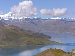
Lakes T'ang-ku-la-yu-mu, Na-mu, and Ch'i-lin are the three largest lakes and are located in central Tibet. In western Tibet are two adjoining lakes, Ma-fa-mu Lake, sacred to Buddhists and Hindus, and Lake La-ang. | Lakes T'ang-ku-la-yu-mu, Na-mu, and Ch'i-lin are the three largest lakes and are located in central Tibet. In western Tibet are two adjoining lakes, Ma-fa-mu Lake, sacred to Buddhists and Hindus, and Lake La-ang. | ||
| Line 87: | Line 84: | ||
Northern Tibet is subject to high temperatures in the summer and intense cold in the winter. The seasonal temperature variation is minimal, with the greatest temperature differences occurring during a 24-hour period. Lhasa, at an elevation of 11,830 feet, has a maximum daily temperature of 85°F (30°C) and a minimum of -2°F (-19°C). | Northern Tibet is subject to high temperatures in the summer and intense cold in the winter. The seasonal temperature variation is minimal, with the greatest temperature differences occurring during a 24-hour period. Lhasa, at an elevation of 11,830 feet, has a maximum daily temperature of 85°F (30°C) and a minimum of -2°F (-19°C). | ||
| − | |||
| − | |||
The arid climate of the windswept Ch'iang-t'ang supports little except grasses. Plant life in the river valleys and in the south and southeast includes willows, poplars, conifers, teak, rhododendrons, oaks, birches, elms, bamboo, sugarcane, babul trees, thorn trees, and tea bushes. The leaves of the lca-wa, khumag, and sre-ral, which grow in the low, wet regions, are used for food. Wildflowers include the blue poppy, lotus, wild pansy, oleander, and orchid. | The arid climate of the windswept Ch'iang-t'ang supports little except grasses. Plant life in the river valleys and in the south and southeast includes willows, poplars, conifers, teak, rhododendrons, oaks, birches, elms, bamboo, sugarcane, babul trees, thorn trees, and tea bushes. The leaves of the lca-wa, khumag, and sre-ral, which grow in the low, wet regions, are used for food. Wildflowers include the blue poppy, lotus, wild pansy, oleander, and orchid. | ||
| − | + | [[Image:Downtown Shigatse.JPG|thumb|right|200px|[[Shigatse]]]] | |
The forests have tigers, leopards, bears, wild boars, wild goats, stone martens (a kind of cat), langurs, lynx, jackals, wild buffaloes, pha-ra (a small jackal), and gsa' (a small leopard). The high grasslands and dry bush areas have brown bears, wild and bighorn sheep, mountain antelope, musk deer, wild asses, wild yaks, snakes, scorpions, lizards, and wolves. Water life includes types of fish, frog, crab, otter, and turtle. | The forests have tigers, leopards, bears, wild boars, wild goats, stone martens (a kind of cat), langurs, lynx, jackals, wild buffaloes, pha-ra (a small jackal), and gsa' (a small leopard). The high grasslands and dry bush areas have brown bears, wild and bighorn sheep, mountain antelope, musk deer, wild asses, wild yaks, snakes, scorpions, lizards, and wolves. Water life includes types of fish, frog, crab, otter, and turtle. | ||
| − | Birds include the jungle fowl, mynah, hawk, the gull, crane, sheldrake, cinnamon teal, and owls. | + | Birds include the jungle fowl, mynah, hawk, the gull, crane, sheldrake, cinnamon teal, and owls. Natural hazards include earthquakes, landslides, and snow. |
| − | + | [[Lhasa]] is Tibet's traditional capital and the capital of the Tibet Autonomous Region. Lhasa contains the world heritage site the [[Potala Palace]] and [[Norbulingka]], the residences of the [[Dalai Lama]], and a number of significant temples and monasteries which are deeply engrained in its history including [[Jokhang]] and [[Ramoche Temple]].[[Shigatse]] is the country's second largest city, west of Lhasa. [[Gyantse]], [[Chamdo]] are also amongst the largest. Other cities in historic Tibet include, [[Nagchu]], [[Nyingchi]], [[Nedong]], [[Barkam]], [[Sakya, Tibet|Sakya]], [[Gartse]], [[Pelbar]], and [[Tingri]]; in [[Sichuan]], [[Kangding]] (Dartsedo); in [[Qinghai]], [[Jyekundo]] or Yushu, [[Machen, Qinghai|Machen]], [[Lhatse]], and [[Golmud]]. | |
| − | |||
| − | |||
[[Image:Chamdo1.JPG|thumb|left|250px|[[Chamdo]]]] | [[Image:Chamdo1.JPG|thumb|left|250px|[[Chamdo]]]] | ||
| − | |||
| − | |||
| − | |||
| − | |||
| − | |||
==Language== | ==Language== | ||
| Line 164: | Line 152: | ||
In February 1912 the [[Qing Dynasty]] [[Emperor of China|Emperor]] abdicated and the new [[Republic of China]] was formed.<ref name="smith">Smith (1996), p. 181</ref> In April 1912 the Chinese garrison of troops in Lhasa surrendered to the Tibetan authorities while the new Chinese Republican government wished to make the commander of the Chinese troops in Lhasa its new Tibetan representative. | In February 1912 the [[Qing Dynasty]] [[Emperor of China|Emperor]] abdicated and the new [[Republic of China]] was formed.<ref name="smith">Smith (1996), p. 181</ref> In April 1912 the Chinese garrison of troops in Lhasa surrendered to the Tibetan authorities while the new Chinese Republican government wished to make the commander of the Chinese troops in Lhasa its new Tibetan representative. | ||
| − | + | [[Image:Flag_of_Tibet.svg|thumb|right|300px|[[Flag of Tibet]] used intermittently between 1912 and 1950. This version was introduced by the 13th Dalai Lama in 1912. The flag is outlawed in the [[People's Republic of China]].]] | |
[[Image:DalaiLama-13 lg.jpg|thumb|left|200px|[[13th Dalai Lama]]]] | [[Image:DalaiLama-13 lg.jpg|thumb|left|200px|[[13th Dalai Lama]]]] | ||
The Dalai Lama returned to Tibet from India in July 1912. By the end of 1912, the Chinese troops in Tibet had returned, via India, to [[China Proper]].<ref name="smith"/> | The Dalai Lama returned to Tibet from India in July 1912. By the end of 1912, the Chinese troops in Tibet had returned, via India, to [[China Proper]].<ref name="smith"/> | ||
Revision as of 05:30, 23 July 2007
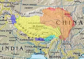
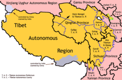
| Tibetan areas designated by the PRC.[1] | |||||||||
| Tibet Autonomous Region (actual control).[2] | |||||||||
| Claimed by India as part of Aksai Chin.[3] | |||||||||
| Claimed (not controlled) by the PRC as part of the TAR.[4] | |||||||||
| Other historically/culturally-Tibetan areas.[5] | |||||||||
Tibet (older spelling Thibet; Tibetan: བོད་; Wylie: Bod; Lhasa dialect IPA: [pʰø̀ʔ]; Simplified and Traditional Chinese: 西藏, Hanyu Pinyin: Xīzàng; also referred to as 藏区 (Simplified Chinese), 藏區 (Traditional Chinese), Zàngqū is a plateau region in Central Asia and the indigenous home to the Tibetan people.
With an average elevation of 16,000 feet, (4900 meters) it is the highest region on Earth and is commonly referred to as the "Roof of the World."
Tibet is today controlled by the People's Republic of China (PRC). As an exclusive mandate, Tibet is also officially claimed by the Republic of China (Taiwan). However in the Tibetan sovereignty debate, the government of the People's Republic of China and the Government of Tibet in Exile disagree over when Tibet became a part of China, and whether this incorporation into China is legitimate according to international law.
The Tibetan Empire came into existence in the seventh century when Emperor Songtsän Gampo united many areas and tribes of the region. From the early 1600s the Dalai Lamas, commonly known as spiritual leaders of the region The historical status of the Dalai Lamas as actual rulers is disputed.
When the Government of Tibet in Exile and the Tibetan refugee community abroad refer to Tibet, they mean the areas consisting of the traditional provinces of Amdo, Kham, and Ü-Tsang, but excluding Sikkim, Bhutan, and Ladakh that have also formed part of the Tibetan cultural sphere.
When the People's Republic of refers to Tibet, it means the Tibet Autonomous Region: a province-level entity which, according to the territorial claims of China, includes Arunachal Pradesh (which is an Indian state but disputed by China). The Autonomous Region covers the Dalai Lama's former domain, consisting of Ü-Tsang and western Kham, while Amdo and eastern Kham are part of Qinghai, Gansu, Yunnan, and Sichuan.
The difference in definition is a major source of dispute.
Geography
Located on the Tibetan Plateau, the world's highest region, Tibet is bordered on the north and east by China, on the west by the Kashmir Region of India and on the south by Nepal, Bangladesh and Bhutan. Tibet occupies about 471,700 square miles (1,221,600 square kilometers) on the high Plateau of Tibet surrounded by enormous mountains.
The Ch’iang-t’ang in the north extends more than 800 miles (1300km) across with an average elevation of 15,000 feet (4500 meters) above sea level. It has brackish lakes and no river systems there. The plateau descends in elevation towards the east. Mountain ranges in the south-east create a north- south barrier to travel and communication.
The Kunlun Mountains, with its highest peak Mu-tzu-t’a-ko reaching 25,338 feet (7723 meters) form a border to the north. The Himalaya mountains, one of the youngest mountain ranges in the world at only four million years old, form the western and southern border — the highest peak is Mount Everest, which rises to 29,035 feet (8850 meters) on the Tibet–Nepal border. North of Ma-fa-mu Lake and stretching east is the Kang-ti-ssu Range, with several peaks, exceeding 20,000 feet. The Brahmaputra River, which flows across southern Tibet to India, separates this range from the Himalayas.
The Indus River, known in Tibet as the Shih-ch'üan Ho, has its source in western Tibet near the sacred Mount Kailas, and flows west across Kashmir to Pakistan. The Hsiang-ch'üan River flows west to become the Sutlej River in western India, the K'ung-ch'üeh River eventually join the Ganges River, and the Ma-ch'üan River flows east and, after joining the Lhasa River, forms the Brahmaputra River. The Salween River flows from east-central Tibet, through Yunnan to Myanmar. The Mekong River has its source in southern Tsinghai as two rivers—the Ang and Cha—which join near the Tibet border to flow through eastern Tibet and western Yunnan to Laos and Thailand. The Yangtze River arises in southern Tsinghai.
Lakes T'ang-ku-la-yu-mu, Na-mu, and Ch'i-lin are the three largest lakes and are located in central Tibet. In western Tibet are two adjoining lakes, Ma-fa-mu Lake, sacred to Buddhists and Hindus, and Lake La-ang.
The climate is dry nine months of the year, and average snowfall is only 18 inches, due to the rain shadow effect whereby mountain ranges prevent moisture from the ocean from reaching the plateaus. Western passes receive small amounts of fresh snow each year but remain traversable all year round. Low temperatures are prevalent throughout these western regions, where bleak desolation is unrelieved by any vegetation beyond the size of low bushes, and where wind sweeps unchecked across vast expanses of arid plain. The cool dry air means grain can be stored for 50 to 60 years, dried meat will last for a year, and epidemics are rare.
Northern Tibet is subject to high temperatures in the summer and intense cold in the winter. The seasonal temperature variation is minimal, with the greatest temperature differences occurring during a 24-hour period. Lhasa, at an elevation of 11,830 feet, has a maximum daily temperature of 85°F (30°C) and a minimum of -2°F (-19°C).
The arid climate of the windswept Ch'iang-t'ang supports little except grasses. Plant life in the river valleys and in the south and southeast includes willows, poplars, conifers, teak, rhododendrons, oaks, birches, elms, bamboo, sugarcane, babul trees, thorn trees, and tea bushes. The leaves of the lca-wa, khumag, and sre-ral, which grow in the low, wet regions, are used for food. Wildflowers include the blue poppy, lotus, wild pansy, oleander, and orchid.
The forests have tigers, leopards, bears, wild boars, wild goats, stone martens (a kind of cat), langurs, lynx, jackals, wild buffaloes, pha-ra (a small jackal), and gsa' (a small leopard). The high grasslands and dry bush areas have brown bears, wild and bighorn sheep, mountain antelope, musk deer, wild asses, wild yaks, snakes, scorpions, lizards, and wolves. Water life includes types of fish, frog, crab, otter, and turtle. Birds include the jungle fowl, mynah, hawk, the gull, crane, sheldrake, cinnamon teal, and owls. Natural hazards include earthquakes, landslides, and snow.
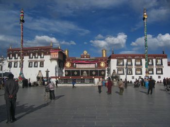
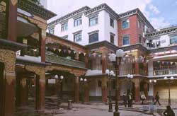
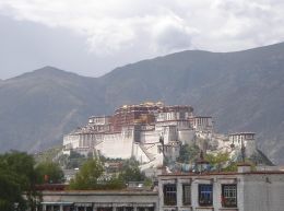
Lhasa is Tibet's traditional capital and the capital of the Tibet Autonomous Region. Lhasa contains the world heritage site the Potala Palace and Norbulingka, the residences of the Dalai Lama, and a number of significant temples and monasteries which are deeply engrained in its history including Jokhang and Ramoche Temple.Shigatse is the country's second largest city, west of Lhasa. Gyantse, Chamdo are also amongst the largest. Other cities in historic Tibet include, Nagchu, Nyingchi, Nedong, Barkam, Sakya, Gartse, Pelbar, and Tingri; in Sichuan, Kangding (Dartsedo); in Qinghai, Jyekundo or Yushu, Machen, Lhatse, and Golmud.
Language
The Tibetan language is generally classified as a Tibeto-Burman language of the Sino-Tibetan language family. Spoken Tibetan includes numerous regional dialects which, in many cases, are not mutually intelligible. Moreover, the boundaries between Tibetan and certain other Himalayan languages are sometimes unclear. In general, the dialects of central Tibet (including Lhasa), Kham, Amdo, and some smaller nearby areas are considered Tibetan dialects, while other forms, particularly Dzongkha, Sikkimese, Sherpa, and Ladakhi, are considered for political reasons by their speakers to be separate languages.[citation needed] Ultimately, taking into consideration this wider understanding of Tibetan dialects and forms, "greater Tibetan" is spoken by approximately 6 million people across the Tibetan Plateau. Tibetan is also spoken by approximately 150,000 exile speakers who have fled from modern-day Tibet to India and other countries.
History
Pre history
Chinese and the "proto-Tibeto-Burman" language may have split sometime before 4000 B.C.E., when the Chinese began growing millet in the Yellow River valley while the Tibeto-Burmans remained nomads. Tibetan split from Burman around AD 500.[6][7]
Prehistoric Iron Age hill forts and burial complexes have recently been found on the Chang Tang plateau but the remoteness of the location is hampering archaeological research. The initial identification of this culture is as the Zhang Zhung culture which is described in ancient Tibetan texts and is known as the original culture of the Bön religion.
The Tibetan Empire
.
A series of kings ruled Tibet from the 7th to the 11th century. At times Tibetan rule extended as far south as Bengal and as far north as Mongolia.
Tibet first enters history in the Geography of Ptolemy under the name batai (βαται), a Greek transcription of the indigenous name Bod. Tibet next appears in history in a Chinese text where it is referred to as fa. The first incident from recorded Tibetan history which is confirmed externally occurred when King Namri Lontsen sent an ambassador to China in the early 7th century.[8]
However general, the history of Tibet begins with the rule of Songtsän Gampo (604–650 C.E.) who united parts of the Yarlung River Valley and ruled Tibet as a kingdom. In 640 he married Princess Wencheng, the niece of the powerful Chinese emperor Emperor Taizong of Tang China.
Tibet continued as a Central Asian empire until the late 9th century.
Mongols & Manchus
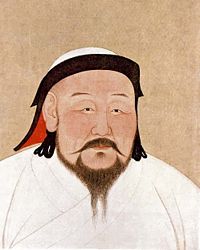
In 1240, the Mongols marched into central Tibet and attacked several monasteries. Köden, younger brother of Mongol ruler Güyük Khan, participated in a ceremony recognizing the Sakya lama as temporal ruler of Tibet in 1247. The Mongol khans had ruled northern China by conquest since 1215. They were the emperors of the Yuan Dynasty. Kublai Khan was a patron of Tibetan Buddhism and appointed the Sakya Lama his "Imperial preceptor," or chief religious official. Tibetans viewed this relationship as an example of yon-mchod, or priest-patron relationship. In practice, the Sakya lama was subordinate to the Mongol khan. The collapse of the Yuan dynasty in 1368 led to the overthrow of the Sakya in Tibet. Tibet was then ruled by a succession of three secular Tibetan dynasties. According to a Chinese source, in 1372, an emperor of China’s Ming Dynasty granted the desi (sde-srid, viceroy) of Tibet the official title of Abhiseca State Tutor, and gave him the jade seal of authority. The following year saw this ruler (Jamyang Sagya Gyaincain) send people to pay tribute to the Ming court.[9]
The Dalai Lama lineage
According to the same Chinese source,[10] in 1578, Althan Khan, who was subordinate to China’s Ming Dynasty from 1571, invited Soinam Gyaco to lecture on Buddhism in what is today considered by China as Qinghai and bestowed upon him the title of "Dalai Lama," thus beginning the official use of the title "Dalai Lama." The 3rd Dalai paid tribute to the Ming imperial court through Althan Khan and wrote to the Chinese prime minister, requesting to be allowed to pay tribute to the imperial court on a regular basis, and was approved. In the 16th century, Altan Khan of Tumet Mongolian tribe supported the Dalai Lama's religious lineage to be the dominant religion among Mongols and Tibetans. This fact is however contested by Tibetan exiles.
According to a Chinese source, the sixth Dalai Lama enjoyed a lifestyle that included drinking, the company of women, and writing love songs.[citation needed] Declaring him to be unworthy as a monk, Mongol leader Lha-bzang Khan invaded Tibet. In fact, he visited the Panchen Lama in Shigatse and requested his forgiveness, and renounced even the vows of a novice monk. Though he continued to live in the Potala Palace, he roamed around Lhasa and other outlying villages, spending his days with his friends in the park behind the Potala Palace and nights in taverns in Lhasa and Shol (an area below the Potala) drinking chang and singing songs. He was known to be a great poet and writer and he wrote several poems. In 1706, he was invited to China and died on the way.[11]
British influence
Main article: British expedition to Tibet
The first Europeans to arrive in Tibet were Portuguese missionaries in 1624 and were welcomed by the Tibetans who allowed them to build a church. The 18th century brought more Jesuits and Capuchins from Europe who gradually met opposition from Tibetan lamas who finally expelled them from Tibet in 1745. However, at the time not all Europeans were banned from the county – in 1774 a Scottish nobleman George Bogle came to Shigatse to investigate trade for the British East India Company, introducing the first potato crop into Tibet.
However by the 19th century the situation of foreigners in Tibet grew more ominous. The British Empire was encroaching from northern India into the Himilayas and Afghanistan and the Russian Empire of the tsars was expanding south into Central Asia and each power became suspicious of intent in Tibet. By the 1850s Tibet had banned all foreigners from Tibet and shut its borders to all outsiders except the Chinese.
In 1865 Great Britain began secretly mapping Tibet. Trained Indian surveyor-spies disguised as pilgrims or traders counted their strides on their travels across Tibet and took readings at night. Nain Singh, the most famous measured the longitude and latitude and altitude of Lhasa and traced the Yarlung Tsangpo River.
Then in 1904 a British diplomatic mission, accompanied by a large military escort, forced its way through to Lhasa. The head of the diplomatic mission was Colonel Francis Younghusband. The principal motivation for the British mission was a fear, which proved to be unfounded, that Russia was extending its footprint into Tibet and possibly even giving military aid to the Tibetan government. But on his way to Lhasa, Younghusband killed 1,300 Tibetans in Gyangzê (as written in "The Great Game" of Peter Hopkirk), because the natives were in fear of what kind of unequal treaty the British would offer the Tibetans. Some documents claim that 5,000 Tibetans were killed by the British army.[1]
When the mission reached Lhasa, the Dalai Lama had already fled to Urga in Mongolia, but a treaty was signed by lay and ecclesiastical officials of the Tibetan government, and by representatives of the three monasteries of Sera, Drepung, and Ganden.[12] The treaty made provisions for the frontier between Sikkim and Tibet to be respected, for freer trade between British and Tibetan subjects, and for an indemnity to be paid from the Tibetan Government to the British Government for its expenses in dispatching armed troops to Lhasa. It also made provision for a British trade agent to reside at the trade mart at Gyangzê. The provisions of this 1904 treaty were confirmed in a 1906 treaty signed between Britain and China, in which the British also agreed "not to annex Tibetan territory or to interfere in the administration of Tibet.".[13] The position of British Trade Agent at Gyangzê was occupied from 1904 until 1944. It was not until 1937, with the creation of the position of "Head of British Mission Lhasa", that a British officer had a permanent posting in Lhasa itself.[14] A Nepalese agency had also been established in Lhasa after the invasion of Tibet by the Gurkha government of Nepal in 1855.[15]
In the Anglo-Chinese Convention of 1906 which confirmed the Anglo-Tibetan Treaty of 1904, Britain agreed "not to annex Tibetan territory or to interfere in the administration of Tibet" while China engaged "not to permit any other foreign state to interfere with the territory or internal administration of Tibet".[16] In the Anglo-Russian Convention of 1907, Britain also recognized the "suzerainty of China over Thibet" and, in conformity with such admitted principle, engaged "not to enter into negotiations with Tibet except through the intermediary of the Chinese Government."[17] The Qing central government established direct rule over Tibet for the first time in 1910.
The 13th Dalai Lama fled to British India in February 1910. The same month, the Chinese Qing government issued a proclamation deposing the Dalai Lama and instigating the search for a new incarnation.[18] While in India, the Dalai Lama became a close friend of the British Political Officer Charles Bell.
The official position of the British Government was it would not intervene between China and Tibet and would only recognize the de facto government of China within Tibet at this time.[19] Bell, in his history of Tibet, wrote of this time that "the Tibetans were abandoned to Chinese aggression, an aggression for which the British Military Expedition to Lhasa and subsequent retreat [and consequent power vacuum within Tibet) were primarily responsible".[20]
Relations with the Republic of China
In February 1912 the Qing Dynasty Emperor abdicated and the new Republic of China was formed.[21] In April 1912 the Chinese garrison of troops in Lhasa surrendered to the Tibetan authorities while the new Chinese Republican government wished to make the commander of the Chinese troops in Lhasa its new Tibetan representative.
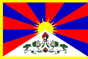
The Dalai Lama returned to Tibet from India in July 1912. By the end of 1912, the Chinese troops in Tibet had returned, via India, to China Proper.[21]
In 1913, Tibet and Mongolia allegedly [22][23] signed a treaty proclaiming mutual recognition and their independence from China. However, the validity of such a treaty is disputed by historians and diplomats[22] as there was not, at the time, nor has there been since, any official publication of the text by either party, and the text does not appear to have been published in any language other than English.[23][24]
In 1914, representatives of China, Tibet and Britain negotiated a treaty in India: the Simla Convention. During the convention, the British tried to divide Tibet into Inner and Outer Tibet. When negotiations broke down over the specific boundary between Inner and Outer, the British demanded instead to advance their line of control, enabling them to annex 90,000 square kilometers of traditional Tibetan territory in southern Tibet, which corresponds to most of the modern Indian state of Arunachal Pradesh, while recognizing Chinese suzerainty over Tibet[25] and affirming the latter's status as part of Chinese territory, with a promise from the Government of China that Tibet will not be converted into a Chinese province.[26][27] Tibetan representatives secretly signed under British pressure; however, the representative of China's central government declared that the secretive annexation of territory was not acceptable. The boundary established in the convention, the McMahon Line, was considered by the British and later the independent Indian government to be the boundary; however, the Chinese view since then has been that since China, which was sovereign over Tibet, did not sign the treaty, the treaty was meaningless, and the annexation and control of southern Tibet Arunachal Pradesh by India is illegal. This paved the way to the Sino-Indian War of 1962 and the boundary dispute between China and India today.
The subsequent outbreak of World War I and Chinese Civil War caused the Western powers and the infighting factions of China proper to lose interest in Tibet, and the 13th Dalai Lama ruled undisturbed until his death in 1933. At that time, the government of Tibet controlled all of Ü-Tsang (Dbus-gtsang) and western Kham (Khams), roughly coincident with the borders of Tibet Autonomous Region today. Eastern Kham, separated by the Yangtze River was under the control of Chinese warlord Liu Wenhui. The situation in Amdo (Qinghai) was more complicated, with the Xining area controlled by ethnic Hui warlord Ma Bufang, who constantly strove to exert control over the rest of Amdo (Qinghai).
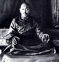
In 1935 the 14th Dalai Lama, Tenzin Gyatso was born in Amdo in eastern Tibet and was recognized as the latest reincarnation. He was taken to Lhasa in 1937 where he was later given an official ceremony in 1939. During the 1940s during World War II, two Austrian mountaineers, Heinrich Harrer and Peter Aufschnaider came to Lhasa, where Harrer became tutor and consort to the young Dalai Lama giving him a sound knowledge of western culture and modern society, until he was forced to leave with the Chinese invasion in 1950.
Rule of the People's Republic of China
Neither the Republic of China nor the People's Republic of China have ever renounced China's claim to sovereignty over Tibet.[28]
In 1950, the People's Liberation Army invaded the Tibetan area of Chamdo, crushing minimal resistance from the ill-equipped Tibetan army. In 1951, the Tibetan representatives, under PLA military pressure, signed a seventeen-point agreement with the PRC's Central People's Government affirming China's sovereignty over Tibet. The agreement was ratified in Lhasa a few months later.[29][30]
Though some of the population of Tibet at that time were serfs ("mi ser"),[31][32] often bound to land owned by monasteries and aristocrats, Tibetans in exile have claimed that the serfs formed only a small part of Tibetan society, and argued that Tibet would have modernized itself without China's intervention. However, the Chinese government claims that most Tibetans were still serfs in 1951,[33] and have proclaimed that the Tibetan government inhibited the development of Tibet during its self-rule from 1913 to 1959, and opposed any modernization efforts proposed by the Chinese government.[34] This agreement was initially put into effect in Tibet proper. However, Eastern Kham and Amdo were outside the administration of the government of Tibet, and were thus treated like any other Chinese province with land redistribution implemented in full. As a result, a resistance broke out in Amdo and eastern Kham in June 1956. The resistance, supported by the US-American CIA, eventually spread to Lhasa. It was crushed by 1959. During this campaign, tens of thousands of Tibetans were killed The 14th Dalai Lama and other government principals fled to exile in India, but isolated resistance continued in Tibet until 1969 when the CIA abruptly withdrew its support.
Although the Panchen Lama remained a virtual prisoner, the Chinese set him as a figurehead in Lhasa, claiming that he headed the legitimate Government of Tibet since the Dalai Lama had fled to India after the failed Tibetan uprising in 1959, and they established him as the traditional head of the Tibetan government.[citation needed] In 1965, the area that had been under the control of the Dalai Lama's government from the 1910s to 1959 (U-Tsang and western Kham) was set up as an Autonomous Region. The monastic estates were broken up and secular education introduced. During the Cultural Revolution, the Chinese Red Guards inflicted a campaign of organized vandalism against cultural sites in the entire PRC, including Tibet's Buddhist heritage. Some young Tibetans joined in the campaign of destruction, voluntarily due to the ideological fervour that was sweeping the entire PRC[35][36] and involuntarily due to the fear of being denounced as enemies of the people.[37] Of the several thousand monasteries in Tibet, over 6,500 were destroyed,[38] only a handful of the most important, religiously or culturally, monasteries remained without major damage according to the Chinese source.[39] And hundreds of thousands of Buddhist monks and nuns were forced to return to secular life.[40] Some were even imprisoned or killed.
In 1989, the Panchen Lama was finally allowed to return to Shigatse, where he addressed a crowd of 30,000 and described what he saw as the suffering of Tibet and the harm being done to his country in the name of socialist reform under the rule of the PRC in terms reminiscent of the petition he had presented to Chinese Premier Zhou Enlai in 1962.[41] . Five days later, he mysteriously died of a massive heart attack at the age of 50.[42]
In 1995 the Dalai Lama named 6 year old Gedhun Choekyi Nyima as the 11th Panchen Lama without Chinese approval, while the PRC named another child, Gyancain Norbu in conflict. Gyancain Norbu was raised in Beijing and has appeared occasionally on state media. The PRC-selected Panchen Lama is rejected by Tibetans [citation needed] who commonly refer to him as the "Panchen Zuma" (literally "fake Panchen Lama"). Gedhun Choekyi Nyima and his family have gone missing - widely believed to be imprisoned by China - and under a hidden identity for protection and privacy according to the PRC.[43]
The PRC continues to portray its rule over Tibet as an unalloyed improvement, but foreign governments continue to make occasional protests about aspects of PRC rule in Tibet because of frequent reports of human rights violation in Tibet by groups such as Human Rights Watch. All governments, however, recognize the PRC's sovereignty over Tibet today, and none have recognized the Government of Tibet in Exile in India.
Evaluation by the Tibetan exile community
The Central Tibetan Administration states that the number that have died in the much unwanted Great Leap Forward, of violence, or other indirect causes since 1950 is approximately 1.2 million,[44] which the Chinese Communist Party denies. The Chinese Communist Party's official toll of deaths recorded for the whole of China for the years of the Great Leap Forward is 14 million[citation needed], but scholars have estimated the number of famine victims to be between 20 and 43 million[45]. As many as 10% of Tibetans were interned, with few survivors.[46] Chinese demographers have estimated that 90,000 of the 300,000 "missing" Tibetans fled the region.[47]
The government of Tibet in Exile also says that, fundamentally, the issue is that of the right to self-determination of the Tibetan people. The Dalai Lama has stated his willingness to negotiate with China for genuine autonomy. Most all Tibetans still call for full Tibetan independence. The Dalai Lama sees the millions of government-imported Han immigrants and preferential socioeconomic policies, as presenting an urgent threat to the Tibetan nation by stealing economic resources and smothering Tibetan culture. Tibetan exile groups say that despite recent attempts to restore the appearance of original Tibetan culture to attract tourism, the traditional Tibetan way of life is now irrevocably changed.
The Chinese government says that when Hu Yaobang, the general secretary of the Chinese Communist Party, visited Lhasa in 1980 he was unhappy when he found out the region was lagging behind neighbouring provinces.[citation needed] Policies were changed, and since then the central government's policy in Tibet has claimed to have granted most religious freedoms, despite the observation of the more stringent government control implemented over Tibetan monasteries.[citation needed] However, in 1998 three monks and five nuns died while in custody, after suffering beatings and torture for having shouted slogans supporting the Dalai Lama and Tibetan independence.[48] Many Tibetans continue to attempt to flee Tibet.[citation needed] Projects that the PRC claims to have benefited Tibet, such as the China Western Development economic plan or the Qinghai-Tibet Railway, are actually politically-motivated actions to consolidate central control over Tibet by facilitating militarization and Han migration while benefit only a few Tibetans.[citation needed] The money funneled into cultural restoration projects is being primarily aimed at purely attracting tourists, and Tibet is still lagging behind the rest of the PRC.[citation needed] The first large hospital in Tibet was not built until 1985.[citation needed] Several of Lhasa's main roads were not paved until 1987 and that the first students at Tibet University did not graduate until 1988.[citation needed] There is still preferential treatment awarded to the Han Chinese population of the TAR in the labour market as opposed to Tibetans.[citation needed]
Evaluation by the People's Republic of China
The government of the PRC maintains that the Tibetan Government did almost nothing to improve the Tibetans' material and political standard of life during its rule from 1913-1959, and that they opposed any reforms proposed by the Chinese government.[49] According to the Chinese government's claim, this is the reason for the tension that grew between some Chinese officials and the Tibetan government in 1959.[50] The government of the PRC also rejects claims that the lives of Tibetans have deteriorated, and claims that the lives of Tibetans have been improved immensely compared to self rule before 1950.[51] Benefits that are commonly quoted include – the GDP of the Tibet Autonomous Region (TAR) today is thirty times that of before 1950, workers in Tibet have the second highest wages in China,[52] the TAR has 22,500 km of highways, as opposed to none in 1950, all secular education in the TAR was created after the revolution, the TAR now has 25 scientific research institutes as opposed to none in 1950, infant mortality has dropped from 43% in 1950 to 0.661% in 2000, life expectancy has risen from 35.5 years in 1950 to 67 in 2000, the collection and publishing of the traditional Epic of King Gesar, which is the longest epic poem in the world and had only been handed down orally before, allocation of 300 million Renminbi since the 1980s for the maintenance and protection of Tibetan monasteries.[53] The Cultural Revolution and the cultural damage it wrought upon the entire PRC is generally condemned as a nationwide catastrophe, whose main instigators, in the PRC's view, the Gang of Four, have been brought to justice. And whose reoccurrence is unthinkable in an increasingly modernized China. The China Western Development plan is viewed by the PRC as a massive, benevolent, and patriotic undertaking by the wealthier eastern coast to help the western parts of China, including Tibet, catch up in prosperity and living standards.
Economy

Tibet's GDP in 2001 was 13.9 billion yuan (USD1.8billion).[54] The Central government exempts Tibet from all taxation and provides 90% of Tibet's government expenditures.[55] The Tibetan economy is dominated by subsistence agriculture. Due to limited arable land, livestock raising is the primary occupation mainly on the Tibetan Plateau, among them are sheep, cattle, goats, camels, yaks and horses. However, the main crops grown are barley, wheat, buckwheat, rye, potatoes and assorted fruits and vegetables.
In recent years, due to the increased interest in Tibetan Buddhism tourism has become an increasingly important sector, and is actively promoted by the authorities. The Tibetan economy is heavily subsidized by the Central government and government cadres receives the second highest salaries in China.[56] The tourism brings in the most income from that of handicrafts. These include Tibetan hats, jewelry (silver and gold), wooden items, clothing, quilts, fabrics, Tibetan rugs and carpets.
The Qinghai-Tibet Railway which links the region to Qinghai in China proper was opened in 2006.[57] The Chinese government claims that the line will promote the development of impoverished Tibet.[58] But opponents argue the railway will harm Tibet. For instance, Tibetan opponents contend that it would only draw more Han Chinese residents, the country's dominant ethnic group, who have been migrating steadily to Tibet over the last decade, bringing with them their popular culture. They believe that the large influx of Han Chinese will ultimately extinguish the local culture.[59]
Other opponents argue that the railway will damage Tibet's fragile ecology and that most of its economic benefits will go to migrant Han Chinese.[60] As activists call for a boycott of the railway, the Dalai Lama has urged Tibetans to "wait and see" what benefits the new line might bring to them. According to Government-in-exile's spokemen, the Dalai Lama welcomes the building of the railway, "conditioned on the fact that the railroad will bring benefit to the majority of Tibetans."[61]
Demographics
Historically, the population of Tibet consisted of primarily ethnic Tibetans. Other ethnic groups in Tibet include Menba (Monpa), Lhoba, Mongols and Hui Chinese. According to tradition the original ancestors of the Tibetan people, as represented by the six red bands in the Tibetan flag, are: the Se, Mu, Dong, Tong, Dru and Ra.
The issue of the proportion of the Han Chinese population in Tibet is a politically sensitive one. The Central Tibetan Administration says that the People's Republic of China has actively swamped Tibet with Han Chinese migrants in order to alter Tibet's demographic makeup.
The death toll in Tibet since the invasion of the People's Liberation Army in 1950 has been estimated at a median of 600,000.[62]
View of the Tibetan exile community
Between the 1960s and 1980s, many prisoners (over 1 million, according to Harry Wu) were sent to laogai camps in Amdo (Qinghai), where they were then employed locally after release. Since the 1980s, increasing economic liberalization and internal mobility has also resulted in the influx of many Han Chinese into Tibet for work or settlement, though the actual number of this floating population remains disputed.
The Government of Tibet in Exile gives the number of non-Tibetans in Greater Tibet as 7.5 million (as opposed to 6 million Tibetans), and claims this is as a result of an active policy of demographically swamping the Tibetan people and further diminishing any chances of Tibetan political independence, and as such, to be in violation of the Geneva Convention of 1946 that prohibits settlement by occupying powers.[citation needed]
The Government of Tibet in Exile questions all statistics given by the PRC government, since they do not include members of the People's Liberation Army garrisoned in Tibet, or the large floating population of unregistered migrants.[citation needed] The Qinghai-Tibet Railway (Xining to Lhasa) is also a major concern, as it is believed to further facilitate the influx of migrants.
View of the People's Republic of China
The PRC government does not view itself as an occupying power and has vehemently denied allegations of demographic swamping. The PRC also does not recognize Greater Tibet as claimed by the government of Tibet in Exile, saying that the idea was engineered by foreign imperialists as a plot to divide China amongst themselves, (Mongolia being a striking precedent, gaining independence with Soviet backing and subsequently aligning itself with the Soviet Union) and that those areas outside the TAR were not controlled by the Tibetan government before 1959 in the first place, having been administered instead by other surrounding provinces for centuries.[63]
The PRC gives the number of Tibetans in Tibet Autonomous Region as 2.4 million, as opposed to 190,000 non-Tibetans, and the number of Tibetans in all Tibetan autonomous entities combined (slightly smaller than the Greater Tibet claimed by exiled Tibetans) as 5.0 million, as opposed to 2.3 million non-Tibetans. In the TAR itself, much of the Han population is to be found in Lhasa. Population control policies like the one-child policy only apply to Han Chinese, not to minorities such as Tibetans [citation needed].
Jampa Phuntsok, chairman of the TAR, has also said that the central government has no policy of migration into Tibet due to its harsh high-altitude conditions, that the 6% Han in the TAR is a very fluid group mainly doing business or working, and that there is no immigration problem.[64]
| Major ethnic groups in Greater Tibet by region, 2000 census. | |||||||
|---|---|---|---|---|---|---|---|
| Total | Tibetans | Han Chinese | others | ||||
| Tibet Autonomous Region: | 2,616,329 | 2,427,168 | 92.8% | 158,570 | 6.1% | 30,591 | 1.2% |
| - Lhasa PLC | 474,499 | 387,124 | 81.6% | 80,584 | 17.0% | 6,791 | 1.4% |
| - Qamdo Prefecture | 586,152 | 563,831 | 96.2% | 19,673 | 3.4% | 2,648 | 0.5% |
| - Shannan Prefecture | 318,106 | 305,709 | 96.1% | 10,968 | 3.4% | 1,429 | 0.4% |
| - Xigazê Prefecture | 634,962 | 618,270 | 97.4% | 12,500 | 2.0% | 4,192 | 0.7% |
| - Nagqu Prefecture | 366,710 | 357,673 | 97.5% | 7,510 | 2.0% | 1,527 | 0.4% |
| - Ngari Prefecture | 77,253 | 73,111 | 94.6% | 3,543 | 4.6% | 599 | 0.8% |
| - Nyingchi Prefecture | 158,647 | 121,450 | 76.6% | 23,792 | 15.0% | 13,405 | 8.4% |
| Qinghai Province: | 4,822,963 | 1,086,592 | 22.5% | 2,606,050 | 54.0% | 1,130,321 | 23.4% |
| - Xining PLC | 1,849,713 | 96,091 | 5.2% | 1,375,013 | 74.3% | 378,609 | 20.5% |
| - Haidong Prefecture | 1,391,565 | 128,025 | 9.2% | 783,893 | 56.3% | 479,647 | 34.5% |
| - Haibei AP | 258,922 | 62,520 | 24.1% | 94,841 | 36.6% | 101,561 | 39.2% |
| - Huangnan AP | 214,642 | 142,360 | 66.3% | 16,194 | 7.5% | 56,088 | 26.1% |
| - Hainan AP | 375,426 | 235,663 | 62.8% | 105,337 | 28.1% | 34,426 | 9.2% |
| - Golog AP | 137,940 | 126,395 | 91.6% | 9,096 | 6.6% | 2,449 | 1.8% |
| - Gyêgu AP | 262,661 | 255,167 | 97.1% | 5,970 | 2.3% | 1,524 | 0.6% |
| - Haixi AP | 332,094 | 40,371 | 12.2% | 215,706 | 65.0% | 76,017 | 22.9% |
| Tibetan areas in Sichuan province | |||||||
| - Ngawa AP | 847,468 | 455,238 | 53.7% | 209,270 | 24.7% | 182,960 | 21.6% |
| - Garzê AP | 897,239 | 703,168 | 78.4% | 163,648 | 18.2% | 30,423 | 3.4% |
| - Muli AC | 124,462 | 60,679 | 48.8% | 27,199 | 21.9% | 36,584 | 29.4% |
| Tibetan areas in Yunnan province | |||||||
| - Dêqên AP | 353,518 | 117,099 | 33.1% | 57,928 | 16.4% | 178,491 | 50.5% |
| Tibetan areas in Gansu province | |||||||
| - Gannan AP | 640,106 | 329,278 | 51.4% | 267,260 | 41.8% | 43,568 | 6.8% |
| - Tianzhu AC | 221,347 | 66,125 | 29.9% | 139,190 | 62.9% | 16,032 | 7.2% |
| Total for Greater Tibet: | |||||||
| With Xining and Haidong | 10,523,432 | 5,245,347 | 49.8% | 3,629,115 | 34.5% | 1,648,970 | 15.7% |
| Without Xining and Haidong | 7,282,154 | 5,021,231 | 69.0% | 1,470,209 | 20.2% | 790,714 | 10.9% |
This table includes all Tibetan autonomous entities in the People's Republic of China, plus Xining PLC and Haidong P. The latter two are included to complete the figures for Qinghai province, and also because they are claimed as parts of Greater Tibet by the Government of Tibet in exile.
P = Prefecture; AP = Autonomous prefecture; PLC = Prefecture-level city; AC = Autonomous county
Excludes members of the People's Liberation Army in active service.
Source: Department of Population, Social, Science and Technology Statistics of the National Bureau of Statistics of China (国家统计局人口和社会科技统计司) and Department of Economic Development of the State Ethnic Affairs Commission of China (国家民族事务委员会经济发展司), eds. Tabulation on Nationalities of 2000 Population Census of China (《2000年人口普查中国民族人口资料》). 2 vols. Beijing: Nationalities Publishing House (民族出版社), 2003. (ISBN 7-105-05425-5)
Culture

Religion
Tibetan Buddhism
Religion is extremely important to the Tibetans; Tibet is the traditional center of Tibetan Buddhism, a distinctive form of Vajrayana, which is also related to the Shingon Buddhist tradition in Japan. Tibetan Buddhism is practiced not only in Tibet but also in Mongolia, the Buryat Republic, the Tuva Republic, and in the Republic of Kalmykia. Tibet is also home to the original spiritual tradition called Bön.
Islam
In Tibetan cities, there are also small communities of Muslims, known as Kachee (Kache), who trace their origin to immigrants from three main regions: Kashmir (Kachee Yul in ancient Tibetan), Ladakh and the Central Asian Turkic countries. Islamic influence in Tibet also came from Persia. After 1959 a group of Tibetan Muslims made a case for Indian nationality based on their historic roots to Kashmir and the Indian government declared all Tibetan Muslims Indian citizens later on that year.[65] There is also a well established Chinese Muslim community (gya kachee), which traces its ancestry back to the Hui ethnic group of China. It is said that Muslim migrants from Kashmir and Ladakh first entered Tibet around the 12th century. Marriages and social interaction gradually led to an increase in the population until a sizable community grew up around Lhasa.[citation needed]
The Potala Palace, former residence of the Dalai Lamas, is a World Heritage Site, as is Norbulingka, former summer residence of the Dalai Lama.
During the suppression of pro-independence forces in the 1950s, and during the Cultural Revolution in the 1960s, most historically significant sites in Tibet were vandalized or totally destroyed.
Since 2002, Tibetans in exile have allowed a Miss Tibet beauty contest in spite of concerns that this event is considered a Western influence. The beauty contest is condemned by the Tibetan government in exile.[citation needed]
Buddhist monasteries in Tibet
Notable monasteries:
- Ani Tsankhung Nunnery
- Changzhu Temple
- Dorje Drak
- Drepung Monastery
- Drigung Monastery
- Dzogchen Monastery
- Ganden Monastery
- Jokhang
- Kumbum Monastery (Kham)
- Labrang Monastery
- Menri Monastery
- Namgyal Monastery
- Narthang Monastery
- Palcho Monastery
- Ralung Monastery
- Ramoche Temple
- Sakya Monastery
- Sanga Monastery
- Sera Monastery
- Shalu Monastery
- Shechen Monastery
- Surmang Monastery
- Tashilhunpo
- Tsurphu Monastery
- Yerpa
Tibetan art
Tibetan representations of art are intrinsically bound with Tibetan Buddhism and commonly depict deities or variations of Buddha in various forms from bronze Buddhist statues and shrines, to highly colorful thangka paintings and mandalas.
Architecture
Tibetan architecture contains Oriental and Indian influences, and reflects a deeply Buddhist approach. The Buddhist wheel, along with two dragons, can be seen on nearly every Gompa in Tibet. The design of the Tibetan Chörtens can vary, from roundish walls in Kham to squarish, four-sided walls in Ladakh.
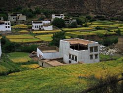
The most unusual feature of Tibetan architecture is that many of the houses and monasteries are built on elevated, sunny sites facing the south, and are often made out a mixture of rocks, wood, cement and earth. Little fuel is available for heat or lighting, so flat roofs are built to conserve heat, and multiple windows are constructed to let in sunlight. Walls are usually sloped inwards at 10 degrees as a precaution against frequent earthquakes in the mountainous area.
Standing at 117 meters in height and 360 meters in width, the Potala Palace is considered as the most important example of Tibetan architecture. Formerly the residence of the Dalai Lama, it contains over a thousand rooms within thirteen stories, and houses portraits of the past Dalai Lamas and statues of the Buddha. It is divided between the outer White Palace, which serves as the administrative quarters, and the inner Red Quarters, which houses the assembly hall of the Lamas, chapels, 10,000 shrines, and a vast library of Buddhist scriptures.
Music
The music of Tibet reflects the cultural heritage of the trans-Himalayan region, centered in Tibet but also known wherever ethnic Tibetan groups are found in India, Bhutan, Nepal and further abroad. First and foremost Tibetan music is religious music, reflecting the profound influence of Tibetan Buddhism on the culture.
Tibetan music often involves chanting in Tibetan or Sanskrit, as an integral part of the religion. These chants are complex, often recitations of sacred texts or in celebration of various festivals. Yang chanting, performed without metrical timing, is accompanied by resonant drums and low, sustained syllables. Other styles include those unique to the various schools of Tibetan Buddhism, such as the classical music of the popular Gelugpa school, and the romantic music of the Nyingmapa, Sakyapa and Kagyupa schools.
Nangma dance music is especially popular in the karaoke bars of the urban center of Tibet, Lhasa. Another form of popular music is the classical gar style, which is performed at rituals and ceremonies. Lu are a type of songs that feature glottal vibrations and high pitches. There are also epic bards who sing of Tibet's national hero Gesar.
Festivals
Tibet has various festivals which commonly are performed to worship the Buddha throughout the year. Losar is the Tibetan New Year Festival and the Monlam Prayer Festival follows it in the first month of the Tibetan calendar which involves many Tibetans dancing and participating in sports events and sharing picnics.
Cuisine
The most important crop in Tibet is barley, and dough made from barley flour called tsampa, is the staple food of Tibet. This is either rolled into noodles or made into steamed dumplings called momos. Meat dishes are likely to be yak, goat, or mutton, often dried, or cooked into a spicy stew with potatoes. Mustard seed is cultivated in Tibet, and therefore features heavily in its cuisine. Yak yoghurt, butter and cheese are frequently eaten, and well-prepared yoghurt is considered something of a prestige item. Butter tea is very popular to drink and many Tibetans drink up to 100 cups a day.[citation needed]
Tibet in popular culture
In recent years there have been a number of films produced about Tibet, mostly notably Hollywood films such as Seven Years in Tibet, starring Brad Pitt, and Kundun, a biography of the Dalai Lama, directed by Martin Scorsese. Both of these films were banned by the Chinese government because of Tibetan nationalist overtones. Other films include Samsara, The Cup and the 1999 Himalaya, a French-American produced film with a Tibetan cast set in Nepal and Tibet. In 2005, exile Tibetan filmmaker Tenzing Sonam and his partner Ritu Sarin made Dreaming Lhasa, the first internationally recognized feature film to come out of the diaspora to explore the contemporary reality of Tibet. In 2006, Sherwood Hu made Prince of the Himalayas, an adaptation of Shakespeare's Hamlet, set in ancient Tibet and featuring an all-Tibetan cast. Seen also briefly in the 1994 movie The Shadow, starring Alec Baldwin. Kekexili
, or Mountain Patrol, is a film made by National Geographic about a Chinese reporter that goes to Tibet to report on the issue involving the endangerment of Tibetan Antelope.
Gallery
- IMG 1972 Sakya.jpg
Monks at Sakya Monastery
- IMG 1719 Gyantze.jpg
Gyantse
- IMG 1125 Lhasa Sera.jpg
Monks at Sera
- YumbuLhakhang.jpg
Yumbo Lhakang
- Drepung monastery.jpg
Drepung Monastery
- IMG 0839 Yarlong Tsangpo.jpg
Yarlung Tsangpo
- Sera15.JPG
Sera Monastery
- Litang-ninos-c01-f.jpg
Tibetan children in Lithang
- OmManiPadmeHum.jpg
ReferencesISBN links support NWE through referral fees
- ↑ 西藏自治区; 青海省; 四川省; 云南省; 甘肃省 (行政区划网).
- ↑ Tibet at a glance (The Office of Tibet, London; 30 September 1996);
Official web page of Arunachal Pradesh;
China-India Border: Eastern Sector (map produced by the United States Central Intelligence Agency; Perry-Castañeda Library Map Collection, University of Texas at Austin). - ↑ China-India Border: Western Sector (map produced by the United States Central Intelligence Agency; Perry-Castañeda Library Map Collection, University of Texas at Austin);
Official Website of Jammu and Kasmir (Directorate of Information, Jammu and Kashmir Government). - ↑ China-India Border: Eastern Sector (map produced by the United States Central Intelligence Agency; Perry-Castañeda Library Map Collection, University of Texas at Austin);
China Tibet Information Center. - ↑ Kingdom of Bhutan (Bhutan Tourism Corporation Limited);
About Sikkim (Government of Sikkim, Department of Information Technology);
History of Leh (Ladakh Autonomous Hill Development Council). - ↑ Van Driem, George "Tibeto-Burman Phylogeny and Prehistory: Languages, Material Culture and Genes".
- ↑ Bellwood, Peter & Renfrew, Colin (eds) Examining the farming/language dispersal hypothesis (2003), Ch 19.
- ↑ Beckwith, C. Uni. of Indiana Diss., 1977
- ↑ Jiawei, Wang, "The Historical Status of China's Tibet", 2000, pp71-79
- ↑ Jiawei, Wang, "The Historical Status of China's Tibet", 2000, pp71-79
- ↑ The Office of His Holiness the Dalai Lama, "The Sixth Dalai Lama, Tsangyang Gyatso", 2007
- ↑ Bell, 1924 p. 284; Allen, 2004, p. 282
- ↑ Bell, 1924, p. 288
- ↑ McKay, 1997, pp. 230-1.
- ↑ Bell, 1924, pp. 46-7, 278-80
- ↑ Convention Between Great Britain and China Respecting Tibet (1906)
- ↑ Convention Between Great Britain and Russia (1907)
- ↑ Smith (1996), p. 175
- ↑ Bell (1924), p. 113
- ↑ Bell (1924), p. 113
- ↑ 21.0 21.1 Smith (1996), p. 181
- ↑ 22.0 22.1 The Tibetan representative who signed this document is said to have been a pro-Russian Buryat monk named Agvan Dorjiev. There exist some doubts as to the existence/validity of this treaty, the 13th Dalai Lama himself denied that he authorized Dorijiev to negotiate a treaty with Mongolia and, besides, neither the cleric or the Tibetan government ever ratified the treaty. see Bell, Charles, Tibet Past and Present, 1924, pp150-151. In January 1913, the Russian Foreign Minister, reported the signing of this treaty to the British Ambassador at St. Petersburg, saying the treaty, in his opinion, was not valid; it was nul et non avenu. The Russian government maintained that, as a Russian subject, Dorjiev could not possibly act in a diplomatic capacity on behalf of the Dalai Lama, a peculiar argument, to say the least. see UK Foreign Office Archive: FO 371/1608.
- ↑ 23.0 23.1 Grunfeld, 1996, p65
- ↑ Quoted by Sir Charles Bell, "Tibet and Her Neighbours", Pacific Affairs(Dec 1937), pp435-436, a high Tibetan official pointed our years later that there was "no need for a treaty; we would always help each other if we could."
- ↑ Article 2 of the Simla Convention
- ↑ Appendix of the Simla Convention
- ↑ Goldstein, Melvyn C., A History of Modern Tibet, 1913-1951, University of California Press, 1989, p75
- ↑ Grunfeld, 1996, pp255-257
- ↑ Gyatso, Tenzin, Dalai Lama XIV, interview, 25 July 1981.
- ↑ Goldstein, Melvyn C., A History of Modern Tibet, 1913-1951, University of California Press, 1989, pp812-813
- ↑ Goldstein, Melvyn, An Anthropological Study of the Tibetan Political System, 1968, p40
- ↑ Rahul, Ram, The Structure of the Government of Tibet, 1644-1911, 1962, pp263-298
- ↑ Jiawei, Wang, "The Historical Status of China's Tibet", 2000, pp194-197
- ↑ Jiawei, Wang, "The Historical Status of China's Tibet", 2000, pp194-197
- ↑ Wang Lixiong, 'Reflections on Tibet', New Left Review 14, March-April 2002
- ↑ Jan Wong, 'TIBET: Life at the top of the world', World Tibet Network News, December 10 1994
- ↑ Tsering Shakya, 'Blood in the Snows', New Left Review 15, May-June 2002
- ↑ 'Monastic Education in the Gönpa' Conservancy for Tibetan Art & Culture
- ↑ Jiawei, Wang, "The Historical Status of China's Tibet", 2000, pp210-211
- ↑ Jiawei, Wang, "The Historical Status of China's Tibet", 2000, pp212-214
- ↑ The petition of 10th Panchen Lama in 1962
- ↑ "Panchen Lama Poisoned arrow", BBC, 2001-10-14. Retrieved 2007-04-29.
- ↑ 'Tibet: 6-year old boy missing and over 50 detained in Panchen Lama dispute', Amnesty International, January 18, 1996
- ↑ 'Tibet: Proving Truth from Facts', The Department of Information and International Relations: Central Tibetan Administration, 1996. p. 53
- ↑ Peng Xizhe (彭希哲), "Demographic Consequences of the Great Leap Forward in China's Provinces," Population and Development Review 13, no. 4 (1987), 639-70.
For a summary of other estimates, please refer to this link - ↑ Black Book ISBN 0-674-07608-7, Internment Est:p. 545, (cites Kewly, Tibet p. 255); Tibet Death Est: p. 546
- ↑ Yan Hao, 'Tibetan Population in China: Myths and Facts Re-examined', Asian Ethnicity, Volume 1, No. 1, March 2000, p.24
- ↑ Amnesty International, 'Call for accountability for Tibetan deaths in custody in Drapchi Prison'
- ↑ Jiawei, Wang, "The Historical Status of China's Tibet", 2000, pp194-197
- ↑ Jiawei, Wang, "The Historical Status of China's Tibet", 2000, pp194-197
- ↑ Peter Hessler, 'Tibet Through Chinese Eyes', The Atlantic Monthly, Feb. 1999
- ↑ 'High wages in Tibet benefit the privliviged', Asian Labour News, 21 February 2005,
- ↑ 'Tibet's March Toward Modernization, section II The Rapid Social Development in Tibet', Information Office of the State Council of the PRC, November 2001
- ↑ "China's Tibet Fact and Figures 2003", China Tibet Information Service, 2002-08-26. Retrieved 2006-02-24.
- ↑ "Tibet's economy depends on Beijing", NPR News, 2002-08-26. Retrieved 2006-02-24.
- ↑ "High wages in Tibet benefit the privileged", Asia Labour News, 2005-02-21. Retrieved 2006-02-24.
- ↑ "China opens world's highest railway", Australian Broadcasting Corporation, 2005-07-01. Retrieved 2006-07-01.
- ↑ "China completes railway to Tibet", BBC News, 2005-10-15. Retrieved 2006-07-04.
- ↑ "Deemed a road to ruin, Tibetans say Beijing rail-way poses latest threat to minority culture", Boston Globe, 2002-08-26. Retrieved 2006-07-04.
- ↑ "China Opens 1st Train Service to Tibet", Washington Post, 2006-06-30. Retrieved 2006-07-04.
- ↑ "Dalai Lama Urges 'Wait And See' On Tibet Railway", Deutsche Presse Agentur, 2006-06-30. Retrieved 2006-07-04.
- ↑ Source List and Detailed Death Tolls for the Twentieth Century Hemoclysm
- ↑ Xinhua News report (Chinese)
- ↑ SINA News report (Chinese)
- ↑ Masood Butt, 'Muslims of Tibet', The Office of Tibet, January/February 1994
Further reading
- Allen, Charles (2004). Duel in the Snows: The True Story of the Younghusband Mission to Lhasa. London: John Murray, 2004. ISBN 0-7195-5427-6.
- Bell, Charles (1924). Tibet: Past & Present. Oxford: Clarendon Press.
- Dowman, Keith (1988). The Power-Places of Central Tibet: The Pilgrim's Guide. Routledge & Kegan Paul. London, ISBN 0-7102-1370-0. New York, ISBN 0-14-019118-6.
- Goldstein, Melvyn C.; with the help of Gelek Rimpoche. A History of Modern Tibet, 1913-1951: The Demise of the Lamaist State. Munshiram Manoharlal Publishers (1993), ISBN 81-215-0582-8. University of California (1991), ISBN 0-520-07590-0.
- Grunfeld, Tom (1996). The Making of Modern Tibet. ISBN 1-56324-713-5.
- Gyatso, Palden (1997). "The Autobiography of a Tibetan Monk". Grove Press. NY, NY. ISBN 0-8021-3574-9
- Human Rights in China: China, Minority Exclusion, Marginalization and Rising Tensions, London, Minority Rights Group International, 2007
- McKay, Alex (1997). Tibet and the British Raj: The Frontier Cadre 1904-1947. London: Curzon. ISBN 0-7007-0627-5.
- Norbu, Thubten Jigme; Turnbull, Colin (1968). Tibet: Its History, Religion and People. Reprint: Penguin Books (1987).
- Pachen, Ani; Donnely, Adelaide (2000). Sorrow Mountain: The Journey of a Tibetan Warrior Nun. Kodansha America, Inc. ISBN 1-56836-294-3.
- Parenti, Michael (2004)."Friendly Feudalism: The Tibet Myth".
- Petech, Luciano (1997). China and Tibet in the Early XVIIIth Century: History of the Establishment of Chinese Protectorate in Tibet. T'oung Pao Monographies, Brill Academic Publishers, ISBN 9-00403-442-0.
- Samuel, Geoffrey (1993). Civilized Shamans: Buddhism in Tibetan Societies. Smithsonian ISBN 1-56098-231-4.
- Schell, Orville (2000). Virtual Tibet: Searching for Shangri-La from the Himalayas to Hollywood. Henry Holt. ISBN 0-8050-4381-0.
- Shakya, Tsering (1999). The Dragon in the Land of Snows: A History of Modern Tibet Since 1947. New York: Columbia University Press. ISBN 0-231-11814-7.
- Smith, Warren W. (Jr.) (1996). Tibetan Nation: A History of Tibetan Nationalism and Sino-Tibetan Relations. Boulder, CO: Westview Press. ISBN 0-8133-3155-2.
- Stein, R. A. (1962). Tibetan Civilization. First published in French; English translation by J. E. Stapelton Driver. Reprint: Stanford University Press (with minor revisions from 1977 Faber & Faber edition), 1995. ISBN 0-8047-0806-1.
- Thurman, Robert (2002). Robert Thurman on Tibet. DVD. ASIN B00005Y722.
- Wilby, Sorrel (1988). Journey Across Tibet: A Young Woman's 1900-Mile Trek Across the Rooftop of the World. Contemporary Books. ISBN 0-8092-4608-2.
- Wilson, Brandon (2004). Yak Butter Blues: A Tibetan Trek of Faith. Heliographica. An Imprint of Pilgrim's Tales. ISBN 1-933037-23-7, ISBN 1-933037-24-5.
- Jiawei, Wang (2000). "The Historical Status of China's Tibet". ISBN-7-80113-304-8.
- Tibet wasn't always ours, says Chinese scholar by Venkatesan Vembu, Daily News & Analysis, 22 February 2007
See also
| This article contains Chinese text. Without proper rendering support, you may see question marks, boxes, or other symbols instead of Chinese characters. |
| This article contains Indic text. Without proper rendering support, you may see question marks or boxes, misplaced vowels or missing conjuncts instead of Indic text. |
- Amdo and Kham in eastern Tibet
- Évariste Régis Huc (Abbé Huc) visited Tibet in 1845-1846, and wrote his observations in Souvenirs d'un voyage dans la Tartarie, le Thibet, et la Chine pendant les années 1844-1846.
- Francis Younghusband led a punitive military expedition to Tibet in 1904.
- Alexandra David-Neel visited Lhasa in 1924, and wrote several books about the country and its culture.
- Human rights in the People's Republic of China
- Central Tibetan Administration aka Tibetan Government in Exile
- International Tibet Independence Movement aka Free Tibet Movement
- List of active autonomist and secessionist movements
- Tibetan American
- Seven Years in Tibet
- Kundun
- Tibetan Buddhism
- South Tibet
- Nangpa La killings
- Ladakh
- Baltistan
External links
Template:Cleanup-spam
Against PRC rule and policies in Tibet
- Tibetan Government in Exile's main web site
- Tibetan Government in Exile's government site
- Students for a Free Tibet's website
For PRC rule and policies in Tibet
- Tibetan History on the China Tibet Information Center of the PRC
- White Paper on Tibetan Culture and Homayk
Apolitical
- Travel guide to Tibet from Wikitravel
Credits
New World Encyclopedia writers and editors rewrote and completed the Wikipedia article in accordance with New World Encyclopedia standards. This article abides by terms of the Creative Commons CC-by-sa 3.0 License (CC-by-sa), which may be used and disseminated with proper attribution. Credit is due under the terms of this license that can reference both the New World Encyclopedia contributors and the selfless volunteer contributors of the Wikimedia Foundation. To cite this article click here for a list of acceptable citing formats.The history of earlier contributions by wikipedians is accessible to researchers here:
The history of this article since it was imported to New World Encyclopedia:
Note: Some restrictions may apply to use of individual images which are separately licensed.
