Difference between revisions of "Berlin" - New World Encyclopedia
Mike Butler (talk | contribs) |
Mike Butler (talk | contribs) |
||
| Line 49: | Line 49: | ||
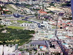
[[Image:Berlin.svg|thumb|left|250px|Natural and built environment.]] | [[Image:Berlin.svg|thumb|left|250px|Natural and built environment.]] | ||
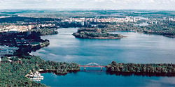
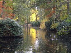
[[Image:Potsdam view from above.jpg|thumb|left|250px|The hinterland of Berlin is covered with woodlands and numerous lakes ([[Havel]] river).]] | [[Image:Potsdam view from above.jpg|thumb|left|250px|The hinterland of Berlin is covered with woodlands and numerous lakes ([[Havel]] river).]] | ||
| − | The name ''Berlin'' | + | The name ''Berlin'' may derive from the old (West Slavic) [[Polabian language|Polabian]] stem ''berl-'' or ''birl-'' meaning "swamp". |
| − | Berlin is located in eastern Germany, about 44 miles (70km) west of the border with [[Poland]] in an area with marshy terrain. Berlin's landscape was shaped by [[ice sheet]]s during the last [[Ice Age]]. The city center lies along the river [[Spree]] in the Berlin-Warsaw ''Urstromtal'' (ancient river valley), formed by water flowing from melting ice sheets | + | Berlin is located in eastern Germany, about 44 miles (70km) west of the border with [[Poland]] in an area with marshy terrain. Berlin's landscape was shaped by [[ice sheet]]s during the last [[Ice Age]]. The city center lies along the river [[Spree]] in the Berlin-Warsaw ''Urstromtal'' (ancient river valley), formed by water flowing from melting ice sheets. |
Substantial parts of present-day Berlin extend onto the low plateaus on both sides of the Spree Valley. Large parts of the boroughs [[Reinickendorf]] and [[Pankow]] lie on the Barnim plateau, while most of the boroughs [[Charlottenburg-Wilmersdorf]], [[Steglitz-Zehlendorf]], [[Tempelhof-Schöneberg]], and [[Neukölln]] lie on the Teltow plateau. The borough of Spandau lies partly within the Berlin ''Urstromtal'' and partly on the Nauen Plain, which stretches to the west of Berlin. | Substantial parts of present-day Berlin extend onto the low plateaus on both sides of the Spree Valley. Large parts of the boroughs [[Reinickendorf]] and [[Pankow]] lie on the Barnim plateau, while most of the boroughs [[Charlottenburg-Wilmersdorf]], [[Steglitz-Zehlendorf]], [[Tempelhof-Schöneberg]], and [[Neukölln]] lie on the Teltow plateau. The borough of Spandau lies partly within the Berlin ''Urstromtal'' and partly on the Nauen Plain, which stretches to the west of Berlin. | ||
| − | The highest elevations in Berlin are the [[Teufelsberg]] | + | The highest elevations in Berlin are the [[Teufelsberg]] and the Müggelberge, both of which have an elevation of about 377 feet (115 meters). The Teufelsberg is a pile of rubble from the ruins of [[World War II]]. |
| − | Berlin has a [[temperate]]/mesothermal climate | + | Berlin has a [[temperate]]/mesothermal climate. The warmest months are June, July, and August, with mean temperatures of 62.1°F to 64.2°F (16.7°C to 17.9°C). The coldest are December, January, and February, with mean temperatures of 31.3°F to 34.2°F (−0.4 to 1.2°C). Berlin's built-up area creates a [[microclimate]], with heat stored by the city's buildings. Temperatures can be 7.2°F (4°C) higher than in the surrounding areas. The mean annual [[precipitation]] totals 22.8 inches (578mm). |
In [[Spandau]], Berlin's westernmost borough, the Spree meets the river [[Havel]], which flows from north to south through western Berlin. The course of the Havel is more like a chain of lakes, the largest being the Tegeler See and [[Wannsee|Großer Wannsee]]. A series of lakes also feeds into the upper Spree, which flows through the [[Müggelsee|Großer Müggelsee]] in eastern Berlin. | In [[Spandau]], Berlin's westernmost borough, the Spree meets the river [[Havel]], which flows from north to south through western Berlin. The course of the Havel is more like a chain of lakes, the largest being the Tegeler See and [[Wannsee|Großer Wannsee]]. A series of lakes also feeds into the upper Spree, which flows through the [[Müggelsee|Großer Müggelsee]] in eastern Berlin. | ||
| − | + | Berlin was devastated by bombing raids during [[World War II]] and many of the old buildings that escaped the bombs were eradicated in the 1950s and 1960s, in both West and East Berlin, in programs to build new residential or business quarters and main roads. Berlin's unique recent history has left the city with an eclectic array of architecture and sights. | |
| − | In the eastern part, many ''[[Plattenbau]]ten'' can be found, reminders of [[Eastern Bloc]] ambitions to create complete residential areas with fixed ratios of shops, kindergartens and schools. Another difference between former east and west is in the design of little red and green men on pedestrian crossing lights ([[Ampelmännchen]] in German) | + | In the eastern part, many ''[[Plattenbau]]ten'' can be found, reminders of [[Eastern Bloc]] ambitions to create complete residential areas with fixed ratios of shops, kindergartens and schools. Another difference between former east and west is in the design of little red and green men on pedestrian crossing lights ([[Ampelmännchen]] in German). The eastern Ampelmännchen design is now used in the western part of the city as well. |
The city had an area of 344.31 square miles (891.82 square kilometers) in 2006. | The city had an area of 344.31 square miles (891.82 square kilometers) in 2006. | ||
Revision as of 01:32, 28 July 2008
| Berlin | |||
| |||
| Flag | Coat of arms | ||
| |||
| Location of Berlin within Germany / EU | |||
| Location of Berlin within Germany / EU | |||
| Coordinates | Template:Coord/display/title,inline | ||
| Time zone | CET/CEST (UTC+1/+2) | ||
| Administration | |||
| Country | Germany | ||
| NUTS Region | DE3 | ||
| City subdivisions | 12 boroughs | ||
| Governing Mayor | Klaus Wowereit (SPD) | ||
| Governing parties | SPD / Left | ||
| Votes in Bundesrat | 4 (from 69) | ||
| Basic statistics | |||
| Area | 892 km² (344 sq mi) | ||
| - Elevation | 34 - 115 m | ||
| Population | 3,405,000 (11/2006)[1][2] | ||
| - Density | 3,818 /km² (9,889 /sq mi) | ||
| - Urban | 3,700,000 | ||
| - Metro | 4,262,480 (12/2004) | ||
| Other information | |||
| GDP/ Nominal | € 80.3 billion (2006) | ||
| Postal codes | 10001–14199 | ||
| Area codes | 030 | ||
| Licence plate code | B | ||
| Website | berlin.de / 3D Berlin | ||
Berlin is the capital city and one of the sixteen states of the Federal Republic of Germany. Located in northeastern Germany, it is the center of the Berlin-Brandenburg metropolitan area, comprising 4.9 million people from over 180 nations.
First documented in the 13th century, Berlin was successively the capital of the Kingdom of Prussia (1701-1918), the German Empire (1871-1918), the Weimar Republic (1919-1933) and the Third Reich (1933-1945). After World War II, the city was divided; East Berlin became the capital of East Germany while West Berlin became a Western enclave, surrounded by the Berlin Wall from 1961-1989. Following the reunification of Germany in 1990, the city regained its status as the capital of all Germany.
Berlin is a major center in European politics, culture, media, and science.
The metropolis is home to world-renowned universities, research institutes, sporting events, orchestras, museums and personalities. Berlin's urban landscape and historical legacy has made it a popular setting for international film productions. Recognized for its festivals, contemporary architecture, nightlife and avant-garde arts, Berlin has evolved into a focal point for individuals attracted by liberal lifestyle, modern zeitgeist and low cost of living.
Geography
The name Berlin may derive from the old (West Slavic) Polabian stem berl- or birl- meaning "swamp".
Berlin is located in eastern Germany, about 44 miles (70km) west of the border with Poland in an area with marshy terrain. Berlin's landscape was shaped by ice sheets during the last Ice Age. The city center lies along the river Spree in the Berlin-Warsaw Urstromtal (ancient river valley), formed by water flowing from melting ice sheets.
Substantial parts of present-day Berlin extend onto the low plateaus on both sides of the Spree Valley. Large parts of the boroughs Reinickendorf and Pankow lie on the Barnim plateau, while most of the boroughs Charlottenburg-Wilmersdorf, Steglitz-Zehlendorf, Tempelhof-Schöneberg, and Neukölln lie on the Teltow plateau. The borough of Spandau lies partly within the Berlin Urstromtal and partly on the Nauen Plain, which stretches to the west of Berlin.
The highest elevations in Berlin are the Teufelsberg and the Müggelberge, both of which have an elevation of about 377 feet (115 meters). The Teufelsberg is a pile of rubble from the ruins of World War II.
Berlin has a temperate/mesothermal climate. The warmest months are June, July, and August, with mean temperatures of 62.1°F to 64.2°F (16.7°C to 17.9°C). The coldest are December, January, and February, with mean temperatures of 31.3°F to 34.2°F (−0.4 to 1.2°C). Berlin's built-up area creates a microclimate, with heat stored by the city's buildings. Temperatures can be 7.2°F (4°C) higher than in the surrounding areas. The mean annual precipitation totals 22.8 inches (578mm).
In Spandau, Berlin's westernmost borough, the Spree meets the river Havel, which flows from north to south through western Berlin. The course of the Havel is more like a chain of lakes, the largest being the Tegeler See and Großer Wannsee. A series of lakes also feeds into the upper Spree, which flows through the Großer Müggelsee in eastern Berlin.
Berlin was devastated by bombing raids during World War II and many of the old buildings that escaped the bombs were eradicated in the 1950s and 1960s, in both West and East Berlin, in programs to build new residential or business quarters and main roads. Berlin's unique recent history has left the city with an eclectic array of architecture and sights.
In the eastern part, many Plattenbauten can be found, reminders of Eastern Bloc ambitions to create complete residential areas with fixed ratios of shops, kindergartens and schools. Another difference between former east and west is in the design of little red and green men on pedestrian crossing lights (Ampelmännchen in German). The eastern Ampelmännchen design is now used in the western part of the city as well.
The city had an area of 344.31 square miles (891.82 square kilometers) in 2006.
History
In 98 C.E., Roman historian Tacitus described the territory of Germania, and what was to become Berlin was well outside the frontiers of the Roman Empire. Germanic tribes then inhabited the region. From the sixth century, Slavic peoples from the east started moving into the sparsely populated area between the Elbe and Oder rivers. About 720, Two Slavic tribes settled in the Berlin region. The Hevelli settled on the river Havel with their central settlement in Brandenburg, while the [[Sprevane settled close to the river Spree in today's district of Berlin-Köpenick. About 750, The Hevelli founded Spandow (today's Spandau) on the river Havel. This seems to be the closest settlement to the area which is today known as Berlin.
In the early ninth century, Slavic tribes settled an area under a name which is recorded in a Latin document as "Berolina". It was a small town with a stockade round, on a trade route linking southern Europe with the Baltic Sea.
In 948, Emperor Otto I the Great established German control over the now largely Slavic inhabitants of the area and founded the dioceses of Havelberg and Brandenburg.
Cities merge
The suburb of Spandau is first mentioned in 1197, and Köpenick in 1209, though these areas did not join Berlin until 1920. The central part of Berlin can be traced back to two towns: Cölln (on the Fisher Island) is first mentioned in a 1237 document, and Berlin (across the Spree in what is now called the Nikolaiviertel) in one from 1244. From the beginning, the two cities formed an economic and social unit. In 1307, the two cities were united politically. Over time, the twin cities came to be known simply as Berlin, the larger of the pair.
In 1415 Frederick I became the elector of the Margraviate of Brandenburg, which he ruled until 1440. His successor, Frederick II, established Berlin as capital of the margraviate, and subsequent members of the Hohenzollern family ruled until 1918 in Berlin, first as electors of Brandenburg, then as kings of Prussia, and finally as German emperors.
In 1448 citizens rebelled in the “Berlin Indignation” against the construction of a new royal palace by Elector Frederick II Irontooth. This protest was not successful, however, and the citizenry lost many of its political and economic privileges. In 1451 Berlin became the royal residence of the Brandenburg electors, and Berlin had to give up its status as a free Hanseatic city. In 1539 the electors and the city officially became Lutheran.
Edict of Potsdam
The Thirty Years' War, between 1618 and 1648, resulted in damage to one third of the houses of Berlin, and the loss of half of the city's population. Frederick William, known as the “Great Elector,” who had succeeded his father George William as ruler in 1640, initiated a policy of promoting immigration and religious tolerance. With the Edict of Potsdam in 1685, Frederick William offered asylum to the French Huguenots. More than 15,000 Huguenots went to Brandenburg, of whom 6000 settled in Berlin. By 1700, approximately twenty percent of Berlin's residents were French, and their cultural influence on the city was immense. Many other immigrants came from Bohemia, Poland, and Salzburg.
Prusian capital
With the coronation of Frederick I in 1701 as king, Berlin became the capital of the Kingdom of Prussia. In 1740 Friedrich II, known as Frederick the Great (1740-1786) came to power. Berlin became, under the rule of the philosophically-oriented Frederick II, a center of the Enlightenment. Following France's victory in the War of the Fourth Coalition, Napoleon Bonaparte marched into Berlin in 1806, but granted self-government to the city.
Industrial expansion
The Industrial Revolution transformed Berlin during the 19th century; the city's economy and population expanded dramatically, and it became the main rail hub and economic center of Germany. Additional suburbs soon developed and increased the area and population of Berlin. In 1861, outlying suburbs including Wedding, Moabit, and several others were incorporated into Berlin. In 1871, Berlin became capital of the newly founded German Empire.
Weimar Republic
At the end of World War I in 1918, the Weimar Republic was proclaimed in Berlin. In 1920, the Greater Berlin Act united dozens of suburban cities, villages, and estates around Berlin into a greatly expanded city and established Berlin as a separate administrative region. After this expansion, Berlin had a population of around four million. Berlin in the 1920s was an exciting city known for its liberal subcultures, including homosexuals and prostitution and well known for its fierce political street fights. This is portrayed in the 1972 film Cabaret, set in 1931.
Hitler
After the 1933 elections, Adolf Hitler and the Nazi Party came to power in 1933. Nazi rule destroyed Berlin's Jewish community, which numbered 170,000 before the Nazis came to power. After the pogrom of Kristallnacht in 1938, thousands of the city's German Jews were imprisoned in the nearby Sachsenhausen concentration camp or, in early 1943, were shipped to death camps, such as Auschwitz. Hitler had planned to rebuild Berlin on a massive scale, renaming it "Welthauptstadt Germania"; apart from the Olympic Stadium, however, the plan never got off the ground because of the war. During the war, large parts of Berlin were destroyed in the 1943–45 air raids and during the Battle of Berlin.
City divided
After the end of the war in Europe in 1945, Berlin received large numbers of refugees from the Eastern provinces. The victorious powers divided the city into four sectors, analogous to the occupation zones into which Germany was divided. The sectors of the Western Allies (the United States, the United Kingdom, and France) formed West Berlin, while the Soviet sector formed East Berlin.
All four allies retained shared responsibility for Berlin. However, the growing political differences between the Western Allies and the Soviet Union led the latter, which controlled the territory surrounding Berlin, to impose the Berlin Blockade, an economic blockade of West Berlin. The allies successfully overcame the Blockade by airlifting food and other supplies into the city from 24 June 1948 to 11 May 1949. In 1949, the Federal Republic of Germany was founded in West Germany and consisted of the American, British and French zones, but excluded those three countries' zones of Berlin, while the Marxist-Leninist German Democratic Republic was proclaimed in East Germany. West Berlin remained a free city that was separate from the Federal Republic of Germany, and issued its own postage stamps. Airline service to West Berlin was granted only to American, British and French airlines. Lufthansa and other German airlines were prohibited from flying to West Berlin.
Cold War
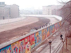
The founding of the two German states increased Cold War tensions. West Berlin was surrounded by East German territory. East Germany, however, proclaimed East Berlin (which it described only as "Berlin") as its capital, a move that was not recognized by the Western powers. Although half the size and population of West Berlin, it included most of the historic center of the city. The tensions between east and west culminated in the construction of the Berlin Wall between East and West Berlin and other barriers around West Berlin by East Germany on 13 August 1961 and were exacerbated by a tank standoff at Checkpoint Charlie on October 27, 1961. West Berlin was now de facto a part of West Germany with a unique legal status, while East Berlin was de facto a part of East Germany.
Berlin was completely separated. It was possible for Westerners to pass from one to the other only through strictly controlled checkpoints. For most Easterners, travel to West Berlin or West Germany was no longer possible. In 1971, a Four-Power agreement guaranteed access across East Germany to West Berlin and ended the potential for harassment or closure of the routes.
Wall demolished
In 1989, pressure from the East German population brought a transition to a market-based economy in East Germany, and its citizens gained free access across the Berlin Wall on November 9, 1989, which was subsequently mostly demolished. Not much is left of it today; the East Side Gallery in Friedrichshain near the Oberbaumbrücke over the Spree preserves a portion of the Wall.
On October 3, 1990, the two parts of Germany were reunified as the Federal Republic of Germany, and Berlin became the German capital according to the unification treaty. In 1999, the German parliament and government began their work in Berlin.
Government
Germany is a federal parliamentary representative democratic republic, whereby the Chancellor is the head of government, and of a pluriform multi-party system. Executive power is exercised by the government. Federal legislative power is vested in both the government and the two chambers of parliament, the Bundestag and Bundesrat.
Since German reunification on October 3, 1990, Berlin has been one of the three city states, together with Hamburg and Bremen, among the present 16 states of Germany. Though most of the ministries are seated in Berlin, some of them, as well as some minor departments, are seated in Bonn, the former capital of West Germany. The European Union invests in several projects within the city of Berlin. Infrastructure, education and social programs are co-financed with budgets taken from EU cohesion funds.
The city and state parliament is the House of Representatives (Abgeordnetenhaus), which had 141 seats in 2008. Berlin's executive body is the Senate of Berlin (Senat von Berlin), which consists of the Governing Mayor (Regierender Bürgermeister) and up to eight senators holding ministerial positions, one of them holding the title "Mayor" (Bürgermeister) as deputy to the Governing Mayor.
The Governing Mayor is simultaneously Lord Mayor of the city (Oberbürgermeister der Stadt) and Prime Minister of the Federal State (Ministerpräsident des Bundeslandes).
Berlin is subdivided into 12 boroughs (Bezirke). Each borough is subdivided into a number of localities (Ortsteile), which represent the traditional urbanized areas that inhabitants identify with. The city of Berlin in 2008 consisted of 95 such localities. The localities often consist of a number of city neighborhoods (usually called Kiez in the Berlin dialect) representing small residential areas.
Each borough is governed by a borough council (Bezirksamt) consisting of five councilors (Bezirksstadträte) and a borough mayor (Bezirksbürgermeister). The borough council is elected by the borough assembly (Bezirksverordnetenversammlung). The boroughs of Berlin are not independent municipalities, and are subordinate to the Senate of Berlin. The borough mayors form the Council of Mayors (Rat der Bürgermeister), led by the city's Governing Mayor, which advises the Senate.
Economy
Berlin was once a major manufacturing center and the economic and financial hub of Germany. Berlin was founded at a point where trade routes crossed the River Spree and quickly became a commercial center. During the early modern period, the city prospered from its role as Prussian capital by manufacturing luxury goods for the Prussian court and supplies for the Prussian military. The city suffered economically during the Cold War, when West Berlin was isolated geographically and East Berlin suffered from poor economic decisions made by East Germany’s socialist central planners.
After the reunification of Germany and Berlin in 1990, substantial subsidies were phased out, formerly received by the city of West Berlin. The industrial base of former East Berlin decreased dramatically within a decade, leading to an unemployment rate of almost 20 percent and stagnant GDP growth rates until 2005. In 2006, the nominal GDP of Berlin experienced a growth rate of 1.5 percent (2.7 percent in Germany) and totaled €80.3 ($104.4) billion. Berlin's per capita GDP was $30,252 in 2004. Since 2006, the unemployment rate steadily decreased to 14.9 percent (2007) but remained above the German (8.4 percent) and the EU27 (6.7 percent) average.
The arrival of the federal government in 1999 brought some economic stimulus to Berlin. Berlin’s service sectors have also benefited from improved transportation and communications links to the surrounding region.
Some manufacturing remains in the city (Siemens and Schering are headquartered there, for instance). Items produced there include textiles, metals, clothing, porcelain and china, bicycles, and machinery. It is also a center for the production of food, chemicals, cigarettes, and confectionery.
The service sectors have become the city’s economic mainstay. Research and development have gained significance, and Berlin now ranks among the top three innovative regions in the EU (after Baden-Württemberg and the Ile de France region).
Fast-growing sectors are communications, life sciences, mobility and services with information and communication technologies, media and music, advertising and design, biotechnology and environmental services, transportation and medical engineering.
Some notable companies with their headquarters in Berlin are Axel Springer AG, Deutsche Bahn, Bombardier Transportation, Universal Music Germany and Vattenfall Europe.
Berlin is among the top five congress cities in the world and is home to Europe's biggest convention center in the form of the Internationales Congress Centrum (ICC). It contributes to the rapidly increasing tourism sector encompassing 592 hotels with 90,700 beds and numbered 17.3 million overnight stays and 7.5 million hotel guests in 2007. Berlin has established itself as the third most visited city destination in the European Union.
Public transport within Berlin is provided by the S-Bahn, which is a mostly overground urban railway system, and the U-Bahn, which is mainly underground. The Straßenbahn or tram (trolley) system operates almost exclusively in the eastern part of the city. Buses provide extensive service linking outlying districts with the city center and to the U-Bahn and S-Bahn. Almost all means of public transport (U- & S- Bahn, trams, buses and most ferries) can be accessed with the same ticket.
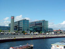
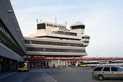
Berlin has three commercial airports. Tegel International Airport (TXL), Tempelhof International Airport (THF), and Schönefeld International Airport (SXF) handled a total of 18.5 million passengers in 2006 and served 155 destinations.
Demographics
With a population of 3,402,312 (2006), Berlin is the country's largest city. The urban area comprises about 3.7 million people while the metropolitan area of the Berlin-Brandenburg region is home to about 4.3 million in an area of 5,370 square kilometers (2,073 sq mi) and the Larger Urban Zone of about 4.9 million people. The population density of the city state Berlin amounts to 3,815 inhabitants per square kilometer (9,870/sq mi).
It is the second most populous city proper and the ninth most populous urban area in the European Union. Berlin has been a center for national and international immigration since the Edict of Potsdam in 1685, which guaranteed religious freedom and a tax-free status to French Calvinists for 10 years. Active immigration and asylum politics in West Berlin have initiated waves of immigrants in the 1960s and 1970s. In the 1990s the Aussiedlergesetze made immigration from the former Soviet Union possible. The current decade experiences a continual increasing influx from various Western countries and especially young EU-Europeans are settling in the city.
About 13.9 percent of the population were of foreign nationality, coming from 183 different countries. The largest groups by nationality are citizens from Turkey (116,665), Poland (42,889), Serbia and Montenegro (24,337), Lebanon (17,806), Russia (14,065), Italy (14,026), United States (12,735), France (11,776), Vietnam (11,513), Croatia (11,378), Bosnia and Herzegovina (10,463), Greece (10,102), UK (9396), Ukraine (8667), Austria (8409), Spain (5962), Iran (5882),Thailand (5876), the People's Republic of China (5620).
German is Germany's only official and most-widely spoken language. English is the most common foreign language and almost universally taught by the secondary level. About 20 percent consider themselves to be speakers of French, followed by speakers of Russian (18 percent), Italian (6.1 percent), and Spanish (5.6 percent).
The largest religious groupings were, in 2006, [Irreligion|No religion]] 60 percent, Evangelical 23 percent, Roman Catholic nine percent, Muslim six percent, and Jewish 0.4 percent. (12,000).
The city has four universities and numerous private, professional and technical colleges (Fachhochschulen), catering for around 130,000 students. The three largest universities are the Freie Universität Berlin (Free University of Berlin) with around 35,000 students, the Humboldt Universität zu Berlin with 35,000 students, and the Technische Universität Berlin with 30,000 students. The Universität der Künste has about 4300 students.
The city has a high concentration of research institutions, such as the Fraunhofer Society and the Max Planck Society, which are independent of, or only loosely connected to its universities. A total number of 62,000 scientists are working in research and development.
The Staatsbibliothek zu Berlin is a major research library. It has two main locations: one near Potsdamer Platz on Potsdamer Straße and one on Unter den Linden. There are 108 public libraries to be found in the city.
Berlin has 878 schools teaching 340,658 children in 13,727 classes and 56,787 trainees in businesses and elsewhere. Berlin has a unique bilingual school program embedded in the "Europaschule." Children get taught the curriculum in German and a foreign language, starting in grammar school and later in secondary school.
Of interest
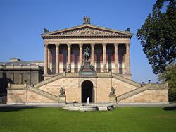
Berlin is home to 153 museums, including Museum Island, a UNESCO World Heritage Site situated on the Spree Island, the Altes Museum (Old Museum) which has the bust of Queen Nefertiti, the Pergamon Museum, the Bode Museum, the Jewish Museum, the German Museum of Technology in Kreuzberg, and the Humboldt Museum of Natural History, which has the largest mounted dinosaur in the world, and the best preserved specimen of an archaeopteryx..
The Gemäldegalerie (Painting Gallery) focuses on the paintings of the "old masters" from the 13th to the 18th centuries, while the Neue Nationalgalerie specializes in 20th-century European painting. The Hamburger Bahnhof exhibits a major collection of modern and contemporary art.
Places of interest include:
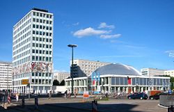
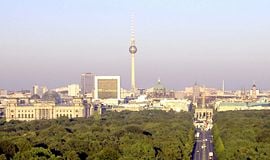
- The Fernsehturm (TV tower) at Alexanderplatz in Mitte is the second highest building in the European Union at 368 meters (1,207 ft). Built in 1969, it is visible throughout most of the central districts of Berlin. The city can be viewed from its 669 foot (204 meter) high observation floor.
- The Karl-Marx-Allee is an avenue lined by monumental residential buildings, designed in the Socialist Classicism Style of the Stalin era. Adjacent to this area is the Rotes Rathaus (Red City Hall), with its distinctive red-brick architecture. The previously built-up part in front of it is the Neptunbrunnen, a fountain featuring a mythological scene.
- The East Side Gallery is an open-air exhibition of art painted on the last existing portions of the Berlin Wall.
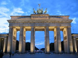
- The Brandenburg Gate is an iconic landmark of Berlin and Germany.
- The Reichstag building is the traditional seat of the German Parliament, renovated in the 1950s after severe World War II damage. The building features a glass dome over the session area, which allows free public access to the parliamentary proceedings and magnificent views of the city.
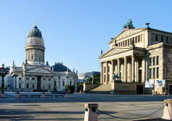
- Gendarmenmarkt, a neoclassical square dating to the Napoleonic occupation, is bordered by two similarly designed cathedrals, the French Cathedral with its observation platform, and the German Cathedral. The Konzerthaus (Concert Hall), home of the Berlin Symphony Orchestra, stands between the two cathedrals.
- The Berliner Dom, a Protestant cathedral and the third church on this site, is located on the Spree Island across from the site of the Berliner Stadtschloss and adjacent to the Lustgarten. A large crypt houses the remains of some of the earlier Prussian royal family.
- Unter den Linden is a tree lined east-west avenue from the Brandenburg Gate to the site of the former Berliner Stadtschloss, and was once Berlin's premier promenade. Many Classical buildings line the street and part of Humboldt University is located there.
- Friedrichstraße was Berlin's legendary street during the Roaring Twenties. It combines twentieth century traditions with the modern architecture of today's Berlin.
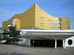
- The Kulturforum, which houses the Gemäldegalerie, is flanked by the Neue Nationalgalerie and the Philharmonic. The Memorial to the Murdered Jews of Europe, a Holocaust memorial, is situated to the north.
- The area around Hackescher Markt has countless clothing outlets, clubs, bars, and galleries. This includes the Hackesche Höfe, a conglomeration of buildings around several courtyards, reconstructed around 1996. Oranienburger Straße and the nearby New Synagogue were the center of Jewish culture before 1933.
- The Straße des 17. Juni, connecting the Brandenburg Gate and Ernst-Reuter-Platz, commemorates the uprisings in East Berlin of June 17, 1953. Approximately half-way from the Brandenburg Gate is the Großer Stern, a circular traffic island on which the Siegessäule (Victory Column) is situated. This monument, built to commemorate Prussia's victories, was relocated 1938–39 from its previous position in front of the Reichstag. The site is annually used as the center stage for the Love Parade.
- The Rathaus Schöneberg, where John F. Kennedy made his famous "Ich bin ein Berliner!" speech, is situated in Tempelhof-Schöneberg.
- The Kurfürstendamm is home to some of Berlin's luxurious stores with the Kaiser Wilhelm Memorial Church at its eastern end on Breitscheidplatz. The church was destroyed in World War II and left in ruins.
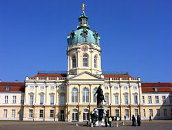
- Schloss Bellevue is the residence of the German President. Schloss Charlottenburg, which was burnt out in the Second World War and largely destroyed, has been rebuilt and is the largest surviving historical palace in Berlin.
- Funkturm Berlin is a 150 meter (492 ft) tall lattice radio tower at the fair area, built between 1924 and 1926. It is the only observation tower, which stands on insulators, and has a restaurant 55 meters (180 ft) and an observation deck 126 meters (413 ft) above ground, which is reachable by an elevator.
Berlin has a diverse and vibrant nightlife scene. Many buildings in the former city center of East Berlin became home to nightclubs, including Kunst Haus Tacheles, techno clubs Tresor, WMF, Ufo, E-Werk, the infamous Kitkatclub and Berghain. The Linientreu has been well known since the 1990s for techno music. The LaBelle discotheque in Friedenau became famous as the location of the 1986 Berlin discotheque bombing.
The Karneval der Kulturen, a multi-ethnic street parade, takes place every Pentecost weekend, and the Christopher Street Day, which is Central Europe's largest gay-lesbian pride event, takes place on the last weekend of June. Berlin is well known for the techno carnival Love Parade and the cultural festival Berliner Festspiele, which include the jazz festival JazzFest Berlin.
Berlin is home to more than 50 theaters, has three opera houses, and seven symphony orchestras in Berlin, including the Berlin Philharmonic Orchestra.
ReferencesISBN links support NWE through referral fees
- ↑ State population. Portal of the Federal Statistics Office Germany. Retrieved 2007-04-25.
- ↑ Indicators for larger urban zones 1999 - 2003. Eurostat. Retrieved 2007-03-09.
Bibliography
- Gross, Leonard, The Last Jews in Berlin. Carroll & Graf Publishers, 1999. ISBN 0-7867-0687-2
- Tertius Chandler, Four Thousand Years of Urban Growth: An Historical Census. Edwin Mellen Pr, 1987. ISBN 0-88946-207-0
- Ribbe, Wolfgang, Geschichte Berlins. Bwv - Berliner Wissenschafts-Verlag, 2002. ISBN 3-8305-0166-8
- Gwertzman, M. Kaufman, The Collapse of Communism, 1990.
- Read, Anthony, and David Fisher, Berlin Rising: Biography of a City. New York: W.W. Norton, 1994. ISBN 0-393-03606-5
- Large, David Clay, Berlin. New York: Basic Books, 2001. ISBN 0-465-02632-X
External links
- Official Website Berlin.de
- Official Tourist Information of Berlin
- Information and pictures of Berlin sights and World Heritage
- Maps of Berlin, from 1738 to the present
- EXBERLINER – Magazine for English speakers
- Architecture of Berlin
- City Panoramas
- 90 Images of Berlin in the 20th Century (German)
- East Berlin, Past and Present
- 3D-Virtual City Model of Berlin
- Interactive Berlin Map and selected locations
Credits
New World Encyclopedia writers and editors rewrote and completed the Wikipedia article in accordance with New World Encyclopedia standards. This article abides by terms of the Creative Commons CC-by-sa 3.0 License (CC-by-sa), which may be used and disseminated with proper attribution. Credit is due under the terms of this license that can reference both the New World Encyclopedia contributors and the selfless volunteer contributors of the Wikimedia Foundation. To cite this article click here for a list of acceptable citing formats.The history of earlier contributions by wikipedians is accessible to researchers here:
The history of this article since it was imported to New World Encyclopedia:
Note: Some restrictions may apply to use of individual images which are separately licensed.


