Difference between revisions of "Kathmandu" - New World Encyclopedia
Mike Butler (talk | contribs) |
Rosie Tanabe (talk | contribs) |
||
| (38 intermediate revisions by 4 users not shown) | |||
| Line 1: | Line 1: | ||
| + | {{Images OK}}{{Submitted}}{{Approved}}{{Copyedited}} | ||
{{Infobox Settlement | {{Infobox Settlement | ||
| − | + | <!-- Basic info —> | |
| − | <!-- Basic info | + | | name = Kathmandu |
| − | | | + | | other_name = काठमांडौ <!--In Nepali, the national language-> |
| − | |other_name = | + | | native_name = येँ देय् <!-- in the native language Nepal Bhasa, please don't change to other names in Nepali or Hindi —> |
| − | |native_name = | + | | settlement_type = Capital <!--For Town or Village (Leave blank for the default City) —> |
| − | + | | motto = My legacy, my pride, my Kathmandu | |
| − | |settlement_type = <!--For Town or Village (Leave blank for the default City) —> | + | | image_skyline = येँदेय्.jpg |
| − | |motto = | + | | imagesize = 240px |
| − | + | | image_caption = | |
| − | |image_skyline = येँदेय्.jpg | + | | image_map = |
| − | |imagesize = 240px | + | | mapsize = |
| − | | | + | | map_caption = |
| − | + | | pushpin_map = Nepal | |
| − | + | | pushpin_label_position = <!-- the position of the pushpin label: left, right, top, bottom, none —> | |
| − | + | | pushpin_map_caption = Location in Nepal | |
| − | + | | pushpin_mapsize = 240 | |
| − | + | <!-- Location —> | |
| − | |image_map = | + | | subdivision_type = Country |
| − | |mapsize = | + | | subdivision_name = {{flag|Nepal}}<!--the name of the country—> |
| − | |map_caption | + | | subdivision_type1 = Development Region |
| − | + | | subdivision_name1 = Central | |
| − | + | | subdivision_type2 = [[Zones of Nepal|Zone]] | |
| − | + | | subdivision_name2 = [[Bagmati Zone]] | |
| − | + | | subdivision_type3 = [[Districts of Nepal|District]] | |
| − | + | | subdivision_name3 = [[Kathmandu District]] | |
| − | + | | subdivision_type4 = [[Human Development Index|HDI]] | |
| − | + | | subdivision_name4 = {{increase}} 1.000 <span style="color:#090;">very high</span><ref>Shyam Thapa, [http://www.un.org/depts/escap/pop/journal/v10n2a1.htm The Human Development Index:A Portrait of the 75 Districts in Nepal] ''Asia-Pacific Population Journal'' 10(2) (1995): 3-14. Retrieved April 28, 2012.</ref> | |
| − | |pushpin_map = Nepal | + | <!-- Politics —> |
| − | |pushpin_label_position = <!-- the position of the pushpin label: left, right, top, bottom, none —> | + | | government_footnotes = |
| − | |pushpin_map_caption = | + | | leader_title = |
| − | |pushpin_mapsize = | + | | leader_name = |
| − | <!-- Location | + | | leader_title1 = <!-- for places with, say, both a mayor and a city manager —> |
| − | |subdivision_type = Country | + | | leader_name1 = |
| − | |subdivision_name = Nepal<!--the name of the country—> | + | | established_title = |
| − | |subdivision_type1 = Development Region | + | | established_date = |
| − | |subdivision_name1 = Central | + | | established_title2 = <!-- Incorporated —> |
| − | |subdivision_type2 = Zone | + | | established_date2 = |
| − | |subdivision_name2 = Bagmati | + | <!-- Area —> |
| − | |subdivision_type3 = District | + | | unit_pref = <!--Enter: Imperial, if Imperial (metric) is desired—> |
| − | |subdivision_name3 = Kathmandu | + | | area_footnotes = |
| − | |subdivision_type4 = | + | | area_total_km2 = 50.67 |
| − | |subdivision_name4 = | + | <!-- Population —> |
| − | <!-- Politics | + | | population_as_of = 2011 |
| − | |government_footnotes | + | | population_footnotes = <ref>{{cite web|title=National Population Census 2011|url=http://census.gov.np/|publisher=National Planning Commission Secretariat, Central Bureau of Statistics (CBS), Government of Nepal|month=September|year=2011}} Retrieved April 28, 2012.</ref> |
| − | + | | population_note = census | |
| − | |leader_title = | + | | population_total = 1006656 |
| − | |leader_name = | + | | population_density_km2 = auto |
| − | |leader_title1 = | + | | population_metro = |
| − | |leader_name1 | + | | population_density_metro_km2 = |
| − | + | <!-- General information —> | |
| − | + | | timezone = [[Nepal Time]] | |
| − | + | | utc_offset = +5:45 | |
| − | + | | timezone_DST = | |
| − | + | | utc_offset_DST = | |
| − | + | | latd= 27|latm = 42|latNS = N | |
| − | |established_title = | + | | longd= 85|longm = 20|longEW = E |
| − | |established_date = | + | | coordinates_display = title |
| − | |established_title2 = | + | | coordinates_type = type:city_region:NP |
| − | |established_date2 | + | | elevation_footnotes = |
| − | + | | elevation_m = 1400 | |
| − | + | <!-- Area/postal codes & others —> | |
| − | <!-- Area | + | | postal_code_type = <!-- enter ZIP code, Postcode, Post code, Postal code... —> |
| − | + | | postal_code = | |
| − | |unit_pref = <!--Enter: Imperial, if Imperial (metric) is desired—> | + | | area_code = |
| − | |area_footnotes = | + | | website = [http://www.kathmandu.gov.np/ kathmandu.gov.np] |
| − | |area_total_km2 = 50.67 | + | | footnotes = |
| − | |||
| − | | | ||
| − | | | ||
| − | |||
| − | |||
| − | |||
| − | |||
| − | | | ||
| − | | | ||
| − | | | ||
| − | | | ||
| − | | | ||
| − | |||
| − | < | ||
| − | |||
| − | |||
| − | |population_note = | ||
| − | |population_total = | ||
| − | |population_density_km2 = | ||
| − | |||
| − | |population_metro = | ||
| − | |population_density_metro_km2 | ||
| − | |||
| − | |||
| − | |||
| − | |||
| − | |||
| − | |||
| − | |||
| − | |||
| − | <!-- General information | ||
| − | |timezone = | ||
| − | |utc_offset = | ||
| − | |timezone_DST = | ||
| − | |utc_offset_DST = | ||
| − | |latd= 27|latm= 42 | ||
| − | |longd= 85|longm= 20 | ||
| − | | | ||
| − | | | ||
| − | | | ||
| − | <!-- Area/postal codes & others | ||
| − | |postal_code_type = <!-- enter ZIP code, Postcode, Post code, Postal code... —> | ||
| − | |postal_code = | ||
| − | |area_code | ||
| − | |||
| − | |||
| − | |||
| − | |||
| − | |website = http://www.kathmandu.gov.np/ | ||
| − | |footnotes = | ||
}} | }} | ||
| − | |||
| − | Considered by some to be among the most beautiful cities in the world, Kathmandu is the most developed city in [[Nepal]]. | + | '''Kathmandu''' ({{lang-ne|काठमांडौ}}, {{lang-new|येँ}}) is the [[Capital (political)|capital]] and the largest city of [[Nepal]], and is situated in the [[World Heritage Site]] [[Kathmandu Valley]]. Considered by some to be among the most beautiful cities in the world, Kathmandu is the most developed city in the nation. |
| + | |||
| + | Founded in 723, Kathmandu was ruled by the [[Malla Dynasty]] from the twelfth to seventeenth centuries, became the base of the [[Gurkha|Gurkha Kingdom]] in 1768, then ruled by the [[Rana dynasty]] after the [[Kot Massacre]] in 1846, to be succeeded by an [[India]]-sponsored king in 1951. Reforms in 1990 established Nepal as a multiparty [[democracy]] within the framework of a constitutional monarchy. The newly formed interim parliament declared the country a democratic federal republic at its first meeting in May 2008, the king vacated the throne in mid-June 2008, and parliament elected the country's first president the following month. | ||
| + | {{toc}} | ||
| + | The religiously rich Kathmandu valley, home to hundreds of [[Hinduism|Hindu]] shrines, had been a lure for young Western travelers attracted by Eastern [[mysticism]], especially during the soul-searching era of the 1960s and 1970s. While the spectacular landscape and the lure of the nearby [[Himalayas]] long drew tourists from around the world, political instability and civil unrest has slowed the stream of visitors. | ||
== Geography == | == Geography == | ||
[[Image:DSCI0441.JPG|thumb|left|250px|View over Kathmandu.]] | [[Image:DSCI0441.JPG|thumb|left|250px|View over Kathmandu.]] | ||
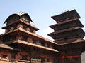
| − | The city of Kathmandu is named after a structure in [[Durbar Square]] called [[Kaasthamandap]]. In [[Sanskrit]], ''Kaasth'' ({{lang-sa2|काष्ठ}}) is "wood" and ''Mandap'' ({{lang-sa2|मंडप/मण्डप}}) is "covered shelter." This unique temple, also known as [[Maru Sattal]], was built in 1596 | + | The city of Kathmandu is named after a structure in [[Durbar Square]] called [[Kaasthamandap]]. In [[Sanskrit]], ''Kaasth'' ({{lang-sa2|काष्ठ}}) is "wood" and ''Mandap'' ({{lang-sa2|मंडप/मण्डप}}) is "covered shelter." This unique [[temple]], also known as [[Maru Sattal]], was built in 1596 C.E. by King [[Laxmi Narsingh Malla.]] This two-story pagoda contains no iron nails or supports and is made entirely from wood, believed to be obtained from a single tree. |
| − | Kathmandu is also sometimes called "Kantipur" | + | Kathmandu is also sometimes called "Kantipur." ''Kanti'' is an alternate name of the Goddess [[Laxmi]], and ''Pur'' means the place where such a goddess resides. [[Newars]], the people who have lived in the Kathmandu valley the longest, use the original term from [[Nepal Bhasa]], ''Yne.'' |
| − | The city is located in the northwestern part of [[Kathmandu Valley]]. The | + | The [[city]] is located in the northwestern part of [[Kathmandu Valley]], at an elevation of approximately 4,500 feet (1,400 meters). The Kathmandu Valley, which covers an area of 218 square miles, has been declared a [[World Heritage Site]] consisting of seven different monument zones. These zones are: The city centers of, Kathmandu, Patan, and Bhaktapur, the two most important Buddhist [[stupa]]s, [[Swayambhunath]] and [[Boudhanath]], and two famous [[Hinduism|Hindu]] shrines, [[Pashupatinath temple]] and [[Changu Narayan]]. |
| − | The city | + | The Bagmati, Bishnumati, Dhobikhola, and Tukucha [[river]]s wind through the city. |
| − | The Kathmandu Valley has a mild climate most of the year. The average maximum daytime temperature in January is 64.4°F (18°C), rising to an average maximum of around 84.2°F (29°C) in July. | + | The [[Kathmandu Valley]] has a mild [[climate]] most of the year. The average maximum daytime [[temperature]] in January is 64.4°F (18°C), rising to an average maximum of around 84.2°F (29°C) in July. There is a rainy [[monsoon]] season between June and August, while May and June can be very hot and humid. In spring (March to April) and autumn (October to November) the temperatures are pleasant with occasional short bursts of [[rain]], while November to February is dry, but can be very cold, especially at night. Mean annual precipitation is 56.18 inches (1427mm). |
| − | [[Earthquake]]s and pollution have damaged Kathmandu's numerous [[Buddhist]] and [[Hindu]] temples and palaces. Human and animal wastes, agricultural run-off, and industrial effluents contaminate water supply. | + | [[Earthquake]]s and pollution have damaged Kathmandu's numerous [[Buddhist]] and [[Hindu]] temples and palaces. Human and animal wastes, [[agriculture|agricultural]] run-off, and [[industry|industrial]] effluents [[contamination|contaminate]] the [[water]] supply. |
== History== | == History== | ||
[[Image:Pashupatinath temple.JPG|thumb|right|250px|Pashupatinath temple.]] | [[Image:Pashupatinath temple.JPG|thumb|right|250px|Pashupatinath temple.]] | ||
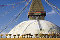
| − | [[Image:ボダナート(Boudhanath)Img291.jpg|thumb|right|250px|[[ | + | [[Image:ボダナート(Boudhanath)Img291.jpg|thumb|right|250px|Bauddhanath temple.]] |
| − | [[Neolithic]] tools found in the Kathmandu Valley indicate that people have been living | + | [[Image:Swayambhunath, 1973.JPG|thumb|right|250px|Swayambhunath stupa.]] |
| + | [[Image:Kathmandu palace.jpg|thumb|right|250px|The Narayanhity Royal Palace in [[Kathmandu]], [[Nepal]]]] | ||
| + | [[Neolithic]] tools found in the Kathmandu Valley indicate that people have been living there for at least 9000 years. People of Tibeto-Burman ethnicity lived in Nepal 2500 years ago. | ||
| − | Indo-Aryan tribes entered the valley around 1500 B.C.E. | + | [[Indo-Aryan]] tribes entered the valley around 1500 B.C.E., and around 1000 B.C.E., small kingdoms and confederations of clans arose. |
| − | The [[Kirant|Kirat]]s, believed to date to before the | + | The [[Kirant|Kirat]]s, believed to date to before the ninth century B.C.E., are the first documented rulers of Kathmandu Valley. The remains of their ''palace'' are in Patan near Kendra Hiranyavarna Mahavihara (called "Patukodon"). |
| − | [[Siddhartha Gautama]] (563–483 B.C.E.), a prince of the Shakya confederation, renounced his royalty to lead an ascetic life and came to be known as the [[Buddha]] ("the one who has awakened"). | + | [[Siddhartha Gautama]] (563–483 B.C.E.), was a prince of the Shakya confederation, who renounced his royalty to lead an [[ascetic]] life and came to be known as the [[Buddha]] ("the one who has awakened"). |
| − | By 250 B.C.E., the region came under the influence of the Mauryan | + | By 250 B.C.E., the region came under the influence of the [[Maurya Empire|Mauryan Empire]] (322–185 B.C.E.), of northern [[India]]. The oldest firmly dated building in the [[earthquake]]-prone valley is almost 1,992 years old, and the earliest known inscription in the Kathmandu Valley is dated at 185 C.E.. |
| − | + | In the fourth century, the region became a puppet state under the [[Gupta Dynasty]] (280 to 550 C.E.). From the late fifth century, rulers called the Licchavis, whose earliest inscriptions date back to 464 C.E.., governed the area. | |
| − | + | The town that became Kathmandu was founded in 723 by Raja Gunakamadeva, and its early name was Manju-Patan. | |
| − | |||
| − | |||
| − | The | + | The [[Malla (Nepal)|Malla Dynasty]], comprising [[Newar]] rulers, ruled Kathmandu Valley and the surrounding area from 1201, until the seventeenth century. |
| − | + | By the late eleventh century, southern [[Nepal]] came under the influence of the [[Chalukya Empire]], an Indian royal dynasty that ruled large parts of southern and central [[India]] between the sixth and the twelfth centuries. From then, [[Hinduism]] prevailed over [[Buddhism]] in southern Nepal. | |
| − | + | The Delhi Sultanate of northern India pillaged thirteenth-century [[Nepal]]. King Jayasthiti Malla (ruled 1382-1395) united most of the country by the late fourteenth century. He was the most capable ruler of this dynasty who curbed the powers of the feudal chiefs, and is known for structuring of Newar society by implementing the [[caste system]] and fixing the status of the different castes. | |
| − | + | In 1482 the kingdom was carved into three smaller areas: Kathmandu, Patan, and Bhadgaon. | |
| − | Modern Nepal was created in the latter half of the eighteenth century when Prithvi Narayan Shah (1723-1775), the ruler of the small principality of Gorkha, united a number of independent hill states to form the Gorkha Kingdom. He conquered the Kathmandu valley in 1768 | + | Modern Nepal was created in the latter half of the eighteenth century when [[Prithvi Narayan Shah]] (1723-1775), the ruler of the small principality of Gorkha, united a number of independent hill states to form the [[Gurkha|Gorkha Kingdom]]. He conquered the Kathmandu valley in 1768, and Kathmandu has served as the seat of the ruling Shah family since that date. Most of ancient [[Nepali Architecture]] present in [[Nepal]] today is from the [[Malla]]/[[Newar]] era. |
Rivalry with the [[British East India Company]] over the annexation of minor states bordering Nepal led to the brief but bloody Anglo-Nepalese War (1815-1816), in which Nepal defended its present-day borders but lost territories west of the Kali River. | Rivalry with the [[British East India Company]] over the annexation of minor states bordering Nepal led to the brief but bloody Anglo-Nepalese War (1815-1816), in which Nepal defended its present-day borders but lost territories west of the Kali River. | ||
| − | In 1833, an earthquake damaged much of Kathmandu. | + | In 1833, an [[earthquake]] damaged much of Kathmandu. |
| − | In 1846, Queen Rajendralakshmi plotted to overthrow Jang Bahadur, a | + | In 1846, Queen Rajendralakshmi plotted to overthrow [[Jang Bahadur]], a military leader who threatened her power. The plot was uncovered and the queen had several hundred princes and chieftains executed in what came to be known as the [[Kot Massacre]]. |
| − | The Ranas were staunchly pro-British, and helped the British during the Sepoy Rebellion in 1857, and in both world wars of the | + | Ultimately, Bahadur won and founded the [[Rana dynasty]], leading to the Rana autocracy. The king was made a titular figure, and the post of prime minister was made powerful and hereditary. The Ranas were staunchly pro-British, and helped the [[Great Britain|British]] during the [[Sepoy Rebellion]] in 1857, and in both world wars of the twentieth century. |
| − | An earthquake in 1934 resulted in the construction of numerous modern-style buildings. | + | An [[earthquake]] in 1934 resulted in the construction of numerous modern-style buildings. |
| − | In the late 1940s, emerging pro-democracy movements and political parties were critical of the Rana autocracy. China occupied Tibet in 1950, making India keen on stability in Nepal. India sponsored Tribhuvan as Nepal's new king in 1951, and a new government, mostly | + | In the late 1940s, emerging pro-democracy movements and political parties were critical of the Rana autocracy. [[China]] occupied [[Tibet]] in 1950, making [[India]] keen on stability in [[Nepal]]. India sponsored [[Tribhuvan Bir Bikram Shah]] (1906–1955) as Nepal's new king in 1951, and a new government, mostly consisting of members of the Nepali Congress Party. |
| − | Kathmandu became popular with western tourists | + | Kathmandu became popular with western tourists in the 1960s when it became a key stop on the [[Hippy Trail]], when Freak Street was the one of the main locations. |
| − | Reforms in 1990 established a multiparty democracy within the framework of a constitutional monarchy. | + | Reforms in 1990 established a multiparty democracy within the framework of a [[constitutional monarchy]]. |
| − | An insurgency led by Maoist extremists broke out in 1996. The ensuing nine-year civil war between insurgents and government forces witnessed the dissolution of the cabinet and parliament and assumption of absolute power by the king. | + | An insurgency led by [[Maoism|Maoist]] extremists broke out in 1996. The ensuing nine-year [[civil war]] between insurgents and government forces witnessed the dissolution of the cabinet and parliament and assumption of absolute power by the king. |
| − | In June 2001, | + | In June 2001, ten members of the royal family, including King [[Birendra]] and Queen Aishwarya, were killed in a shooting spree, allegedly shot by Crown Prince [[Dipendra]]. He temporarily became king before dying of his wounds. His brother, Prince [[Gyanendra]], inherited the throne. |
| − | Several weeks of mass protests in April 2006 were followed by several months of peace negotiations between the Maoists and government officials, and culminated in a November 2006 peace accord and the promulgation of an interim constitution. | + | Several weeks of mass protests in April 2006 were followed by several months of [[peace]] negotiations between the Maoists and government officials, and culminated in a November 2006 [[peace accord]] and the promulgation of an interim constitution. |
| − | The newly formed interim parliament declared Nepal a democratic federal republic at its first meeting in May 2008, the king vacated the throne in mid-June 2008, and parliament elected the country's first president the following month. | + | The newly formed interim parliament declared Nepal a [[democratic federal republic]] at its first meeting in May 2008, the king vacated the throne in mid-June 2008, and parliament elected the country's first president the following month. |
== Government == | == Government == | ||
[[Image:Kathmandu street.jpg|thumb|250px|right|A crowded street in Kathmandu.]] | [[Image:Kathmandu street.jpg|thumb|250px|right|A crowded street in Kathmandu.]] | ||
| − | Nepal | + | In 2008, Nepal was a brand-new democratic republic in which the chief of state is the president, who is elected by Parliament, and the head of government is the prime minister. The unicameral Constituent Assembly has 601 seats, of which 240 are decided by direct popular vote, 335 by proportional representation, and 26 are appointed by the cabinet (Council of Ministers). |
| − | Nepal is divided into 14 zones and 75 districts, grouped into five development regions. Each district is headed by a permanent chief district officer responsible for maintaining law and order and coordinating the work of field agencies of the various government ministries. | + | Nepal is divided into 14 zones and 75 districts, grouped into five development regions. Each district is headed by a permanent chief district officer responsible for maintaining [[law and order]] and coordinating the work of field agencies of the various government ministries. |
The [[Kathmandu Valley]], with its conurbation of 1.5 million inhabitants, is located in the Bagmati Zone, named after the river [[Bagmati]], which is in [[Central Region, Nepal|Central Development Region]] of Nepal. | The [[Kathmandu Valley]], with its conurbation of 1.5 million inhabitants, is located in the Bagmati Zone, named after the river [[Bagmati]], which is in [[Central Region, Nepal|Central Development Region]] of Nepal. | ||
| − | Kathmandu | + | Kathmandu city is the headquarters of the Kathmandu district. Kathmandu city is looked after by Kathmandu metropolitan office located at [[Bagdarbar]]. The city hosts Singha Darbar, the government seat of Nepal (with the office of Prime Minister, Supreme Court and Senate). Most of the ministries are present in the Singha Darbar premises. |
| − | |||
| − | Kathmandu city is looked after by Kathmandu metropolitan office located at [[Bagdarbar]]. The city hosts Singha Darbar, the government seat of Nepal (with the office of Prime Minister, Supreme Court and Senate). Most of the ministries are present in the Singha Darbar premises | ||
The metropolitan area has been divided into five sectors and 35 wards. | The metropolitan area has been divided into five sectors and 35 wards. | ||
== Economy == | == Economy == | ||
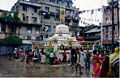
| − | [[Image:Durbar-seller.jpg|thumb|right| | + | [[Image:Durbar-seller.jpg|thumb|right|225px|A seller warming himself in Durbar Square.]] |
| − | [[ | + | [[Nepal]] is among the poorest and least developed countries in the world with almost one-third of its [[population]] living below the [[poverty]] line. [[Agriculture]] is the mainstay of the economy, providing a livelihood for three-fourths of the population and accounting for 38 percent of GDP. Industrial activity mainly involves the processing of agricultural produce including [[jute]], [[sugarcane]], [[tobacco]], and [[grain]]. Per capita GDP was estimated at $1000 in 2007. |
| − | |||
| − | Being the capital city of [[Nepal]], Kathmandu is home to most of the government offices, embassies, corporate houses, and the palace. Kathmandu houses most of the banks, business houses, offices, organizations and share market of Nepal. [[New Road]] is regarded as financial hub, being the location of most | + | Being the capital city of [[Nepal]], Kathmandu is home to most of the government offices, embassies, corporate houses, and the palace. Kathmandu houses most of the banks, business houses, offices, organizations and share market of Nepal. [[New Road]] is regarded as the financial hub, being the location of most [[bank]]s. |
| − | Many students from all over Nepal come to Kathmandu to have higher Secondary Education (+2 Level). | + | Many students from all over Nepal come to Kathmandu to have higher [[Secondary Education]] (+2 Level). |
| − | An estimated 30 percent of Nepalis depend on tourism for their livelihood. The main source is the trekkers who come to see and climb some of the world’s most spectacular peaks. However, the nine year insurgency in Nepal has had a serious impact on the tourism industry | + | An estimated 30 percent of Nepalis depend on [[tourism]] for their livelihood. The main source is the trekkers who come to see and climb some of the world’s most spectacular peaks, the [[Himalayas]] to the north of the city. However, the nine year insurgency in Nepal has had a serious impact on the tourism industry. |
| − | In the 1970s, new | + | In the 1970s, new [[road]]s were built and air transport services were expanded, making Kathmandu the hub of the national [[transportation]] system. [[Tribhuvan International Airport]] is located about 25 km from the city center, offering domestic and international flights. |
== Demographics == | == Demographics == | ||
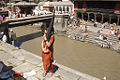
| − | Kathmandu's population was 671,846 in 2001, although 1,081,845 people were estimated to be living in the metropolitan area. | + | [[Image:Kathmandu Pedicab 2001.jpg|thumb|right|225px|Rickshaw drivers near Durbar Square.]] |
| + | Kathmandu's [[population]] was 671,846 in 2001, although 1,081,845 people were estimated to be living in the metropolitan area. | ||
Regarding ethnicity, Chhettri people made up 15.5 percent of Nepal's population in 2001, Brahmans 12.5 percent, Magar 7 percent, Tharu 6.6 percent, Tamang 5.5 percent, Newar 5.4 percent, Muslim 4.2 percent, Kami 3.9 percent, Yadav 3.9 percent, other 32.7 percent, unspecified 2.8 percent. | Regarding ethnicity, Chhettri people made up 15.5 percent of Nepal's population in 2001, Brahmans 12.5 percent, Magar 7 percent, Tharu 6.6 percent, Tamang 5.5 percent, Newar 5.4 percent, Muslim 4.2 percent, Kami 3.9 percent, Yadav 3.9 percent, other 32.7 percent, unspecified 2.8 percent. | ||
| − | [[Nepali language|Nepali]] is the [[ | + | [[Nepali language|Nepali]] is the most widely spoken [[language]] of the valley. [[Nepal Bhasa]]/[[Newari]] is the language spoken by native people, the [[Newar]]s. [[Hindi]] and [[English language|English]] are understood by most of the educated population of the city. |
| − | The Kathmandu | + | The Kathmandu district itself is known as the "city of temples," attracting [[Hindu]] people and those who have interest in others’ [[religion]]. With 80.6 percent of the population [[Hinduism|Hindu]] in 2001, [[Buddhism|Buddhist]] 10.7 percent, [[Muslim]] 4.2 percent, [[Kirant]] 3.6 percent, other 0.9 percent, [[Nepal]] remains the only official Hindu state in the world. |
| − | Nepal University | + | [[Nepal University]], formerly called Tribhuvan University, is the only [[university]] in Kathmandu. Established in 1959, and with approximately 272,746 students, it the biggest university in Nepal. |
| − | == | + | ==Society and culture== |
[[Image:Nepal - Kathmandu - 002 - the interesting 3D rooftops of Thamel.jpg|thumb|right|250px|Rooftops of Thamel.]] | [[Image:Nepal - Kathmandu - 002 - the interesting 3D rooftops of Thamel.jpg|thumb|right|250px|Rooftops of Thamel.]] | ||
| − | + | Thamel, located on two parallel streets west of the old palace, has been the center of the tourist industry in Kathmandu for over two decades, growing up between two of the original hotels, the [[Kathmandu Guesthouse]] and [[Hotel Uste]]. Even though Thamel has been described as the "ghetto," most low-budget travelers consider it a tourist haven. [[Ason Bazaar]], [[Durbar Square]], [[Samakushi]], and [[Swayambhunath]] are nearby. [[Hashish]] is sold openly on the streets here. Thamel also acts as the pre-base camp for [[mountaineer]]s, and has a wide range of [[mountaineering]] gear shops, foreign money exchange booths, pubs, clubs and nightlife along with the innumerable travel lodges and guest houses. | |
| − | |||
| − | Thamel, | ||
| − | + | Kathmandu is the location of regular annual religious festivals. In spring, the [[Shivaratri]] and the [[Machendra Jatra]] take place, with a [[procession]] bearing the image of the [[deity]] [[Machendra]]. The Gai Jatra, or "festival of the cow," takes place in late summer. The Indra Jatra, which features a procession honoring the goddess [[Devi]], represented by a young girl, takes place in and, in early autumn. | |
| − | + | The city has been referenced in numerous songs, including works by [[Cat Stevens]] ("Katmandu," [[Mona Bone Jakon]] (1970)); [[Bob Seger]] ("Katmandu," [[Beautiful Loser]] (1975)); [[Krematorij]] ("Kathmandu," Three Springs (2000)); [[Fito Páez]] ("Tráfico por Katmandú"—"Traffic through Kathmandu"); [[Will Ackerman]] ("A Happy Home in Kathmandu," The Opening of Doors (1993)); Tantra ("The Hills of Katmandu," early 1980s); and [[Godiego]] ("Coming Together in Kathmandu" (1980). | |
| − | + | Numerous works of [[literature]] have been set in Kathmandu, including [[Kim Stanley Robinson]]'s 1989 work, ''Escape from Kathmandu.'' The book ''Arresting God in Kathmandu'' written by [[Samrat Upadhyay]] in 2001 earned international acclaim, followed by his book of short stories ''The Royal Ghosts: Stories'' in 2006. | |
| − | + | ===Places of interest=== | |
| − | * | + | * [[Kathmandu Durbar Square]], a [[UNESCO]] [[World Heritage Site]], which is the most extensive of the three royal palace squares in the Kathmandu Valley. It contains 60 important historic buildings from the seventeenth and eighteenth centuries. |
| − | * | + | * Taleju Bhawani Temple, the main building of Kathmandu Durbar Square, was built in 1576 by Raja [[Mahindra Malla]]. |
| − | * | + | * Jagannath temple, built in the sixteenth century, is known for erotic figures carved on the wooden eaves struts. |
| − | * | + | * Kasthamandap, said to have been built from the timber of a single tree in 1596, is the building from which Kathmandu derives its name. |
| − | * | + | * Hanuman Dhoka Palace, which is the old palace of the [[Newar]] kings, and is Kathmandu's most notable building. A figure of the god Hanuman guards the palace’s main gate. |
| − | + | * The [[Narayanhity Royal Palace]], which long served as the royal residence, was constructed under order of the [[Shah dynasty]] in the eighteenth century. | |
| − | + | * [[Swayambhunath]], situated on a hilltop two miles west of Kathmandu town, is the oldest [[Buddhism|Buddhist]] monument in the Kathmandu Valley. It is also known as the 'Monkey Temple' as there are holy [[monkey]]s living in parts of the [[temple]] in the northwest. The Swayambhunath complex consists of a [[stupa]], a variety of shrines and temples, including a [[Tibetan monastery]], a [[museum]] and a [[library]]. The stupa has Buddha's eyes and eyebrows painted on, with a nose-like Nepali symbol of unity. There are shops, restaurants and hostels. | |
| − | + | * [[Bauddhanath]], located eight kilometers west of Kathmandu city, is the largest Buddhist stupa in Nepal. On top of the [[dome]] is a square tower covered with gilded [[brass]] sheets on which are painted faces of the eternal, all-seeing Buddha. The stupa originated in the fifth century but has been repeatedly added to. | |
| − | + | * The [[Singha Durbar]] (literally, Lion Palace), which is the official [[seat of government]] of [[Nepal]], was built by the [[Rana dynasty]] as the private residence of the hereditary [[Prime Minister of Nepal]]. The neo-classical style Singha Durbar now houses both chambers of the [[Parliament of Nepal]], as well as ministries and government offices. | |
==Looking to the future== | ==Looking to the future== | ||
| − | + | As the capital city, Kathmandu faces the same challenges Nepal faces. Security concerns relating to the Maoist conflict have led to a decrease in [[tourism]], a key source of [[foreign exchange]]. Further challenges are posed by the small size of the economy, its technological backwardness, its remoteness, its landlocked geographic location, and its susceptibility to [[natural disaster]]. Kathmandu has problems with [[contamination|contaminated]] water supply, while [[earthquake]]s and [[pollution]] have damaged Kathmandu's numerous [[Buddhist]] and [[Hindu]] temples and palaces. | |
| − | |||
| − | |||
| − | |||
| − | |||
| − | |||
| − | |||
| − | |||
| − | |||
== Gallery == | == Gallery == | ||
| Line 275: | Line 217: | ||
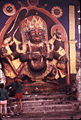
Image:KatmanduMarket1920.jpg|A view of Kathmandu Durbar Square from 1920. [[Bhairava]] in the background. | Image:KatmanduMarket1920.jpg|A view of Kathmandu Durbar Square from 1920. [[Bhairava]] in the background. | ||
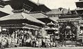
Image:KatmanduDurbarMarket2007.jpg| Same as the picture to the left but from 2007, shot for comparison. | Image:KatmanduDurbarMarket2007.jpg| Same as the picture to the left but from 2007, shot for comparison. | ||
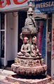
| − | Image:Small stupa in Kathmandu.jpg|Small stupa in Kathmandu | + | Image:Small stupa in Kathmandu.jpg|Small [[stupa]] in Kathmandu |
Image:Stone carving in Kathmandu.jpg|Stone carving in Kathmandu street | Image:Stone carving in Kathmandu.jpg|Stone carving in Kathmandu street | ||
Image:IMG 0361 Kathmandu Bodnath.jpg|[[Boudhanath Stupa]] in Kathmandu, Nepal | Image:IMG 0361 Kathmandu Bodnath.jpg|[[Boudhanath Stupa]] in Kathmandu, Nepal | ||
| Line 281: | Line 223: | ||
</gallery></center> | </gallery></center> | ||
| − | == | + | ==Notes== |
| − | + | <references/> | |
| − | == | + | ==References== |
| − | * Bindloss, Joseph. 2006. ''Kathmandu'' | + | * Bindloss, Joseph. 2006. ''Kathmandu.'' (Lonely Planet citiescape Asia.) Footscray, Vic: Lonely Planet. ISBN 9781741049398 |
| − | * Choegyal, Lisa. 1992.'' Kathmandu'' | + | * Choegyal, Lisa. 1992.'' Kathmandu.'' (Insight city guides.) Singapore: Apa Publications. ISBN 9780134719542 |
| − | ISBN 9780134719542 | + | * "NEPAL: The Mad Prince of Kathmandu - A royal squabble over marriage leads to a massacre of the ruling family in the Himalayan kingdom." 2001. ''TIME'' (magazine). 32. OCLC 93064974 |
| − | * "NEPAL: The Mad Prince of Kathmandu - A royal squabble over marriage leads to a massacre of the ruling family in the Himalayan kingdom" | + | * Shrestha, Dinesh. 2007. ''Timeless Kathmandu.'' Kathmandu: Himalayan MapHouse. ISBN 9789993347255 |
| − | * Shrestha, Dinesh. 2007. ''Timeless Kathmandu'' | + | * Thapa, R.B., Y. Murayama, and S. Ale. 2008. "Kathmandu." ''Cities'' 25 (1): 45-57. OCLC 212730484 |
| − | * Thapa, R. B., Y. Murayama, and S. Ale. 2008. "Kathmandu" | + | * Willesee, Amy, and Mark Whittaker. 2004. ''Love & death in Kathmandu: a strange tale of royal murder.'' New York: St. Martin's Press. ISBN 9780312329945 |
| − | * Willesee, Amy, and Mark Whittaker. 2004. Love & death in Kathmandu: a strange tale of royal murder. New York: St. Martin's Press. ISBN 9780312329945 | ||
| + | == External links == | ||
| + | All links retrieved October 5, 2022. | ||
| + | * [http://www.catmando.com/ktm-metropolitan/herit.html Katmandu - World Heritage city] | ||
| − | |||
| − | |||
| − | |||
| − | |||
| − | |||
| − | |||
| − | |||
| − | |||
| − | |||
| − | |||
| − | |||
| − | |||
[[Category:Geography]] | [[Category:Geography]] | ||
[[Category:Cities]] | [[Category:Cities]] | ||
| + | [[Category:Asia]] | ||
{{credit|Kathmandu|256926660|}} | {{credit|Kathmandu|256926660|}} | ||
Latest revision as of 17:13, 5 October 2022
| Kathmandu काठमांडौ |
|
| — Capital — | |
 |
|
| Motto: My legacy, my pride, my Kathmandu | |
 Kathmandu |
|
| Coordinates: 27°42′N 85°20′E | |
|---|---|
| Country | |
| Development Region | Central |
| Zone | Bagmati Zone |
| District | Kathmandu District |
| HDI | |
| Area | |
| - Total | 50.67 km² (19.6 sq mi) |
| Elevation | 1,400 m (4,593 ft) |
| Population (2011)[2] | |
| - Total | 1,006,656 |
| - Density | 19,866.9/km² (51,455/sq mi) |
| census | |
| Time zone | Nepal Time (UTC+5:45) |
| Website: kathmandu.gov.np | |
Kathmandu (Nepali: काठमांडौ, Nepal Bhasa: येँ) is the capital and the largest city of Nepal, and is situated in the World Heritage Site Kathmandu Valley. Considered by some to be among the most beautiful cities in the world, Kathmandu is the most developed city in the nation.
Founded in 723, Kathmandu was ruled by the Malla Dynasty from the twelfth to seventeenth centuries, became the base of the Gurkha Kingdom in 1768, then ruled by the Rana dynasty after the Kot Massacre in 1846, to be succeeded by an India-sponsored king in 1951. Reforms in 1990 established Nepal as a multiparty democracy within the framework of a constitutional monarchy. The newly formed interim parliament declared the country a democratic federal republic at its first meeting in May 2008, the king vacated the throne in mid-June 2008, and parliament elected the country's first president the following month.
The religiously rich Kathmandu valley, home to hundreds of Hindu shrines, had been a lure for young Western travelers attracted by Eastern mysticism, especially during the soul-searching era of the 1960s and 1970s. While the spectacular landscape and the lure of the nearby Himalayas long drew tourists from around the world, political instability and civil unrest has slowed the stream of visitors.
Geography

The city of Kathmandu is named after a structure in Durbar Square called Kaasthamandap. In Sanskrit, Kaasth (काष्ठ) is "wood" and Mandap (मंडप/मण्डप) is "covered shelter." This unique temple, also known as Maru Sattal, was built in 1596 C.E. by King Laxmi Narsingh Malla. This two-story pagoda contains no iron nails or supports and is made entirely from wood, believed to be obtained from a single tree.
Kathmandu is also sometimes called "Kantipur." Kanti is an alternate name of the Goddess Laxmi, and Pur means the place where such a goddess resides. Newars, the people who have lived in the Kathmandu valley the longest, use the original term from Nepal Bhasa, Yne.
The city is located in the northwestern part of Kathmandu Valley, at an elevation of approximately 4,500 feet (1,400 meters). The Kathmandu Valley, which covers an area of 218 square miles, has been declared a World Heritage Site consisting of seven different monument zones. These zones are: The city centers of, Kathmandu, Patan, and Bhaktapur, the two most important Buddhist stupas, Swayambhunath and Boudhanath, and two famous Hindu shrines, Pashupatinath temple and Changu Narayan.
The Bagmati, Bishnumati, Dhobikhola, and Tukucha rivers wind through the city.
The Kathmandu Valley has a mild climate most of the year. The average maximum daytime temperature in January is 64.4°F (18°C), rising to an average maximum of around 84.2°F (29°C) in July. There is a rainy monsoon season between June and August, while May and June can be very hot and humid. In spring (March to April) and autumn (October to November) the temperatures are pleasant with occasional short bursts of rain, while November to February is dry, but can be very cold, especially at night. Mean annual precipitation is 56.18 inches (1427mm).
Earthquakes and pollution have damaged Kathmandu's numerous Buddhist and Hindu temples and palaces. Human and animal wastes, agricultural run-off, and industrial effluents contaminate the water supply.
History


Neolithic tools found in the Kathmandu Valley indicate that people have been living there for at least 9000 years. People of Tibeto-Burman ethnicity lived in Nepal 2500 years ago.
Indo-Aryan tribes entered the valley around 1500 B.C.E., and around 1000 B.C.E., small kingdoms and confederations of clans arose.
The Kirats, believed to date to before the ninth century B.C.E., are the first documented rulers of Kathmandu Valley. The remains of their palace are in Patan near Kendra Hiranyavarna Mahavihara (called "Patukodon").
Siddhartha Gautama (563–483 B.C.E.), was a prince of the Shakya confederation, who renounced his royalty to lead an ascetic life and came to be known as the Buddha ("the one who has awakened").
By 250 B.C.E., the region came under the influence of the Mauryan Empire (322–185 B.C.E.), of northern India. The oldest firmly dated building in the earthquake-prone valley is almost 1,992 years old, and the earliest known inscription in the Kathmandu Valley is dated at 185 C.E.
In the fourth century, the region became a puppet state under the Gupta Dynasty (280 to 550 C.E.). From the late fifth century, rulers called the Licchavis, whose earliest inscriptions date back to 464 C.E., governed the area.
The town that became Kathmandu was founded in 723 by Raja Gunakamadeva, and its early name was Manju-Patan.
The Malla Dynasty, comprising Newar rulers, ruled Kathmandu Valley and the surrounding area from 1201, until the seventeenth century.
By the late eleventh century, southern Nepal came under the influence of the Chalukya Empire, an Indian royal dynasty that ruled large parts of southern and central India between the sixth and the twelfth centuries. From then, Hinduism prevailed over Buddhism in southern Nepal.
The Delhi Sultanate of northern India pillaged thirteenth-century Nepal. King Jayasthiti Malla (ruled 1382-1395) united most of the country by the late fourteenth century. He was the most capable ruler of this dynasty who curbed the powers of the feudal chiefs, and is known for structuring of Newar society by implementing the caste system and fixing the status of the different castes.
In 1482 the kingdom was carved into three smaller areas: Kathmandu, Patan, and Bhadgaon.
Modern Nepal was created in the latter half of the eighteenth century when Prithvi Narayan Shah (1723-1775), the ruler of the small principality of Gorkha, united a number of independent hill states to form the Gorkha Kingdom. He conquered the Kathmandu valley in 1768, and Kathmandu has served as the seat of the ruling Shah family since that date. Most of ancient Nepali Architecture present in Nepal today is from the Malla/Newar era.
Rivalry with the British East India Company over the annexation of minor states bordering Nepal led to the brief but bloody Anglo-Nepalese War (1815-1816), in which Nepal defended its present-day borders but lost territories west of the Kali River.
In 1833, an earthquake damaged much of Kathmandu.
In 1846, Queen Rajendralakshmi plotted to overthrow Jang Bahadur, a military leader who threatened her power. The plot was uncovered and the queen had several hundred princes and chieftains executed in what came to be known as the Kot Massacre.
Ultimately, Bahadur won and founded the Rana dynasty, leading to the Rana autocracy. The king was made a titular figure, and the post of prime minister was made powerful and hereditary. The Ranas were staunchly pro-British, and helped the British during the Sepoy Rebellion in 1857, and in both world wars of the twentieth century.
An earthquake in 1934 resulted in the construction of numerous modern-style buildings.
In the late 1940s, emerging pro-democracy movements and political parties were critical of the Rana autocracy. China occupied Tibet in 1950, making India keen on stability in Nepal. India sponsored Tribhuvan Bir Bikram Shah (1906–1955) as Nepal's new king in 1951, and a new government, mostly consisting of members of the Nepali Congress Party.
Kathmandu became popular with western tourists in the 1960s when it became a key stop on the Hippy Trail, when Freak Street was the one of the main locations.
Reforms in 1990 established a multiparty democracy within the framework of a constitutional monarchy.
An insurgency led by Maoist extremists broke out in 1996. The ensuing nine-year civil war between insurgents and government forces witnessed the dissolution of the cabinet and parliament and assumption of absolute power by the king.
In June 2001, ten members of the royal family, including King Birendra and Queen Aishwarya, were killed in a shooting spree, allegedly shot by Crown Prince Dipendra. He temporarily became king before dying of his wounds. His brother, Prince Gyanendra, inherited the throne.
Several weeks of mass protests in April 2006 were followed by several months of peace negotiations between the Maoists and government officials, and culminated in a November 2006 peace accord and the promulgation of an interim constitution.
The newly formed interim parliament declared Nepal a democratic federal republic at its first meeting in May 2008, the king vacated the throne in mid-June 2008, and parliament elected the country's first president the following month.
Government

In 2008, Nepal was a brand-new democratic republic in which the chief of state is the president, who is elected by Parliament, and the head of government is the prime minister. The unicameral Constituent Assembly has 601 seats, of which 240 are decided by direct popular vote, 335 by proportional representation, and 26 are appointed by the cabinet (Council of Ministers).
Nepal is divided into 14 zones and 75 districts, grouped into five development regions. Each district is headed by a permanent chief district officer responsible for maintaining law and order and coordinating the work of field agencies of the various government ministries.
The Kathmandu Valley, with its conurbation of 1.5 million inhabitants, is located in the Bagmati Zone, named after the river Bagmati, which is in Central Development Region of Nepal.
Kathmandu city is the headquarters of the Kathmandu district. Kathmandu city is looked after by Kathmandu metropolitan office located at Bagdarbar. The city hosts Singha Darbar, the government seat of Nepal (with the office of Prime Minister, Supreme Court and Senate). Most of the ministries are present in the Singha Darbar premises.
The metropolitan area has been divided into five sectors and 35 wards.
Economy

Nepal is among the poorest and least developed countries in the world with almost one-third of its population living below the poverty line. Agriculture is the mainstay of the economy, providing a livelihood for three-fourths of the population and accounting for 38 percent of GDP. Industrial activity mainly involves the processing of agricultural produce including jute, sugarcane, tobacco, and grain. Per capita GDP was estimated at $1000 in 2007.
Being the capital city of Nepal, Kathmandu is home to most of the government offices, embassies, corporate houses, and the palace. Kathmandu houses most of the banks, business houses, offices, organizations and share market of Nepal. New Road is regarded as the financial hub, being the location of most banks.
Many students from all over Nepal come to Kathmandu to have higher Secondary Education (+2 Level).
An estimated 30 percent of Nepalis depend on tourism for their livelihood. The main source is the trekkers who come to see and climb some of the world’s most spectacular peaks, the Himalayas to the north of the city. However, the nine year insurgency in Nepal has had a serious impact on the tourism industry.
In the 1970s, new roads were built and air transport services were expanded, making Kathmandu the hub of the national transportation system. Tribhuvan International Airport is located about 25 km from the city center, offering domestic and international flights.
Demographics

Kathmandu's population was 671,846 in 2001, although 1,081,845 people were estimated to be living in the metropolitan area.
Regarding ethnicity, Chhettri people made up 15.5 percent of Nepal's population in 2001, Brahmans 12.5 percent, Magar 7 percent, Tharu 6.6 percent, Tamang 5.5 percent, Newar 5.4 percent, Muslim 4.2 percent, Kami 3.9 percent, Yadav 3.9 percent, other 32.7 percent, unspecified 2.8 percent.
Nepali is the most widely spoken language of the valley. Nepal Bhasa/Newari is the language spoken by native people, the Newars. Hindi and English are understood by most of the educated population of the city.
The Kathmandu district itself is known as the "city of temples," attracting Hindu people and those who have interest in others’ religion. With 80.6 percent of the population Hindu in 2001, Buddhist 10.7 percent, Muslim 4.2 percent, Kirant 3.6 percent, other 0.9 percent, Nepal remains the only official Hindu state in the world.
Nepal University, formerly called Tribhuvan University, is the only university in Kathmandu. Established in 1959, and with approximately 272,746 students, it the biggest university in Nepal.
Society and culture

Thamel, located on two parallel streets west of the old palace, has been the center of the tourist industry in Kathmandu for over two decades, growing up between two of the original hotels, the Kathmandu Guesthouse and Hotel Uste. Even though Thamel has been described as the "ghetto," most low-budget travelers consider it a tourist haven. Ason Bazaar, Durbar Square, Samakushi, and Swayambhunath are nearby. Hashish is sold openly on the streets here. Thamel also acts as the pre-base camp for mountaineers, and has a wide range of mountaineering gear shops, foreign money exchange booths, pubs, clubs and nightlife along with the innumerable travel lodges and guest houses.
Kathmandu is the location of regular annual religious festivals. In spring, the Shivaratri and the Machendra Jatra take place, with a procession bearing the image of the deity Machendra. The Gai Jatra, or "festival of the cow," takes place in late summer. The Indra Jatra, which features a procession honoring the goddess Devi, represented by a young girl, takes place in and, in early autumn.
The city has been referenced in numerous songs, including works by Cat Stevens ("Katmandu," Mona Bone Jakon (1970)); Bob Seger ("Katmandu," Beautiful Loser (1975)); Krematorij ("Kathmandu," Three Springs (2000)); Fito Páez ("Tráfico por Katmandú"—"Traffic through Kathmandu"); Will Ackerman ("A Happy Home in Kathmandu," The Opening of Doors (1993)); Tantra ("The Hills of Katmandu," early 1980s); and Godiego ("Coming Together in Kathmandu" (1980).
Numerous works of literature have been set in Kathmandu, including Kim Stanley Robinson's 1989 work, Escape from Kathmandu. The book Arresting God in Kathmandu written by Samrat Upadhyay in 2001 earned international acclaim, followed by his book of short stories The Royal Ghosts: Stories in 2006.
Places of interest
- Kathmandu Durbar Square, a UNESCO World Heritage Site, which is the most extensive of the three royal palace squares in the Kathmandu Valley. It contains 60 important historic buildings from the seventeenth and eighteenth centuries.
- Taleju Bhawani Temple, the main building of Kathmandu Durbar Square, was built in 1576 by Raja Mahindra Malla.
- Jagannath temple, built in the sixteenth century, is known for erotic figures carved on the wooden eaves struts.
- Kasthamandap, said to have been built from the timber of a single tree in 1596, is the building from which Kathmandu derives its name.
- Hanuman Dhoka Palace, which is the old palace of the Newar kings, and is Kathmandu's most notable building. A figure of the god Hanuman guards the palace’s main gate.
- The Narayanhity Royal Palace, which long served as the royal residence, was constructed under order of the Shah dynasty in the eighteenth century.
- Swayambhunath, situated on a hilltop two miles west of Kathmandu town, is the oldest Buddhist monument in the Kathmandu Valley. It is also known as the 'Monkey Temple' as there are holy monkeys living in parts of the temple in the northwest. The Swayambhunath complex consists of a stupa, a variety of shrines and temples, including a Tibetan monastery, a museum and a library. The stupa has Buddha's eyes and eyebrows painted on, with a nose-like Nepali symbol of unity. There are shops, restaurants and hostels.
- Bauddhanath, located eight kilometers west of Kathmandu city, is the largest Buddhist stupa in Nepal. On top of the dome is a square tower covered with gilded brass sheets on which are painted faces of the eternal, all-seeing Buddha. The stupa originated in the fifth century but has been repeatedly added to.
- The Singha Durbar (literally, Lion Palace), which is the official seat of government of Nepal, was built by the Rana dynasty as the private residence of the hereditary Prime Minister of Nepal. The neo-classical style Singha Durbar now houses both chambers of the Parliament of Nepal, as well as ministries and government offices.
Looking to the future
As the capital city, Kathmandu faces the same challenges Nepal faces. Security concerns relating to the Maoist conflict have led to a decrease in tourism, a key source of foreign exchange. Further challenges are posed by the small size of the economy, its technological backwardness, its remoteness, its landlocked geographic location, and its susceptibility to natural disaster. Kathmandu has problems with contaminated water supply, while earthquakes and pollution have damaged Kathmandu's numerous Buddhist and Hindu temples and palaces.
Gallery
The palace in the Kathmandu Durbar Square.
Bhairava sculpture, Durbar Square market place 1972.
A view of Kathmandu Durbar Square from 1920. Bhairava in the background.
Same as the picture to the left but from 2007, shot for comparison.
Small stupa in Kathmandu
Stone carving in Kathmandu street
Boudhanath Stupa in Kathmandu, Nepal
Pashupatinath Temple in Kathmandu, Nepal


Notes
- ↑ Shyam Thapa, The Human Development Index:A Portrait of the 75 Districts in Nepal Asia-Pacific Population Journal 10(2) (1995): 3-14. Retrieved April 28, 2012.
- ↑ National Population Census 2011. National Planning Commission Secretariat, Central Bureau of Statistics (CBS), Government of Nepal (September 2011). Retrieved April 28, 2012.
ReferencesISBN links support NWE through referral fees
- Bindloss, Joseph. 2006. Kathmandu. (Lonely Planet citiescape Asia.) Footscray, Vic: Lonely Planet. ISBN 9781741049398
- Choegyal, Lisa. 1992. Kathmandu. (Insight city guides.) Singapore: Apa Publications. ISBN 9780134719542
- "NEPAL: The Mad Prince of Kathmandu - A royal squabble over marriage leads to a massacre of the ruling family in the Himalayan kingdom." 2001. TIME (magazine). 32. OCLC 93064974
- Shrestha, Dinesh. 2007. Timeless Kathmandu. Kathmandu: Himalayan MapHouse. ISBN 9789993347255
- Thapa, R.B., Y. Murayama, and S. Ale. 2008. "Kathmandu." Cities 25 (1): 45-57. OCLC 212730484
- Willesee, Amy, and Mark Whittaker. 2004. Love & death in Kathmandu: a strange tale of royal murder. New York: St. Martin's Press. ISBN 9780312329945
External links
All links retrieved October 5, 2022.
Credits
New World Encyclopedia writers and editors rewrote and completed the Wikipedia article in accordance with New World Encyclopedia standards. This article abides by terms of the Creative Commons CC-by-sa 3.0 License (CC-by-sa), which may be used and disseminated with proper attribution. Credit is due under the terms of this license that can reference both the New World Encyclopedia contributors and the selfless volunteer contributors of the Wikimedia Foundation. To cite this article click here for a list of acceptable citing formats.The history of earlier contributions by wikipedians is accessible to researchers here:
The history of this article since it was imported to New World Encyclopedia:
Note: Some restrictions may apply to use of individual images which are separately licensed.