Difference between revisions of "Missouri" - New World Encyclopedia
Vicki Phelps (talk | contribs) |
Vicki Phelps (talk | contribs) |
||
| Line 158: | Line 158: | ||
As many of the early settlers in western Missouri migrated from the Upper South, they brought along enslaved [[African American]]s and a desire to continue their culture and the institution of [[slavery]]. They settled predominantly along the Missouri River, in an area of flatlands that enabled plantation [[agriculture]] and became known as "Little Dixie". In the early 1830s, [[Mormon]] migrants from northern states and [[Canada]] began settling near Independence and areas just north of there. Conflicts over slavery and [[religion]] arose between the "old settlers" (mainly from the South) and the Mormons (mainly from the [[North]] and [[Canada]]). The Mormon War erupted, and by 1839 the settlers had expelled the Mormons from Missouri. | As many of the early settlers in western Missouri migrated from the Upper South, they brought along enslaved [[African American]]s and a desire to continue their culture and the institution of [[slavery]]. They settled predominantly along the Missouri River, in an area of flatlands that enabled plantation [[agriculture]] and became known as "Little Dixie". In the early 1830s, [[Mormon]] migrants from northern states and [[Canada]] began settling near Independence and areas just north of there. Conflicts over slavery and [[religion]] arose between the "old settlers" (mainly from the South) and the Mormons (mainly from the [[North]] and [[Canada]]). The Mormon War erupted, and by 1839 the settlers had expelled the Mormons from Missouri. | ||
| − | Conflicts over slavery exacerbated border tensions among the states and territories. In 1838-1839 a border dispute with Iowa | + | Conflicts over slavery exacerbated border tensions among the states and territories. In 1838-1839 a border dispute with [[Iowa]] resulted in both states' calling up militias along the border. After many incidents with Kansans crossing the western border for attacks (including setting a fire in the historic Westport area of Kansas City), a border war erupted between Missouri and [[Kansas]]. |
| − | From the 1830s to the 1860s, Missouri's population almost doubled with every decade. Most of the newcomers were Americans, but many Irish and German immigrants arrived in the late 1840s and 1850s. Having fled [[famine]], oppression, and revolutionary upheaval, they were not sympathetic to slavery. | + | From the 1830s to the 1860s, Missouri's population almost doubled with every decade. Most of the newcomers were Americans, but many [[Ireland|Irish]] and [[Germany|German]] immigrants arrived in the late 1840s and 1850s. Having fled [[famine]], oppression, and revolutionary upheaval, they were not sympathetic to slavery. |
Most Missouri farmers practiced subsistence farming. The majority of those who held slaves had fewer than five each. The tensions over slavery had chiefly to do with the future of the state and nation. In 1860 enslaved African Americans made up less than 10 percent of the state's population of 1,182,012.<ref>[http://fisher.lib.virginia.edu/collections/stats/histcensus/ Historical Census Browser, 1860 Federal Census, University of Virginia Library], accessed 21 Mar 2008</ref> | Most Missouri farmers practiced subsistence farming. The majority of those who held slaves had fewer than five each. The tensions over slavery had chiefly to do with the future of the state and nation. In 1860 enslaved African Americans made up less than 10 percent of the state's population of 1,182,012.<ref>[http://fisher.lib.virginia.edu/collections/stats/histcensus/ Historical Census Browser, 1860 Federal Census, University of Virginia Library], accessed 21 Mar 2008</ref> | ||
| − | After the secession of Southern states began, the Missouri legislature called for the election of a special convention on secession. The convention voted decisively to remain within the Union. | + | After the secession of Southern states began, the Missouri legislature called for the election of a special convention on secession. The convention voted decisively to remain within the Union. Despite the presence of strong pro-Southern elements in the state, Union forces succeeded in installing a pro-Union provisional government that was immediately recognized by Washington, D.C., as the legal government. This decision provided both pro-Union militia forces for service within the state and volunteer regiments for the Union Army. |
| − | + | After winning victories at the battle of Wilson's Creek and the siege of Lexington and suffering losses elsewhere, the state's Confederate forces had little choice but to retreat to [[Arkansas]] and later [[Texas]]. Though regular Confederate troops staged some large-scale raids into Missouri, the fighting in the state for the next three years consisted chiefly of [[guerrilla warfare]]—quick, small-unit tactics. Such insurgencies also arose in other portions of the Confederacy occupied during the Civil War. | |
| − | |||
| − | |||
| − | |||
| − | |||
| − | |||
| − | Though regular Confederate troops staged some large-scale raids into Missouri, the fighting in the state for the next three years consisted chiefly of [[guerrilla warfare]] | ||
In 1930, there was a diphtheria epidemic in the area around Springfield which killed approximately 100 people. Serum was rushed to the area and stopped the epidemic. | In 1930, there was a diphtheria epidemic in the area around Springfield which killed approximately 100 people. Serum was rushed to the area and stopped the epidemic. | ||
Revision as of 03:07, 20 November 2008
Template:US state
Missouri is a state in the Midwestern region of the United States[1]. Missouri was originally acquired from France as part of the Louisiana Purchase and became defined as the Missouri Territory. Part of the Missouri Territory was admitted into the union as the 24th state in 1821.
Missouri mirrors the demographic, economic, and political makeup of the nation, with a mixture of urban and rural culture. It has long been considered a political bellwether state.[2] It has both Midwestern and Southern cultural influences, reflecting its history as a border state. It is also a transition between the eastern and western United States, as St. Louis is often called the "western-most eastern city" and Kansas City the "eastern-most western city."
Missouri's geography is highly varied. The northern part of the state lies in dissected till plains (formed from the soil and rocks left by melting glaciers and cut by rivers and stream), while the southern part lies in the Ozark Mountains, with the Missouri River dividing the two. The confluence of the Mississippi and Missouri rivers is located near St. Louis.[3]
Etymology and pronunciation
The state is named after the Missouri River, which in turn is named after the Siouan Indian tribe whose Illinois name, ouemessourita (wimihsoorita[4]), means "those who have dugout canoes".[5] The etymology lies behind Bob Dyer's tribute, "River of the Big Canoes."
The pronunciation of the final syllable of "Missouri" is a matter of controversy, with significant numbers insisting on a relatively tense vowel (as in "meet") or lax ("mitt" or "mutt"). From a linguistic point of view, there is no correct pronunciation, but rather, there are simply patterns of variation.
Geography

Missouri borders eight different states. It is is bounded on the north by Iowa; on the east, across the Mississippi River, by Illinois, Kentucky, and Tennessee; on the south by Arkansas; and on the west by Oklahoma, Kansas, and Nebraska (the last across the Missouri River.) The two largest Missouri rivers are the Mississippi, which defines the eastern boundary of the state, and the Missouri, which flows from west to east through the state, practically connecting the two largest cities, Kansas City and St. Louis.
Although today the state is usually considered part of the Midwest,[6][7] historically Missouri was sometimes considered a Southern state,[8] chiefly because of the settlement of migrants from the South and its status as a slave state before the Civil War. The counties that made up "Little Dixie" were those along the Missouri River in the center of the state, settled by southern migrants who held the greatest concentration of slaves.
Residents of cities farther north and of the state's large metropolitan areas, including those where most of the state's population resides (Kansas City, St. Louis, and Columbia), typically consider themselves Midwestern. In rural areas and cities farther south, such as Cape Girardeau, Poplar Bluff, Springfield, and Sikeston, residents typically self-identify as more Southern.
Topography

North of the Missouri River lie the Northern Plains that stretch into Iowa, Nebraska, and Kansas. Here, gentle rolling hills remain behind from the glaciation that once extended from the north to the Missouri River. Missouri has many large river bluffs along the Mississippi, Missouri, and Meramec Rivers.
The Ozark foothills begin around Rolla. The Ozark plateau begins around Springfield and extends into northwestern Arkansas, southeastern Kansas, and northeastern Oklahoma. Springfield in southwestern Missouri lies on the most northwestern part of the Ozark plateau. Southern Missouri rises to the Ozark Mountains, a dissected plateau surrounding the Precambrian igneous St. Francois Mountains.
The southeastern part of the state is the Bootheel region, part of the Mississippi Alluvial Plain or Mississippi embayment. It is in this part of the state as well as the south-central part, that speech patterns are comparable to those of Kentucky, Arkansas, and Tennessee. This region is the lowest, flattest, and wettest part of the state, as well as among the poorest, as the economy is mostly agricultural.[9] It is also the most fertile, with cotton and rice crops predominant.
The Bootheel was the epicenter of the New Madrid earthquakes of 1811–1812. Scientists estimate there is a 7 to 10 percent chance, in the next 50 years, of a repeat of a major earthquake like those of 1811-1812, which likely had magnitudes of between 7.5 and 8.0. There is a 25 to 40 percent chance, in a 50-year time span, of a magnitude 6.0 or greater earthquake.
Missouri is known as "The Cave State" with over 6,000 recorded caves (second to Kentucky). Perry County has both the largest number of caves and the single longest cave in the state.[10]
Climate
Missouri generally has a humid continental climate, with cold winters and hot and humid summers. In the southern part of the state, particularly in the Bootheel, the climate borders on a humid subtropical climate. Located in the interior United States, Missouri often experiences extremes in temperatures. Without high mountains or oceans nearby to moderate temperature, its climate is alternately influenced by air from the cold Arctic and the hot and humid Gulf of Mexico.
History
| Missouri state insignia | |
|---|---|
| Motto | Salus populi suprema lex esto (Latin, "The welfare of the people shall be the supreme law") |
| Slogan | Show Me |
| Bird | Bluebird |
| Animal | Missouri Mule (1995) |
| Fish | Channel Catfish (1997) |
| Insect | Honey bee (1985) |
| Flower | Hawthorn (1923) |
| Tree | Flowering Dogwood (1955) |
| Song | "Missouri Waltz" (1949) |
| Quarter |  Released in 2003 |
| Dance | Square dance (1995) |
| Fossil | Crinoid (1989) |
| Dinosaur | Hypsibema missouriensis (2004) [1] |
| Gemstone | Aquamarine |
| Mineral | Galena (1967) |
| Musical instrument | Fiddle |
| Rock | Mozarkite (1967) |

Prehistory
People first arrived in the area now known as Missouri about 12,000 B.C.E. and lived by hunting mammoths, mastodons, and giant bison. Around 7,000 B.C.E. the Archaic culture developed. When the Woodland culture arrived about 3,000 years ago, the nomadic lifestyle of the previous peoples changed into a more settled one in which crops were grown. As communities grew larger, some of them built flat-topped mounds that were probably used for ceremonies and burials. Among the tribes that came to live in Missouri were the Chickasaw and MIssissippian in the southeast; the Oto, Missouri, and Ioway in the north; and the Osage in the south.
Early history
Spanish explorer Hernando de Soto crossed into Missouri on his journey through the Southeast in search of gold, becoming the first European to see the state. Not until 1673 did other Europeans arrive, the Frenchmen Father Jacques Marquette and Louis Jolliet. In 1682, another French explorer, René-Robert Cavelier, Sieur de La Salle, traveled the length of the Mississippi River and claimed the land alongside it for France. He gave the region the name Louisiana in honor of Louis XIV. Fur trappers and missionaries followed, and lead began to be mined in 1715 with African slaves. The town of Ste. Genevieve was the first permanent settlement, the second being the fur-trading post called St. Louis, established in 1763.
In 1762, aware that it was losing the French and Indian War, France ceded its holdings west of the Mississippi to Spain to keep them out of British hands. After the American Revolutionary War, American settlers began to filter into the Spanish-held territory in search of land. In the early 1800s, Spain signed the territory back over to the French, who sold it to the new United States. President Thomas Jefferson asked Meriwether Lewis to explore this new acquisition. The Lewis and Clark Expedition left from St. Louis in 1804, following the Missouri River west, returning two years later.
The state was the epicenter of the New Madrid earthquakes in 1811-1812, possibly the most massive earthquakes in the United States since the founding of the country. Casualties were light due to the sparse population.
Statehood
Missouri was admitted as a slave state in 1821 as part of the Missouri Compromise, which was intended to keep the number of slave and free states equal. St. Louis, in particular, and later Independence and St. Joseph, served as departure points for settlers heading to the West. River traffic and trade along the Mississippi was integral to the state's economy. To try to control flooding, by 1860 the state had completed construction of 140 miles (230 km) of levees on the Mississippi.[11]
In 1835 the Platte Purchase was added to the northwest corner of the state after the land was purchased from the native tribes, making the Missouri River the border north of the Kansas River. This addition made what was already the largest state in the Union at the time (about 66,500 square miles (172,000 km²) to Virginia's 65,000 square miles (which included West Virginia at the time) even larger.[12]
Conflict over slavery
As many of the early settlers in western Missouri migrated from the Upper South, they brought along enslaved African Americans and a desire to continue their culture and the institution of slavery. They settled predominantly along the Missouri River, in an area of flatlands that enabled plantation agriculture and became known as "Little Dixie". In the early 1830s, Mormon migrants from northern states and Canada began settling near Independence and areas just north of there. Conflicts over slavery and religion arose between the "old settlers" (mainly from the South) and the Mormons (mainly from the North and Canada). The Mormon War erupted, and by 1839 the settlers had expelled the Mormons from Missouri.
Conflicts over slavery exacerbated border tensions among the states and territories. In 1838-1839 a border dispute with Iowa resulted in both states' calling up militias along the border. After many incidents with Kansans crossing the western border for attacks (including setting a fire in the historic Westport area of Kansas City), a border war erupted between Missouri and Kansas.
From the 1830s to the 1860s, Missouri's population almost doubled with every decade. Most of the newcomers were Americans, but many Irish and German immigrants arrived in the late 1840s and 1850s. Having fled famine, oppression, and revolutionary upheaval, they were not sympathetic to slavery.
Most Missouri farmers practiced subsistence farming. The majority of those who held slaves had fewer than five each. The tensions over slavery had chiefly to do with the future of the state and nation. In 1860 enslaved African Americans made up less than 10 percent of the state's population of 1,182,012.[13]
After the secession of Southern states began, the Missouri legislature called for the election of a special convention on secession. The convention voted decisively to remain within the Union. Despite the presence of strong pro-Southern elements in the state, Union forces succeeded in installing a pro-Union provisional government that was immediately recognized by Washington, D.C., as the legal government. This decision provided both pro-Union militia forces for service within the state and volunteer regiments for the Union Army.
After winning victories at the battle of Wilson's Creek and the siege of Lexington and suffering losses elsewhere, the state's Confederate forces had little choice but to retreat to Arkansas and later Texas. Though regular Confederate troops staged some large-scale raids into Missouri, the fighting in the state for the next three years consisted chiefly of guerrilla warfare—quick, small-unit tactics. Such insurgencies also arose in other portions of the Confederacy occupied during the Civil War.
In 1930, there was a diphtheria epidemic in the area around Springfield which killed approximately 100 people. Serum was rushed to the area and stopped the epidemic.
During the mid-1950s and 1960s, St. Louis suffered deindustrialization and loss of jobs in railroads and manufacturing as did other major industrial cities. At the same time highway construction made it easy for middle-class residents to leave the city for newer housing in the suburbs. The city has gone through decades of readjustment to developing a different economy. Suburban areas have developed separate job markets, both in knowledge industries and services, such as major retail malls.
Demographics

In 2006, Missouri had an estimated population of 5,842,713; an increase of 45,010 (0.8 percent) from the prior year and an increase of 246,030 (4.4 percent) since the year 2000. Over half of Missourians (3,145,584 people, or 56.2 percent) live within the state's two largest metropolitan areas–St. Louis and Kansas City. The state's population density is also closer to the national average than any other state.
| Demographics of Missouri (csv) | |||||
|---|---|---|---|---|---|
| By race | White | Black | AIAN | Asian | NHPI |
| AIAN is American Indian or Alaskan Native - NHPI is Native Hawaiian or Pacific Islander | |||||
| 2000 (total population) | 86.90% | 11.76% | 1.08% | 1.37% | 0.12% |
| 2000 (Hispanic only) | 1.96% | 0.12% | 0.07% | 0.03% | 0.01% |
| 2005 (total population) | 86.54% | 12.04% | 1.03% | 1.61% | 0.13% |
| 2005 (Hispanic only) | 2.49% | 0.14% | 0.07% | 0.03% | 0.01% |
| Growth 2000-2005 (total population) | 3.23% | 6.15% | -0.57% | 21.83% | 10.71% |
| Growth 2000-2005 (non-Hispanic only) | 2.57% | 5.94% | -1.34% | 21.81% | 10.99% |
| Growth 2000-2005 (Hispanic only) | 32.07% | 26.42% | 10.52% | 22.82% | 8.09% |
The five largest ancestry groups in Missouri are: German (23.5 percent), Irish (12.7 percent), American (10.5 percent), English (9.5 percent), and French (3.5 percent). "American" includes some of those reported as Native American or African American, but also European Americans whose ancestors have lived in the United States for a considerable time.
German Americans are an ancestry group present throughout Missouri. African Americans are a substantial part of the population in St. Louis, Kansas City, and in the southeastern bootheel and some parts of the Missouri River Valley, where plantation agriculture was once important. Missouri Creoles of French ancestry are concentrated in the Mississippi River Valley south of St. Louis. A relatively small number (40,000-50,000) of recent Bosnian immigrants live mostly in the St. Louis area.
In 2004, 6.6 percent of the state's population was reported as younger than 5 years old, 25.5 percent younger than 18, and 13.5 percent was 65 or older. More than the national average (81.3 percent) of Missouri residents were high school graduates, and 21.6 percent had a bachelor's degree or higher. Only 3.4 percent of Missourians were foreign-born, and 5.1 percent reported speaking a language other than English at home.
In 2000, there were 2,194,594 households in Missouri, with 2.48 people per household. The homeownership rate was 70.3 percent, and the mean value of an owner-occupied dwelling was $89,900.
Religion
Of those Missourians who identify with a religion, three out of five are Protestants. There is also a moderate-sized Roman Catholic community in some parts of the state; approximately one out of five Missourians are Catholic. Areas with more numerous Catholics include St. Louis and the Missouri Rhineland, particularly south of the Missouri River.[14]
The religious affiliations of the people of Missouri according to the American Religious Identification Survey:[15]
- Christian – 77%
- Protestant
- Roman Catholic – 19%
- Latter-Day Saints – 1%*
- Other or unspecified Christian – 8%
- Other religions – 2%
- Not religious – 15%
- No answer – 5%
Several religious organizations have headquarters in Missouri, including the Lutheran Church—Missouri Synod as well as the United Pentecostal Church International. Kansas City is the headquarters of the Church of the Nazarene. Independence, outside of Kansas City, is the headquarters for the Community of Christ (formerly the Reorganized Church of Jesus Christ of Latter Day Saints), and the Latter Day Saints group Remnant Church of Jesus Christ of Latter Day Saints. This area and other parts of Missouri are also of significant religious and historical importance to The Church of Jesus Christ of Latter-day Saints, which maintains several sites/visitors centers, and whose members make up about 1 percent of Missouri's population. Springfield is the headquarters of the Assemblies of God and the Baptist Bible Fellowship International. The General Association of General Baptists has its headquarters in Poplar Bluff. The Pentecostal Church of God is headquartered in Joplin.
Economy
The Bureau of Economic Analysis estimates that Missouri's total state product in 2006 was $225.9 billion. Per capita personal income in 2006 was $32,707, a ranking that is 26th in the nation. Major industries include aerospace, transportation equipment, food processing, chemicals, printing/publishing, electrical equipment, light manufacturing, and beer.
The agriculture products of the state are beef, soybeans, pork, dairy products, hay, corn, poultry, sorghum, and eggs. Missouri is ranked sixth in the nation for the production of hogs and seventh for cattle. Missouri is ranked in the top five states in the nation for production of soy beans. As of 2001, there were 108,000 farms, the second largest number in any state after Texas. Missouri actively promotes its rapidly growing wine industry.
Missouri has vast quantities of limestone. Other resources mined are lead, coal, Portland cement, and crushed stone. Missouri produces the most lead of all of the states. Most of the lead mines are in the central eastern portion of the state. Missouri also ranks first or near first in the production of lime.
Tourism, services, and wholesale/retail trade follow manufacturing in importance.
Transportation

Rivers
The Mississippi River and Missouri River are commercially navigable over their entire lengths in Missouri. The Missouri was channelized through dredging and jetties and the Mississippi was given a series of locks and dams to avoid rocks and deepen the river. St. Louis is a major destination for barge traffic on the Mississippi River.
Law and government
The current constitution of Missouri provides for three branches of government: the legislative, judicial, and executive. The legislative branch consists of the House of Representatives and the Senate. These bodies comprise the Missouri General Assembly.
The House of Representatives has 163 members who are apportioned based on the last decennial census. The Senate consists of 34 members from districts of approximately equal populations. The judicial department comprises the Supreme Court of Missouri, which has seven judges, the Missouri Court of Appeals (an intermediate appellate court divided into three districts, sitting in Kansas City, St. Louis, and Springfield), and 45 Circuit Courts, which function as local trial courts. The executive branch is headed by the governor and includes five other state-wide elected offices.
Status as a political bellwether
Missouri is widely regarded as a state bellwether in American politics. The state has a longer stretch of supporting the winning presidential candidate than any other state, having voted with the nation in every election since 1904 with the exception of Adlai Stevenson in 1956. In 2004, George W. Bush won the state's 11 electoral votes by a margin of 7 percentage points with 53.3 percent of the vote. Missouri has a notable urban-rural split, as Democrat John Kerry won only the independent city of St. Louis and three of the state's 114 counties: St. Louis County, Ste. Genevieve, and Jackson County (which contains most of Kansas City).
In 2008, Senator John McCain of Arizona leads Senator Barack Obama of Illinois. The margin, however, is extremely close at 0.171 percent or slightly fewer than 5,000 votes and a recount is mandatory.
After the Civil War, Missouri was long a state that voted for the conservative Democratic party. Its most prominent Democratic statesman was U.S. President Harry S. Truman. As party membership and policies have changed, since the late 1970s, the state's voting has trended to Republican candidates, yet neither party is dominant. Democrats are now generally strongest among urban populations of Kansas City, St. Louis and Columbia, home of the University of Missouri. Republicans are strongest in the southwestern areas near Springfield (home of Governor Matt Blunt) and Joplin, and southeastern areas near Poplar Bluff and Cape Girardeau (childhood home of Rush Limbaugh). Many of the rural areas have recently favored Republican candidates.
Missouri is a bellwether on hot-button issues such as same-sex marriage and embryonic stem cell research. In 2004, Missouri voters overwhelmingly (71%) passed an amendment to the Constitution of Missouri defining marriage as the union of one man and one woman. Around 20 states have followed Missouri's decision and effected the same amendments. In 2006, a ballot initiative labeled "Amendment 2" regarding embryonic stem cell research drew widespread attention. This issue was a factor in the 2006 U.S. Senate race between Republican incumbent Jim Talent, who opposed embryonic stem cell research, and Democratic challenger Claire McCaskill, who supported it. The measure narrowly passed by 51%-49%. Claire McCaskill also narrowly defeated Jim Talent for that Senate seat, a race which was considered crucial as to which political party would control the U.S. Senate.
Laissez-faire alcohol and tobacco laws

Missouri has been known for its population's generally "stalwart, conservative, noncredulous" attitude toward regulatory regimes, which is one of the origins of the state's official nickname, the "Show-Me State."[16] As a result, and combined with the fact that Missouri is one of America's leading alcohol-producing states, regulation of alcohol and tobacco in Missouri is among the most laissez-faire in America.
With a large German immigrant population and the development of a brewing industry, Missouri always has had among the most permissive alcohol laws in the United States. It never enacted statewide prohibition. Missouri voters rejected prohibition in three separate referenda in 1910, 1912, and 1918. Alcohol regulation did not begin in Missouri until 1934. Today, alcohol laws are controlled by the state government, and local jurisdictions are prohibited from going beyond those state laws. Missouri has no statewide open container law or prohibition on drinking in public, no alcohol-related blue laws, no local option, no precise locations for selling liquor by the package (thereby allowing even drug stores and gas stations to sell any kind of liquor), no differentiation of laws based on alcohol percentage, no prohibition on consumption by minors (as opposed to possession), and no prohibition on absinthe. State law protects persons from arrest or criminal penalty for public intoxication and also expressly prohibits any jurisdiction from going dry. Missouri law also expressly allows parents and guardians to serve alcohol to their children. Along with the French Quarter in New Orleans, Louisiana, the Power & Light District in Kansas City is one of the few places in the United States where a state law explicitly allows persons over the age of 21 to possess and consume open containers of alcohol in the street, as long as the beverage is in a plastic cup.
- See also: List of smoking bans in Missouri
As for tobacco, Missouri has the second-lowest cigarette excise taxes in the United States (behind South Carolina), at 17 cents per pack, as of November 2007.[17][18] The electorate voted in 2002 and 2006 to keep it that way.[19] Missouri has the third highest percentage of adult smokers of any U.S. state.[20] No statewide smoking ban ever has been seriously entertained before the Missouri General Assembly, and only 20% of Missourians support such a statewide ban in public places.[21] In 2007, Forbes named St. Louis as America's "best city for smokers."[17] Missouri state law allows bars and restaurants which seat less than 50 people, bowling alleys, and billiard parlors to decide their own smoking policies, without limitation,[22]
Additionally, in Missouri, it is "an improper employment practice" for an employer to refuse to hire, to fire, or otherwise to disadvantage any person because that person lawfully uses alcohol and/or tobacco products when he or she is not at work.[23]
Local government
Missouri has 114 counties and one independent city (St. Louis), which is the most densely populated area in Missouri. The largest county by population (2000 U.S. census) is St. Louis County (1,016,315 residents).
The seven largest cities in Missouri are Kansas City, St. Louis, Springfield, Independence, Columbia, Lee's Summit, and Saint Joseph.
St. Louis is the principal city of the largest metropolitan area in Missouri, comprising seventeen counties and the independent city of St. Louis; eight of those counties lie in the state of Illinois. As of 2006, Greater St. Louis was the 16th largest urban area in the nation.
Kansas City is Missouri's largest city . As of 2004, it was the 27th largest metropolitan area in the nation.
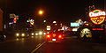
Branson is a major tourist attraction in the the Ozarks of southwestern Missouri.
Branson

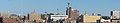
Cape Girardeau
Columbia
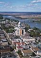
Jefferson City
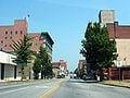
Joplin
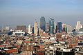
Kansas City

Saint Joseph
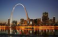
Saint Louis

.JPG)


Education
Missouri State Board of Education
The Missouri State Board of Education has general authority over all public education in the state of Missouri. It is made up of eight citizens appointed by the governor and confirmed by the Missouri Senate.

Primary and secondary schools
Education is compulsory from ages seven to sixteen in Missouri, commonly but not exclusively divided into three tiers of primary and secondary education: elementary school, middle school or junior high school and high school. The public schools system includes kindergarten to 12th grade. District territories are often complex in structure. In some cases, elementary, middle and junior high schools of a single district feed into high schools in another district. High school athletics and competitions are governed by the Missouri State High School Activities Association or MSHSAA.
Colleges and universities
The University of Missouri System is Missouri's statewide public university system, the flagship institution and largest university in the state is the University of Missouri in Columbia. The others in the system are University of Missouri–Kansas City, University of Missouri–St. Louis, and Missouri University of Science and Technology.

Notable highly rated[24] private institutions include Washington University in St. Louis and Saint Louis University.
Lincoln University in Jefferson City is one of a number of historically black colleges and universities. Founded in 1866, it was created by members of the 62nd and 65th United States Colored Troops as "Lincoln Institute", to provide education to freedmen. It was created on a model of combining academics and labor. In 1921, the state officially recognized the growth of Lincoln's undergraduate and graduate programs by classifying it as a university. The institution changed its name to "Lincoln University of Missouri." In 1954, the university began to accept applicants of all races.
To develop new teachers for needed public schools, in 1905 the state established a series of normal schools at colleges in each region of the state. This was based on the widely admired German model of public education. Normal schools were for the training of teachers of students in primary/elementary schools. The initial network consisted of Southeast Missouri State University in Cape Girardeau, Missouri State University (formerly Southwest Missouri State University) in Springfield, Truman State University (formerly Northeast Missouri State University) in Kirksville, Northwest Missouri State University in Maryville, and University of Central Missouri (formerly Central Missouri State University) in Warrensburg. Within several years, the normal school curriculum expanded to a full four years of academic subjects.
There are numerous junior colleges, trade schools, church universities and private universities in the state.
The state also funds a $2000, renewable merit-based scholarship, Bright Flight, given to the top 3 percent of Missouri high school graduates who attend a university in-state.
The nineteenth-century border wars between Missouri and Kansas have continued as a sports rivalry between the University of Missouri and University of Kansas. The rivalry is chiefly expressed through football games between the two colleges. It is the oldest college rivalry west of the Mississippi River and the second oldest in the nation. Each year when the universities meet to play, the game is coined "Border Showdown." An exchange occurs following the game where the winner gets to take a historic marching band drum, which has been passed back and forth for decades.
Miscellaneous topics
- USS Missouri, a U.S. Navy Iowa class battleship, was named in honor of the state.
- The phrase "I'm from Missouri" means I'm skeptical of the matter and not easily convinced. This is related to the state's motto of "Show Me," whose origin is popularly ascribed to an 1899 speech by Congressman Willard Vandiver, who declared that "I come from a country that raises corn and cotton, cockleburs and Democrats, and frothy eloquence neither convinces nor satisfies me. I'm from Missouri, and you have got to show me." However, according to researchers, the phrase was in circulation earlier in the 1890s.[25] According to another story, the phrase was originally a reference to Missouri laborers being brought to Colorado to quell a miner's strike and requiring frequent instruction.[26]
- Missouri is known as "The Cave State" with over 6000 recorded caves (second to Kentucky). Perry County has both the largest number of caves and the single longest cave in the state.[10]
Notes
- ↑ http://www.census.gov/const/regionmap.pdf
- ↑ http://www.chicagotribune.com/news/nationworld/chi-0411030358nov03,1,6377649.story?coll=chi-newsnationworld-utl&ctrack=1&cset=true
- ↑ Introduction to Missouri - The Show Me State Capital Jefferson City
- ↑ McCafferty, Michael. 2004. Correction: Etymology of Missouri (restricted access). American Speech, 79.1:32
- ↑ American Heritage Dictionary: Missouri
- ↑ http://www.eduplace.com/ss/maps/pdf/midwestus_nl.pdf
- ↑ Midwest Region Economy at a Glance
- ↑ UNC-CH surveys reveal where the ‘real’ South lies
- ↑ Income Inequality in Missouri
- ↑ 10.0 10.1
Scott House (2005-05-14). Fact Sheet on 6000 Caves. The Missouri Speleological Survey, Inc.. Cite error: Invalid
<ref>tag; name "MSS" defined multiple times with different content - ↑ New York Times, "Louisiana: The Levee System of the State", 10/8/1874; accessed 11/15/2007
- ↑ Meinig, D.W. (1993). The Shaping of America: A Geographical Perspective on 500 Years of History, Volume 2: Continental America, 1800-1867. New Haven: Yale University Press. ISBN 0-300-05658-3; pg. 437
- ↑ Historical Census Browser, 1860 Federal Census, University of Virginia Library, accessed 21 Mar 2008
- ↑ http://www.valpo.edu/geomet/pics/geo200/religion/catholic.gif Valparaiso University
- ↑ 2001 American Religious Identification Survey, City University of New York
- ↑ Missouri Secretary of State - State Archives - Origin of "Show Me" slogan
- ↑ 17.0 17.1 [http://www.forbes.com/business/2007/11/01/tobacco-smoking-north-carolina-biz-cx_tvr_1101smoking.html "Best Cities for Smokers," Forbes Magazine, November 1, 2007
- ↑ "State Tax Rates on Cigarettes," Federation of Tax Administrators, January 1, 2007
- ↑ "A burning issue," St. Louis Post-Dispatch, November 12, 2006
- ↑ Rob Roberts, "Critics: Don't expect smoking ban for years, if ever," Kansas City Business Journal, November 24, 2004
- ↑ James R. Davis and Ross C. Brownson, "A Policy for Clean Indoor Air in Missouri: History and Lessons Learned," St. Louis University Public Law Review, Volume 13, p. 749 (1994)
- ↑ Section 191.769, Revised Statues of Missouri
- ↑ Section 290.145, Revised Statutes of Missouri
- ↑ “America's Best Colleges 2008: National Universities: Top Schools.” USNews.com: . January 18, 2008.
- ↑ "I'm from Missouri — Show Me." http://www.barrypopik.com/index.php/new_york_city/entry/summary3
- ↑ Origin of "Show Me" Slogan. Secretary of State, Missouri. http://www.sos.mo.gov/archives/history/slogan.asp
ReferencesISBN links support NWE through referral fees
- Blashfield, Jean F. 2009. Missouri. New York: Children's Press. ISBN 9780531185858
- Lago, Mary Ellen. 2003. Missouri. New York: Children's Press. ISBN 0516223909
External links
All links Retrieved June 7, 2008.
- Missouri's African American History
- Science In Your Backyard: Missouri
- Missouri State & County QuickFacts
- Missouri - Race and Hispanic Origin: 1810 to 1990
- State Fact Sheets: Missouri
- Missouri
Credits
New World Encyclopedia writers and editors rewrote and completed the Wikipedia article in accordance with New World Encyclopedia standards. This article abides by terms of the Creative Commons CC-by-sa 3.0 License (CC-by-sa), which may be used and disseminated with proper attribution. Credit is due under the terms of this license that can reference both the New World Encyclopedia contributors and the selfless volunteer contributors of the Wikimedia Foundation. To cite this article click here for a list of acceptable citing formats.The history of earlier contributions by wikipedians is accessible to researchers here:
The history of this article since it was imported to New World Encyclopedia:
Note: Some restrictions may apply to use of individual images which are separately licensed.