Difference between revisions of "Grand Staircase-Escalante National Monument" - New World Encyclopedia
Mary Anglin (talk | contribs) |
Mary Anglin (talk | contribs) |
||
| Line 134: | Line 134: | ||
| − | |||
| − | |||
| − | |||
| − | |||
| − | |||
| − | |||
| − | |||
| − | |||
<center> | <center> | ||
| Line 158: | Line 150: | ||
|} | |} | ||
</center> | </center> | ||
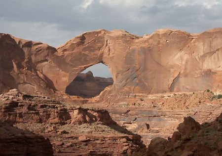
| + | [[Image:StevensArchUT.jpg|thumb|center|450px|<center>Stevens Arch, near the mouth of [[Coyote Gulch]], is formed from [[Navajo Sandstone]].</center>]] | ||
| + | |||
| + | {| | ||
| + | |- style ="background-color:#b9f; " | ||
| + | | colspan =9 | <center> '''Other Pictures of the Area''' </center> | ||
| + | |- | ||
| + | | width = 160px | [[Image:JuniperTreeUT.jpg| width = 160px |148px]] | ||
| + | | width = 160px | [[Image:BrokenBowArch.jpg| width = 160px |148px]] | ||
| + | | width = 160px | [[Image:DryForkDome.jpg| width = 160px |148px]] | ||
| + | | width = 160px | [[Image:DeerCreekUT.jpg| width = 160px |148px]] | ||
| + | | width = 160px | [[Image:DevilsGardenUT.jpg| width = 160px |148px]] | ||
| + | |- style ="vertical-align:top; " | ||
| + | | Willow Gulch | ||
| + | | Broken Bow Arch | ||
| + | | Sandstone Dome | ||
| + | | Deer Creek | ||
| + | | Devil's Garden Hoodoos | ||
| + | |- | ||
| + | | width = 140px | [[Image:PeekaBoo.jpg| width = 120px |108px]] | ||
| + | | width = 160px | [[Image:SoonerRocksUT.jpg| width = 160px |148px]] | ||
| + | | width = 160px | [[Image:DryForkNarrows.jpg| width = 160px |148px]] | ||
| + | | width = 160px | [[Image:PineCreekUT.jpg| width = 160px |148px]] | ||
| + | | width = 140px | [[Image:CalfCreekFallsUT.jpg| width = 120px |108px]] | ||
| + | |- style ="vertical-align:top; " | ||
| + | | Peek-a-Boo Gulch | ||
| + | | Sooner Rocks | ||
| + | | Dry Fork Narrows | ||
| + | | Pine Creek | ||
| + | | Calf Creek Falls | ||
| + | |} | ||
==Notes== | ==Notes== | ||
Revision as of 21:35, 12 July 2008
| Grand Staircase-Escalante National Monument | |
|---|---|
| IUCN Category III (Natural Monument) | |
| | |
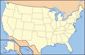
| Location: | Kane County and Garfield County, Utah, USA |
| Nearest city: | Kanab, UT |
| Area: | 1.9 million acres (7,689 km²) |
| Established: | September 18, 1996 |
| Governing body: | U.S. Bureau of Land Management |
The Grand Staircase-Escalante National Monument contains 1.9 million acres (7,571 km²) of land in southern Utah, the United States. There are three main regions: the Grand Staircase, the Kaiparowits Plateau, and the Canyons of the Escalante. President Bill Clinton designated the area as a U.S. National Monument in 1996 using his authority under the Antiquities Act.
, is one of the three main sections of the Grand Staircase-Escalante National Monument, is part of the Glen Canyon National Recreation Area, and borders the adjacent Capitol Reef National Park. It is an increasingly popular recreational destination in Utah's Canyon Country.
Regions
The Grand Staircase-Escalante National Monument spans nearly 1.9 million acres of public lands in south-central Utah. It is a high, rugged, and remote area which consists of three regions; the Grand Staircase, the Kaiparowits Plateau, and the Canyons of the Escalante.
The last part of the continental United States to be mapped, the remote area remains wilderness. While it is popular among tourists, it is also valued for the opportunities it provides in education and scientific research in the fields of geology, paleontology, archeology and biology.
Grand Staircase
The Grand Staircase refers to an immense sequence of sedimentary rock layers that stretch south from Bryce Canyon National Park through Zion National Park and into the Grand Canyon. In the 1870s, geologist Clarence Dutton first conceptualized this region as a huge stairway ascending out of the bottom of the Grand Canyon northward with the cliff edge of each layer forming giant steps. Dutton divided this layer cake of Earth history into five steps from the youngest (uppermost) rocks:
- Pink Cliffs,
- Grey Cliffs,
- White Cliffs,
- Vermilion Cliffs, and
- Chocolate Cliffs.
Since then, modern geologists have further divided Dutton's steps into individual rock formations.
Kaiparowits Plateau
The Kaiparowits Plateau is a large, high-altitude landform. Its extension to the southeast, Fiftymile Mountain, runs nearly to the Colorado River and Lake Powell, and is a prominent part of the northern skyline from the Glen Canyon National Recreation Area. Roughly triangular in shape, it extends for over 50 miles (80 km) from near the town of Escalante to the south and southwest through Kane County and nearly to the border with Arizona. At its southeastern end the plateau rises from Lake Powell nearly 4,000 feet (1200 m) to an elevation of 7,584 feet (2311 m). The northeastern edge of the plateau is defined by the Straight Cliffs, below which are the broad sandstone flats of the Escalante River. The western edge of the plateau is at the Paria River, Cottonwood Canyon, and the Cockscomb.
Canyons of the Escalante
The Canyons of the Escalante is a collective name for the erosional landforms created by the Escalante River and its tributaries, the Escalante River Basin. These sandstone features include high vertical canyon walls, water pockets, narrow slot canyons, domes, pedestals, arches, and natural bridges. This area, extending over 1,500 square miles (3900 km²), rises in elevation from 3,600 feet (1100 m) to over 11,000 feet (3350 m).
Geography
Escalante is a small town (population 818 in the 2000 census) in Garfield County, along Utah Scenic Byway 12. The town is surrounded by rugged geography - spectacular canyons and dramatic rock formations. To the south and east of Escalante are areas that were among the last places in America to be explored and mapped. [1]
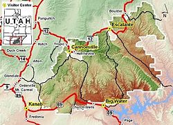
The towns of Escalante and Boulder sit on the northeast edge of the Grand Staircase-Escalante National Monument, and the towns of Big Water, Glendale and Kanab are on its southwest. The Monument stretches across 1.7 million acres (2656.25 square miles), slightly larger in area than the state of Delaware. The principal attractions within the monument are based around tributaries of the two major river systems - the Paria and the Escalante.
The western part of the Monument is dominated by the Paunsaugunt Plateau and the Paria River, and is adjacent to Bryce Canyon National Park. This section shows the geologic progression of the Grand Staircase.
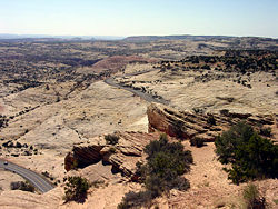
The center section is dominated by a single long ridge, called Kaiparowits Plateau from the west, and called Fifty-Mile Mountain when viewed from the east. Fifty-Mile Mountain stretches southeast from Escalante to the Colorado River in Glen Canyon. The eastern face of the mountain is a steep, 2200 foot (650 m) escarpment. The western side (the Kaiparowits Plateau) is a shallow slope descending to the south and west, and is the largest roadless piece of land in the lower 48 states.
East of Fifty Mile Mountain are the Canyons of the Escalante. The Monument is bounded by Glen Canyon National Recreation Area on the east and south. The most popular hiking and backpacking area is the Canyons of the Escalante, shared with Glen Canyon National Recreation Area. Highlights include the slot canyons of Peekaboo, Spooky and Brimstone Canyons, and the backpacking areas of lower Coyote Gulch and of Harris Wash.
The Hole-in-the-Rock Road runs through an area west of the Escalante River extending southeast from the town of Escalante, along the base of Fifty Mile Mountain. It is named after an unusual geologic feature at its southeastern end, "Hole-in-the-Rock". It closely follows the historic route used by the Mormon San Juan Expedition to colonize an area to the east of the Colorado River. It is an important access route for visiting the Canyons of the Escalante and the flat desert at the base of Fifty Mile Mountain that is actively used for grazing cattle.
Paleontology
In the 1880s, many large dinosaur skeletons were excavated from southern Utah in regions north of the Grand Staircase. Following these discoveries there was little interest in further exploration. In the late 20th and early 21st centuries there has been greatly renewed interests in the strata of the Grand Staircase, particularly since the exposure and collection of new fossils in previously unexplored strata has a high probability of revealing fossil remnants of hitherto unseen species — a matter of substantial importance to young paleontological researchers wishing to advance in their profession.
Southern Utah has continued to reward researchers owing to its climatological "sweet spot" for exposing fossil remnants for observation and collection at the surface. At locations south, in Arizona, the climate is so dry that erosion is relatively slow. Further north, the wetter climates encourage growth of forests, which destroy fossiles by the actions of roots and soil bacteria. In southern Utah, there are enough strong and wet storms to cause episodic rapid erosion and the consequent exposure of fossil remains, but with insufficient annual average rainfall to support destructive deep rooted plant life.
In 2002, a volunteer at Grand Staircase-Escalante discovered a 75-million-year-old dinosaur near the Arizona border. On October 3, 2007, the dinosaur's name, Gryposaurus monumentensis (hook-beaked lizard from the monument) was announced in the Zoological Journal of the Linnean Society. Monumentensis was at least 30 feet (9.1 m) long and 10 feet (3.0 m) tall, and has a powerful jaw with more than 800 teeth. [2]
Two ceratopsid (horned) dinosaurs, also discovered at Grand Staircase-Escalante, were introduced by the Utah Geological Survey in 2007. They were uncovered in the Wahweap formation, which is just below the Kaiparowits formation where the duckbill was extracted. They lived about 80 to 81 million years ago. The two fossils are called the Last Chance skull and the Nipple Butte skull. They were found in 2002 and 2001, respectively. [3]
Human history
Humans didn't settle permanently in the area until the late Basketmaker period, somewhere around 500 C.E. Both the Fremont and ancestral Puebloan people lived here; the Fremont hunting and gathering below the plateau and near the Escalante Valley, and the ancestral Puebloans farming in the canyons. Both groups grew corn, beans, and squash, and built brush-roofed pithouses and took advantage of natural rock shelters. Ruins and rock art can be found throughout the Monument.
The first record of white settlers in the region dates from 1866, when Captain James Andrus led a group of cavalry to the headwaters of the Escalante River. In 1871 Jacob Hamlin of Kanab, on his was to resupply the second John Wesley Powell expedition, mistook the Escalante River for the Dirty Devil River and became the first Anglo to travel the length of the canyon.
In 1879 the San Juan Expedition crossed through the Monument on their way to their proposed colony in the far southeastern corner of Utah. They eventually arrived at the 1200-foot (400 m) sandstone cliffs that surrounded Glen Canyon they found and named Hole-in-the-Rock, a narrow, steep, and rocky crevice and sandy slope that led down to the river. After six weeks of labor they had rigged a pulley system to lower their wagons and animals down the cliff, where they crossed the river and climbed back out through Cottonwood Canyon on the other side.
Management
The Monument is managed by the Bureau of Land Management rather than the National Park Service. This was the first National Monument managed by the BLM. Visitor centers are located in Cannonville, Big Water, Escalante, and Kanab.
Controversy
The Grand Staircase-Escalante National Monument was declared in September, 1996 at the height of the 1996 presidential election campaign by President Bill Clinton, and was controversial from the moment of creation. The declaration ceremony was held at Grand Canyon National Park in Arizona, and not in the state of Utah. The Utah congressional delegation and state governor were notified only 24 hours in advance. This was seen by many as a transparent political ploy to gain votes in the contested state of Arizona. That November, Clinton won Arizona by a margin of 2.2 percent, and lost Utah to Republican Bob Dole by 21.1 percent.
Local officials and Congressman Chris Cannon (R - UT) objected to the designation of the Monument, questioning whether the Antiquities Act allowed such vast amounts of land to be designated. [4]
In 1965, the Southern California Edison Company proposed the construction of a 5000 megawatt coal-fired generation plant within the Kaiparowits Plateau.[5] This plant was intended to be fed by large coal deposits in the plateau, which may have yielded up to 4 billion tons of fuel. The electricity produced would have gone to the growing populations near Los Angeles, San Diego, and Phoenix. Initially hailed as an economic boon to this isolated area of southern Utah, the proposal met with growing opposition from federal regulatory agencies and from environments groups, who had only recently experienced the scenic canyons of the Colorado River and its tributaries being inundated by Lake Powell, behind the Glen Canyon Dam. After ten years of dispute and facing rising construction costs, the proposal was abandonded in 1975.
The largest deposit of compliance coal in the United States - 62 billion tons - lie under the surface of the Kaiparowits Plateau. In 1991 Andalex Resources, a Dutch-owned company, applied for a Utah state permit to develop a coal mine on 10,000 acres of leased plateau land. The company proposed an underground mine which would produce 2-2.5 million tons of coal a year for 30 years and provide jobs for the local economy. Environmentalists opposed any mining in the area, and Andalex' plans were held up for four years while studies were being done by the Bureau of Land Management and fighting legal opposition led mainly by the Southern Utah Wilderness Alliance. Designation of the area as a national monument prompted Andalex to withdraw its Kaiparowits Plateau mine proposal. The decision to withdraw was met positively by environmentalists and with regret by those anticipating increased income to the area. [6]
Wilderness designation for the lands in the Monument had long been sought by environmental groups; while designation of the Monument is not legally the same as Wilderness designation, for most practical purposes it is very similar. Bill Clinton significantly improved his standing with environmentalists by designating the Monument.
There are contentious issues peculiar to the state of Utah. Certain plots of land were assigned when Utah became a state (in 1896) as School and Institutional Trust Lands (SITLa, a Utah state agency), to be managed to produce funds for the state school system. These lands included scattered plots in the Monument that, critics claimed, could no longer be developed for the sake of Utah's school children. The SITLa plots within the Monument were exchanged for federal lands elsewhere in Utah, plus equivalent mineral rights and $13 million dollars cash by an act of Congress, the Utah Schools and Lands Exchange Act of 1998, supported by Democrats and Republicans, and signed into law as Public Law 105-335 on October 31, 1998. [7]
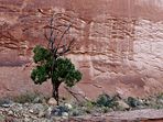
|
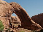
|

|
|

| ||||
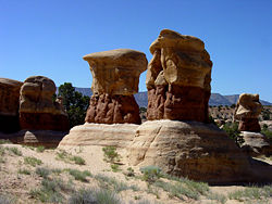
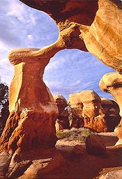
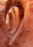
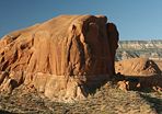
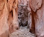
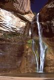
| Willow Gulch | Broken Bow Arch | Sandstone Dome | Deer Creek | Devil's Garden Hoodoos | ||||
|
|
|

|
| ||||
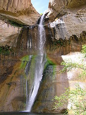
| Peek-a-Boo Gulch | Sooner Rocks | Dry Fork Narrows | Pine Creek | Calf Creek Falls | ||||
Notes
- ↑ John Crossley. Grand Staircase-Escalante National Monument The American Southwest. Retrieved July 12, 2008.
- ↑ BBC News. October 3, 2007. Duck-billed dinosaur had big bite Retrieved July 12, 2008.
- ↑ Joe Bauman and Ray Boren. October 4, 2007. Utah's new dino-stars: Discoveries give clues to distant past Deseret News. Retrieved July 12, 2008.
- ↑ Mathew Barrett Gross. February 13, 2002. Monumental effort University of Montana - Headwaters News. Retrieved July 12, 2008.
- ↑ Utah History Encyclopedia: Kaiparowits
- ↑ John D. Grahame and Thomas D. Sisk. 2002. Coal Mining vs. Wilderness on the Kaiparowits Plateau Northern Arizona University. Retrieved July 12, 2008.
- ↑ Public Law 105-335. October 31, 1998. Utah Schools and Lands Exchange Act of 1998 US Government Printing Office. Retrieved July 12, 2008.
ReferencesISBN links support NWE through referral fees
- Grand Staircase-Escalante National Monument (Utah). 1999. Grand Staircase-Escalante National Monument: proposed management plan, final environmental impact statement. Cedar City, Utah: U.S. Dept. of the Interior, Bureau of Land Management.
- Keiter, Robert B., Sarah B. George, and Joro Walker. 1998. Visions of the Grand Staircase-Escalante examining Utah's newest national monument. Salt Lake City: Utah Museum of Natural History. ISBN 058511207X and ISBN 9780585112077
- Larmer, Paul. 2004. Give and take: how the Clinton administration's public lands offensive transformed the American West. Paonia, Colo: High Country News Books. ISBN 0974448508 and ISBN 9780974448503
- Smith, Julian. 2003. Moon handbooks. Four corners : including Navajo and Hopi country, Moab, and Lake Powell. Emeryville, Calif: Avalon Travel. ISBN 1566915813 and ISBN 9781566915816
- Urmann, David, and Suzanne Gibbs Taylor. 1999. Trail guide to Grand Staircase Escalante National Monument. Salt Lake City: Gibbs Smith, Publisher. ISBN 0879058854 and ISBN 9780879058852
External links
All links Retrieved June 24, 2008.
Credits
New World Encyclopedia writers and editors rewrote and completed the Wikipedia article in accordance with New World Encyclopedia standards. This article abides by terms of the Creative Commons CC-by-sa 3.0 License (CC-by-sa), which may be used and disseminated with proper attribution. Credit is due under the terms of this license that can reference both the New World Encyclopedia contributors and the selfless volunteer contributors of the Wikimedia Foundation. To cite this article click here for a list of acceptable citing formats.The history of earlier contributions by wikipedians is accessible to researchers here:
- Grand_Staircase-Escalante_National_Monument history
- Grand_Staircase history
- Kaiparowits_Plateau history
- Canyons_of_the_Escalante history
The history of this article since it was imported to New World Encyclopedia:
Note: Some restrictions may apply to use of individual images which are separately licensed.
