Difference between revisions of "Santa Fe, New Mexico" - New World Encyclopedia
Mary Anglin (talk | contribs) |
Mary Anglin (talk | contribs) |
||
| Line 174: | Line 174: | ||
==Santa Fe style and “The City Different”== | ==Santa Fe style and “The City Different”== | ||
[[Image:NewMexicoCathedralSantaFe.jpg|thumb|right|Cathedral Basilica of Saint Francis of Assisi, 1869]] | [[Image:NewMexicoCathedralSantaFe.jpg|thumb|right|Cathedral Basilica of Saint Francis of Assisi, 1869]] | ||
| − | The Spanish laid out the city according to the “Laws of the Indies”, town planning rules and ordinances which had been established in | + | The Spanish laid out the city according to the “Laws of the Indies”, town planning rules and ordinances which had been established in 1573 by [[Phillip II of Spain|King Philip II]]. The fundamental principle was that the town be laid out around a central plaza. On its north side was the [[Palace of the Governors]], while on the East was the church that later became the [[Cathedral Basilica of Saint Francis of Assisi]]. |
| − | An important style implemented in planning the city was the radiating grid of streets centering from the central Plaza. Many were narrow and included small alley-ways, but each gradually merged into the more casual byways of the agricultural perimeter areas. As the city grew throughout the 19th century, the building styles evolved | + | An important style implemented in planning the city was the radiating grid of streets centering from the central Plaza. Many were narrow and included small alley-ways, but each gradually merged into the more casual byways of the agricultural perimeter areas. As the city grew throughout the 19th century, the building styles also evolved, coming to incorporate styles from around the nation. The city government realized that the economic decline, which had started more than twenty years before with the railway moving west and the Federal government closing down Fort Marcy, might be reversed by the promotion of [[tourism]]. |
| − | To achieve that goal, the city created the idea of imposing a unified building style – the [[Pueblo Revival Style architecture|Spanish Pueblo Revival]] look, which was based on work done restoring the Palace of the Governors. The sources for this style came from the many defining features of local architecture: vigas and canales from many old adobe homes, churches built many years before and found in the Pueblos, and the earth-toned, adobe-colored look of the exteriors. | + | To achieve that goal, the city created the idea of imposing a unified building style – the [[Pueblo Revival Style architecture|Spanish Pueblo Revival]] look, which was based on work done restoring the Palace of the Governors. The sources for this style came from the many defining features of local [[architecture]]: vigas and canales from many old adobe homes, churches built many years before and found in the Pueblos, and the earth-toned, adobe-colored look of the exteriors. |
| − | After 1912 this style became official: all buildings were to be built using these elements. By 1930 there was a broadening to include the “Territorial”, a style of the pre-statehood period which included the addition of portals and white-painted window and door pediments | + | After 1912 this style became official: all buildings were to be built using these elements. By 1930 there was a broadening to include the “Territorial”, a style of the pre-statehood period which included the addition of portals and white-painted window and door pediments, resulting in the city losing a great deal of its architectural history and eclecticism. Among the architects most closely associated with this “new” style is [[John Gaw Meem]]. |
| − | |||
| − | By an ordinance passed in 1958, new and rebuilt buildings, especially those in designated historic districts, must exhibit a Spanish Territorial or Pueblo style of architecture, with flat roofs and other features suggestive of the area's traditional [[adobe]] construction. However, many contemporary houses in the city are built from lumber, concrete blocks, and other common building materials, but with stucco surfaces (sometimes referred to as "faux-dobe | + | By an ordinance passed in 1958, new and rebuilt buildings, especially those in designated historic districts, must exhibit a Spanish Territorial or Pueblo style of [[architecture]], with flat roofs and other features suggestive of the area's traditional [[adobe]] construction. However, many contemporary houses in the city are built from lumber, concrete blocks, and other common building materials, but with stucco surfaces (sometimes referred to as "faux-dobe") reflecting the historic style. |
| − | |||
| − | |||
| − | |||
== Notes == | == Notes == | ||
Revision as of 00:47, 6 November 2008
| Santa Fe, New Mexico | |||
| — City — | |||
| City of Santa Fe | |||
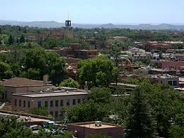
| Santa Fe's Downtown Area | |||
|
|||
| Nickname: The City Different | |||
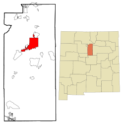
| Location in Santa Fe County, New Mexico | |||
| Coordinates: {{#invoke:Coordinates|coord}}{{#coordinates:35|40|2|N|105|57|52|W|type:city | |||
|---|---|---|---|
| name= }} | |||
| Country | |||
| State | |||
| County | Santa Fe County | ||
| Founded | ca. 1607-8 | ||
| Government | |||
| - Mayor | David Coss (D) | ||
| Area | |||
| - City | 37.4 sq mi (96.9 km²) | ||
| - Land | 37.3 sq mi (96.7 km²) | ||
| - Water | 0.1 sq mi (0.2 km²) | ||
| Elevation | 7,000 ft (2,134 m) | ||
| Population (2006) | |||
| - City | 72,056 | ||
| - Metro | 183,782 (Santa Fe-Espanola CSA) | ||
| Time zone | MST (UTC-7) | ||
| - Summer (DST) | MDT (UTC-6) | ||
| ZIP codes | 87500-87599 | ||
| Area code(s) | 505 | ||
| FIPS code | 35-70500 | ||
| GNIS feature ID | 0936823 | ||
| Website: http://www.santafenm.gov/ | |||
Santa Fe (Navajo: Yootó) is the capital of the state of New Mexico. It is the fourth-largest city in the state and is the seat of Santa Fe County. Santa Fe (literally 'holy faith' in Spanish) had a population of 62,203 at the April 1, 2000 census; the estimate for July 1, 2006, is 72,056.[1] It is the principal city of the Santa Fe, New Mexico Metropolitan Statistical Area which encompasses all of Santa Fe County and is part of the larger Santa Fe-Española Combined Statistical Area.
Geography
Santa Fe is located in the north central part of the state of New Mexico, in the northern Rio Grande valley at the foot of the Sangre de Cristo Mountains, and covers an area of 37.4 square miles (96.9 km²).
The city is situated at 7,000 feet (2,134 meters) above sea level, making it the highest state capital in the United States, followed by: Cheyenne, Wyoming (6,062 ft [1,848 m]); Denver, Colorado (5,280 ft [1,609.3 m]); Carson City, Nevada (4,802 ft [1,463 m]); Salt Lake City, Utah (4,226 ft [1,288 m]); and Helena, Montana (4,058 ft [1,237 m]).
Santa Fe is characterized by cool winters and warm summers. The average temperature in Santa Fe ranges from a low of 14°F (-10°C) to a high of 40°F (4°C) in winter, low of 55°F (13°C) to a high of 86°F (30°C) in summer. Santa Fe receives 2-3 inches (50-75 mm) of rain per month in summer and about 5 inches (13 cm) of snow per month in winter.[2] Its relatively dry, invigorating climate makes it a popular summer resort, while mountain skiing attracts winter visitors.
History
The first known inhabitants of New Mexico were members of the Clovis culture of Paleo-Indians(10,000 to 9,000 B.C.E.). The culture is named for the New Mexico city where the first artifacts of this culture were excavated in the early 1930s.[3] Later inhabitants include Native Americans of the Anasazi and the Mogollon cultures. By the time of European contact in the 1500s, the region was already settled by the villages of the Pueblo peoples and groups of Navajo, Apache and Ute.
Santa Fe under Spain and Mexico
What is now the city of Santa Fe was originally occupied by a number of Pueblo Indian villages with founding dates between 1050 to 1150, near the Santa Fe River.
Santa Fe was the capital of Nuevo México, a province of New Spain explored by Francisco Vásquez de Coronado and established in 1515. The "Kingdom of New Mexico" was first claimed for the Spanish Crown in 1540, almost 70 years before the founding of Santa Fe. Coronado and his men also traveled to the Grand Canyon and through the Great Plains on their New Mexico expedition.
Spanish colonists first settled in northern New Mexico in 1598. Don Juan de Oñate became the first Governor and Captain-General of New Mexico and established his capital in 1598 at San Juan Pueblo, 25 miles (40 km) north of Santa Fe. The city of Santa Fe was founded by Don Pedro de Peralta, New Mexico's third Spanish governor. Peralta gave the city its full name, "La Villa Real de la Santa Fé de San Francisco de Asís", or "The Royal City of the Holy Faith of Saint Francis of Assisi."
The town was formally founded and made a capital in 1610,[4] making it the oldest capital city in what is today the United States. Jamestown, Virginia (1607) is of similar vintage but not as a capital city. It is at least the third oldest surviving American city founded by European colonists, behind St. Augustine (1565) and Pensacola, Florida (1559).
Except for the years 1680-1692, when, as a result of the Pueblo Revolt, the native Pueblo people drove the Spaniards out of the area known as New Mexico, later to be reconquered by Don Diego de Vargas, Santa Fe remained Spain's provincial seat until the outbreak of the Mexican War of Independence in 1810. In 1824 the city's status as the capital of the Mexican territory of Santa Fé de Nuevo México was formalized in the 1824 Constitution of Mexico.
Santa Fe and the United States
In 1841, a small military and trading expedition set out from Austin, Texas, with the goal of gaining control over the Santa Fe Trail. Known as the Santa Fe Expedition, the force was poorly prepared and was easily repelled by the Mexican army. In 1846, the United States declared war on Mexico, and Brigadier General Stephen W. Kearny led the main body of his Army of the West of some 1,700 soldiers into the city to claim it, along with the entire New Mexico Territory for the United States. By 1848 the U.S. officially gained New Mexico through the Treaty of Guadalupe Hidalgo.
In 1851, Jean Baptiste Lamy arrived in Santa Fe and began construction of Saint Francis Cathedral. For a few days in March 1862, the Confederate flag of General Henry Sibley flew over Santa Fe, until he was defeated by Union troops.
Santa Fe was originally envisioned as an important stop on the Atchison, Topeka and Santa Fe Railway. But as the tracks progressed into New Mexico, the civil engineers decided that it was more practical to go through Lamy, a town in Santa Fe County to the south of Santa Fe. The result was a gradual economic decline. This was reversed in part through the creation of a number of resources for the arts and archaeology, notably the School of American Research, created in 1907 under the leadership of the prominent archaeologist Edgar Lee Hewett.
The first aeroplane to fly over Santa Fe was piloted by Rose Dugan, carrying Vera von Blumenthal as passenger. Together they began the development of the Pueblo Indian pottery industry, a major contribution to the founding of the annual Santa Fe Indian Market.
In 1912, New Mexico became the United States of America's 47th state, with Santa Fe as its capital.
Government
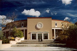
The City of Santa Fe is a charter city, meaning it is governed according to its own charter document rather than by state, provincial, regional or national laws. The Charter of the City of Santa Fe was adopted by the voters of the City of Santa Fe, New Mexico, at a Special Municipal Election held on December 9, 1997; and amended by the voters of the City of Santa Fe, New Mexico, at a Regular Municipal Election held on March 4, 2008.[5]
The city is divided into four electoral districts, each represented by two councilors. Councilors are elected to staggered four-year terms and one councilor from each district is elected every two years.[5]
The municipal judgeship is an elected position and a requirement of the holder is that they be a member of the state bar. The judge is elected to four-year terms. [5]
The mayor is the chief executive officer of the city and is a member of the governing body. The mayor has numerous powers and duties, but does not vote with the councilors except to break ties.[5] Day-to-day operations of the municipality are undertaken by the city manager's office.[5]
Demographics
As of the censusGR2 of 2000, there were 62,203 people, 27,569 households, and 14,969 families living in the city. The population density was 1,666.1 people per square mile (643.4/km²). There were 30,533 housing units at an average density of 817.8/sq mi (315.8/km²). According to the Census Bureau's 2006 American Community Survey, the racial makeup of the city was 75 percent White, 2.5 percent Native American, 1.9 percent Asian, 0.4 percent African American, 0.3 percent Pacific Islander, 16.9 percent from other races, and 3.1 percent from two or more races. Hispanic or Latino of any race were 44.5 percent of the population.
There were 27,569 households out of which 24.1 percent had children under the age of 18 living with them, 37.6 percent were married couples living together, 12.1 percent had a female householder with no husband present, and 45.7 percent were non-families. 36.4 percent of all households were made up of individuals and 10.2 percent had someone living alone who was 65 years of age or older. The average household size was 2.20 and the average family size was 2.90.
In the city the population was spread out with 20.3 percent under the age of 18, 8.9 percent from 18 to 24, 29.0 percent from 25 to 44, 28.0 percent from 45 to 64, and 13.9 percent who were 65 years of age or older. The median age was 40 years. For every 100 females there were 91.7 males. For every 100 females age 18 and over, there were 89.0 males.
The median income for a household in the city was $40,392, and the median income for a family was $49,705. Males had a median income of $32,373 versus $27,431 for females. The per capita income for the city was $25,454. About 9.5 percent of families and 12.3 percent of the population were below the poverty line, including 17.2 percent of those under age 18 and 9.2 percent of those age 65 or over.
Education
The public schools in Santa Fe are operated by Santa Fe Public Schools, with two major high schools, Santa Fe High School and Capital High School.
There are also several charter schools, including Monte Del Sol, the Academy for Technology and the Classics and Charter School 37. The city boasts numerous private elementary schools as well, including Rio Grande School, Desert Montessori School, La Mariposa Montessori, Santa Fe School for the Arts, and The Tara School.
The city has six private college preparatory high schools, Santa Fe Waldorf School k-12St. Michael's High School, Desert Academy, New Mexico School For The Deaf, Santa Fe Secondary School, and Santa Fe Preparatory School. It is also home to Santa Fe Indian School, an off-reservation school for Native Americans.
There are two private liberal arts colleges in Sante Fe: St. John's College and the College of Santa Fe and a community college, Santa Fe Community College. Santa Fe is home to the Institute of American Indian Arts, which as of 2008 had graduated more than 3,800 students representing 90 percent of the 562 federally recognized Native American tribes in the nation, and has become well known internationally for its achievements.
Science and technology
Santa Fe has had an association with science and technology since 1943 when the town served as the gateway to Los Alamos National Laboratory (LANL), a 45 minute drive from the city. In 1984, the Santa Fe Institute (SFI) was founded to research complex systems in the physical, biological, economic, and political sciences. It hosts such Nobel laureates as Murray Gell-Mann (physics), Philip Warren Anderson (physics), and Kenneth Arrow (economics).
The National Center for Genome Resources (NCGR) was founded in 1994 to focus on research at the intersection among bioscience, computing, and mathematics. In the 1990s and 2000s several technology companies formed to commercialize technologies from LANL, SFI, and NCGR. This community of companies has been dubbed the "Info Mesa."
Arts and culture
Tourism
After State government, tourism is a major aspect of the Santa Fe economy, with visitors attracted year-round by the climate and related outdoor activities, as well as the city's and region's cultural activities.
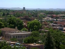
Most tourist activity takes place in the historic downtown, especially on and around the Plaza, a one-block square adjacent to the Palace of the Governors, the original seat of New Mexico's territorial government since the time of Spanish colonization.
Some visitors find Santa Fe particularly attractive around the second week of September when the aspens in the Sangre de Cristo Mountains turn yellow and the skies are clear and blue. This is also the time of the annual Fiestas de Santa Fe, celebrating the "reconquering" of Santa Fe by Don Diego de Vargas, a highlight of which is the burning Zozobra, a fifty-foot marionette also called "Old Man Gloom."
Within easy striking distance for day-trips is the town of Taos, about 70 miles (113 km) North and the historic Bandelier National Monument about 30 miles (48 km) away. Santa Fe's ski area, Ski Santa Fe, is about 16 miles (26 km) north of the city.
Arts
A large artistic community thrives in Santa Fe. The capital city has museums of Spanish colonial, international folk, Navajo ceremonial, modern Native American, and other modern art. Another museum honors late resident Georgia O'Keeffe, one of the most well-known New Mexico-based artists. Colonies for artists and writers thrive, and the small city teems with art galleries. In August, the city hosts the annual Santa Fe Indian Market, which is the oldest and largest juried Native American art showcase in the world.
Performing arts include the renowned Santa Fe Opera which presents five operas in repertory each July to August, the Santa Fe Chamber Music Festival held each summer, and the restored Lensic Theater a principal venue for many kinds of performances.
Canyon Road, east of the Plaza, has the highest concentration of art galleries in the city, and is a major destination for international collectors, tourists and locals. Santa Fe's art market is the second largest in the United States, after New York City, and the Canyon Road galleries showcase a wide array of contemporary Southwestern, indigenous American, and experimental art, in addition to older Russian, Taos Masters, and Native American pieces.
There are many outdoor sculptures, including many statues of Saint Francis, and several other holy figures, such as Kateri Tekakwitha. Given that Saint Francis was known for his love of animals it is not surprising that there are great numbers of representations of crows, bulls, elephants, livestock and other beasts, all over town. The styles run the whole spectrum from Baroque to Post-modern.
Literature
Numerous authors followed the influx of specialists in the visual arts. Well-known writers like Cormac McCarthy, Roger Zelazny, Alice Corbin Henderson, Mary Austin, Witter Bynner, Paul Horgan, George R. R. Martin, Mitch Cullin, Evan S. Connell, Richard Bradford, Jack Schaefer, Hampton Sides and Micheal McGarritty have been residents of Santa Fe. Walker Percy lived on a dude ranch outside of Santa Fe before returning to Louisiana to begin his literary career.
Museums
Santa Fe has many world-class museums. Many are located around the historic downtown Plaza or close by:
- New Mexico Museum of Art – collections of Southwestern Arts.
- Institute of American Indian Arts Museum – Native American arts with political aspects.
- Georgia O'Keeffe Museum – devoted to the work of O'Keeffe and others whom she influenced.
- The History Museum – currently located in the historic Palace of the Governors, showcasing the history of Santa Fe.
- Site Santa Fe – A contemporary art space, known as the forefront for contemporary art presentation in the Southwest.
Others are located in the Museum Hill district:
- Museum of International Folk Art – showcasing folk art and craftsmanship from around the world.
- Museum of Indian Arts and Culture and Laboratory of Anthropology – exhibits Native American arts.
- Wheelwright Museum of the American Indian – Native American art and history.
- Museum of Spanish Colonial Art – arts during the Spanish-colonial era.
Santa Fe style and “The City Different”
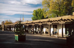
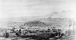
The Spanish laid out the city according to the “Laws of the Indies”, town planning rules and ordinances which had been established in 1573 by King Philip II. The fundamental principle was that the town be laid out around a central plaza. On its north side was the Palace of the Governors, while on the East was the church that later became the Cathedral Basilica of Saint Francis of Assisi.
An important style implemented in planning the city was the radiating grid of streets centering from the central Plaza. Many were narrow and included small alley-ways, but each gradually merged into the more casual byways of the agricultural perimeter areas. As the city grew throughout the 19th century, the building styles also evolved, coming to incorporate styles from around the nation. The city government realized that the economic decline, which had started more than twenty years before with the railway moving west and the Federal government closing down Fort Marcy, might be reversed by the promotion of tourism.
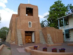
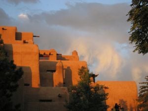
To achieve that goal, the city created the idea of imposing a unified building style – the Spanish Pueblo Revival look, which was based on work done restoring the Palace of the Governors. The sources for this style came from the many defining features of local architecture: vigas and canales from many old adobe homes, churches built many years before and found in the Pueblos, and the earth-toned, adobe-colored look of the exteriors.
After 1912 this style became official: all buildings were to be built using these elements. By 1930 there was a broadening to include the “Territorial”, a style of the pre-statehood period which included the addition of portals and white-painted window and door pediments, resulting in the city losing a great deal of its architectural history and eclecticism. Among the architects most closely associated with this “new” style is John Gaw Meem.
By an ordinance passed in 1958, new and rebuilt buildings, especially those in designated historic districts, must exhibit a Spanish Territorial or Pueblo style of architecture, with flat roofs and other features suggestive of the area's traditional adobe construction. However, many contemporary houses in the city are built from lumber, concrete blocks, and other common building materials, but with stucco surfaces (sometimes referred to as "faux-dobe") reflecting the historic style.
Notes
- ↑ Subcounty population estimates: New Mexico 2000-2006 (CSV). United States Census Bureau, Population Division (2007-06-28). Retrieved 2008-05-28.
- ↑ The Weather Channel. Monthly Averages for Santa Fe, NM Retrieved November 5, 2008.
- ↑ Crystalinks.com.Clovis People Retrieved November 5, 2008.
- ↑ City of Santa Fe. Santa Fe, A Rich History Retrieved November 5, 2008.
- ↑ 5.0 5.1 5.2 5.3 5.4 City of Santa Fe. Santa Fe Municipal Charter Retrieved November 5, 2008.
ReferencesISBN links support NWE through referral fees
- Acuna, Rodolfo. 1987. Occupied America: A History of Chicanos, New York: Harper Collins. ISBN 006040163X
- Hammett, Kingsley. 2004 . Santa Fe: A Walk Through Time, Layton, Utah: Gibbs Smith, ISBN 1586851020
- Ivey, James. 2003. An Uncertain Founding: Santa Fe Common-place - The Interactive Journal of Early American Life. Retrieved November 4, 2008.
- Larson, Jonathan, Another day, Halloween, I'll cover you, One song glory, Out tonight, Rent, et al. 1996. "Rent : vocal selections / Jonathan Larson". ISBN 9780793572298
- National Park Service. American Southwest Retrieved November 4, 2008.
- Wilson, Chris. 1997. The Myth of Santa Fe: Creating a Modern Regional Tradition. Albuquerque, NM: UNM Press. ISBN 0826317464
External links
All Links Retrieved November 4, 2008.
- Arts and cultural organizations
- Lensic Performing Arts Center official site
- Santa Fe Opera official site
- Santa Fe New Music official site
- Santa Fe Chamber Music Festival official site
- Santa Fe Pro Musica official website
- Santa Fe Arts And Culture web portal
- Theater Grottesco multidimensional ensemble theater
- Wise Fool New Mexico Community and Circus Arts
- Warehouse 21
- City/County/State
- City of Santa Fe official site
- Santa Fe Convention & Visitors Bureau official tourism site
- Santa Fe Chamber of Commerce
- Newspapers and publications
- Journal Santa Fe daily newspaper online
- Santa Fe Reporter weekly newspaper online
- The Santa Fean Magazine monthly magazine
- SantaFe.com Regional Portal Site
Credits
New World Encyclopedia writers and editors rewrote and completed the Wikipedia article in accordance with New World Encyclopedia standards. This article abides by terms of the Creative Commons CC-by-sa 3.0 License (CC-by-sa), which may be used and disseminated with proper attribution. Credit is due under the terms of this license that can reference both the New World Encyclopedia contributors and the selfless volunteer contributors of the Wikimedia Foundation. To cite this article click here for a list of acceptable citing formats.The history of earlier contributions by wikipedians is accessible to researchers here:
The history of this article since it was imported to New World Encyclopedia:
Note: Some restrictions may apply to use of individual images which are separately licensed.
