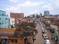
Kigali
| Kigali | |
| Kigali, Rwanda | |
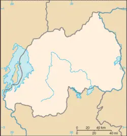
| Map of Rwanda showing the location of Kigali. | |
| Coordinates: {{#invoke:Coordinates|coord}}{{#coordinates:1|56|38|S|30|03|34|E|type:city | |
|---|---|
| name= }} | |
| Province | Kigali City |
| District(s) | Gasabo Kicukiro Nyarugenge |
| Government | |
| - Mayor | Aisa Kirabo Kacyira |
| Area | |
| - Total | 730 km² (281.9 sq mi) |
| Elevation | 1,567 m (5,141 ft) |
| Population (2005) | |
| - Total | 851,024 |
| estimated | |
| Time zone | CAT (UTC+1) |
| - Summer (DST) | none (UTC+1) |
| Website: http://www.kigalicity.gov.rw/ | |
Kigali has been the economic, cultural, and transport hub of Rwanda since it became capital at independence in 1962. The city is coterminous with the province of Kigali City, which was enlarged in January 2006 as part of local government reorganisation in the country. The city's urban area covers about 70% of the municipal boundaries.[1]
Geography
The name "Kigali" comprises the Bantu prefix "ki" and Rwanda "gali" meaning "broad". The city takes it's name from Mount Kigali.
The city is built in hilly country, sprawling across about four ridges and the valleys in between. The tops of the ridges have an average elevation of 5246 feet (1600 meters) while the valleys are around 4270 feet (1300 meters). The city is ringed most of the way round by higher hills, with some suburban sprawl rising up these. The highest of these is Mt Kigali, with an elevation of 6075 feet (1850 meters) above sea level.
Because of the high altitude, Kigali has a pleasant tropical highland climate. Temperatures range from 68°F (20°C) to 71°F (21.6°C) year round There are four seasons; long rains from mid March to mid May, short rains from mid-October to mid-December; a long dry period from mid-May to mid-October, and a short dry season from mid-December to mid-March. Average annual precipitation is 35 inches (900mm).
Rivers and canals Size – land area, size comparison Environmental issues
The city centre is located on one of the city's four ridges, with the main government area on another. There is a Muslim quarter, to the northeast is a squatters’ settlement, and southeast is an industrial area. The bigger houses and office buildings tend to be on the tops of the ridges, while the poorer people live in the valleys.
History
The Twa, the aboriginal Pygmy inhabitants, a group of diminutive forest hunters and gatherers, have probably lived in the Rwanda region possibly as far back as 30,000 B.C.E.
By the fifteenth century the Hutu and Tutsi had moved in. The Hutus primarily were farmers who lived on hilltops, and the Tutsi were warriors and herders who lived on the hillsides and in the valleys. In the 19th century that evolved into a feudal-type system with sharp social divisions in which Tutsis dominated.
In 1895 the Rwandan king accepted German rule to maintain his power, and the area became part of German East Africa. The Germans did nothing to develop the country economically. They kept the indigenous administration system by applying the same type of indirect rule established by the British Empire in the Ugandan kingdoms.
Kigali was founded in 1907 under German colonial rule.
After Germany's loss in World War I (1914-1918), Belgium took over Rwanda with a League of Nations mandate. Belgian rule in the region was far more direct and harsh than German rule, and favored the minority Tutsi upper class over lower classes of Tutsis and Hutus.
After World War II (1939-1945), Rwanda became a United Nations (UN) trust territory administered by Belgium.
In 1959, King Mutara III Charles was assassinated and his younger brother became the Abega clan monarch, King Kigeli V.
In 1961, Dominique Mbonyumutwa, with the support of the Belgian government, led a coup d'état, overthrowing King Kigeli V.
Upon Rwanda's independence on July 1, 1962, Kigali became capital. The traditional capital was the seat of the mwami (king) in Nyanza, while the colonial seat of power was in Butare, then known as Astrida.
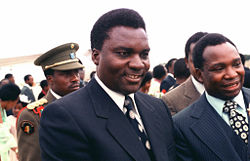
Gregoire Kayibanda was the first president (1962–1973), followed by Juvenal Habyarimana (1973–1994). The latter, who many view as a ruthless dictator, was unable to find a solution to increasing social unrest, calls for democracy, and the long-running problem of Rwandan Tutsi refugees. By the 1990s, Rwanda had up to one million refugees scattered around neighboring countries, mostly in Uganda and Burundi.
In 1990, the Tutsi-dominated Rwandan Patriotic Front (RPF) invaded Rwanda from Uganda. During the fighting, top Rwandan government officials, mainly Hutu, began secretly training young men into informal armed bands called Interahamwe (a Kinyarwanda term roughly meaning "those who fight together"). Government officials also launched a radio station that began anti-Tutsi propaganda.
The military government of Habyarimana responded to the RPF invasion with pogroms against Tutsis, whom it claimed were trying to re-enslave the Hutus. In August 1993, the government and the RPF signed a cease-fire agreement known as the Arusha Accords in Arusha, Tanzania, to form a power-sharing government, but fighting between the two sides continued. The United Nations sent a peacekeeping force known as the United Nations Assistance Mission for Rwanda (UNAMIR). UNAMIR was vastly underfunded and understaffed.
On April 6, 1994, President Habyarimana was assassinated when his airplane was shot down while landing in Kigali. Over the next three months, with logistical and military assistance and training from France, the military and Interahamwe militia groups killed between half a million and one million Tutsis and Hutu moderates in the Rwandan genocide.
Beginning on April 6, 1994, Kigali was the scene of the genocide, and of fierce fighting between the army (mostly Hutu) and Tutsi-dominated Rwandese Patriotic Front.
On July 4, 1994, the war ended as the RPF entered Kigali. Over two million Hutus fled the country, fearing Tutsi retribution. Most have since returned, but some remain in the Congo,
In 2004, a ceremony was held in Kigali at the Gisozi Memorial (sponsored by the Aegis Trust and attended by many foreign dignitaries) to commemorate the tenth anniversary of the genocide. The country observes a national day of mourning each year on April 7.
Government
Rwanda is a presidential republic in which the chief of state is the president, elected by popular vote for a seven-year term, and is eligible for a second term, and the head of government is the prime minister. The bicameral parliament consists of a senate of 26 members, both elected and appointed to serve eight-year terms, and a chamber of deputies of 80 seats, including 53 members elected by popular vote, 24 women elected by local bodies, and three selected by youth and disability organizations, all to serve five-year terms.
Kigali is a province-level city governed by a city council who appoints an executive committee to run the day-to-day operations of the city. The executive committee consists of a mayor and two deputies. The city is split into three administrative districts called sectors: Gasabo, Kicukiro, and Nyarugenge.[2]
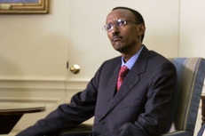
The main home and offices of the Rwandan president, Paul Kagame, are located in the city, as are the government ministries.
Economy
Rwanda is a poor rural country with about 90 percent of the population engaged in (mainly subsistence) agriculture. It is the most densely populated country in Africa and is landlocked with few natural resources and minimal industry. Primary foreign exchange earners are coffee and tea.
The 1994 genocide decimated Rwanda's fragile economic base, severely impoverished the population, particularly women, and eroded the country's ability to attract private and external investment. However, Rwanda has made substantial progress in stabilizing and rehabilitating its economy to pre-1994 levels, although poverty levels were higher in 2008.
Per capita GDP was estimated at $800 in 2007.
Tin ore (cassiterite) is mined nearby, and the city built a smelting plant in the 1980s. Business in Rwanda is growing, and many new buildings are emerging across the city, including the BCDI tower and the Centenary House office block. Tourism and expatriate NGO workers provide important input into the economy also.
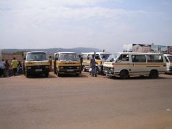
Kigali is the hub of the Rwanda transport network, with hourly express bus routes to all major towns in the country. There are also taxi minibus services (matatus) leaving from Kigali, for the major towns. Public transport within Kigali is exclusively by taxi minibus. There are also motorbike taxis ('taxi moto'). Kigali International Airport has passenger connections daily to Nairobi and less frequently to Addis Ababa, Brussels, Bujumbura and Johannesburg. There are also weekly cargo flights to Amsterdam.
Demographics
The population of Kigali was estimated at 851,024 in 2005. Hutu (Bantu) make up 84 percent of Rwanda's population, Tutsi (Hamitic) 15 percent, and Twa (Pygmy) one percent. Official languages include Kinyarwanda universal Bantu vernacular, French, and English, while Kiswahili (Swahili) is used in commercial centers
Roman Catholics made up 56.5 percent of Rwanda's population in 2001, Protestants 26 percent, Adventists 11.1 percent, and Muslims 4.6 percent, Those following indigenous beliefs made up 0.1 percent, and those with no religion 1.7 percent.
The Kigali Institute of Science, Technology and Management, in Kigali, is the first technology-focused institution of higher education to be created by the Rwanda government.
Of interest
The city now has three international class hotels, built as part of the country's bid to increase tourism and better support business travellers:
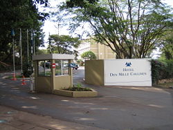
- The Mille Collines in the Kiyovu area. This hotel became a refugee centre during the genocide, as famously depicted in the film Hotel Rwanda (although the hotel shown in the film is in fact in South Africa). It is also the setting for the famous novel Un dimanche à la piscine à Kigali, by Quebecer Gil Courtemanche, and its movie adaptation Un dimanche à Kigali.
- The Novotel Umubano in the Kacyiru area. This was formerly a Le Meridien hotel, then known as Le Meridien Umubano. It was bought by Novotel after the genocide.
- The KIGALI SERENA HOTEL Formerly InterContinental Kigali. Formerly a Belgian-owned hotel, known then as Diplomates, this splendid and original Hotel was also - albeit briefly - portrayed in the second half of Hotel Rwanda. It was later bought by the InterContinental Hotels group, and extensively remodelled in 2003.
There are also several memorials, museums, and centers dedicated to the Rwandan Genocide including the Kigali Genocide Memorial Centre.
The city hosts since the We Are the Future center, a child care center giving children a chance to live their childhoods and develop a sense of hope. The center is managed under the direction of the mayor’s office, and the international NGO Glocal Forum serves as the fundraiser and program planner and coordinator for the WAF child center in each city. Each WAF city is linked to several peer cities and public and private partners to create a unique international coalition. Launched in 2004, the program is the result of a strategic partnership between the Glocal Forum, the Quincy Jones Listen Up Foundation and Mr. Hani Masri, with the support of the World Bank, UN agencies and major companies.
A notable residents is Joe (JoJo) Muvuna, a Freshman Basketball Player (Forward) on Loyola Maryland Greyounds.
Looking to the future
The main thing with NWE is the mission to somehow integrate purpose and values. Wikipedia typically ends articles haphazardly. In this case it was a list of tourist attractions. A city, like a nation, is somewhat of a work in progress, that the persons and events of the city's history are what shape the city, and that some cities are on the rise, and others are definitely on the way down.
Does the city face no challenges or offer up anything else as a legacy?"
Does the city need reconstruction?
Is it a model city?
Will it run out of water?
Does it have a crucial role to play in the nation?
ReferencesISBN links support NWE through referral fees
- ↑ "Kigali at a Glace", Official Website of Kigali City, accessed 15 August, 2008
- ↑ Administrative Map of Kigali
Further reading
- Miracle in Kigali. 2007. Gardners Books. ISBN 9781903571705
- Curtin, Philip, et al. African History: From Earliest Times to Independence, 2nd ed. New York: Addison Wesley Longman, 1995. ISBN 0582050707
- Fisanick, Christina, ed. The Rwanda Genocide. Farmington Hills, MI: Greenhaven Press, 2004. ISBN 0737719869
- Gasana J, L Twagilimana, W Hallenbeck, and G Brenniman. 1997. "Industrial discharges of metals in Kigali, Rwanda, and the impact on drinking water quality". Bulletin of Environmental Contamination and Toxicology. 58 (4): 523-6. OCLC 117456588
- Geltman, P, and E Stover. 1997. "Letter From Kigali - Genocide snd the Pligm of Children in Rwanda". JAMA : the Journal of the American Medical Association. 277 (4): 289. OCLC 86839170
- Hilsum, Lindsey. 1995. "Where is Kigali?" The Granta. (51): 145. OCLC 90984905
- Holmes S, and AG Jones. 1995. "The road from Goma to Kigali: caring for refugees in Rwanda". Journal of Emergency Nursing: JEN : Official Publication of the Emergency Department Nurses Association. 21 (1). OCLC 118502628
- Uwimbabazi, Claudine. 2005. The role of SMEs in the economic development of Kigali City, Rwanda. Thesis (M.A.)—Nelson Mandela Metropolitan University, 2006. OCLC 79593279
External links
- Encyclopaedia Britannica Kigali Retrieved December 28, 2008.
- The Africa Guide Rwanda Retrieved December 28, 2008.
- World Fact Book 2008Kigali Retrieved December 28, 2008.
- Placenames of the World Retrieved December 28, 2008.
- Kigali Environmental Programmes Retrieved December 30, 2008.
- Kigali City official website Retrieved December 29, 2008.
- Satellite Image of Kigali from Google Earth. Retrieved December 29, 2008.
- Kigali Independent University Retrieved December 29, 2008.
- Website of Hotel Des Mille Collines Retrieved December 29, 2008.
- Kigali Genocide Memorial Centre Retrieved December 29, 2008.
- Kigali Public Library Retrieved December 29, 2008.
- Photo tour of Kigali from RwandaTourism.com Retrieved December 29, 2008.
- Kigali institute of Education Retrieved December 29, 2008.
Credits
New World Encyclopedia writers and editors rewrote and completed the Wikipedia article in accordance with New World Encyclopedia standards. This article abides by terms of the Creative Commons CC-by-sa 3.0 License (CC-by-sa), which may be used and disseminated with proper attribution. Credit is due under the terms of this license that can reference both the New World Encyclopedia contributors and the selfless volunteer contributors of the Wikimedia Foundation. To cite this article click here for a list of acceptable citing formats.The history of earlier contributions by wikipedians is accessible to researchers here:
The history of this article since it was imported to New World Encyclopedia:
Note: Some restrictions may apply to use of individual images which are separately licensed.
