Mojave Desert

The Mojave Desert (Mojave is used for the desert while Mohave is used for the native people) occupies a significant portion of southern California and smaller parts of southwestern Utah, southern Nevada, and northwestern Arizona, in the United States. Named after the Mohave tribe of Native Americans, it occupies over 22,000 square miles (57,000 km²) in a typical Basin and Range topography.
The Mojave Desert's boundaries are generally defined by the presence of Joshua Trees — they are considered an indicator species for the desert. The topographical boundaries include the Tehachapi together with the San Gabriel and San Bernardino mountain ranges. The mountain boundaries are quite distinct since they are outlined by the two largest faults in California: the San Andreas and the Garlock. The Great Basin shrub steppe lies to the north; the warmer Sonoran Desert lies to the south and east. The desert is believed to have between 1,750 and 2,000 species of plants.
Climate
The Mojave Desert receives less than 6 inches (150 mm) of rain a year and is generally between 3,000 and 6,000 feet (1,000 and 2,000 m) in elevation. The Mojave Desert also contains the Mojave National Preserve, as well as the lowest and hottest place in North America: Death Valley, where the temperature normally approaches 120°F (50°C) in late July and early August. Zion National Park, in Utah, lies at the junction of the Mojave, the Great Basin, and the Colorado Plateau. Despite its aridity, the Mojave (and particularly the Antelope Valley in its southwest) has long been a center of alfalfa production, fed by irrigation coming from groundwater and (in the 20th century) from the California Aqueduct.
The Mojave is a desert of temperature extremes and four distinct seasons. Winter months bring temperatures dipping to below 20° F on valley floors, and below 0° F at higher elevations. Storms moving from the Pacific Northwest can bring rain and snow across the region — more often, the rain shadow created by the Sierra Nevada as well as mountain ranges within the desert such as the Spring Mountains bring only clouds and wind. In longer periods between storm systems, winter temperatures in valleys can approach 80°.
Spring weather continues to be influenced by Pacific storms, but rainfall is more widespread and occurs less frequently after April. By early June, it is rare for another Pacific storm to have a significant impact on the region's weather, and temperatures after mid-May are normally above 90° F and frequently above 100°.
Summer weather is dominated by heat — temperatures on valley floors can soar above 120° F and above 130° F at the lowest elevations — and the presence of the North American monsoon. Low humidity, high temperatures and low pressure draw in moisture from the Gulf of Mexico, creating thunderstorms across the desert southwest. While the Mojave does not get nearly the amount of rainfall that the Sonoran desert to the east receives, monsoonal moisture will create thunderstorms as far west as California's Central Valley from mid-June through early September.
Autumns are generally pleasant, with one to two Pacific storm systems creating regional rain events. October is one of the driest and sunniest months in the Mojave, and temperatures usually remain between 70° F and 90° F on the valley floors.
Wind is the most significant non-temperature-related weather phenomenon in the Mojave. Across the region, windy days are common, and in areas near the transition between the Mojave and the California low valleys, including near Cajon Pass, Soledad Canyon and the Tehachapi areas. During the June Gloom, cooler air can be pushed out into the desert from Southern California; in Santa Ana wind events, hot air from the desert blows out into the Los Angeles basin and other coastal areas. Wind farms in these areas generate power from these winds.
The other major weather factor in the region is elevation. The highest peak within the Mojave is Charleston Peak at 11,918 feet (3,633 m), while Death Valley is below sea level. Accordingly, temperatures and precipitation ranges wildly, in all seasons, across the region.
Cities and regions
While the Mojave Desert itself is sparsely populated, it has increasingly become urbanized in recent years. Las Vegas, Nevada is the largest city in the Mojave, with a metropolitan population of around 1.9 million in 2006. Palmdale is the largest city in California in the desert, and over 850,000 people live in areas of the Mojave attached to the Greater Los Angeles metroplex, including Palmdale, Lancaster, Victorville and Hesperia – these areas are referred to as the "High Desert." Smaller cities in the Mojave include St. George, Lake Havasu City, Kingman, Laughlin and Bullhead City, and Pahrump. All have experienced rapid population growth since 1990.
Towns with fewer than 30,000 people in the Mojave include Barstow, California, Needles, California, Ridgecrest, California, Mesquite, Nevada, Hurricane, Utah, Moapa Valley, Nevada, California City, California, Twentynine Palms, California and Mojave, California.
The Mojave Desert contains a number of ghost towns, the most significant of these being the silver-mining town of Calico, California and the old railroad depot of Kelso. Some of the other ghost towns are of the more modern variety, created when Route 66 (and the lesser-known US Highway 91) were abandoned in favor of the Interstates. The Mojave Desert is crossed by major highways Interstate 15, Interstate 40, US Highway 395 and US Highway 95.
As much of the Mojave is in the Basin and Range Region, few long streams cross the desert. The Mojave River is an important source of water for the southern parts of the desert. The Amargosa River flows from the Great Basin Desert south to near Beatty, Nevada, then underground through Ash Meadows before returning to the surface near Shoshone, California and ending in Death Valley. A part of the Colorado River traverses the far eastern portion of the Mojave.
Tourism
The Mojave Desert is one of the most popular tourism spots in North America, primarily because of gambling mecca Las Vegas. The desert is also known for its scenic beauty, with four national parks – Death Valley, Joshua Tree, Zion and Grand Canyon all within the desert or adjoining it. Lakes Mead, Mohave and Havasu provide watersport recreation, and sand dunes in the region entice off-road enthusiasts.
Among the more popular and unique tourist attractions in the Mojave is the self described world's tallest thermometer at 134 feet high, which is located along Interstate 15 in Baker, California. Kelso Dunes is also a popular recreation spot.

.
Mojave Desert in fiction
- The Newcomer ship in Alien Nation hovered over the Mojave Desert at its fictional 1988 arrival.
- In Steven King short story The Langoliers a time rip is situated over the Mojave Desert.
- Fictional character Captain Christopher Pike of the Star Trek universe called the Mojave his home, having grown up in the town of Mojave, built in what was once desert "wasteland".
- The play Fool For Love, written and directed by Sam Shepard in 1983, takes place on the edge of the Mojave Desert.
- The Mojave Desert has been featured four times throughout the series of the FOX hit drama television show, 24:
- In the first season of 24, terrorist, Mandy, blew up a 747 airplane and then parachuted into the Mojave Desert.
- In the second season of 24, George Mason sacrifices his life to dispose of a nuclear bomb safely in the Mojave Desert.
- In the fourth season of 24, Air Force One was shot down by a stealth fighter over the Mojave Desert and Jack Bauer had to go in and find the Nuclear Football briefcase, which was among the wreckage of the aircraft, before the terrorists could get it.
- In the first episode of the fifth season of 24, Jack Bauer is living and working (under an assumed name in order to avoid detection by American or Chinese authorities) in the city of Mojave, CA.
- In Hunter S. Thompson's book Fear and Loathing in Las Vegas, and its film adaptation, when Raoul Duke, Dr. Gonzo and the hitchhiker are on their way to Las Vegas, they are driving through the Mojave Desert. Duke is contemplating what to do with the hitchhiker: "How long could we maintain, I wondered. How long before one of us starts raving and jabbering at this boy? What will he think then? This same lonely desert was the last known home of the Manson family, will he make this grim connection when my attorney starts screaming about bats and huge manta rays coming down on the car?"
- The stark back-drop for Madonna's 1997 comeback "Frozen" video is the desert shot through a cold filter.
- In the PlayStation video game Parasite Eve 2, the majority of the storyline unfolds in a small town called Dryfield (said in game to be located in the Mojave desert).
- The music video for the Spice Girls' second single, Say You'll Be There, was shot in this desert in September 1996.
- The post-apocalyptic computer game Wasteland is set in the area.
- Paulo Coelho's book, The Valkyries, is set in the Mojave Desert.
Native Mojave plants and animals
Plants
- Abies concolor.File:Barrelsonacliff.jpgBarrel Cactus in Virgin River Gorge, Arizona
- Astragalus newberryi
- Barrel Cactus
- Banana yucca
- Beaver Tail Prickly Pear
- California Fan Palm
- Camissonia campestris Mojave suncup
- Cooper dyssodia
- Death Valley monkeyflower
- Desert candle
- Desert five-spot
- Desert larkspur
- Desert Lily
- Desert rock pea
- Desert star
- Erigeron concinnus
- Ipomopsis arizonica
- Island Oak No longer found in the Mojave Desert.
- Joshua Tree
- Jojoba
- Jumping Cholla
- Larrea tridentata
- Linanthus demissus
- Lupinus arizonicus
- Mojave prickly poppy.File:Joshuatreescape.jpgJoshua Trees in Washington County, Utah in the southwest corner of the state
- Mojave sage
- Mojave yucca
- Mormon Tea
- Pencil Cholla
- Phacelia calthifolia
- Phacelia crenulata
- Pinus monophylla
- Prairie clover
- Senna covesii
- Teddy-bear Cholla
- Utah Juniper
- White woolly daisy
- Wide-bannered lupine
- Yucca brevifolia
Animals
- Big Horn Sheep
- Chuckwalla
- Cougar
- Coyote
- Desert horned lizard
- Desert iguana
- Desert kit fox
- Desert tortoise
- Gila Monster
- Hummingbird
- Jackrabbit
- Fringe-toed lizard
- Mohave tui chub Endangered fish
- Mojave Green Rattlesnake
- Mountain Goat
- Pronghorn
- Scorpion
- Tarantula
- Western Diamondback Rattlesnake
- Zebra-tailed lizard
- Gopher Snake
- Red-tailed Hawk
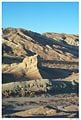
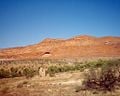
Photos from the Mojave Desert
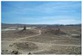
Pinnacles National Natural Landmark
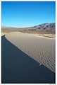
Kelso Sand Dunes
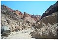
Slot Canyon in Afton Canyon
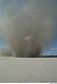
Dust Devil, El Mirage Dry Lake
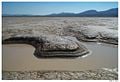
Water hole, Coyote Dry Lake
Rainbow Canyon, near the city of Barstow
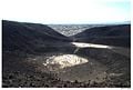
Amboy Crater
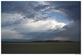
Summer Storm
Pioneer cabin remains near St. George, Utah.


See also
- Amboy Crater
- Black Rock Road
- Colorado Desert
- Death Valley and Death Valley National Park
- List of deserts by area
- List of North American deserts
- List of California regions
- Low Desert
- Mojave phone booth
- Mojave Road
- Solar One
- Sonora Desert
- Zzyzx Road An actual road that runs through the Mojave Desert.
- Palen Mountains
- Lake Delores
External links
- Mojave Desert images at bioimages.vanderbilt.edu (slow modem version)
- Off-Road Trails in the Mojave Desert
ReferencesISBN links support NWE through referral fees
- Mojave Desert Wildflowers, Jon Mark Stewart, 1998, pg. iv
| Deserts |
|---|
| Ad-Dahna | Alvord | Arabian | Aral Karakum | Atacama | Baja California | Barsuki | Betpak-Dala | Chalbi | Chihuahuan | Dasht-e Kavir | Dasht-e Lut | Dasht-e Margoh | Dasht-e Naomid | Gibson | Gobi | Great Basin | Great Sandy Desert | Great Victoria Desert | Kalahari | Karakum | Kyzylkum | Little Sandy Desert | Mojave | Namib | Nefud | Negev | Nubian | Ordos | Owyhee | Qaidam | Registan | Rub' al Khali | Ryn-Peski | Sahara | Saryesik-Atyrau | Sechura | Simpson | Sonoran | Strzelecki | Syrian | Taklamakan | Tanami | Thar | Tihamah | Ustyurt |
Template:California Template:Nevada Template:Arizona
 |
State of Utah Salt Lake City (capital) |
|---|---|
| Topics | Cities |
Counties | Flag | Flower | Governors | Portal | Song |
| Regions | Cache Valley |
Colorado Plateau | Dixie | Great Basin | Great Salt Lake | Great Salt Lake Desert | Mojave Desert | Monument Valley | San Rafael Swell | Uinta Mountains | Wasatch Back | Wasatch Front | Wasatch Range |
|
Largest Cities |
American Fork |
Bountiful | Cedar City | Clearfield | Cottonwood Heights | Draper | Holladay | Kaysville | Layton | Lehi | Logan | Midvale | Murray | Ogden | Orem | Pleasant Grove | Provo | Riverton | Roy | St. George | Salt Lake City | Sandy | South Jordan | South Salt Lake | Spanish Fork | Springville | Taylorsville | Tooele | West Jordan | West Valley City |
| Counties | Beaver |
Box Elder | Cache | Carbon | Daggett | Davis | Duchesne | Emery | Garfield | Grand | Iron | Juab | Kane | Millard | Morgan | Piute | Rich | Salt Lake | San Juan | Sanpete | Sevier | Summit | Tooele | Uintah | Utah | Wasatch | Washington | Wayne | Weber |
| Attractions | Arches National Park |
Bonneville Salt Flats | Bryce Canyon National Park | Canyonlands National Park | Capitol Reef National Park | Great Salt Lake | Ski Areas | Sundance Film Festival | Temple Square | Utah Shakespearean Festival | Zion National Park |
| Colorado River system |
|---|
| Dams and aqueducts (see US Bureau of Reclamation) |
| Shadow Mountain Dam | Granby Dam | Glen Canyon Dam | Hoover Dam | Davis Dam | Parker Dam | Palo Verde Diversion Dam | Imperial Dam | Laguna Dam | Morelos Dam | Colorado River Aqueduct | San Diego Aqueduct | Central Arizona Project Aqueduct | All-American Canal | Coachella Canal | Redwall Dam |
| Natural features |
| Colorado River | Rocky Mountains | Colorado River Basin | Grand Lake | Sonoran desert | Mojave desert | Imperial Valley | Colorado Plateau | Grand Canyon | Glen Canyon | Marble Canyon | Paria Canyon | Gulf of California/Sea of Cortez | Salton Sea |
| Tributaries |
| Dirty Devil River | Dolores River | Escalante River | Gila River | Green River | Gunnison River | Kanab River | Little Colorado River | Paria River | San Juan River | Virgin River |
| Major reservoirs |
| Fontenelle Reservoir | Flaming Gorge Reservoir | Taylor Park Reservoir | Navajo Reservoir | Lake Powell | Lake Mead | Lake Havasu |
| Dependent states |
| Arizona | California | Colorado | Nevada | New Mexico | Utah (See: Colorado River Compact) |
| Designated areas |
| Glen Canyon National Recreation Area | Lake Mead National Recreation Area |
Credits
New World Encyclopedia writers and editors rewrote and completed the Wikipedia article in accordance with New World Encyclopedia standards. This article abides by terms of the Creative Commons CC-by-sa 3.0 License (CC-by-sa), which may be used and disseminated with proper attribution. Credit is due under the terms of this license that can reference both the New World Encyclopedia contributors and the selfless volunteer contributors of the Wikimedia Foundation. To cite this article click here for a list of acceptable citing formats.The history of earlier contributions by wikipedians is accessible to researchers here:
The history of this article since it was imported to New World Encyclopedia:
Note: Some restrictions may apply to use of individual images which are separately licensed.