Bogota, Colombia
| Bogotá | |||
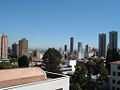
| Downtown view from Colpatria Building | |||
|
|||
| Motto: Bogotá, 2600 metros más cerca de las estrellas Bogotá, 2600 meters closer to the stars |
|||
 |
|||
| Country | Colombia | ||
|---|---|---|---|
| Department | Bogotá, D.C.* | ||
| Foundation | August 6, 1538 | ||
| Government | |||
| - Mayor | Luis Eduardo Garzón, PDA | ||
| Area | |||
| - City | 1,587 km² (612.7 sq mi) | ||
| - Land | 1,731.9 km² (668.7 sq mi) | ||
| Elevation | 2,640 m (8,661 ft) | ||
| Population (2005 census) [1] | |||
| - City | 6,778,691Ranked 1 | ||
| - Density | 3,914/km² (10,137.1/sq mi) | ||
| - Metro | 8,090,883 | ||
| *Bogotá is physically within and is the capital of Cundinamarca Department, but as the Capital District is treated as its own department. | |||
| Website: City Official Site Mayor Official Site Bogotá Tourism | |||
.svg)
Bogotá—officially named Bogotá, D.C. (D.C. for "Distrito Capital", which means "Capital District"), formerly called Santa Fe de Bogotá, is the capital city of Colombia, as well as the largest and most populous city in the country, with 6,776,009 inhabitants (2005 census). Bogotá and its metropolitan area, which includes municipalities such as Chía, Cota, Soacha, Cajicá and La Calera, had an estimated population of 7,881,156 [1] according to the 2005 census.
History
Originally called by the Muiscas Bacatá meaning “planted fields”.[2] It was the center of their civilization before the Spanish explorers colonized the area, and it sustained a large population. The European settlement was founded in August 6, 1538, by Gonzalo Jiménez de Quesada and was named "Santa Fé de Bacatá" after his birthplace Santa Fé and the local name. "Bacatá" had become the modern "Bogotá" by the time it was made the capital of the New Kingdom of Granada, which was then part of the Viceroyalty of Peru, and later of the Viceroyalty of New Granada. The city soon became one of the centers of Spanish colonial power and civilization in South America.
In 1810-11 its citizens revolted against Spanish rule and set up a government of their own, but had to contend with internal divisions and the temporary return to power of Spanish military loyalists, who resumed control of the city from 1816 to 1819, when Simón Bolívar captured it after his victory at Boyacá. Bogotá was then made the capital of Gran Colombia, a federation combining the territories of modern Panama, Colombia, Venezuela, and Ecuador. When that republic was dissolved into its constituent parts, Bogotá remained the capital of New Granada, which later became the Republic of Colombia. See History of Colombia.
In 1956, the municipality was joined to other neighboring municipalities forming a "Special District" (Spanish: Distrito Especial). With the Constitution of 1991, Bogotá was confirmed as the Capital of Colombia acquiring the name "Santa Fe de Bogotá", and changing the category from Special District to "Capital District" (Spanish: Distrito Capital).
In August 2000 the capital's name was officially changed back from "Santa Fé de Bogotá" to the more usual "Bogotá". The local government consists of a Capital District, the current chief of government is Luis Eduardo Garzón.
Flag

The flag originates from the insurgency movement against the colonial authorities, which began on July 20, 1810. During this insurgency, the rebels wore armbands with yellow and red bands, as these colours were the ones in the Spanish flag which was the one used as the flag for the New Kingdom of Granada.
In October 9, 1952, exactly 142 years after these events, decree 555 of 1952 officially and definitively adopted the patriotic armband as the flag of Bogotá.
The flag itself is divided horizontally in two, the top band is yellow and the bottom band is red. The yellow colour denotes the gold from the earth, as well as the virtues of justice, clemency, benevolence, the so-called "mundane qualities" (defined as nobility, excellence, richness, generosity, splendour, health, steadfastness, joy and prosperity), long life, eternity, power and constancy. The red colour denotes the virtue of charity, as well as the qualities of bravery, nobility, values, audacity, victory, honour and furor, Colombians call it the blood of their people.
Coat of arms

The coat of arms of the city was granted by emperor Charles V (Charles I of Spain) to the New Kingdom of Granada, by royal decree given in Valladolid, Spain on December 3, 1548. It contains a black eagle in the center, which symbolises steadfastness. The eagle is also a symbol of the Habsburgs, which was the ruling family of the Spanish empire at the time. The eagle is crowned with gold and holds a red pomegranate inside a golden background. The border contains olive branches with nine golden pomegranates in a blue background. The two red pomegranates symbolize audacity, and the nine golden ones represent the nine states which constituted the New Kingdom of Granada at the time.
In 1932 the coat of arms was officially recognized and adopted as the symbol of Bogotá.
Anthem
The lyrics to the anthem of Bogotá were written by Pedro Medina Avendaño, the melody was composed by Roberto Pineda Duque. The song was officially declared the anthem by decree 1000 of July 31, 1974, by then Mayor of Bogotá, Aníbal Fernandez de Soto.
Population and area
Divisions
Template:Bogota DC
Location
Bogotá is located in the centre of the country, on the east of the "sabana de Bogotá", 2640 meters (8661 feet) above sea level. Although "sabana", as it is popularly called, is literally "savanna", the geographical site is actually a high plateau in the Andes mountains. The extended region is also known as "altiplano cundi-boyacense" which literally means "high plateau of Cundinamrca and Boyaca"
The Bogotá River crosses the 'sabana' forming Tequendama Falls to the south. Tributary rivers form valleys with flourishing villages, whose economy is based on agriculture, livestock raising and artisanal production.

The 'sabana' is bordered to the east by the Eastern Cordillera of the Andes mountain range. Surrounding hills, which limit city growth, run from south to north, parallel to the Guadalupe and Monserrate mountains. The western city limit is the Bogotá river; Sumapaz paramo borders the south and to the north Bogotá extends over the mentioned plateau up to the towns of Chía and Sopó.
Climate
The average temperature on the 'sabana' is 14.0°C (57°F), varying from -8°C (18°F) to 20°C (68°F). Dry and rainy seasons alternate throughout the year. The driest months are December, January, February and March; the rainiest are April, May, September, October and November. June and July are usually rainy periods and August is sunny with high winds.

Frost usually occurs in dry season. During this period, the temperature falls below 0°C. The lowest temperature ever recorded was -8°C (17°F) inside the city and -10°C (14°F) in the nearby towns of the savanna.
Climatic conditions are irregular and quite variable due to the El Niño and La Niña climatic phenomena, which occur in and around the Pacific basin and are responsible for very pronounced climatic changes.
| Climate chart for Bogotá | |||||||||||
|---|---|---|---|---|---|---|---|---|---|---|---|
| J | F | M | A | M | J | J | A | S | O | N | D |
33.0
19
5
|
43.2
19
6
|
66.0
19
7
|
111.8
19
8
|
94.0
19
8
|
55.9
18
8
|
40.6
18
7
|
48.3
18
7
|
73.7
18
7
|
114.3
18
7
|
88.9
19
7
|
53.3
19
6
|
| temperatures in °C precipitation totals in mm source: The Weather Channel | |||||||||||
|
Imperial conversion
| |||||||||||
Urban layout and nomenclature
The urban layout dates back to Colonial times, and is a square layout adopted from Spain. The current street layout has calles which run perpendicular to the hills heading east-west with numbering increasing towards the north, and towards the south from calle 1, and carreras which run parallel to the hills in the south-north direction with numbering increasing east and west from carrera 1. New urban sectors incorporate diagonal – similar to streets – and transversal – similar to carreras. Streets are numbered.
It has over one thousand neighborhoods or divisions forming the developed urban network. Neighborhoods of higher economic status are primarily located to the north and north-east. Poorer neighborhoods are located to the south and south-east, many of them squatter areas. The middle classes usually inhabit the central, western and north-western sections of the city.
Demographics
The largest and most populous city in Colombia, Bogotá has 7,881,156 inhabitants in its metropolitan area (2005 census).
As with Colombia as a whole, the vast bulk of the city's population consists of mestizos (those of mixed Amerindian and white European descent) and those of white European descent. However, there is a lesser number of residents of African descent than in the country as whole given the city's distance from coastal areas such as Cartagena, where the descendants of African slaves have traditionally resided.
Crime
In the 1990's, Bogotá was considered one of the most dangerous cities in the world. At one point it had a homicide rate of 80 per 100,000. Since then, however, Bogotá has gone to great lengths to change its crime rate and its image. The change was the result of a participatory and integrated security policy that was first adopted in 1995. Because of its success, this security policy has continued to be implemented ever since. In 2005, Bogotá had a murder rate of 23 persons per 100,000 inhabitants, a 71% drop from what it had 10 years ago. Interestingly, by the way of comparison, the city today has a lower murder rate than Washington, D.C., Caracas, São Paulo, Mexico City, Panama City, and Rio de Janeiro.[3][4]
Government

Bogotá is the capital of the Republic of Colombia, and houses the national legislature, the Supreme Court of Justice, and the center of the executive administration as well as the residence of the President of the Republic. The Principal Mayor and District Council – both elected by popular vote – are responsible for city administration.
The city divided into 20 localities: Usaquén, Chapinero, Santa Fe, San Cristóbal, Usme, Tunjuelito, Bosa, Kennedy, Fontibón, Engativá, Suba, Barrios Unidos, Teusaquillo, Los Mártires, Antonio Nariño, Puente Aranda, La Candelaria, Rafael Uribe Uribe, Ciudad Bolívar, Sumapáz.
Each of the 20 localities is governed by an administrative board elected by popular vote, made up of no less than seven members, as determined by the District Council. The Principal Mayor designates local mayors from a trio proposed by the respective administrative board.
Economy
Bogotá is Colombia's largest economic center, followed by Medellín, Cali, and Barranquilla. Most companies in Colombia have their headquarters in Bogotá (for example, Bavaria, Avianca, Postobon, Bancolombia and Coltejer), and it is home to most foreign companies doing businesses in Colombia and neighbouring countries as well as Colombia's main stock market. Bogotá is a major center for import and export of goods for Colombia and the Andean Community in Latin America.
Manufacturing, commerce and trade
Bogotá is the hub of Colombian business. It has a busy banking, insurance sector, and a Stock exchange. Engineering firms provide services for many regions of Colombia and Central America. Bogotá houses the central governmental institutions and military headquarters. It is the centre of the telecommunications network and has the biggest industrial facilities in the country.
Some services are public and others are private. The public services include energy, sewer and phones. Energy and sewer bills are stratified based on the location of owner's residence. Thus, the wealthier sections of society help subsidize the energy bills of the poorer sections of society. Telephone service is provided by both "Empresa de Telecomunicaciones de Bogotá" (ETB), a city-owned company, and "Capitel", owned by Colombia Telecomunicaciones and "EPM Bogotá", owned in turn by the Medellín public services company (Empresas Públicas de Medellín - EPM) . Coin or card-operated payphones are also available, along with cell phone providers. There are (as of May 2007) three main operators of wireless phones: Movistar (owned by Spanish firm Telefónica), Comcel (owned by Telmex) and Tigo (co-owned by ETB, EPM and Millicom).
Bogotá also receives money from exports like flowers and emeralds. In downtown Bogotá, millions of dollars in domestically produced rough and cut emeralds are bought and sold daily. Other important industries include financial services, especially banking. Bogotá is headquarters to major commercial banks, and to the Banco de la República, Colombia's central bank. Bogotá is also a printing and publishing centre. The city is a major convention destination with many major convention centres: Centro Ferial de Convenciones Corferias, Centro de Convenciones y Eventos Cafam, Centro de Convenciones Gonzalo Jiménez de Quesada, among others. Because of its status as site of the country's capital, it is home to a number of government agencies, which represent another major component of the city's economy.
The city's industrial base include staples of the Colombian economy such as GM Colmotores, Compañía Colombiana Automotriz, and Ecopetrol.
Transportation
Bogotá has a modern transportation system. It includes an international airport, bus lines, taxis, the TransMilenio rapid transit system, and a train that serves as transportation for the outskirts of the city.
Buses are the main means of mass transportation. There are two bus systems: the traditional system and the trasmilenio. The traditional system runs a variety of bus types, operated by several companies on normal streets and avenues:
- bus; large buses.
- buseta; medium size buses.
- microbus or colectivo; vans or minivans.
The buses are divided into two categories: "ejecutivo", which is supposed to be a deluxe service and is not supposed to carry standing passengers, and "corriente" or normal service. Bus fares range, as of March 2006, from COP 900 to 1250 (US$ .40 aprox.)
In addition, Bogotá has several types of taxis. Yellow taxis (cabs) are by far the most common. People often use them in order to get to their destination faster, although they are more expensive. Bogotá also has white taxis, used mostly as shuttles by hotels or companies to transport customers.
Airports
Bogotá's principal airport is El Dorado International Airport which is going to be the largest airport in South America. Several national airlines (Avianca, AeroRepública, AIRES and SATENA), and international airlines (such as Iberia, American Airlines, Varig, Copa, Continental, Delta, Air France, Air Canada, Aerogal, TAME, TACA) operate from El Dorado. Bogotá's airport is one of the largest and most expensive in Latin America. Because of its central location in Colombia and America, it is preferred by national land transportation providers, as well as national and international air transportation providers. The airport is heavily congested, and is handling more passengers than it is capable of doing efficiently.
Currently, a major expansion of El Dorado airport is on the way. The planning stage is finished and works should start before the end of 2007. This will expand the airport's capacity from the current 8 million passengers a year to 16 million.
A secondary airport, Guaymaral Airport, serves as a base for Police Aviation and all general aviation activities.
Bus terminals
Bogotá is a hub for national and international bus routes. This terminal serves routes to the majority of cities and towns in Colombia [5] and is the largest in the country. International services are provided to Ecuador and Venezuela by certain bus companies.
TransMilenio
TransMilenio is a bus rapid transit system, a network combining modern articulated buses that operate on exclusive roads (busways) and smaller buses (feeders) that operate in residential areas, bringing passengers to the main grid. TransMilenio's main routes are: Caracas Avenue, 80th Street, Avenue of the Americas, Northern Highway (Autopista Norte), Jiménez Avenue, and 30th Avenue (also referred to as Norte Quito Sur or N.Q.S. for short). The Suba Avenue routes and the southern leg of the 30th Avenue route were opened in April 2006. The third phase of the system will cover 7th Avenue, 10th Avenue, and 26th Street (or Avenida El Dorado). The system is expected to cover the entire city by 2030.
Although the Transmilenio rapid bus service is considered efficient and carries commuters to numerous corners of the city it is the most expensive form of transportation in the city (only taxis are more expensive) and because is a diesel based system, the fares are constantly raised due to changing oil prices. Currently a ticket costs 1400 COP. While the Transmilenio is expansive, there are some main routes that are not yet reached. Another current problem is the overcrowding of buses.
Bike paths network
Bogotá's network of bike paths, also called ciclorutas, is one of the most extensive dedicated bike path networks of any city in the world, with a total extension of 303 km. It extends from the north of the city, 170th Street, to the south, 27th Street, and from Monserrate on the east, to the Bogotá River on the west. The cicloruta was started by the Antanas Mockus administration (1995-1998), and considerably extended during the administration of Mayor Enrique Peñalosa. Since the construction of the ciclorutas, bicycle use has increased 5 times in the city, and it is estimated that there are between 300,000 and 400,000 trips made daily in Bogotá by bicycle. A large portion of this use is in southern, poorer areas.
Tourist train
On Sundays, many people ride a popular tourist train with their family. On weekends, the train runs from Bogotá to Zipaquirá and Nemocón, towns on the outskirts of Bogotá. The route is 53 km long ending in Zipaquira (famous for the salt cathedral). Another line goes towards the north for 47 km and ends at Briceño.
Colleges and universities

Bogotá's colleges and universities have a major impact on the city and region's economy. Not only are they major employers, but they also attract national and international industries to the city and surrounding region, including highly needed technology industries. The city is Colombia's educational "Mecca"; it boasts more schools, colleges, and universities than any other city in Colombia.
Parks and recreation
- There are many parks and most of them have facilities for concerts, plays, movies, storytellers and other activities. "Simón Bolívar Metropolitan Park", for instance, is a big park which is regularly used to stage free concerts (such as the annual Rock al Parque, a free festival in which new and popular Latin rock bands play for free). The park is also frequented in the month of August and used for kite flying, a national tradition. The whole complex is five times bigger than central park.
- Another public park is Parque Nacional (National Park), one of the biggest in Bogotá. The park has many trees and green spaces, as well as ponds, games for children, many foot and bicycle paths, and venues for entertainment such as public screenings of movies and concerts and events organized by the Council of Bogotá. It is located between two main streets, the Circunvalar Avenue and the 7th Avenue.

- The Bogotá Botanical Garden (Jardín Botánico de Bogotá).
- There are many other parks around the city of Bogotá. Each neighborhood has its own park. Some of these parks are private and others are public. Some private parks demand that people from the neighborhood have a card to be able to get into the park. Public parks are for everybody. Some of them have watchmen. These parks also have sporting venues, which provide sports programs for children and adults, such as volleyball, basketball, taekwondo, football, and other sports.
- The most active park (in both leisure activity, promotion of high-end products and nightlife) is the "Parque de la 93" located between 93rd and 93Ath street, and 12th and 13th avenue. Several of the top restaurants and bars in the city are located in this park or in the vicinity of a "T" shaped pedestrian strip dubbed "La T" (The T) in the intersection of 82nd street and Cra.12. More recently, restaurant activity has begun in the "Zona G" (Gourmet Zone) in and around 67th and 70th Streets, as well as other locations like Usaquen (north-east), and La Macarena (center east).
- Bogotá has not only natural parks but also amusement parks like Mundo Aventura and Salitre Mágico. There is a special rate to get into these parks and people have to buy tickets to be able to play mechanical games. Mundo Aventura park has mechanical games such as sky-coaster, roller coaster, hammer, and other adult amusements. For children there are some mechanical games like little roller coaster, carousel, turtles, and so on. In this park, people can find both amusements and nature, with animals such as goats for children to feed. Besides, there is a "Cerdodromo", which is a place where pigs race.
- The other amusement park is "Salitre Mágico", which is one of the entertainment centers for children and adults. The are many mechanical games like pirate ship, apocalypse, 3 roller coasters and other games. The park is next to the Simón Bolívar park, which is a well known place in Bogotá (used also for concerts through the year).
- For relaxing and finding peace from the stress of city life, the Parque del Chicó, with trees, gardens, artificial creeks and ponds, and a colonial style house converted into a museum, is worth a visit.
- Not so far from the city, up north, the Parque Jaime Duque offers a cultural encounter for visiting families. It has rides, a giant map of Colombia, popular exhibits, and a zoo. A big hand holding the world symbolizes God, and a reproduction of the Taj Mahal provides a picture collection with reproductions of famous paintings.
- Bogotá has an interactive museum of sciences called Maloka.
- Bogotá has seen concerts of important international artist like Alanis Morissette, Angra, Black Eyed Peas, Dream Theater, Jamiroquai, Jon Bon Jovi, Guns n' roses, Gwen Stefani, Helloween, Metallica, Marilyn Manson and Therion .
Sister cities
 Tokyo, Japan
 Los Angeles, California
 Buenos Aires, Argentina
 London, United Kingdom
 Madrid, Spain
 Mexico City, Mexico
- Miami, Florida
 Seoul, South Korea
- New York City
 Ottawa, Canada
Trivia

- Bogotá hosts the Iberoamerican Theater Festival, the biggest theater festival in the world, every two years.
- In 2007, Bogotá is the Book Capital of the World
- The city also celebrates the International Book Fair, one of the three major book fairs of the Spanish-speaking Americas.
- The tallest building in the city is the Colpatria Tower.
- The former motto of the city was "2600 metres closer to the stars" (in reference to its altitude above sea level).
- The city has institutionalized a day without cars on the streets, called "El Día sin Carro" (No car day). It takes place every first Thursday of February. See Car Free Days and United Nations Car Free Days.
- Bogotá has the highest quality as well as the most expensive potable water in Latin America.
- The Capital District as a whole has the largest economy in Colombia and ranks eighth in Latin America.
- The Gold Museum has the biggest gold handicraft collection in the world.
- Bogotá has one of the most extensive dedicated Bike Paths Network of any city in the world, with a total of 300km.
ReferencesISBN links support NWE through referral fees
- ↑ DANE, Censo General 2005 Resultados Area Metropolitana de Bogotá
- ↑ Arias, S. and Meléndez, M. (2002). "Sacred and Imperial Topographies in Juan de Castellanos's Elegías de varones ilustres de Indias", Mapping Colonial Spanish America: Places and Commonplaces of Identity, Culture and Experience. Bucknell University Press. ISBN 0838755097.
- ↑ 2005 Washington, DC Murder Rate Infoplease.com
- ↑ Profiling Bogotá's Security Plan, Comunidad Segura.
- ↑ Bogotá Transportation Terminal & Train Station Bogota-dc.com
Gallery
- Bogota Eje ambiental.JPG
View of downtown Bogotá from nearby Monserrate
- IMG 0454.JPG
An Eastern view of Bogotá's International Business District with Monserrate looming above
- TransMilenio2004-7-10.jpg
Transmilenio's 19th Street Station
- Transmilenio en el centro.JPG
Station at Jiménez Avenue and Seventh Carrera
- IMG 0102.JPG
Bavaria Central Park
- North CB.JPG
Overview of Bavaria Central Park
- Santafe.jpg
Santamaría Bullring with Park Towers behind
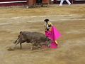
Bullfighting in Bogotá
- Bogota-christmas-2005.jpg
Colpatria Bank Building
- Salitre 20061110 44.JPG
Colpatria Tower at night
- SNMN Bog.JPG
Negret Sculpture at National Museum
- Mural Colombiano congreso Bogota.jpg
Mural at the eliptic room of the National Congress.
- Iglesia SFB.JPG
Saint Francis of Assisi Church
- Bogota1.jpg
Panoramic view of downtown Bogotá from nearby Monserrate
- Monserrate 03.jpg
Monserrate Church
- Candelaria Church 01.jpg
Candelaria Church
Downtown Bogotá
- Salitre 20061111 07.JPG
View of the Maloka Museum dome theater from the museum
- Salitre 20061111 18.JPG
The Maloka Museum from the sidewalk
- Salitre 20061111 19.JPG
View of the Maloka dome theater
- Salitre 20061111 59.JPG
Maloka Dome theater facade
- Salitre 20061111 60.JPG
Maloka Dome theater facade
- Plaza de Toros de Bogotá.JPG
Up: Santamaría Bullring Down: Distrital Planetarium
- Interior Teatro Colon Bogota.jpg
The painted ceiling and Murano chandelier of the Teatro Colon
- Balcony Teatro Colon Bogota.jpg
Private balcony view of the Teatro Colon
- Exterior Teatro Colon Bogota.jpg
The frontal facade of the Teatro Colon
- Iglesia Del Carmen.jpg
Cathedral of Our Lady of Carmen


See also
- Bogota's Carnival
- Bogota's Bike Paths Network
- Bolivar Square
- Children's Museum of Bogotá
- Rock al parque
- Feria Internacional del libro
External links
- Travel guide to Bogota, Colombia from Wikitravel
- City Official Site
- Mayor Official Site
- Bogotá Tourism Guide
- Skyscrapers and Buildings in Bogotá - Photographies and general information about buildings in the city.
- Bogotá Tourism - Directory & travel information
- BogoWiki - A Wiki dedicated to Bogotá
- Hostels in Bogotá
- Bogotá from The Air - Aerial photographs of Bogotá
- Museos de Bogotá - A museum guide for the Colombian capital
- Harvard Gazette Archives Text on Antanas Mockus's many inspired strategies to change Bogotá
Credits
New World Encyclopedia writers and editors rewrote and completed the Wikipedia article in accordance with New World Encyclopedia standards. This article abides by terms of the Creative Commons CC-by-sa 3.0 License (CC-by-sa), which may be used and disseminated with proper attribution. Credit is due under the terms of this license that can reference both the New World Encyclopedia contributors and the selfless volunteer contributors of the Wikimedia Foundation. To cite this article click here for a list of acceptable citing formats.The history of earlier contributions by wikipedians is accessible to researchers here:
The history of this article since it was imported to New World Encyclopedia:
Note: Some restrictions may apply to use of individual images which are separately licensed.