San Juan Archipelago
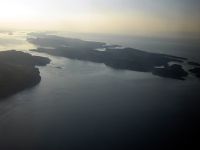
The San Juan Islands are a part of the San Juan Archipelago in the northwest corner of the continental United States. The archipelago is split into two groups of islands based on national sovereignty. San Juan Islands are part of the U.S. state of Washington, while the Gulf Islands are part of the Canadian province of British Columbia. There are over 450 islands in the entire archipelago at high tide, but fewer than one-sixth are permanently inhabited.
In the archipelago, fifteen islands are accessible by public ferry. Public ferries serve nine Gulf Islands and six San Juan Islands.
History
The islands were part of the traditional area of the Central Coast Salish. Linguistically, the Central Coast Salish consisted of five groups: Squamish, Halkomelem, Nooksack, Northern Straits (which includes the Lummi dialect), and Klallam. Exploration and settlement by Europeans brought smallpox to the area by the 1770s. In 1843, the Hudson's Bay Company established Fort Camosun at nearby Vancouver Island.
The 1846 Oregon Treaty forced by President Polk established the 49th parallel as the boundary between Canada and the U.S., except in the San Juan archipelago. While both sides agreed that all of Vancouver Island would remain British, the treaty wording was left vague enough as to put the boundary between modern-day Gulf Islands and San Juan Islands in dispute. Conflicts over this border led to the Pig War in 1859. Skirmishes continued until the boundary issue was eventually placed in the hands of Kaiser Wilhelm I of Germany for arbitration. The border was finally established in 1872.
The name "San Juan" was given to the San Juan Islands by the Spanish explorer Francisco de Eliza, who charted the islands in 1791, naming them Isla y Archiepelago de San Juan. The expedition sailed under the authority of the Viceroy of Mexico, Juan Vicente de Güemes Padilla Horcasitas y Aguayo, 2nd Count of Revillagigedo and Eliza named several places for him, including the San Juan Islands and Orcas Island (short for "Horcasitas"). San Juan Island itself was first discovered (by a European) by one of the officers under Eliza's command, Gonzalo López de Haro (for whom Haro Strait is named). The Spanish had found the islands a year earlier during the exploring voyage of Manuel Quimper on the Princesa Real, but it was not clear that they were islands. Subsequent explorations of the region by the British, under George Vancouver, and the Americans, under Charles Wilkes, resulted in many of the Spanish names being replaced with English ones. Vancouver's expedition occurred within a year of Eliza's, and Vancouver encountered other Spanish ships and traded information. Thus Vancouver knew of the names given by Eliza's expedition and tended to keep them, although he renamed some things, like the Strait of Georgia. Wilkes, sailing in 1841, had some British charts, but may not have been aware of the Spanish names and charts. He liberally gave new names to nearly every coastal feature not already named on the charts he had. The names Wilkes gave tended to be patriotically American (heroes of the War of 1812 for example), or to honor members of his crew. In 1847, due to the confusion of multiple names on different charts, the British Admiralty reorganized the official charts of the region. The project, led by Henry Kellett, applied only to British territory, which at the time included the San Juan Islands but not Puget Sound. Kellett systematically kept the British and Spanish names and removed nearly all of Wilkes' names. In some cases Kellett moved Spanish names around to replace names given by Wilkes. Thus in Puget Sound itself, the names given by Wilkes are common and Spanish names rare, while the reverse is true for the San Juan and Gulf Islands (although the Spanish did not explore Puget Sound as thoroughly as the British and Americans, resulting in fewer Spanish names to start with). Wilkes had given the name Navy Archipelago to the San Juan Islands, and named individual islands for distinguished officers of the US Navy, such as Rodgers Island for San Juan Island, and Hull Island for Orcas Island. Some of his names survived the editing of Kellett, such as Chauncey, Shaw, Decatur, Jones, Blakely, Perry, Sinclair, Lawrence, Gordon, and Percival, all named after American naval officers.[1]
San Juan Islands today
Today, the San Juan Islands are an important tourist destination, with sea kayaking and orca-watching two of the primary attractions. Part of the charm that attracts tourists and residents to the San Juan Islands is that each island seems to have a character of its own, both in terms of geography and of the lifestyle of the people who live there.
Politically, the bulk of the San Juan Islands make up San Juan County, Washington, though some of the furthest east of the islands are in the mainland counties of Whatcom and Skagit, including Lummi, Guemes, and Cypress Islands.
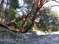
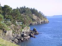
The majority of the San Juan Islands are quite hilly, the tallest mountain being Mount Constitution at almost exactly a half-mile (800 m) elevation (see Orcas Island), with some flat areas and valleys, often quite fertile, in between. The coastlines are a mixed bag of sandy and rocky beaches, shallow and deep harbors, placid and reef-studded bays. Gnarled, ochre-colored madrona trees (Arbutus) grace much of the shorelines while evergreen fir and pine forests cover large inland areas.
The San Juan Islands get less rainfall than Seattle, about 65 miles (105 km) to the south, due to the rain shadow of Olympic Mountains to the southwest. Summertime high temperatures are around 70 °F (21 °C) while average wintertime lows are in the high thirties and low forties. Snow is infrequent in winter except for the higher elevations, but the islands are subject to high winds at times—those from the northeast sometimes bring brief periods of freezing and Arctic-like windchills.
Beginning in about 1900 the San Juan Islands became infested with European rabbits, an exotic invasive species, as the result of the release of domestic rabbits on Smith Island. Rabbits from the San Juan Islands were used later for several introductions of European rabbits into other, usually midwestern, states.
Transportation
Three ferry systems serve some of the San Juan Islands.
- The Washington State Ferries system serves Lopez Island, Shaw Island, Orcas Island, and San Juan Island (typically in that order), from a dock in Anacortes.
- Skagit County serves Guemes Island, also from a dock in Anacortes
- Whatcom County serves Lummi Island, from a dock on the Lummi Indian Reservation.
Passenger-only ferries serve more islands. Passenger-only ferry service is usually seasonal and offered by private business.
- Victoria San Juan Cruises serves Eliza Island, Sinclair Island, Blakely Island, Orcas Island, Lopez Island and San Juan Island from the Bellingham Cruise Terminal in Bellingham, Washington.
San Juan Airlines and Destinations
- Kenmore Air (To & From: Roche Harbor, Seattle/Boeing Field, Seattle/Lake Union)
- San Juan Airlines (To & From: Anacortes, Bellingham, Eastsound (Orcas Island), Lopez Island, Blakely, Decatur)
The San Juan Islands
|
|
|
|
The Gulf Islands are the islands in the Strait of Georgia between Vancouver Island and the mainland Pacific coast of British Columbia, Canada.
The name "Gulf Islands" comes from "Gulf of Georgia," a historical misnomer for the Strait of Georgia.
The Gulf Islands are usually divided into two groups, the southern and northern Gulf Islands. The dividing line is approximately that formed by the city of Nanaimo on Vancouver Island, and the mouth of the Fraser River on the mainland. All the major islands are served by B.C.E. Ferries.
Southern Gulf Islands

The southern Gulf Islands include hundreds of islands and islets, and form part of an archipelago that also includes the San Juan Islands in the United States.
The major islands in alphabetical order are:
- Gabriola Island
- Galiano Island
- Kuper Island
- Mayne Island
- North and South Pender Islands
- Saltspring Island
- Saturna Island
- Thetis Island
- Valdes Island
Northern Gulf Islands
The major islands in alphabetical order are:
- Denman Island
- Hornby Island
- Lasqueti Island
- Texada Island
Cortes Island, and Quadra Island are sometimes considered part of the Gulf Islands, but as they are not in the Georgia Strait they are more properly considered part of the Discovery Islands.
Ecology
The islands and surrounding ocean are rich with ecologically diverse plants and sea life including Garry oaks, wild lilies, kelp beds and Orca whales. Gulf Islands National Park Reserve of Canada was established in 2003 by Parks Canada to protect the area’s unique ecosystem.
The Gulf Islands are home to one of the last remaining pockets of Garry oak ecosystems. Only about five percent of Garry oak ecosystems remain in their natural state, landing 91 of the approximately 350 species it supports on the province's list of species at risk. The unique Mediterranean climate of the islands is ideal for Garry oak ecosystems. Garry oak ecosystems are home to more plant species, such as the camas, than any other terrestrial ecosystem in coastal B.C. and are one of Canada's most at-risk natural habitats.
Today, Garry oak meadows exist in the shallow and exposed soil of valleys, rocky foothills and southern slopes — areas that the settlers of the past 150 years have found unsuitable for agriculture or development.
The Garry Oak Ecosystems Recovery Team (GOERT), a partnership of a number of governmental and non-governmental agencies that comprise 22 individuals, was established in 1999 after the delegates of the First International Garry Oak Ecosystem Symposium met in Victoria and declared the ecosystem endangered. Since then, GOERT has been working to motivate public and private restoration of the rare ecosystem and promote conservation activities. [1]
Notes
- ↑ Phillips, James W. (1971). Washington State Place Names. University of Washington Press. ISBN 0-295-95158-3.
ReferencesISBN links support NWE through referral fees
External links
- The Gulf Islands Guide
- Gulf Islands National Park Reserve — Parks Canada
- Come to the Islands Canadian Geographic Special Feature on B.C.'s Gulf Islands
- Maps of the Gulf Islands A collection of Interactive Maps and photographs of the Gulf Islands
- Gulf Islands, British Columbia at the Open Directory Project
- San Juan County, Washington at the Open Directory Project
Coordinates:
Credits
New World Encyclopedia writers and editors rewrote and completed the Wikipedia article in accordance with New World Encyclopedia standards. This article abides by terms of the Creative Commons CC-by-sa 3.0 License (CC-by-sa), which may be used and disseminated with proper attribution. Credit is due under the terms of this license that can reference both the New World Encyclopedia contributors and the selfless volunteer contributors of the Wikimedia Foundation. To cite this article click here for a list of acceptable citing formats.The history of earlier contributions by wikipedians is accessible to researchers here:
The history of this article since it was imported to New World Encyclopedia:
Note: Some restrictions may apply to use of individual images which are separately licensed.


