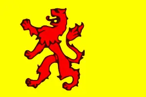
Holland
- This article is about a region in the Netherlands. For other uses of "Holland," see Holland (disambiguation).
This article is specifically about Holland, not the Netherlands. For information about the country of the Netherlands as a whole, refer to articles about the Netherlands.
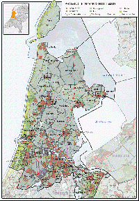
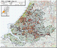
Information specifically about Holland can also be found in the articles on North Holland and South Holland.
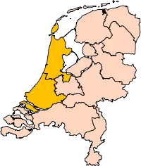
Holland is a region in the western part of the Netherlands. A maritime and economic power in the 17th century, Holland today consists of the Dutch provinces of North Holland and South Holland.
The name "Holland"
The name "Holland" first appeared in sources in 866 for the region around Haarlem and by 1064 was being used as the name of the entire county. By this time the inhabitants of Holland were referring to themselves as "Hollanders". [1] "Holland" is derived from the Middle Dutch term holtland, meaning "wooded land". This spelling variation remained in use until around the 14th century, at which time the name stabilized as "Holland" (alternative spellings at the time: "Hollant" or "Hollandt"). Popular, but incorrect, etymology holds that "Holland" is derived from hol land ("hollow land") and was inspired by the low-lying geography of Holland.
Usage
The proper name of the area in both Dutch and English is "Holland." Holland is a region within the country of the Netherlands. The name Holland is informally and quite incorrectly used in English and other languages, including sometimes the Dutch language itself, to mean the whole of the modern country of the Netherlands.
The people of Holland are referred to as "Hollanders" in both Dutch and English. Today this refers specifically to people from the current provinces of North Holland and South Holland. Strictly speaking, the term "Hollanders" does not refer to people from the other provinces in the Netherlands, but colloquially "Hollanders" is sometimes mistakenly used in this wider sense.
When referring to the Netherlands as a whole, the adjective is "Dutch." "Dutch" is not used as an adjective for "Holland" in a modern context because "Dutch" refers to all of the Netherlands, not just Holland. However, there is a good deal of confusion about this. In actual practice, the adjective "Dutch" is often, but somewhat inaccurately, used in the specific context of Holland.
Geography
Holland is situated in the west of the Netherlands. A maritime water-oriented region, Holland lies on the North Sea at the mouths of the Rhine and the Meuse (Maas). It has numerous rivers and lakes and an extensive inland canal and waterway system. To the south is Zealand. The region is bordered on the east by the IJsselmeer and four different provinces of the Netherlands.
Holland is protected from the sea by a long line of coastal dunes. Most of the land area behind the dunes consists of polder landscape lying well below sea level. At present the lowest point in Holland is a polder near Rotterdam, which is about seven meters below sea level. Continuous drainage is necessary to keep Holland from flooding. In earlier centuries windmills were used for this task. The landscape was (and in places still is) dotted with windmills, which have become a symbol of Holland.
Holland is 7,494 square kilometers (land and water included), making it roughly 13 percent of the area of the Netherlands. Looking at land alone, it is 5,488 square kilometers in size. The population was 6.1 million in 2008.
The main cities in Holland are Amsterdam, Rotterdam and The Hague. Amsterdam is formally the capital of the Netherlands and its most important city. The Port of Rotterdam is Europe's largest and most important harbor and port. The Hague is the seat of government of the Netherlands. These cities, combined with Utrecht and other smaller municipalities, effectively form a single city - a conurbation called Randstad.
The Randstad area is one of the most densely populated regions of Europe, but still relatively free of urban sprawl. There are strict zoning laws. Population pressures are enormous, property values are high, and new housing is constantly under development on the edges of the built-up areas. Surprisingly, much of the province still has a rural character. The remaining agricultural land and natural areas are highly valued and protected. Most of the arable land is used for intensive agriculture, including horticulture and greenhouse agri-businesses.
Regions within Holland
Holland is comprised of various regions that, for historical or other reasons, have their own identities. Some of these regions are unofficial, ill-defined and sometimes overlapping. Others are official and are part of regional groupings artificially created for various administrative purposes.
These regions are not the same as the municipalities. For example, the South Holland village of Warmond is officially part of the municipality of Teylingen, but it is also located in the "Dune and Bulb Region" (called "Duin- en Bollenstreek" or usually just "Bollenstreek"). This is significant because the identity of Warmond is closely tied to the Bollenstreek.
Language
See the article on the Dutch language for a more detailed description.
The language primarily spoken in Holland is Dutch. Hollanders often refer to the Dutch language as "Hollands."
The standard Dutch that is spoken in the Netherlands is mostly based on the Dutch spoken in Holland; however, there are many local variations in dialect throughout the Netherlands.
Despite the correspondence between standard Dutch and the Dutch spoken in Holland, there are local variations within Holland itself that differ from standard Dutch. The main cities each have their own traditional dialect. A small number of people, especially in the area north of Amsterdam, still speak what is considered to be an original, older dialect, called "Hollandic." The areas where people still speak with the Hollandic dialect are Volendam and Marken and the area around there, West Friesland and the Zaanstreek.
Territory and political structure
"Holland" is not in itself a province of the Netherlands. It is divided into two provinces of the Netherlands—North Holland (Noord-Holland) and South Holland (Zuid-Holland). These provinces were created in 1840 largely because it was unacceptable for Holland to remain such an overwhelmingly large and powerful province in comparison to the other provinces. A few regions that were historically part of Holland have been ceded to other provinces.
- Some cessions occurred as a result of reforms during the French occupation (1795-1813).
- In 1818 Willemstad and surroundings, the Biesbosch and the Land van Altena became part of the province of North Brabant.
- In 1942, after the Battle of the Netherlands, the Germans transferred the islands of Vlieland and Terschelling to the province of Friesland. This was not changed back after World War II.
- In 1950, the island of Urk went to the province of Overijssel and then in 1986 to the province of Flevoland.
- In 1970 Oudewater was transferred from South Holland to the province of Utrecht.
- In 1989 Woerden was transferred from South Holland to the province of Utrecht.
- In 2000 's-Graveland and Kortenhoef, both in the province of North-Holland, were merged withLoosdrecht in the Province of Utrecht.
- In 2002 Vianen was transferred from South Holland to the province of Utrecht.
- The municipality of Eemnes has a co-operation with Laren and Blaricum. They are collectively referred to as the "BEL region."
The image of Holland at home and abroad
The predominance of Holland in the Netherlands has resulted in regionalism on the part of the other provinces. This is a reaction to the perceived threat that Holland poses to the identities and local cultures of the other provinces. The other provinces have a strong, and often negative,[2] image of Holland and the Hollanders, to whom certain qualities are ascribed.[3]
Hollanders themselves, however, have a weak self-image.[4] They take Holland's cultural dominance for granted. To them, the concepts of "Holland" and the "Netherlands" coincide. Consequently they see themselves not primarily as "Hollanders," but simply as "Dutch" (Nederlanders).[5] This phenomenon is called "hollandocentrism".[6]
Holland tends to be associated with a particular image. The stereotypical image of Holland is an artificial amalgam of tulips, windmills, clogs, cheese and traditional dress (klederdracht). Like all stereotypes, this is far from the truth and reality of life in Holland. This can at least in part be explained by the active exploitation of these stereotypes in promotions of Holland and the Netherlands. In fact only in a few of the more traditional villages, such as Volendam and locations in the Zaan area, are the different costumes and wooden shoes still worn by some inhabitants.
ReferencesISBN links support NWE through referral fees
- ↑ Antheun Janse, "Een zichzelf verdeeld rijk" in Thimo de Nijs and Eelco Beukers (eds.), 2003, Geschiedenis van Holland, Volume 1, p. 73
- ↑ Rob van Ginkel, "Hollandse Tonelen" in Thimo de Nijs and Eelco Beukers (eds.), Geschiedenis van Holland, Volume 3, p. 688
- ↑ Hans Knippenberg and Ben de Pater, "Brandpunt van macht en modernizing" in Thimo de Nijs and Eelco Beukers (eds.), 2003, Geschiedenis van Holland, Volume 3, p. 556
- ↑ Hans Knippenberg and Ben de Pater, "Brandpunt van macht en modernizing" in Thimo de Nijs and Eelco Beukers (eds.), 2003, Geschiedenis van Holland, Volume 3, p. 556
- ↑ Thimo de Nijs, "Hollandse identiteit in perspectief" in Thimo de Nijs and Eelco Beukers (eds.), 2003, Geschiedenis van Holland, Volume 3, p. 700
- ↑ Rob van Ginkel, "Hollandse Tonelen" in Thimo de Nijs and Eelco Beukers (eds.), 2003, Geschiedenis van Holland, Volume 3, p. 647
External Links
Template:Commons-inline
Credits
New World Encyclopedia writers and editors rewrote and completed the Wikipedia article in accordance with New World Encyclopedia standards. This article abides by terms of the Creative Commons CC-by-sa 3.0 License (CC-by-sa), which may be used and disseminated with proper attribution. Credit is due under the terms of this license that can reference both the New World Encyclopedia contributors and the selfless volunteer contributors of the Wikimedia Foundation. To cite this article click here for a list of acceptable citing formats.The history of earlier contributions by wikipedians is accessible to researchers here:
The history of this article since it was imported to New World Encyclopedia:
Note: Some restrictions may apply to use of individual images which are separately licensed.
