Danube
| Danube | |
|---|---|
| | |
| Origin | Black Forest (Schwarzwald-Baar, Baden-Württemberg, Germany) |
| Mouth | Black Sea (Romania and Ukraine) |
| Basin countries | Romania (28.9%), Hungary (11.7%), Austria (10.3%), Serbia and Montenegro (10.3%), Germany (7.5%), Slovakia (5.8%), Bulgaria (5.2%), Bosnia and Herzegovina (4.8%), Croatia (4.5%), Ukraine (3.8%), Czech Republic (2.6%), Slovenia (2.2%), Moldova (1.7%), Switzerland (0.32%), Italy (0.15%), Poland (0.09%), Albania (0.03%) |
| Length | 2,888 km |
| Source elevation | 1,078 m |
| Avg. discharge | 30 km before Passau: 580 m³/s Vienna: 1,900 m³/s Budapest: 2,350 m³/s Belgrade: 4,000 m³/s just before Delta: 6,500 m³/s |
| Basin area | 817,000 km² |
The Danube is Europe's second-longest river (after the Volga).
It rises in the Black Forest in Germany as two smaller rivers – the Brigach and the Breg – which join at Donaueschingen, and it is from here that it is known as the Danube, flowing south-eastwards for a distance of some 2850 km (1771 miles) before emptying into the Black Sea via the Danube Delta in Romania.
The Danube has been an important international waterway for centuries, as it remains today. Known to history as one of the long-standing frontiers of the Roman Empire, the river flows through — or forms a part of the borders of — ten countries: Germany, Austria, Slovakia, Hungary, Croatia, Serbia, Bulgaria, Romania, Moldova, and Ukraine.
The Danube flows through the following large cities:
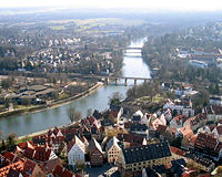
- Ulm - Germany
- Ingolstadt - Germany
- Regensburg - Germany, capital of Upper Palatinate
- Passau - Germany
- Linz - Austria
- Vienna - capital of Austria, where the Danube floodplain is called the Lobau
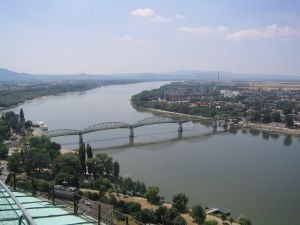
- Bratislava - capital of Slovakia
- Budapest - capital of Hungary
- Vukovar - Croatia
- Novi Sad - capital of the Serbian province of Vojvodina
- Belgrade - capital of Serbia
- Ruse - Bulgaria
- Brăila - Romania
- Galaţi - Romania
- Tulcea - Romania
Tributaries
The Danube's tributary rivers reach into seven other countries. Some Danubian tributaries are important rivers in their own right, navigable by barges and river boats of shallow draught. Ordered from source to mouth, the main tributaries are:
- Iller - Lech - Regen (entering at Regensburg) - Isar - Inn (entering at Passau) - Enns - Morava - Leitha - Váh (entering at Komárno) - Hron - Ipel - Sió - Drava - Tisza - Sava (entering at Belgrade) - Velika Morava - Caraş - Jiu - Iskar - Olt - Vedea - Argeş - Ialomiţa - Siret - Prut
The Danube is navigable by ocean ships from the Black Sea to Brăila, in Romania and by river ships to Kelheim; smaller craft can navigate further upstream to Ulm, in Germany. About 60 of its tributaries are also navigable. See Danube-Black Sea Canal.
Since the construction of the German Rhine-Main-Danube Canal in 1992, the river has been part of a trans-European waterway from Rotterdam on the North Sea to Sulina on the Black Sea (3500 km). In 1994 the Danube was declared one of ten Pan-European transport corridors, routes in Central and Eastern Europe that required major investment over the following ten to fifteen years. The amount of goods transported on the Danube increased to about 100 million tons in 1987. In 1999, transport on the river was made difficult by the NATO bombing of 3 bridges in Serbia and Montenegro. The clearance of the debris was finished in 2002. The temporary pontoon bridge that hampered navigation was finally removed in 2005.
At the Iron Gate, the Danube flows through a gorge that forms part of the boundary between Serbia and Romania; it contains two hydroelectric dams, Đerdap I and Đerdap II.
The gorge lies between Romania in the north and Serbia in the south. The Danube-Black Sea Canal shortens the distance to the Black Sea by 400 km and another canal in Romania, the Danube-Bucharest Canal (60% finished) is supposed to link Danube to Bucharest. In Serbia and Montenegro there is Dunav-Tisa-Dunav channel as well.
The Danube delta
The Danube Delta has been a UNESCO World Heritage Site since 1991. Its wetlands (on the Ramsar list of wetlands of international importance) support vast flocks of migratory birds, including the endangered Pygmy Cormorant (Phalacrocorax pygmaeus). Rival canalization and drainage scheme threaten the delta.
Geology
Although the headwaters of the Danube are relatively small today, geologically, the Danube is much older than the Rhine, with which its catchment area competes in today's southern Germany. This has a few interesting geological complications. Since the Rhine is the only river rising in the Alps mountains which flows north towards the North Sea, an invisible line divides large parts of southern Germany, which is sometimes referred to as the European Watershed.
However, before the last ice age in the Pleistocene, the Rhine started at the southwestern tip of the Black Forest, while the waters from the Alps that today feed the Rhine were carried east by the so-called Urdonau (original Danube). Parts of this ancient river's bed, which was much larger than today's Danube, can still be seen in (now waterless) canyons in today's landscape of the Swabian Alb. After the Upper Rhine Valley had been eroded, most waters from the Alps changed their direction and began feeding the Rhine. Today's upper Danube is but a meek reflection of the ancient one.
Since the Swabian Alb is largely shaped of porous limestone, and since the Rhine's level is much lower than the Danube's, today subsurface rivers carry much water from the Danube to the Rhine. On many days in the summer, when the Danube carries little water, it completely oozes away noisily into these underground channels at two locations in the Swabian Alp, which are referred to as the Donauversickerung (Danube Sink). Most of this water resurfaces only 12 km south at the Aachtopf, Germany's wellspring with the highest flow, an average of 8,000 liters per second, north of Lake Constance - thus feeding the Rhine. The European Water Divide thus in fact only applies for those waters that pass beyond this point, and only during the days of the year when the Danube carries enough water to survive the sink holes in the Donauversickerung.
Since this enormous amount of underground water erodes much of its surrounding limestone, it is estimated that the Danube upper course will one day disappear entirely in favor of the Rhine, an event called stream capturing.
Human history
The Danube basin contains sites of the earliest human cultures: the Danubian Neolithic cultures include the Linear Pottery Cultures of the mid-Danube basin (see also Linear Ceramic culture) The Vucedol culture of the third millennium B.C.E. is famous for their ceramics. Later, many sites of the Vinca culture are sited along the Danube.
Cultural significance
The Danube is mentioned in the title of a famous waltz by Austrian composer Johann Strauss, An der schönen, blauen Donau (By the Beautiful Blue Danube).
Another famous waltz about the Danube is The Waves of the Danube (Romanian: Valurile Dunării) by the Romanian composer Ion Ivanovici (1845-1902), and the work took the audience by storm when performed at the 1889 Paris Exposition.
The German tradition of landscape painting, the Danube school, was developed in the Danube valley in the 16th century.
Economics of the Danube
Drinking Water
Along its path, the Danube is a source of drinking water for about ten million people. In Baden-Württemberg, Germany, almost thirty percent (As of 2004) of the water for the area between Stuttgart, Bad Mergentheim, Aalen and the Alb-Donau-Kreis comes from purified water of the Danube. Other cities like Ulm and Passau also use some water from the Danube.
In Austria and Hungary, most water comes from ground and spring sources, and only in rare cases is water from the Danube used. Most states find also to difficult to clean the water because of extensive pollution; only parts of Romania where the water is cleaner still use a lot of drinking water from the Danube.
As "Corridor VII" of the European Union, the Danube is an important transport route. Since the opening of the Rhine-Main-Danube Canal, the river connects the Black Sea with the industrial centres of Western Europe and with the Port of Rotterdam. The waterway is designed for large scale inland vessels (110 by 11,45 meters) but it can carry much larger vessels on most of it's course. The Danube has been partly canalized in Germany (5 locks) and Austria (10 Locks). Further plans to build a number of new locks in order to improve navigation have been blocked by environmentalists, in spite of the general consensus about the positive effects of inland waterway transport in comparison with road and rail.
Downstream from the Freudenau Locks in Vienna, canalization of the Danube was limited to the Gabcikovo dam and locks near Bratislawa and the two double Iron Gate locks in the border stretch of the Danube between Serbia and Rumania. These locks have larger dimensions (similar to the locks in the Russian Volga river, some 300 by over 30 meters). Downstream of the Iron Gate, the river is free flowing all the way to the Black Sea, a distance of more than 860 kilometers.
The Danube connects with the Rhine-Main-Danube Canal at Kelheim, and with the Wiener Donaukanal in Vienna. Apart from a couple of secundary navigable branches, the only major navigable rivers linked to the Danube are the Drava, Sava and Tisza. In Serbia, a canal network also connects to the river; the network, known as the Duna-Tisza-Duna canals, links sections downstream and upstream of the Tisza mouth with this tributary of the Danube. (Source: NoorderSoft Waterways Database)
Fishing
The importance of fishing on the Danube, which used to be critical in the Middle Ages, has declined dramatically. Some fishermen are still active at certain points on the river, and the Danube Delta still has an important industry.
Tourism
There are many important tourist and natural spots along the Danube, including the Wachau valley, the Nationalpark Donau-Auen in Austria, the Naturpark Obere Donau in Germany,Kopacki rit in Croatia, Iron Gates (Danube Gorge) and Danube Delta in Romania.
Notes
(Donau in German; Dunaj in Slovak; Duna in Hungarian; Dunav in Croatian; Дунав/Dunav in Serbian; Дунав in Bulgarian; Dunăre in Romanian; Дунай (Dunay) in Ukrainian; Danuvius in Latin)
External links
- Danube Sink
- Aachtopf spring
- The Danube Delta
- Danube Basin Map (GIF - 257 KB), Map+info, PDF
- Danube Portal
- 'The Ister': A 2840km documentary film journey up the Danube
- The Danube / Danube Tourist Commission | A River's lure
- DANUBE-BRIDGES | Hungarian
Historical images of Orsova and Danube river
Credits
New World Encyclopedia writers and editors rewrote and completed the Wikipedia article in accordance with New World Encyclopedia standards. This article abides by terms of the Creative Commons CC-by-sa 3.0 License (CC-by-sa), which may be used and disseminated with proper attribution. Credit is due under the terms of this license that can reference both the New World Encyclopedia contributors and the selfless volunteer contributors of the Wikimedia Foundation. To cite this article click here for a list of acceptable citing formats.The history of earlier contributions by wikipedians is accessible to researchers here:
The history of this article since it was imported to New World Encyclopedia:
Note: Some restrictions may apply to use of individual images which are separately licensed.

