Difference between revisions of "Bujumbura" - New World Encyclopedia
Mike Butler (talk | contribs) |
Mike Butler (talk | contribs) |
||
| Line 31: | Line 31: | ||
|footnotes = | |footnotes = | ||
}} <!-- Infobox ends !--> | }} <!-- Infobox ends !--> | ||
| − | '''Bujumbura''' ({{pronEng|ˌbuːdʒəmˈbuːrə}}), the [[capital city]] of [[Burundi]], | + | '''Bujumbura''' ({{pronEng|ˌbuːdʒəmˈbuːrə}}), the [[capital city]] of [[Burundi]], and is Burundi's largest city and its administrative, communications, and economic center. |
==Geography== | ==Geography== | ||
Etymology of name – if available. | Etymology of name – if available. | ||
| − | + | Burundi, a landlocked country, lies on a rolling plateau, with [[Lake Tanganyika]] in its southwest corner. Bujumbura lies at the northeastern corner of [[Lake Tanganyika]] | |
| − | a. | + | |
| − | |||
| − | |||
| − | |||
Elevation: {{convert|794.0|m|ft|0|abbr=on}} | Elevation: {{convert|794.0|m|ft|0|abbr=on}} | ||
| − | + | ||
| + | The average elevation of the central plateau is 5,600 feet, with lower elevations at the borders. The highest peak, Mount Karonje, at 8,809 feet (2,685 m), lies to the southeast of the capital | ||
| + | |||
| + | Because of its elevation, the nation's climate is temperate despite its proximity to the Equator, with the warmest and most humid area in the lowlands around Lake Tanganyika. | ||
| + | |||
Rivers and canals | Rivers and canals | ||
Size – land area, size comparison | Size – land area, size comparison | ||
Environmental issues | Environmental issues | ||
Districts | Districts | ||
| + | The city center is a [[colonial]] town with a large [[market]], the [[national stadium]], a large [[mosque]], and the [[cathedral]] for the [[Roman Catholic Archdiocese of Bujumbura|Archdiocese of Bujumbura]]. | ||
==History== | ==History== | ||
| Line 52: | Line 54: | ||
[[Image:Bujumbura market.jpg|thumb|left|The market in central Bujumbura.]] | [[Image:Bujumbura market.jpg|thumb|left|The market in central Bujumbura.]] | ||
| − | The city center | + | |
| + | |||
| + | The city was the center of an ethnically inspired civil war in the 1990s and early 21st century. | ||
==Government== | ==Government== | ||
| Line 69: | Line 73: | ||
Financial and business services sector | Financial and business services sector | ||
Tourism | Tourism | ||
| − | + | Manufactures include [[textiles]] and [[soap]]. | |
| + | |||
Transport: Road, rail, air, sea | Transport: Road, rail, air, sea | ||
| + | Bujumbura is Burundi's main port and ships most of the country's chief export, [[coffee]], as well as [[cotton]], skins, and [[tin]] ore. | ||
| + | |||
[[Ferry|Ferries]] sail from Bujumbura to [[Kigoma]] in [[Tanzania]], while the city is also home to the [[Bujumbura International Airport]] and the [[University of Bujumbura]]. | [[Ferry|Ferries]] sail from Bujumbura to [[Kigoma]] in [[Tanzania]], while the city is also home to the [[Bujumbura International Airport]] and the [[University of Bujumbura]]. | ||
Revision as of 01:40, 12 August 2008
| Bujumbura, Burundi | |
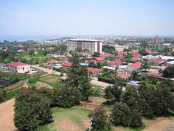
| Central Bujumbura, with Lake Tanganyika in the background | |
| Coordinates: {{#invoke:Coordinates|coord}}{{#coordinates:3|23|00|S|29|22|00|E|type:city | |
|---|---|
| name= }} | |
| Province | Bujumbura-Ville |
| Population (1994) | |
| - City | 300,000 |
| - Urban | 300,000 |
| estimated | |
| Time zone | CAT (UTC+1) |
| - Summer (DST) | none (UTC+1) |
Bujumbura (pronounced /ˌbuːdʒəmˈbuːrə/), the capital city of Burundi, and is Burundi's largest city and its administrative, communications, and economic center.
Geography
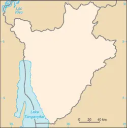
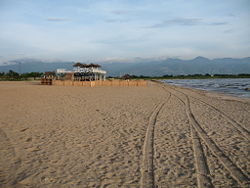
Etymology of name – if available. Burundi, a landlocked country, lies on a rolling plateau, with Lake Tanganyika in its southwest corner. Bujumbura lies at the northeastern corner of Lake Tanganyika
Elevation: 794.0 m (2,605 ft)
The average elevation of the central plateau is 5,600 feet, with lower elevations at the borders. The highest peak, Mount Karonje, at 8,809 feet (2,685 m), lies to the southeast of the capital
Because of its elevation, the nation's climate is temperate despite its proximity to the Equator, with the warmest and most humid area in the lowlands around Lake Tanganyika.
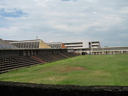
Rivers and canals Size – land area, size comparison Environmental issues Districts The city center is a colonial town with a large market, the national stadium, a large mosque, and the cathedral for the Archdiocese of Bujumbura.
History
Bujumbura grew from a small village after it became a military post in German East Africa in 1889. After World War I it was made the administrative center of the Belgian League of Nations mandate of Ruanda-Urundi. The city's name was changed from Usumbura to Bujumbura when Burundi became independent in 1962. Since independence, Bujumbura has been the scene of frequent fighting between the country's two main ethnic groups, with Hutu militias opposing the Tutsi-dominated Burundi army.
The city was the center of an ethnically inspired civil war in the 1990s and early 21st century.
Government
Burundi is a republic. The president, who is elected by popular vote to a five-year term and is eligible for a second term, is both the chief of state and head of government. The bicameral parliament consists of a national assembly with a minimum of 100 seats, of which 60 percent must be Hutu and 40 percent Tutsi, with at least 30 percent being women, and with additional seats appointed by a National Independent Electoral Commission to ensure ethnic representation. Members are elected by popular vote to serve five-year terms. A and with remaining seats assigned to ethnic groups and former chiefs of state.
Burundi is divided into 17 provinces, 117 communes, and 2,638 colonies. The capital city, Bujumbura, has by far the largest population. Smaller cities include Gitega, Muyinga, Ngozi, and Ruyigi.
Economy
Overview – Any specialization: For instance, is a manufactured product is associated with particular cities a. Milwaukee—cheese and beer b. Los Angeles—entertainment industry c. Sheffield—coal d. top 20 cities in the U.S. are highly specialized
Per capita GDP, rank Financial and business services sector Tourism Manufactures include textiles and soap.
Transport: Road, rail, air, sea Bujumbura is Burundi's main port and ships most of the country's chief export, coffee, as well as cotton, skins, and tin ore.
Ferries sail from Bujumbura to Kigoma in Tanzania, while the city is also home to the Bujumbura International Airport and the University of Bujumbura.
Demography
Bujumbura had an estimated population of 300,000 in 1994. Population = 187,297 Race/ethnicity - historical background of ethnic groups Language Religion Colleges and universities
Of interest
Museums in the city include the Burundi Museum of Life and the Burundi Geological Museum. Other nearby attractions include the Rusizi National Park, the Livingstone-Stanley Monument at Mugere (where David Livingstone and Henry Morton Stanley visited 14 days after their first historic meeting at Ujiji in Tanzania), and the source of the southernmost tributary of the Nile, described locally as the source of the Nile.
The city is also where a lot of the Disney movie George of the Jungle is supposed to take place (though the film's location bears very little resemblance to the real city).
ReferencesISBN links support NWE through referral fees
- World Fact Book 2008 Burundi Retrieved August 12, 2008.
External links
Official Bujumbura's Website www.villedebujumbura.org
Credits
New World Encyclopedia writers and editors rewrote and completed the Wikipedia article in accordance with New World Encyclopedia standards. This article abides by terms of the Creative Commons CC-by-sa 3.0 License (CC-by-sa), which may be used and disseminated with proper attribution. Credit is due under the terms of this license that can reference both the New World Encyclopedia contributors and the selfless volunteer contributors of the Wikimedia Foundation. To cite this article click here for a list of acceptable citing formats.The history of earlier contributions by wikipedians is accessible to researchers here:
The history of this article since it was imported to New World Encyclopedia:
Note: Some restrictions may apply to use of individual images which are separately licensed.


