Galle
| Old Town of Galle and its Fortifications* | |
|---|---|
| UNESCO World Heritage Site | |

| |
| State Party | |
| Type | Cultural |
| Criteria | iv |
| Reference | 451 |
| Region** | Asia-Pacific |
| Inscription history | |
| Inscription | 1988 (10th Session) |
| * Name as inscribed on World Heritage List. ** Region as classified by UNESCO. | |
Galle (காலி in Tamil) (pronounced as one syllable in English, IPA: /gɔːl/, the same as "Gaul," and in Sinhalese, IPA: [gaːlːə]) refers to a town situated on the southwestern tip of Sri Lanka, 119 km from Colombo. Galle had been known as Gimhathiththa (although Ibn Batuta in the fourteenth century refers to it as Qali) before the arrival of the Portuguese in the sixteenth century, when it served as the main port on the island. Galle reached the height of its development in the eighteenth century, before the arrival of the British, who developed the harbor at Colombo.
Galle blends both the past and the present, the native and the colonial. The first Portuguese fleet, led by Laurenco De Almeida, sailed into the country nearly five centuries ago at this port. The Dutch, more than three centuries ago, built their famous ninety-acre fort which still retains its old world charm with its high ramparts and ornate pepperpot towers. Cottage industries, such as turtle-shell ware, ebony ornaments and beeralu lace, flourished about a century or so ago before gradually declining or passing into oblivion. Galle once rose to the leading center of the native arts and crafts.
The Fort, like most of the forts in Sri Lanka, sits on a small peninsula, belonging to the sea as much as to the land. Treacherous rocks sit in the water near the fort, along with a treacherous current, requiring a pilot to approach it. Shipwrecks litter the sea floor here. Attackers could only attempt a conquest from the land side, where the Zon, Maan and Ster bastions block passage.
Background

Galle, presents the best example of a fortified city built by Europeans in south and southeast Asia, showing the interaction between European architectural styles and south Asian traditions. The largest remaining fortress in Asia built by European colonialists. Other prominent landmarks in Galle include St. Mary's Cathedral founded by Jesuit priests, one of the main Shiva temples on the island, and the Amangalla, a historic luxury hotel.
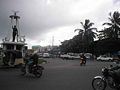
Galle, the main town in the most southerly part of the island, has a population of around 100,000, and is connected by rail to Colombo and Matara. It is home to a cricket ground, the Galle International Stadium, rebuilt after the 2004 tsunami. Test matches resumed there on December 18, 2007. Rumassala Kanda, a large mound-like hill, forms the eastern protective barrier to the Galle harbor. Local tradition associates this hill with some events of the Ramayana.
On December 26, 2004 the massive Boxing Day Tsunami, caused by the 2004 Indian Ocean earthquake that occurred a thousand miles away off the coast of Indonesia, devastated the city. Thousands died in the city alone. The Dutch fort, also known as Ramparts of Galle, withstood the mighty Boxing Day tsunami which destroyed the Galle town.
History
According to James Emerson Tennent, Galle had been the ancient seaport of Tarshish, from which King Solomon drew ivory, peacocks and other valuables. Cinnamon had been exported from Sri Lanka as early as 1400 B.C.E. and the root of the word itself may come from Hebrew, so Galle may have been the main port for the spice.
Galle had been a prominent seaport long before western rule in the country. Persians, Arabs, Greeks, Romans, Malays and Indians traded through Galle port. The "modern" history of Galle starts in 1505, when a storm drove Lourenço de Almeida's Portuguese ship into the harbor. The people of the city refused to let the Portuguese enter it, so the Portuguese took it by force.
In 1640, the Portuguese surrendered the city to the Dutch East India Company. The Dutch built the present Fort in the year 1663. They built a fortified wall, using solid granite, and built three bastions, known as "sun," "moon" and "star." After the British took over the country from the Dutch in the year 1796, they preserved the Fort unchanged, and used it as the administrative center of Galle.
Galle Fort
The Portuguese first built Galle fort, which the Dutch modified during the seventeenth century. During the Dutch period in Ceylon, the Dutch brought laborers from Indonesia and Mozambique to build the massive fort. Even today, after 400 years of existence, it looks new and polished. Today many Dutch people who still own most of the properties inside the fort look to make it one of the modern wonders of the world. The citizens of Dutch fort in Galle have been trying to make this a free port and a free trade zone. If successful, the companies and individuals who reside inside the city will be free of taxes. Currently, businesses have a ten year period of no withholding tax, no tax on capital gains, no corporate tax, no VAT, and no profit tax from the start of the business.
Some of the famous Moor (Muslim) families living inside the fort include the Noordeen Cassim's family and Fatima Koppen Adams families who run a story telling center for the tourists and children who visit the site daily. Many Moor families live inside the fort along with Dutch, English, Portuguese and Germans. More details regarding the history of the fort can be found at the visitors center and at the Dutch period museum inside the Fort.
Galle Lighthouse
| Galle Lighthouse | |
|---|---|
| File:Galle Lighthouse.jpg Galle Lighthouse on the ramparts of the Old Dutch fort | |
| Location: | Galle fort, Galle, Sri Lanka |
| Year first constructed: | 1939 |
| Year first lit: | 1939 |
| Automated: | n/a |
| Construction: | Ccast iron |
| Tower shape: | Round tower |
| Markings/Pattern: | White |
| Height: | 26.5 m |
| Range: | 47 m |
| Characteristic: | two white flashes every 15 s |
The Sri Lanka Ports Authority operates and maintains Dondra Head Lighthouse, an offshore Lighthouse in Galle, Sri Lanka. Sri Lanka's oldest light station dating back to 1848, the original lighthouse had been destroyed by fire in 1934. The light station stands within the walls of the ancient Galle fort, a UNESCO world heritage site and well known tourist attraction, making it the country's most often visited lighthouse.
Entrance Gate
The British had broken through the rampart between the Zon and Maan bastions to create a big entrance gate, replacing the old, smaller one near the harbor. On the inside of the older gate is the coat of arms of the United Dutch East India Company-Vereenigde Oost-Indische Compagnie (VOC)[1], where the British have put it, after putting up their own on the outside. The road leading up to the old gate had been a causeway, with on the left the water of the bay and on the right a swampy area. A large moat runs along the wall of the ramparts connecting the Zon, Maan and Ster bastions. A harbor no longer exists.
Inside the Fort
The Old Gate pierces the ramparts south of the harbor with a British Coat of Arms on the inner side and the initials of the Dutch East India Company and its coat of arms crowning the top of the gate. South of the harbor the Zwart (Black) Bastion remains as the only surviving part of the original Portuguese fortifications. The circuit of the walls continues via the Akersloot and Aurora bastions to the Point Utrecht bastion, topped by a modern lighthouse, then to Flag Rock, the southernmost point of the walls, before looping back north through the Triton, Neptune, Clippenberg and Aeolus bastions.
The final section between the Aeolus and Star bastions, part of a military base, is off limits to the public. While some of the bastions retain their original Dutch names, the Triton, Aeolus, Neptune and Aurora bastions had been renamed by the British in honor of the Royal Navy ships of the line which took part in the British seizure of Sri Lanka from the Dutch during the Napoleonic Wars. [2].
Ramparts
The fort ramparts are there, tall, massive and well preserved, black and awesome against the serpent green of the grass, thick walls of enormous granite dotted with little holes for the cannons to peep through. Lovers walk here, on the rampart top, holding hands and talking sweet nothings oblivious to the spray of the sea which dashes its waves against the western wall. The north side of the fort is the newly renovated Galle Cricket ground where they play international cricket matches. The entire locality dazzles in picture postcard perfection. The evenings here are beautiful, especially if you were to sit on the old Dutch ramparts and watch the sunsets on fire in the midst of a marmalade Paul McCartney sky. You can imagine that a Dutch soldier from Rotterdam may have stood guard on the same rampart where you stand, eyes alert and long musket in hand, watching the same sun go down five centuries ago.
The ancient port city of Galle is Sri Lanka's fourth largest town, with a population of around 80,000 people and a history that stretches back hundreds of years. Some historians have suggested that Galle might even be the Biblical Tarshish, where King Solomon's ships called to take on gemstones, spices and scented woods. There's nothing to establish the truth of this rather fanciful tale, but it is at least certain that Galle is Sri Lanka's oldest living city, contrasting with the more ancient—but deserted—capitals of Sigiriya, Anuradhapura and Polonnaruwa.
Located on the south-western shore of the island, about 115km south of Colombo and just 18km south of the popular beach resort of Hikkaduwa, Galle was for centuries Sri Lanka's main port, a position which strengthened during the periods of Portuguese and Dutch colonial rule. Galle only lost its primacy in the late 19th century, when the British expanded and developed the harbour at Colombo to become the island's major port. Today Galle Harbour still handles fishing vessels, a certain amount of container traffic, as well as a few luxury yachts. It's a shadow of its former self, though, and this adds to the mellow, laid-back atmosphere of the place.
Although there is plenty of good accommodation available in Galle, as well as some very passable places to eat, many visitors will prefer to stay at one of the nearby beach resorts of Hikkaduwa, Unawatuna or Weligama. A visit to Galle makes an excellent and enjoyable day trip when it seems time to take a break from beach life and indulge in a little history and culture.
The National Maritime Museum, Galle
Located within the Fort of Galle in a colonial Dutch ware-house with imposing pillars, the National Maritime Museum displays the fauna & flora of the sea. Artifacts consist of preserved material and scaled down models of whales and fishes. Generally, the Museum displays all the resources of the sea. Displays show the traditional methods of fishing diorama form with life sized models. Some artifacts of underwater archaeology are on display. The 'walk-into-the sea' diorama, showing the natural coral beds, sea grass beds and deep sea fishes constitutes an interesting experiment. Finally, one leaves the museum seeing the causes of sea pollution, coast erosion and methods used to combat those problems. [3]
Demographics
Galle is sizeable town, by Sri Lankan standards, and has a population of 90,934, the majority of whom are of Sinhalese ethnicity; there is a large Sri Lankan Moor minority who are the descendants of the Arab traders that established the ancient port of Galle.
| Ethnicity | Population | % Of Total |
|---|---|---|
| Sinhalese | 66,114 | 72.71 |
| Sri Lankan Tamils | 989 | 1.09 |
| Indian Tamils | 255 | 0.28 |
| Sri Lankan Moors | 23,234 | 25.56 |
| Other (including Burgher, Malay) | 342 | 0.38 |
| Total | 90,934 | 100 |
Source: 2001 Census
Gallery
View of the city from the sea side
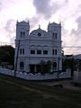
Mosque
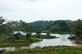
The beauty of Galle countryside, Wakwella with Sri Lanka's longest bridge on the river Gin


See also
- Tsunami
- Place names in Sri Lanka
External links
- Old Town of Galle and its Fortifications, UNESCO World Heritage . Retrieved July 26, 2008.
- Official website of the Sri Lanka Tourism Board. Retrieved July 26, 2008.
- Maritime Archaeology & History of Sri Lanka. Retrieved July 26, 2008.
- Audio interview with Galle resident about life in Galle. Retrieved July 26, 2008.
- The Walled City - Galle. Retrieved July 26, 2008.
- CPAmedia Historic Galle. Retrieved July 26, 2008.
- A Historic tour through the city of Galle. Retrieved July 26, 2008.
- The old world's romantic city: Galle!. Retrieved July 26, 2008.
- Galle - A Port City in History. Retrieved July 26, 2008.
- Galle Light. Retrieved July 26, 2008.
- Galle Fort Hotel. Retrieved July 26, 2008.
| ||||||||||
| |||||||
| |||||||
Credits
New World Encyclopedia writers and editors rewrote and completed the Wikipedia article in accordance with New World Encyclopedia standards. This article abides by terms of the Creative Commons CC-by-sa 3.0 License (CC-by-sa), which may be used and disseminated with proper attribution. Credit is due under the terms of this license that can reference both the New World Encyclopedia contributors and the selfless volunteer contributors of the Wikimedia Foundation. To cite this article click here for a list of acceptable citing formats.The history of earlier contributions by wikipedians is accessible to researchers here:
The history of this article since it was imported to New World Encyclopedia:
Note: Some restrictions may apply to use of individual images which are separately licensed.
- ↑ 1700'S Treasure of the Dutch East Indies Company. Retrieved July 26, 2008.
- ↑ (Irshad Cassim)
- ↑ (Irshad Cassim)