Kabul
| Kabul کابل | |
|---|---|
 | |
 Kabul | |
| Province | Kabul |
| Coordinates | |
| Population (2005)[1] |
2,994,000 (1st) UN estimate of city proper |
| City Districts | 18 sectors or boroughs |
| Area - Elevation |
1,790 m (5,873 ft) |
| Time zone | UTC+4:30 Kabul |
| Mayor | Engineer Mir Abdul Ahad Sahebi |
| Chief of Police | General Mohammad Ayub Salangi[2] |
Kābul (Persian: کابل, IPA: [kɑː'bʊl]) is the capital and largest city of Afghanistan, as well as an economic and cultural centre.
Kabul is over 3,000 years old and many empires have fought over the city for its strategic location along the trade routes of Southern and Central Asia. In 1504, Babur captured Kabul and used it as his headquarters until 1526, before his conquest of India. In 1776, Timur Shah Durrani made it the capital of modern Afghanistan.[3]
Geography
Etymology of name – if available.
Kabul is situated 5900 feet (1800 meters) above sea level in a narrow valley, between the two steep Asmai and Sherdawaza mountain ranges along the Kabul River.
The Kabul river, that rises in the Sanglakh Range in Afghanistan, is little more than a trickle for most of the year, but swells in summer due to melting snows.
Kabul has a semi-arid climate with precipitation concentrated in the winter (in the form of snow) and spring months. The average maximum daytime temperature in January is 39.2°F (4°C), rising to an average maximum of around 89.6°F (32°C) in June. Summers run from June to September and are moderate, with very low humidity. Winters are harsh, snowy and long, lasting from December to March. Spring in Kabul starts in late March and is the wettest part of the year. Mean annual precipitation is 15 inches (384mm).
Size – land area, size comparison
In Kabul’s districts 5 and 6, household and medical waste was discarded on streets. Human waste was contained in open sewers, which flowed into the Kabul River and contaminated the city’s drinking water. Urban dumpsites are used instead of managed landfills in Kabul
Districts
- Areas of Kabul City
- Shahr-e Naw (New City)
- Wazir Akbar Khan
- Macro Ryans (1, 2, 3 and 4)
- Khair Khana (1, 2 and 3)
- Dashti Barchi
- Kartey Sakhi
- Qalai Wazir
- Khushhall Khan
- Afshar
- Klola Pushta and Taimani
- Kartey Parwan
- Kartey Naw (New Quarter)
- Kartey (3 & 4)
- Darul-Aman
- Chehlstoon
- Chendawol
- Shahr-e Kohna (Old City of Kabul)
- Deh Buri
- Bibi Mahroo
History
The city of Kabul is thought to have been established between 2000 B.C.E. and 1500 B.C.E.[4] In the Rig Veda (composed between 1700–1100 B.C.E.) the word "Kubhā" is mentioned, which appears to refer to the Kabul River. There is a reference to a settlement called Kabura by the Persian Achaemenids around 400 B.C.E.[citation needed] which may be the basis for the use of the name Kabura by Ptolemy.[5] Alexander the Great conquered Kabul during his conquest of the Persian Empire. The city later became part of the Seleucid Empire before becoming part of the Mauryan Empire. The Bactrians founded the town of Paropamisade near Kabul, but it was later ceded to the Mauryans in the 1st century B.C.E.

According to many noted scholars, the Sanskrit name of Kabul is Kamboj.[6][7][8].[9][10] It is mentioned as Kophes or Kophene in the classical writings. Gazetteer of Bombay Presidency 1904 maintains that the ancient name of Kabul was Kambojapura, which Ptolemy (160 C.E.) mentions as Kaboura (from Ka(m)bo(j)pura?). Hiuen Tsang refers to the name as Kaofu, which according to Dr. J. W. McCrindle,[11] Dr Sylvain Lévi,[12] Dr. B. C. Law,[13] Dr. R. K. Mukkerji,[14] N. L. Dey[15] and many other scholars,[16] is equivalent to Sanskrit Kamboja (Kamboj/Kambuj). Kaofu was also the appellation of one of the five tribes of the Yuechi who had migrated from across the Hindukush into Kabul valley around Christian era.[17] According to some scholars, the fifth clan mentioned among the Tochari/Yuechi may have been a clan of the Kambojas[18]
The Greco-Bactrian Kingdom captured Kabul from the Mauryans in the early 2nd century B.C.E., then lost the city to their subordinates in the Indo-Greek Kingdom in the mid 2nd century B.C.E. Indo-Scythians expelled the Indo-Greeks by the mid 1st century B.C.E., but lost the city to the Kushan Empire nearly 100 years later. It was conquered by Kushan Emperor Kujula Kadphises in the early 1st century CE and remained Kushan territory until at least the 3rd century CE.[19][20] Kabul was one of the two capital cities of Kushans.
Around 230 C.E. the Kushans were defeated by the Sassanid Empire and were replaced by Sassanid vassals known as the Kushanshas or Indo-Sassanids. In 420 C.E. the Kushanshahs (Kushan kings) were driven out of Afghanistan by the Chionites tribe known as the Kidarites, who were then replaced in the 460s by the Hephthalites. The Hephthalites were defeated in 565 C.E. by a coalition of Persian and Turkish armies, and most of the realm fell to those Empires. Kabul became part of the surviving Kushano-Hephthalite Kingdom of Kapisa, who were also known as Kabul-Shahan. The rulers of Kabul-Shahan built a huge defensive wall around the city to protect it from invaders. This wall has survived until today and is considered a historical site. Around 670 C.E. the Kushano-Hephthalites were replaced by the Shahi or Hindu-Shahi dynasty.
Islamic conquest
In 674, the Islamic invasions reached modern-day Afghanistan and occupied Kabul. However, it was not until the 9th century when Ya'qub bin Laith as-Saffar, a coppersmith turned ruler, established Islam in Kabulistan. Over the remaining centuries to come the city was successively controlled by the Samanids, Ghaznavids, Ghorids, Timurids, Mughols, Durranis, and finally by the Barakzais.
In the 13th century the Mongol horde passed through. In the 14th century, Kabul rose again as a trading center under the kingdom of Timur-Lung (Tamerlane), who married the sister of Kabul's ruler at the time. But as Timurid power waned, the city was captured in 1504 by Babur and made into his headquarters. Haidar, an Indian poet who visited at the time wrote "Dine and drink in Kabul: it is mountain, desert, city, river and all else."
Modern history
Nadir Shah of Persia captured the city in 1738 but was assassinated nine years later. Ahmad Shah Durrani, an Afghan military commander and personal bodyguard of Nader, took the throne in 1747, asserted Pashtun rule and further expanded his new Afghan Empire. His son Timur Shah Durrani, after inheriting power, transferred the capital of Afghanistan from Kandahar to Kabul in 1776.[21] Timur Shah died in 1793 and was succeeded by his son Zaman Shah Durrani.
In 1826, the kingdom was claimed by Dost Mohammed and taken from him by the British Indian Army in 1839 (see Afghan Wars), who installed the unpopular puppet Shah Shuja. An 1841 local uprising resulted in the loss of the British mission and the subsequent Massacre of Elphinstone's army of approximately 16,000 people, which included civilians and camp followers on their retreat from Kabul to Jalalabad. In 1842 the British returned, plundering Bala Hissar in revenge before retreating back to India. Dost Mohammed returned to the throne.
The British invaded in 1878 as Kabul was under Sher Ali Khan's rule, but the British residents were again massacred. The invaders again came in 1879 under General Roberts, partially destroying Bala Hissar before retreating to India. Amir Abdur Rahman was left in control of the country.
In the early 20th century, King Amanullah Khan rose to power. His reforms included electricity for the city and schooling for girls. He drove a Rolls-Royce, and lived in the famous Darul Aman Palace. In 1919, after the Third Anglo-Afghan War, Amanullah announced Afghanistan's independence from foreign interventions at Eidgah Mosque. In 1929, Ammanullah Khan left Kabul because of a local uprising and his brother Nader Khan took control. King Nader Khan was assassinated in 1933 and his 19-year-old son, Zahir Shah, became the long lasting King of Afghanistan.
Kabul University opened for classes in early 1930s, and in 1940s, the city began to grow as an industrial center. The streets of the city began being paved in the 1950s.
In the 1960s, Kabul developed a cosmopolitan mood. The first Marks and Spencer store in Central Asia was built there. Kabul Zoo was inaugurated in 1967, which was maintained with the help of visiting German Zoologists.
In 1969, a religious uprising at the Pul-e Khishti Mosque protested the Soviet Union's increasing influence over Afghan politics and religion. This protest ended in the arrest of many of its organizers including Mawlana Faizani, a popular Islamic scholar.
In July 1973, Zahir Shah was ousted in a bloodless coup and Kabul became the capital of a republic under Mohammad Daoud Khan, the new President. In 1975 an east-west electric trolleybus system provided public transportation across the city. The system was built with assistance from Czechoslovakia.
After the Soviet invasion of Afghanistan, on December 24, 1979, the Red Army occupied the capital. They turned the city into their command center during the 10-year conflict between the Soviet-allied government and the Mujahideen rebels. The American Embassy in Kabul closed on January 30, 1989. The city fell into the hands of local militias after the 1992 collapse of Mohammad Najibullah's pro-communist government. As these forces divided into warring factions, the city increasingly suffered. In December, the last of the 86 city trolley buses came to a halt because of the conflict. A system of 800 public buses continued to provide transportation services to the city.

By 1993 electricity and water in the city was completely out. At this time, Burhannudin Rabbani's militia (Jamiat-e Islami) held power but the nominal prime minister Gulbuddin Hekmatyar's Hezb-e Islami began shelling the city, which lasted until 1996. Kabul was factionalised, and fighting continued between Jamiat-e Islami, Abdul Rashid Dostum and the Hezbi Wahdat. Tens of thousands of civilians were killed and many more fled as refugees. The United Nations estimated that about 90% of the buildings in Kabul were destroyed during these years.
Kabul was captured by the Taliban in September 1996, publicly lynching ex-President Najibullah and his brother. During this time, all the fighting between different militias came to an end. Burhannudin Rabbani, Gulbuddin Heckmatyar, Abdul Rashid Dostum, Ahmad Shah Massoud, and the rest all fled the city.
Approximately five years later, in October 2001, the United States invaded Afghanistan. The Taliban abandoned Kabul in the following months because of extensive American bombing, while the Afghan Northern Alliance (former mujahideen or millias) came to retake control of the city. On December 20, 2001, Kabul became the capital of the Afghan Transitional Administration, which transformed to the present government of Afghanistan that is led by US-backed President Hamid Karzai.
Since the beginning of 2003, the city is slowly developing with the help of foreign investment. Security is also improving by the year, despite the occasional attacks on government forces.
Government
Kabul City is one of the 15 districts of Kabul Province, and is divided into 18 sectors. Each sector covers several neighborhoods of the city. The number of Kabul's sectors were increased from 11 to 18 in 2005.
Unlike other cities of the world, Kabul City has two independent councils or administrations at once: Prefecture and Municipality. The Prefect who is also the Governor of Kabul Province is appointed by the Ministry of Interior, and is responsible for the administrative and formal issues of the entire province. The Mayor of Kabul City is selected by the President of Afghanistan, who engages in the city's planning and environmental work.
The police and security forces belong to the prefecture and Ministry of Interior. The Chief of Police is selected by the Minister of Interior and is responsible for law enforcement and security of the city.
Economy
Overview – Any specialization: For instance, is a manufactured product is associated with particular cities a. Milwaukee—cheese and beer b. Los Angeles—entertainment industry c. Sheffield—coal d. top 20 cities in the U.S. are highly specialized
Per capita GDP, rank Financial and business services sector Tourism
Kabul's main products include munitions, cloth, furniture and beet sugar, but, since 1978, a state of nearly continuous war has limited the economic productivity of the city.
Transport: Road, rail, air, sea The city is a hub for Germany’s and Europe’s high-speed passenger rail network. Autobahns radiate from Cologne's ring road. Cologne's international airport is Cologne Bonn Airport, also called Konrad Adenauer Airport. The Rhine harbor is one of the larger inland ports in Germany. Public transport within the city includes buses, a subway system, and the Rheinseilbahn aerial tramway crossing the Rhine. Cologne has pavement-edge cycle lanes linked by cycle priority crossings.
Transport

Kabul is linked with Ghazni, Kandahar, Herat and Mazar-e Sharif via a long beltway (circular highway) that stretches across the country. It is also linked by highways with Pakistan to the east and southeast and Tajikistan to the north.
Kabul International Airport serves the population of the city as a method of traveling to other cities or countries. The airport is a hub to Ariana Afghan Airlines, which is the national airlines carrier of Afghanistan. However, airlines from other nations also use the airport to arrive and depart. A new $35 million dollar terminal for international flight passengers, near the old terminal, is under construction and will be completed by 2008.[22]
Kabul has its own public buses (Millie Bus / "National Bus") that take commuters on daily routes to many destinations throughout the city. The service currently has approximately 800 buses but is gradually expanding and upgrading with more buses being added. Plans are underway to reintroduce the modern electric buses that the city once had. Besides the buses, there are yellow taxicabs that can be spotted just about anywhere in and around the city. The Kabul bus system has recently discovered a new source of revenue in whole-bus advertising from MTN similar to "bus wrap" advertising on public transit in more developed nations.
Private vehicles are also on the rise in Kabul, with Land Rover, BMW, Toyota, Nissan and Hyundai dealerships in the city. More people are buying new cars as the roads and highways are being improved. The average car driven in Kabul is a Toyota Corolla. With the exception of motorcycles many vehicles in the city operate on LPG.
GSM/GPRS mobile phone services in the city are provided by Afghan Wireless, Etisalat, Roshan and MTN. In November 2006, the Afghan Ministry of Communications signed a US 64.5 million dollar agreement with a company (ZTE Corporation) on the establishment of a countrywide fibre optical cable network. This will improve telephone, internet, television and radio broadcast services not just in Kabul but throughout the country.[23] Internet was introduced in the city in 2002 and has been expanding rapidly.
There are a number of post offices throughout the city. Package delivery services like FedEx, TNT N.V., DHL and others are also available.
The city has many local radio stations which also have programs in the English, Hindi and local languages. Besides foreign channels, the local television channels of Afghanistan include:
Demographics


Kabul had a population of 2,994,000 in 2005.
The population of the city reflects the general multi-ethnic, multi-cultural, and multi-confessional characteristics of Afghanistan. Persian-speakers form the majority of the city's population, with the predominately Sunnite Tajiks being the largest group,[24][25] followed by Shi'ite Hazaras. There is also a sizable number of Persian-speaking Pashtuns.
Pashto-speakers, also Sunnites, form the most important minority, followed by the Turkic-speaking Uzbeks. There are also sizable numbers of Aimak, Baloch, Pashai, as well as Sikhs and Hindus who speak their native language as their mother tongue and Persian as the native language of Kabul.
Colleges and universities
All public schools in Kabul began to reopen in 2002, and ever since then they are improving every year. Many boys and girls are now attending classes. Some of the public schools are Amani High School, Durrani High School, Ghulam Haider Khan High School, Sultan Razia School, etc.
There are also several new universities and private colleges opened in the last few years.
Universities in Kabul
- Kabul University
- Kabul Polytechnic
- American University of Afghanistan
- National Military Academy of Afghanistan
- University of Afghanistan
- Kabul Medical University
- International School of Kabul
Of interest

The old part of Kabul is filled with bazaars nestled along its narrow, crooked streets. Cultural sites include the Afghan National Museum, notably displaying an impressive statue of Surya excavated at Khair Khana, the ruined Darul Aman Palace, the Mausoleum of Emperor Babur and Chehlstoon Park, the Minar-i-Istiqlal (Column of Independence) built in 1919 after the Third Afghan War, the mausoleum of Timur Shah Durrani, and the imposing Id Gah Mosque (founded 1893). Bala Hissar is a fort destroyed by the British in 1879, in retaliation for the death of their envoy, now restored as a military college. The Minaret of Chakari, destroyed in 1998, had Buddhist swastika and both Mahayana and Theravada qualities.
Other places of interest include Kabul City Center, which is Kabul's first shopping mall, the shops around Flower Street and Chicken Street, Wazir Akbar Khan district, Babur Gardens, Kabul Golf Club, Kabul Zoo, Shah Do Shamshera and other famous Mosques, the Afghan National Gallery, Afghan National Archive, Afghan Royal Family Mausoleum, the OMAR Mine Museum, Bibi Mahroo Hill, Kabul Cemetery, and Paghman Gardens.
Tappe-i-Maranjan is a nearby hill where Buddhist statues and Graeco-Bactrian coins from the 2nd century B.C.E. have been found. Outside the city proper is a citadel and the royal palace. Paghman and Jalalabad are interesting valleys north and east of the city.


- Airports
- Kabul International Airport
- Parks
- Bāgh-e Bābur Park (Babur Gardens)
- Bāghi Bālā Park
- Lake Qargha Park
- Zarnegar Park
- Shar-e Naw Park
- Bagh-e Zanana (Women's Park)
- Chaman-e-Hozori
- Mosques
- Haji Abdul Rahman Mosque (Under construction)
- Id Gah Mosque
- Pul-e Khishti Mosque
- Shah-e Do Shamshera Mosque
- Mausoleums
- Mausoleum of Tamim Ansar
- Museums
- Kabul Museum
- National Archives
- Negaristani Milli
- Hotels
Reconstruction and developments
As of October 2007, there are approximately 16 licensed banks in Kabul: including Da Afghanistan Bank, Afghanistan International Bank, Standard Chartered Bank, Kabul Bank, Azizi Bank, Punjab National Bank, Habib Bank and others. Western Union offices are also found in many locations throughout the city.
A small sized indoor shopping mall (Kabul City Center) with a 4-star (Safi Landmark) hotel on the top six floors opened in 2005. A 5-star Serena Hotel also opened in 2005. Another 5-star Marriott Hotel is under construction. The landmark InterContinental Hotel has also been refurbished and is in operation.

An initial concept design called the City of Light Development, envisioned by Dr. Hisham N. Ashkouri, Principal of ARCADD, Inc. for the development and the implementation of a privately based investment enterprise has been proposed for multi-function commercial, historic and cultural development within the limits of the Old City of Kabul along the Southern side of the Kabul River and along Jade Meywand Avenue,[29] revitalizing some of the most commercial and historic districts in the City of Kabul, which contains numerous historic mosques and shrines as well as viable commercial activities among war damaged buildings. Also incorporated in the design is a new complex for the Afghan National Museum. Dr. Ashkouri has signed a Memorandum of Understanding with His Excellency Ambassador Said Tayeb Jawad in Washington, DC to undertake this project and to develop it for actual implementation over the next 20 to 25 years. Dr. Ashkouri has presented the City of Light Plan to President Karzai and has received a letter of support from the President and the Minister of Urban Development in support of this project’s development.
About 4 miles (6 km) from downtown Kabul, in Bagrami, a 22-acre (9 ha) wide industrial complex has completed with modern facilities, which will allow companies to operate businesses there. The park has professional management for the daily maintenance of public roads, internal streets, common areas, parking areas, 24 hours perimeter security, access control for vehicles and persons. Another phase with additional 27 acres (11 ha) of land will be added immediately proceeding the first phase.[30]

The city hosts the We Are the Future (WAF) center, a child care center giving children a chance to live their childhoods and develop a sense of hope. The center is managed under the direction of the mayor’s office and the international NGO. Glocal Forum serves as the fundraiser, program planner and coordinator for the WAF center. Launched in 2004, the program is the result of a strategic partnership between the Glocal Forum, the Quincy Jones Listen Up Foundation and Mr. Hani Masri, with the support of the World Bank, UN agencies and major companies.
A $25 million Coca-Cola bottling plant was opened in 2006. Financing was provided by a Dubai-based Afghan family. President Hamid Karzai formally opened the facility in an attempt to attract more foreign investment in the city.
In late 2007 the government announced that all the residential houses situated on mountains would be removed within a year so that trees and other plants can be grown on the hills. The plan is to try to make the city greener and provide residents with a more suitable place to live, on a flat surface. Once the plan is implemented it will provide water supply and electricity to each house. All the city roads will also be paved under the plan, which will solve transportation problems.[31]
Looking to the future
Does the city face no challenges or offer up anything else as a legacy?"
Does the city need reconstruction?
Is it a model city?
Will it run out of water?
Does it have a crucial role to play in the nation?
Gallery
- A view from Kabul InterContinental.jpg
View from Kabul InterContinental
- Bagh-e-Bala1.jpg
Bagh-e Bala Park
- Kabul - Mausoleum of Tamim Ansar.jpg
Mausoleum of Tamim Ansar
- Downtown area of Kabul.jpg
Section of downtown area of Kabul
- Qargha.jpg
Qargha district in kabul
- Qargha panorama.jpg
Qargha lake
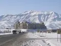
- Kabul serena.jpg
Kabul Serena hotel
Darul Aman Palace
- Kabul TV Hill view.jpg
View from TV-Hill

See also
- 2002 Hindu Kush earthquakes
- City of Light Development
- List of cities in Afghanistan
- Kabul Express
- Kabul Golf Club
- Radio Kabul
Notes and references
- ↑ UN World Urbanization Prospects: The 2005 Revision Population Database...link
- ↑ Quqnoos.com, Kabul's disgraced police chief replaced (July 06, 2008}
- ↑ Britannica Concise Encyclopedia - Kabul...Link
- ↑ The history of Afghanistan, Ghandara.com website
- ↑ "Kabul" Chambers's Encyclopaedia: A Dictionary of Universal Knowledge (1901 edition) J.B. Lippincott Company, New York, page 385
- ↑ Ethnologische Forschungen und Sammlung von Material für dieselben, 1871, p 244, Adolf Bastian - Ethnology.
- ↑ The People of India: A Series of Photographic Illustrations, with ..., 1868, p 155, John William Kaye, Meadows Taylor, Great Britain India Office - Ethnology.
- ↑ Supplementary Glossary, p. 304, H. M. Elliot.
- ↑ Various Census of India, 1867, p 34.
- ↑ Memoir on Cuneiform Inscription, 1849, p 98, Cuneiform inscriptions; Journal of the Royal Asiatic Society of Great Britain & Ireland, 1849, p 98, Henry Creswicke Rawlinson, Royal Asiatic Society of Great Britain and Ireland.
- ↑ Alexander’s Invasion, p 38, J. W. McCrindle; Megasthenes and Arrian, p 180, J. W. McCrindle.
- ↑ Pre-Aryan and Pre-Dravidian in India, 1993 edition, p 100, Dr Sylvain Lévi, Jules Bloch, Jean Przyluski, Asian Educational Services - Indo-Aryan philology.
- ↑ Some Kṣatriya Tribes of Ancient India, 1924, p 235, Dr B. C. Law - Kshatriyas; Indological Studies, 1950, p 36; Tribes in Ancient India, 1943, p 3.
- ↑ Chandragupta Maurya and His Times, 1966, p 173, Dr Radhakumud Mookerji - History; Studies in Ancient Hindu Polity: Based on the Arthaṡâstra of Kautilya, 1914, p 40, Narendra Nath Law, Kauṭalya, Radhakumud Mookerji; The Fundamental Unity of India, 2004, p 86; The Fundamental Unity of India (from Hindu Sources), 1914, p 57, Dr Radhakumud Mookerji.
- ↑ Geographical Dictionary of ancient and Medieval India, Dr Nundo Lal Dey.
- ↑ The Modern Review, 1907, p 135, Ramananda Chatterjee - India; Literary History of Ancient India in Relation to Its Racial and Linguistic ..., p 165, Chandra Chakraberty; Prācīna Kamboja, jana aura janapada =: Ancient Kamboja, people and country, 1981, Dr Jiyālāla Kāmboja, Dr Satyavrat Śāstrī - Kamboja (Pakistan) etc.
- ↑ The Ancient Geography of India, p 15, A Cunningham.
- ↑ Ancient Kamboja, People and the Country, 1981, p 43, Dr J. L. Kamboj.
- ↑ Hill, John E. 2004. The Western Regions according to the Hou Hanshu. Draft annotated English translation...link
- ↑ Hill, John E. 2004. The Peoples of the West from the Weilue 魏略 by Yu Huan 魚豢: A Third Century Chinese Account Composed between 239 and 265 C.E. Draft annotated English translation... Link
- ↑ Encyclopaedia Britannica - The Durrani dynasty (from Afghanistan)...Link
- ↑ Pajhwok Afghan News - Work on terminal at Kabul Airport starts...Link
- ↑ Pajhwok Afghan News - Ministry signs contract with Chinese company...Link
- ↑ "Kābul (city)". Microsoft® Encarta® Online Encyclopedia (2007). Retrieved on 2007-12-02.
- ↑ Cole, Juan (2006-05-30). Kabul under Curfew after Anti-US, anti-Karzai Riots. San Francisco Bay Area Indymedia. Retrieved 2007-11-27.
- ↑ http://www.lmhotelgroup.com/Lmhotelgroup/safihome.asp
- ↑ http://www.goldenstarkabul.com
- ↑ http://www.heetal.com
- ↑ Kabul - City of Light Project...link
- ↑ Afghanistan Industrial Parks Development Authority...Kabul (Bagrami)
- ↑ Pajhwok Afghan News, Kabul beautification plan announced (December 17, 2007)
Further reading
External links
- Encyclopaedia Britannica Kabul Retrieved December 2, 2008.
- World Fact Book 2008 Afghanistan Retrieved December 2, 2008.
- Map of Kabul City
- What's On In Kabul (pdf format)
- Historical Photos of Kabul
- The Story of Kabul
- Kabul Caravan
- Kabul - City of Light, 9 Billion dollar modern urban development project
- Sada-e Azadi Radio/TV/Newspaper (ISAF)
Credits
New World Encyclopedia writers and editors rewrote and completed the Wikipedia article in accordance with New World Encyclopedia standards. This article abides by terms of the Creative Commons CC-by-sa 3.0 License (CC-by-sa), which may be used and disseminated with proper attribution. Credit is due under the terms of this license that can reference both the New World Encyclopedia contributors and the selfless volunteer contributors of the Wikimedia Foundation. To cite this article click here for a list of acceptable citing formats.The history of earlier contributions by wikipedians is accessible to researchers here:
The history of this article since it was imported to New World Encyclopedia:
Note: Some restrictions may apply to use of individual images which are separately licensed.