Difference between revisions of "Astana" - New World Encyclopedia
Mike Butler (talk | contribs) |
Mike Butler (talk | contribs) |
||
| Line 66: | Line 66: | ||
Climatically Astana is the second coldest capital in the world (behind Ulaanbataar, Mongolia), with temperatures of around -31°F (-35°C) common in the late autumn. The new city is also known to regularly freeze for around six months every year. Overall however, Astana has a continental climate, with exceptionally cold winters and moderately hot summers, arid and semiarid. The average annual temperature in Astana is one degree Celsius. January is the coldest month with an average temperature of 3.2°F (-16°C). July is the hottest month with an average temperature of 68°F (20°C). Annual precipitation totals 18.9 inches (32.7mm). | Climatically Astana is the second coldest capital in the world (behind Ulaanbataar, Mongolia), with temperatures of around -31°F (-35°C) common in the late autumn. The new city is also known to regularly freeze for around six months every year. Overall however, Astana has a continental climate, with exceptionally cold winters and moderately hot summers, arid and semiarid. The average annual temperature in Astana is one degree Celsius. January is the coldest month with an average temperature of 3.2°F (-16°C). July is the hottest month with an average temperature of 68°F (20°C). Annual precipitation totals 18.9 inches (32.7mm). | ||
| − | Astana can be divided largely into a few different areas. North of the railway line, which crosses Astana in an east-west direction, are industrial and poorer residential areas. Between the railway line and the river Ishim is the city center, where in 2008 intense building activity was under way. To the west and east are more elevated residential areas with parks and the new area of government administration to the south of the Ishim. The city's land area totalled 710.2 square kilometers in 2008. | + | Astana can be divided largely into a few different areas. North of the railway line, which crosses Astana in an east-west direction, are industrial and poorer residential areas. Between the railway line and the river Ishim is the city center, where in 2008 intense building activity was under way. To the west and east are more elevated residential areas with parks and the new area of government administration to the south of the Ishim. The city's land area totalled 274.2 square miles (710.2 square kilometers) in 2008. |
There many large building projects were under way, including the construction of a diplomat quarter, and a variety of different government buildings, and scheduled for completion by 2030. The original plans for the new Astana were drawn up by the late [[Japan]]ese architect [[Kisho Kurokawa]]. Astana's current chief planner, [[Vladimir Laptev]], wants to build a [[Berlin]] in a [[Eurasian]] style. He has stated that a purely administrative capital such as [[Canberra]] is not one of his goals. | There many large building projects were under way, including the construction of a diplomat quarter, and a variety of different government buildings, and scheduled for completion by 2030. The original plans for the new Astana were drawn up by the late [[Japan]]ese architect [[Kisho Kurokawa]]. Astana's current chief planner, [[Vladimir Laptev]], wants to build a [[Berlin]] in a [[Eurasian]] style. He has stated that a purely administrative capital such as [[Canberra]] is not one of his goals. | ||
| − | |||
| − | |||
==History== | ==History== | ||
Revision as of 01:02, 14 July 2008
| Astana Астана |
|||
|
|||
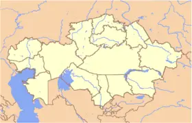
| Location in Kazakhstan | |||
| Coordinates: {{#invoke:Coordinates|coord}}{{#coordinates:51|10|0|N|71|26|0|E|type:city | |||
|---|---|---|---|
| name= }} | |||
| Country | | ||
| Province | Akmola Province | ||
| Founded | 1830 | ||
| Government | |||
| - Akim (mayor) | Imangali Tasmagambetov | ||
| Area | |||
| - Total | 710.2 km² (274.2 sq mi) | ||
| Elevation | 347 m (1,138 ft) | ||
| Population (1 Dec 2007) | |||
| - Total | 600,200 | ||
| - Density | 841/km² (2,178.2/sq mi) | ||
| Time zone | BTT (UTC+6) | ||
| Postal code | 010000 - 010015 | ||
| Area code(s) | +7 7172[1] | ||
| ISO 3166-2 | AST | ||
| License plate | Z | ||
| Website: http://www.astana.kz | |||
Astana (Kazakh: Астана; former names include Akmola, Akmolinsk, Tselinograd, and Aqmola), is the capital and second largest city (behind Almaty) of Kazakhstan. [2] . It is located in the north-central portion of Kazakhstan, within Akmola Province, although it is politically separate from the rest of the province, which has its own capital.
Geography
The word Astana in Kazakh language literally means Capital city. In Kazakh and Russian, it is pronounced "As-ta-na", while in English and many other languages, the common pronunciation is "As-ta-na". In June 2008, a parliamentary proposal was put forward to change the city's name to "Nursultan", in honor of the then president, an idea rejected by the president himself.
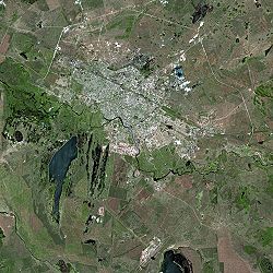
The city is located in central Kazakhstan on the Ishim River in a very flat, semi-desert steppe region which covers most of the country's territory. The elevation of Astana is at 1138 feet (347 meters) above sea level. Astana is in a spacious steppe landscape, in the transient area between the north of Kazakhstan and the extremely thinly settled national center, because of the river Ishim. The older boroughs lie north of the river, whilst the new boroughs were located south of the Ishim.
Climatically Astana is the second coldest capital in the world (behind Ulaanbataar, Mongolia), with temperatures of around -31°F (-35°C) common in the late autumn. The new city is also known to regularly freeze for around six months every year. Overall however, Astana has a continental climate, with exceptionally cold winters and moderately hot summers, arid and semiarid. The average annual temperature in Astana is one degree Celsius. January is the coldest month with an average temperature of 3.2°F (-16°C). July is the hottest month with an average temperature of 68°F (20°C). Annual precipitation totals 18.9 inches (32.7mm).
Astana can be divided largely into a few different areas. North of the railway line, which crosses Astana in an east-west direction, are industrial and poorer residential areas. Between the railway line and the river Ishim is the city center, where in 2008 intense building activity was under way. To the west and east are more elevated residential areas with parks and the new area of government administration to the south of the Ishim. The city's land area totalled 274.2 square miles (710.2 square kilometers) in 2008.
There many large building projects were under way, including the construction of a diplomat quarter, and a variety of different government buildings, and scheduled for completion by 2030. The original plans for the new Astana were drawn up by the late Japanese architect Kisho Kurokawa. Astana's current chief planner, Vladimir Laptev, wants to build a Berlin in a Eurasian style. He has stated that a purely administrative capital such as Canberra is not one of his goals.
History
Early history
A unit of Siberian cossacks from Omsk founded a huge fortress on the upper Ishim in 1824, which later became the town of "Akmolinsk". During the early 20th Century, the town became a major railway junction, causing a major economic boom that lasted until the Russian Civil War.
The Gulags once spread over the Kazakhstan steppe like a thick wreath. Eleven camps housed hundreds of thousands of prisoners and their families. Outside Astana, there once stood the ALZHIR camp, a Russian acronym for the Akmolinskii Camp for Wives of Traitors of the Motherland, one of the most notorious in the Gulag archipelago, which was reserved for the wives of men considered "enemies of the people" by Joseph Stalin.[3]
In 1961, it was renamed "Tselinograd" and made capital of the Soviet Virgin Lands Territory (Tselinny Krai). The city was at the centre of the Virgin Lands Campaign led by Nikita Khrushchev in the 1950s, in order to turn the state into a second grain producer for the Soviet Union. The high portion of Russian immigrants in this area, which later led to ethnic tension, can be traced to the influx of agricultural workers at this time. Additionally, many Russian-Germans were resettled here after being deported under Joseph Stalin at the beginning of World War II, when Nazi Germany invaded the Soviet Union.
After Kazakhstan gained its independence in 1991, the city and the region were renamed "Aqmola". The name was often translated as "White Tombstone," but actually means "Holy Place" or 'Holy Shrine'. The "White Tombstone" literal translation was too appropriate for many visitors to escape notice in almost all guide books and travel accounts.
As Kazakhstan's new capital
In 1994, the city was designated as the future capital of the newly-independent country, and again renamed to the present "Astana" after the capital was officially moved from Almaty in 1997. Despite the isolated location of the new capital in the centre of the Kazakh Steppe and the forbidding climate in winter, Kazakhstan simply needed a more central location than its former location of Almaty, which lies on the far southeastern border with Kyrgyzstan.[citation needed] Some speculate that it was a move to impose more control over the Russian-dominated north of the country.[attribution needed] Other reasons include the belief that the new city project is a strategic move to position the capital further from the borders with China, Kyrgyzstan, and Uzbekistan,[citation needed] or that Almaty was limited in its development by mountains,[citation needed] or that President Nursultan Nazarbayev created a "Potemkin village", either to present an image of a modern, clean Kazakhstan to entice foreign investment.[citation needed] Internal political concerns may have played a part:[citation needed] Nazarbayev, like most of the Kazakh political establishment, belongs to the Great Horde (Kazakh, ulı jüz) in whose territory Almaty lies. The move to the traditional territory of the Middle Horde may have been a gesture to the Middle and Little Hordes' political sensibilities.[citation needed]
To some Kazakhs, the move remains controversial. Critics resent the massive expenditure of public funds to build the new government complexes, as well as the continuing cost of airfare and hotel expenses for the many government workers who still live in Almaty.[attribution needed] The lucrative development contracts handed out to companies owned by President Nazarbayev's family members also remain highly suspect.[attribution needed]
Government
Imangali Tasmagambetov, formerly mayor of Almaty, was appointed mayor of Astana on April 4, 2008.
Economy
Politics and government are the main economic activity in the capital, which also forms a Special Economic Zone. Since the move, Astana has seen one of the world's greatest building projects, as oil money has been spent on government buildings, a massive home for the president, a mosque, and numerous parks and monuments. The project is designed to not just make the town the centre of Kazakhstan, but of all Central Asia.
Astana International Airport was, like the plan for the whole new city, designed by the late Japanese architect Kisho Kurokawa. The Astana Metro is a planned underground construction in Astana.
Demographics
officially estimated population (1 Dec. 2007) of 600,200 By 2007, Astana’s population has more than doubled since the move, to over 600,000, and it is estimated to top 1 million by 2030. Migrant workers – legal and illegal – have been attracted from across Kazakhstan and neighboring states such as Uzbekistan and Kyrgyzstan, and Astana is a magnet for young professionals seeking to build a career. This has changed the city’s demographics, bringing more ethnic Kazakhs to a city that formerly had a Slav majority. Astana’s ethnic Kazakh population has risen to some 60 per cent, up from 17 per cent in 1989. [4]
In 1999, Astana had a population of 281,000. The ethnic mix was about 60% Kazakh and 30% Russian, Ukrainian, and German.[5]
Many argue that a drive to attract ethnic Kazakhs northward was the key factor in shifting the capital, which was officially put down to lack of space for expansion in the former capital, Almaty, and its location in an earthquake zone. [6]
As of city population count (carried out 5 Nov. - 5 Dec. 2007) preliminary results Astana has 700,000 inhabitants[7].
Of interest
The architectural quality of the new buildings is, by the standards of almost all critics, quite high.
In December 2006, Kazakh President Nursultan Nazarbayev unveiled plans to build Khan Shatyry, a "giant, transparent tent", over an area of the city. The tent will be 150 metres high, and was designed by British architect Norman Foster.[8] It is expected to take around a year to build.[9] Foster has also designed two other buildings in the city.
Today there are many construction works under way, such as embassy buildings, representative riversides along the Ishim River, and some infrastructure for transportation and communication. In the centre of town, the Avenue of the Republic acts as the main hub of activity. It is bordered by many stores, coffee houses, restaurants, discotheques and even some casinos. Worth a visit are the:
- Modern governmental quarter
- Ishim banks
- "Oceanarium"
- Astana Central National Mosque
- Islamic Center
- Roman Catholic Cathedral
- Market hall
- Bayterek Tower
Astana is home to FC Astana, a football (soccer) team in the Kazakhstan Premier League, which won the national championship in 2000, 2001 and 2006. The city is also home to the Astana-Tigers basketball team who successfully took the 2004/2005 season title, as well as Barys Astana of the Kazakh Ice Hockey League. In addition, Team Astana is a professional cycling team that competes on the UCI ProTour. They participated in the 2007 Tour de France wearing blue national uniforms, but were excluded during the race after the conviction of Alexander Vinokourov for illegal doping practises, and have since been banned from the 2008 race.[10]
- Pic 39.JPG
- Pic 54.JPG
- Pic 55.JPG
- Pic 214.JPG
- Pic 50.JPG
- Pic 40.JPG
- 0001dw41.jpeg
- S640x480.jpeg
ReferencesISBN links support NWE through referral fees
- ↑ CODE OF ACCESS
- ↑ Astana city official site
- ↑ Pope Pays Tribute to Victims of Soviet Atrocities
- ↑ Kazakhstan’s Capital Holds A Lavish Anniversary Celebration
- ↑ www.angelfire.com Astana
- ↑ [Kazakhstan’s Capital Holds A Lavish Anniversary Celebration
- ↑ www.astana.kz Astana city population count preliminary results (in Russian)
- ↑ Foster + Partners
- ↑ Giant tent to be built in Astana BBC News Online
- ↑ Tour de France organizers exclude Astana team; Alberto Contador may not defend title
External links
- City of Astana Official website
- Astana International Airport (official site)
- Astana - New City
- Astana Research Project (German)
- Travel to Astana
Credits
New World Encyclopedia writers and editors rewrote and completed the Wikipedia article in accordance with New World Encyclopedia standards. This article abides by terms of the Creative Commons CC-by-sa 3.0 License (CC-by-sa), which may be used and disseminated with proper attribution. Credit is due under the terms of this license that can reference both the New World Encyclopedia contributors and the selfless volunteer contributors of the Wikimedia Foundation. To cite this article click here for a list of acceptable citing formats.The history of earlier contributions by wikipedians is accessible to researchers here:
The history of this article since it was imported to New World Encyclopedia:
Note: Some restrictions may apply to use of individual images which are separately licensed.


