Orkhon Valley Cultural Landscape
Coordinates:
| Orkhon Valley Cultural Landscape* | |
|---|---|
| UNESCO World Heritage Site | |

| |
| State Party | |
| Type | Cultural |
| Criteria | ii, iii, iv |
| Reference | 1081 |
| Region** | Asia-Pacific |
| Inscription history | |
| Inscription | 2004 (28th Session) |
| * Name as inscribed on World Heritage List. ** Region as classified by UNESCO. | |
Orkhon Valley Cultural Landscape sprawls along the banks of the Orkhon River in Central Mongolia, some 360 km west from the capital Ulaanbaatar. It was inscribed by UNESCO in the World Heritage List as representing evolution of nomadic pastoral traditions spanning more than two millennia.
Importance
For many centuries, the Orkhon Valley was viewed as the seat of the imperial power of the steppes. The first evidence comes from a stone stele with runic inscriptions, which was erected in the valley by Bilge Khan, an 8th-century ruler of the Göktürk Empire. Some 25 miles to the north of the stele, in the shadow of the sacred forest-mountain Ötüken, was his Ördü, or nomadic capital. During the Qidan domination of the valley, the stele was reinscribed in three languages, so as to record the deeds of a Qidan potentate.
Mountains were considered sacred in Tengriism as an axis mundi, but Ötüken was especially sacred because the ancestor spirits of the khagans and beys resided here. Moreover, a force called qut was believed to emanate from this mountain, granting the khagan the divine right to rule the Turkic tribes.[1] Whoever controlled this valley was considered heavenly appointed leader of the Turks and could rally the tribes. Thus control of the Orkhon Valley was of the utmost strategic importance for every Turkic state. Historically every Turkic capital (Ördü) was located here for this exact reason.
Sites
The main monuments of the Orkhon Valley are as follows:
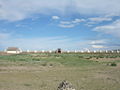
Ordu-Baliq (Khar Balgas)
Ruins of Khar Balgas, an 8th-century capital of the Uyghur Empire, which cover 50 square km and contain evidence of the palace, shops, temples, and monasteries.
Ordu-Baliq (also spelled Ordu Balykh, Ordu Balik, Ordu-Baliq, Ordu Balig, Ordu Baligh, meaning "city of the court"), also known as Mubalik, was the capital of the first Uyghur Empire, built on the site of the former Göktürk imperial capital, 17 km north-to-northeast of the later Mongol capital, Karakorum. Its ruins are known as Kharabalghasun (Karabalgasun, Kara Balgasun, Khar Balgas), that is, "black city". They form part of the World Heritage Site Orkhon Valley Cultural Landscape.

Location
Ordu-Baliq is situated in a grassy plain called the Talal-khain-dala teppe, on the western bank of the Orkhon River in the Khotont sum of the Arkhangai Province, Mongolia, 16 km northeast of the Khotont village, or 30 km north-to-northwest of Kharkhorin. The Orkhon emerges from the gorges of the Khangai Mountains and flows northward to meet the Tuul River (on whose upper reaches the current capital of Mongolia, Ulan Bator, is located). A favorable micro-climate makes the location ideal for pasturage, and it lies along the most important east-west route across Mongolia. As a result, the Orkhon Valley was a center of habitation and important political and economic activity long prior to the birth of Genghis Khan who made it known to the wider world.
History
In 744, after the defeat of the last Göktürk Kaghan by the Uigur-Qarluk-Basmyl alliance, the Uyghurs under Bayanchur Khan established their imperial capital Ordu Baliq on the site of the old ördü ("nomadic capital"). Apparently designed by Sogdian architects, Ordu Baliq is believed to have been the earliest walled city in Mongolia. Ordu-Baliq flourished until 840, when it was ruined by the invading Yenisey Kyrgyzes.
The capital occupied 25 square kilometers. The ruins of the town, which include the 10 meter high town wall, a 12 meter high tower and another 14 meter high sentry tower, clearly indicate that Ordu Baliq was an affluent and large town. The urban area may be divided into three main parts. The central part consisting of numerous buildings surrounded by a continuous wall forms the biggest part. Ruin of a large number of temples and dwelling houses are to be found to the south beyond the center. The Khan's residential palace, which was also ringed by high walls on all sides, stood in the northeastern part of the town, where the Russian archaeologist Nikolay Yadrintsev discovered a green granite monument with a statue of a dragon perched at the top and bearing a runic inscription glorifying the khagans.
Ordu Baliq was a fully-fortified commandry and commercial entrepot typical of the central points along the length of the Silk Road. The well-preserved remains now consist of concentric fortified walls and lookout towers, stables, military and commercial stores, and administrative buildings. There are also remains of a water drainage system there. Archaeologists established that certain areas of the town were allotted for trade and handcrafts, while in the center of the town were palaces and temples, including a monastery. The palace had fortified walls around it and two main gates, north and south, as well as moats filled with water and watchtowers.
An Arab ambassador from the Samanid Empire, Tamim ibn Bahr, visited Ordu Baliq in 821 C.E. and left the only written account of the city. He travelled through uninhabited steppes until arriving in the vicinity of the Uighur capital. He described Ordu-Baliq itself as a great town, "rich in agriculture and surrounded by rustaqs (villages) full of cultivation lying close together. The town had twelve iron gates of huge size. The town was populous and thickly crowded and had markets and various trades."[2] The most colorful detail of his description is the 100-foot (30 m)-high golden yurt on top of the citadel where the khagan held court.
Discovery
In 1871, the Russian traveller Paderin was the first European to visit the ruins of the Uighur capital, of which only the wall and a tower were in existence, while the streets and ruins outside the wall could be seen at a distance. He was told that the Mongols call it either Kara Balghasun ("black city") or khara-kherem ("black wall"). Paderin's belief that this was the old Mongol capital Karakorum has been shown to be incorrect.
The Mongolian Karakorum, has been identified by several authorities with a site on which the 16th century Buddhist monastery of Erdene Zuu was built, some 17 km to the southeast. North and north-east of the monastery are ruins of ancient buildings. The site was identified as a ruined Uyghur capital by the expedition of Nikolay Yadrintsev in 1889, and the two expeditions of the Helsingfors Ugro-Finnish society (1890), followed by that of the Russian Academy of Sciences, under Friedrich Wilhelm Radloff (1891).
Karakorum
Ruins of Genghis Khan's capital Karakorum which could have included the famed Xanadu palace.


Karakorum (Khalkha Mongolian: Khara-khorin, Classical Mongolian: Qara Qorum) was the capital of the Mongol Empire in the 13th century, although for only about 30 years. Its ruins lie in the northwestern corner of the Övörkhangai Province of Mongolia, near today's town of Kharkhorin, and adjacent to the Erdene Zuu monastery. They are part of the upper part of the World Heritage Site Orkhon Valley Cultural Landscape.
History
Foundation. The Orkhon valley had already been a center of the Xiongnu, Göktürk and Uighur empires. To the Göktürks, the nearby Khangai Mountains had been the location of the Ötükän, and the Uighur capital Karabalgasun was located close to where later Karakorum would be erected. This area is probably also one of the oldest farming areas in Mongolia[3].
In 1218/19, Genghis Khan rallied his troops for the campaign against the Khwarezm Empire in a place called Karakorum[4], but the actual foundation of a city is usually said to have only occurred in 1220. Until 1235, Karakorum seems to have been little more than a yurt town, only then, after the defeat of the Jin empire did Genghis' successor Ögedei erect walls around the place and build a fixed palace. [5]
Prosperity. Under Ögedei and his successors, Karakorum became a major site for world politics. Möngke had the palace enlarged, and the great stupa temple completed.[5]
William of Rubruck. William of Rubruck, a Flemish Franciscan missionary and papal envoy to the Mongols reached Karakorum in 1254. He has left one of the most detailed, though not always flattering, accounts of the city. He compared it rather unfavourably to the village of Saint-Denis near Paris, and stated that the monastery in said village is ten times as important as the Khan's palace. On the other hand he also described the town as a very cosmopolitan and religiously tolerant place, and the silver tree he described as part of Möngke Khan's palace has become the symbol of Karakorum[6]. He described the walled city as having four doors in the four directions, two quarters of fixed houses, one for the "Saracenes" and one for the "Cathai" ( = Northern Chinese), twelve pagan temples, two mosques, as well as a nestorian church.[5]
Later Times. When Kublai Khan claimed to the throne of the Mongol Empire in 1260 (as did his younger brother Ariq Boke), he relocated his capital to Shangdu, and later to Dadu (Beijing). Karakorum was reduced to the administrative center of a provincial backwater of the Yuan Dynasty founded in China in 1271. Even worse, the ensuing wars with Ariq Boke and later Kaidu hit the town hard. In 1260, Kublai disrupted the town's grain supply, in 1277 Kaidu took Karakorum, only to be ousted by Yuan troops and Bayan of the Baarin in the following year.[7] In 1298/99 prince Ulus Buqa looted the markets and the grain storehouses. However, the first half of the 14th century proved to be a second time of prosperity: in 1299, the town was expanded eastwards, in 1311 and again from 1342 to 1346 the stupa temple (after 1346 known as Xingyuange (Traditional Chinese: 興元閣, "Pavillion of the Rise of the Yuan")) were renewed.[5]
Decline. After the collapse of the Yuan dynasty in 1368 Karakorum became the residence of Biligtü Khan in 1370. In 1388, Ming troops under General Xu Da took and destroyed the town. Saghang Sechen's Erdeni-yin Tobči claims that a khuriltai in 1415 decided to rebuild it, but no archeological evidence for such a venture has been found yet. However, Karakorum (still or again) was inhabitated at the beginning of the 16th century, when Batu-Möngke Dayan Khan made it a capital once again. In the following years, the town changed hands between Oirads and Chinggisids several times, and was consequently given up for good.[5]
Excavations. In 1585 Abadai Khan of the Khalkha built the Tibetan Buddhist Erdene Zuu monastery near the site. Various construction materials were taken from the ruin to build this monastery.

The actual location of Karakorum was long unclear. First hints that Karakorum was located at Erdene Zuu were already known in the 18th century, but until the 20th century there was a dispute whether not the ruins of Karabalgasun were not in fact those of Karakorum. In 1889, the site was conclusively identified as the former Mongol capital by Nikolai Yadrintsev, who discovered the Orkhon script during the same expedition. Yadrintsev's conclusions were seconded by Wilhelm Radloff.
First excavations were done in 1933/34 under D. Bukinich. After his Soviet - Mongolian excavations in 1948/49, Sergei Kiselev concluded that he had found the remains of Ögödei's palace, however this conclusion has been put into doubt by the findings of the 2000 - 2004 German - Mongolian excavations, which seem to point to the great stupa temple rather than Ögödei's palace.[8]
Findings of the excavations include paved roads, some brick and many adobe buildings, floor heating systems, bed-stoves, evidence for processing of copper, gold, silver, iron (incl. iron wheel naves), glass, jewels, bones, and birchbark, as well as ceramics and coins from China and Central Asia. Four kilns have also been unearthed.[9][10]
Modern days. Prime Minister Tsakhiagiin Elbegdorj appointed in 2004 a working group of professionals to develop a project to build a new city at the site of the ancient capital Karakorum. According to him, the new Karakorum was to be designed to be an exemplary city with a vision of becoming the capital of Mongolia. After his resignation and appointment of Miyeegombiin Enkhbold as Prime Minister this project was abandoned.
Xanadu
| Xanadu Chinese: 上都; pinyin: Shàngdū Zanadu, Shangdu, or Shang-tu |
|
| Coordinates: {{#invoke:Coordinates|coord}}{{#coordinates:42|21|35|N|116|10|47|E|type:city | |
|---|---|
| name= }} | |
| Coordinates: | |
Xanadu, also Zanadu, Shangdu, or Shang-tu (Chinese: 上都; pinyin: Shàngdū) was the summer capital of Kublai Khan's Yuan Dynasty in China, a division of the Mongol Empire (which covered much of Asia and also encroached upon eastern Europe). The city was located in what is now called Inner Mongolia, 275 kilometers (171 mi) north of Beijing, about 28 kilometers (17 mi) northwest of the modern town of Duolun. The layout of the capital is roughly square shaped with sides of about 2200m, it consists of an "Outer City", and an "Inner City" in the southeast of the capital which has also roughly a square layout with sides about 1400m, and the palace, where Kublai Khan stayed in summer. The palace has sides of roughly 550m, 40% the size of the Forbidden City in Beijing. The most visible modern-day remnants are the earthen walls though there is also a ground-level, circular brick platform in the centre of the inner enclosure. Xanadu was visited by Venetian explorer Marco Polo in 1275; it became fabled as a metaphor for opulence, most famously in the English Romantic Samuel Taylor Coleridge's poem Kubla Khan.
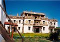
Erdene Zuu Monastery
Erdene Zuu monastery is the first Buddhist monastery established in Mongolia. It was partly destroyed by Communist authorities in 1937-40.


The Erdene Zuu monastery (Mongolian: Эрдэнэ Зуу) is probably the most ancient Buddhist monastery in Mongolia. It is in Övörkhangai Province, near the town of Kharkhorin and adjacent to the ancient city of Karakorum. It is part of the World Heritage Site entitled Orkhon Valley Cultural Landscape.
The Erdene Zuu monastery was built in 1585 by Abtai Sain Khan,[11] upon the (second) introduction of Tibetan Buddhism into Mongolia. Stones from the ruins of Karakorum were used in construction.[12] It is surrounded by a wall featuring 102 stupas[13]. The number 108, being a sacred number in Buddhism,[14] and the number of beads in a Buddhist rosary, was probably envisioned, but never achieved[15]. The monastery temples' wall were painted, and the Chinese-style roof was covered with green tiles. The monastery was damaged by warfare in the 1680s, but was rebuilt in the 18th century and by 1872 had a full 62 temples inside.
In 1939 the Communist leader Khorloogiin Choibalsan had the monastery ruined, as part of a purge[16] that obliterated hundreds of monasteries in Mongolia and killed over ten thousand monks.[17][18] Three small temples and the external wall with the stupas remained; the temples became museums in 1947. They say that this part of the monastery was spared destruction on account of Joseph Stalin's pressure. One researcher claims that Stalin's pressure was connected to the short visit of US vice president Henry A. Wallace's delegation to Mongolia in 1944.[19]
Erdene Zuu was allowed to exist as a museum only; the only functioning monastery in Mongolia was Gandantegchinlen Khiid Monastery in the capital, Ulaanbaatar. However, after the fall of Communism in Mongolia in 1990, the monastery was turned over to the lamas and Erdene Zuu again became a place of worship. Today Erdene Zuu remains an active Buddhist monastery as well as a museum that is open to tourists.
On a hill outside the monastery sits a stone phallus. The phallus is said to retain the sexual impulses of the monks and ensure their good behavior.[20]
Gallery
A view of the outer wall
Laviran Temple at Erdene Zuu monastery.
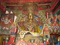
A Buddha at the monastery


Additional Significant Sites
- Early eighth century Turkic memorials to Bilge Khan and Kul Tigin with their Orkhon inscriptions are admittedly the most impressive monuments from the nomadic Göktürk Empire. They were excavated and deciphered by Russian archaeologists in 1889-93.
- Remains of the thirteenth and fourteenth century Mongol palace at Doit Hill, thought to be Ögedei Khan's residence.
- Tuvkhun Hermitage is another spectacular monastery, overlooking a hill at 2,600 meters above sea-level. It was almost totally destroyed by the Communists.

See also
- Architecture of Mongolia
- Khara-Khoto
- Uyghur Empire
- The Black City of Khara-Khoto
Notes
- ↑ Franke, Herbert. The Cambridge History of China. Cambridge University Press, 1994. ISBN 0521214475. Page 347.
- ↑ Minorsky, 2006.
- ↑ Micheal Walther, Ein idealer Ort für ein festes Lager. Zur Geographie des Orchontals und der Umgebung von Charchorin (Karakorum), in: Dschingis Khan und seine Erben, p. 128
- ↑ Micheal Weiers, Geschichte der Mongolen, Stuttgart 2004, p. 76
- ↑ 5.0 5.1 5.2 5.3 5.4 Hans - Georg Hüttel, Karakorum - Eine historische Skizze, in: Dschingis Khan und seine Erben, p. 133 - 137
- ↑ Hans - Georg Hüttel, Der Silberbaum im Palast des Ögedei Khan, in: Dschingis Khan und seine Erben, p. 152
- ↑ Rolf Trauzettel, Die Yüan-Dynastie, in: Michael Weiers (editor), Die Mongolen, Beiträge zu ihrer Geschichte und Kultur, Darmstadt 1986, p. 230
- ↑ Hans-Georg Hüttel, Der Palast des Ögedei Khan - Die Ausgrabungen des Deutschen Archäologischen Instituts im Palastbezirk von Karakorum, in: Dschingis Khan und seine Erben, p. 140 - 146
- ↑ Christina Franken, Die Brennöfen im Palastbezirk von Karakorum, in: Dschingis Khan und seine Erben, p. 147 - 149
- ↑ Ulambayar Erdenebat, Ernst Pohl, Aus der Mitte der Hauptstadt - Die Ausgrabungen der Universität Bonn im Zentrum von Karakorum, in: Dschingis Khan und seine Erben, p. 168 - 175
- ↑ Erdene Zuu Monastery. Culture Mongolia. Retrieved 2007-03-12.
- ↑ Karakorum. Culture Mongolia. Retrieved 2007-03-12.
- ↑ Image:ErdeneZuuMonasteryMongolia.JPG reveals 100 stupas, plus two hidden behind the far corner
- ↑ Snipe, Lynn "Jnana". Buddhism in the Numbers. Urban Dharma. Retrieved 2007-03-12.
- ↑ Niels Gutschow, Andreas Brandt, Die Baugeschichte der Klosteranlage von Erdeni Joo (Erdenezuu), in Claudius Müller (ed.), Dschingis Khan und seine Erben, Bonn 2005, p.353
- ↑ http://www.ciaonet.org/atlas/countries/mn_data_loc.html#a6
- ↑ "Dalai Lama's visit shines spotlight on Mongolia's explosion of faiths", USA Todays.com, 2006-08-24. Retrieved 2007-03-12.
- ↑ Terror Years. Issue 6. Mongolia Today. Retrieved 2007-03-12.
- ↑ Kollmar-Paulenz, Karénina (2003). Buddhism in Mongolia After 1990. Journal of Global Buddhism 4: 18–34.
- ↑ Kharakhorum (Karakorum). Sights of Interest in Mongolia. Legend Tour. Retrieved 2007-03-12.
ReferencesISBN links support NWE through referral fees
- This article incorporates public domain text posted on-line by The United States Library of Congress: A Country Study: Mongolia.
- Drompp, Michael Robert (2005). Tang China and the Collapse of the Uighur Empire: A Documentary History. Brill, 366. ISBN 9004141294.
- Minorsky, V. (1948). Tamīm ibn Baḥr's Journey to the Uyghurs. Bulletin of the School of Oriental and African Studies 12 (2): 31.
- Dschingis Khan und seine Erben (exhibition catalogue), München 2005
- Qara Qorum-City (Mongolia). 1: Preliminary Report of the Excavations, Bonn 2002
External Links
- Glazier, James (2005-09-24). Khar Balgasyn Tuur - Ruins of Uigher Capital (8th Century). Indiana University. Retrieved 2006.
- Silk Road Seattle - Karakorum and Cities along the Silk Road, posted at the web site of the University of Washington, 2004.
- Treasures of Mongolia - Karakorum, Mongolia, UNESCO Courier, by Namsrain Ser-Odjav, March 1986.
- William of Rubruck's Account of the Mongols
- Picture story by German photographer Marc Steinmetz for GEO magazine
- Mongolian-German excavations (in German)
- Mr. Don Croner's report on present-day condition of Shangdu, nice photos, and travel directions.
- Shangdu Google Satellite Map (maplandia)
- Shangdu city uncovered (chinadaily.com)
- Historical Remains at Yuan Shangdu (UNESCO World Heritage)
External links
- Official website
- Article with pictures
- Encyclopedia Britannica article on Karakorum and Erdene Zuu.
- Photo collection at Culture Mongolia
- A few pictures
- Excerpt from article "The Life of Zanabazar"; discusses the construction of Erdene Zuu
| |||||||
Credits
New World Encyclopedia writers and editors rewrote and completed the Wikipedia article in accordance with New World Encyclopedia standards. This article abides by terms of the Creative Commons CC-by-sa 3.0 License (CC-by-sa), which may be used and disseminated with proper attribution. Credit is due under the terms of this license that can reference both the New World Encyclopedia contributors and the selfless volunteer contributors of the Wikimedia Foundation. To cite this article click here for a list of acceptable citing formats.The history of earlier contributions by wikipedians is accessible to researchers here:
The history of this article since it was imported to New World Encyclopedia:
Note: Some restrictions may apply to use of individual images which are separately licensed.