Ancient City of Vijayanagara

The Ancient City of Vijayanagararefers to the urban core of the imperial city and the surrounding principalities of the capital of the Vijayanagar empire during the 14th century to 16th century CE. Notes by foreign travelers such as Abdur Razzak, the Persian who visited Vijayanagara in 1440, mention six fortifications before the gates to the royal palace. The large area between the first and third fortifications contained agricultural fields, gardens and residences. The notes of Robert Sewell describe countless shops and bazaars (markets) filled with people from different nationalities between this fortification and the palace.
Described
Excavations
Recent excavations have unearthed archaeological artifacts dating from the 3rd century B.C.E. to early in the 2nd millennium, documenting evidence from over seven hundred important sites. Those sites include ash mounds, ancient settlements, megalithic cemeteries, temples and rock art. Those findings show that the Vijayanagar area had been densely settled for a long period before the creation of the empire.
Land
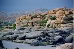
Starting at its outermost fortifications, the principality of Vijayanagar spans from Anegondi in the north to Hospet in the south and covers a total area of 650 km².[1][2] Vijayanagara's core, an area of 25 km², includes the Tungabhadra River flowing through rocky terrain with huge boulders piled in massive formations.
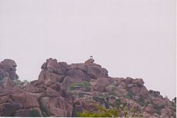
In addition to that naturally daunting landscape, builders constructed fortifications surrounding the regal city in several layers.[3] The rocky hillocks made excellent sentinel points for watch towers. South of the river the rocky landscape disappears, replaced by flat cultivable land. Granite boulders provided the raw material for the large and small temples complexes built there. The largest populations settled to the south of the irrigated lands watered by a system of clever ducts and anecut (dams) channeling water to the capital from the river.[4] At its peak, Vijayanagara may have had up to a million residents.
Zoning
For the sake of simplicity, archaeologists divided the capital area into many zones. The Sacred Centre and the Royal Centre constituted the major two zones. The former, generally spread along the south bank, hosts the highest concentration of religious structures. The Royal Centre has been noted for it’s the stately structures, both civil and military. The seat of power of the empire located at the core of that area.
Islamic Quarter, also sometimes called, as the Moorish Quarter sits between the northern slop of the Malyavanta hill towards and the Talarigatta Gate. According to the archaeologists, high-ranking Muslim officers of the king’s court and the military officers stayed in that area. [5]
Legends
Two important legends played an important role in making Hampi (the core area of Vijayanagar) a pilgrim destination for several centuries prior to the Vijayanagara era. One legend describes the marriage of a local Goddess, Pampa, with Virupaksha (Lord Shiva) on the Hemakuta Hill. Thereafter devotees considered had an incarnation of Parvati. From Pampa came the name Pampe or (in Kannada) Hampe.
The second legend draws on the Hindu epic Ramayana. Lord Rama and his brother, Lakshmana, while searching for Sita in the vicinity of the ancient capital of Kishkindha, met Hanuman on Rishyamuka Hill. Rama mad a covenant with Sugreeva, the monkey king in exile, to find Sita and get rid of the evil King Vali. The presence of a temple with icons of Lord Rama, Lakshmana and Sugreeva celebrated that agreement. Legend says that Hanuman, the devout follower of Rama, had been born on Anjenadri Hill near the Tungabhadra river facing Hampi. Hence he received the name Anjaneya.[6] Archaeologists trace the history of Hampi to neolithic settlements while inscriptions confirm that in more recent times the area came under the rule of the Chalukyas, Rashtrakutas, Hoysalas and finally the tiny kingdom of Kampili.
The legendary association of this area with Lord Virupaksha (Harihara and Bukka Raya being of Shaiva faith) and Lord Rama (the personification of the perfect king) was not lost on the empire's founders. Its natural ruggedness and inaccessibility must have been additional reasons to choose this location for the capital of the new empire.[7] During the empire's rule, Vijayanagara was known as one of the most beautiful cities in India.[8] A copper plate inscription (Tamarashasana) of Marappa (one of the Sangama brothers) is dated 1346 and traces the Sangama genealogy, identifying the Sangama family deity (gotradhidaivam) as Lord Virupaksha of Hampi.[9] Inscriptions attesting to the elevation of Lord Virupaksha to Rashtra devata (God of the Kingdom) have been found. By the time of Bukka I, the capital had already grown into a great capital and inscriptions call it great Nagari named Vijaya situated in Hemakuta.[10]
Forts and Roads
The Vijayanagar empire created its cities primarily for protection against invasion. The city itself was a fortress and designed as such in every possible way. It was built of massive stone and earthen walls, with hilltop fortresses and watch towers scattered across its length and breadth. Visitors to the city, irrespective of their guild and intention, had to travel through a heavily fortified and protected area before reaching the main urban core which gave them an ample view of the might that protected the empire. Massive fortifications stood at every possible entry into the main metropolitis and in other crucial locations. Additional defensive features were watch posts and bastions located along roads, gates and hilltops that provided maximum visibility.[11]
The capital was the political nerve centre of the empire as well as a center of commerce and pilgrimage. Envoys from other kingdoms, merchants, pilgrims, soldiers and ordinary people all travelled about in the great city on its extensive network of roads. Research has shown over 80 transportation related sites linked by several broad roads about 30 to 60 m wide that were the major transport routes into the city core. Smaller roads , less than 10 m wide, led to temples, settlements and irrigation fields. All major roadways could be monitored from watch towers, gates and rest houses.[12]
Urban Settlements
The greater metropolitan region of the city was inhabited by royalty, imperial officers, soldiers, agriculturists, craftsman, merchants, labourers among others. Literary sources from this era testify to the presence of large military encampments on the city's outskirts. Outside the metropolis, walled towns and villages were scattered about the countryside. Some settlements may have been populated by only a few thousand people while others were large enough to hold ten to fifteen thousand residents. Each settlement had multiple shrines and temples. Numerous Vijayanagar period relics have been lost due to the inhabitation of these settlements by modern day settlers.[13]
Agriculture and Craft
While today the city's landscape appears to be barren, there is recorded evidence of extensive deforestation and numerous agricultural activities. This suggests that the landscape has changed dramatically. Virtually all available arable land was irrigated using a variety of innovative methods. A significant percentage of the population was involved in agriculture, making the city self sufficient for food. This enabled it to withstand long sieges, of which there were many during the empire's three century long existence. Numerous canals were dug to provide a perennial water supply to the narrow strip of fertile land bordering the Tungabhadra River. Many of these canals are still in use today though they usually have been modified to meet current requirements. Many of the tanks (bunds) created for water storage purposes like the Kamalapura tank are still in use. Excavation of the Intensive Survey Area has shown the presence of sixty water reservoir embankments.[14] Numerous other agricultural features such as check dams, erosion control walls and wells have been recorded. The net result of these systems was a complex agricultural landscape characterized by a multitude of agricultural regimes appropriate to the complex topography, resources, needs and differing populations.[15]
Sandur, which formed the southern boundary of the greater metropolitan region, is still known today for iron and haematite ores. Iron slag and other metallurgical debris have been documented at more than thirty sites. Of these, five sites have been dated to the Vijayanagar period and contain iron smelting workshops.[16]
Sacred sites
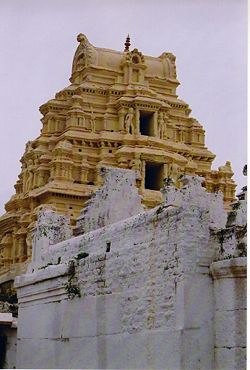
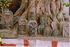
As well as being a bustling commercial and military encampment, the metropolitan area had over one hundred and forty sacred sites, making it an important centre of religion and religious pilgrimage. Along with temples, numerous sacred images and structures have been recorded in residential and defensive sites. Sacred sites include large temples with towering gopuras, such as the Mallikarjuna temple in the town of Mallappanagudi located on the main road connecting modern Hospet and Vijayanagara and built in the period of Deva Raya I.[17] There are many smaller temples and shrines. Even more numerous are the images of deities carved into boulder and slab surfaces as well as hero stones (virgal) which were also considered sacred. Sculpted icons of Hanuman, Bhairava, Virabhadra and goddesses in various forms are also frequently seen as well as images from folk traditions such as naga stones (snake stones) linked with woman's ritual activities. Tombs associated with Muslim inhabitants of the city are also present.[18]
Notes
- ↑ Studies conducted by Vijayanagara metropolitan survey concluded that the ancient fortified city with all its walled suburban settlements encompassed that area. Some suburbs had been as big as towns, people still populating the place. John M. Fritz and George Michell, eds. New Light on Hampi, Recent research in Vijayanagara, MARG, 2001, p. 5
- ↑ This data closely matches the writings of Persian traveller Abdur Razzak who estimated the size of the capital in 1440 as 540 km²-Hampi. A Travel Guide, Department of Tourism, India, Good Earth publication, 2003,p. 101
- ↑ An inscription of Harihara II dated 1378 depicts the Vijayanagar fortification as "arms stretching out to embrace Hemakuta Hill" - Hampi, A Travel Guide, Department of Tourism, India, Good Earth publication, 2003,p. 63
- ↑ In semi arid lands like the Vijayanagara area, abundant and free flowing water served as the best index of the empire's prosperity. The water supply system at Vijayanagara constituted an elaborate system supplying agricultural and drinking water so advanced for its time that engineers incorporated most of its features into the Tungabhadra Dam Project in the 1950's - Hampi, A Travel Guide, Department of Tourism, p. 88
- ↑ Zones of Hampi Zones of Hempi
- ↑ A shrine located here with a rock carving of Hanuman marks his place of birth. The Chintamani ashram on the bank of the river near Anegondi marks the spot where Sugriva fought Vali, and the location of Vali's death at the hands of Lord Rama. At the extreme northeast corner of Vijayanagara stands a mound believed the burial place of Vali, according to John McKim Malville, New Light on Hampi, Recent research in Vijayanagara, edited by John M. Fritz and George Michell, MARG, 2001, p. 132
- ↑ Hampi, A Travel Guide, Department of Tourism, India, Good Earth publication, 2003, pp20-27
- ↑ Portuguese traveller Domingo Paes wrote in 1520 that in Vijayanagara, the streets were beautiful with beautiful houses having balconies and arcades, Hampi, A Travel Guide p70, Department of Tourism, India
- ↑ New Light on Hampi, Recent research in Vijayanagara, edited by John M. Fritz and George Michell, MARG, 2001, p13
- ↑ Epigrapia Carnatica, V, Hn 133; New Light on Hampi, Recent research in Vijayanagara, edited by John M. Fritz and George Michell, MARG, 2001, p22
- ↑ Carla M. Sinopoli and Kathleen D. Morrison, New Light on Hampi, Recent research in Vijayanagara, edited by John M. Fritz and George Michell, MARG, 2001, p 104
- ↑ Carla M. Sinopoli and Kathleen D. Morrison, New Light on Hampi, Recent research in Vijayanagara, edited by John M. Fritz and George Michell, MARG, 2001, p106
- ↑ Carla M. Sinopoli and Kathleen D. Morrison, New Light on Hampi, Recent research in Vijayanagara, edited by John M. Fritz and George Michell, MARG, 2001, p106
- ↑ Carla M. Sinopoli and Kathleen D. Morrison, New Light on Hampi, Recent research in Vijayanagara, edited by John M. Fritz and George Michell, MARG, 2001, p107
- ↑ Carla M. Sinopoli and Kathleen D. Morrison, New Light on Hampi, Recent research in Vijayanagara, edited by John M. Fritz and George Michell, MARG, 2001, p108
- ↑ Carla M. Sinopoli and Kathleen D. Morrison, New Light on Hampi, Recent research in Vijayanagara, edited by John M. Fritz and George Michell, MARG, 2001, p108
- ↑ Carla M. Sinopoli and Kathleen D. Morrison, New Light on Hampi, Recent research in Vijayanagara, edited by John M. Fritz and George Michell, MARG, 2001, p109
- ↑ Carla M. Sinopoli and Kathleen D. Morrison, New Light on Hampi, Recent research in Vijayanagara, edited by John M. Fritz and George Michell, MARG, 2001, p109
ReferencesISBN links support NWE through referral fees
- Hampi, A Travel Guide, Department of Tourism, India, Good Earth publication, New Delhi 2003 ISBN 81-877801-7-7
- New Light on Hampi, Recent research in Vijayanagara, edited by John M. Fritz and George Michell, MARG, 2001, ISBN 81-85026-53-X
External links
Credits
New World Encyclopedia writers and editors rewrote and completed the Wikipedia article in accordance with New World Encyclopedia standards. This article abides by terms of the Creative Commons CC-by-sa 3.0 License (CC-by-sa), which may be used and disseminated with proper attribution. Credit is due under the terms of this license that can reference both the New World Encyclopedia contributors and the selfless volunteer contributors of the Wikimedia Foundation. To cite this article click here for a list of acceptable citing formats.The history of earlier contributions by wikipedians is accessible to researchers here:
The history of this article since it was imported to New World Encyclopedia:
Note: Some restrictions may apply to use of individual images which are separately licensed.


