Jaisalmer
| Jaisalmer Rajasthan • India | |

 | |
| Coordinates: | |
| Time zone | IST (UTC+5:30) |
| Area • Elevation |
5.1 km² (2 sq mi) • 225 m (738 ft) |
| District(s) | Jaisalmer |
| Population • Density |
58,286 (2001) • 11,429 /km² (29,601 /sq mi) |
| Mayor | Sang Singh Bhati |
| Codes • Pincode • Telephone • Vehicle |
• 345 00x • +02992 • RJ 15 |
Coordinates: Jaisalmer pronunciation ▶ (Hindi: जैसालमेर), nicknamed "The Golden City", is a town in the Indian state of Rajasthan. The town stands on a ridge of yellowish sandstone, crowned by a fort, which contains the palace and several ornate Jain temples. Many of the houses and temples are finely sculptured. It lies in the heart of the Thar Desert and has a population of about 78,000. It is the administrative headquarters of Jaisalmer District.
Origin of name
Jaisalmer is named after its founder Rawal Jaisal (see History). "Jaisalmer" means "the Hill Fort of Jaisal". Jaisalmer is also called as the Golden city of India because the yellow sand gives a yellowish-golden touch to the city & its surrounding area.
History
The majority of the inhabitants of Jaisalmer are Bhati Rajputs, who take their name from an ancestor named Bhatti, renowned as a warrior when the tribe were located in the Punjab. Shortly after this the clan was driven southwards, and found a refuge in the Indian desert, which was henceforth its home. Deoraj, a famous prince of the Bhati family, is esteemed the real founder of the Jaisalmer dynasty, and with him the title of rawal commenced. In 1156 Rawal Jaisal, the sixth in succession from Deoraj, founded the fort and city of Jaisalmer, and made it his capital as he moved from his former capital at Lodhruva (which is situated about 15 km to the south-east of Jaisalmer). In 1294, the Bhatis so enraged the emperor Ala-ud-din Khilji that his army captured and sacked the fort and city of Jaisalmer, so that for some time it was quite deserted. After this there is nothing to record till the time of Rawal Sahal Singh, whose reign marks an epoch in Bhati history in that he acknowledged the supremacy of the Mughal emperor Shah Jahan. The Jaisalmer princes had now arrived at the height of their power, but from this time till the accession of Rawal Mulraj in 1762 the fortunes of the state rapidly declined, and most of its outlying provinces were lost. In 1818 Mulraj entered into political relations with the British. Maharawal Salivahan, born in 1887, succeeded to the chiefship in 1891.
The Maharajas of Jaisalmer trace their lineage back to Jaitsimha, a ruler of the Bhati Rajput clan. The major opponents of the Bhati Rajputs were the powerful Rathor clans of Jodhpur and Bikaner. They used to fight battles for the possession of forts, waterholes or cattle. Jaisalmer was positioned strategically and was a halting point along a traditional trade route traversed by the camel caravans of Indian and Asian merchants. The route linked India to Central Asia ,Egypt, Arabia, Persia, Africa and the West.
Medieval period
During the Islamic invasion of India, Jaisalmer escaped direct Muslim conquest due to its geographical situation in the desert region. The Rawals of Jaisalmer agreed to pay an annual tribute to the Delhi Sultans. The first siege of Jaisalmer occurred during the reign of Allaud-din Khilji. It was provoked by Bhatis' raid on a caravan filled with treasure. According to local ballads, the Bhatis defended the fort for seven years until the enemy army forced beached the ramparts. Bhatis, facing certain defeat, proclaimed the rite of jauhar. Later, Sultan Ferozshah also sieged Jaisalmer after the rulers of Jaisalmer raided his camp at Anasagar lake near Ajmer. The siege led to another jauhar. Jaitsimha's son Duda perished in the attack. Duda's descendants ruled over Jaisalmer for about two centuries. Duda's descendant Lunakarna had a fight with Humayun when the latter passed through Jaisalmer en route to Ajmer. Mughal emperor Akbar was married to one of the Jaisalmer princesses.
Later, Jaisalmer was ruled by a noble called Sabala Simha, who won the patronage of the Mughal emperor Shah Jahan for services rendered in his Peshawar campaign.
Princely Jaisalmer
Jaisalmer was one of the last states to sign a treaty with the British. During the British Raj, Jaisalmer was the seat of a princely state of the same name, ruled by the Bhati clan of rajputs. The present descendant is Brijraj Singh. Though the city is under the governance of the Government of India, a lot of welfare work is carried out by him and his family. The Royal Family still commands a lot of respect from the people.[citation needed]
Traditionally, the main source of income was the levies on the caravans. However, the glory of Jaisalmer faded when Bombay emerged as a port and the sea trade replaced the traditional land routes. The partition of India in 1947 lead to closing of all the trade routes on the Indo-Pak border and rendered Jaisalmer a drought-prone desert backwater on the international border. Ironically, skirmishes between India and Pakistan gave Jaisalmer a strategic importance and made it serviceable as an army supply depot. Later, the Rajasthan Canal served to revive the surrounding desert areas. Roads and railroads were then built, knitting the hitherto remote town with the rest of Rajasthan.
Later, the Government of Rajasthan decided to promote Jaisalmer as a tourist destination.
Geography
Jaisalmer is located at [1]. It has an average elevation of 229 metres (751 feet).
Jaisalmer is situated on the border of India and Pakistan in West Rajasthan. The area of Jaisalmer is 5.1 km². The maximum summer temperature is around 41.6°C while the minimum is 25°C. The maximum winter temperature is 23.6°C while the minimum is 7.9°C. The average rainfall is 150mm. [1]
Jaisalmer is almost entirely a sandy waste, forming a part of the great Indian desert. The general aspect of the area is that of an interminable sea of sandhills, of all shapes and sizes, some rising to a height of 150 ft. Those in the west are covered with log bushes, those in the east with tufts of long grass. Water is scarce, and generally brackish; the average depth of the wells is said to be about 250 ft. There are no perennial streams, and only one small river, the Kakni, which, after flowing a distance of 28 m., spreads over a large surface of flat ground, and forms a lake orjhil called the Bhuj-Jhil. The climate is dry and healthy. Throughout Jaisalmer only raincrops, such as bajra, joar, motif, til, etc., are grown; spring crops of wheat, barley, etc., are very rare. Owing to the scant rainfall, irrigation is almost unknown.
Distances: New Delhi (864 km), Jaipur (558 km), Mumbai (1177 km), Ahmedabad (626 km).
Economy
Tourism is a major industry in Jaisalmer.
The Government of India initiated departmental exploration for oil in 1955-56 in the Jaisalmer area[2]. Oil India Limited's discovered natural gas in 1988 in the Jaisalmer basin[3].
Also known for their fine leather messenger bags made from wild camels native to the area.
Demographics
As of 2001 India census[2], Jaisalmer had a population of 58,286. Males constitute 57% of the population and females 43%. Jaisalmer has an average literacy rate of 64%, higher than the national average of 59.5%: male literacy is 73%, and female literacy is 50%. In Jaisalmer, 16% of the population is under 6 years of age.
The main part of the population lead a wandering life, grazing their flocks and herds. Large herds of camels, horned cattle, sheep and goats are kept. The principal trade is in wool, ghee, camels, cattle and sheep. The chief imports are grain, sugar, foreign cloth, piece-goods. It suffered from famine in 1897, 1900 and other years, to such an extent that it has had to incur a heavy debt for extraordinary expenditure.
Tourism
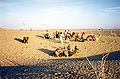
While Jaisalmer may always have been remote, it is filled with many artistic structures and monuments of local historical importance. Jaisalmer's medieval mud fortress and walled township make it a popular tourist destination. The surrounding desolate landscape evidences a stark, austere beauty. Camel safaris through the nearby desert dunes are popular with tourists; competition for business is fierce. A few quiet days spent wandering around the town and the surrounding desert can be a wonderful way of unwinding from the chaos of larger Indian cities.
Tourist accommodation is available inside the fort itself. However, eco-conscious tourists might consider staying outside the fort to avoid putting additional pressure on the fort's archaic sewage system (three of the 99 bastions have already crumbled because of water seeping into the foundations). In the past year, there have been hotels and residents inside the fort taking initiatives to help with restoration and avoid displacement. Visitors may want to check with the local hotels inside the fort and ask what they are doing to contribute. This action could lead to tourists inside the fort supporting expedited conservation efforts through awareness and action.
Visitor attractions
Jaisalmer Fort
Built in 1156 by the Bhati Rajput ruler Jaisal, it is situated on Trikuta Hill and had been the scene of many battles. Its massive sandstone walls are a tawny lion color during the day, turning to a magical honey-gold as the sun sets. The famous Indian film director Satyajit Ray wrote a detective novel and later turned it into a film – Sonar Kella (The Golden Fortress) which was based on this fort. This is a living fort and about a quarter of city's population still live inside the fort. The main attractions inside the fort are: Raj Mahal (Royal palace), Jain temples and the Laxminath temple.
Havelis
The main havelis in Jaisalmer are:
- Patwon-ki-Haveli: Built by Guman Chand Patwa (and later by his five sons), a wealthy merchant and banker who had over three hundred trading centres from Afghanistan to China. This ornate five-storey complex took fifty years to complete. This is the largest, the most magnificent, and the most elaborate of Jaisalmer havelis.
- Salim Singh-ki-Haveli: It was built by the scheming Prime Minister Salim Singh in 1815. It has a beautifully arched roof capped with blue cupolas and carved brackets in the form of peacocks.
- Nathmalji-ki-Haveli: Bult by a Prime Minister of princely state of Jaisalmer. Its facade is a riot of ornamentation: flowers, birds, elephants, soldiers, a bicycle and even a steam engine.
Museums
- Desert Culture Centre & Museum
- Jaisalmer Folklore Museum
- Government Museum
Other
- Gadsisar Lake
Excavated in 1367 by Rawal Gadsi Singh, it is a scenic rainwater lake surrounded by small temples and shrines.
In neighbourhood
- Bhattiani Sati Rani
- Bada Bagh

- Amar Sagar
- Lodhruva
- Mool Sagar
- Kuldhara
- Desert National Park
- Sam sand dunes
- Khuri village
- Akal Wood fossil Park
Desert Festival
This is held over three days in Jan/Feb every year. This is the best time to visit Jaisalmer to witness many performing arts like Kalbelia dances and folk songs and music.
Gallery
- Jaisalmer-1.jpg
- Jaisalmer-2.jpg
- Jaisalmer-3.jpg
- IMG 2512.JPG
- Jaisalmer forteresse.jpg
- Turbines-thar-india.jpg

See also
- Indira Gandhi Canal
- Pokhran
- Baba Ramdevji
Further reading
- Bhati, Hari Singh. 2002. ANNALS OF JAISALMER: A Pre-Mediaeval History. Kavi Prakashan, Bikaner.
- Gahlot, Sukhvirsingh. 1992. RAJASTHAN: Historical & Cultural. J. S. Gahlot Research Institute, Jodhpur.
- Somani, Ram Vallabh. 1993. History of Rajasthan. Jain Pustak Mandir, Jaipur.
- Tod, James & Crooke, William. 1829. Annals & Antiquities of Rajasthan or the Central and Western Rajput States of India. 3 Vols. Reprint: Low Price Publications, Delhi. 1990. ISBN 81-85395-68-3 (set of 3 vols.)
External links
- State Government of Rajasthan - Official home page
- Tourism Department of Rajasthan - Tourism Home Page
- Jaisalmer - The Golden City
- Jaisalmer and the Thar Desert - Photo gallery
- Hotels in Jaisalmer, Rajasthan
- Jaisalmer city info
ReferencesISBN links support NWE through referral fees
- Jaisalmer In Jeopardy
- Genealogy of the ruling chiefs of Jaisalmer
- Jaisalmer, Rajasthan
- The 1911 Edition Encyclopedia
| State of Rajasthan Rajasthan Topics | |
|---|---|
| Capital | Jaipur |
| Divisions | Ajmer | Bharatpur | Bikaner | Jaipur | Jodhpur | Kota | Udaipur |
| Districts | Ajmer | Alwar | Banswara | Baran | Barmer | Bhilwara | Bikaner | Bharatpur | Bundi | Chittorgarh | Churu | Dausa | Dholpur | Dungarpur | Ganganagar | Hanumangarh | Jaipur | Jaisalmer | Jalore | Jhalawar | Jhunjhunu | Jodhpur | Karauli | Kota | Nagaur | Pali | Rajsamand | Sawai Madhopur | Sikar | Sirohi | Tonk | Udaipur |
| Major cities | Alwar • Bhilwara • Bikaner • Jaipur • Jaisalmer • Jodhpur • Udaipur |
Credits
New World Encyclopedia writers and editors rewrote and completed the Wikipedia article in accordance with New World Encyclopedia standards. This article abides by terms of the Creative Commons CC-by-sa 3.0 License (CC-by-sa), which may be used and disseminated with proper attribution. Credit is due under the terms of this license that can reference both the New World Encyclopedia contributors and the selfless volunteer contributors of the Wikimedia Foundation. To cite this article click here for a list of acceptable citing formats.The history of earlier contributions by wikipedians is accessible to researchers here:
The history of this article since it was imported to New World Encyclopedia:
Note: Some restrictions may apply to use of individual images which are separately licensed.