Christmas Island
| Territory of Christmas Island | |||||
| |||||
| Anthem: Advance Australia Fair | |||||
| Capital | Flying Fish Cove ("The Settlement") | ||||
|---|---|---|---|---|---|
| Largest city | capital | ||||
| Official languages | English (de facto) | ||||
| Government | Federal constitutional monarchy | ||||
| - Queen | Elizabeth II | ||||
| - Administrator | Neil Lucas | ||||
| - Shire President | Gordon Thomson | ||||
| Territory of Australia | |||||
| - Sovereignty transferred to Australia |
1957 | ||||
| Area | |||||
| - Total | 135 km² 52 sq mi | ||||
| - Water (%) | 0 | ||||
| Population | |||||
| - 2006 estimate | 1,493 | ||||
| - Density | 11.06/km² n/a/sq mi | ||||
| Currency | Australian dollar (AUD)
| ||||
| Internet TLD | .cx | ||||
| Calling code | +61 | ||||
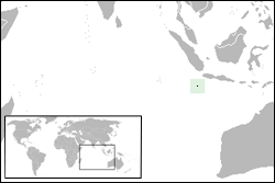
The Territory of Christmas Island is a small territory of Australia located in the Indian Ocean, 2650 kilometers (1645 mi) northwest of Perth in Western Australia, 360 kilometers (225 mi) south of Jakarta, Indonesia and 1350 kilometers (840 mi) South of Singapore.
It maintains about 1,600 residents who live in a number of "settlement areas" on the northern tip of the island: Flying Fish Cove (also known as Kampong), Settlement, Silver City , Poon Saan and Drumsite.
It has a unique natural topography and is of immense interest to scientists and naturalists due to the number of species of endemic flora and fauna which have evolved in isolation and undisturbed by human habitation.
While there has been mining activity on the island for many years, 65% of its 135 square kilometers (52 sq mi) are now National Park and there are large areas of pristine and ancient rainforest.
Geography
Christmas Island is a quadrilateral with hollowed sides, about 19 km (12 miles) in greatest length and 14.5 km (9 miles) in extreme breadth. The total land area is 135 km² (52 square miles), with 138.9 km (86.3 miles) of coastline.
Christmas Island is believed to be on a tectonic plate moving northwards. this plate is estimated to be moving at a rate of a few centimeters a year. Formation of Christmas Island, according to one theory is as follows:
- 60 million years ago an undersea volcano rose above the level of the ocean and a coral atoll was formed.
- 20 million years ago subsidence of the atoll began and limestone accumulated as the corals sank.
- 10 million years ago a series of uplifts reversed the subsidence and Christmas Island emerged. Because theses uplifts happened on several different occasions, Christmas Island has a stepped appearance. The combined effects of the erosion of the sea cliff and each successive uplift formed each individual terrace. Examples of some of the more recent faultings and lava flows can be seen at the Dales, Dolly Beach, Waterfall, Ross Hill Gardens, Winifred Beach and Egeria Point. There are also many examples of caves and sinkholes typical of limestone formations throughout Christmas Island. [1]
Rocky, sheer cliffs from 10-20 m high form most of the coastline, while the interior is a slightly undulating plateau that ranges from 160-360 m above sea level. Christmas Island also contains a few, small sand and coral rubble beaches. The central plateau is seperated from the shore by a a series of steep slopes or cliffs. [2]
Location: 10°30′S 105°40′E
Climate
Christmas Island is located at the southern edge of the equatorial low pressure belt that, during the coarse of the year, moves north and south of the equator. The island therefore experiences a typical tropical, equatorial climate with a wet and a dry season. The wet season, when the north-west monssons blow is generally from December to April with south-east trade winds bring slightly lower temperatures and humidity, and much less rain for the remainder of the year. The mean annual rainfall is 2154.0 mm. Heavy downpours lasting several days are common during the monsoon, Christmas ISland is sometimes affected by cyclones and cyclonic swells from the north-west. As with most tropical locations, humidity and temperatures vary little with humidity ranges from 80-90%, and temperature ranges from average maximum of 28º Celsius (March/April) to average minimums of 22º Celsius (August/September). [3] The island is mainly tropical rainforest, of which 65% is National Park.
Flora and fauna
Christmas Island is of immense scientific value as it was uninhabited until the late nineteenth century, so many unique species of fauna and flora exist which have evolved independently of human interference. Among the best-known is the Christmas Island red crab, which numbered some 100 million on the island as of 2004 . Two-thirds of the island has been declared a National Park which is managed by the Australian Department of Environment and Heritage through Parks Australia.
There are around 200 species of native flowering plants on the island. The distribution of these plants is related to the depth of the soil, the soil's moisture retention and exposure to and distance from the sea. The dense rainforest has evolved in the deep soils of the plateau and on the terraces. The forests are dominated by twenty-five tree species. Ferns, orchids and vines grow on the branches in the humid atmosphere beneath the canopy. The 135 plant species include sixteen which are only found on Christmas Island.
The annual red crab mass migration (around 100 million animals) to the sea to spawn has been called one of the wonders of the natural world [4] and takes place each year around November, after the start of the wet season and in synchronization with the cycle of the moon.
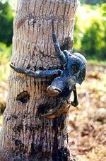
The land crabs and sea birds are the most noticeable animals on the island. Twenty terrestrial and intertidal crabs (of which thirteen are regarded as true land crabs, only dependent on the ocean for larval development) have been described. Robber crabs, known elsewhere as coconut crabs, also exist in large numbers on Christmas Island and are capable of opening and devouring coconuts with their strong claws.
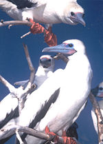
Christmas Island is a focal point for sea birds of various species. Eight species or subspecies of sea birds nest on the island. The most numerous is the Red-footed Booby that nests in colonies, in trees, on many parts of the shore terrace. The widespread Brown Booby nests on the ground near the edge of the seacliff and inland cliffs. Abbott's Booby (listed as endangered) nests on tall emergent trees of the western, northern and southern plateau rainforest. The Christmas Island forest is the only nesting habitat of the Abbott's Booby left in the world. The endemic Christmas Island Frigatebird (listed as endangered) has nesting areas on the north-eastern shore terraces. Great Frigatebirds nest in semi-deciduous trees on the shore terrace with the greatest concentrations being in the North West and South Point areas. The Common Noddy and two species of bosuns or tropicbirds with their brilliant gold or silver plumage and distinctive streamer tail feathers also nest on the island. Of the ten native land birds and shorebirds, seven are endemic species or subspecies. Some 76 vagrant and migrant bird species have been recorded.
History
For centuries, Christmas Island's isolation and rugged coasts provided natural barriers to settlement. British and Dutch navigators first included the island on their charts from the early seventeenth century, and Captain William Mynors of the British East India Company vessel, the Royal Mary, named the island when he passed by on Christmas Day, 25 December 1643. The island first appears on a map produced by Pieter Goos and published in 1666 . Goos had labeled the island Moni.
The earliest recorded visit was in March 1688 by William Dampier of the British ship Cygnet, who found it uninhabited. An account of the visit can be found in Dampier's Voyages, which describes how, when trying to reach Cocos from New Holland, his ship was pulled off course in an easterly direction and after 28 days arrived at Christmas Island. Dampier landed at the Dales (on the West Coast) and two of his crewmen were the first recorded people to set foot on Christmas Island.
The next visit was by Daniel Beekman, who described it in his 1718 book, A Voyage to and from the Island of Borneo, in the East Indies.
In 1771, the Indian vessel, the Pigot, attempted to find an anchorage but was unsuccessful; the crew reported seeing wild pigs and coconut palms. However, pigs have never been introduced to the island, so the Pigot may have found a different island.
Exploration and annexation
The first attempt at exploring the island was in 1857 by the crew of the Amethyst. They tried to reach the summit of the island, but found the cliffs impassable.
During the 1872-76 Challenger expedition to Indonesia, naturalist Dr John Murray carried out extensive surveys.
In 1887 , Captain Maclear of HMS Flying Fish, having discovered an anchorage in a bay that he named Flying Fish Cove, landed a party and made a small but interesting collection of the flora and fauna. In the next year, Pelham Aldrich, on board HMS Egeria, visited it for ten days, accompanied by J. J. Lister, who gathered a larger biological and mineralogical collection.
Among the rocks then obtained and submitted to Sir John Murray for examination were many of nearly pure phosphate of lime, a discovery which led to annexation of the island by the British Crown on 6 June 1888.
Settlement and exploitation
Soon afterwards, a small settlement was established in Flying Fish Cove by G. Clunies Ross, the owner of the Keeling Islands (some 900 kilometers to the south west) to collect timber and supplies for the growing industry on Cocos.
Phosphate mining began in the 1890s using indentured workers from Singapore, China, and Malaysia.
The island was administered jointly by the British Phosphate Commissioners and District Officers from the United Kingdom Colonial Office through the Straits Settlements, and later the Crown Colony of Singapore.
Japanese invasion
During World War II, many of the European residents of Christmas Island were evacuated in anticipation of a Japanese invasion. Japan invaded and occupied the island in 1942, as the Indian garrison mutinied, and interned the residents until the end of World War II in 1945. For a short time after the war, Christmas Island came under the jurisdiction of the new Colony of Singapore.
Transfer to Australia
At Australia's request, the United Kingdom transferred sovereignty to Australia in 1957. The Australian government paid the government of Singapore £2.9 million in compensation, a figure based mainly on an estimated value of the phosphate foregone by Singapore.
The first Australian Official Representative arrived in 1958 and was replaced by an Administrator in 1968. Christmas Island and the Cocos (Keeling) Islands together are called the Australian Indian Ocean Territories and since 1997 share a single Administrator resident on Christmas Island.
Since the late 1980s or early 1990s Christmas Island periodically received boatloads of refugees, mostly from Indonesia. Early in the Twenty-first Century, John Howard, the Australian Prime Minister, passed legislation through the Australian Parliament which excised Christmas Island from Australia's migration zone, meaning that asylum seekers arriving there could not automatically apply to the Australian government for refugee status, allowing the Australian navy to relocate them to other countries (Papua New Guinea's Manus Island, and Nauru) as part of the so-called Pacific Solution.
Government
Christmas Island is a non-self governing territory of Australia, administered by the Australian Department of Transport and Regional Services (DOTARS). The legal system is under the authority of the Governor General of Australia and Australian law. An Administrator (Neil Lucas, as of 28 January 2006) appointed by the Governor-General of Australia represents the monarch and Australia.
The Australian Government provides Commonwealth-level government services through the Christmas Island Administration and DOTARS. Together with the Cocos (Keeling) Islands, Christmas Island forms the Australian Government's Indian Ocean Territories (IOT).
The Christmas Island Act 1958, administered by the Australian Federal Government's Department of Transport and Regional Services on behalf of the Minister for Local Government, Territories and Roads, provides the legislative basis for the Territory's administrative, legislative and judicial system. The Minister is responsible for the State-level services in the Territory.
Christmas Island residents who are Australian citizens also vote in Commonwealth (federal) elections. Christmas Island residents are represented in the House of Representatives through the Northern Territory electorate of Lingiari and in the Senate by Northern Territory Senators.
State Government
There is no State Government; instead, state government type services are provided by contractors, including departments of the Western Australian Government, with the costs met by the Australian (Commonwealth) Government.
Local Government
The Local Government Act 1995 (WA)(CI) was introduced in 1992. The first Shire Council was elected in 1993. The Shire Council has the same responsibilities as a local government on the Australian mainland. A unicameral Shire of Christmas Island with 9 seats provides local government services and is elected by popular vote to serve four-year terms. Elections are held every two years, with half the members standing for election.
In early 1986 , the Christmas Island Assembly held a design competition for an island flag; the winning design was adopted as the informal flag of the territory for over a decade, and in 2002 it was made the official flag of Christmas Island. The blue and green triangles represent the sea surrounding the island and the vegetation of the island. The Southern cross in the blue triangle is the representation appearing in the Australian flag. The image in the green triangle is the Golden Bosun Bird, which is unique to the island. The gold disk in the center of the flag represents the island's phosphate mining history and was originally included to provide a background for the green map of Christmas Island.
The Australian Federal Police (AFP) are responsible for providing police services to the Community of Christmas Island. No firearms are allowed on Christmas Island. In addition to the normal police functions the AFP carry out other duties including immigration, processing of aircraft, visiting ships and yachts; and co-ordination of emergency operations.
Economy
Phosphate mining had been the only significant economic activity, but in December 1987 the Australian Government closed the mine. In 1991 , the mine was reopened by a consortium which included many of the former mine workers as shareholders. With the support of the government, a $34 million casino opened in 1993 . The casino closed in 1998 and has not re-opened. The Australian Government in 2001 agreed to support the creation of a commercial spaceport on the island, however this has not yet been constructed, and appears that it will not proceed in the future. The Australian Government began construction of an Immigration Reception and Processing Centre (IRPC) on the island located at North West Point. The IRPC is due to be completed in late 2007. The facility is estimated to cost $210 million, and will contain 800 beds.
Government and transport also contribute significantly to the economy. The Government sector includes administration, health, education, policing and defense.
Tourism, hospitality and retail trade is an important income earner. It is estimated that the industry was worth $3-5m in 2003.
Tourism
The Christmas Island National Park covers 63% of the island. This means that for the visitor interested in flora and fauna there is a great deal to see. The same is true for the coastal waters where the marine life is equivalently spectacular. The coral reefs that surround the island offer tourists breathtaking snorkeling and scuba diving opportunities. Nature walks, blowholes, caves, golf, bird watching and beaches are also polular with visitors to Christmas Island. A range of hotel and self contained accommodation is available on Christmas Island.
Each year, between October and January the famous migration of large numbers (estimated at 100 million) of red crabs occurs as they return to spawn.
Communications and Transportation
Telephone services are provided by Telstra and are a part of the Australian network with the same prefix as Western Australia (08).There is full interstate access by phone or fax to and from the Australian mainland. A Telstra GSM Mobile Telephone Service operates on the Island. Four free-to-air television stations from Australia are broadcast (ABC, SBS, GWN and WIN) in the same time-zone as Perth. Radio broadcasts from Australia include ABC Radio National, ABC Regional radio and Red FM. All services are provided by satellite links from the mainland. Radio 6RCI is the local radio station, transmitting on 105.3FM from Rocky Point and 102.1FM from Drumsite. Transmissions are in English, Malay and Chinese and the station is staffed by volunteer announcers. Broadband internet became available to subscribers in urban areas in mid 2005.
A local newspaper The Islander is produced bi-weekly by the Shire of Christmas Island and is available throughout the Island.
Direct flights operate to Christmas Island from either Perth, Cocos Islands and Singapore. Flights are operated by AUSTASIA AIRLINES (Using SilkAir A320 Charter) or NATIONAL JET SYSTEMS.
A container port exists at Flying Fish Cove with an alternative container unloading point to the south of the island at Norris Point for use during the December to March "swell season" of seasonal rough seas.
The road network covers most of the island and is generally good quality, although four wheel drive vehicles are needed to access some more distant parts of the rain forest or the more isolated beaches.
Demographics
As of 2006, the estimated population is 1,493. (The Australian Bureau of Statistics reports a population of 1,508 as of the 2001 Census.)
The 2001 Census lists the ethnic composition as 60% Chinese, 10-15% European and 25-30% Malay. Religions practiced on Christmas Island include Buddhism 75%, Christianity 12%, Islam 7% and others 4%. English is the official language, but Chinese and Malay are also spoken.
Education
The Christmas Island District High School provides education from pre-school level through to Year 12 secondary level. The school is staffed by teachers from the Education Department of Western Australia and follows the state curriculum.
There is one public library on the island, the Shire of Christmas Island Public Library.
Culture
Christmas Island’s culture has influenced by the diversity of the settlers' native tongues and cultures. This is evidenced by the range of ethnic festivals held throughout the year. Today most residents are Chinese followed by Australian/Europeans and Malay. All Christmas Islanders are permanent residents of Australia and the most hold Australian citizenship.
Language
English is the official language of Christmas Island although there are many residents who communicate in Malay or one of the four Chinese dialects. Early Christmas Island settlers spoke English & Cocos Malay, a unique version of Bahasa Indonesia which has been isolated from the mainstream language for over 150 years. Early Chinese arrivals mainly spoke Cantonese, and many early place names around the island are Cantonese words - such as Poon Saan- literally meaning half way up the hill.
Arrivals from Penang after World War II introduced other Chinese languages including Hakka, Hainese, Hokkien and Teochew, whilst those from Singapore introduced Mandarin. Bahasa Malayu is widely spoken by the Malay Community.
A sizeable proportion of Christmas Island’s community is not fluent in English and many residents still converse in their native tongue. Tourism has had an impact on the island's language. Indonesian is frequently spoken along with many of the Chinese languages. Thai, Japanese, German and a few other European languages are sometimes heard.
Religion
Differing languages and religious beliefs work in harmony on Christmas Island, despite the diversity of races. The different cultures freely share and borrow from each others and religious tolerance is evident from the number of Chinese temples-Buddhist, Taoist, Confucian and others as well as a Christian church, Muslim Mosque and a Baha'i Centre. Christmas, Easter, Chinese New Year & Hari Raya are some of the religious and cultural festivals are observed on the island.The increased number of holidays and festivals that are celebrated on the island is evidence of this multicultural mix and the adaptation and blending of cultures.
Notes
- This article contains material from the CIA World Factbook which, as a U.S. government publication, is in the public domain.
- ↑ Commonwealth of Australia - Department of the Environment and Water Resources. Christmas Island - Physical Characteristics, Retrieved August 31, 2007.
- ↑ Commonwealth of Australia - Department of the Environment and Water Resources. Christmas Island - Physical Characteristics, Retrieved August 31, 2007.
- ↑ Commonwealth of Australia - Department of the Environment and Water Resources. Christmas Island - Physical Characteristics, Retrieved August 31, 2007.
- ↑ Commonwealth of Australia - Geoscience Australia. Christmas Island, Retrieved August 31, 2007.
Sources and further reading
- CIA World Factbook 2002
- The Wilderness Society. Defending Australia's Wildcountry, Retrieved August 31, 2007.
- Andrews, Charles. 1899. A description of Christmas Island (Indian Ocean). Within Geographical Journal; # 13 - 1, pp. 17-35.
- Andrews, Charles William. 1900. A monograph of Christmas Island (Indian Ocean): physical features and geology. London: [s.n.].
- National Library of Australia. 1979. The Indian Ocean: a select bibliography of resources for study in the National Library of Australia. Canberra: National Library of Australia. ISBN 0642991502
- Wharton, W. J. L. 1888. Account of Christmas Island, Indian Ocean. Within Proceedings of the Royal Geographical Society and Monthly Record of Geography, #10, pp. 613-624.
External links
- Christmas Island Shire official website
- Christmas Island Act 1958
- Christmas Island at the Open Directory Project
- Christmas Island in the CIA World Factbook
- Christmas Island Travel Guide from Unearth Travel a creative commons travel wiki
- Flag of the World Website
- Australian Government Department of Transport and Regional Services Official Website
- Christmas Island Tourism Association Website A tourist guide to Christmas Island
Credits
New World Encyclopedia writers and editors rewrote and completed the Wikipedia article in accordance with New World Encyclopedia standards. This article abides by terms of the Creative Commons CC-by-sa 3.0 License (CC-by-sa), which may be used and disseminated with proper attribution. Credit is due under the terms of this license that can reference both the New World Encyclopedia contributors and the selfless volunteer contributors of the Wikimedia Foundation. To cite this article click here for a list of acceptable citing formats.The history of earlier contributions by wikipedians is accessible to researchers here:
The history of this article since it was imported to New World Encyclopedia:
Note: Some restrictions may apply to use of individual images which are separately licensed.

