Transportation in South Korea
Overview
An extensive networks of railways, highways, bus routes, ferry services, and air routes that criss-cross the country comprise Transportation in South Korea.
Railways
History
1899-1989. South Korea's railroad network links the entire country. The first railroad linking Seoul and Inch'on openeded September 1899. The Japanese construced other major lines during the colonial period, including Mokpo, Masan, and Busan lines. They connected to Seoul and Sinuiju in North Korea linking with the Trans-Siberian Railway. The Korean War badly damaged the railroad network, which the South Korean governments rebuilt and improved. The establishment of the DMZ severed railroad lines between North and South Korea.
Throughout the 1970s and 1980s, the Korean National Railroad, a state-run corporation under the Ministry of Transportation, managed all rails, electrifying heavily used tracks and laying additional tracks. Railroads in the 1980s primarily transported freight, but they also carried significant passenger traffic around Seoul and in the heavily-traveled corridor linking the capital with the southern port of Pusan. Although the railroad system grew little during the 1980s (with 5,600 kilometers of tracks in 1980), rail improvements—the increased electrification of tracks, replacement of older tracks, and the addition of rolling stock— allowed rail traffic to boom. Some of the busiest lines south of Seoul linking the capital with Pusan and Mokpo had three or four tracks. The 1980s also saw the introduction of high-speed trains connecting Seoul with Busan, Jeonju, Mokpo, and Gyeongju. The famous "Blue Train" (Saemaul-ho) between Seoul and Busan (via Daejeon and Daegu) took only four hours and fifty minutes and offered two classes of service, first class and special. In 1987 approximately 525 million passengers and 59.28 million metric tons were transported by the railroad system.
In 1987, the combined length of the country's railroad network measured approximately 6,340 kilometers, including approximately 761.8 kilometers of doubletrack railroads and 1,023 kilometers of electric railroads. Electrified Suburban lines connected to the Seoul subway system. Rolling stock included 459 diesel locomotives, 90 electric locomotives, 133 motor coaches, and 370 electric motor cars. In 1989, the Ministry of Transportation and Construction opened negotiations for the construction of a high-speed railway systems similar to those in Japan and France. The Korail (en) (ko) is the sole passenger railway operator.
1990 to 2007. Total railroad passengers in South Korea have decreased since 1990s. Despite continuous road construction, railways still constitute one of the primary means by which South Koreans travel over long distances within the country. In 2002, 3,124 km (1,941 mi) of track and that incresed to 3,472 km (1,361 km electrified) in 2005.
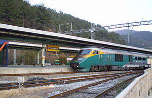
High-speed service. The high-speed railway known as Korea Train Express (KTX) currently operates between Seoul and Busan or Mokpo. The railway uses French TGV technology. Service started in April 2004—with some sections op erating along preexisting track—while service on the railway's fully separated tracks will begin in 2010. Trains reach a maximum speed of 300 km/h on dedicated high-speed tracks.
South Korean KTX engineers established HSR-350x independently, making South Korea one of the top four High-speed train producing nations in the world. In 2007-2008, HSR-350x will be on service in Honam Line. High-speed trains operate on normal tracks as well, including a tilting train called TTX(Tilting Train eXpress). Announcement of TTX service on the Gyeongbu and Honam line, using an ATP safety system, is expected.
Currently, these lines provide high-speed service:
- Gyeongbu Line(KTX): Haengsin(depot) - Seoul - Gwangmyeong - Cheonan-Asan - Daejeon - Dongdaegu - Miryang - Gupo - Busan
- Honam Line(KTX): Haengsin(depot) - Yongsan - Gwangmyeong - Cheonan-Asan - Seodaejeon - Nonsan - Iksan - Gimjae - Jeongeup - Jangseong - Gwangju/Songjeongni - Naju - Mokpo
Railroad Service between South and North Korea
Until the division of Korea following the end of the Second World War, the Gyeongi Line and Gyeongwon Line extended into what is now North Korea. The Gyeongi Line connected Seoul to Kaesŏng, P'yŏngyang, and Shinŭiju on the Chinese border, while the Gyeongwon Line served Wŏnsan on the east coast. Another line—the Kŭmgang-san Line—connected the Southern city of Cheorwon on the Gyeongwon Line to Mt. Kŭmgang in the North. The Gyeongui Line is one of two lines whose south and north halves are now being reconnected, the other line being the Donghae Bukbu Line. On 17 May two test trains ran on the reinstalled lines; one on the west from Munsan to Kaesong; the second on the east from Jejin to Kumgang.[1]
Railway Lines
The principal railway line is the Gyeongbu Line (경부선), which connects the capital and largest city (Seoul) with the country's second largest city and largest seaport (Busan); the second is Honam Line (호남선), which branches off of the Gyeongbu Line at Daejeon, and ends at Gwangju or Mokpo. Here is a table of major railway lines in South Korea:
| Line | Name in Hangul | Major Stations Served | Operater |
|---|---|---|---|
| Gaya Line | 가야선 | Gaya | Korail |
| Bukjeonju Line | 북전주선 | Jeonju | |
| Yeocheon Line | 여천선 | Yeocheon | |
| Gyeongbu Line | 경부선 | Seoul, Daejeon, Dongdaegu, Busan | |
| Gyeongui Line | 경의선 | Seoul, Paju | |
| Seoul Gyowoi Line | 서울교외선 | Goyang, Yangju, Uijeongbu | |
| Gyeongin Line | 경인선 | Guro, Bupyeong Incheon | |
| Gyeongwon Line | 경원선 | Yongsan, Cheongnyangni, Uijeongbu, Soyosan, Sintanni | |
| Gyeongchun Line | 경춘선 | Cheongnyangni, Chuncheon | |
| Janghang Line | 장항선 | Cheonan, Janghang | |
| Chungbuk Line | 충북선 | Jochiwon, Cheongju, Chungju, Bongyang | |
| Honam Line | 호남선 | Seodaejeon, Iksan, Songjeongni, Naju, Mokpo | |
| Jeolla Line | 전라선 | Iksan, Jeonju, Suncheon, Yeosu | |
| Jungang Line | 중앙선 | Cheongnyangni, Wonju, Jecheon, Yeongju, Andong, Gyeongju | |
| Gyeongbuk Line | 경북선 | Gimcheon, Yeongju | |
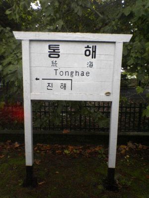
| Yeongdong Line | 영동선 | Yeongju, Donghae, Gangneung | |
| Taebaek Line | 태백선 | Jecheon, Taebaek | |
| Donghae Nambu Line | 동해남부선 | Bujeon, Ulsan, Gyeongju, Pohang | |
| Donghae Bukbu Line | 동해북부선 | Jejin | |
| Gyeongjeon Line | 경전선 | Samnangjin, Masan, Jinju, Suncheon, Songjeongni | |
| Jinhae Line | 진해선 | Jinhae | |
| Jeongseon Line | 정선선 | Jeongseon | |
| Mungyeong Line | 문경선 | Mungyeong | |
| Gaun Line | 가은선 | Gaun | |
| Gwangju Line | 광주선 | Songjeongni, Gwangju | |
| Hwasun Line | 화순선 | Jangdong | |
| Gunsan Line | 군산선 | Gunsan | |
| Okgu Line | 옥구선 | Okgu | |
| A'REX | 인천국제공항철도 | Gimpo Airport, Incheon Airport | Airport Express Co. |
(high-speed service is available for bold lines)
For former or proposed railway lines, see also the articles on the Gimpo Line, Suin Line, Suryo Line, and Kŭmgang-san Line.For planned or constructing lines, see Jungbunaeryuk Line and Gangwon Line. No railway service exits on Jeju Island.
Classes of service
Most routes enjloy frequent service, with trains every 15-60 minutes connecting Seoul to all major South Korean cities. Four classes of train operate: KTX, the Korean high-speed railway system, travels from downtown Seoul to downtown Busan faster than an airplane, makes less stops and yet costs more; the Saemaul-ho (새마을호, "New Village") service, makes the fewest stops and provides the most comfortable seating; Mugunghwa-ho (무궁화호, "Rose of Sharon") service, popular with most Koreans, stops at most stations, and offers a mixture of reserved and unreserved seating; and Commuter (통근 열차) service, the slowest and cheapest of the three, stops at all stops, and offers no reserved seating.
Subways
Main article: Subways in South Korea
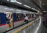
South Korea's six largest cities—Seoul, Busan, Daegu, Gwangju, Daejeon and Incheon—all have subway systems.
Seoul's subway system is the oldest system in the country, with the Seoul Station-Cheongnyangni section of Line 1 opening in 1974.
Streetcars
Streetcars operated in Seoul from the turn of the 20th century until roughly 1970. The network covered the whole downtown area (Junggu and Jongnogu) as well as surrounding neighbourhoods, including Cheongnyangni in the east, Mapogu in the west, and Noryangjin across the Han River to the south. The network was largely replaced by the subway system whose construction began in the early 1970s. Lines 1 and 2 follow the old streetcar routes along Jongno and Euljiro respectively.
Buses
Regional services
Virtually all towns in South Korea of any size whatsoever are served by regional bus service. Regional routes are classified as Gosok bus ("high speed." express bus) or Shioe bus (pronounced "shee-way" — literally, "suburban." intercity bus) with Gosok buses operating over the longer distances and making the fewest (if any) stops en route. Shioe buses typically operate over shorter distances, are somewhat slower, and make more stops.
The expansion and rapid improvement of South Korea's long-distance highway system led to the growth of an excellent intercity bus system in the 1980s. In 1988 there were ten express bus companies operating a fleet of some 900 buses connecting all of the major cities of Korea.
Local services
Within cities and towns, two types of city bus operate in general: Jwaseok ("coach") and Doshihyeong or Ipseok ("city type" or "standing"). Both types of bus often serve the same routes, make the same(or less) stops, and operate on similar frequencies, but Jwaseok buses are more expensive, offer comfortable seating; while Doshihyeong buses are cheaper, have fewer and less comfortable seats. Many small city and town does not have Jwaseok bus and their buses are officially called Nongeochon Bus("bus of rural area").
Some cities have their own bus classifying system.
| 'Traditional' type of bus | Seoul | Busan | Daegu |
|---|---|---|---|
| Jwaseok | Rapid ("gwangyeok," red) Trunk ("ganseon," blue) |
Rapid ("geuphaeng") Coach ("jwaseok") |
Rapid ("geuphaeng") |
| Doshihyeong/Ipseok | Trunk ("ganseon," blue) Branch ("jiseon," green) |
Regular("ilban") | Circulation("sunhwan") Trunk("ganseon") Branch("jiseon"). |
| Village | Branch ("jiseon," green) Circulation ("sunhwan," yellow) |
Village ("maeul-bus") | N/A |
Other services
Incheon International Airport is served by an extensive network of comfortable, high-speed buses from all parts of the country. While many department stores had their own small network of buses for shoppers before, this is no longer so due to government regulations. However, most churches and daycares still send buses around to pick up their congregants or pupils.
Roads
Main article: Roads and Expressways in South Korea
Roads and expressways rapidly expanded during the late 1980s, before and after the 1988 Olympics. Although the total kiometers of roads rapidly increased, the construction failed to keep pace with the flood of cars and trucks on Korean roadways. In 1988, Horea registered 51,000 kilometers of roadways, less than half unpaved. Express highways between major cities measured 1,539 kilometers in 1988,compared to 86.8 kilometers in 1967. With few cars and trucks on the roads in the 1960s, traffic congestion never happened. That changed with the explosive sale of Korean made automobiles in the late 1980s. In 1989 the government started construction on nine new expressways with a combined length of 1,243 kilometers. In 1996, the expressways and two additional projects completed, South Korea had twenty-one expressways with a combined length of 2,840 kilometers.
The total number of motor vehicles climbed rapidly in the 1980s with 845,000 passenger cars and 748,000 commercial vehicles in 1988, up from a combined total of about 744,000 in 1980. In 1988 South Korean automakers produced 504,000 vehicles for domestic sale and 576,134 vehicles for export. In the first nine months of 1989, domestic sales reached nearly 800,000 vehicles.
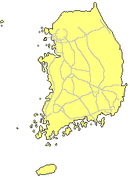
Highways in South Korea are classified into freeways (expressways/motorways), national highways, and various classifications below the national level. All freeways are toll highways, and all freeways except Route 130 are operated by the Korea Highway Corporation (Website). The freeway network serves all parts of South Korea. The Highway Corporation operates excellent service amenities (dining and service facilities) en route. Click here for a map of the freeway system.
Need updating from 1988 to 2007.
total:
86,990 km
paved:
64,808 km (including 1,996 km of expressways)
unpaved:
22,182 km (1998 est.)
Waterways
1,609 km; use restricted to small native craft
Ferries
Virtually cut off from the Asian mainland, South Korea is a seafaring nation, with one of the world's largest shipbuilding industries and an extensive system of ferry services. As one of the world's most advanced IT technology exporters, South Korea operates one of the largest merchant fleets that sail regularly to China, Japan, and the Middle East. Most fleet operators are large conglomerates, while most ferry operators are small, private operators. The south and west coasts of the country are dotted with small islands which are served by ferries. In addition, the larger offshore Jeju and Ulleung Islands are also served by ferry. Ferries also operate between South Korea, China, and Japan. Major centers for ferry service include Incheon, Mokpo, Pohang, and Busan.
Ports and Harbours
Jinhae, Incheon, Gunsan, Masan, Mokpo, Pohang, Busan, Donghae, Ulsan, Yeosu, Jeju
Merchant Marine
total:
461 ships (1,000 GRT or over) totaling 5,093,620 GRT/8,100,634 DWT
ships by type:
bulk 98, cargo 149, chemical tanker 39, combination bulk 4, container 53, liquefied gas 13, multi-functional large load carrier 1, passenger 3, petroleum tanker 61, refrigerated cargo 26, roll-on/roll-off 4, specialized tanker 4, vehicle carrier 6 (1999 est.)
Air Travel
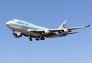
Although most interurban travel was either by express bus or by train, air service between major cities was increasingly available and popular, especially among business travelers. Korean Air, founded by the government in 1962 and privately owned since 1969, was South Korea's sole airline until 1988. Korean Air served nine major domestic routes in 1988 and also offered international service to Japan, the United States, Canada, West Germany, France, Hong Kong, Iraq, Libya, Malaysia, the Philippines, Saudi Arabia, Singapore, Switzerland, Taiwan, Thailand, and the United Arab Emirates. A second carrier, Asiana Airlines, was established in 1988 to serve three domestic cities. To accommodate the rapidly growing number of air travelers, Incheon International Airport (serves Seoul) opened in 2000. There also were international airports at Gimpo(serves Seoul), Gimhae(serves Busan), Jeju, Cheongju, and Yangyang. Some international/domestic airports are under construction.
Airlines
South Korea is served by two international airlines: the largest carrier being Korean Air (Website) and the second largest carrier being Asiana Airlines (Website). Both provide frequent domestic service and operate extensive international networks. There are also two small domestic airliners (Hansung Airlines, Jeju Air) on service with much lower fares.
Airports
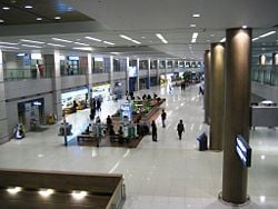
Seoul is served by two airports: Incheon International Airport (Website) and Gimpo International Airport (formerly Kimpo International Airport)(Website). International routes mainly serve Incheon, while domestic services mainly use Gimpo. Other major airports are located at Busan and Jeju.
Number of airports: 103 (1999 est.)
Airports - with paved runways:
total:
67
over 3,047 m:
1
2,438 to 3,047 m:
18
1,524 to 2,437 m:
15
914 to 1,523 m:
13
under 914 m:
20 (1999 est.)
Airports - with unpaved runways:
total:
36
over 3,047 m:
1
914 to 1,523 m:
3
under 914 m:
32 (1999 est.)
Heliports: 203 (1999 est.)
Notes
- This article contains material from the Library of Congress Country Studies, which are United States government publications in the public domain.
- ↑ "Korean trains in historic link-up", BBC News, 2007-05-17. Retrieved 2007-05-17.
ReferencesISBN links support NWE through referral fees
- Kim, Jeffrey H. 2003. Strategies for developing an intelligent transportation systems industrial base in South Korea. Thesis (S.M.)—Massachusetts Institute of Technology, Engineering Systems Division, Technology and Policy Program, 2003. OCLC: 55087812
- Kim, Tschangho John, and Sunduck Suh. 1990. Advanced transport and spatial systems models: applications to Korea. New York: Springer-Verlag. ISBN 9780387972770
- Korea. 1999. Science and technology, transportation: implementing arrangement between the United States of America and the Republic of Korea, signed at Washington June 12, 1995. Washington, D.C.: Dept. of State. OCLC: 43110498
External Links
- South Korea Transportation. Retrieved August 6, 2007.
- South Korea Transportation & Trucking News: Transportation & Tourism. Retrieved August 6, 2007.
- Transportation in South Korea. Retrieved August 6, 2007.
See also
- List of Korea-related topics
- Transportation in North Korea
Credits
New World Encyclopedia writers and editors rewrote and completed the Wikipedia article in accordance with New World Encyclopedia standards. This article abides by terms of the Creative Commons CC-by-sa 3.0 License (CC-by-sa), which may be used and disseminated with proper attribution. Credit is due under the terms of this license that can reference both the New World Encyclopedia contributors and the selfless volunteer contributors of the Wikimedia Foundation. To cite this article click here for a list of acceptable citing formats.The history of earlier contributions by wikipedians is accessible to researchers here:
The history of this article since it was imported to New World Encyclopedia:
Note: Some restrictions may apply to use of individual images which are separately licensed.
