Difference between revisions of "Template: Location map/doc" - New World Encyclopedia
(Auto-import and credit) |
Svemir Brkic (talk | contribs) m (Cleanup) |
||
| Line 1: | Line 1: | ||
{{template doc page}} | {{template doc page}} | ||
<!-- DOCUMENTATION --> | <!-- DOCUMENTATION --> | ||
| − | Creates a location map as a [[m:Help:composite images|composite image]] of an existing map in [[equirectangular projection]] with a marker and an optional label superimposed onto it. | + | Creates a location map as a [[m:Help:composite images|composite image]] of an existing map in [[equirectangular projection]] with a marker and an optional label superimposed onto it. Note: |
:* Using "caption=xxx" frames the map (empty "caption=" leaves map unframed); | :* Using "caption=xxx" frames the map (empty "caption=" leaves map unframed); | ||
:* The marker/label is not checked for valid latitude/longitude & could land anywhere on the article page, even beyond the bottom; | :* The marker/label is not checked for valid latitude/longitude & could land anywhere on the article page, even beyond the bottom; | ||
| Line 213: | Line 213: | ||
[[Category:Mapping templates]] | [[Category:Mapping templates]] | ||
| − | |||
| − | |||
| − | |||
| − | |||
| − | |||
| − | |||
| − | |||
| − | |||
| − | |||
| − | |||
| − | |||
| − | |||
| − | |||
| − | |||
| − | |||
| − | |||
[[sq:Stampa:Harta e pozicionit]] | [[sq:Stampa:Harta e pozicionit]] | ||
| − | |||
| − | |||
| − | |||
| − | |||
| − | |||
</includeonly><noinclude> | </includeonly><noinclude> | ||
{{Credits|165161307}} | {{Credits|165161307}} | ||
</noinclude> | </noinclude> | ||
Latest revision as of 13:08, 14 May 2008
Creates a location map as a composite image of an existing map in equirectangular projection with a marker and an optional label superimposed onto it. Note:
- Using "caption=xxx" frames the map (empty "caption=" leaves map unframed);
- The marker/label is not checked for valid latitude/longitude & could land anywhere on the article page, even beyond the bottom;
- To suppress the marker, set marksize=1 pixel wide.
- To place multiple markers/labels, refer below to: See also.
- To map along converging longitudes, refer to: Template:Location_map_skew.
Usage
{{Location map
|location
|label      = label text
|label_size = map font size, per cent
|position   = left or right or top or bottom or none –
               position of the label relative to the mark, defaults to right
|background = color, background color for the label, defaults to none
|lon_dir=W    longitude: W=west, E=east (default)
|lat_dir=S    latitude: S=south, N=north (default)
|lat_deg    = latitude degrees
|lat_min    = latitude minutes
|lat_sec    = latitude seconds
|lon_deg    = longitude degrees
|lon_min    = longitude minutes
|lon_sec    = longitude seconds
|lat        = latitude (decimal format; enter negative numbers for southern latitude)
|long       = longitude (decimal format; enter negative numbers for western longitude)
|mark       = marker image file name, a red dot by default
|marksize   = marker size, default=8
|border     = border color or none
|caption    = map caption; for no caption enter "caption="; if the parameter is omitted then the caption will be "Marker text (location map name)"
|float      = left or right or center or none
|width      = map width
|AlternativeMap = Alternative map file name (changes background map, border coordinates are determined based on the map name); this is only recommended for use in templates }}
Parameter location refers to {Template:Location map location} containing the name and coordinates of a map.
Available maps
List of templates Template:Location map location (without "Template:" prefix here):
- Location map
- Location map/Info
- Location map/doc
- Location map Angola
- Location map Azerbaijan
- Location map Bolivia
- Location map Bosnia
- Location map Botswana
- Location map Burundi
- Location map Canada Nova Scotia
- Location map China
- Location map Croatia
- Location map Democratic Republic of the Congo
- Location map Ecuador
- Location map Eritrea
- Location map Germany
- Location map Gloucestershire
- Location map Greater London
- Location map Greece
- Location map Guatemala
- Location map Guinea
- Location map Guyana
- Location map India
- Location map Indonesia
- Location map Iran
- Location map Isle of Man
- Location map Israel
- Location map Israel north haifa
- Location map Kazakhstan
- Location map Kyrgyzstan
- Location map Lebanon
- Location map Mali
- Location map Morocco
- Location map Myanmar
- Location map Nepal
- Location map Nigeria
- Location map Northern Ireland
- Location map Pakistan
- Location map Peru
- Location map Poland
- Location map Republic of the Congo
- Location map Russia
- Location map Rwanda
- Location map Scotland
- Location map Senegal
- Location map Somerset
- Location map South Africa
- Location map Sri Lanka
- Location map Sudan
- Location map Switzerland
- Location map Tajikistan
- Location map Tanzania
- Location map Turkmenistan
- Location map UAE
- Location map UAE en-map.png
- Location map USA
- Location map USA Alaska
- Location map USA California
- Location map USA Hawaii
- Location map Uganda
- Location map United Kingdom
- Location map United Kingdom Leicestershire
- Location map Uzbekistan
- Location map Vietnam
- Location map Zambia
- Location map end
- Location map many
- Location map marker
- Location map start
See also Category:Location map templates (currently very incomplete, but useful for some subcategories).
Creating new maps
- Find an appropriate blank map in equirectangular projection.
- Create a template named Template:Location map location (copy the content of any other map template into it and enter appropriate values).
Examples
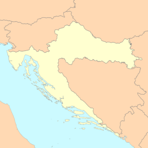
Map with the default label (degrees)
Pag (Croatia)
{{Location map
 |Croatia | label=Pag
 |mark=<!--dot-->Green pog.svg
 |lat_deg=44|lat_min=26
 |lon_deg=15|lon_min=3
 |position=right
 |width=300
 |float=right
}}
|
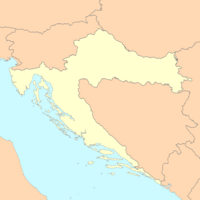
Map with the default label (decimal)
Pag (Croatia)
{{Location map | Croatia
 |label=Pag
 |lat= <!--decimal form--> 44.44
 |long=15.05
 |position=right
 |width= <!--smaller--> 200
 |float=right
}}
|
Marker/Label outside of Map
Pag (Croatia)
{{Location map | Croatia
 |label=Pag
 |lat=44.44
 |long=<!--outside map-->11.05
 |position=right
 |width=200
 |float=right
}}
|
Map with a custom label and text background
Imotski
{{Location map
 |Croatia
 |label=Imotski
 |lat=43.44
 |long=17.21
 |position=right
 |width=300
 |float=right
 |background=#FFFFDD
 |caption=Imotski on the map of Croatia
 }}
|
Map with enlarged marker and label
Pag (Croatia)
{{Location map
 |Croatia
 |label=Pag
 |label_size=200
 |lat=44.44
 |long=15.05
 |marksize=14
 |position=right
 |width=300
 |float=right
 |background=#FFFFDD
 |caption=Pag Island on the map of Croatia
 }}
|
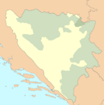
Map with no caption
Brčko (Bosnia and Herzegovina)
{{Location map
 |Bosnia
 |label=Brčko
 |position=left
 |width=150
 |lat=44.87
 |long=18.81
 |float=right
 |caption=
 }}
|
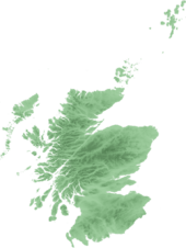
Western Hemisphere
Lockerbie (Scotland)
{{Location map
 |Scotland
 |label=Lockerbie  | marksize=9
 |mark=Blue_pog.svg
 |lat_dir=N | lat_deg=55 | lat_min=07
            | lat_sec=16
 |lon_dir=W | lon_deg=03 | lon_min=21
            | lon_sec=19
 |position=right
 |width=170
 |float=right
 |caption=Lockerbie in Scotland
}}
|
Country that crosses 180° meridian
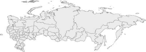
Uelen (Russia)
{{Location map
 |Russia
 |label=Uelen  | marksize=7
 |mark=Locator Dot.gif
 |lat_deg=66|lat_min=09
 |lon_deg=169|lon_min=48|lon_dir=W
 |position=left
 |width=500
 |float=left
 |background=yellow
}}
|
See also
- Template:Location map many - placing multiple markers/labels.
- Template:Location map+ - placing long list of markers/labels.
- Template:Location map skew - mapping along converging longitudes (non-equirectangular).
Credits
New World Encyclopedia writers and editors copied and adjusted this Wikipedia template in accordance with New World Encyclopedia standards. This article abides by terms of the Creative Commons CC-by-sa 3.0 License (CC-by-sa), which may be used and disseminated with proper attribution.The history of earlier contributions by wikipedians is accessible to researchers here:
The history of this article since it was imported to New World Encyclopedia:
Note: Some restrictions may apply to use of individual images which are separately licensed.
