Difference between revisions of "Gaborone" - New World Encyclopedia
Mike Butler (talk | contribs) |
Mike Butler (talk | contribs) |
||
| Line 178: | Line 178: | ||
* [[Nelson Ramaotwana]] | * [[Nelson Ramaotwana]] | ||
* [[Paul Rantao]] | * [[Paul Rantao]] | ||
| + | |||
| + | ==Further reading== | ||
| + | * Wiseman, John A. 1992. Botswana. World bibliographical series, v. 150. Oxford, Eng: Clio Press. ISBN 9781851091713 | ||
==References== | ==References== | ||
Revision as of 03:31, 13 November 2008
| Gaborone | |
| Modern buildings in Gaborone | |
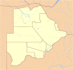
| Location of Gaborone in Botswana | |
| Coordinates: {{#invoke:Coordinates|coord}}{{#coordinates:24|39|29|S|25|54|44|E|type:city | |
|---|---|
| name= }} | |
| Country | Botswana |
| District | South-East |
| Elevation | 900 m (2,953 ft) |
| Population (1 January 2005) | |
| - Total | 208,411 |
| Time zone | GMT +2 (UTC) |
Gaborone (pronunciation: /ˌɡæbəˈroʊni/) estimated population 208,411 (1 January 2005), is the capital and largest city of the landlocked nation of Botswana, in Southern Africa It is the administrative capital of the South-East district of what is considered one of the most stable nation economically and politically on the continent.
Geography
Before 1969, the name was Gaberones, from Gaborone's Village, following the early practice of referring to African tribal capitals by the name of the chief, in this case Chief Kgosi Gaborone of the BaTlokwa. The old Gaberones became a suburb of the new Gaborone.
Gaborone lies in the flat valley between Kgale and Oodi Hills, on the Notwane River in the south eastern corner of Botswana, and 15 kilometers (9.3 mi) from the South African border.
Elevation
Gaborone has a semi-arid climate which is hot and dry for most of the year. There is little distinction between average summer and winter temperatures, although in winter months it can be chilly at night. Summers are extremely hot with high humidity in the mornings. The average maximum daytime temperature in January is 89.6°F (32°C), dropping to an average maximum of around 73.4°F (23°C) in July. Rain is erratic, but falls mostly in summer in heavy localised downpours that are followed quickly by a return of strong sunshine. Mean annual precipitation is 20.5 inches (523mm).
Size – land area, size comparison
Environmental issues The new city has a relatively good water supply, which has facilitated growth.
Districts A railway line divides the city into two. Suburbs in Gaborone include Broadhurst, Gaborone West, The Village, and Naledi. A posh suburb lies outside the city's boundaries - Phakalane. Here, one will find 5-star hotels, good restaurants, and a buzzing night life.
History
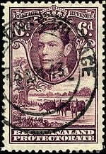
Before 1969, the city was known as Gaberones [1]. Gaberones replaced Mafeking as the capital of the Bechuanaland Protectorate in 1965. Mafeking (now Mafikeng) was outside the Bechuanaland Protectorate, in what is now the North West Province of South Africa, an odd arrangement that dated from the early colonial period. When the Protectorate became independent, Botswana needed a capital city within its territory; earlier it had been thought Lobatse might serve as capital but it was decided that it would be too limited, and instead a new capital city would be created adjacent to Gaberones, a small colonial administrative settlement. The original name, Gaberones, is from Gaborone's Village, following the early practice of referring to African tribal capitals by the name of the chief, in this case Chief Kgosi Gaborone of the BaTlokwa, whose village, now called Tlokweng, was just across a river from the "Government Camp" (colonial government headquarters). "Gabs" is still a common abbreviation for Gaborone, sometimes used in casual speech. A newer nickname for Gaborone is 'GC' or 'Gabz' as the city has grown in leaps and bounds over the last decade.
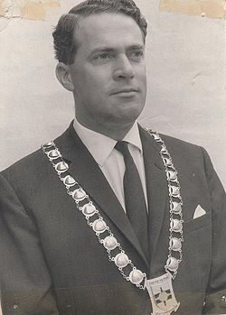
The centre of the city was constructed in three years, including Assembly buildings, government offices, a power station, a hospital, schools, a radio station, a telephone exchange, police stations, a post office, and more than 1,000 houses. The basic infrastructure was in place for Independence Day on 30 September 1966, when Bechuanaland was the eleventh British dependency in Africa to become independent. The first mayor of Gaborone was Reverend J. D. Jones, whose town council led the planning and development of the town in preparation for Independence day. The old Gaberones became a suburb of the new Gaborone, and is now known as "the Village".
Government
Botswana is a representative democratic republic. The president, who is both the chief of state and head of government, is elected by parliament for a five-year term and is eligible for a second term. The bicameral parliament consists of the House of Chiefs, a largely advisory 15-member body with eight permanent members consisting of the chiefs of the principal tribes, and the National Assembly, comprising 63 members, 57 of whom are directly elected by popular vote.
Economy
Botswana has maintained one of the world's highest economic growth rates since independence in 1966. Through fiscal discipline and sound management, Botswana has transformed itself from one of the poorest countries in the world to a middle-income country with a per capita GDP of nearly $15,000 in 2007. Two major investment services rank Botswana as the best credit risk in Africa.
Diamond mining has fueled much of the expansion and currently accounts for more than one-third of GDP and for 70-80% of export earnings. Tourism, financial services, subsistence farming, and cattle raising are other key sectors. On the downside, the government must deal with high rates of unemployment and poverty. Unemployment officially was 23.8 percent in 2004, but unofficial estimates place it closer to 40 percent.
Financial and business services sector
Manufacturing Nearby manganese and asbestos mines have led to industrial expansion.
Transport: Road, rail, air, sea
For many years, Gaborone was the fastest growing city in the world. Even today, it is still considered the fastest growing city in Africa. [2] Every year, the majority of the country's infrastructural budget goes towards improving the city's roads, buildings, and services[citation needed]. Since most of the large buildings are relatively new, the entire downtown area tends towards modernism, built generally with a mix of glass, steel and bricks. The modernist city is surrounded by lower-rise development that has not been subject to the same planning as the city's centre. But the city is surrounded by villages- Ramotswa to the south east, Mogoditshane to the north west, and Mochudi to the east and Tlokweng. A lot of people live in these villages and work in Gaborone.
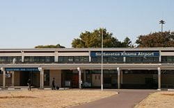
Public transport in the city is generally not bad, when compared with major African cities. 'Kombis' and taxis ply the routes within the city while buses service surrounding villages and other towns in Botswana. It was originally planned as a relatively small town, and its rapid development has necessitated construction of a larger city dam to provide an adequate water supply. Sir Seretse Khama International Airport lies about 10km north of the city and connects with Johannesburg, Cape Town, Harare, Francistown and Maun. Currently, there are about 130 houses newly constructed in Block 7, north of the city in a joint venture between BHC, a parastatal and Chinese owned companies. There is also some development in the northeastern parts of the city, along the A1 highway. Interestingly, the city's central business district (CBD) is still under construction so when one says 'downtown', they actually mean the Mall and Government Enclave areas where tall buildings are usually found.
Gaborone's industrial areas are found along the railway line, notably in Broadhurst, Gaborone West and in Phase 4. Kgalagadi (Coca-Cola) beverages owns a bottling factory in Broadhurst. There is no heavy industry in Gaborone, with motor vehicle assembly plants owned by Hyundai and Volvo closing citing viability problems. Still, a lot of businesses are setting up in Gaborone.
The Southern African Development Community (SADC) has its headquarters in Gaborone; the organization was formed in 1980 to increase economic cooperation among its members and reduce dependence on South Africa. The main campus of the University of Botswana is in the city.
Demographics
Population, population rank Race/ethnicity - historical background of ethnic groups Language Religion The University of Botswana, the nation's largest tertiary education provider, has its main campus in central Gaborone.
With nearly 40 percent of sexually active adults infected with HIV, UNICEF reported that more than 112,000 children have been orphaned, mostly due to the spread of the disease, and that figure is expected to double or triple by 2010. Though receiving government support once they are registered, those orphaned often are exploited by relatives or have to drop out of school to care for the sick. The government vigorously campaigns against the disease, providing tests, drugs, and condoms, but the virus continues to spread. Life expectancy has dropped to 34.
Of interest
Mayors
- J. D. Jones
- Serara T. Ketlogetswe
- Botsalo Bagwasi
- Nelson Ramaotwana
- Paul Rantao
Further reading
- Wiseman, John A. 1992. Botswana. World bibliographical series, v. 150. Oxford, Eng: Clio Press. ISBN 9781851091713
ReferencesISBN links support NWE through referral fees
- Bruce Bennett, "A note on place names, historical terms, etc.", [3]
External links
- World Fact Book 2008 Botswana Retrieved November 12, 2008.
- Encyclopaedia Britannica Gaborone Retrieved November 12, 2008.
- Gaborone - Botswana Tourism Board
- Map
- South Africa DirectGabarone Retrieved November 12, 2008.
- NationMaster Gaborone Retrieved November 12, 2008.
Credits
New World Encyclopedia writers and editors rewrote and completed the Wikipedia article in accordance with New World Encyclopedia standards. This article abides by terms of the Creative Commons CC-by-sa 3.0 License (CC-by-sa), which may be used and disseminated with proper attribution. Credit is due under the terms of this license that can reference both the New World Encyclopedia contributors and the selfless volunteer contributors of the Wikimedia Foundation. To cite this article click here for a list of acceptable citing formats.The history of earlier contributions by wikipedians is accessible to researchers here:
The history of this article since it was imported to New World Encyclopedia:
Note: Some restrictions may apply to use of individual images which are separately licensed.


