Difference between revisions of "Cartagena, Colombia" - New World Encyclopedia
Mike Butler (talk | contribs) |
Mike Butler (talk | contribs) |
||
| Line 101: | Line 101: | ||
In March 1741 the city was attacked by British and American colonial troops led by admiral [[Edward Vernon]], who arrived at Cartagena with a fleet of 186 ships and 23,600 men against six Spanish ships and 3600 men, in an action known as the [[Battle of Cartagena de Indias]]. After weeks of intense fighting, the siege was repelled by the Spanish and native forces led by commander General [[Blas de Lezo]], who inflicted heavy casualties on the English troops. This victory prolonged Spain's control of the Caribbean, which helped secure its large [[Spanish Empire|Empire]] until the 19th century. | In March 1741 the city was attacked by British and American colonial troops led by admiral [[Edward Vernon]], who arrived at Cartagena with a fleet of 186 ships and 23,600 men against six Spanish ships and 3600 men, in an action known as the [[Battle of Cartagena de Indias]]. After weeks of intense fighting, the siege was repelled by the Spanish and native forces led by commander General [[Blas de Lezo]], who inflicted heavy casualties on the English troops. This victory prolonged Spain's control of the Caribbean, which helped secure its large [[Spanish Empire|Empire]] until the 19th century. | ||
| − | The last of several movements rebelling againsy Spanish rule sprang up around 1810, following the independence of St | + | The last of several movements rebelling againsy Spanish rule sprang up around 1810, following the independence of St Domingue in 1804 (present-day [[Haiti]]). Leaders included [[Simón Bolívar]] (1783-1830) and Francisco de Paula Santander (1792-1840), who became the first two presidents of Colombia. The rebellion succeeded in 1819 when the territory of the Viceroyalty of New Granada became the Republic of Greater Colombia, organized as a confederation along with [[Ecuador]] and [[Venezuela]] ([[Panama]] was part of Colombia). |
| + | The Spanish controlled Cartagena from 1815 to 1821, when patriot forces recaptured the city. | ||
| + | Cartagena continued as Colombia’s leading port, although hampered by poor transport within the country. Internal divisions led to the secession of [[Venezuela]] and [[Quito]] (today's [[Ecuador]]) in 1830. The name New Granada was used until 1856 when it became the Grenadine Confederation. After a two-year [[civil war]], in 1863 the United States of Colombia was created, lasting until 1886, when the country became known as the Republic of Colombia. U.S. intentions to build the [[Panama Canal]] led to the separation of Panama in 1903 and its establishment as a nation. | ||
| − | + | The opening of the Magdalena River valley petroleum fields after 1917 was a boost to Cartagena, especially the completion of the Barrancabermeja to Bahía de Cartagena pipeline in 1926, as well as the construction of an oil refinery. | |
| − | |||
| − | |||
| + | Tensions between the two leading political parties led to the assassination of the Liberal presidential candidate on April 9, 1948. This ignited ''La Violencia'' ("The Violence"), causing violence that spread throughout the country and claimed the lives of at least 180,000 Colombians. From 1953 to 1964 the violence between the two political parties decreased, first when [[Gustavo Rojas]] (1900-1975) deposed the president in a [[coup d'etat]] and negotiated with the [[Guerrilla warfare|guerrillas]], and then under the military junta of General Gabriel París Gordillo (1910-2008). | ||
| − | + | A coalition government, known as the National Front, in which the presidency would alternate between parties every four years, ended "La Violencia" and sought to institute social and economic reforms. But social and political injustices continued, and [[guerrilla]] movements including FARC, ELN, and M-19 appeared. | |
| − | |||
| − | |||
== Government == | == Government == | ||
| Line 118: | Line 117: | ||
==Economy== | ==Economy== | ||
| + | |||
Colombia's economy has experienced positive growth over the five years to 2008 despite a serious armed conflict. The economy continues to improve in part because of austere government budgets, focused efforts to reduce public debt levels, an export-oriented growth strategy, improved domestic security, and high commodity prices. Ongoing economic problems facing President URIBE include reforming the pension system, reducing high unemployment, and funding new exploration to offset declining oil production. | Colombia's economy has experienced positive growth over the five years to 2008 despite a serious armed conflict. The economy continues to improve in part because of austere government budgets, focused efforts to reduce public debt levels, an export-oriented growth strategy, improved domestic security, and high commodity prices. Ongoing economic problems facing President URIBE include reforming the pension system, reducing high unemployment, and funding new exploration to offset declining oil production. | ||
| Line 123: | Line 123: | ||
Tourism is increasingly important, especially medical tourism. Cartagena has become a center for plastic surgery, dental treatment, and the latest technology in bariatric weight-loss operations for people from the United States and in other “First World” countries, where health services costs keep rising. | Tourism is increasingly important, especially medical tourism. Cartagena has become a center for plastic surgery, dental treatment, and the latest technology in bariatric weight-loss operations for people from the United States and in other “First World” countries, where health services costs keep rising. | ||
| + | |||
| + | Other important exports include platinum and coffee. | ||
Per capita GDP, rank | Per capita GDP, rank | ||
Revision as of 04:25, 23 August 2008
| Cartagena de Indias | |||
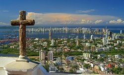
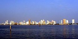
| View of the Santa Cruz de Manga Islands, Boca Grande and Castillo Grande, and Tierra Bomba seen from Cerro de la Popa. Cartagena de Indias, Colombia. | |||
|
|||
| Nickname: The Heroic City The Door of the Americas Capital of the Caribbean The Mother City The Walled City The Key of the West Indies The Fort of the Kingdom Best Fortified City of the Americas |
|||
| Coordinates: 10°24′N 75°30′W | |||
|---|---|---|---|
| Department | Bolívar Department | ||
| Region | Caribbean Region | ||
| Foundation | 1533 | ||
| Government | |||
| - Mayor | Judith Pinedo | ||
| Area | |||
| - City | 572 km² (220.9 sq mi) | ||
| Elevation | 1 m (3 ft) | ||
| Population (2006) | |||
| - City | 1,239,430 | ||
| - Urban | 1,090,127 | ||
| - Metro | 149,303 | ||
| Website: (Spanish) Government of Cartagena official website Tourism Office Official Site | |||
Cartagena de Indias (pronounced [kaɾtaˈhena ð̞e ˈin̪d̪jas] in Spanish; the usual English pronunciation is IPA: /ˌkɑrtəˈheɪnə deɪ ˈɪndiəs/), is a large city seaport on the northern coast of Colombia. Capital of the Bolívar Department. Founded in 1533 by Spaniard Don Pedro de Heredia, and named after the port of Cartagena in Spain's Murcia region, it was a major center of early Spanish settlement in the Americas which had impressive development in the XVIII century as the de facto capital of the Viceroyalty of New Granada and as the main hub of commerce and transportation in the late viceroyal era, situation that is reflected in its alternative capitality today. Nowadays continues to be the economic hub of the Caribbean region as well as a popular tourist destination.
Geography
Cartagena faces the Caribbean Sea to the west. To the south is the Cartagena Bay, which has two entrances: Bocachica (Small Mouth) in the south, and Bocagrande (Big Mouth) in the north. The old colonial walled city and fortress, a UNESCO Heritage site, are located on a peninsula and the island of Getsemaní. The city has spread over the islands of Manga and Manzanillo, and on the mainland.
Due to Cartagena's tropical location, the climate changes little, with an average high of 88.6°F (32°C) and an average low of 77°F (25°C) throughout the year. Cartagena also averages around 90 percent humidity, with a rainy season typically in October. Cartagena receives about 40 inches (1000mm) of rain each year.
The northern area has the Rafael Núñez International Airport, in the neighborhood of Crespo, only 10 minutes away from downtown or the old part of the city.
The Ciudad Amurallada (Walled City) has four sectors: San Diego, named after San Diego Convent, nowadays the Beaux Arts School Building; La Matuna, the commercial and financial area; Getsemaní, where African slaves used to live; and Santo Domingo.
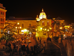
Downtown is the heart of the city, with a varied architecture, mainly of a colonial style, but there are also republican and Italian style buildings, such as the Cathedral's bell tower. The official entrance to downtown is through Puerta del Reloj (Clock Gate). A few steps from there there is the Plaza de la Aduana (Customs Square), next to the mayor's office. Nearby is San Pedro Claver Square, and his namesake's church, as well as the Museum of Modern Art.
Nearby is the Plaza de Bolívar (Bolívar's Square) and the Palace of the Inquisition to one side. Not to far is the office of Historical Archives, with the Government Palace, the office building of the Governor of the Department of Bolivar. Across from the palace is the Cathedral of Cartagena which dates back to the 16th century.
Bocagrande (Big Mouth) is the most modern area of the city, with many hotels, shops, restaurants, nightclubs and art galleries. It forms part of a land extension delimited by Cartagena Bay to the east and the Caribbean Sea to the west, where you will find El Laguito (The Little Lake) and Castillogrande (Big Castle), two renowned neighborhoods. Originally constructed for foreign oil workers, the majority of the land which makes up Bocagrande was established through land reclamation. Bocagrande is now considered the city's most popular area for tourists.
History
Primitive societies proliferated in this area because of the relative mildness of climate and the abundance of wildlife. The area from the Sinu river delta, in northwestern Colombia, to the Cartagena de Indias bay, appears to be the first documented human community in today's Colombia, the Puerto Hormiga Culture, which appeared around 7000 B.C.E. and lasted to around 3000 B.C.E.
The rise of a much more developed culture, the Monsú, who lived at the end of the Dique Canal, near today's Cartagena neighborhoods, Pasacaballos and Ciénaga Honda, at the northernmost part of Barú Island. The Monsú culture inherited the Puerto Hormiga culture´s use of the art of pottery but also developed a mixed economy of agriculture and basic manufacture. Remnants of a communal huts indicate that Cartagena the seat of the first organized society in Colombia, and one of the most ancient in the Americas.
Around 1500 B.C.E., the area was inhabited by different tribes of the Karib language family, more precisely the Mocanae sub-family. These were: The Kalamarí Tribe, in the downtown island; Carex Tribe, Tierrabomba island; Bahaire Tribe, Barú island, then peninsula; Cospique Tribe, the eastern coast of the exterior bay, and the Yurbaco Tribe, in the suburban area of Turbaco.
Some subsidiary tribes of the Kalamari lived in today's neighborhood of Pie de la Popa, and other subsidiaries from the Cospique lived in the Membrillal and Pasacaballos areas. Among these, according to the first chronicles the Kalamarí Tribe had preeminence. These tribes, though physically and administratively separated, shared common architecture, such as hut structures consisting of circular rooms with tall roofs inside wooden palisades.
Spanish explorer Rodrigo De Bastidas (1468-1527) discovered the Magdalena River delta in his first journey from Guajira to the south in 1527, a trip that ended in the Urabá gulf, where earlier Spanish settlements had failed. De Nicuesa and De Ojeda noted the existence of a big bay on the way from Santo Domingo to Urabá and Panama isthmus, encouraging De Bastidas to investigate. On his second trip, in 1530, he noted the enormous Cartagena de Indias's bay of 9 square miles with profound waters.
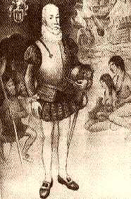
Cartagena de Indias was founded on June 1, 1533, by Spanish commander Pedro de Heredia, in the former seat of the indigenous Caribbean Calamarí village. Cartagena gained fame when fleets stopped there to take on gold and other products of northern South America for convoy to Spain. As the city prospered, it attracted pirates and corsaires, including English admiral and privateer Sir Francis Drake (1540-1595), who took the city in 1585, and French admiral and privateer Sire Bernard Desjeans, Baron de Pointis (1645-1707), who raided Cartagena in 1697.
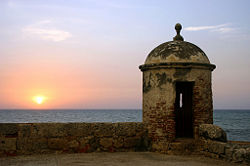
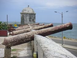
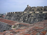
To resist these attacks, during the 17th century the Spanish Crown hired European military engineers to construct fortresses. This construction took 208 years, and ended with some 11 kilometres of walls surrounding the city, the San Felipe de Barajas Castle, named in honor of Spain's King Philip IV, constructed to repel land attacks, equipped with sentry boxes, buildings for food and weapons storage, and underground tunnels.
When reviewing the costs of the defenses, in Havana and Cartagena de Indias, Charles III of Spain (1716-1788), in his famed ironical style, is claimed to have said, while taking his spyglass: "This is outrageous! For this price those castles should be seen from here!"
Cartagena was a major trading port, specially for precious metals. Gold and silver from the mines in New Granada and Peru were loaded in Cartagena on the galleons bound for Spain via Havana. Cartagena was also a slave port; Cartagena and Veracruz (México) were the only cities authorized to trade with black people. The first slaves arrived with Pedro de Heredia and they worked as cane cutters to open roads, in the desecration of tombs of the aboriginal population of Sinu, and in the construction of buildings and fortresses. The agents of the Portuguese company Cacheu distributed human 'cargos' from Cartagena for mine exploitation in Venezuela, the West Indies, the Nuevo Reino de Granada and the Viceroyalty of Perú.
On February 5, 1610, the Catholic Monarchs established from Spain the Inquisition Holy Office Court in Cartagena de Indias by a Royal Decree issued by King Philip II. The inquisitors left in 1821 but the Inquisition Palace, finished in 1770, remains.
In 1717, Cartagena became part of the Spanish colonial Viceroyalty of New Granada, which corresponded mainly to modern Panama, Colombia, Ecuador, and Venezuela.
In March 1741 the city was attacked by British and American colonial troops led by admiral Edward Vernon, who arrived at Cartagena with a fleet of 186 ships and 23,600 men against six Spanish ships and 3600 men, in an action known as the Battle of Cartagena de Indias. After weeks of intense fighting, the siege was repelled by the Spanish and native forces led by commander General Blas de Lezo, who inflicted heavy casualties on the English troops. This victory prolonged Spain's control of the Caribbean, which helped secure its large Empire until the 19th century.
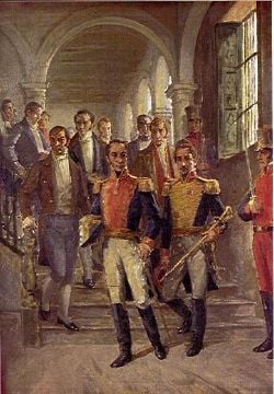
The last of several movements rebelling againsy Spanish rule sprang up around 1810, following the independence of St Domingue in 1804 (present-day Haiti). Leaders included Simón Bolívar (1783-1830) and Francisco de Paula Santander (1792-1840), who became the first two presidents of Colombia. The rebellion succeeded in 1819 when the territory of the Viceroyalty of New Granada became the Republic of Greater Colombia, organized as a confederation along with Ecuador and Venezuela (Panama was part of Colombia).
The Spanish controlled Cartagena from 1815 to 1821, when patriot forces recaptured the city.
Cartagena continued as Colombia’s leading port, although hampered by poor transport within the country. Internal divisions led to the secession of Venezuela and Quito (today's Ecuador) in 1830. The name New Granada was used until 1856 when it became the Grenadine Confederation. After a two-year civil war, in 1863 the United States of Colombia was created, lasting until 1886, when the country became known as the Republic of Colombia. U.S. intentions to build the Panama Canal led to the separation of Panama in 1903 and its establishment as a nation.
The opening of the Magdalena River valley petroleum fields after 1917 was a boost to Cartagena, especially the completion of the Barrancabermeja to Bahía de Cartagena pipeline in 1926, as well as the construction of an oil refinery.
Tensions between the two leading political parties led to the assassination of the Liberal presidential candidate on April 9, 1948. This ignited La Violencia ("The Violence"), causing violence that spread throughout the country and claimed the lives of at least 180,000 Colombians. From 1953 to 1964 the violence between the two political parties decreased, first when Gustavo Rojas (1900-1975) deposed the president in a coup d'etat and negotiated with the guerrillas, and then under the military junta of General Gabriel París Gordillo (1910-2008).
A coalition government, known as the National Front, in which the presidency would alternate between parties every four years, ended "La Violencia" and sought to institute social and economic reforms. But social and political injustices continued, and guerrilla movements including FARC, ELN, and M-19 appeared.
Government
Administrative divisions
Economy
Colombia's economy has experienced positive growth over the five years to 2008 despite a serious armed conflict. The economy continues to improve in part because of austere government budgets, focused efforts to reduce public debt levels, an export-oriented growth strategy, improved domestic security, and high commodity prices. Ongoing economic problems facing President URIBE include reforming the pension system, reducing high unemployment, and funding new exploration to offset declining oil production.
Cartagena has experienced heavy urban development in the early 21st century, particularly with the construction of new skyscrapers. As of October 2007, there were 42 high-rises under construction, including an effort to create Colombia's tallest, the Torre de la Escollera. The new high-rise, extraordinarily narrow, was expected to be completed in early 2007, and was planned to stand at 676 ft (206 m) and have 58 floors. However, a construction defect, accentuated by the strong Caribbean winds, has led to its dismantling. A new, 20-story building will be constructed in its place. The building reached the 56th floor (in girders, solely) before the wind bent the structure severely.
Tourism is increasingly important, especially medical tourism. Cartagena has become a center for plastic surgery, dental treatment, and the latest technology in bariatric weight-loss operations for people from the United States and in other “First World” countries, where health services costs keep rising.
Other important exports include platinum and coffee.
Per capita GDP, rank Financial and business services sector Tourism
Sugar and tobacco are processed there, while other products include cosmetics, textiles, fertilizer, and leather goods.
Transport: Road, rail, air, sea
- Rafael Núñez International Airport
Demography
Cartagena has a population of 1,240,000 in its Metropolitan Area, and 1,090,000 in the city (2005 Census), being the fifth largest urban area in Colombia.
Of interest
The complex was completed with:
- The San Sebastián del Pastelillo Fort: in today's neighborhood of Manga, called del Pastelillo (the cupcake) because of its low altitude to avoid being affected by the Castle of San Felipe whose cannons may have destroyed it if made taller. The fort replaced the first defense of the city: The Tower of Boquerón, a medievalesque tower that dominated the bay and city, similar to Torre del Homenaje in Santo Domingo, but round.
- The Santa Cruz de Castillogrande Fort: in today's neighborhood of Castillogrande, specifically in the Naval Club, a cross shaped fort which controlled the entry in the inner bay.
- The San Juan de Manzanillo Fort: smaller than its brother in Castillogrande, in order to not crossfiring it, but in the opposite side of the strait.
- The San Luis de Bocachica fort: Beautifully finished cross shaped fort, an exponent of the renaissance military architecture, dominated alone the Bocachica strait which lead to the ocean but was destroyed by Vernon in the XVIII century, only some remains are over some places of Bocachica, near its successor, the San Fernando fort.
- The San Fernando de Bocachica fort: Built nearer to the Sea than its older brother, the San Luis, it was more modern and state-of-the-art, being more roundly shaped, with space for more musketeers rather than massive cannons, and fare more neoclassical and delicate in its outer layers, revealing the tendency in military architecture in the XVIII century.
- The San José de Bocachica batteries: Built with the new plan of the San Fernando Fort, was designed to point to the line of flotation of the ships, and that's why its almost under sea level.
- The Angel San Rafael Battery: A masterpiece of the History of Military Architecture, its the only exponent in the world of "inside defense" The battery has few cannons to the outside, only the necessary to support the defense of San Fernando but its use was to attract the sieging forces to enter in a tunnel that appear as accidentally opened 500 meters away from the fort, so they are attracted to take it easily to siege the castle of San Fernando. When the tunnel ends, it enters to a dry moat inside the battery and where if fully equipped more than 400 muskets are pointing just at the first entrance, the design of the "devil holes" where the muskets are, avoid to the invader to see them and death is automatic. No one ever intended catch the trap but to prove it tests were done with cattle in the late XVIII century and the theory was confirmed. Recently the battery, a jewel of the crown in the military architecture history, was rebuilt after years of abandon.
- The Santa Barbara Battery: Designed near the tunnel entrance to Angel San Rafael was a small battery used as a decoy and to support fire to the Bocachica system, its most important object was to attract the siegers to the mainland so they can see the tunnel entrance and die at the Angel San Rafael death moat. The Santa Barbara battery disappeared with the years, only its founding stones remain over the seas.
- The Batteries of Chamba and Santiago: Mainly designed as support batteries for San Luis fort, but after the destruction of it by a resented Vernon he brutalized ever more these forts that had the unfortunate luck of being in a very deep sea area which made easy to destroy from a small distance. Ruins remain of both in the oceanic shore of the Tierrabomba Island, no plans exist to rebuild them.
- The Batteries of Mas, Crespo and the Revellín of El cabrero.: Destroyed by erosion and the desperate efforts of the XIX century administrations to dinamize the city's building industry were support forts for the massive San Lucas and Santa Catalina fortresses in the city Walls.
- The walls of the old city. 11 km of walls, more than 20 mini forts within it, 4 auxiliary doors, only one bridge-fort to connect the city to the mainland.
- There is another religious temple that you should take time to admire: The restored Santo Domingo Church, in front of Plaza Santo Domingo (Santo Domingo Square). The square was decorated with the sculpture Mujer Reclinada ("Reclining Woman"), a gift from the renowned Colombian artist Fernando Botero.
- Another notable building is the Teatro Heredia (Heredia Theater), an architectural jewel located in front of the Plaza de la Merced. A few meters away is the Calle de la Factoría (Factory Street); on it is the Marquis of Valdehoyos House which now functions as the Historical Photographic Library.
- A little bit further on is Augustinian Fathers Convent is the University of Cartagena. This university is a higher education center, opened to the public in the late 19th century. The Claustro de Santa Teresa (Saint Theresa Cloister), which has been remodeled into a hotel, operated by Charleston Hotels became an upscale Colombian hotel chain. It has its own square, protected by the San Francisco Bastion.
- Islas del Rosario
- India Catalina
- Steps of La Popa mount
- El Castillo de San Felipe (Particularly the tunnels.)
- The Walled city of Cartagena
- El Cartagena Gold Museum
- The Palace of the Inquisition (or the Torture Chambers)
- The Underground Tomb
- Hard Rock Cafe (located in Downtown)
- Las Bóvedas
- Playa Blanca, Barú (located in the island of Barú)
- El Reloj (clock tower)
Culture
World Heritage site
| Port, Fortresses and Group of Monuments, Cartagena* | |
|---|---|
| UNESCO World Heritage Site | |
| |
| State Party | |
| Type | Cultural |
| Criteria | iv, vi |
| Reference | 285 |
| Region** | Latin America and the Caribbean |
| Inscription history | |
| Inscription | 1980 (8th Session) |
| * Name as inscribed on World Heritage List. ** Region as classified by UNESCO. | |
The Port, Fortresses and Group of Monuments of Cartagena were selected in 1984 by the United Nations Educational, Scientific and Cultural Organization for being located in a bay by the Caribbean Sea, having the most extensive fortifications in South America. A system of zones that divides the city into three neighborhoods: San Pedro, with the cathedral and many Andalusian-style palaces; San Diego, where merchants and the middle class lived; and Getsemani, the 'popular quarters'.[1]
In Popular Culture
- Cartagena gained modern notoriety in the 1984 hit movie, Romancing the Stone when romance novelist Joan Wilder (Kathleen Turner) travels to Cartagena to deliver a treasure map in an effort to ransom her kidnapped sister. The Cartagena scenes were actually filmed in Mexico, and it doesn't reflect the real Cartagena. In the Family Guy episode Barely Legal, the mayor, thinking the film to be real, sends all the police officers to Cartagena, which is referred to as being a fictional city.
- In that movie, Michael Douglas' character refers to it as Cartage(ny)a. This has largely been adopted by tourists and is a constant thorn in the sides of locals. The "N" in Cartagena is solid. You will find only one business in the entire city that refers to this film.
- The first chapter of Brian Jacques' novel The Angel's Command takes place in 1628 Cartagena.
- The movie "Love in the Time of Cholera (film)" released on November 16, 2007 in the USA, is filmed in Cartagena.
- La Queimada, "Burn!" with Marlon Brando was filmed in Cartagena and released in 1969.
- The movie "The Mission (film)" released in 1986 with Robert De Niro was filmed in Cartagena and Brazil. The interpreter for the director was a Colombian who had recently moved to Canada.
- The poem “Románc” by Sándor Kányádi is talking about the beauty of Cartagena.
- Cartagena is referred to by Tom Cruise's character, Vince, in a scene in the film Collateral just before he terminates the blues trumpet player.
- A fictionalized version of the raid on Cartagena is chronicled in Chapter 27 in the novel Captain Blood.
Notes
ReferencesISBN links support NWE through referral fees
- Lemaitre, Eduardo; Historia Extensa de Cartagena de Indias, Ed. Aguilar 1976.
- Cartagena's healthy business climate International Reports.net, retrieved August 23, 2008.
- Encyclopaedia BritannicaCartagena Retrieved August 23, 2008.
External links
Travel guide to Cartagena from Wikitravel
- (Spanish) Cartagena Major's Office website
- Library of Congres - United States: Cartagena, Colombia
- (Spanish) Luis Angel Arango Library: History of Cartagena
Credits
New World Encyclopedia writers and editors rewrote and completed the Wikipedia article in accordance with New World Encyclopedia standards. This article abides by terms of the Creative Commons CC-by-sa 3.0 License (CC-by-sa), which may be used and disseminated with proper attribution. Credit is due under the terms of this license that can reference both the New World Encyclopedia contributors and the selfless volunteer contributors of the Wikimedia Foundation. To cite this article click here for a list of acceptable citing formats.The history of earlier contributions by wikipedians is accessible to researchers here:
The history of this article since it was imported to New World Encyclopedia:
Note: Some restrictions may apply to use of individual images which are separately licensed.
