Difference between revisions of "Nepal" - New World Encyclopedia
Mike Butler (talk | contribs) (→Issues) |
Mike Butler (talk | contribs) |
||
| Line 54: | Line 54: | ||
|footnotes = | |footnotes = | ||
}} | }} | ||
| − | '''Nepal''', officially known as the '''State of Nepal''' (Nepali: नेपाल {{IPAudio|Nepal.ogg|[neˈpaːl]}})a landlocked Himalayan country in [[South Asia]], | + | '''Nepal''', officially known as the '''State of Nepal''' (Nepali: नेपाल {{IPAudio|Nepal.ogg|[neˈpaːl]}})a landlocked Himalayan country in [[South Asia]], is a culturally rich kingdom with eight of the world's highest mountains. |
| − | For a small territory, the Nepali landscape is uncommonly diverse, ranging from the humid Terai in the south to the lofty [[Himalaya]]s in the north | + | For a small territory, the Nepali landscape is uncommonly diverse, ranging from the humid Terai in the south to the lofty [[Himalaya]]s in the north. |
| − | + | Rapidly changing political parties make the political scene in Nepal one of the most confusing in the world. In the 10 years from 1996, Nepal sustained a Maoist insurgency, the heir-apparent allegedly murdered the royal family, and the new king dismissed and re-instated parliament. | |
| − | + | Although country is the birthplace of Siddhartha Gautama, who became the Buddha, more than 80 percent of Nepalese follow [[Hinduism]], which is higher than the percentage of Hindus in [[India]], making it the single most Hindu nation in the world. | |
==Geography== | ==Geography== | ||
[[Image:Nepal map.png|thumb|350px|left|Map of Nepal]] | [[Image:Nepal map.png|thumb|350px|left|Map of Nepal]] | ||
| + | The origin of the name "Nepal" is uncertain, but the most popular understanding is that it derived from "Ne" (holy) and "pal" (cave). | ||
| − | + | Bordered by [[China]] (including the [[Tibet Autonomous Region|Tibet]]) to the north, and by [[India]] to the south, east and west, Nepal is of roughly trapezoidal shape, 500 miles (800 kilometers) long and 125miles (200 kilometers) wide, with an area of 56,827 square miles (147,181 square kilometres), or slightly larger than the state of Arkansas in the United States. | |
| − | |||
| − | Bordered by [[China]] ([[Tibet Autonomous Region|Tibet]]) to the north and by [[India]] to the south, east and west, Nepal is of roughly trapezoidal shape, 500 miles (800 kilometers) long and 125miles (200 kilometers) wide, with an area of 56,827 square miles (147,181 square kilometres), or slightly larger than the | ||
[[Image:Nepal_topo_en.jpg|thumb|250px|left|Topographic map of Nepal]] | [[Image:Nepal_topo_en.jpg|thumb|250px|left|Topographic map of Nepal]] | ||
Although Nepal shares no boundary with [[Bangladesh]], a narrow strip of land, about 13 miles (21 kilometers) wide, called the Chicken's Neck, separates the two countries. Efforts are under way to make this area a free-trade zone. | Although Nepal shares no boundary with [[Bangladesh]], a narrow strip of land, about 13 miles (21 kilometers) wide, called the Chicken's Neck, separates the two countries. Efforts are under way to make this area a free-trade zone. | ||
| − | The Himalayan arc extends about 1491 miles ( | + | The Himalayan arc extends about 1491 miles (2400km) from Nanga Parbat (26,699 feet or 8138 metres), the second highest peak in Pakistan, in the west, to Namche Barwa (25,149 feet or 7756 metres) in Tibet, in the east. This region includes [[Nepal]], [[Bhutan]], and as well as parts of [[Pakistan]], [[India]], and [[China]]. The geological process of forming the Himalayas began with the collision of Indian sub-continent and [[Eurasia]] at the [[Paleocene]]/[[Eocence]] epoch. This thickened the Indian crust to its present thickness of 41 miles or 70 kilometers. |
| − | Nepal | + | Nepal may be divided into three areas: the mountain, hill, and Terai regions. These ecological belts run east-west and are bisected by Nepal's river systems. The lowest point is Kanchan Kalan, at 229 feet (70 meters) above sea level. The highest point is (Sagarmatha) Mount Everest at 29,028 feet (8848 meters). |
| − | [[Image:Himalayas.jpg|thumb|350px|right | + | [[Image:Himalayas.jpg|thumb|350px|right|Perspective view of the Himalaya and Mount Everest as seen from space looking south-south-east from over the Tibetan Plateau. ([[:Image:himalaya_annotated.jpg|annotated version]])]] |
| − | The mountain region is the highest in the world. Mount Everest is located on the border with [[China]] between Nepal and Tibet. The south-east ridge on the Nepalese side of the mountain is easier to climb, which is why | + | The mountain region is the highest in the world. Mount Everest is located on the border with [[China]] between Nepal and Tibet. The south-east ridge on the Nepalese side of the mountain is easier to climb, which is why many climbers enter Nepal. Eight of the world's highest mountains are located in Nepal, including Kanchenjunga, the world's third highest peak, and Annapurna I, II, III and IV. |
| − | The hill region (''Pahad'' in Nepali) abuts the mountains and varies from 3300 | + | The hill region (''Pahad'' in Nepali) abuts the mountains and varies from 3300 to 13,125 feet (1000 to 4000 meters) in altitude. Two low mountain ranges, the Mahabharat Lekh and Siwalik Hills (also called the Churia Range) dominate the region. The hilly belt includes the Kathmandu Valley, the country's most fertile and urbanised area. Despite its geographical isolation and limited economic potential, the region always has been the political and cultural centre of Nepal. Elevations above 8200 feet (2500 meters) are sparsely populated. |
| − | The Terai Plains bordering India are part of the northern rim of the Indo-Gangetic plains. | + | The Terai Plains bordering India are part of the northern rim of the Indo-Gangetic plains. This region has a hot, humid climate. |
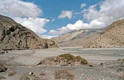
[[Image:KaliGandaki.jpg|thumb|250px|The arid and barren Himalayan landscape]] | [[Image:KaliGandaki.jpg|thumb|250px|The arid and barren Himalayan landscape]] | ||
Nepal has five climatic zones, broadly corresponding to altitude. The tropical and subtropical zones lie below 3940 feet (1200 metres), the temperate zone 3900 to 7875 feet (1200 to 2400 metres), the cold zone 7875 to 11,800 feet (2400 to 3600 metres), the sub-arctic zone 11,800 to 14,400 feet (3600 to 4400 metres), and the arctic zone above 14,400 feet (4400 metres). Nepal has five seasons: summer, monsoon, autumn, winter and spring. The Himalaya blocks cold winds from Central Asia in winter, and forms the northern limit of the monsoon wind patterns. | Nepal has five climatic zones, broadly corresponding to altitude. The tropical and subtropical zones lie below 3940 feet (1200 metres), the temperate zone 3900 to 7875 feet (1200 to 2400 metres), the cold zone 7875 to 11,800 feet (2400 to 3600 metres), the sub-arctic zone 11,800 to 14,400 feet (3600 to 4400 metres), and the arctic zone above 14,400 feet (4400 metres). Nepal has five seasons: summer, monsoon, autumn, winter and spring. The Himalaya blocks cold winds from Central Asia in winter, and forms the northern limit of the monsoon wind patterns. | ||
| Line 86: | Line 85: | ||
About 25.4 percent of Nepal is covered with forest, of which around 9.6 percent consists of "primary forest" which is relatively intact. About 12.1 percent is classified as "protected," about 21.4 percent is "conserved," and about 5.1 percent are classified as "production forest." Nepal's 2000-2005 deforestation rate was about 1.4 percent per year. | About 25.4 percent of Nepal is covered with forest, of which around 9.6 percent consists of "primary forest" which is relatively intact. About 12.1 percent is classified as "protected," about 21.4 percent is "conserved," and about 5.1 percent are classified as "production forest." Nepal's 2000-2005 deforestation rate was about 1.4 percent per year. | ||
| − | Nepal has three | + | Nepal has three river systems: the Koshi River basin in the east, the Narayani River basin (India's Gandak River), and the Karnali River basin in the west. All become tributaries of the Ganges River in northern India. Besides providing fertile alluvial soil, the backbone of the agrarian economy, these rivers present possibilities for hydroelectricity and irrigation. But building dams in Nepal is problematic, because of the high risk of earthquakes. Deep gorges have hindered transport and communication networks, resulting in a fragmented economy. |
Natural hazards include severe thunderstorms, flooding, landslides, drought, and famine depending on the timing, intensity, and duration of the summer monsoons. | Natural hazards include severe thunderstorms, flooding, landslides, drought, and famine depending on the timing, intensity, and duration of the summer monsoons. | ||
| Line 95: | Line 94: | ||
==History== | ==History== | ||
| − | + | Neolithic tools found in the Kathmandu Valley indicate that people have been living in the Himalayan region for at least 9000 years. Ancient Indian epics such as the Mahabharata mention the ''Kiratas'', the inhabitants of Nepal in the first millennium B.C.E..e. People who were probably of Tibeto-Burman ethnicity lived in Nepal 2500 years ago. Ramayana, which refers to the era before Mahabharat, says Mithila (later known as Janakpur) was the birth place of the goddess Sita. The presence of sites such as Valmik ashram indicates the presence of Aryan culture in Nepal at that period. | |
| − | |||
| − | |||
| − | Around 1000 B.C.E., small kingdoms and confederations of clans arose. | + | Indo-Aryan tribes entered the valley around 1500 B.C.E. Around 1000 B.C.E., small kingdoms and confederations of clans arose. [[Siddhartha Gautama]](563–483 B.C.E.), a prince of the Shakya confederation, renounced his royalty to lead an ascetic life and came to be known as the [[Buddha]] ("the one who has awakened"). |
By 250 B.C.E., the region came under the influence of the Mauryan empire of northern India, and later became a puppet state under the Gupta Dynasty in the fourth century. | By 250 B.C.E., the region came under the influence of the Mauryan empire of northern India, and later became a puppet state under the Gupta Dynasty in the fourth century. | ||
| Line 105: | Line 102: | ||
From the late fifth century, rulers called ''the Licchavis'' governed the area. The Licchavi dynasty went into decline in the late eighth century and was followed by a Newar era, from 879, although the extent of their control over the entire country is uncertain. | From the late fifth century, rulers called ''the Licchavis'' governed the area. The Licchavi dynasty went into decline in the late eighth century and was followed by a Newar era, from 879, although the extent of their control over the entire country is uncertain. | ||
| − | By late | + | By late eleventh century, southern Nepal came under the influence of the Chalukya Empire of southern India. Under the Chalukyas, Nepal's religious establishment changed as the kings patronised [[Hinduism]] instead of the Buddhism prevailing at that time. |
[[Image:Patan temples.jpg|thumb|250px|left|Hindu temples in Patan, the capital of one of the three medieval kingdoms]] | [[Image:Patan temples.jpg|thumb|250px|left|Hindu temples in Patan, the capital of one of the three medieval kingdoms]] | ||
| − | By the early thirteenth century, | + | By the early thirteenth century, Arimalla was the first king of a dynasty whose rulers' names ended with the Sanskrit suffix ''malla'' ("wrestler"). There was a period of upheaval before these kings consolidated their power. |
| − | |||
| − | |||
| − | |||
| − | |||
| − | + | Thirteenth-century Nepal was pillaged by the Delhi Sultanate of northern India. King Jayasthitimalla united most of the country by the late fourteenth century, but in 1482 the kingdom was carved into three: Kathmandu, Patan, and Bhadgaon. | |
| − | After 1800, the heirs of Prithvi Narayan Shah | + | Modern Nepal was created in the latter half of the eighteenth century when Prithvi Narayan Shah, the ruler of the small principality of Gorkha, united a number of independent hill states to form the Gorkha Kingdom. He conquered the Kathmandu valley in 1768. After Shah's death, the Shah dynasty began to expand into India. Between 1788 and 1791, Nepal invaded Tibet and robbed the Tashilhunpo Monastery. Alarmed, the Chinese emperor Qianlong dispatched a sizeable army that forced the Nepalese to retreat and pay heavy repatriations. After 1800, the heirs of Prithvi Narayan Shah were unable to maintain political control, and a period of internal turmoil followed. |
| − | Rivalry with the British East India Company over the annexation of minor states bordering Nepal | + | Rivalry with the British East India Company over the annexation of minor states bordering Nepal led to the brief but bloody Anglo-Nepalese War (1815–16), in which Nepal defended its present day borders but lost territories west of the Kali River, including present day Uttarakhand state and several Punjab Hill States. The Treaty of Sugauli ceded parts of the Terai and [[Sikkim]] to the company in exchange for Nepalese autonomy. |
| − | Factionalism among royal family members led to instability after the war. In 1846, a | + | Factionalism among royal family members led to instability after the war. In 1846, a plot to overthrow Jang Bahadur, a fast-rising military leader, was discovered by the reigning queen, led to the Kot Massacre. Armed clashes between military personnel and administrators loyal to the queen led to the execution of several hundred princes and chieftains around the country. Bahadur won and founded the Rana dynasty, leading to the Rana autocracy. The king was made a titular figure, and the post of Prime Minister was made powerful and hereditary. |
The Ranas were staunchly pro-British, and assisted the British during the Sepoy Rebellion in 1857, and later in both World Wars. In 1923 the United Kingdom and Nepal formally signed an agreement of friendship, in which Nepal's independence was recognised by the UK. | The Ranas were staunchly pro-British, and assisted the British during the Sepoy Rebellion in 1857, and later in both World Wars. In 1923 the United Kingdom and Nepal formally signed an agreement of friendship, in which Nepal's independence was recognised by the UK. | ||
Revision as of 02:57, 12 March 2007
| नेपाल Nepāl | |||||
| |||||
| Motto: जननी जन्मभूमिष्च स्वर्गादपि गरीयसी (Sanskrit) "Mother and motherland are dearer than the heavens" | |||||
| Anthem: Rastriya Gaan | |||||
| Capital (and largest city) |
Kathmandu 27°42′N 85°19′E | ||||
| Official languages | Nepali | ||||
|---|---|---|---|---|---|
| Government | interim constitutional arrangements | ||||
| - King | King Gyanendra Bir Bikram Shah[1] | ||||
| - Interim Head of State | Girija Prasad Koirala | ||||
| - Prime Minister | Girija Prasad Koirala | ||||
| Unification | December 21 1768 | ||||
| Area | |||||
| - Total | 147,181 km² (93rd) 56,827 sq mi | ||||
| - Water (%) | 2.8 | ||||
| Population | |||||
| - July 2005 estimate | 27,133,000 | ||||
| - 2002 census | 23,151,423 | ||||
| - Density | 184/km² 477/sq mi | ||||
| GDP (PPP) | 2005 estimate | ||||
| - Total | $39.14 billion | ||||
| - Per capita | $1,675 | ||||
| HDI (2003) | 0.526 (medium) | ||||
| Currency | Rupee (NPR)
| ||||
| Time zone | NPT (UTC+5:45) | ||||
| - Summer (DST) | not observed (UTC+5:45) | ||||
| Internet TLD | .np | ||||
| Calling code | +977 | ||||
Nepal, officially known as the State of Nepal (Nepali: नेपाल [neˈpaːl] )a landlocked Himalayan country in South Asia, is a culturally rich kingdom with eight of the world's highest mountains.
For a small territory, the Nepali landscape is uncommonly diverse, ranging from the humid Terai in the south to the lofty Himalayas in the north.
Rapidly changing political parties make the political scene in Nepal one of the most confusing in the world. In the 10 years from 1996, Nepal sustained a Maoist insurgency, the heir-apparent allegedly murdered the royal family, and the new king dismissed and re-instated parliament.
Although country is the birthplace of Siddhartha Gautama, who became the Buddha, more than 80 percent of Nepalese follow Hinduism, which is higher than the percentage of Hindus in India, making it the single most Hindu nation in the world.
Geography
The origin of the name "Nepal" is uncertain, but the most popular understanding is that it derived from "Ne" (holy) and "pal" (cave).
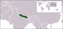
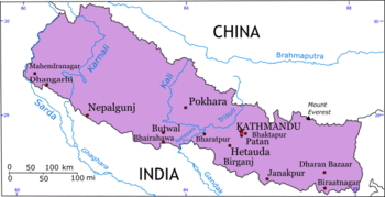
Bordered by China (including the Tibet) to the north, and by India to the south, east and west, Nepal is of roughly trapezoidal shape, 500 miles (800 kilometers) long and 125miles (200 kilometers) wide, with an area of 56,827 square miles (147,181 square kilometres), or slightly larger than the state of Arkansas in the United States.
Although Nepal shares no boundary with Bangladesh, a narrow strip of land, about 13 miles (21 kilometers) wide, called the Chicken's Neck, separates the two countries. Efforts are under way to make this area a free-trade zone.
The Himalayan arc extends about 1491 miles (2400km) from Nanga Parbat (26,699 feet or 8138 metres), the second highest peak in Pakistan, in the west, to Namche Barwa (25,149 feet or 7756 metres) in Tibet, in the east. This region includes Nepal, Bhutan, and as well as parts of Pakistan, India, and China. The geological process of forming the Himalayas began with the collision of Indian sub-continent and Eurasia at the Paleocene/Eocence epoch. This thickened the Indian crust to its present thickness of 41 miles or 70 kilometers.
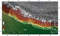
Nepal may be divided into three areas: the mountain, hill, and Terai regions. These ecological belts run east-west and are bisected by Nepal's river systems. The lowest point is Kanchan Kalan, at 229 feet (70 meters) above sea level. The highest point is (Sagarmatha) Mount Everest at 29,028 feet (8848 meters).

The mountain region is the highest in the world. Mount Everest is located on the border with China between Nepal and Tibet. The south-east ridge on the Nepalese side of the mountain is easier to climb, which is why many climbers enter Nepal. Eight of the world's highest mountains are located in Nepal, including Kanchenjunga, the world's third highest peak, and Annapurna I, II, III and IV.
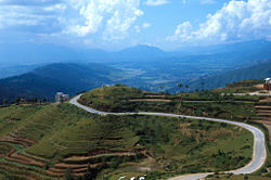
The hill region (Pahad in Nepali) abuts the mountains and varies from 3300 to 13,125 feet (1000 to 4000 meters) in altitude. Two low mountain ranges, the Mahabharat Lekh and Siwalik Hills (also called the Churia Range) dominate the region. The hilly belt includes the Kathmandu Valley, the country's most fertile and urbanised area. Despite its geographical isolation and limited economic potential, the region always has been the political and cultural centre of Nepal. Elevations above 8200 feet (2500 meters) are sparsely populated.
The Terai Plains bordering India are part of the northern rim of the Indo-Gangetic plains. This region has a hot, humid climate.
Nepal has five climatic zones, broadly corresponding to altitude. The tropical and subtropical zones lie below 3940 feet (1200 metres), the temperate zone 3900 to 7875 feet (1200 to 2400 metres), the cold zone 7875 to 11,800 feet (2400 to 3600 metres), the sub-arctic zone 11,800 to 14,400 feet (3600 to 4400 metres), and the arctic zone above 14,400 feet (4400 metres). Nepal has five seasons: summer, monsoon, autumn, winter and spring. The Himalaya blocks cold winds from Central Asia in winter, and forms the northern limit of the monsoon wind patterns.
About 25.4 percent of Nepal is covered with forest, of which around 9.6 percent consists of "primary forest" which is relatively intact. About 12.1 percent is classified as "protected," about 21.4 percent is "conserved," and about 5.1 percent are classified as "production forest." Nepal's 2000-2005 deforestation rate was about 1.4 percent per year.
Nepal has three river systems: the Koshi River basin in the east, the Narayani River basin (India's Gandak River), and the Karnali River basin in the west. All become tributaries of the Ganges River in northern India. Besides providing fertile alluvial soil, the backbone of the agrarian economy, these rivers present possibilities for hydroelectricity and irrigation. But building dams in Nepal is problematic, because of the high risk of earthquakes. Deep gorges have hindered transport and communication networks, resulting in a fragmented economy.
Natural hazards include severe thunderstorms, flooding, landslides, drought, and famine depending on the timing, intensity, and duration of the summer monsoons.
Environmental issues include deforestation (overuse of wood for fuel and lack of alternatives), with resulting erosion and degradation of ecosystems, contaminated water (with human and animal wastes, agricultural run-off, and industrial effluents), wildlife conservation, and vehicular emissions.
Kathmandu, with a population of 800,000, is the capital and largest city. The other main cities include Bharatpur, Biratnagar, Bhairahawa, Birgunj, Janakpur, Pokhara, Nepalgunj, and Mahendranagar.
History
Neolithic tools found in the Kathmandu Valley indicate that people have been living in the Himalayan region for at least 9000 years. Ancient Indian epics such as the Mahabharata mention the Kiratas, the inhabitants of Nepal in the first millennium B.C.E. People who were probably of Tibeto-Burman ethnicity lived in Nepal 2500 years ago. Ramayana, which refers to the era before Mahabharat, says Mithila (later known as Janakpur) was the birth place of the goddess Sita. The presence of sites such as Valmik ashram indicates the presence of Aryan culture in Nepal at that period.
Indo-Aryan tribes entered the valley around 1500 B.C.E. Around 1000 B.C.E., small kingdoms and confederations of clans arose. Siddhartha Gautama(563–483 B.C.E.), a prince of the Shakya confederation, renounced his royalty to lead an ascetic life and came to be known as the Buddha ("the one who has awakened").
By 250 B.C.E., the region came under the influence of the Mauryan empire of northern India, and later became a puppet state under the Gupta Dynasty in the fourth century.
From the late fifth century, rulers called the Licchavis governed the area. The Licchavi dynasty went into decline in the late eighth century and was followed by a Newar era, from 879, although the extent of their control over the entire country is uncertain.
By late eleventh century, southern Nepal came under the influence of the Chalukya Empire of southern India. Under the Chalukyas, Nepal's religious establishment changed as the kings patronised Hinduism instead of the Buddhism prevailing at that time.
By the early thirteenth century, Arimalla was the first king of a dynasty whose rulers' names ended with the Sanskrit suffix malla ("wrestler"). There was a period of upheaval before these kings consolidated their power.
Thirteenth-century Nepal was pillaged by the Delhi Sultanate of northern India. King Jayasthitimalla united most of the country by the late fourteenth century, but in 1482 the kingdom was carved into three: Kathmandu, Patan, and Bhadgaon.
Modern Nepal was created in the latter half of the eighteenth century when Prithvi Narayan Shah, the ruler of the small principality of Gorkha, united a number of independent hill states to form the Gorkha Kingdom. He conquered the Kathmandu valley in 1768. After Shah's death, the Shah dynasty began to expand into India. Between 1788 and 1791, Nepal invaded Tibet and robbed the Tashilhunpo Monastery. Alarmed, the Chinese emperor Qianlong dispatched a sizeable army that forced the Nepalese to retreat and pay heavy repatriations. After 1800, the heirs of Prithvi Narayan Shah were unable to maintain political control, and a period of internal turmoil followed.
Rivalry with the British East India Company over the annexation of minor states bordering Nepal led to the brief but bloody Anglo-Nepalese War (1815–16), in which Nepal defended its present day borders but lost territories west of the Kali River, including present day Uttarakhand state and several Punjab Hill States. The Treaty of Sugauli ceded parts of the Terai and Sikkim to the company in exchange for Nepalese autonomy.
Factionalism among royal family members led to instability after the war. In 1846, a plot to overthrow Jang Bahadur, a fast-rising military leader, was discovered by the reigning queen, led to the Kot Massacre. Armed clashes between military personnel and administrators loyal to the queen led to the execution of several hundred princes and chieftains around the country. Bahadur won and founded the Rana dynasty, leading to the Rana autocracy. The king was made a titular figure, and the post of Prime Minister was made powerful and hereditary.
The Ranas were staunchly pro-British, and assisted the British during the Sepoy Rebellion in 1857, and later in both World Wars. In 1923 the United Kingdom and Nepal formally signed an agreement of friendship, in which Nepal's independence was recognised by the UK.
In the late 1940s, emerging pro-democracy movements and political parties in Nepal were critical of the Rana autocracy. China occupied Tibet in 1950, making India keen on stability in Nepal, to avoid an expansive military campaign. Thus India sponsored Tribhuvan as Nepal's new king in 1951, and a new government, mostly comprising the Nepali Congress Party.
In early 1959, King Mahendra issued a new constitution, and the first democratic elections for a national assembly were held. The Nepali Congress Party, a moderate socialist group, gained a substantial victory in the election. Its leader, B.P. Koirala, formed a government and served as prime minister.
Declaring parliamentary democracy a failure 18 months later, King Mahendra dismissed the Koirala government and promulgated a new constitution on December 16, 1962. The new constitution established a "partyless" system of panchayats (councils) which King Mahendra considered to be a democratic form of government closer to Nepalese traditions. As a pyramidal structure progressing from village assemblies to a Rastriya Panchayat (National Parliament), the panchayat system enshrined the absolute power of the monarchy.
King Mahendra was succeeded by his 27 year-old son, King Birendra , in 1972. Amid student demonstrations and anti-regime activities in 1979, King Birendra called for a national referendum to decide on the nature of Nepal's government—either the continuation of the panchayat system with democratic reforms or the establishment of a multiparty system. The referendum was held in May 1980, and the panchayat system won a narrow victory.
In 1989, the "Jan Andolan" (People's) Movement forced the monarchy to accept constitutional reforms and establish a multiparty parliament in May 1991. The Nepali Congress Party won the country's first democratic elections, with Girija Prasad Koirala becoming prime minister.
In 1992, in a situation of economic crisis and chaos, with spiralling prices as a result of implementation of changes in policy of the new Congress government, the radical left stepped up their political agitation. The various groups set up a Joint People's Agitation Committee, and called for a general strike on April 6.
Violence broke out on the evening of the strike. Two activists were killed early the next day. Later in the day, police fired on a mass rally of the Agitation Committee at Tundikhel in the capital Kathmandu. Riots broke out, leaving 14 dead.
In February 1996, a Maoist party started a bid to replace the parliamentary monarchy with a so-called people's new democratic republic, through a Maoist revolutionary strategy known as the people's war, which has led to the Nepalese Civil War. Led by Dr Baburam Bhattarai and Pushpa Kamal Dahal (also known as "Prachanda"), the insurgency began in five districts in Nepal. The Maoists declared the existence of a provisional "people's government" at the district level in several locations. At one point, 70 percent of Nepal's countryside was under Maoist rule. More than 13,000 people died in the civil war.
In June 2001, 10 members of the royal family, including King Birendra and Queen Aishwarya, were killed in a shooting spree, allegedly by Crown Prince Dipendra. He temporarily became king before dying of his wounds. His brother, Prince Gyanendra, inherited the throne. Meanwhile, the Maoist rebellion escalated, and in October 2002 the king temporarily deposed the government and took complete control of it. A week later he reappointed another government, but the country is still unstable because of the civil war with the Maoists, the various political factions, the king's attempts to take more control of the government and worries about the competence of Gyanendra's son and heir, Prince Paras.
In the face of unstable governments and a Maoist siege on the Kathmandu Valley in August 2004, popular support for the monarchy began to wane. On February 1, 2005, Gyanendra dismissed the entire government and assumed full executive powers, declaring a "state of emergency" to quash the Maoist movement.
In April 2006, strikes and street protests in Kathmandu forced the king to reinstate the parliament. A seven-party coalition resumed control of the government and stripped the king of most of his powers. A cease fire was agreed to, on November 21, 2006, with the Maoist parties. As of January 15, 2007, Nepal was governed by a unicameral legislature under an interim constitution.
Government and politics
The politics of Nepal take place in a framework of a monarchy in transition to a parliamentary democracy. In 2007, the Prime Minister of Nepal was the head of government. Nepal has a pluriform multi-party system. Nepal is (still) a monarchy that is multiethnic, multilingual, and Hindu, that retains the king in the role of head of state.
The executive comprised the king and the Council of Ministers (the cabinet). The leader of the coalition or party securing the maximum seats in an election was appointed as the prime minister. The king appoints the cabinet on the recommendation of the prime minister. Governments in Nepal have tended to be highly unstable; no government has survived for more than two years since 1991, either through internal collapse or parliamentary dissolution by the monarch.
Legislative power is vested in both the government and the Nepal House of Representatives. Nepal's legislature was bicameral consisting of a House of Representatives and a National Council. The House of Representatives consists of 205 members directly elected. The National Council had 60 members, 10 nominated by the king, 35 elected by the House of Representatives and the remaining 15 elected by an electoral college made up of chairs of villages and towns. The legislature had a five-year term, but was dissolvable by the king before its term could end. All Nepalese citizens 18 years and older became eligible to vote.
Nepal's judiciary is legally separate from the executive and legislative branches, is based on Hindu legal concepts and English common law, and has not accepted compulsory International Court of Justice jurisdiction. The constitution affirms the right of judicial review. The king appoints the chief justice and all other judges to the supreme, appellate, and district courts upon the recommendation of the Judicial Council. All lower court decisions, including acquittals, are subject to appeal. The Supreme Court is the court of last appeal. The king may grant pardons and may suspend, commute, or remit any sentence by any court.
Nepal is divided into 14 zones and 75 districts grouped into five development regions. Each district is headed by a fixed chief district officer responsible for maintaining law and order and coordinating the work of field agencies of the various government ministries.
The Nepalese political landscape consists of more than 24 political parties. Based on the parliamentary seats occupied by various parties since 1991, the Nepali Congress Party, the Communist Party of Nepal, the National Democratic Party, the Nepal Sadbhawana Party, the People’s Front Nepal and the Nepal Workers and Peasants Party are the significant ones.
The United People's Front of Nepal, which had won third largest number of seats in 1991 parliamentary election, began to splinter in 1993. Its one faction later merged with Nepal Communist Party to form PFN. However, the other faction established the Communist Party of Nepal (Maoist) in 1995, which staged an armed rebellion in 1996 and gradually emerged as a major political force - holding a balance of power.
All these political realignments have made the political scene of Nepal one of the most confusing in the world. Break-up of the parties had become a norm rather than an exception in Nepal. Parties never agreed on most issues of national significance. However, the situation began to change after King Gyanendra took an absolute power in 2005.
Nepal's military consists of the Nepali Army which includes the Nepalese Army Air Service, (the air force unit under it), and the Nepalese Police Force. Service is voluntary and the minimum age for enlistment is 18 years. Nepal spent $99.2-million in 2004 on its military— 1.5 percent of its GDP. The Nepali Army has 90,000 soldiers, who were engaged in the civil war against the Maoist insurgents.
Economy
Nepal is among the poorest and least developed countries in the world with almost one-third of its population living below the poverty line. Nepal's workforce of about 10 million suffers from a severe shortage of skilled labour. The rate of unemployment and underemployment approaches half of the working-age population. Thus, many Nepalese move to India in search of work, the Gulf countries and Malaysia being new sources of work. Nepal receives $50-million a year through the Gurkha soldiers who serve in the Indian and British armies and are highly esteemed for their skill and bravery
Agriculture is the mainstay of the economy, providing a livelihood for three-fourths of the population and accounting for 38 percent of GDP. Agricultural produce—mostly grown in the Terrai region bordering India—includes rice, corn, wheat, sugarcane, root crops, milk, and water buffalo meat. Industrial activity mainly involves the processing of agricultural produce including jute, sugarcane, tobacco, and grain.
The spectacular landscape and deep, exotic culture of Nepal represents considerable potential for tourism, but security concerns relating to the Maoist conflict have led to a decrease in tourism, a key source of foreign exchange. Nepal has considerable scope for exploiting its potential in hydropower and tourism, areas of recent foreign investment interest. Prospects for foreign trade or investment in other sectors will remain poor, however, because of the small size of the economy, its technological backwardness, its remoteness, its landlocked geographic location, its civil strife, and its susceptibility to natural disaster.
Hilly and mountainous terrain in the northern two-thirds of the country has made the building of roads and other infrastructure difficult and expensive. There were just over 5200 miles (8500 km) of paved roads, and one 34-mile (59 km) railway line in the south in 2003. Aviation is in a better state, with 48 airports, 10 of them with paved runways.
The distribution of wealth among people is consistent with that in many developed and developing countries: the highest 10 percent of households control 39.1 percent of the national wealth and the lowest 10 percent control only 2.6 percent.
Nepal's GDP for the year 2005 is estimated at just over US$39-billion making it the 83rd-largest economy in the world. Per-capita income is around US$1402, ranked 163rd.
Exports, excluding unrecorded border trade with India, totalled $822-million in 2005. Export commodities were carpets, clothing, leather goods, jute goods, and grain. Export partners were India 53.7percent, US 17.4 percent, Germany 7.1 percent.
Imports totalled $2-billion. Import commodities were gold, machinery and equipment, petroleum products, and fertilizer. Import partners were India 47.7 percent, UAE 11.2 percent, China 10.8 percent, Saudi Arabia 4.9 percent, Kuwait 4.2 percent.
Demographics
Nepal had a population of 27,676,547 in 2005, with a growth rate of 2.2 percent. The median age is 20.07 (19.91 for males and 20.24 for females). Life expectancy is 59.8 years (60.9 for males and 59.5 for females). Nepal is the only country in the world where males outlive females.
In the Terai, much of the population is physically and culturally similar to the Indo-Aryans of northern India. Indo-Aryan and East Asian looking mixed people live in the hill region. The mountainous highlands are sparsely populated. Kathmandu Valley, in the middle hill region, constitutes a small fraction of the nation's area but is the most densely populated, with almost 5 percent of the population.
The northern mountains are sparsely populated. A majority of the population live in the central highlands despite the migration of a significant section of the population to the fertile Terrai belt in recent years.
Ethnicity
Perched on the southern slopes of the Himalayan Mountains, the Kingdom of Nepal is as ethnically diverse as its terrain of fertile plains, broad valleys, and the highest mountain peaks in the world. The Nepalese are descendants of three major migrations from India, Tibet, and Central Asia.
Among the earliest inhabitants were the Newar of the Kathmandu Valley and aboriginal Tharu in the southern Terai region. The ancestors of the Brahman and Chetri caste groups came from India, while other ethnic groups trace their origins to Central Asia and Tibet, including the Gurung and Magar in the west, Rai and Limbu in the east, and Sherpa (people) and Bhotia in the north.
The Chhetri are largest ethnic group of Nepal making up 15.5 percent of the country's population. They are predominantly Hindus and are of eastern Indo-Aryan stock. The word "Chhetri" is actually a corruption of the Sanskrit word "Kshatriya", meaning hereditary warriors and rulers who are below the priestly Brahman caste but above the merchant and farmer/craftsman castes that altogether make up Hinduism's four "clean" or touchable castes. The royal family belongs to the Thakuri-subcaste of Chhetris.
Other groups are the Brahman-Hill 12.5 percent, Magar 7 percent, Tharu 6.6 percent, Tamang 5.5 percent, Newar 5.4 percent, Kami 3.9 percent, Yadav 3.9 percent, other 32.7 percent, unspecified 2.8 percent.
Religion
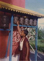
According to the 2001 census, Hindus constitute 80.6 percent of the population. Buddhists make up 10.7 percent, Muslims 4.2 percent, Kirant 3.6 percent, other religions 0.9 percent. Nepal is the only official Hindu state in the world. Differences between Hindus and Buddhists have been subtle due to the intermingling of Hindu and Buddhist beliefs. Both share common temples and worship common deities and many of Nepal's Hindus could also be regarded as Buddhists and vice versa. Buddhists, who practise the Theravadan form of the religion, are mostly concentrated in the eastern regions and the central Terrai. Buddhism was relatively more common among the Newar and Tibeto-Nepalese groups. Among the Tibeto-Nepalese, those most influenced by Hinduism were the Magar, Sunwar, Limbu and Rai. Hindu influence is less prominent among the Gurung, Bhutia, and Thakali groups, who employ Buddhist monks for their religious ceremonies.
There is a strong tradition of animism and shamanism, especially in rural areas. Spiteful witches, hungry ghosts, and angry spirits are thought to inflict illness and misfortune. Shamans mediate between the human and supernatural realms to discover the cause of illness and recommend treatment.
Brahmin priests read Vedic scriptures and ensure weddings and funerals rituals are performed correctly. At temples, priests care for icons, and are responsible for ensuring the purity of the temple. Buddhist monasteries train initiates in philosophy and meditation. Lay followers gain religious merit by giving money to monasteries.
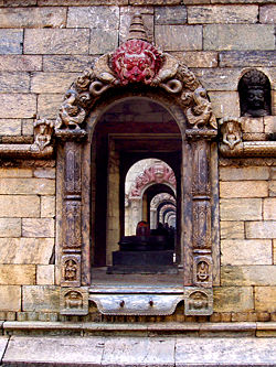
In Hindu mythology, the Himalayas are where the gods live, especially Shiva. Pashupatinath, a large Shiva temple in Kathmandu, is among the holiest sites in Nepal and attracts Hindu pilgrims from all over South Asia. In the Kathmandu Valley, there are hundreds of Hindu shrines, many of which are constructed near rivers or at the base of pipal trees, which are considered sacred. For Buddhists, Nepal is the birthplace of Lord Buddha, and is home to a number of important Buddhist monasteries and supas, including Boudha and Swayambhu.
Hindus and Buddhists believe in reincarnation, a belief that holds an individual's actions in life will lead to a higher or lower rebirth. The ultimate goal is to attain enlightenment, to stop the cycle of rebirth. Hindus cremate their, preferably on the banks of a river, as do some Buddhists.
Occupation
Only men plow, while fetching water is generally considered women's work, as is cooking, care of children, washing clothes, and collecting firewood and fodder. Men do the heavier agricultural work and often work in trade, portering, and other work outside the village. Women tend to work longer, have less free time, and die younger. Children and older people do a lot of household work. Woman's status in Nepal has been steadily rising.
Marriage and the family
Descent is through the male line. Arranged marriages are the norm, because marriages create bonds between families. The bride's family provides a substantial dowry to the groom's family. The groom's family gives clothing, jewellery, and personal items to the bride. Both families are expected to host a feast during the wedding celebration, which last three days. The cost of a wedding, especially to the bride's family, is high and often puts families into debt.
Polygyny, where a man has multiple wives, is illegal but occurs in the older generation and in remote areas. Child marriages, once considered auspicious, are now prohibited. Love marriage is gaining in popularity in the cities.
Landholding Hindu castes favour a domestic unit in which the sons of a household, along with their parents, wives, and children, live together, sharing resources and expenses. The old have authority over the young, and men over women. New daughters-in-law occupy the lowest position. The emphasis is on filial over individualism. In urban areas, more couples opt for nuclear family arrangements.
Fathers are legally obliged to leave equal portions of land to each son, resulting in holdings diminishing in every generation. Daughters do not inherit paternal property unless they remain unmarried past the age 35.
Ownership
A few landlords have traditionally held most agricultural land. Civil servants often paid in grants of land, remained absentee owners and collected taxes from tenant-farming peasants. Since the 1950s, efforts have been made to protect the rights of tenants, but without the redistribution of land. The growing population has worsened land shortages, of which nearly every acre is been farmed intensively.
Language
Nepal's diverse linguistic heritage evolved from four major language groups: Indo-Aryan, Tibeto-Burman, Mongolian and various indigenous language isolates. According to the 2001 national census, 92 different living languages are spoken in Nepal (a 93rd category was "unidentified"). The major languages of Nepal (percent spoken as mother tongue) are Nepali (49 percent), Maithili (12 percent), Bhojpuri (8 percent), Tharu (6 percent), Tamang (5 percent),Nepal Bhasa (4 percent), Magar (3 percent), Awadhi (2 percent), Bantawa (2 percent), Limbu (1 percent), and Bajjika (1 percent). The remaining 81 languages are each spoken as mother tongue by less than one percent of the population.
Derived from Sanskrit, Nepali is related to the Indian language Hindi and written in Devanagari script. Nepali is the official, national language and serves as lingua franca among Nepalis of different ethnolinguistic groups. Hindi is also widely spoken, especially in the southern Terai Region. Many Nepalese in government and business also speak English.
Classes and castes
Hindu castes and Buddhist and animist ethnic groups have condensed into a single caste hierarchy. High-caste Hindus, who tend to be wealthy and politically dominant, are at the top, followed by alcohol-drinking “matwali” castes, which include Mongolian ethnic groups. At the bottom are the poorest untouchable Hindu castes that have traditionally performed occupations considered defiling by higher castes. The Newars of the Kathmandu Valley have a caste system that has been absorbed into the national caste hierarchy. Caste discrimination is officially illegal but has not disappeared.
The culture of high caste Hindus has been Nepal’s "prestige culture." Westernization is competing with the high caste Hindu culture. The ability to speak English is a mark of prestige and an asset in the job market. In cities, most men and more of women wear Western clothes. Modern status symbols include motorcycles, cars, fashionable clothing, televisions, and computers.
Culture
Nepali culture is influenced by the cultures of Tibet, and India, which borders to the south. There are similarities in clothing, language and food.
Food and drink
A typical Nepali meal is dal-bhat - boiled dal, pulses which have been stripped of their outer hulls and split and made into a thick, spicy stew, served with rice and vegetables, and some spicy relish. This is consumed twice daily, once in the morning and again after sunset. Between these main meals, snacks such as chiura (beaten rice) and tea are consumed. Meat, eggs, and fish are considered a treat. In the mountainous region the staple diet is based on wheat, maize, millet and potatoes. Most prefer eating with their right hand, though some people have started using spoons, forks, and knives.
A festive meal, like one served during a marriage, is a treat, and include vegetarian as well as non-vegetarian dishes. Some of such vegetarian preparations are: Baji (a preparation from flattened rice), Wauncha Tukan (green mustard vegetable), Bhuti (a preparation of white beans), Pharsi (pumpkin curry), Lainsoo (dried radish curry), Simpu (bran curry), Pahmaya (curry of green pulses), Hamoh Kwa (sesame seed curry), Chhou Kwa (bamboo shoot soup), Dhau (yogurt), Sakhah (brown sugar to accompany dhau), and Sisabusa (raw radish, raw peas, and fresh fruit pieces). Meat preparations may include Della (meat placed atop baji), Tahkugu Pukala (big slice of fried meat), Cheekugu Pukala (small pieces of fried meat), Tahkha (jelly meat), Chhakoola (meat pieces in curry), Dayekala (meat curry), Hayenla (meat curry with ginger), Gorma (white jellied meat),
A millet-based alcoholic drink known as "Tongba" and other cereal-based alcoholic drinks are popular, including chhaang and the distilled rakshi. There is a separate Newari cuisine.
=Etiquette
The customary greeting is to press one's palms together in front of the chest and say namaste ("I greet the god within you"). Men in urban areas shake hands. Physical contact between the sexes is not appropriate in public. Hospitality is essential. Guests are offered food and not permitted to help prepare food or clean up. It is polite to eat with the right hand. It is insulting to point the soles of one's feet at someone, and step over a person.
Housing
Pagoda-style temples, Buddhist stupas, palaces, and multistory brick houses with elaborately carved wooden door frames and screened windows are found in Kathmandu and the nearby cities of Patan and Bhaktapur. Smaller temples and older residential buildings are falling into disrepair. When British ruled India, the Rana rulers used Western architectural styles into palaces and public buildings.
Most houses in rural Nepal are made up of a tight bamboo framework with mud and cow-dung walls. Village houses are clustered in river valleys or along ridge tops. These dwellings remain cool in summers and retain warmth in the winter. Dwellings at higher altitudes are mostly timber-based.
Education
Mothers provide most childcare, helped by older siblings, cousins, and grandparents. Neighbors may cuddle, instruct, and discipline children. Authority in households depends on seniority, therefore the relative age of siblings is important and children are addressed by birth order.
Rituals mark the child's development. There are rituals for the first taste of rice and the first haircut. When a girl reaches puberty, she is prohibited from seeing male family members.
Children are expected to work around the house. Both girls and boys are entitled to schooling, but if a family needs help at home or lacks money, only the sons are sent to school. It is believed that education is wasted on girls, who will marry and take their wage-earning abilities to another household.
Universities are under-funded. Nepalis respect degrees obtained abroad and many scholars study overseas or in India. However, some good scholarship has emerged. The political reforms of the 1990s have permitted a more open and critical intellectual environment.
The total literacy rate is 53.74 percent (68.51 percent for males and 42.49 percent for females).
Literature
Nepali literature dates only to the nineteenth century with Bhanubhakta Acharya's adaptation of the Hindu epic, “Ramayana.” Government censorship led Nepali authors and poets to publish outside of Nepal until the 1930s, when Nepal's first literary journal, “Sharada,” created an outlet for literary expression. Nepali writers and poets include Lakshmi Prasad Devkota, Lekhnath Paudyal, Balkrishna Sama, and Guruprasad Mainali.
Music
Musical genres from Tibet and India have had a strong influence on traditional Nepali music. Indigenous Newari music developed and flourished during the medieval era. The Malla kings were known for their interest in arts. It is percussion-based, sometimes with flutes or shawm accompanying the intense, nasal vocal lines. Particular songs are played for each season, and each time of day. The songs narrate or depict the mood of the season or time. Each caste has its songs and bands. Women, even of the musician castes, are less likely than men to play music, except in traditional all-female wedding parties.
The sarangi, a four-stringed, hand-carved instrument is usually played by wandering minstrels.
There is pop, religious, classical, and folk music. Since the sixties, Nepali rock, or rock music sung to Nepali lyrics, has become popular among youth. Nepali rap and Nepali reggae has blossomed with the advent of the music video industry. There are also many heavy metal bands.
Dance
Traditional Nepali folklore retains a strong influence in society and its stories are widely acted out in dance and music. Culture of different ethnic groups are rich in their own ways. However, Newari culture is the most common culture in the capital city. Most of the festivals observed in the country are the Newari festivals. The Newar people are well known for masked dance that tell stories of the gods and heroes.
Media
Television was introduced in the 1980s. In 2007 there were six television broadcasting channels: Nepal Television - the national television channel; NTV 2 Metro - a city channel owned by the government; and four private channels - Kantipur Television, Image Channel, Channel Nepal and Nepal 1. Also many other networks, particularly those that originate in India, are available with the installation of increasingly popular satellite dishes, although lack of electrification makes this difficult. Radio is listened to throughout the kingdom. As of 2000, there were 12 radio stations.
Sport
Football (soccer) is the most popular sport, followed by cricket and kabaddi. The Martyrs Memorial Football League is the national football championship.
The Nepali year begins in mid-April and is divided into 12 months. Saturday is the official weekly day of rest. Main holidays include the National Day (birthday of the late king Tribhuvan) December 28, Prithvi Jayanti, (January 11), and Martyr's Day (February 18) and a mix of Hindu and Buddhist festivals
Issues
Infant mortality is high, respiratory and intestinal diseases are endemic, and malnutrition is widespread. Life expectancy is 57 years. Poverty, poor hygiene, and lack of health care contribute to this. There are poorly equipped and unhygienic hospitals only in urban areas. Rural health clinics often lack resources. Western medicine has social prestige, but many people consult shamans and other religious practitioners.
Environmental issues include deforestation (overuse of wood for fuel and lack of alternatives), with resulting erosion and degradation of ecosystems, contaminated water (with human and animal wastes, agricultural run-off, and industrial effluents), wildlife conservation, and vehicular emissions.
A joint border commission continues to work on contested sections of the border with India, including a 400 square kilometer dispute over the source of the Kalapani River. India has instituted a stricter border regime to restrict transit of Maoist insurgents and illegal cross-border activities. Approximately 103,000 Bhutanese Lhotshampas (Hindus) have been confined in refugee camps in southeastern Nepal since 1990.
Nepal has 100,000-200,000 internally displaced persons as a result of the conflict between government forces and Maoist rebels. Nepal is the location for the illicit production of cannabis and hashish for the domestic and international drug markets, and is a transit point for opiates from Southeast Asia to the West.
Girls have been lured or abducted from villages to work as prostitutes in Indian cities and child laborers in carpet factories. Prostitution has spread Aids. Boycotts of Nepali carpets have not addressed the social problems that force children to become family wage earners.
ReferencesISBN links support NWE through referral fees
- Gotz Hagmuller, Patan Museum: The Transformation of a Royal Palace in Nepal,Serindia, London, 2003. ISBN 0-9-6-26-58-X
- Kunda Dixit, A people war: Images of the Nepal conflict 1996-2006, Nepa-Laya, Kathmandu, 2006.
- Crossette, Barbara, So Close to Heaven: The Vanishing Buddhist Kingdoms of the Himalayas, Vintage, New York, 1995. ISBN 0-679-74363-4
- Bista, Dor Bahadur (1967). People of Nepal. Dept. of Publicity, Ministry of Information and Broadcasting, Govt. of Nepal. ISBN 99933-0-418-2.
- Michael Hutt, ed., Himalayan 'people's war' : Nepal's Maoist rebellion, London : C. Hurst, 2004
- Peter Matthiessen (1993). The Snow Leopard. Penguin. ISBN 0-00-272025-6.
- Joe Simpson (1997). Storms of Silence. Mountaineers Books. ISBN 0-89886-512-3.
- Samrat Upadhyay (2001). Arresting God in Kathmandu. Mariner Books. ISBN 0-618-04371-3.
- Joseph R. Pietri (2001). The King of Nepal. Joseph R. Pietri. ISBN 0-615-11928-X.
- Maurice Herzog (1951). Annapurna. The Lyons Press. ISBN 1-55821-549-2.
- Dervla Murphy (1968). The Waiting Land: A Spell in Nepal. Transatlantic Arts. ISBN 0-7195-1745-1.
- Rishikesh Shaha (2001). Modern Nepal: A Political History. Manohar Publishers and Distributors. ISBN 81-7304-403-1.
External links
- Nepal Encarta, accessed March 12, 2007.
- India-Nepal Open Border Nepal Democracy, accessed March 12, 2007.
- Football at the heart of the Himalayas fifa.com, accessed March 12, 2007.
- The Best Memoir You Never Heard Of: "Shadow Over Shangri-La" SFGate.com, accessed March 12, 2007.
- Nepal: Basic Fact Sheet Nepal homepage, accessed March 12, 2007.
- Jailed ex-PM in Nepal court plea BBC News, accessed March 12, 2007.
- Nepali Times weekly Nepali Times, accessed March 12, 2007
- Euro Nepal Communication - France NépalFrance Népal info, accessed March 12, 2007.
- Nepal Tourism Board Naturally Nepal, accessed March 12, 2007.
- Nepal Encyclopaedia Britannica.com, accessed March 12, 2007.
- Nepal: Background Notes United States Department of State, accessed March 12, 2007.
- Country Study: Nepal U.S. Library of Congress, accessed March 12, 2007.
- NepalPlanet Nepal Wiki, accessed March 12, 2007.
- Nepal Open Directory Project, accessed March 12, 2007.
- MyHimalayas Nepal travelogues and pictures MyHimalayas, accessed March 12, 2007.
- Images and Photos from Nepal Nepal Photo Gallery, accessed March 12, 2007.
- IPS Crisis in the Himalayas Inter Press Service, accessed March 12, 2007.
- Nepal information Welcome to Nepal, accessed March 12, 2007.
- Nepal Countries and Their Cultures: Ma-Ni, accessed March 12, 2007.
Credits
New World Encyclopedia writers and editors rewrote and completed the Wikipedia article in accordance with New World Encyclopedia standards. This article abides by terms of the Creative Commons CC-by-sa 3.0 License (CC-by-sa), which may be used and disseminated with proper attribution. Credit is due under the terms of this license that can reference both the New World Encyclopedia contributors and the selfless volunteer contributors of the Wikimedia Foundation. To cite this article click here for a list of acceptable citing formats.The history of earlier contributions by wikipedians is accessible to researchers here:
The history of this article since it was imported to New World Encyclopedia:
Note: Some restrictions may apply to use of individual images which are separately licensed.
