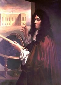
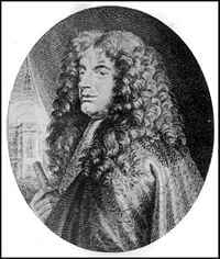
Giovanni Domenico Cassini
<<Please flesh out this article and organize it into sections, as with other bios.>>
Giovanni Domenico Cassini (June 8, 1625–September 14, 1712) was an Italian-French astronomer, engineer, and astrologer. Cassini, also known as Giandomenico Cassini, was born in Perinaldo, near Sanremo, at that time in the Republic of Genoa. His father was James Cassini, who first assigned a tutor to Cassini's education, and later sent the young man to study theology and law under the Jesuits in Genoa. In 1646, the later published a book of within which was contained some of Cassini's early attempts at poetry.
Cassini was early introduced to astronomy through a text devoted to astrology, and soon he was very knowledgeable about it; strangely enough, it was this knowledge that led to his first appointment.
In 1644 the Marquis Cornelio Malvasia, who was a senator of Bologna with a great interest in astrology, invited Cassini to Bologna and offered him a position in the Panzano Observatory which he was constructing at that time. Most of their time was spent calculating newer, better, and more accurate ephemerides for astrological purposes, using the rapidly advancing astronomical methods and tools of the day. At the age of 25, Cassini was appointed by the senate to the post of astronomer at the newly-completed observatory, where he remained from 1648 to 1669. During this time he also served as professor of astronomy at the University of Bologna.
When Cassini arrived in Bologna, one of his first tasks was to improve the measurement of the meridian line passing through the Cathedral of Saint Petronius. He not only accompished this, but also constructed additional astronomical instrumentation, completed in 1655. The primary purpose of this undertaking was to fix the religious feasts of the Roman church at the right time of year, one of his duties as astronomer. He also redrew the meridian line according to his own observations.
Cassini published solar tables, and calculated the parallax of the sun, the arc subtended by the disk of the earth were it observed from the Sun. This, in combination with the same measurement of the sun from the earth, could yield comparative measurements of the two bodies. Cassini's measurements were not, however, particularly accurate in the light of later measurements, and his conclusion that the sun was about a million times larger than the earth was found to be exaggerated.
During his time in Bologna, Cassini established an international reputation by his many accomplishments. In 1652, Cassini penned an account of the appearance of a comet. At the time, the motions of comets were believed not to be governed by any particular law, but contrary to this contention, Cassini attempted to establish the orbit of the comet from a few observations.
In 1657, Cassini was asked to accompany the ambassador to the Roman pontiff from Bologna, in order to settle a dispute between Bologna and Ferrara regarding the two major river systems that the communities shared. He showed marked skills as a diplomat, and was asked to remain in Rome to undertake a number of public works, including the repair of Fort Urban. Pope Clement IX was so impressed with Cassini that he encouraged the astronomer to become an ecclesiastic, but Cassini resisted this invitation. He did, however, become the supterintendant of the waters in the papal estates.
In 1664, Cassini observed the red spot on the surface of Jupiter, and by observing its movement, calculated the jovian day to be 9 hours and 56 minutes. He also estimated the period of rotation of venus, mars and the sun, stating the last of these as 27 days, a figure not far from current estimates (25 days).
King Louis XIV of France, anxious to obtain Cassini's employ at a new observatory in Paris, offered the astronomer a handsome pension that was competitive with his income at Bologna. Cassini hesitated to accept the post until he could gain the approval of the pope and the Bolognese government, which was forthcoming on the condition that he would return in two years. These conditions were eventually dropped, and Cassini thoroughly adopted his new country, to the extent that he became interchangeably known as Jean-Dominique Cassini—although that is also the name of his great-grandson. He was appointed director of the Paris observatory in 1671, and remained so until his death.
In 1673 he became a French citizen. While in France Cassini also served as the court astronomer/astrologer of Louis XIV ("The Sun King") for forty-one years, serving the expected dual role yet focusing the overwhelming majority of his time on astronomy rather than the astrology he had studied so much of in his youth.
Two important tasks that involved Cassini and his crew of astronomers and measurement-takers were map-making and determining longitude. Cassini instituted a project to map the world, and was asssisted in this venture by many of the world's leading observatories. These reported their observations to the Paris observatory under Cassini's direction, where they were tablulated and translated into a map projection that was viewed favorably by King Louis.
During the 1670s and 1680s, Cassini sent out several expeditions to different parts of the world to undertake astronomical observations with varying success. One problem these teams confronted was the change in the periods of pendulums when brought to different latitudes. This problem was not solved with great success, and the teams themselves, having no communication with their home base in Paris for years at a time, had to improvise their own solutions.
In 1672 he sent his colleague Jean Richer to Cayenne, French Guiana, while he himself stayed in Paris. The two made simultaneous observations of Mars and thus found its parallax to determine its distance, thus measuring for the first time the true dimensions of the Solar System.
Around this time, Cassini began work on a project to create a topographic map of France, using Reiner Gemma Frisius's technique of triangulation. The project was continued by his son Jacques Cassini and eventually finished by his grandson Cassini de Thury and published as the Carte de Cassini in 1789[1] or 1793.[2] It was the first topographic map of an entire country.
Cassini was the first to observe four of Saturn's moons, which he called Sidera Lodoicea; he also discovered the Cassini Division (1675). Around 1690, Cassini was the first to observe differential rotation within Jupiter's atmosphere.
Cassini was the first to make successful measurements of longitude by the method suggested by Galileo, using eclipses of the satellites of Jupiter as a clock. He had compiled tables of Jupiter while at Bologna, publishing them in 1668. His work was continued by Roemer, who demonstrated that the times of revolution of Jupiter's moons vary with the approach to and retreat from Jupiter during the earth's annual journey around the sun. Roemer concluded that the variations were due to the extra time it takes light to travel from Jupiter to earth at different times during the year. Cassini is said to have entertained, but abandoned this line of reasoning.
During this time, Cassini's method of determining longitude was used to measure accurately the size of France for the first time. The country turned out to be considerably smaller than expected, and the king quipped that Cassini had taken more of his kingdom from him than he had won in all his wars.
In 1683, he discovered the zodiacal light.
Named after Cassini
- Cassini-Huygens Mission to Saturn
- The Cassini Division in Saturn's rings
- Cassini Regio, dark area on Iapetus
- Cassini crater on Mars
- Cassini crater on the Moon
- Cassini's Laws
- 24101 Cassini, an asteroid
- Cassini's identity for Fibonacci numbers
- Cassini Web Server
See also
Notes
ReferencesISBN links support NWE through referral fees
<<We need at least 3 reliable references here, properly formatted.>>
- Corney, Bolton, John Nichols, and Henry John Rose. 1839. A new general biographical dictionary. London: Shoberl, [Privately printed]. 101-102.
- Brown, Lloyd Arnold. 1979. The story of maps. New York: Dover Publications. 215-224.
External links
- Catholic Encyclopedia article
- John J. O'Connor and Edmund F. Robertson. Giovanni Domenico Cassini at the MacTutor archive
Credits
New World Encyclopedia writers and editors rewrote and completed the Wikipedia article in accordance with New World Encyclopedia standards. This article abides by terms of the Creative Commons CC-by-sa 3.0 License (CC-by-sa), which may be used and disseminated with proper attribution. Credit is due under the terms of this license that can reference both the New World Encyclopedia contributors and the selfless volunteer contributors of the Wikimedia Foundation. To cite this article click here for a list of acceptable citing formats.The history of earlier contributions by wikipedians is accessible to researchers here:
The history of this article since it was imported to New World Encyclopedia:
Note: Some restrictions may apply to use of individual images which are separately licensed.

