Cusco
- This article is about the city in Peru. For other uses of the term, see Cusco (disambiguation).
| ||||||||||||||||||||||||||||||||||||||||||
| ||||||||||||||||||||||||||||||||||||||||||


Cusco (also spelled Cuzco, and in the local Quechua language as Qusqu IPA: ['qos.qo]) is a city in southeastern Peru, near the Urubamba Valley (Sacred Valley) of the Andes mountain range. It is the capital of the Cusco Region as well as the Cusco Province. Cusco is the historic capital of the Inca Empire.
Geography
The name Cusco comes from a Quechua word (Qosqo) meaning navel or center "Qosqo" was transliterated into Spanish as "Cusco".[1][2] On maps from the 19th century (as early as 1810[3][4]) and through the mid-20th century, the name appears as "Cuzco", although since then in official Peruvian cartography (in Spanish) the name has returned to the original transliteration: Cusco.
Located in the southern highlands, at the west end of the Huatanay valley, which is a basin extending 20 miles (30km) east to Huambutio. High in the Andes mountains, Cusco's altitude is around 10,800 feet (3300 meters). The Huatanay, Huancaro, and Chunchullmayo rivers, which are tributaries of the Vilcanota, provide water.
Cusco's temperature is relatively consistent year-round, with average maximum daytime temperatures of 70°F (21°C), with July minimums of 30°F (-1°C). Usually, it is cold at night and the temperature increases considerably until noon. Frost is rare. The rainy season goes from November to March, and the dry season goes from April to October.The average annual precipitation is 32 inches (812mm).
Cusco was found in 2006 to be the spot on Earth with the highest ultraviolet light level.[5]
Size – land area, size comparison Environmental issues Districts
History


Peruvian territory was inhabited at approximately 11,000 years B.C.E.[6] The oldest known complex society in Peru, the Norte Chico civilization, flourished along the coast of the Pacific Ocean between 3000 and 1800 B.C.E.[7] These early developments were followed by archaeological cultures such as Chavin, Paracas, Mochica, Nazca, Wari, and Chimu.
The Killke occupied the Cusco region from 900 to 1200 C.E. Archaeologists discovered, on March 13, 2008, the ruins of an ancient temple, roadway and irrigation systems at Sacsayhuaman, a famed fortress overlooking the Inca capital of Cuzco. Previous carbon-14 dating of Sacsayhuaman revealed that the Killke culture constructed the fortress in the 1100s.[8] In 2007, excavations uncovered another temple on the edge of the fortress, indicating religious as well as military use of the facility.[9]
Inca city state
The Inca people began as a tribe in the Cuzco area around the 12th century C.E. Under the leadership of Manco Capac, they formed the small city-state of Cuzco (Quechua Qosqo). Manco Capac ruled for about 40 years, establishing a code of laws, and is thought to have abolished human sacrifice. He is thought to have reigned until about 1230, though some put his death in 1107.
In 1438, under the command of the ninth Sapa Inca (paramount leader) Pachacutec (1438-1471/1472), whose name literally meant "world-shaker", the Incas began a far-reaching expansion, extending from the northern border of present-day Ecuador to the center of present-day Chile. Pachacutec reorganized the kingdom of Cuzco into an empire, the Tahuantinsuyu, a federalist system which consisted of a central government with the Inca at its head and four provincial governments with strong leaders: Chinchasuyu (NW), Antisuyu (NE), Contisuyu (SW), and Collasuyu (SE).
Pachacuti is also thought to have built Machu Picchu, on a mountain ridge 50 miles (80km) northwest of Cusco, either as a family home or as a retreat.
As the capital of the Inca Empire, many believe that the city of Cusco was planned to be shaped like a puma. The city had two sectors: the urin and hanan, which were further divided to each encompass two of the four provinces, Chinchasuyu (NW), Antisuyu (NE), Qontisuyu (SW) and Collasuyu (SE). A road led from each of these quarters to the corresponding quarter of the empire. Each local leader was required to build a house in the city and live part of the year in Cusco, but only in the quarter of Cusco that corresponded to the quarter of the empire in which he had territory.
After Pachacuti, when an Inca died his title went to one son and his property was given to a corporation controlled by his other relatives (a process called split inheritance), so each title holder had to build a new house and add new lands to the empire, in order to own the land his family needed to maintain after his death.
According to Inca legend, the city was built by Pachacuti, but archaeological evidence points to a slower, more organic growth of the city beginning before Pachacuti. There was however a city plan, and two rivers were channeled around the city.
The city fell to the sphere of Huáscar, who was Sapa Inca from 1527 to 1532, after the death of Huayna Capac in 1527. It was captured by the generals of Atahualpa in April 1532 in the Battle of Quipaipan, and 19 months later by the Spaniards (see battle of Cuzco).
Spanish conquest
Spanish conquistador Francisco Pizarro (c. 1471 or 1476 – June 26, 1541) and his brothers, who were attracted by the news of a rich and fabulous kingdom, arrived in the country which they called Peru in 1532. At that time, the Inca Empire was preoccupied by a five-year civil war between two princes, Huáscar and Atahualpa. On November 16, 1532, while the natives were celebrating in Cajamarca, the Spanish captured the Inca Atahualpa by surprise during the Battle of Cajamarca. When Huascar was killed, the Spanish tried and convicted Atahualpa of the murder, executing him by strangulation.
The first Spaniards arrived in Cusco on November 15, 1533, and Pizarro who officially discovered the city on March 23, 1534, named it the "Very noble and great city of Cusco". Pizarro set up government in Cuzco at that time but moved the capital to Lima on the coast in 1535.
Political and administrative institutions were organized. The new rulers instituted an encomienda system, by which the Spanish extracted tribute from the local population, part of which was forwarded to Seville in return for converting the natives to Christianity. Title to the land itself remained with the king of Spain.
The many buildings constructed in Cusco after the Spanish conquest are of Spanish influence with a mix of Inca architecture, including the Santa Clara and San Blas barrios. The Spanish undertook the construction of a new city on the foundations of the old Inca city, replacing temples with churches and palaces with mansions for the conquerors.
Under colonial rule, agriculture, cattle raising, mining, and trade with Spain made Cusco prosperous. This allowed the construction of many churches and convents, and even a cathedral, university and Archbishopric. Often, Spanish buildings were juxtaposed atop the massive stone walls built by the Inca.
Cusco was also hit by an earthquake in 1650. The rebuilding that followed produced prolific artistic masonry, painting, sculpture, jewelry, and ornamental woodworking.
A major earthquake in May 1950 badly destroyed the Dominican Priory and Church of Santo Domingo, which were built on top of the impressive Coricancha (Temple of the Sun). The city's Inca architecture, however, withstood the earthquake. Many of the old Inca walls were thought to have been lost after the earthquake, but the granite walls of the Coricancha were exposed, as well as many walls throughout the city. While some wanted to restore the buildings to their colonial splendor, a contingent of Cusco citizens urged city officials to retain the exposed walls. Eventually they won out.
Government
Peru is a constitutional republic. The president is both the chief of state and head of government, and is elected by popular vote for a five-year term, being eligible for a nonconsecutive reelection. The unicameral Congress of the Republic of Peru has 120 members elected by popular vote to serve five-year terms.
Cusco is the capital of the Cusco region, and of the Cusco province, one of the region's 13 provinces. The province is divided into eight districts, each of which is headed by a mayor (alcalde).
Economy
Abundant mineral resources are found in Peru's mountainous areas, and coastal waters provide excellent fishing grounds. However, overdependence on minerals and metals subjects the economy to fluctuations in world prices, and a lack of infrastructure deters trade and investment.
Per capita GDP, rank Financial and business services sector Tourism Manufacturing
The surrounding Huatanay Valley is strong in agriculture, including corn, barley, quinoa, tea and coffee and gold mining.
Transport: Road, rail,
The city is served by Alejandro Velasco Astete International Airport.
Demographics
The city had a population of 348,935 in 2008, which is triple the figure of 20 years earlier.
Amerindians made up 45 percent of the population in 2003, mestizo (mixed Amerindian and white) 37 percent, white 15 percent, black, Japanese, Chinese, and other 3 percent.
Spanish and Quechua are the official languages, while Aymara and a large number of minor Amazonian languages are spoken in Peru.
Roman Catholic make up 81 percent of the population, Seventh Day Adventist 1.4 percent, other Christian 0.7 percent, other 0.6 percent, while 16.3 percent had either an unspecified or no religion. in 2003.
Colleges and universities
Of interest

The original Inca city, said to have been founded in the 11th century, was sacked by Pizarro in 1535. There are still remains, however, of the palace of the Incas, the Temple of the Sun and the Temple of the Virgins of the Sun. There are still Inca building remains and foundations, which in some cases have proved to be stronger than the foundations built in present-day Peru. Among the most noteworthy buildings of the city is the cathedra of Santo Domingo.
The major nearby Inca sites are Pachacuti's presumed winter home, Machu Picchu, which can be reached on foot by a Inca trail or by train; the "fortress" at Ollantaytambo; and the "fortress" of Sacsayhuaman.
Other less-visited ruins include: Inca Wasi, the highest of all Inca sites at 3,980 m (13,134 ft); Old Vilcabamba the capital of the Inca after the capture of Cusco; the sculpture garden at Chulquipalta (aka Chuquipalta, Ñusta España, The White Rock, Yurak Rumi); as well as Huillca Raccay, Patallacta, Choquequirao, Moray and many others.
- The Inca road system, or Qhapaq Ñan, was the most extensive of the many roads and trails constructed in pre-Columbian South America. The most important Inca road was the Camino Real, as it is known in Spanish, with a length of 5200 km (3,230 mi). It began in Quito, Ecuador, passed through Cusco, and ended in what is now Tucumán, Argentina.
Thanks to remodelling, Cusco's main stadium, Estadio Garcilaso de la Vega, attracted many more tourists during South America's continental soccer championship, the Copa América 2004 held in Peru. The stadium is home to one of the country's most successful soccer clubs, Cienciano. Cusco's local team has made a name for itself in the world of club soccer, as it has won several international competitions in South America, although it has yet to achieve such success in its home country. Nonetheless, it is still considered to be one of the best teams in Peru. The team is strongly supported throughout Cusco; men without a set at home will stand in the street and watch the game on televisions in shop windows. Tickets are sought-after and buying them entails long queueing.
Food
As headquarters to the Inca Empire, Cusco was an important agricultural region and a natural reserve for thousands of native Peruvian species, including hundreds of potato varieties.[citation needed]
More recently, thanks to Peruvian and foreign cooks, Cusco has begun to offer many fusion and neo-Andean restaurants in which the cuisine, prepared with modern techniques and incorporating a blend of traditional Andean and international ingredients, delivers an innovative, exciting dining experience.[10]. Cusco is one of the Andean cities in which visitors can taste many spices, of different origins, and agricultural produce, mostly organic, treated and grown in environmental friendly and traditional ways,[citation needed] frequently using ancient techniques such as the "Chaquitaclla" (foot plough).[11].
Industry
- Cusqueña brewery
Gallery
- Cusco-plaza-c04.jpg
Plaza de Armas
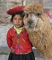
A girl with her Alpaca
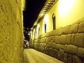
Inca Wall
- Piedra de 12 angulos.jpg
Twelve-angle rock
- Cuzco001.jpg
Plaza de Armas
- Iglesia-La-Compania---Cuzco.jpg
The Church of La Compañia on the Plaza de Armas
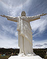
Cristo Blanco


.jpg)
Notes
- ↑ Ianssonium, Ioannem (1647) Mapa del Perú, image in Wikipedia Commons
- ↑ Bellin, Jacques Nicolas (1758) Suite du Perou Audience de Charcas Paris, France, image in Wikipedia Commons;
- ↑ Pinkerton, John (1810) "Peru" World Atlas Cadell and Davies, London, image in the David Rumsey Map Collection;
- ↑ Carey, Mathew (1814) "Peru" World Atlas Mathew Carey, Philadelphia, image in the David Rumsey Map Collection;
- ↑ Liley, J. Ben and McKenzie, Richard L. (April 2006) "Where on Earth has the highest UV?" UV Radiation and its Effects: an update NIWA Science, Hamilton, NZ;
- ↑ Tom Dillehay et al, "The first settlers", p. 20.
- ↑ Jonathan Haas et al, "Dating the Late Archaic occupation of the Norte Chico region in Peru", p. 1021.
- ↑ Pre-Inca temple uncovered in Peru - CNN.com
- ↑ NEWS - Comcast.net
- ↑ Guide to Peruvian Food, Cusco Reference
- ↑ chaquitaclla - Britannica Online Encyclopedia
Further reading
- Bauer, Brian S. 1998. The sacred landscape of the Inca: the Cusco ceque system. Austin: University of Texas Press. ISBN 9780292708655
- Burns, Kathryn. 1999. Colonial habits: convents and the spiritual economy of Cuzco, Peru. Durham, NC: Duke University Press. ISBN 9780822322917
- Frost, Peter, and Ben Box. 2001. Cusco & the Sacred Valley handbook: the travel guide. Bath: Footprint. ISBN 9781903471074
- McEwan, Gordon Francis. 2005. Pikillacta: the Wari Empire in Cuzco. Iowa City: University of Iowa Press. ISBN 9780877459316
- Sallnow, Michael J. 1987. Pilgrims of the Andes: regional cults in Cusco. Smithsonian series in ethnographic inquiry. Washington, D.C.: Smithsonian Institution Press. ISBN 9780874748260
- Walker, Charles. 1999. Smoldering ashes: Cuzco and the creation of Republican Peru, 1780-1840. Durham [N.C.]: Duke University Press. ISBN 9780822322610
- Zuidema, R. Tom. 1990. Inca civilization in Cuzco. Austin: University of Texas Press.
External links
- Encyclopaedia Britannica Cusco Retrieved September 6, 2008.
- World Fact Book 2008 Peru Retrieved September 6, 2008.
- PromPerú: Government Tourism Site
- Cusco at Google Maps
- Cusco GPS map
- Travel guide
- Tourist guide at Wikitravel
- Photos of Cusco and the Sacred Valley
- Photos Sacsayhuaman at Pasaporteblog.com {es}
Credits
New World Encyclopedia writers and editors rewrote and completed the Wikipedia article in accordance with New World Encyclopedia standards. This article abides by terms of the Creative Commons CC-by-sa 3.0 License (CC-by-sa), which may be used and disseminated with proper attribution. Credit is due under the terms of this license that can reference both the New World Encyclopedia contributors and the selfless volunteer contributors of the Wikimedia Foundation. To cite this article click here for a list of acceptable citing formats.The history of earlier contributions by wikipedians is accessible to researchers here:
The history of this article since it was imported to New World Encyclopedia:
Note: Some restrictions may apply to use of individual images which are separately licensed.