Estuary
| aquatic ecosystems |
|---|
| marine |
| salt marsh |
| intertidal |
| estuary |
| lagoon |
| deep sea |
| benthos |
| habitats |
|
|
| freshwater |
| lakes |
| rivers |
| wetlands |
| stratification |
|
|
| aquatic layers |
| wild fisheries |
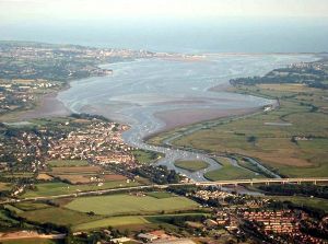
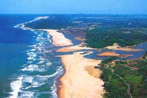
An estuary is a semi-enclosed coastal body of water where freshwater from one or more rivers or streams mixes with saltwater from the sea. Estuaries are often associated with high levels of biological diversity. They are attractive areas for fishing, boating, and tourism. In addition, they provide opportunities for scientific research and education. However, many estuaries are under threat from overfishing and activities that lead to pollution.
Etymology and common names
The term estuary can be traced to the Latin word aestuarium, derived from aestus, which means "tide" or "boiling (of the sea)."[1]
The names of estuaries vary. Examples include bay (as in Chesapeake Bay), sound (as in Puget Sound), or inlet (as in Cook Inlet). These terms are not mutually exclusive.
Estuary characteristics
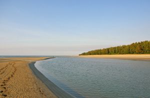
An estuary is typically the tidal mouth of a river and is made up of brackish water. Freshwater from the river is prevented from flowing directly into the open sea by one or more land formations, such as peninsulas and barrier islands. Thus an estuary forms a transition zone between freshwater and saltwater.
Estuaries are often characterized by sedimentation or silt carried in from terrestrial runoff and, frequently, from offshore. The pH, salinity, and water levels of estuaries vary, depending on the river that feeds the estuary and the ocean from which it derives its salinity (oceans and seas have different salinity levels).
Estuaries are more likely to occur on submerged coasts, where the sea level has risen in relation to the land. This process floods valleys to form rias and fjords. These can become estuaries if there is a stream or river flowing into them.
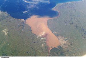
Large estuaries, like Chesapeake Bay and the Gulf of St. Lawrence, often have many streams flowing into them and can have complex shapes. Where an enormous volume of river water enters the sea (as, for example, from the Amazon into the South Atlantic), its estuary could be thought of as extending well beyond the coast.
Circulation within estuaries
The flow of water within estuaries may be described in two ways:
- Estuarine circulation is common in estuaries; it occurs when fresh or brackish water flows out near the surface, while denser, saline water flows inward near the bottom.
- Anti-estuarine flow is its opposite, in which dense water flows out near the bottom and less dense water circulates inward at the surface.
These two terms, however, have a broader oceanographic application that extends beyond estuaries proper. For example, they are used when describing the circulation of water in nearly closed ocean basins.
The time it takes an estuary to go through a complete cycle is called its flushing time.[2]
Types of estuaries
Estuaries can be grouped based on the circulation of water within them.
- Salt wedge. River output greatly exceeds marine input; there is little mixing, and thus a sharp contrast between fresh surface water and saline bottom water.
- Highly stratified. River output and marine input are more even, with river flow still dominant; turbulence induces more mixing of salt water upward than the reverse.
- Slightly stratified. River output is less than the marine input. Here, turbulence causes mixing of the whole water column, such that salinity varies more longitudinally rather than vertically.
- Vertically mixed. River output is much less than marine input, such that the freshwater contribution is negligible; longitudinal salinity variation only.
- Inverse estuary. Located in regions with high evaporation, there is no freshwater input and in fact salinity increases inland; overall flow is inward at the surface, downwells at the inland terminus, and flows outward subsurface.
- Intermittent estuary. Estuary type varies dramatically depending on freshwater input, and is capable of changing from a wholly marine embayment to any of the other estuary types.[3]
Estuaries may also be grouped based on their structure rather than circulation.
- Bar-built estuaries are effectively synonymous with barrier island lagoons, such as Texas's Laguna Madre.
- Tectonic estuaries form when the sea floods a geologically subsident region.
- Coastal plain estuaries are flooded river valleys, and fjords are submerged glacier-eroded valleys.
Importance of estuaries
An estuary retains many nutrients derived from both land and sea, and it protects water quality. It thus forms an ecosystem that is filled with a rich variety of living organisms. For this reason, estuaries are an abundant source of food and human settlements are built around them. These locations often thrive with business and recreational activities, particularly connected to fishing, boating, and tourism. In addition, estuaries are important for research and educational activities.
Human impacts
Of the 32 largest cities in the world, 22 are located on estuaries.[4] For example, New York is located at the mouth of the Hudson River estuary.[5]
As ecosystems, estuaries are under threat from human activities such as pollution and overfishing. Estuaries are impacted by events far upstream, and concentrate materials such as pollutants and sediments.[6] Land run-off and industrial, agricultural, and domestic waste enter rivers and are discharged into estuaries. Contaminants can be introduced which do not disintegrate rapidly in the marine environment, such as plastics, pesticides, furans, dioxins, phenols and heavy metals.
Such toxins can accumulate in the tissues of many species of aquatic life in a process called bioaccumulation. They also accumulate in benthic environments, such as estuaries and bay muds: a geological record of human activities of the last century.
For example, Chinese and Russian industrial pollution, such as phenols and heavy metals, in the Amur River have devastated fish stocks and damaged its estuary soil.[7]
Estuaries tend to be naturally eutrophic because land runoff discharges nutrients into estuaries. With human activities, land run-off also now includes the many chemicals used as fertilizers in agriculture as well as waste from livestock and humans. Excess oxygen depleting chemicals in the water can lead to hypoxia and the creation of dead zones.[8] It can result in reductions in water quality, fish, and other animal populations.
An additional problem is overfishing. Chesapeake Bay, North America's second largest estuary, once had a flourishing oyster population that has been almost wiped out by overfishing. Historically, the oysters filtered the estuary's entire water volume of excess nutrients every three or four days. Today, that process takes almost a year,[9] and sediment, nutrients, and algae can cause problems in local waters. Oysters filter these pollutants, and either eat them or shape them into small packets that are deposited on the bottom where they are harmless.
See also
- Biome
- Chesapeake Bay
- Ecosystem
- Fjord
- Hudson River
- Ocean
- River
- River delta
- Sea
- Stream
Notes
- ↑ Estuary Online Etymology Dictionary. Retrieved December 19, 2008.
- ↑ M. Tomczak (2000), Oceanography Notes Ch. 15: The flushing time Retrieved December 12, 2008.
- ↑ M. Tomczak (2000), Oceanography Notes Ch. 12: Estuaries Retrieved December 12, 2008.
- ↑ Ross 1995.
- ↑ Estuaries NOAA Ocean Service Education. Retrieved December 12, 2008.
- ↑ G. Branch (Dec. 1999), Estuarine vulnerability and ecological impacts, TREE vol. 14, no. 12.
- ↑ Indigenous Peoples of the Russian North, Siberia and Far East: Nivkhi Arctic Network for the Support of the Indigenous Peoples of the Russian Arctic. Retrieved December 12, 2008.
- ↑ Sebastian A. Gerlach, Marine Pollution: Diagnosis and Therapy (Berlin: Springer-Verlag, 1981, ISBN 0387109404).
- ↑ Oyster Reefs: Ecological importance NOAA Restoration Portal. Retrieved December 12, 2008.
ReferencesISBN links support NWE through referral fees
- Bianchi, Thomas S. 2007. Biogeochemistry of Estuaries. Oxford: Oxford University Press. ISBN 978-0195160826
- Dyer, K.R. 1997. Estuaries: A Physical Introduction, 2nd ed. Chichester: John Wiley. ISBN 0471974714
- Hardisty, Jack. 2007. Estuaries: Monitoring and Modeling the Physical System. Malden, MA: Blackwell Publ. ISBN 978-1405146425
- Little, Colin. 2000. The Biology of Soft Shores and Estuaries. Biology of habitats. Oxford: Oxford University Press. ISBN 0198504268
- Ross, D.A. 1995. Introduction to Oceanography. New York: Harper Collins College Publishers. ISBN 978-0673469380
External links
All links retrieved August 15, 2017.
- Part I: What is an Estuary? San Francisco State University.
- Estuaries NOAA Ocean Service Education.
| ||||
|---|---|---|---|---|

|
Biogeography · Climatology & paleoclimatology · Coastal/Marine studies · Geodesy · Geomorphology · Glaciology · Hydrology & Hydrography · Landscape ecology · Limnology · Oceanography · Palaeogeography · Pedology · Quaternary Studies | |||
Credits
New World Encyclopedia writers and editors rewrote and completed the Wikipedia article in accordance with New World Encyclopedia standards. This article abides by terms of the Creative Commons CC-by-sa 3.0 License (CC-by-sa), which may be used and disseminated with proper attribution. Credit is due under the terms of this license that can reference both the New World Encyclopedia contributors and the selfless volunteer contributors of the Wikimedia Foundation. To cite this article click here for a list of acceptable citing formats.The history of earlier contributions by wikipedians is accessible to researchers here:
The history of this article since it was imported to New World Encyclopedia:
Note: Some restrictions may apply to use of individual images which are separately licensed.

