File: Later three kingdoms map.PNG
From New World Encyclopedia
No higher resolution available.
Later_three_kingdoms_map.PNG (477 × 489 pixels, file size: 38 KB, MIME type: image/png)
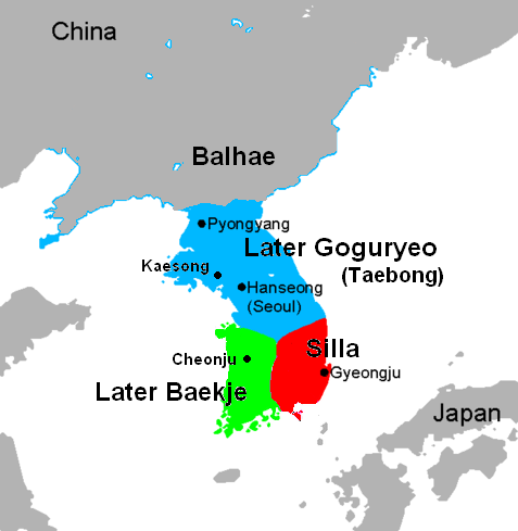
Map showing the division of Korea during the later three kingdoms period (892-936).
This image is a derivitive created from an image available through Wikipedia and Wikimedia Commons. The original image is from the Wikipedia user Chris 73 and is freely available at http://commons.wikimedia.org/wiki/Image:Three_Kingdoms_of_Korea_blank.png under the creative commons cc-by-sa 2.5 license.
File history
Click on a date/time to view the file as it appeared at that time.
| Date/Time | Thumbnail | Dimensions | User | Comment | |
|---|---|---|---|---|---|
| current | 17:15, 23 October 2007 | | 477 × 489 (38 KB) | Anne Inoue (talk | contribs) | Map showing the division of Korea during the later three kingdoms period (892-936). This image is a derivitive created from an image available through [http://www.wikipedia.org/ Wikipedia] and [http://commons.wikimedia.org/wiki/Main_Page Wikimedia Common |
You cannot overwrite this file.
File usage
The following page uses this file: