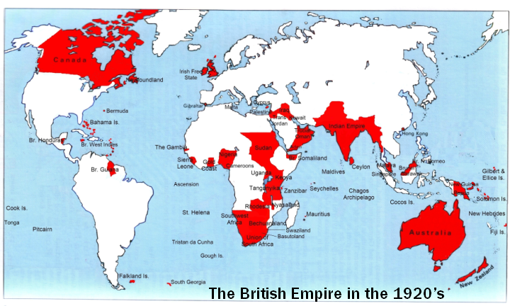
File: Map of the British Empire in the 1920's.png
From New World Encyclopedia
No higher resolution available.
Map_of_the_British_Empire_in_the_1920's.png (720 × 432 pixels, file size: 398 KB, MIME type: image/png)
File history
Click on a date/time to view the file as it appeared at that time.
| Date/Time | Thumbnail | Dimensions | User | Comment | |
|---|---|---|---|---|---|
| current | 21:00, 22 June 2006 | | 720 × 432 (398 KB) | Clinton Bennett (talk | contribs) | [http://en.wikipedia.org/wiki/Image:Map_of_the_British_Empire_in_the_1920%27s.png source and rights] |
You cannot overwrite this file.
File usage
The following page uses this file: